This post should really be called: Places I’ve been to because I’ve read about them in historical novels. I decided, however, that it was too long a title.
I’m stepping a little outside my usual milieu for this post, but in my summary for the blog it does say “lots of books” and I’ve been a bit neglectful on the book front. Basically I’m going to take you through some of my favourite historical books and then elucidate some of the history of the places they inspired me to visit. So this will be part historical travelogue and part book review.
It won’t cover every place I’ve been inspired to see by books, but it will cover a good selection.
There also will be mild spoilers about the plots of the books, mainly because they’re historical novels and it’s a bit difficult to discuss the history they’re written about with out giving away some of the events they cover.
I’ve sorted them into medieval mysteries and historical novels and they’re listed in chronological order for the time they’re set.
Mysteries
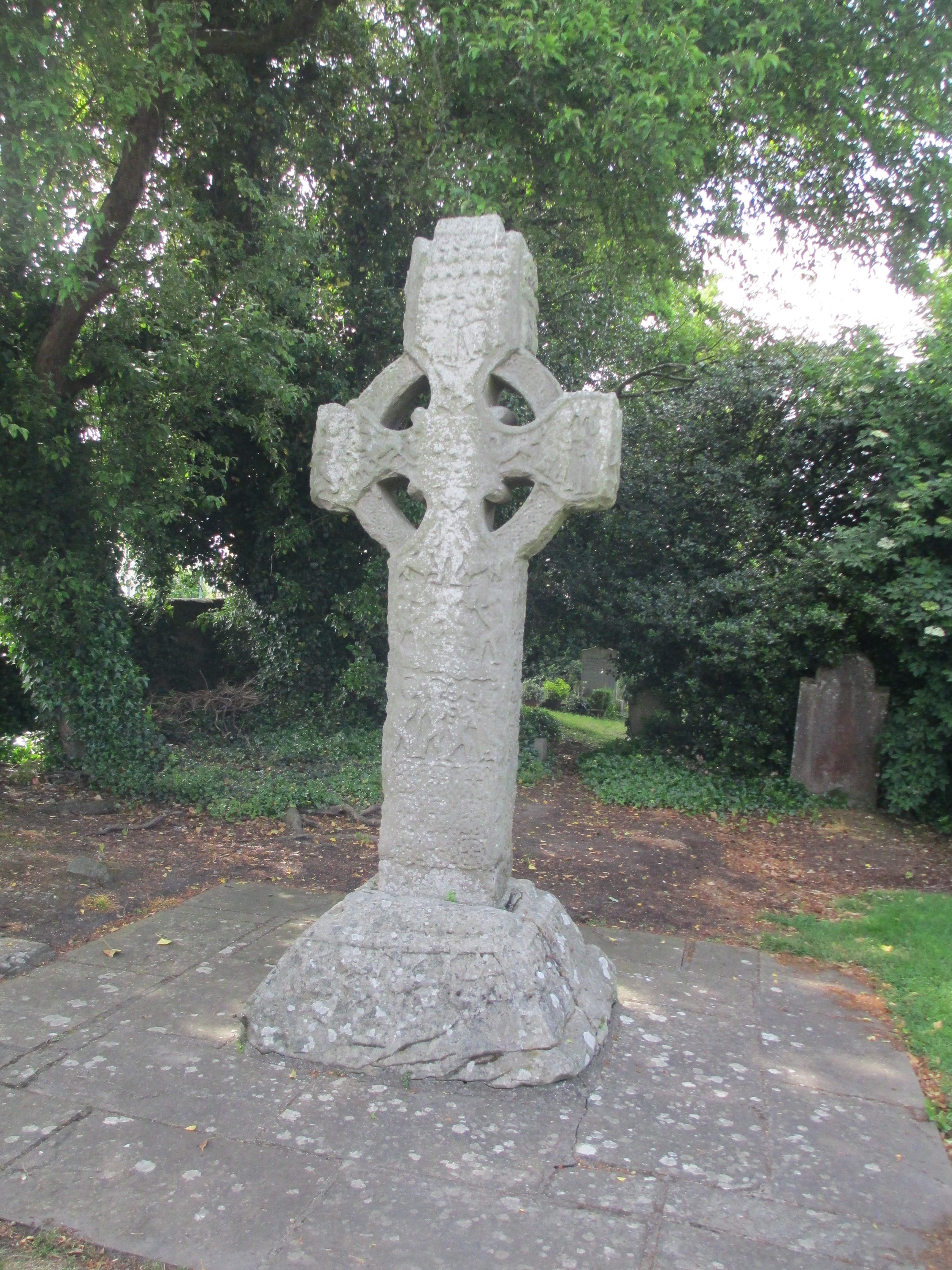
Books: Sister Fidelma Series by Peter Tremayne
At the time of writing this post the Sister Fidelma mysteries number 28 and Tremayne has been writing them since 1994. The mystery series is set, mainly, in mid seventh century Ireland. I say mainly because Fidelma does travel abroad occasionally. Fidelma is a dalaigh, an advocate in the Irish system of laws that would come to be known as the Brehon laws. At the beginning of the series she is also a member or the religious community of Kildare. Fidelma is the daughter of Failbe Fland the king of Cashel, who died shortly after her birth. Her brother later becomes king of Cashel. As well as being intriguing mysteries in their own right the Sister Fidelma series are also a fascinating window into the complex and layered legal system of Ireland in the 7th century and Celtic christianity. Celtic christianity is quite different to the Roman form which would become ascendant with time. For more information on the books and Sister Fidelma’s time, follow this link

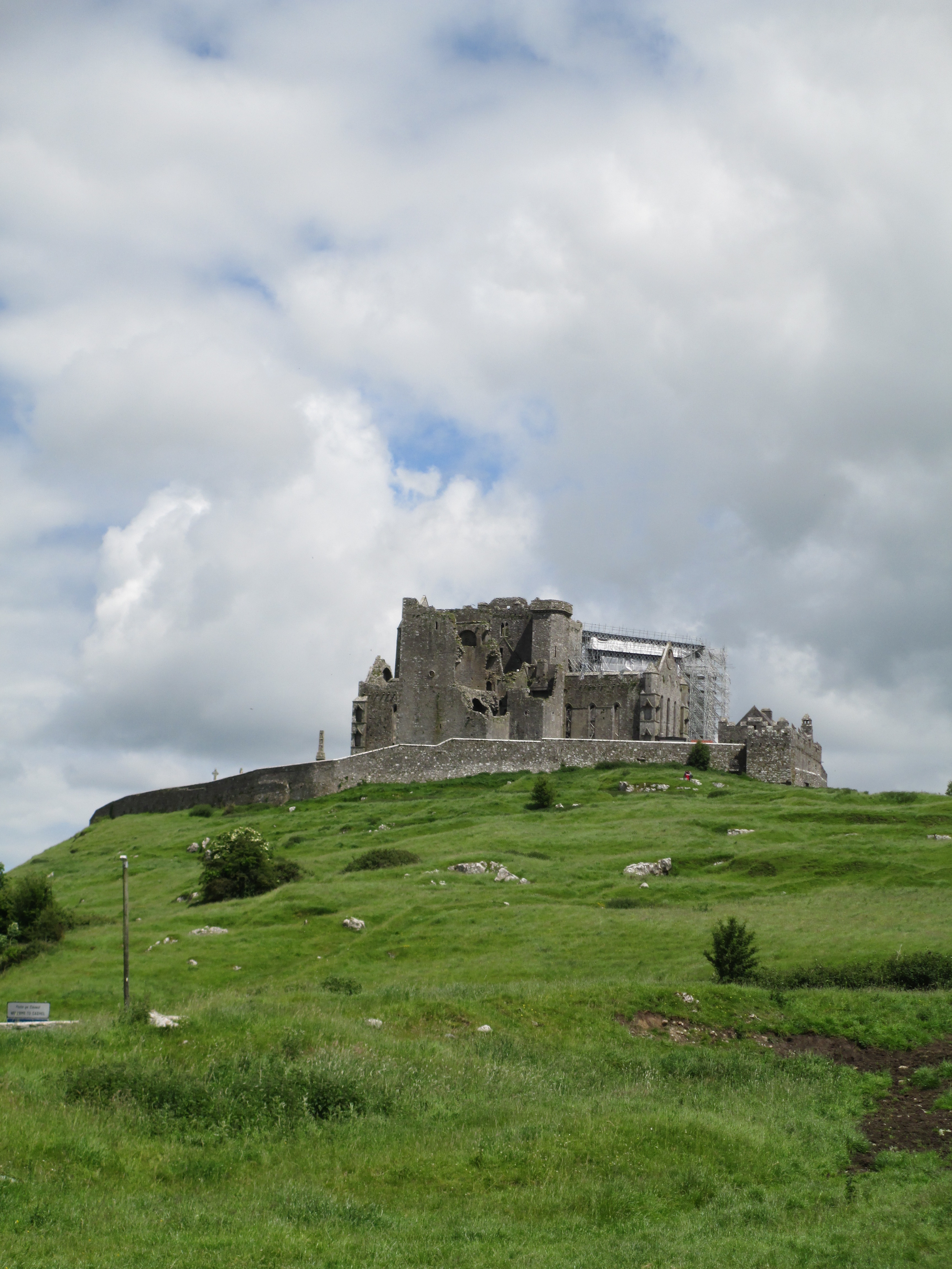
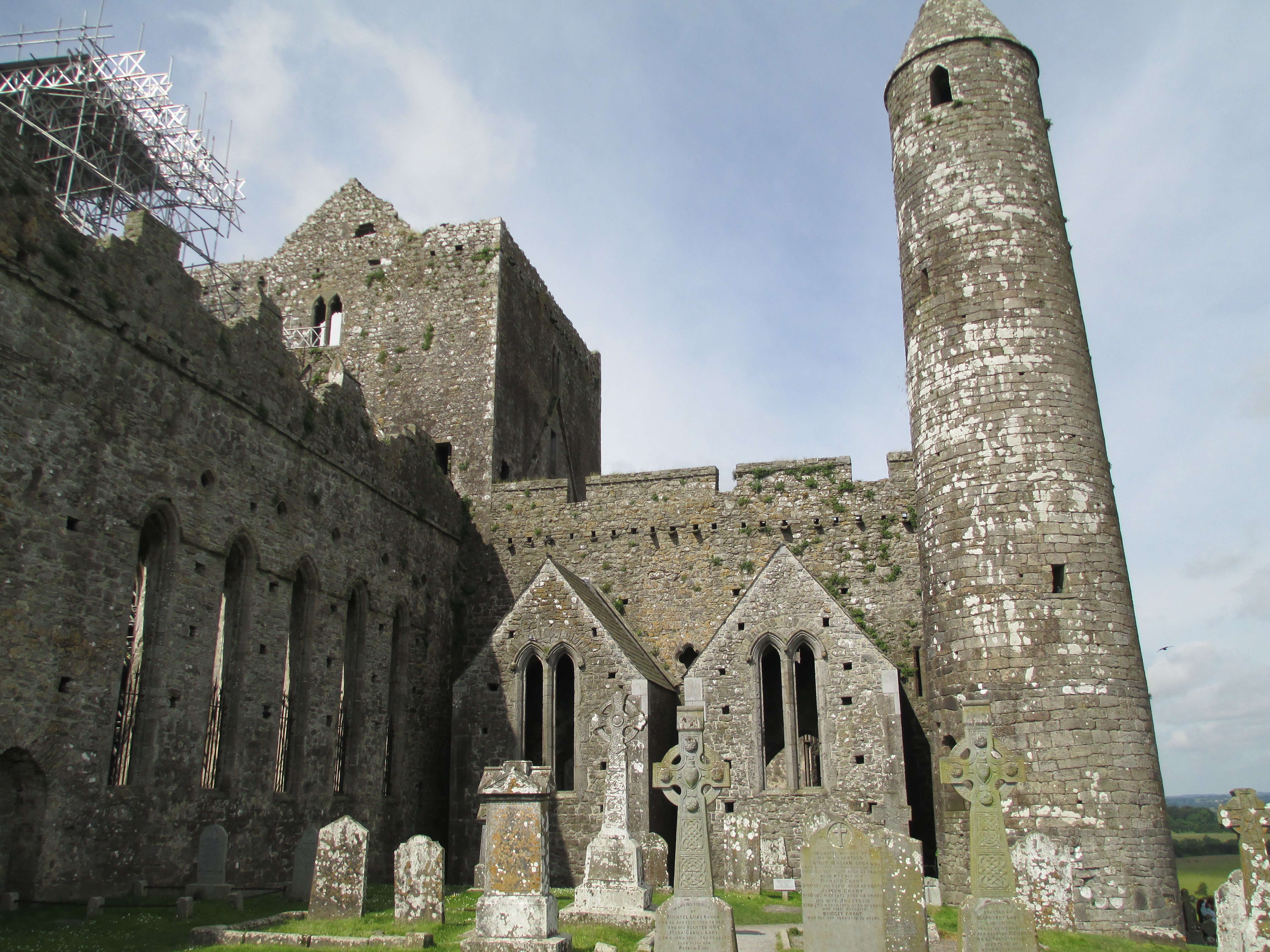
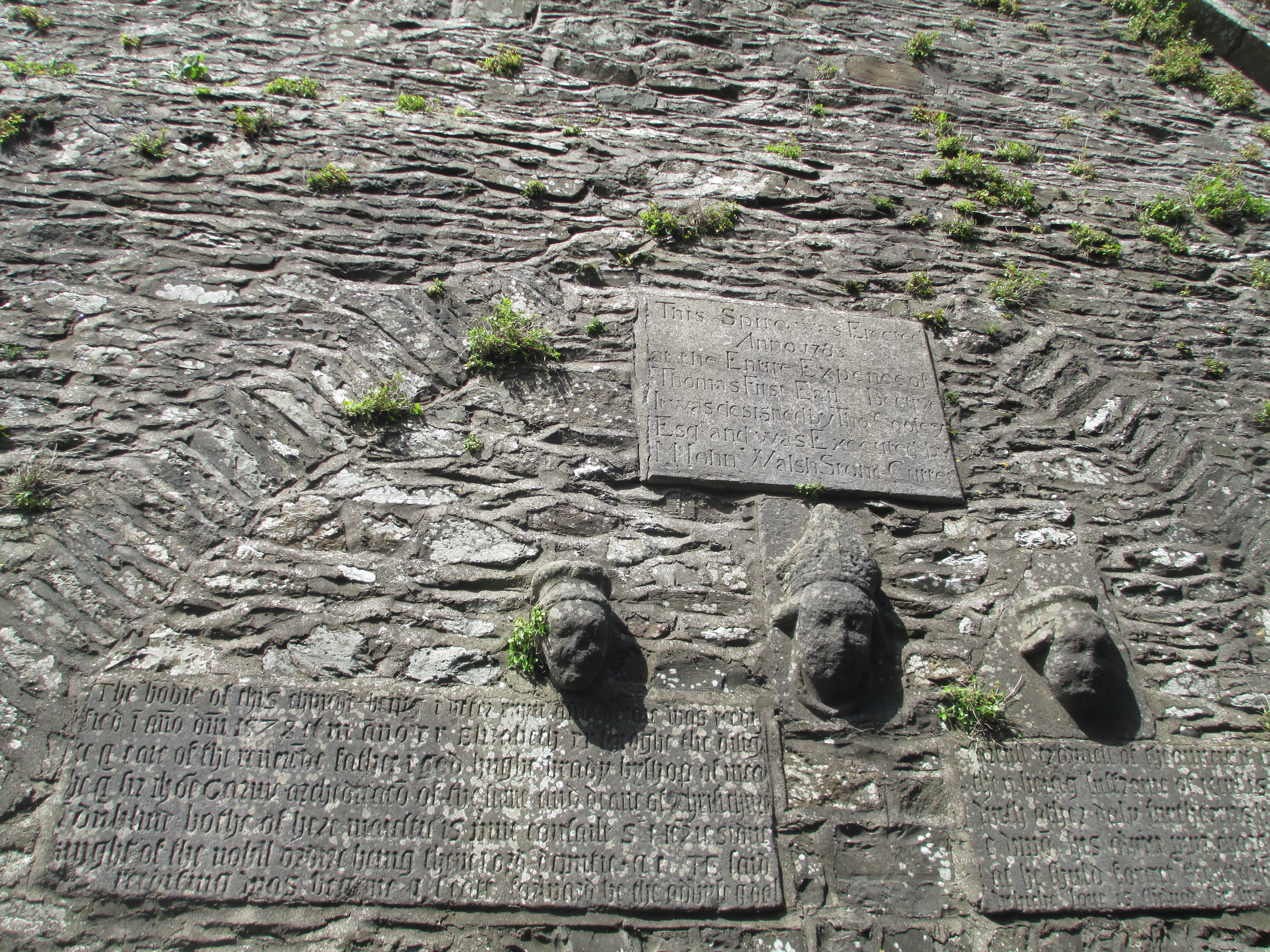
Place: Cashel, Ireland.
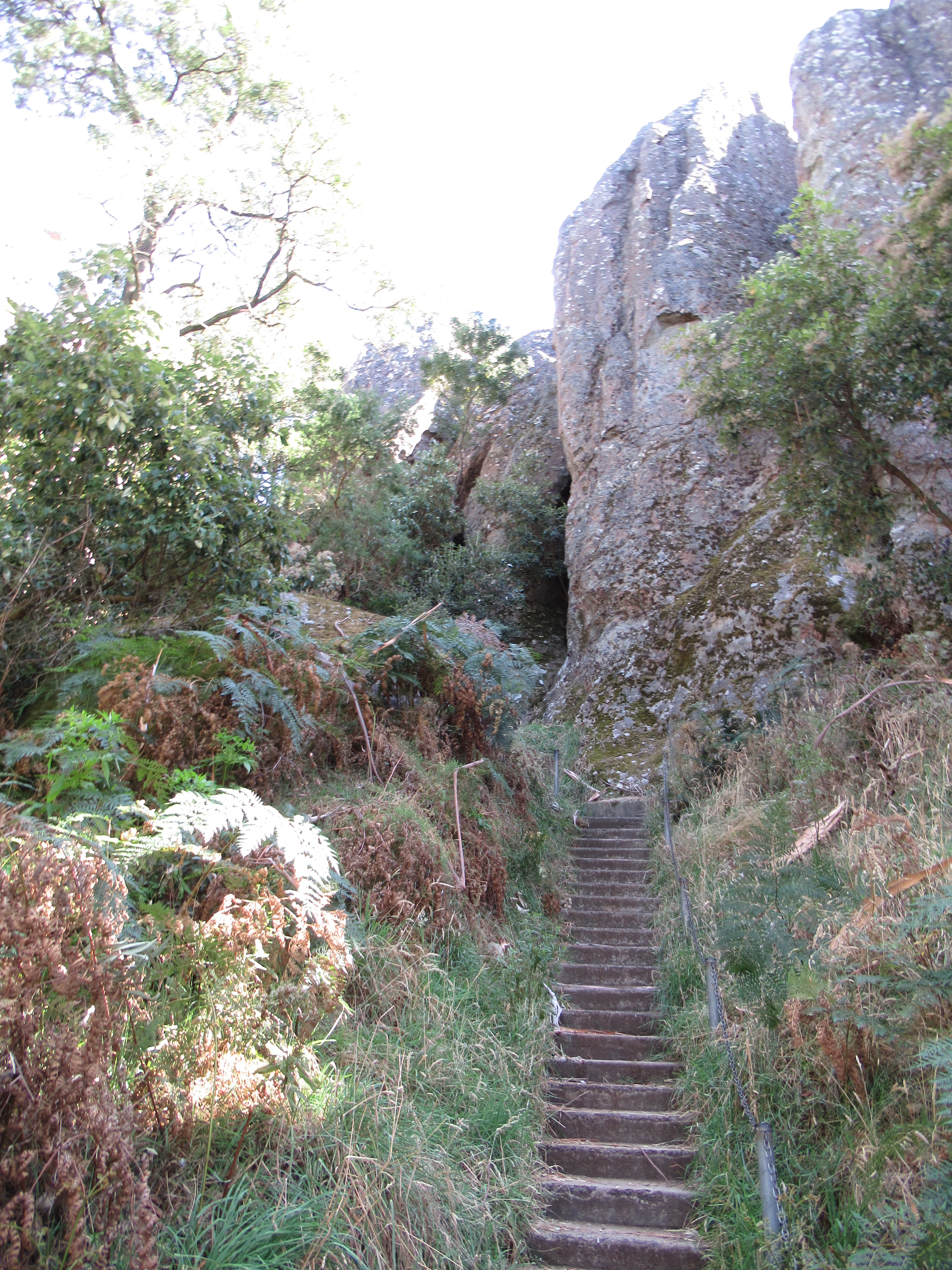
Fidelma is from Cashel and a number of the books are set in or around there, so naturally I looked it up. As soon as I did there was no doubt in my mind that I had to go there. It is one of the most incredible places I’ve been and is a favoured tourist destination in Ireland, so try to get there before all the buses roll up. The highlight for me is the 12th century Cormac’s Chapel with some truly spectacular surviving wall paintings and a very early 12th century round tower both of which you can seen in the photos below.
I’ve written about the history of the Rock of Cashel before, so you can find more information here.

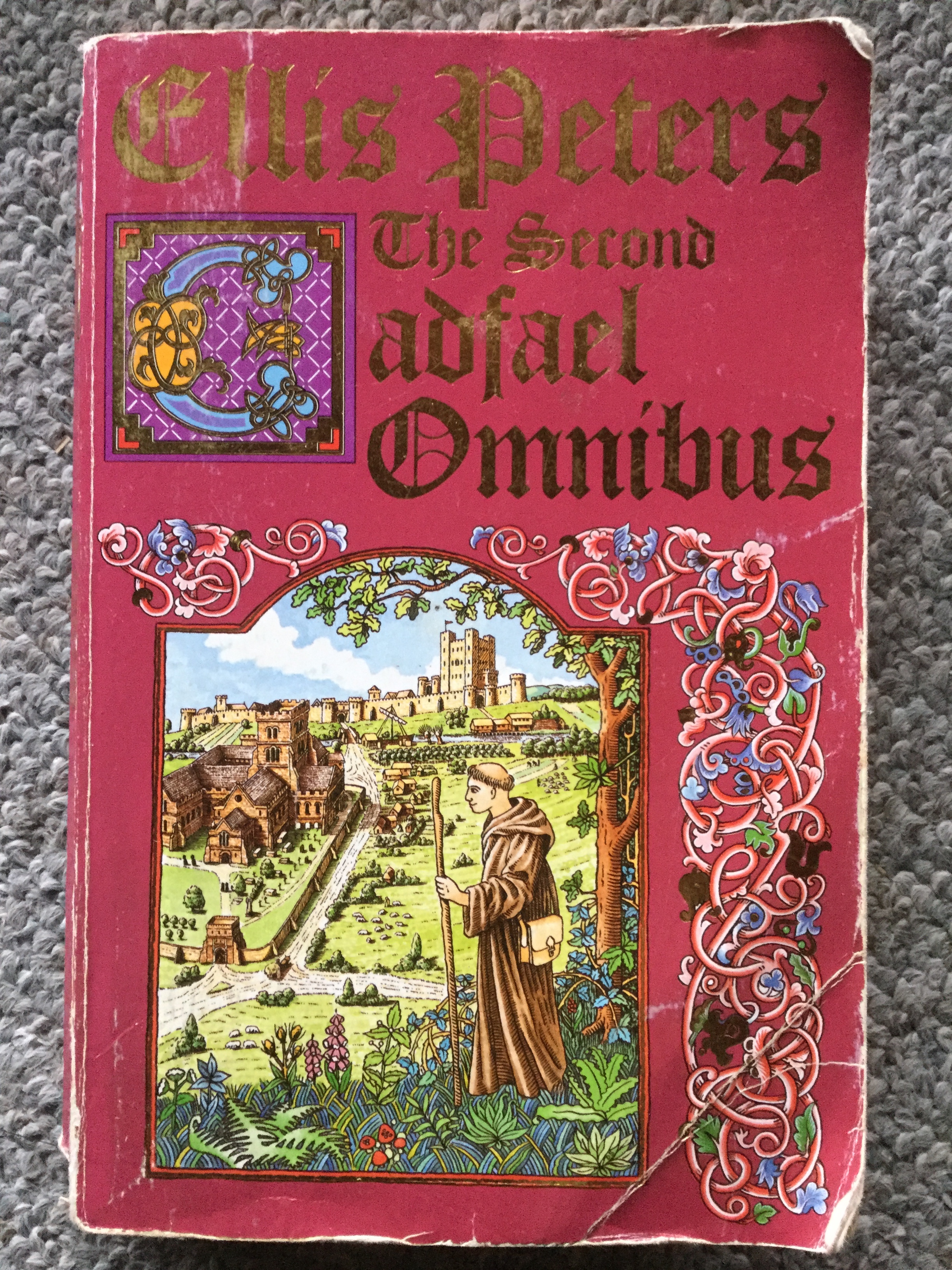
Books: Brother Cadfael mysteries by Ellis Peters
These books were the progenitor of the medieval mysteries genre. They were also one of my earliest forays into medieval fiction, when my mother gave them to me to read when I was about 11. For those who haven’t come across them, the Brother Cadfael books follow former crusader turned monk and herbalist Brother Cadfael predominantly in Shrewsbury Abbey. The books are set in the Period of Anarchy in England (1135-1153). In creating Brother Cadfael, Peters not only illuminates Wales and the Marches of the time, but has created one of the most human and complex characters to ever lead a medieval mystery series, as well as starting the genre. The 20 books were published between 1977 and 1994 and there is also a TV series starring Derek Jacobi. So enduring is the appeal of Brother Cadfael that Shrewsbury Abbey has part of a stain glass window dedicated to him (you can see it in the photos below). For more information on the books click here.
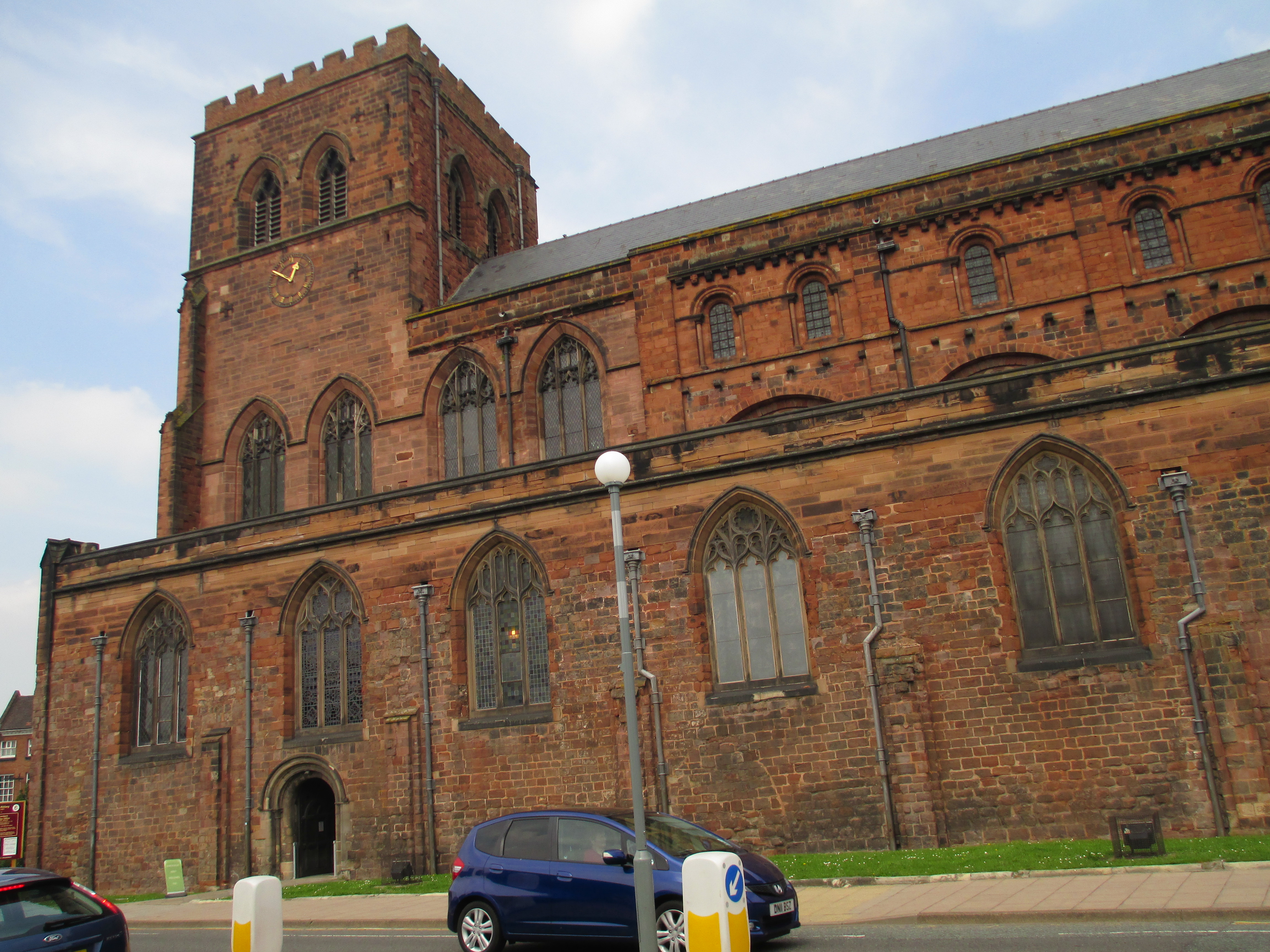
Place: Shrewsbury Abbey
Shrewsbury was one of the definites on my list of places to go in the Welsh Marches. There actually isn’t that much left of the Abbey itself, which was once an entire complex, but the church remains reasonably intact. The Abbey of St Peter and St Paul was founded by Earl Roger de Montgomery in 1083. It was a Benedictine monastery. It survived as a complete abbey until, like many other religious institutions, the dissolution of the monasteries. By the time the dissolution of the monasteries act was passed in 1536 the abbey was 34th out of 602 monasteries in terms of wealth. Abbot Thomas Boteler was given a pension and so were some of his monks when the abbey was dissolved in 1540. The majority of the buildings were demolished and sold off, some of the church survived though. The nave was left standing while the rest was demolished and a new east wall was built. This is the church you see remaining today. In the photos below you can see the interior and exterior of the remaining abbey and you can see where the new wall was built after the remainder of the abbey was demolished.


Books: Owen Archer mysteries by Candace Robb
The Owen Archer series is set in mid 14th century York, in the dying years of the reign of Edward III. It follows Owen Archer a one eyed Welshman who was in the army of the Duke of Lancaster until he was blinded and no longer able to fight. He is seconded to John Thoresby, the Archbishop of York, Chancellor of England and a worldly and devious man. Thoresby sends him to York to investigate suspicious deaths and so begins the 10 book, so far, series. Owen meets and eventually marries apothecary Lucie Wilton and deals with all manner of crimes and mysteries for the Archbishop. The books paint a beautifully detailed picture of 14th century York as well as creating a truly memorable collection of characters both historic and fictional. For more information see the author’s site.

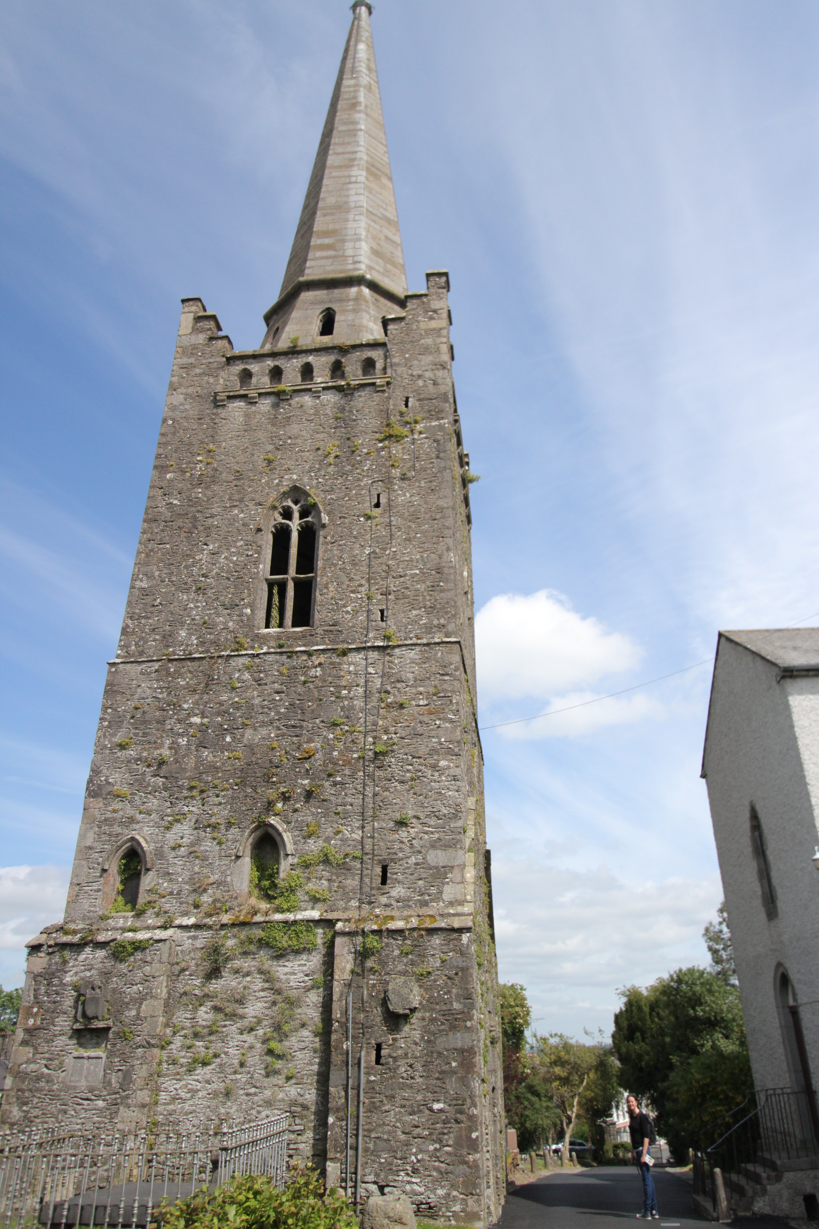
Place: York Minster
The Owen Archer books were not the only reason I went to York, but they were a large contributing factor. I do not have the time in this post to write about the history of the whole of York however, so I’m going to focus on the Minster which features heavily in the books. The original Minster dates to 627, when it was built for the baptism of Edwin King of Northumbria, the site of this building is unknown. The majority of the Minster that you can see now dates to the 13th century and later. The nave was constructed between 1280 and 1350, the north and south transept between 1220 and 1260 and the east end and central tower between 1361 and 1472. It is still very much an active church and remains one of the great cathedrals of England. The photos you can see below are the exterior, the altar and part of the nave, the magnificent quire screen with reliefs of the Kings of England on it and the roof of the Chapter House vestibule which dates to the 1270s and 1280s. 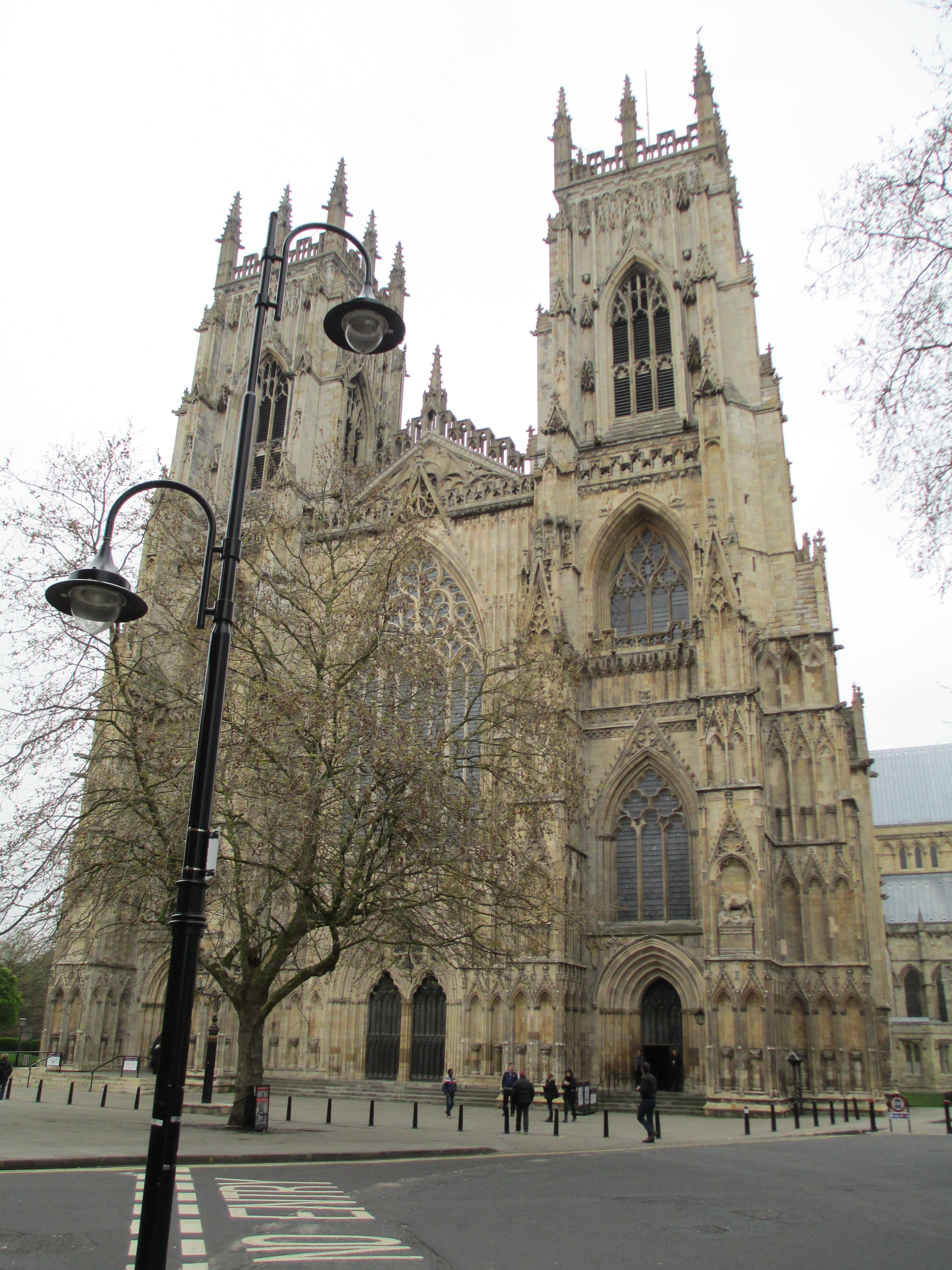


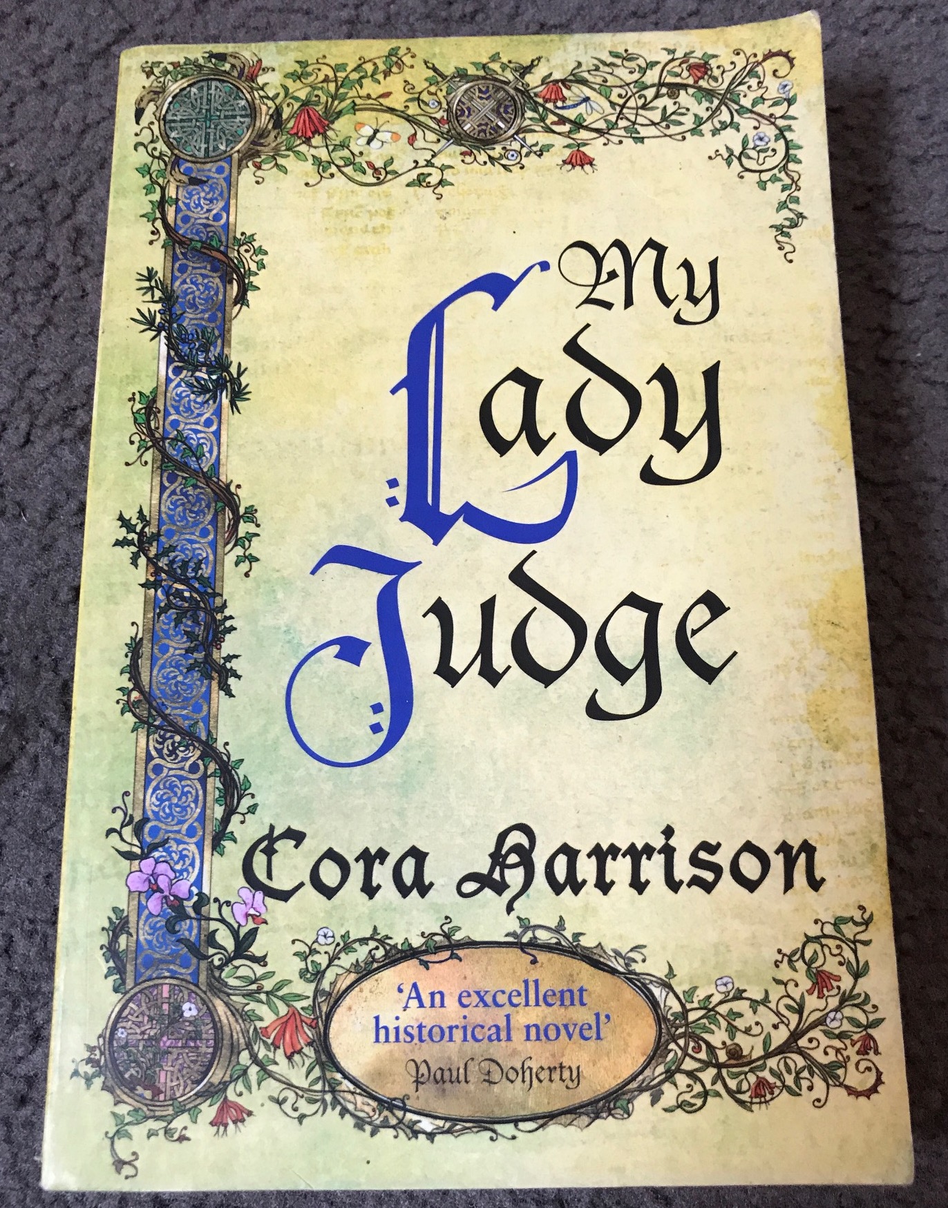
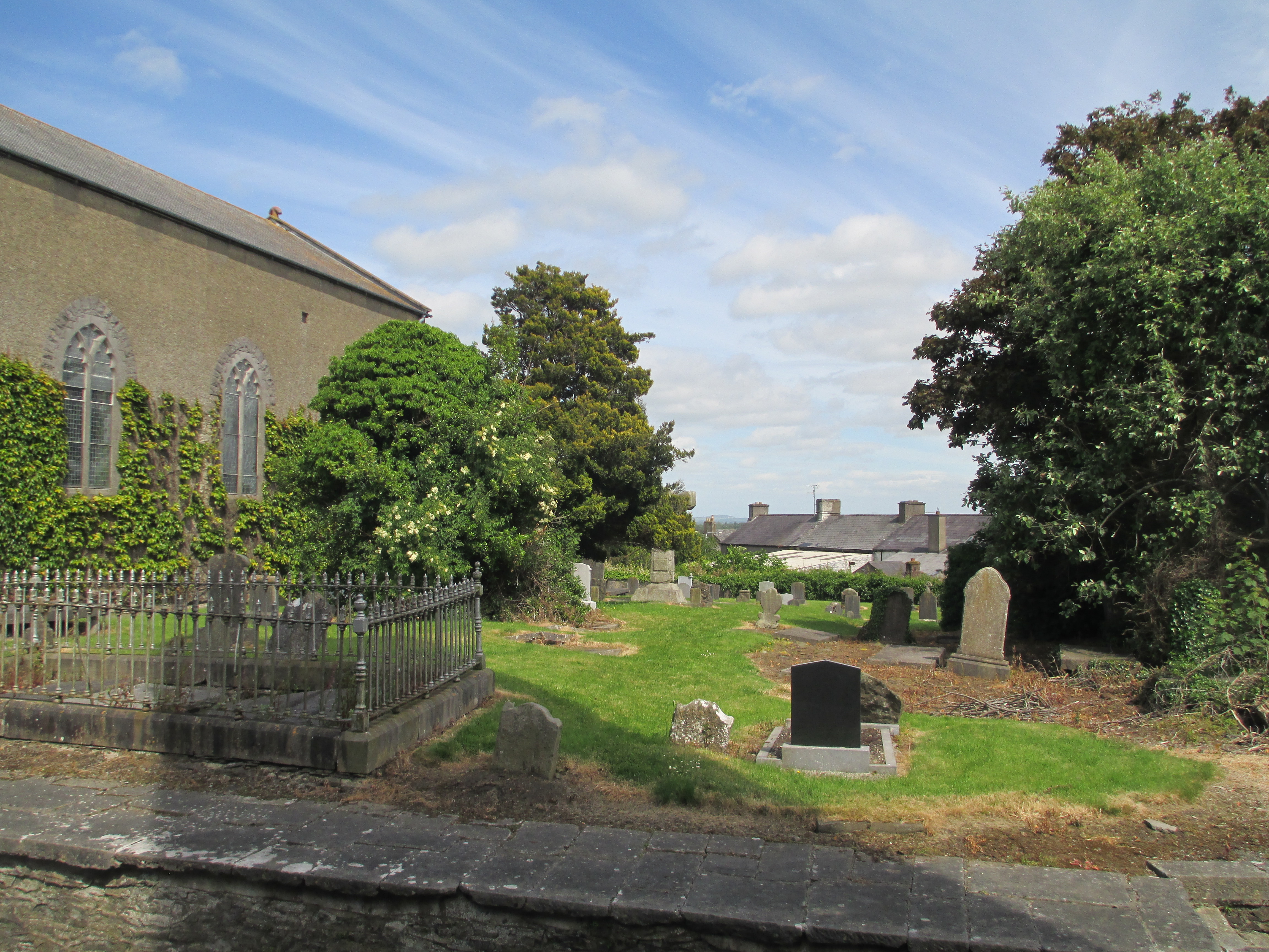
Books: The Burren Mysteries by Cora Harrison
The Burren Mysteries are set in 16th century Ireland in the region called the Burren just out of Galway. They follow Mara, Brehon (judge) of the Burren as she runs her law school and deals with investigating crimes in the region. They illuminate the intricate Brehon laws of Ireland, like the Sister Fidelma books, and bring life to one of the most spectacular areas of Ireland. Mara is a sympathetic, but strong character and her world feels very real. There are fifteen books in the series, at the time of writing this post, and the mysteries themselves are very much key to each of the novels. They are usually complex and fit well with the rule of law of the time. The true stars of the series for me though, will always be the Burren itself and the fascinating, ancient and egalitarian legal system of the Brehon laws. For more on the series see the author’s site
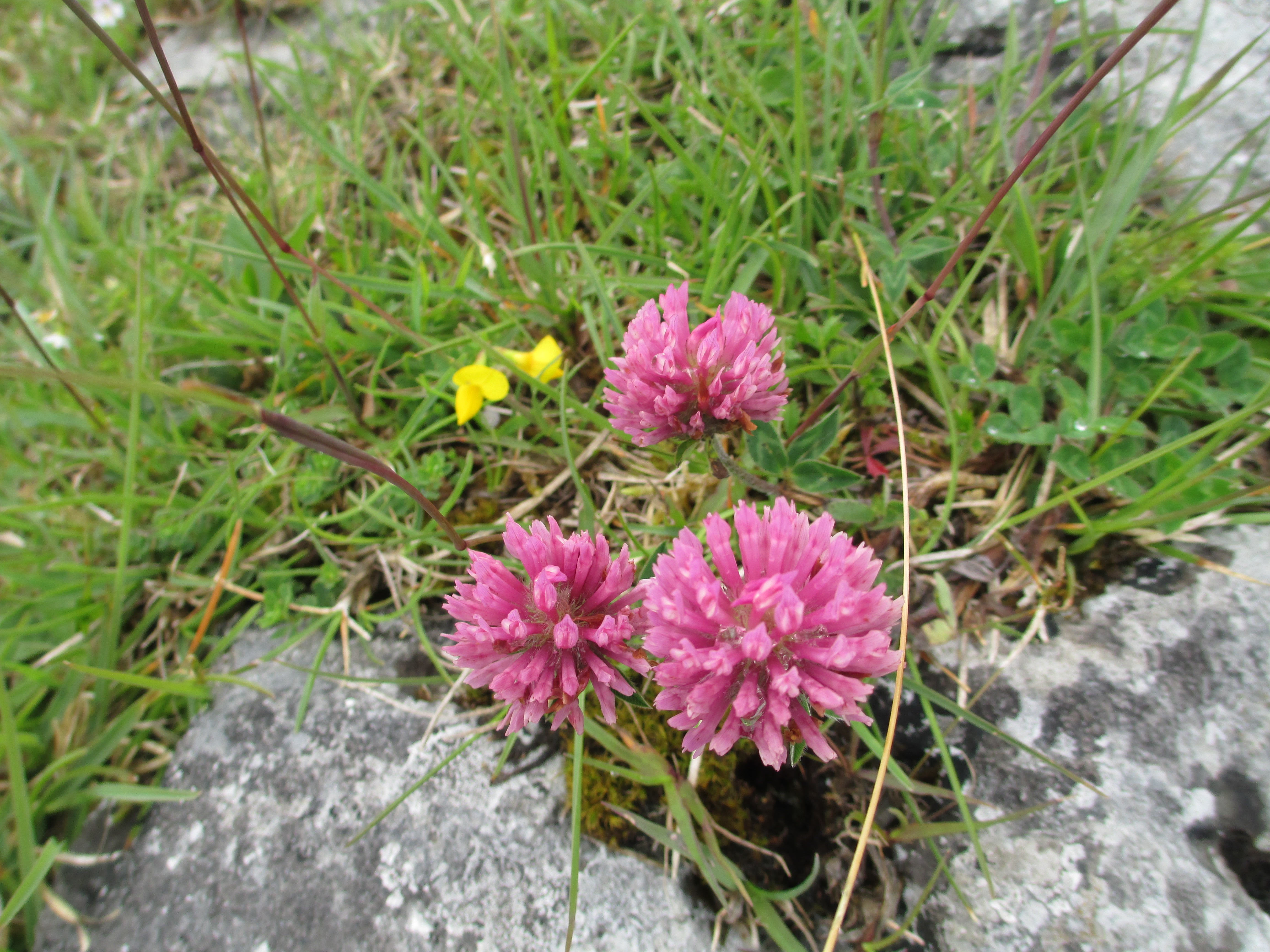
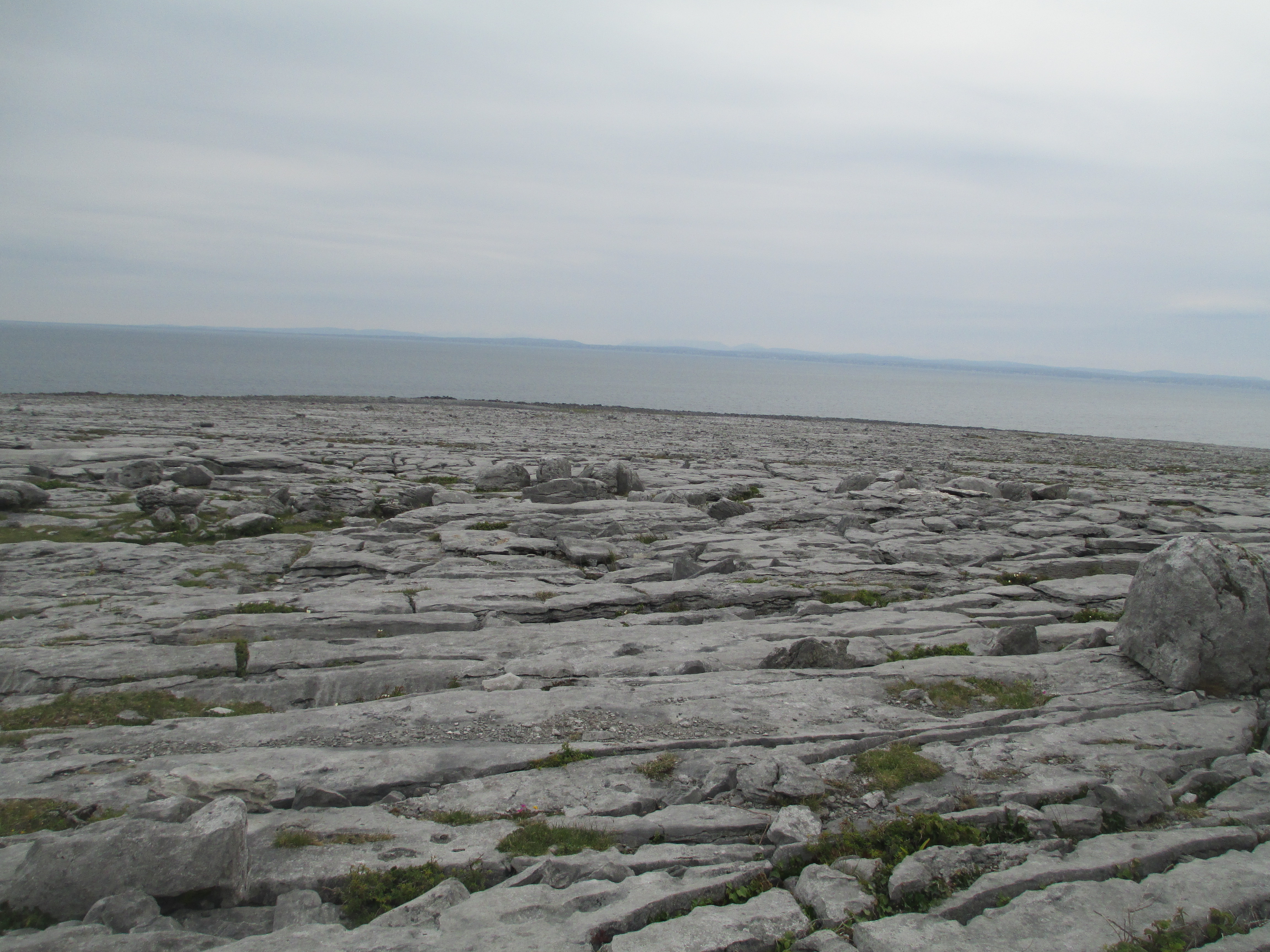
Place: The Burren, Ireland
This series was the entire reason I was intrigued enough to go to the Burren when I was in Ireland. It is one of the most beautiful and fascinating places I have ever been. The ground is largely carboniferous limestone, the top soil was stripped off by glaciers, and wild flowers grow in profusion through the cracks, called grykes. There is also a number of monasteries, ancient monuments, churches and round towers making it close to my favourite place in Ireland. It is truly beautiful. I have written about it before, specifically about Temple Cronan, so you can read more here
You can get an idea of the area from the photos below.


Historical Fiction:
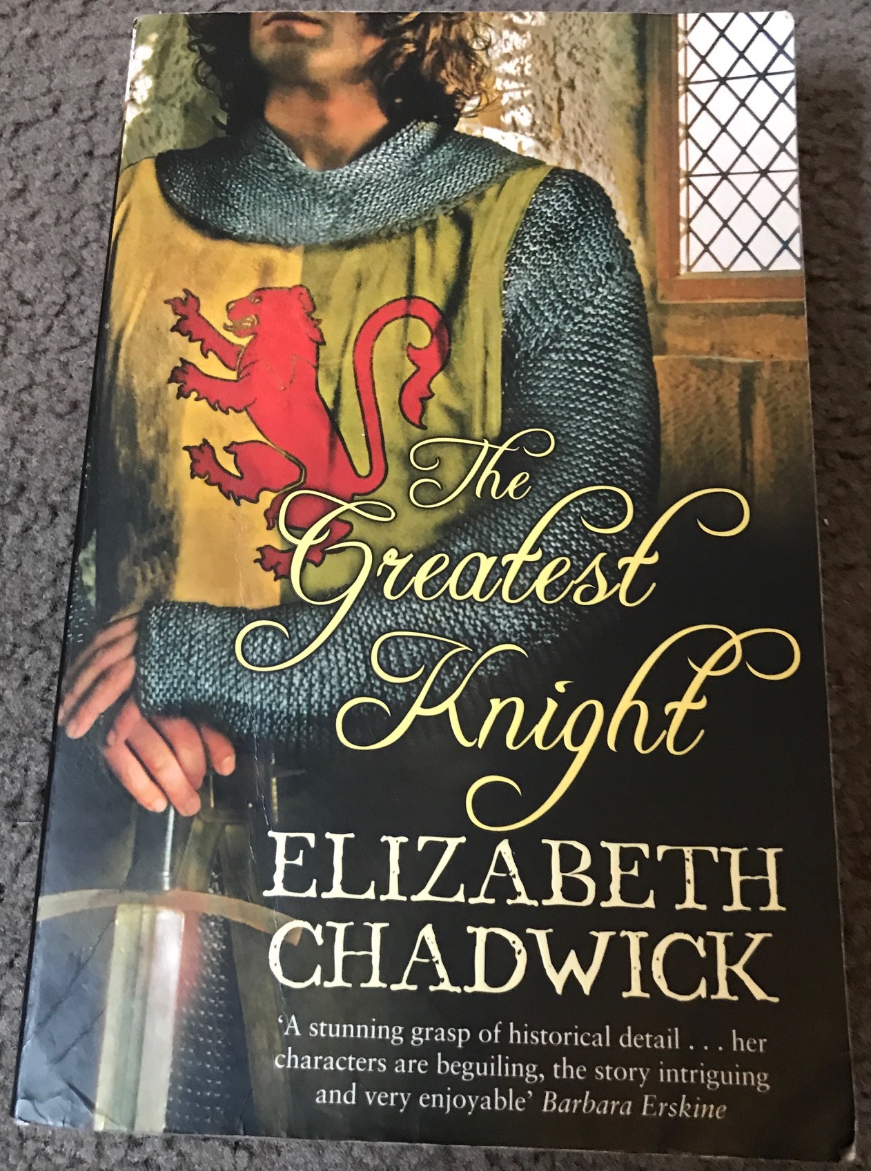
Book: The Greatest Knight by Elizabeth Chadwick
The Greatest Knight follows the early years of William Marshal. From his early knighthood in 1167 until 1194 with the return of Richard I from Crusade and the birth of Marshal’s daughter Mahelt. Marshal was involved in the majority of the important events for the English crown in the this period and lived a complex and fascinating life, remaining a man of loyalty and integrity. The book covers Marshal’s life admirably and it was the novel that introduced me to Marshal in the first place. I went on to read every biography I could find on him, and to write my honours thesis on the man, but this book will remain important to me because it was where I first met him. For more information on the Greatest Knight and its sequels see the author’s site.
Place: Marshal Sites.
The Greatest Knight introduced me to Marshal and led me to travelling to a great number of Marshal related sites. I am not going to go into detail about the life of William Marshal here. If you want more detail you can read my short piece about him here.
I have also written about his wife Isabel de Clare, from whom he gained lands, money and status here.
For this post I am creating a visual diary of key Marshal sites, some of which I have already written about.

Tintern Abbey in Wales, of which Marshal was a patron

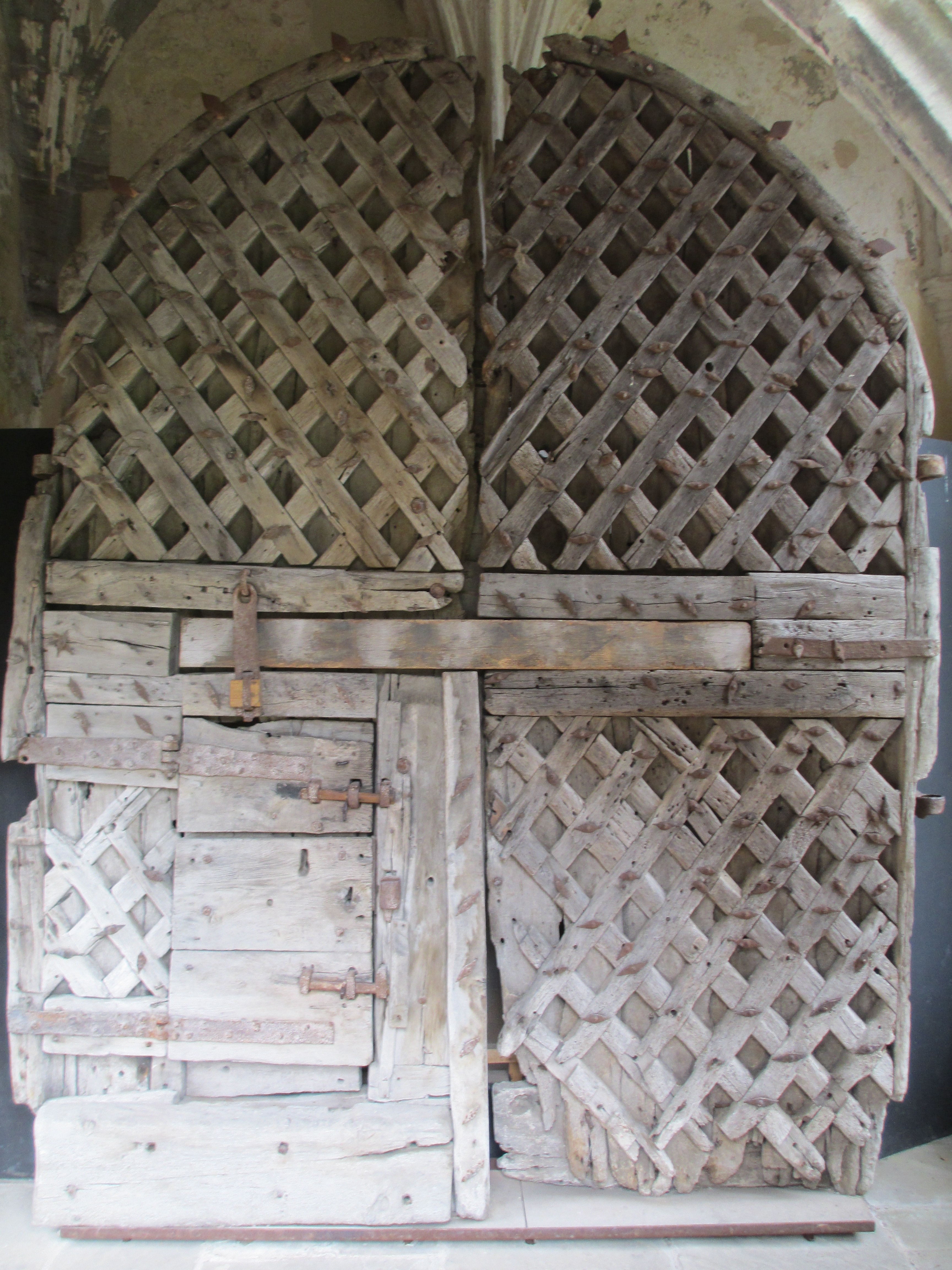

Chepstow Castle in Wales. Marshal was responsible for large portions of it and probably the doors in the photo above. For more information on the history of Chepstow Castle see this previous post here
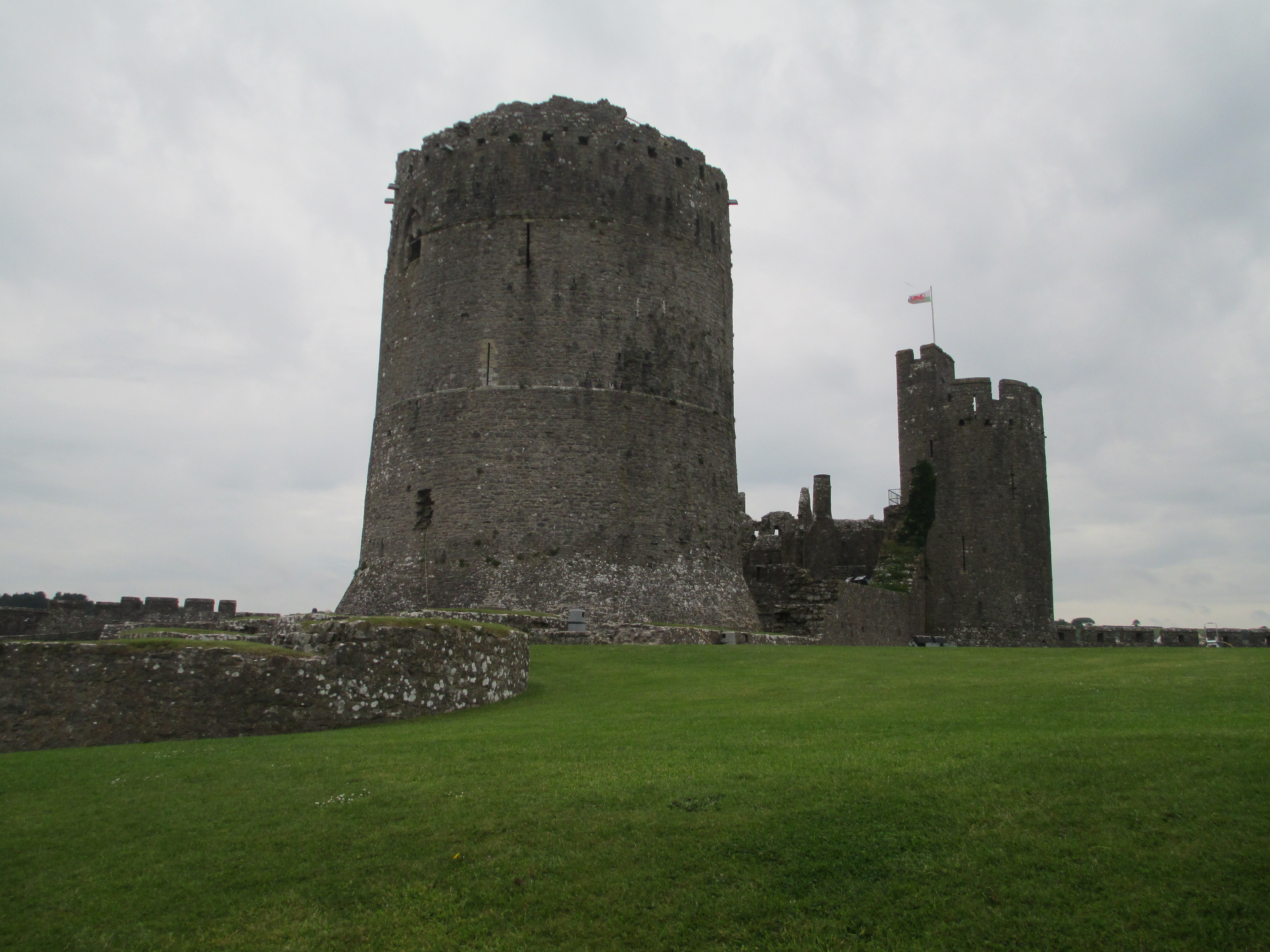
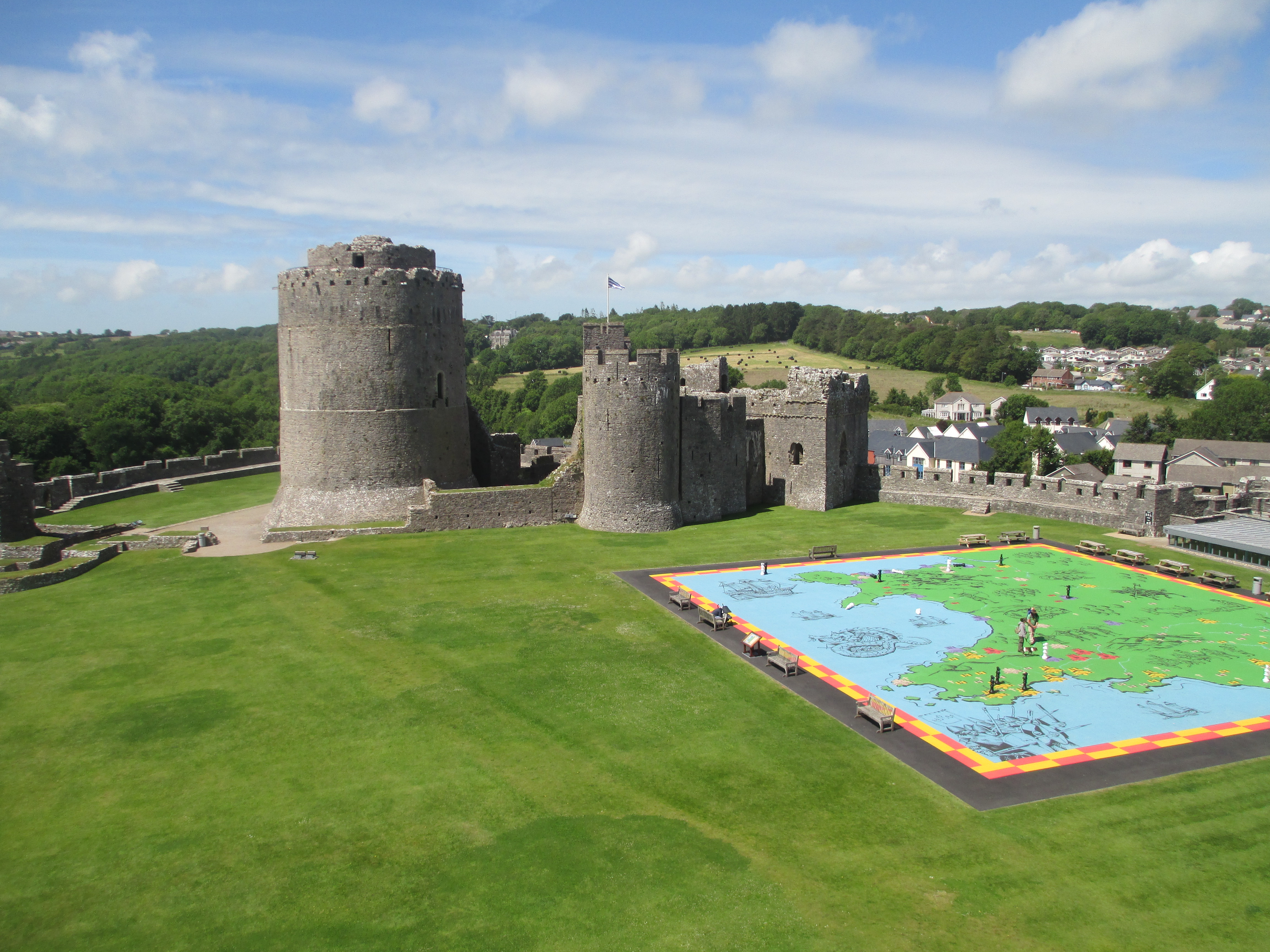
Pembroke Castle in Wales. Marshal was responsible for parts of it including the massive round tower you can see in the photos above. For more information on the history of Pembroke see this previous post

Ferns Castle in Ireland. Marshal built most of it originally. For more information on the history of Ferns Castle see this previous post.

Kilkenny Castle in Ireland. Built partly by Marshal. He was largely responsible for the early form of the round towers. There isn’t much of the medieval castle still visible.
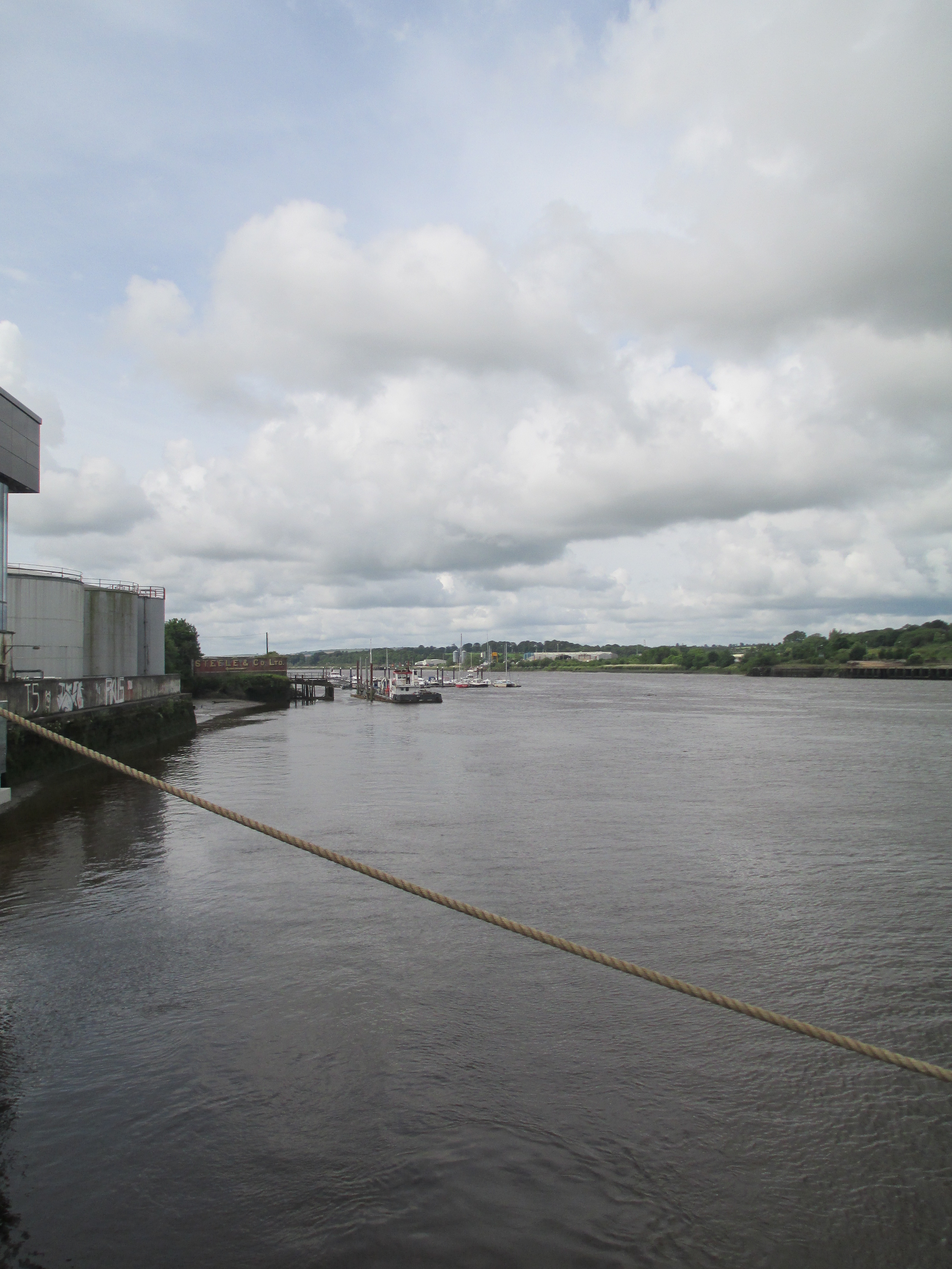
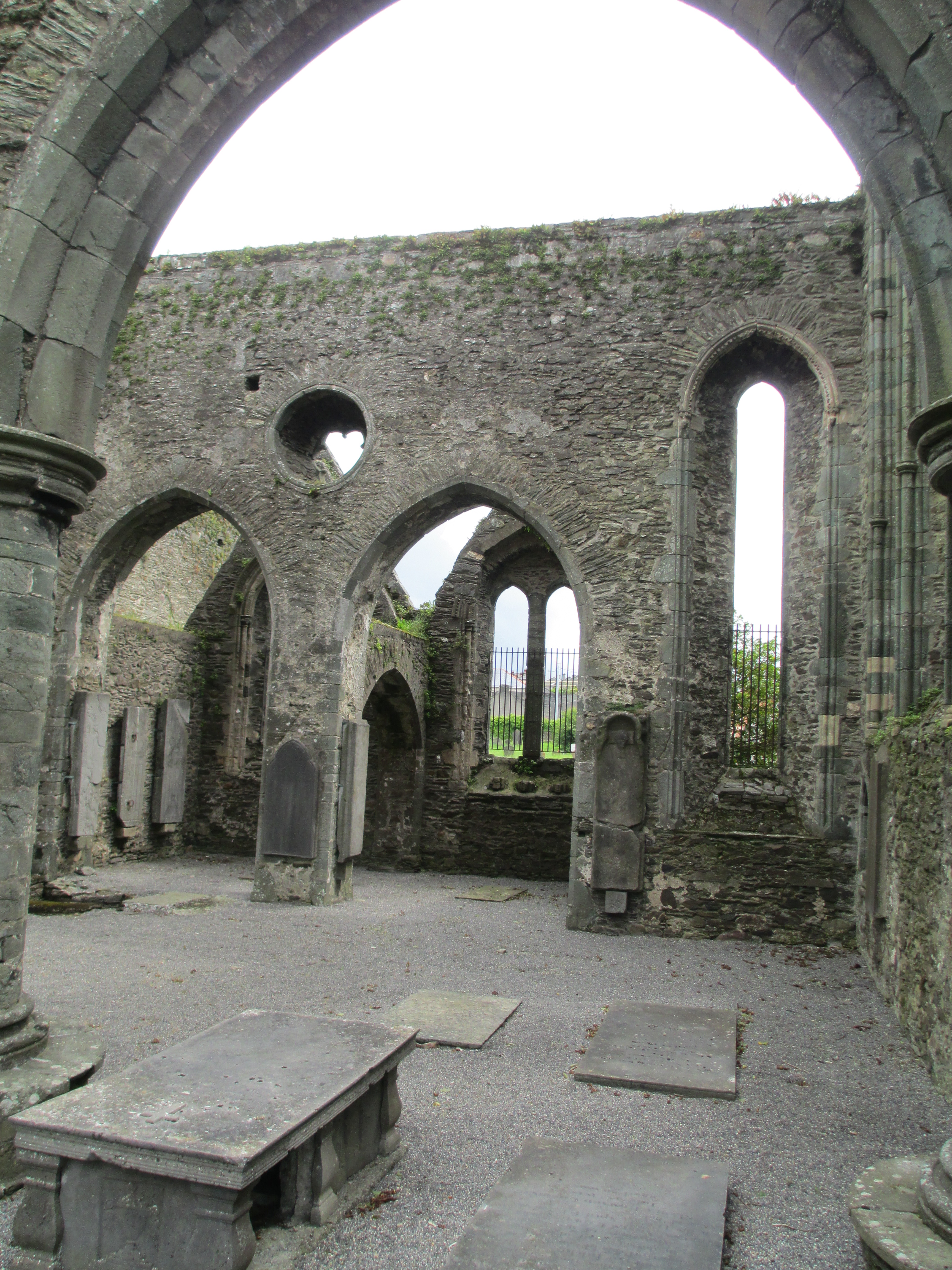
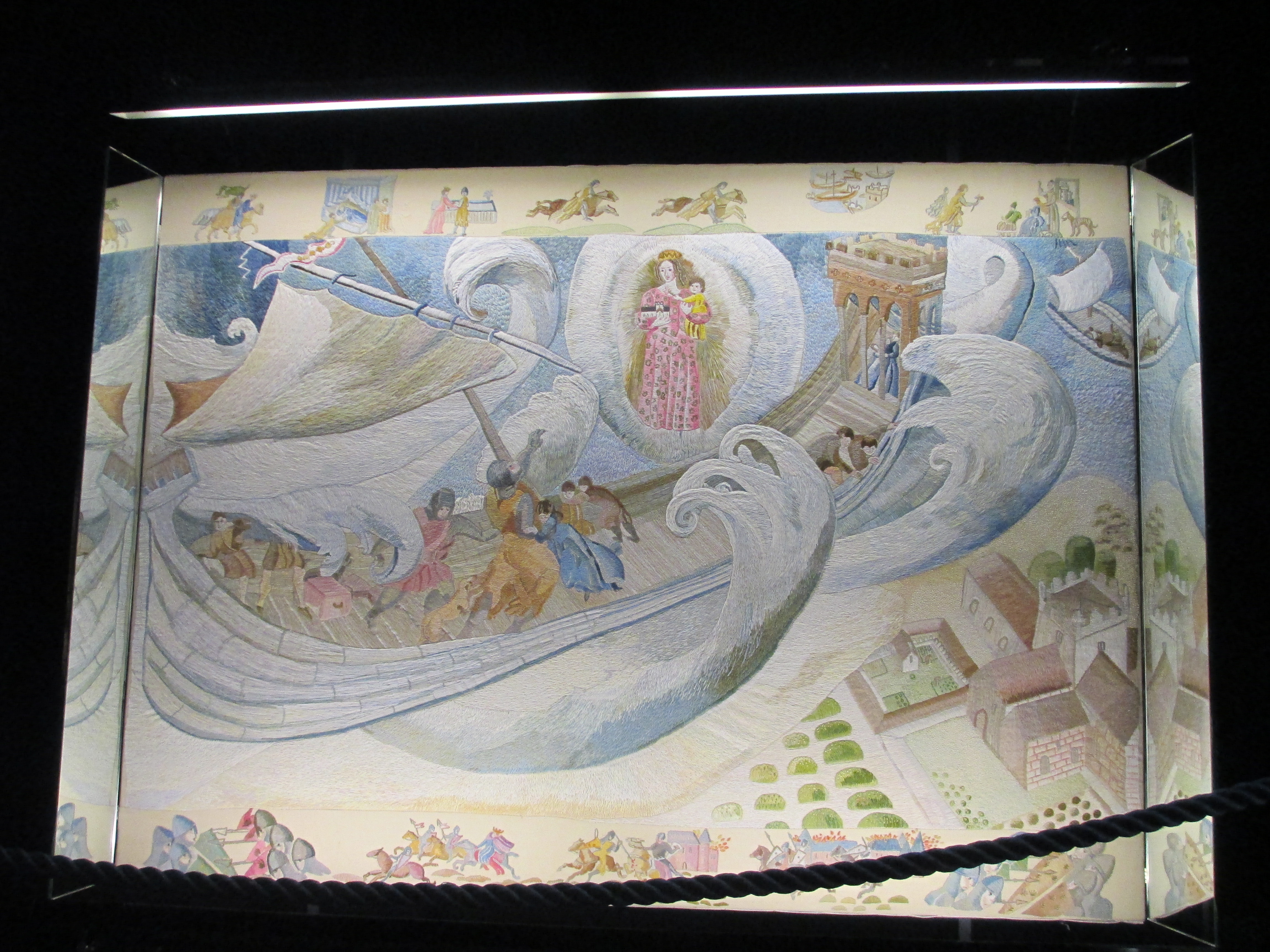
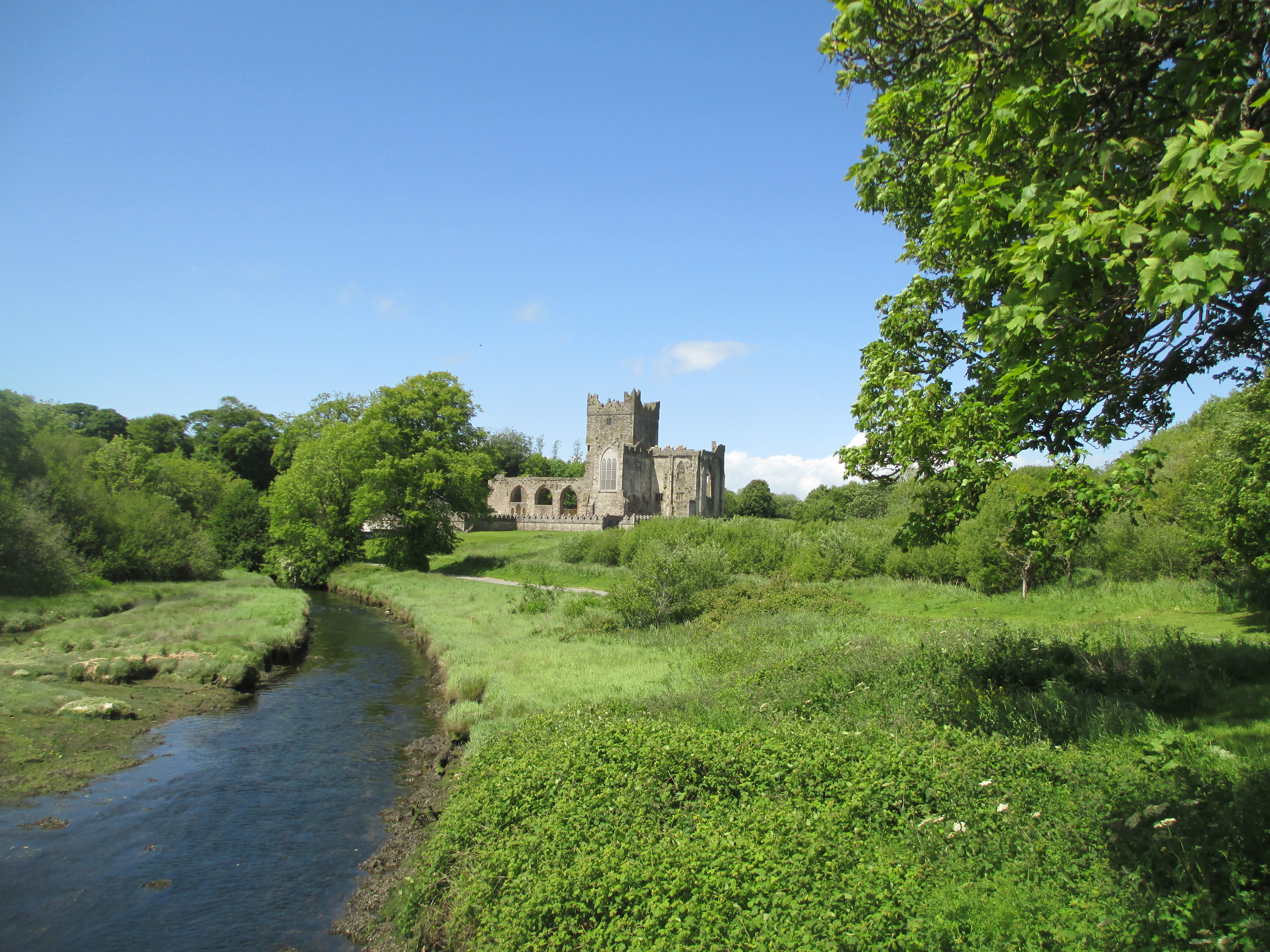
The Barrow River in New Ross in Ireland, St Mary’s Abbey in New Ross and one of the sections of the New Ross Tapestry.
Marshal founded the town of New Ross essentially so he could have a non royal controlled port in his lands in Ireland. He and Isabel de Clare were instrumental in the construction of St Mary’s Abbey. The panel of the New Ross tapestry depicts the storm which Marshal barely survived when crossing the Irish Sea in 1201. He swore to God that if he survived he would found an abbey. He did and it can be seen in the photo below. For more on Marshal, Isabel and Ireland see this previous post.
Tintern Parva in Ireland.
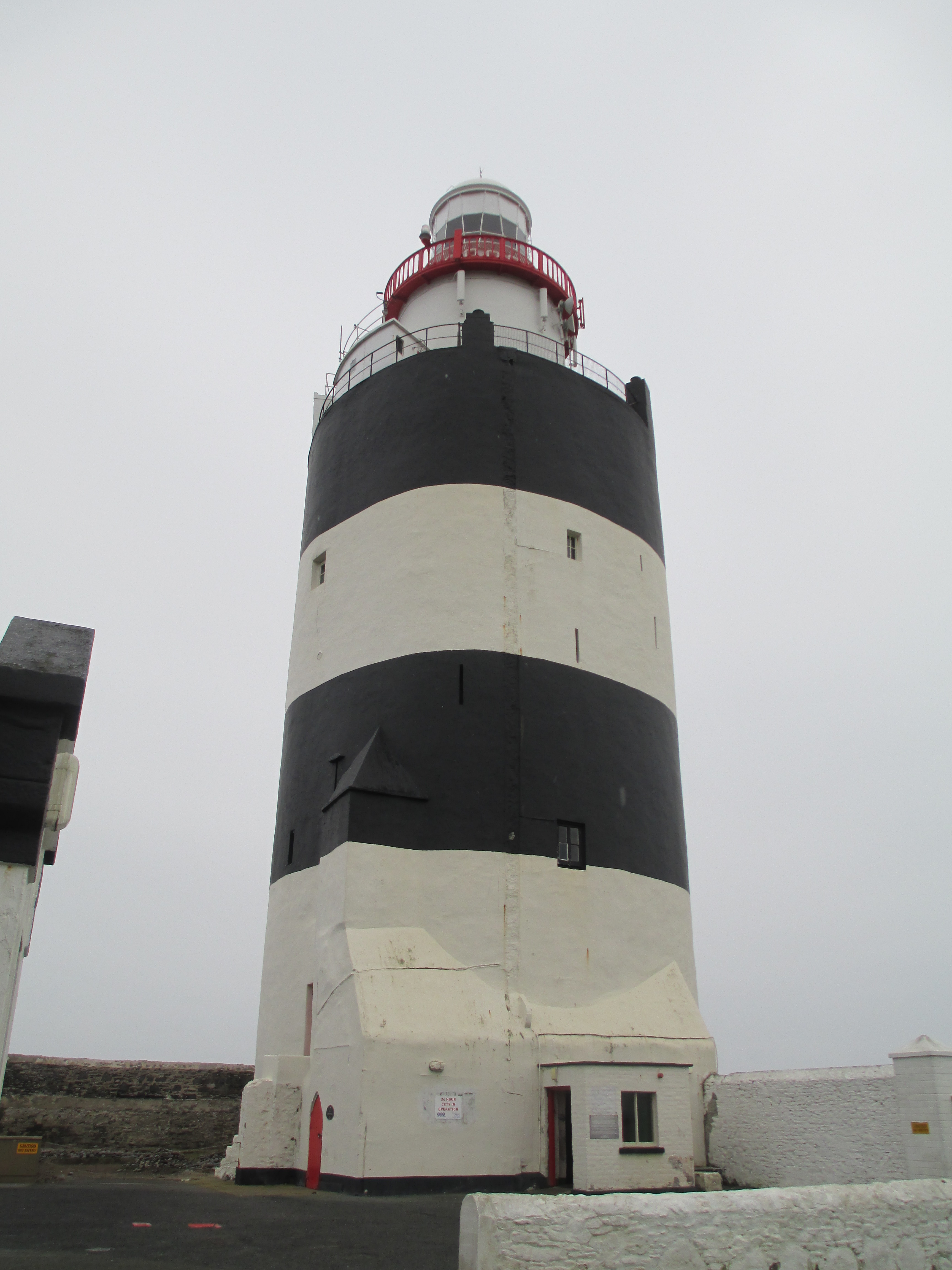

Hook Head Light house in Ireland, which was built on Marshal’s orders in the early 1200s as a landmark and to guide ships up to Marshal’s newly built port at New Ross. For more on the lighthouse see this previous post.

Lincoln Castle. While Marshal had nothing to do with the construction of Lincoln Castle it was the site of the one of the most decisive battles in English history, which had Marshal at its head. In 1217 the young Henry III’s forces, led by his Regent Marshal who was in his early 70s, met with the forces of Prince Louis of France who was trying to take England. The battle was a rout and Marshal’s forces were victorious. It was the beginning of the end of Louis’ attempt to gain the English crown. There were so few casualties it was known as the Faire of Lincoln. For more on the battle and the history of Lincoln Castle in general see this previous post.
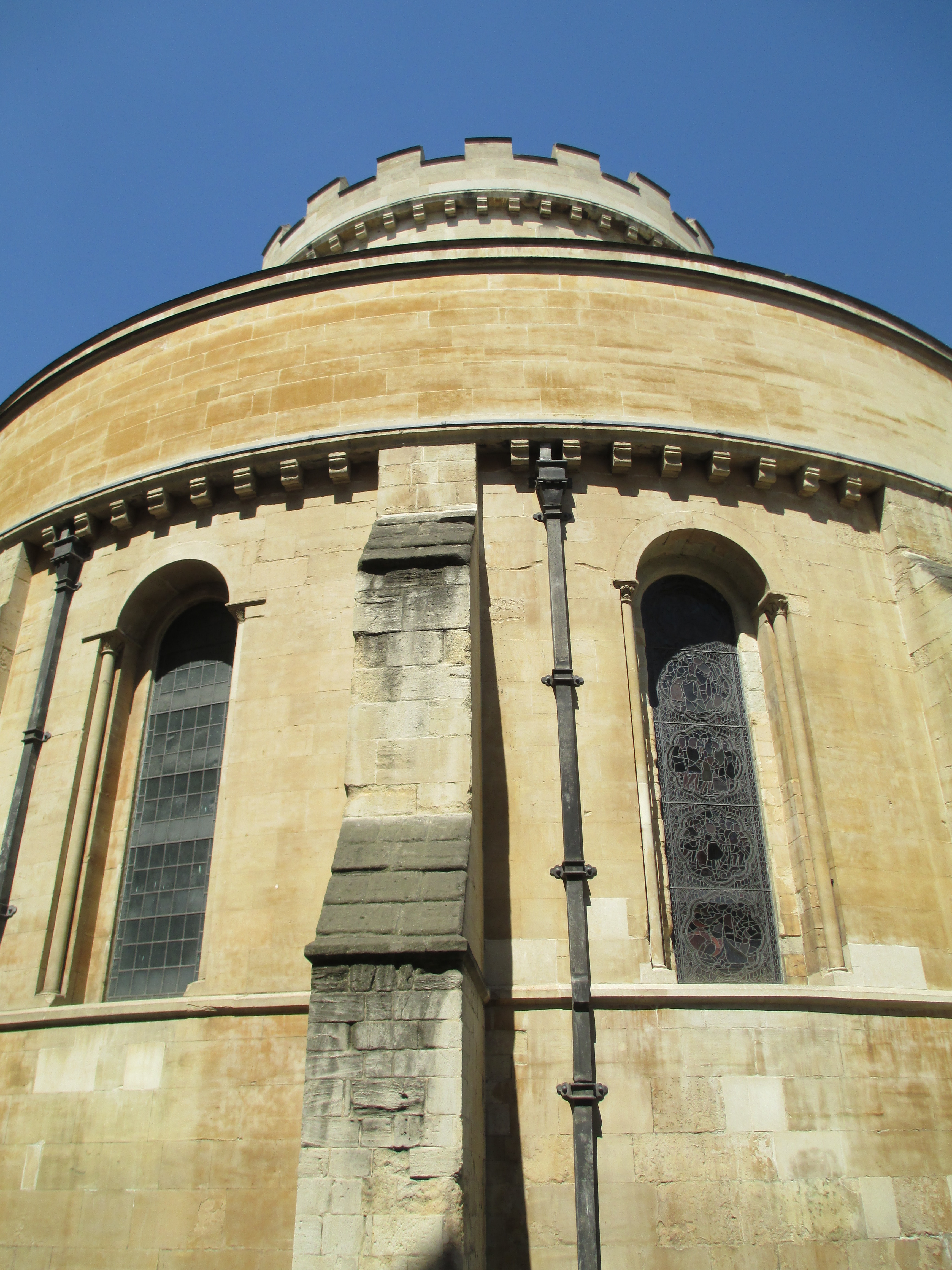
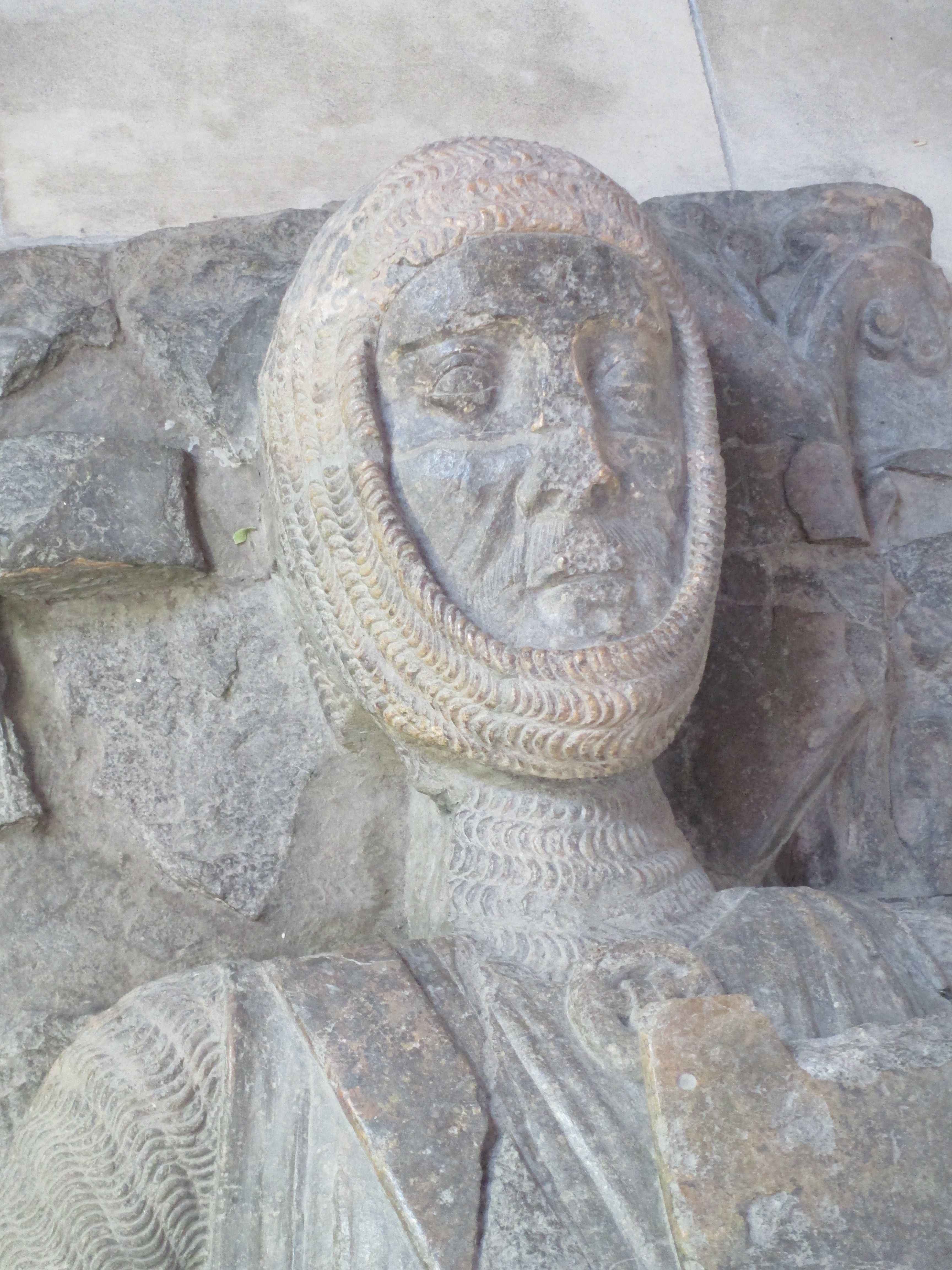
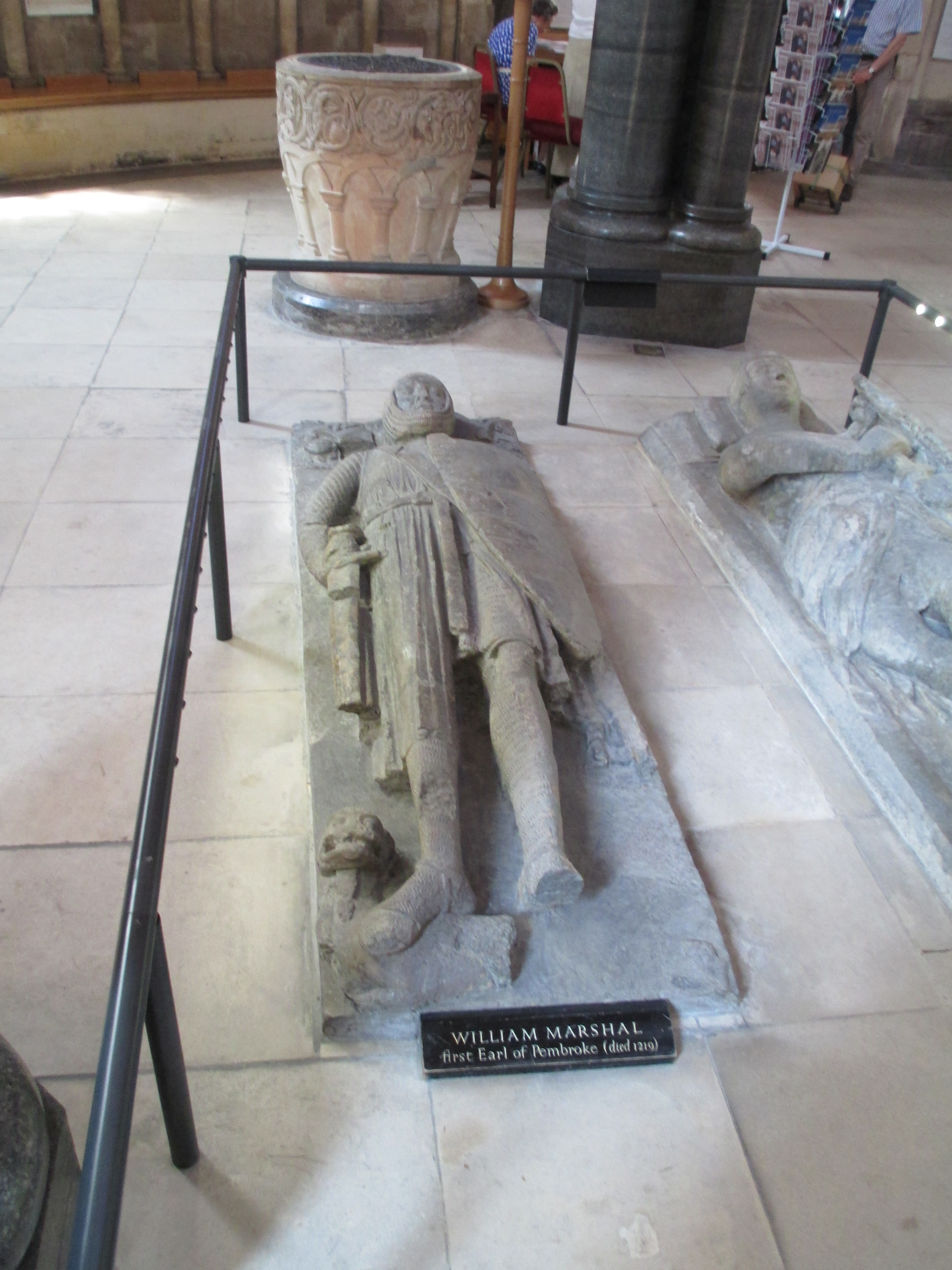
The Temple Church and Marshal’s effigy there.
The Temple Church in London is one of the few surviving actually medieval churches in London. It was built by the Knights Templar and it is deliberately round to mimic the Holy Sepulchre in Jerusalem. Marshal joined the order of the Templars just before his death and was interred in the Church. The effigy was damaged severely during the Blitz but thankfully enough survived and it was restored.
Marshal died well for the medieval period, managing his death and ensuring all the right steps were taken. For more information on Marshal’s death see this previous post.
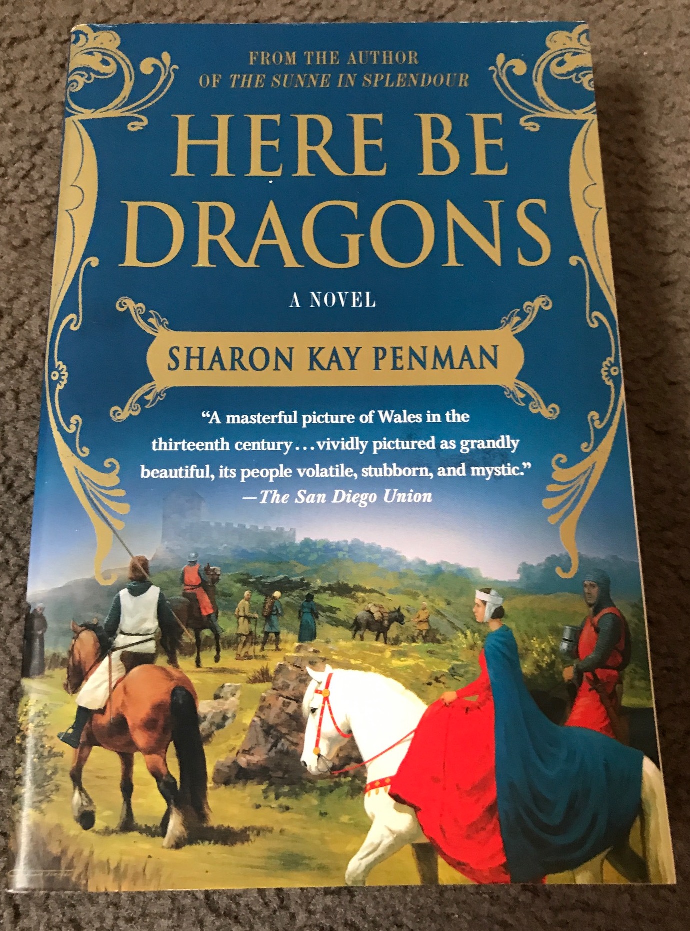
Books: The Welsh Princes trilogy (especially Here Be Dragons) by Sharon Penman
Sharon Penman is probably my favourite medieval author. Here Be Dragons, the first of her Welsh Princes trilogy, was the first book of hers I read. The Welsh Princes Trilogy were also the books that got me interested in Wales. They follow the final years of Wales as an independent kingdom or kingdoms depending on how you look at. They focus on North Wales and the princes in Gwynedd.
Here Be Dragons follows the life of Llywelyn ap Iorwerth, known as Llywelyn Fawr (meaning Llywelyn the Great). He was a Welsh Prince from North Wales who united most, but not all, of Wales and held off the English. You can find out more about Llywelyn in this previous post and about his wife Joan who was King John’s illegitimate daughter, in this previous post.
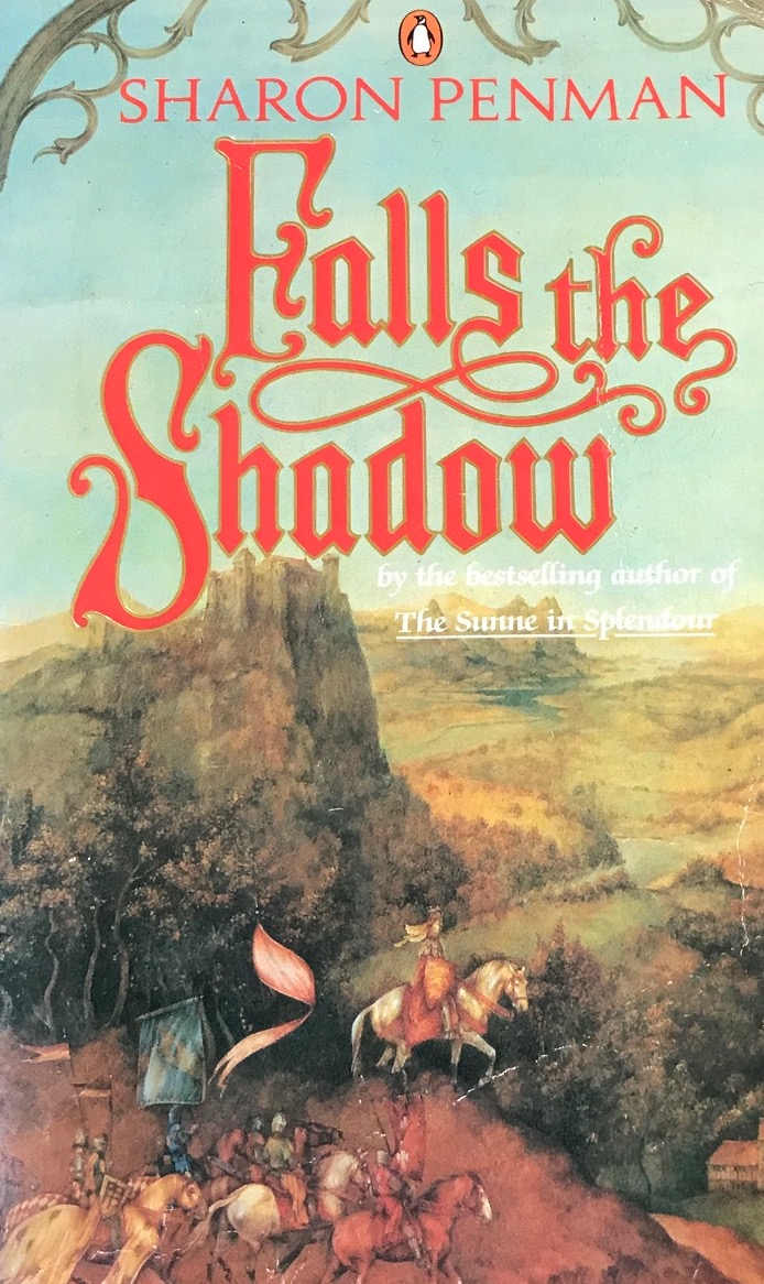
The second book Falls the Shadow follows the end of Llywelyn and Joan’s lives and the life of their son Dafydd and Llywelyn’s grandson Llywelyn ap Gruffydd. A large part of the narrative is also dedicated to the life and love of Simon de Montfort and his wife Eleanor of England (the sister of Henry III and daughter of King John). I’ve never written anything about the de Montforts, though I probably will at some point, so I can’t provide an old post for more information. De Montfort has been credited with being the founder of the concept of the parliament and he led the barons revolt against Henry III. It is much more complicated than that of course, and he and Eleanor are both worth much more time than I can dedicate here. So to learn more about them at here’s a link to the Britannica article.
The final book in the trilogy is the Reckoning. I’ve only ever managed to read it twice because it depicts the fall of Wales to the English as well as the life of Llywelyn ap Gruffydd as he tries to fulfil his grandfather’s dreams of a united Wales. Like de Montfort I’ve never written about Llewelyn before, but you can find more about him here.
Penman brings the period alive and creates characters that are not only enduring, but who you really care about. The series is also helped by covering one of the most fascinating and sometimes unbelievable part of English and Welsh history. It was a time populated with many extraordinary people, but also a time of immense tragedy as a country fell. You can find out more about Sharon and her other books here.

Place: Wales in general but several specific sites
While this trilogy inspired me to become interested in the history of Wales in general and certainly inspired me to go there, it would be a whole other post to discuss history of all of Wales. So I’m going to keep it simple and focus instead on a couple of places in Wales I would never have gone without reading these particular books.
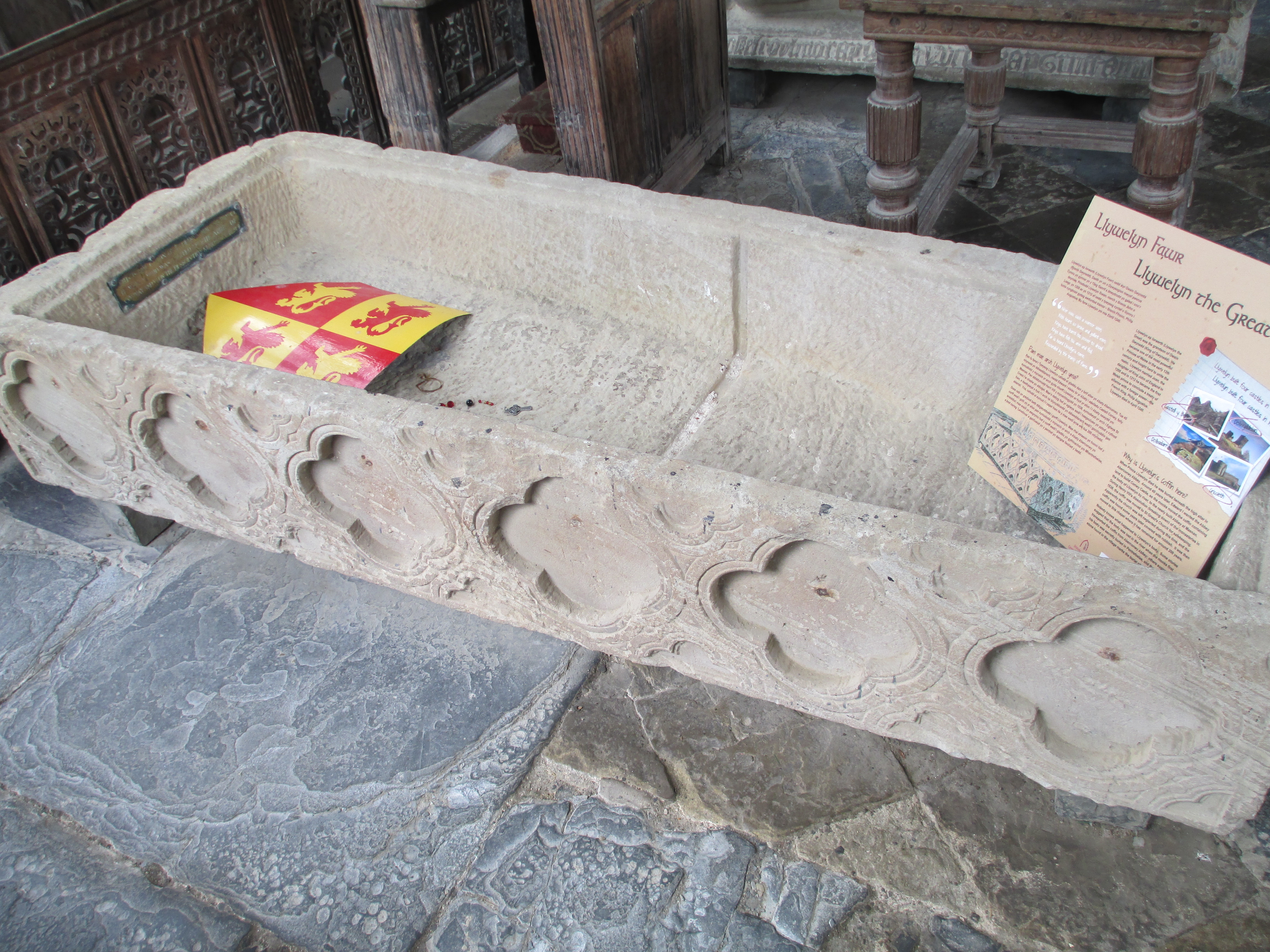

Llewelyn’s tomb in Llanrwst parish church


Joan’s tomb in Beaumaris


Conwy Castle. I visited this castle because it is an amazing example of late 13th century medieval architecture, for more on the castle see this previous post, and because it is on the site of the abbey where Llewelyn was originally buried. The town is also where a statue of Llewelyn stands, though it much smaller than it looks and smaller than it should be. You can see it below.

I wanted to add in two natural rather than historical sites as well.

Mount Snowdon. The photo is the view from the top. Penman describes the mountains in Northern Wales so evocatively that I had to see them. I was lucky enough to get spectacular weather when I took the train up Mount Snowdon.


Aber Falls, known as Raeadr Fawr in Welsh. These falls feature in a particularly intense scene in Here Be Dragons. They are very close to Abergwyngregyn, a small Welsh town that was once one of the homes of the Welsh Princes. There is nothing left of the residence, but the waterfall is spectacular.
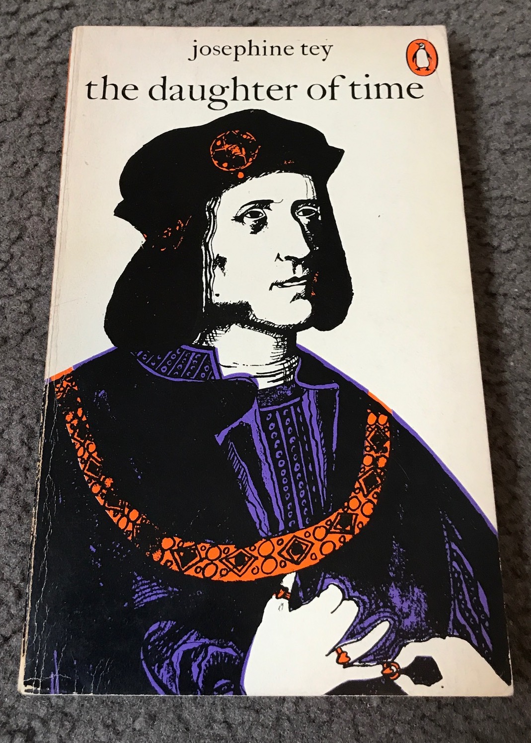
Book: Daughter of Time by Josephine Tey
While this is a contemporary mystery it is the first book that introduced me both to the concept of history being written by the victors and the many arguments surrounding Richard III, so it is worthy of inclusion. If you haven’t read Daughter of Time do, everyone should if only so you can learn that history is not immutable fact.
Tey takes the unusual step of having her usual detective Alan Grant stuck in hospital with a broken leg. In his boredom, he begins to investigate the history of Richard III with the help of a young American student to do the leg work. The book looks at how the popular narrative of Richard III as a nephew killing villain has been constructed and Grant investigates until he finds what he sees to be the truth behind Richard III. I am not going to get into the Richard III debate here (though for the record I fall on the side of he probably didn’t kill his nephews but we can never really know) but regardless of where you fall in the debate, Daughter of Time is fascinating. It not only imparts a the history of Richard III and his period, but it deconstructs how history is constructed. In managing the latter in a readable, relatable and engaging way it is one of the most important books written.
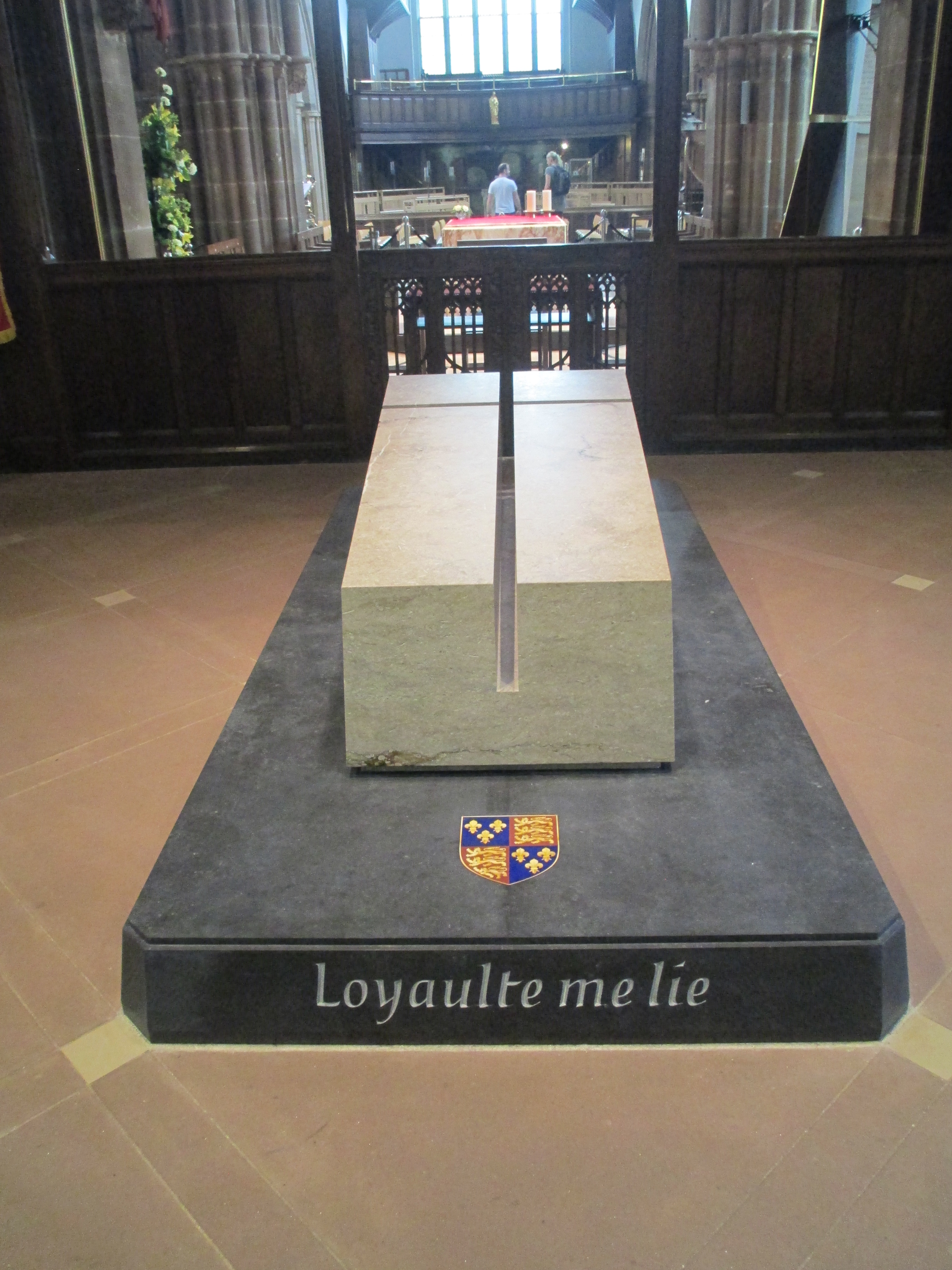
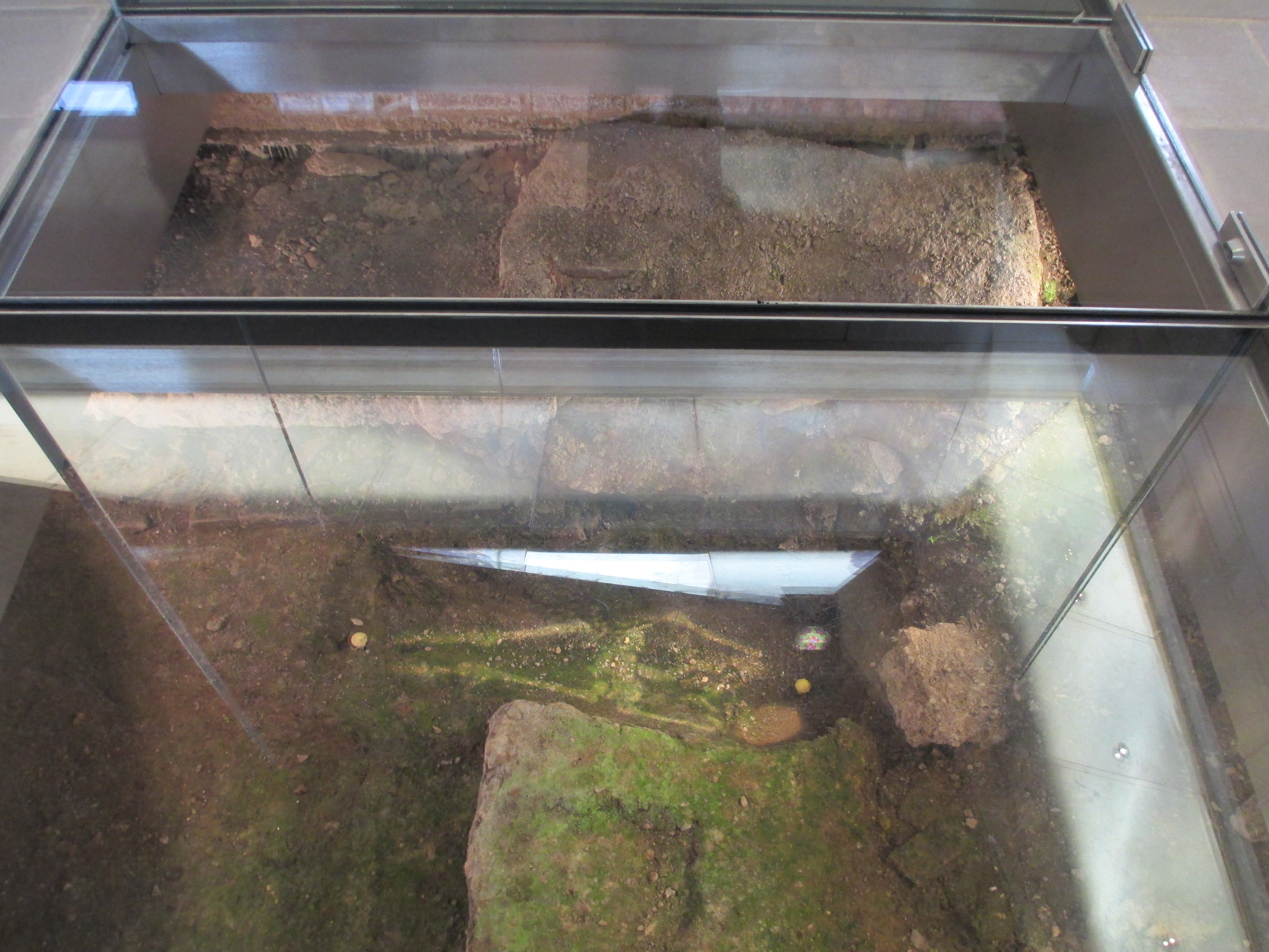
Place: Richard III’s grave and tomb
I was quite young when I read Daughter of Time, 12 or so I think, so while I was aware of Richard III and knew a little about him it was Daughter of Time which introduced me to arguments regarding the truth of his story and cemented my interest in the king. So while Sharon Penman’s Sunne in Splendour (a retelling of Richard’s life) also deserves credit, I’ve decided to list Daughter of Time as the main reason I went to Richard III’s grave and tomb in 2015.
I travelled especially to Leicester. I know both Richard’s burial in Leicester and the monument to him in the cathedral have their dissenters (there’s lots of articles about this, google it if you’re interested). I, however, found both the monument and Richard’s actual grave surprisingly moving. When I was there in 2015 the cathedral still had some work to do in providing information both about the cathedral and Richard III (though I’ve heard from other people they have improved substantially). The Richard III centre across the road was fascinating and a well realised tribute. You can see both Richard’s tomb in the cathedral and his grave in the photos below.


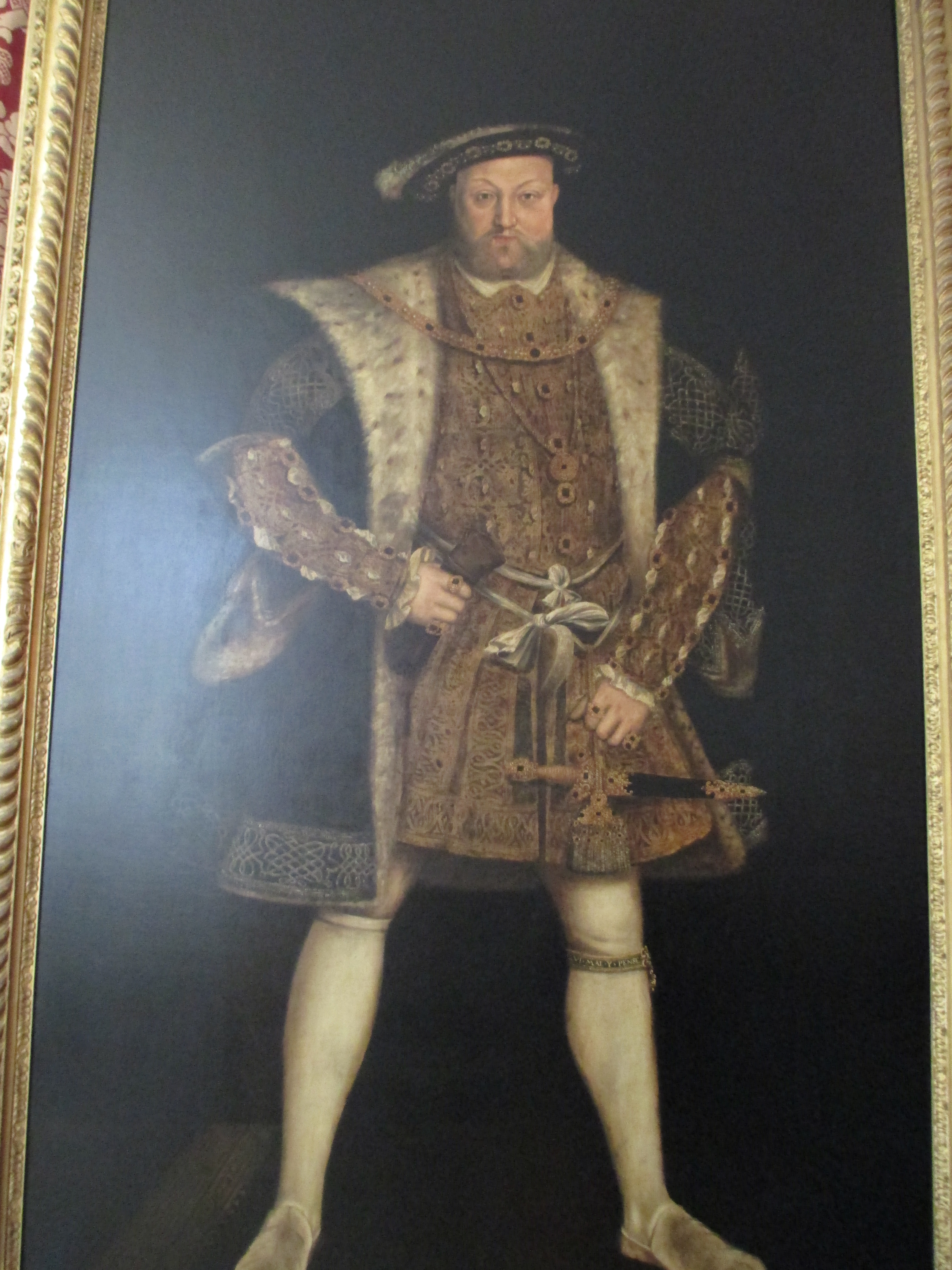
Book: Henry VIII’s Shoes by Karen Wallace
This might seem to be an odd book to finish on. It’s a children’s book to start with and it’s actually set in the present day although Henry VIII does still feature. This however, for me, was the book that began my interest in history. It’s the story of a group of English kids who go to Hampton Court for a school trip, and find some shoes in the maze. They turn out to be Henry VIII’s shoes and then Henry himself shows up.. chaos ensues.
I was reading this as an eight year old when my grade 3 teacher (Mr Spaull) assigned a project where we could pick any historical figure we wanted. At my Mum’s suggestion, because of this book, I chose Henry VIII and the rest is literally history. I started with the Tudors and then moved back to the Plantagenets, read a lot of historical fiction and a bit of non fiction, studied history as much as I could at school, studied history at uni, did my honours degree in medieval history and ultimately ended up working in a history library (Australian history, but still) all because I was reading this book at the right time. So books and teachers can change lives, even in slightly unexpected ways.

Place: Hampton Court
I’ve credited this book as the genesis of my interest in history, which is true, but in the spirit of this post it is also the primary reason I went to Hampton Court.
Hampton Court is probably best known for its association with Henry VIII. It was built by Cardinal Wolsey, but Henry took it from him in 1529. He expanded it greatly and was determined to make it a pleasure palace.
It wasn’t just Henry’s palace though. It was used by succeeding monarchs as well, including his three children. It was there, during the Hampton Court Conference, that James I commissioned the King James Bible. James’ son Charles brought an art collection, one which Oliver Cromwell admired when he took over as Lord Protector of England. Charles II installed his mistresses there and William III and Mary II commissioned Christopher Wren to extensively remodel the buildings. Wren originally wanted to demolish the whole thing and start again but they didn’t have the money, so he settled for rebuilding the king and queen’s apartments. Hampton Court is now run by Historic Palaces. You can see photos of Hampton Court below.


The photo above seemed to be a good way to finish. It’s taken in 2012 when I made it to the centre of Hampton Court maze, in a funny way I’d made it back to where I started my journey into history.
References:
Sister Fidelma and Cashel:
Site visits 2012 and 2015.
Sister Fidelma’s time: http://www.sisterfidelma.com/fidelma.html
Brother Cadfael and Shrewsbury
Site visit 2012
Shrewsbury Abbey: http://www.shrewsburyabbey.com/A%20Rare%20Benedictine.html
Owen Archer and York Minster:
Site visit 2012
Candace Robb: http://www.emmacampion.com/books
York Minster guides.
The Burren Mysteries and The Burren
Site visits 2012 and 2015
Cora Harrison: http://www.coraharrison.com/burren.html
The Greatest Knight and William Marshal
Site visits 2012 and 2015
Elizabeth Chadwick: http://elizabethchadwick.com/knight/
The Welsh Princes and Sharon Penman
Site visits 2012 and 2015
Sharon Penman: http://www.sharonkaypenman.com/
Daughter of Time and Richard III
Site visit 2015
Henry VIII’s Shoes and Hampton Court
Site visit 2012
Hampton Court history: https://www.hrp.org.uk/media/1205/hcphistory_v1.pdf
The photos are all mine.


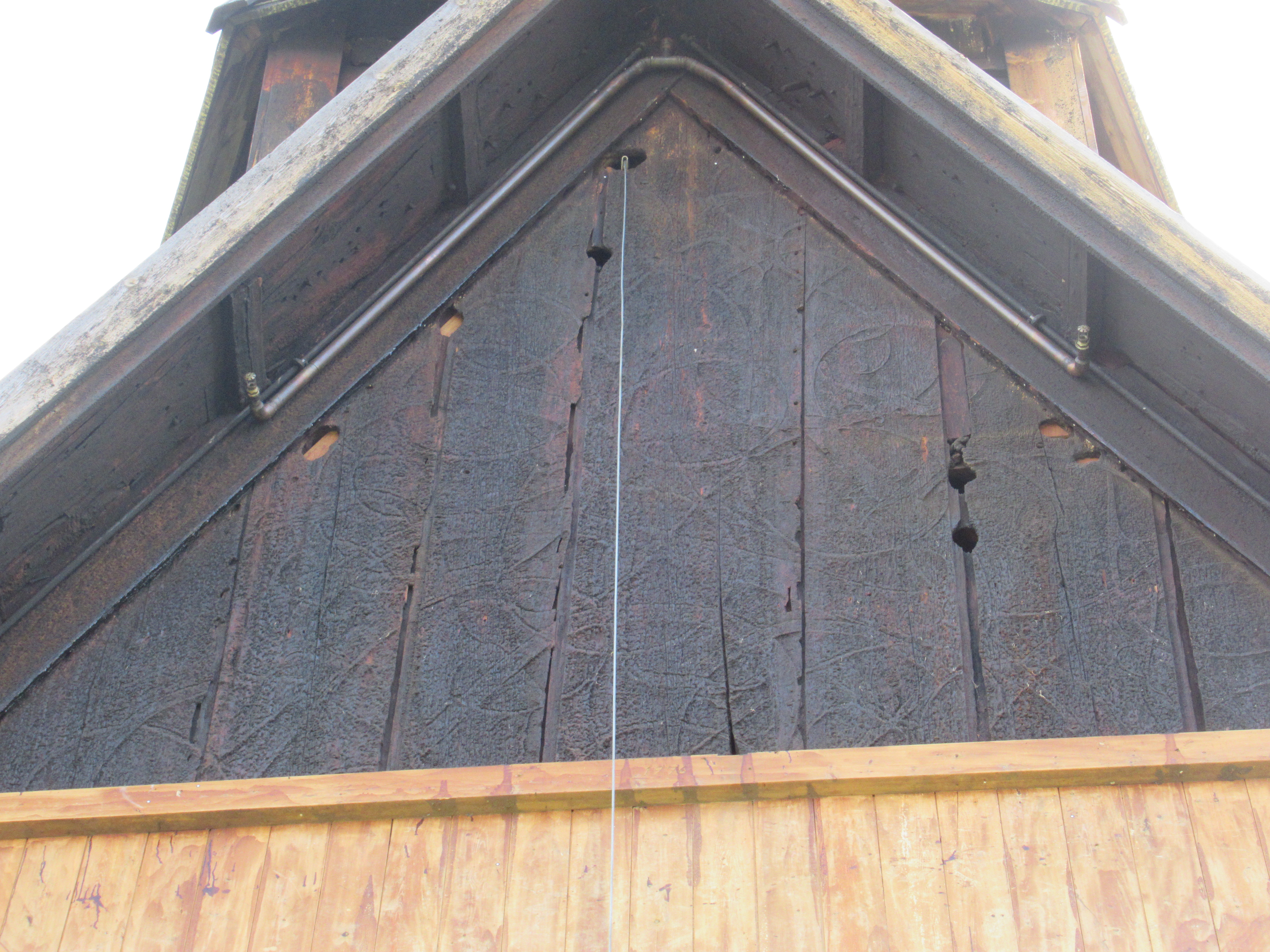
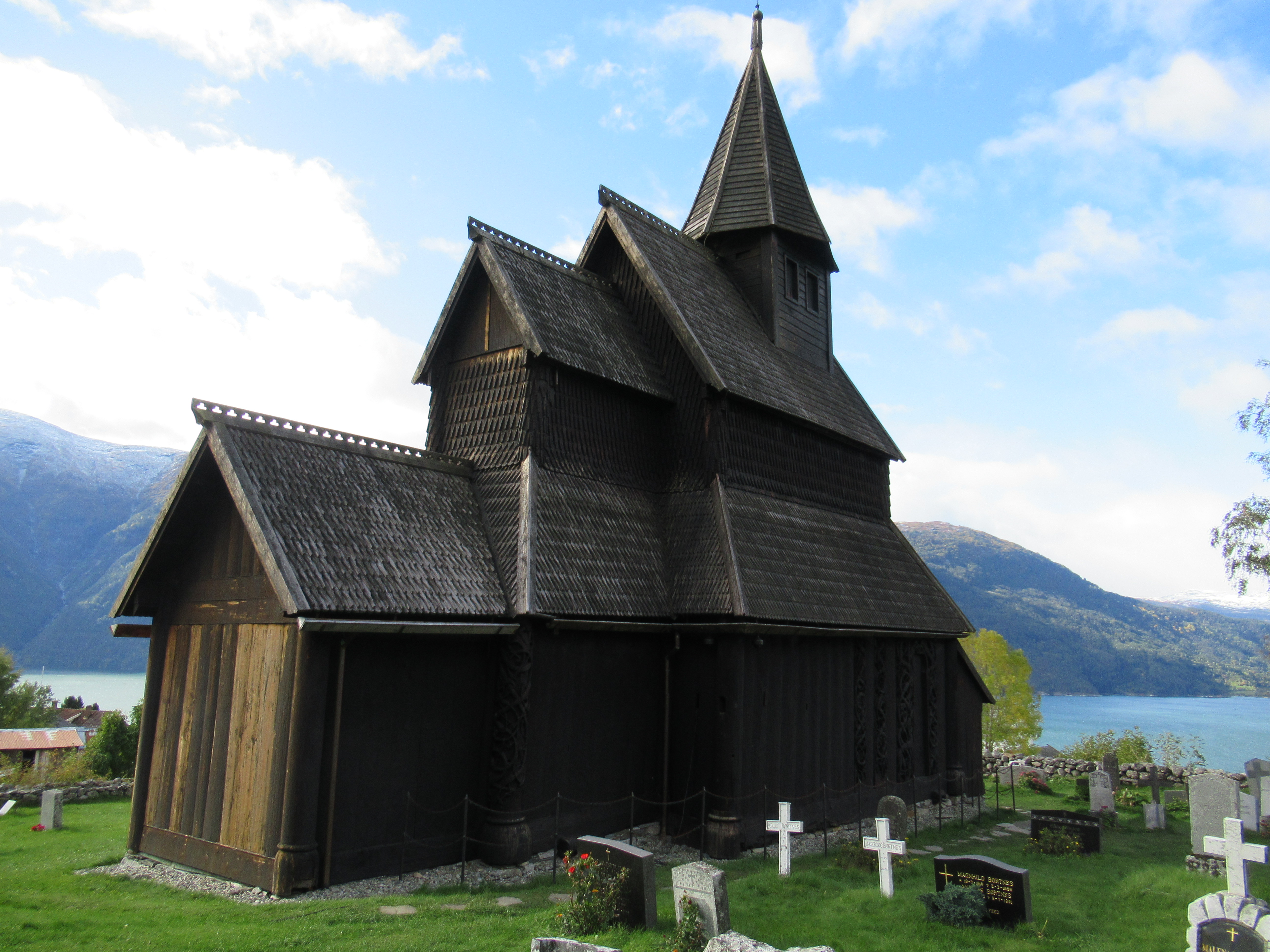
 It is, however, its completeness as a 12th century wooden structure inside and out, and especially the carvings, which make it truly remarkable.
 There were once over 1000 stave churches in Norway, but now only 28 remain. Most were built between 1130 and 1350 though a few are later. The black death affected the construction of new buildings after the mid 14th century. The reason they survived, even though they are wooden, is because the wood is coated regularly in pitch to protect it from the weather (this is still done at Urnes). In the case of Urnes it has a stone foundation, which stops it rotting from the ground up. The previous church on the site was a post hole church, the holes have been found in archaeological investigations.

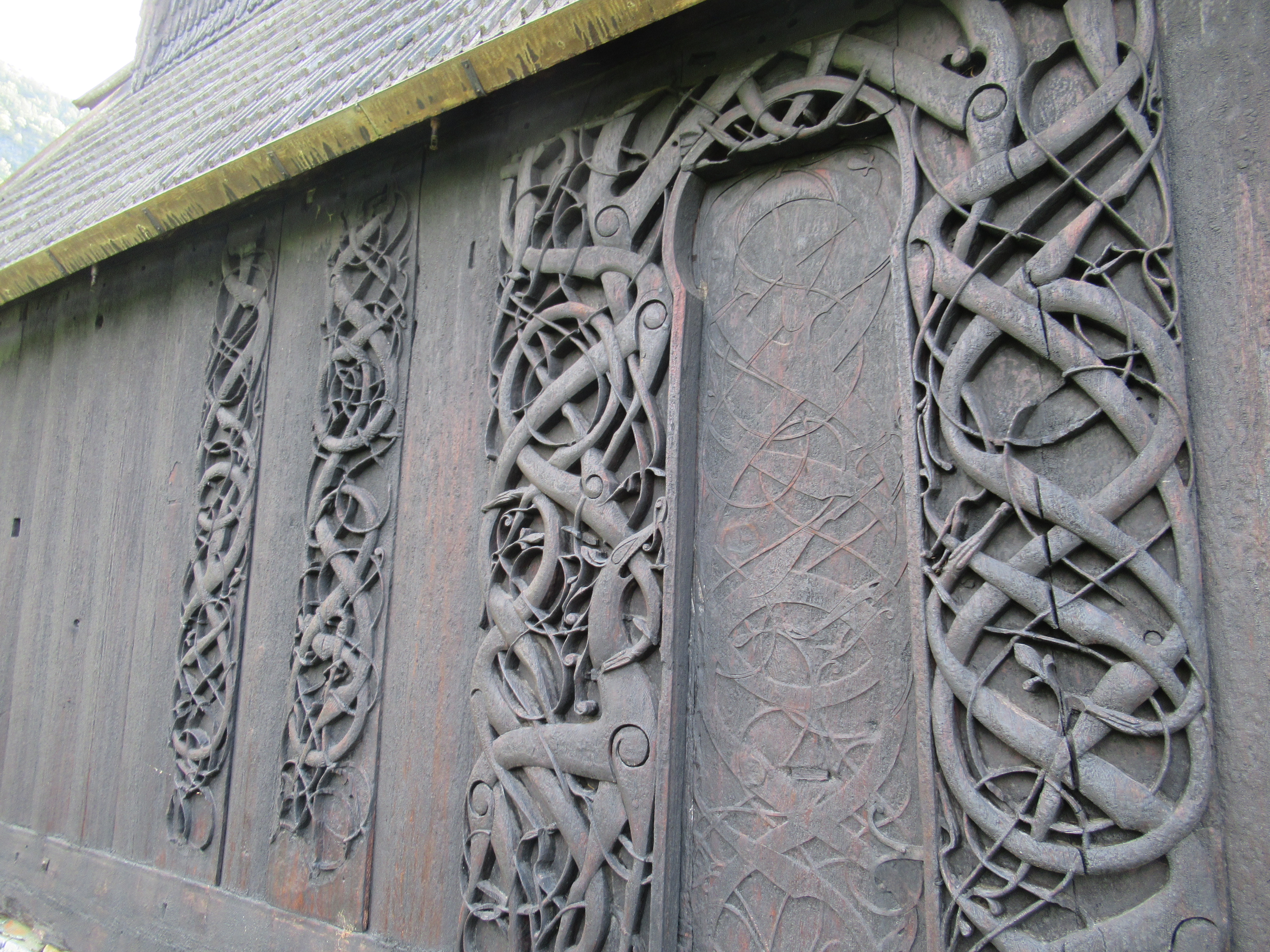
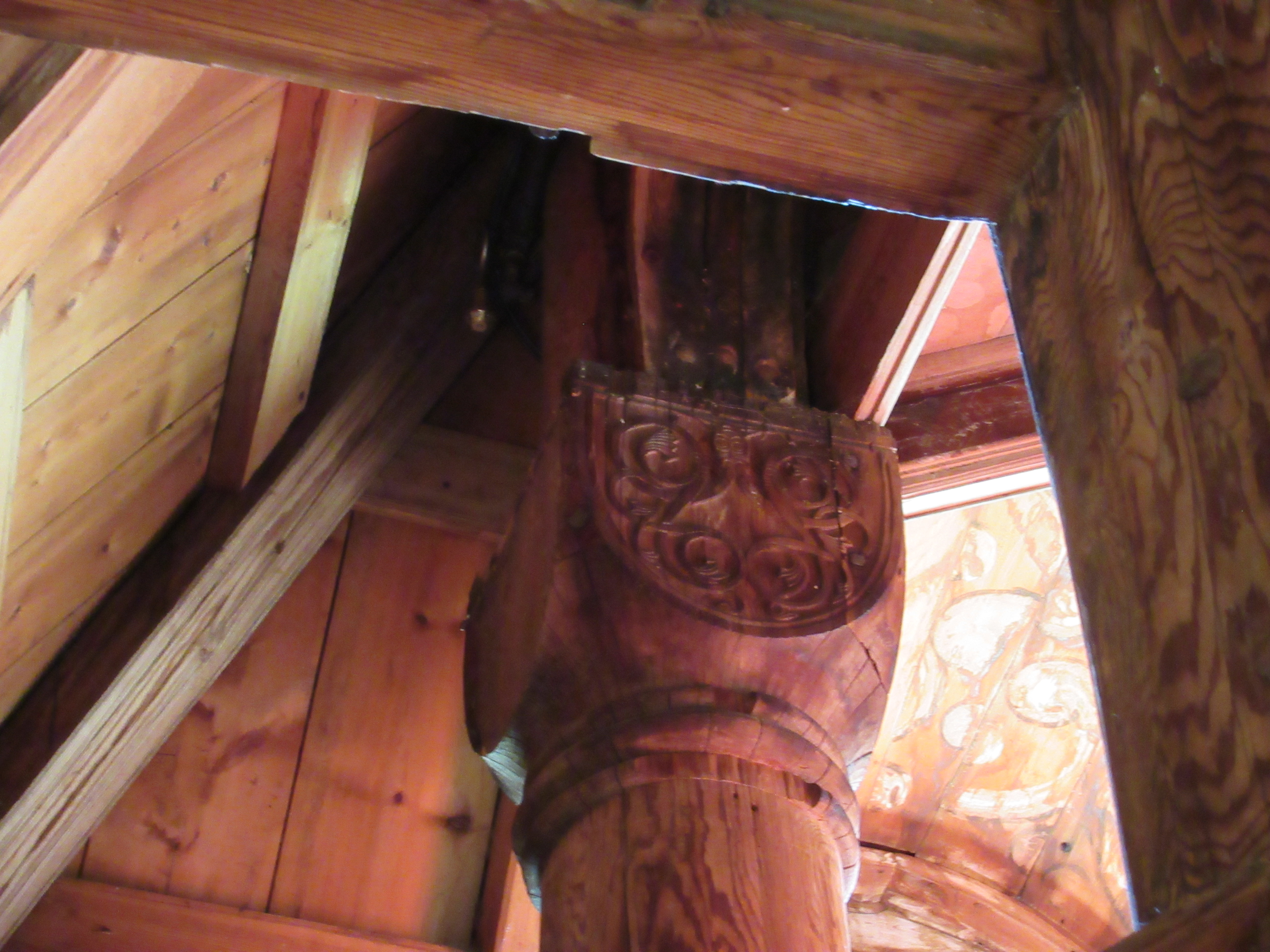
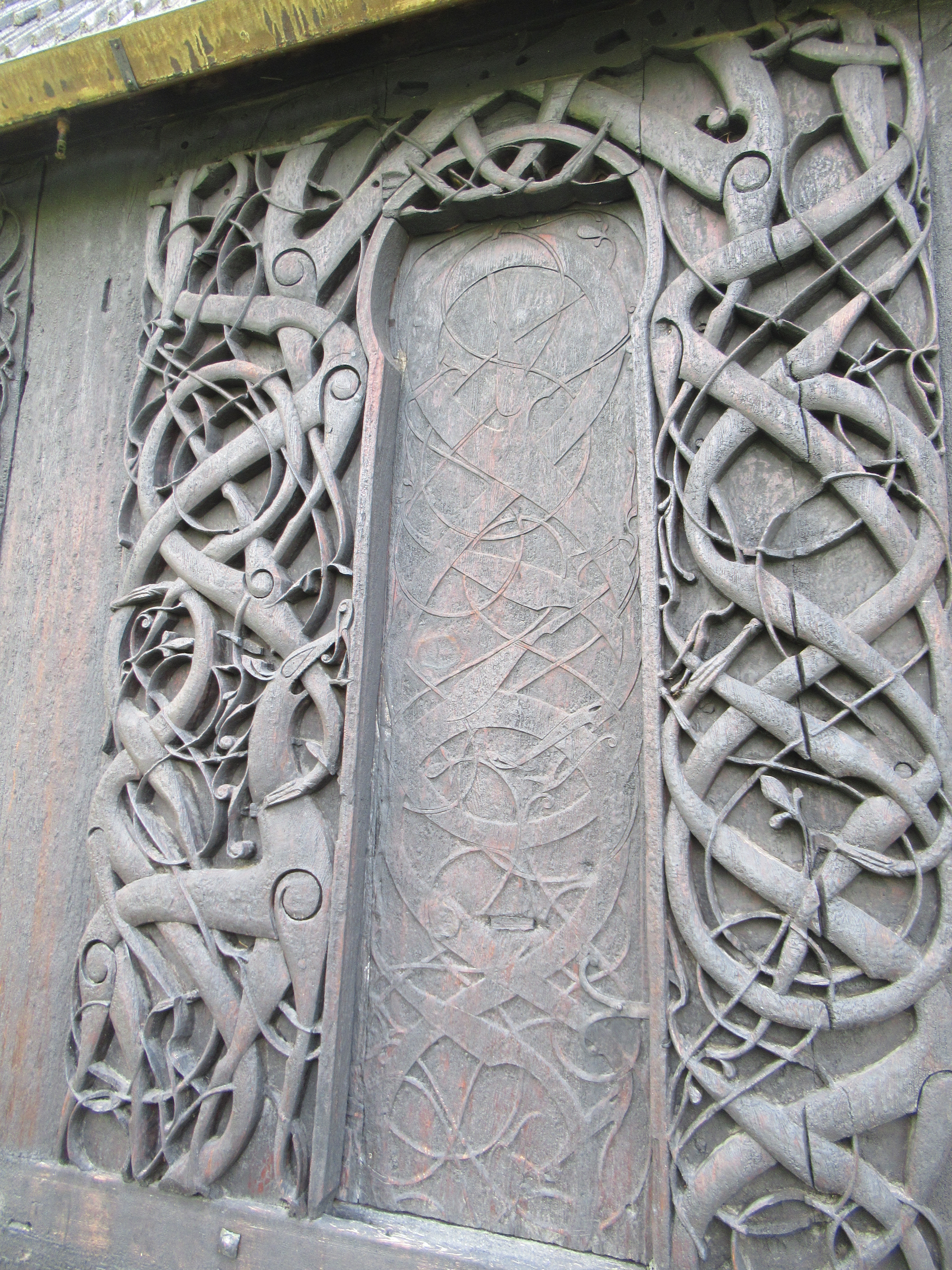 The carving above is the side door which is no longer used, but would most likely have originally been the main entrance. You can see a stylised lion in the carvings on the left. These carvings most likely come from the exterior of the earlier church and were reused in the current church. You can see the interior of the door below.
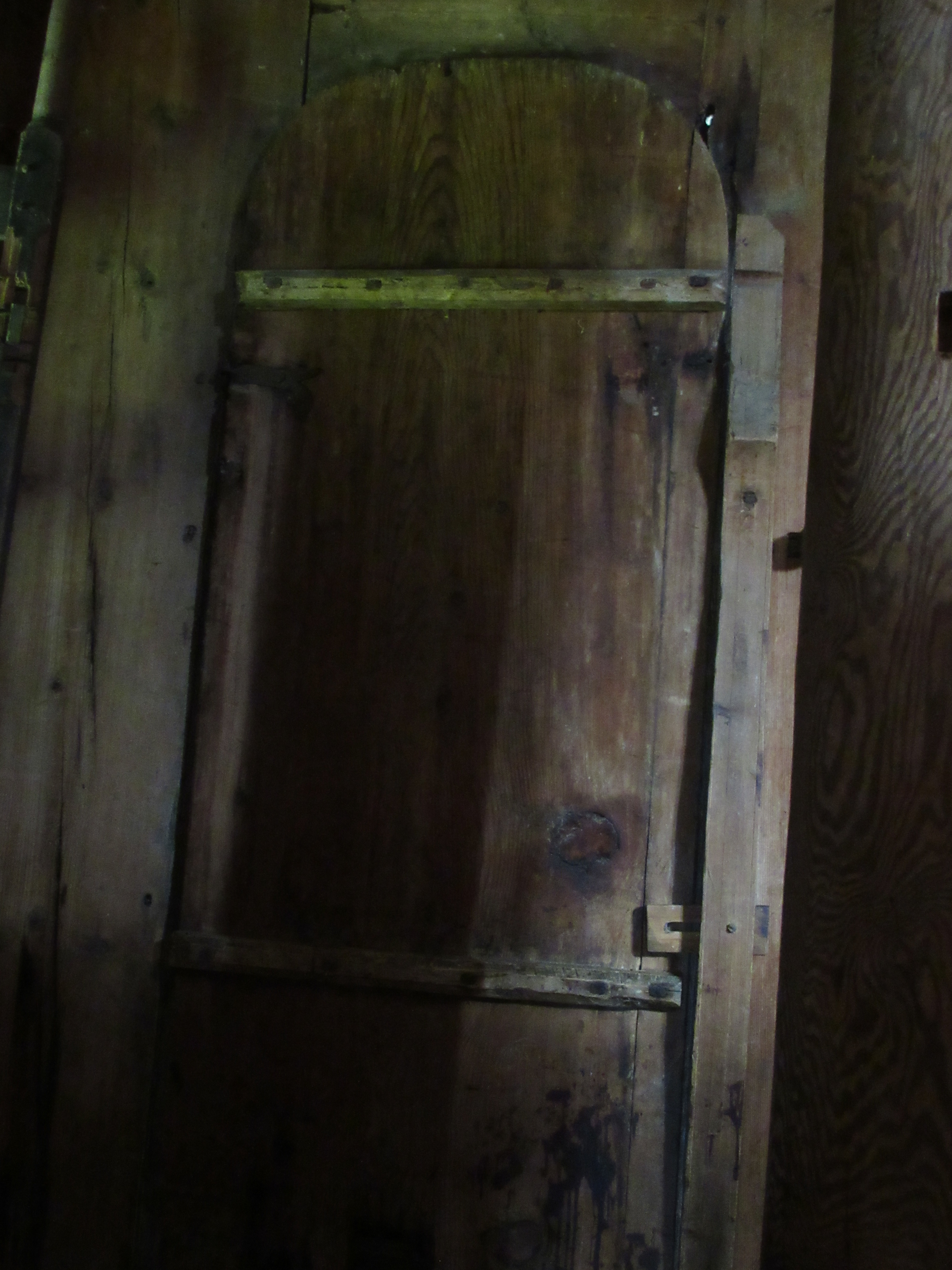


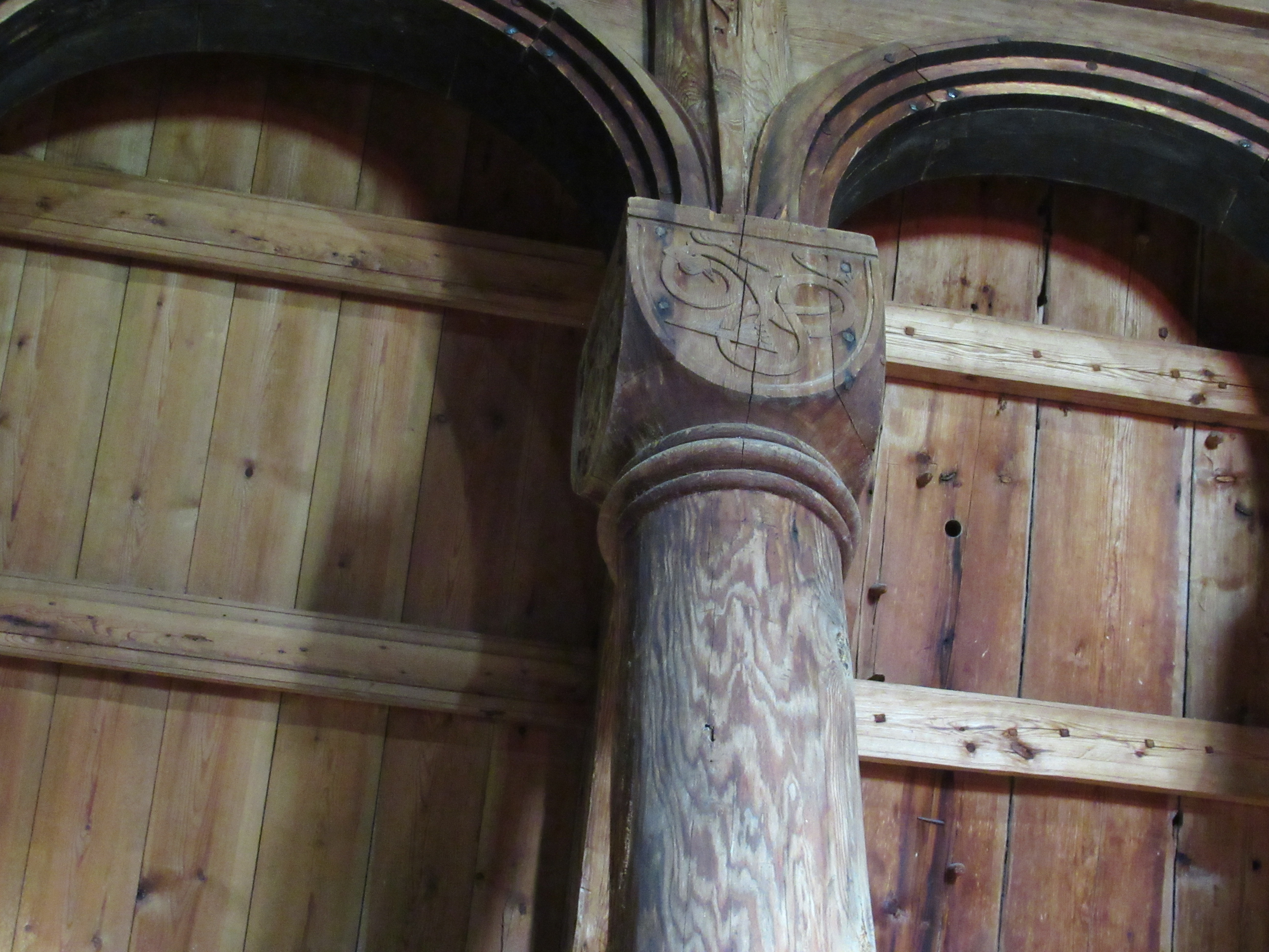
 Leaving aside the exterior of the church for the moment, the interior is just as if not more impressive.


 Along with a medieval bishop’s chair
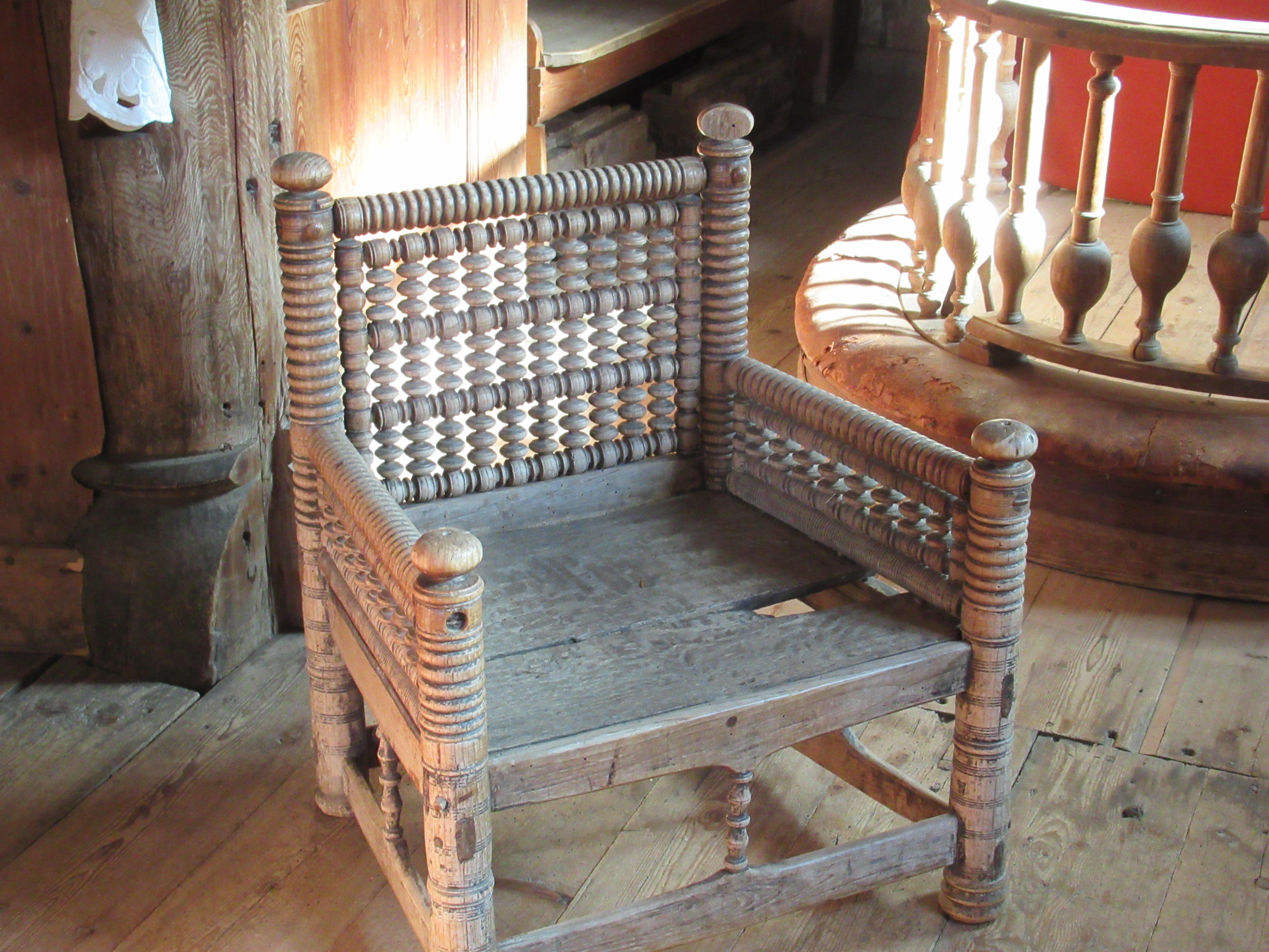
 and the chandelier which hangs from the ceiling
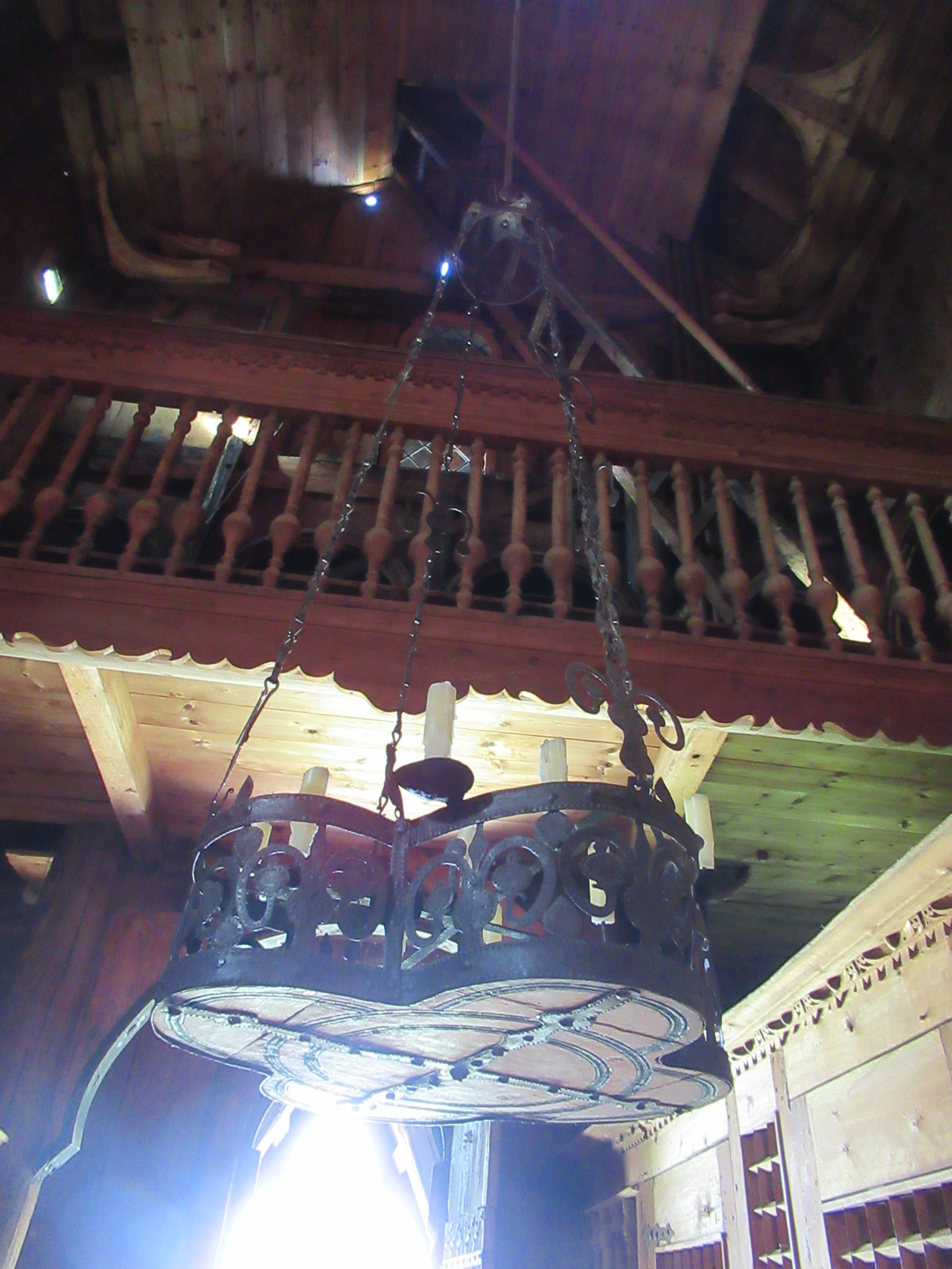 The gallery you can see part of above the chandelier, and above the chancel in the earlier photo, was added later and sadly involved cutting some of the original columns and capitals.
 The paintings and figures you can see on the walls are also 17th century.
 For a town with a population of not much over 6000 Kells has made an inordinately strong mark on Irish History.


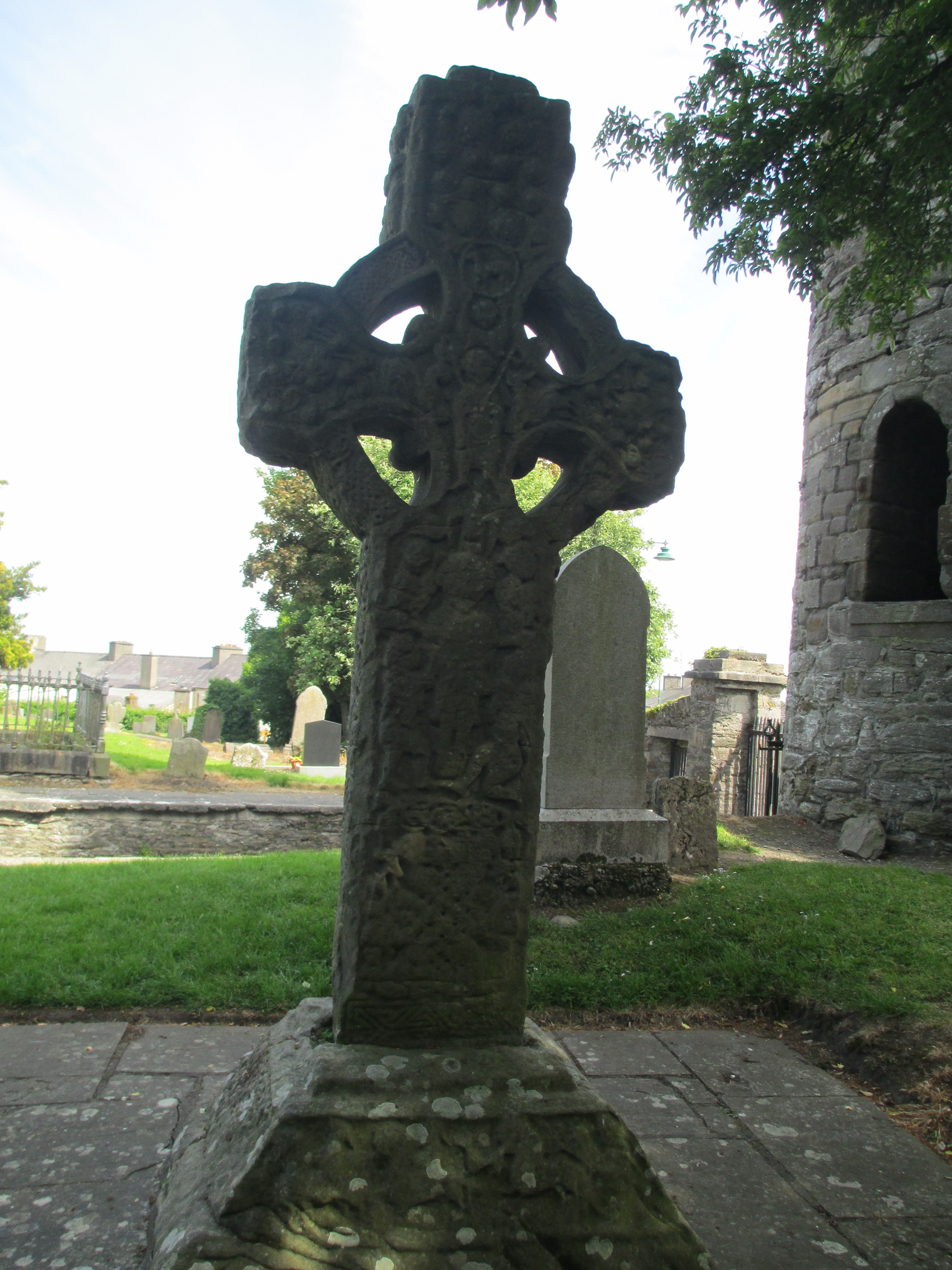

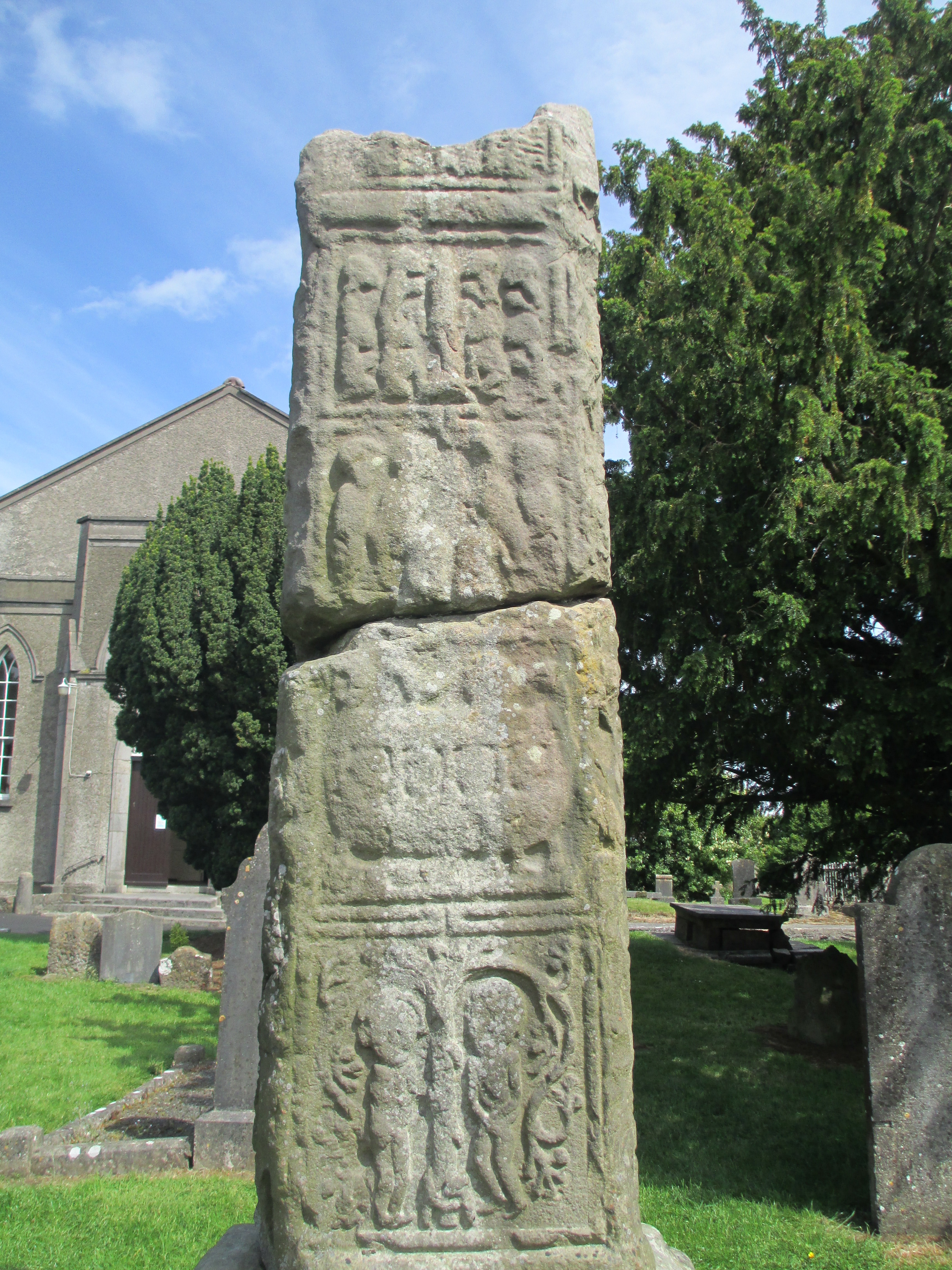

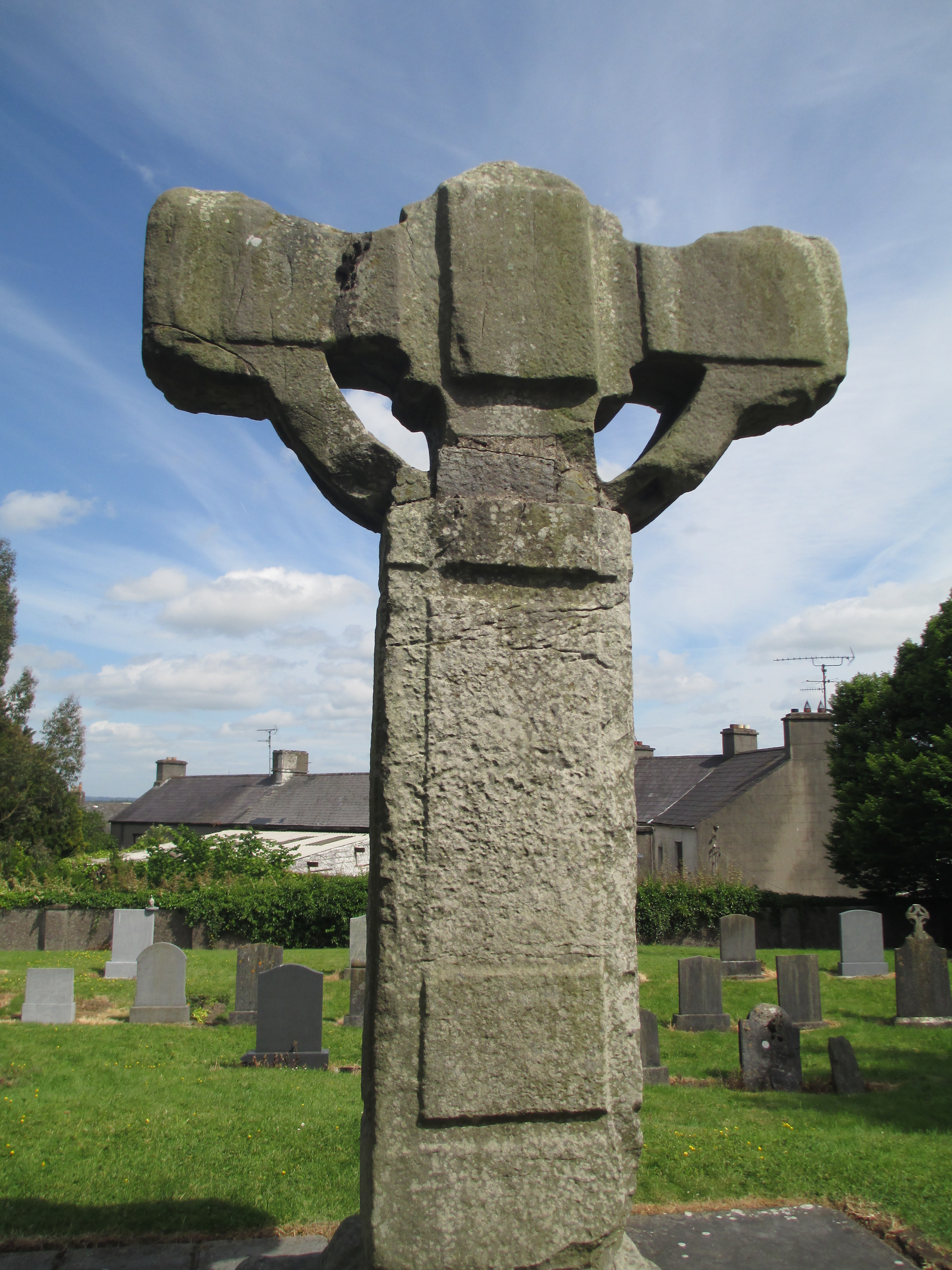 The 12th century east cross shows the crucifixion

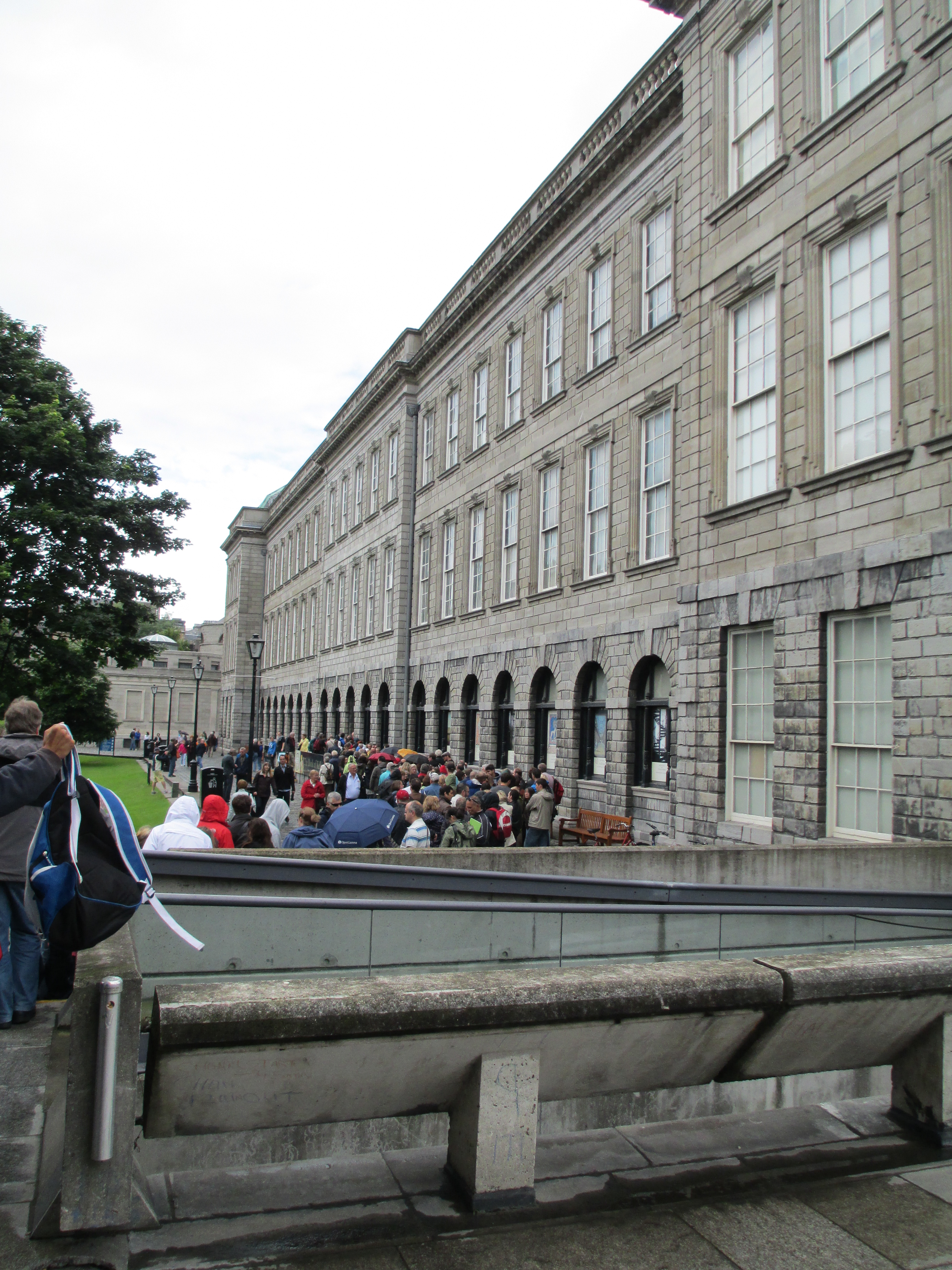 The Book of Kells was absolutely worth the wait, it is truly remarkable.
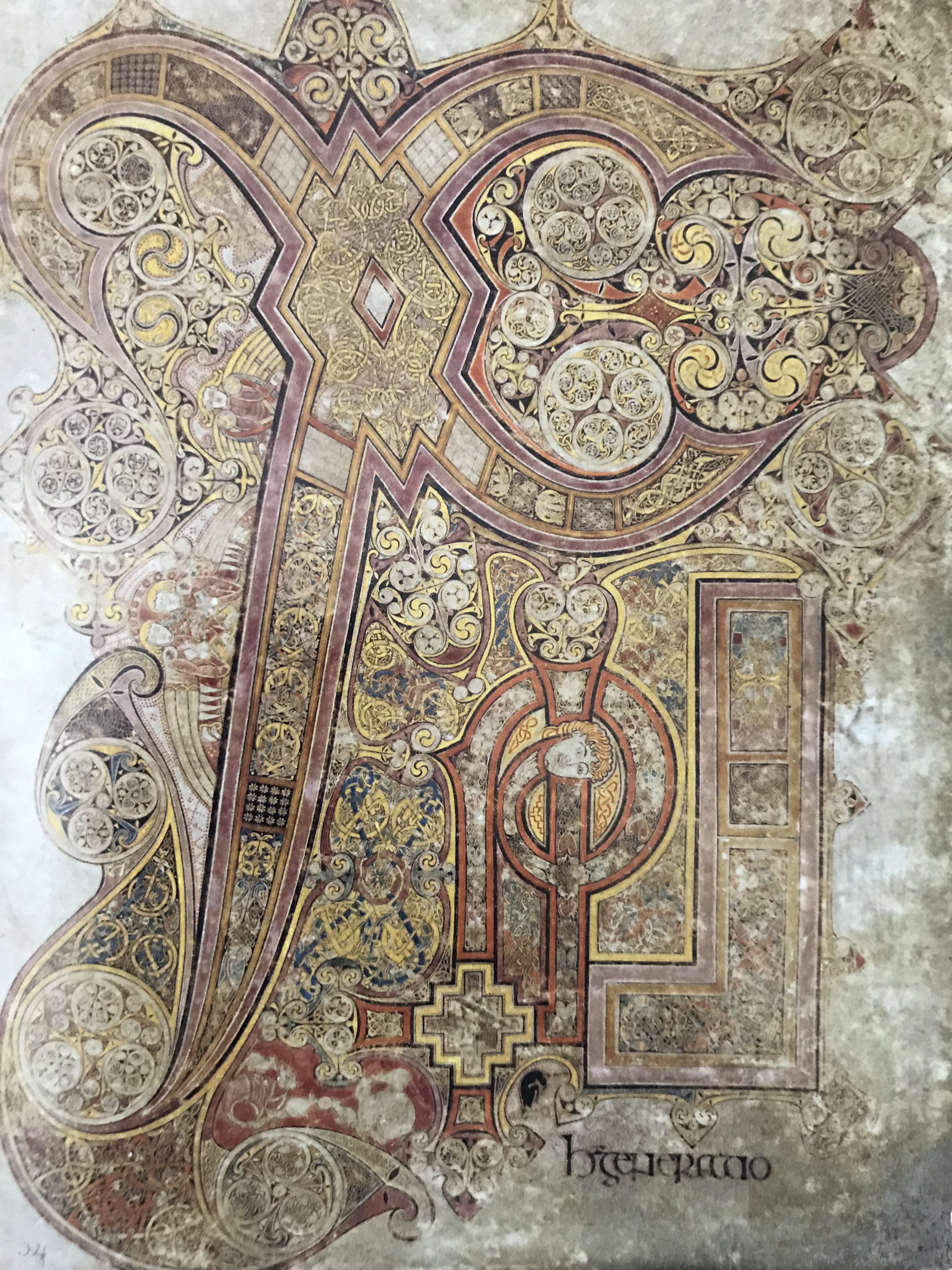

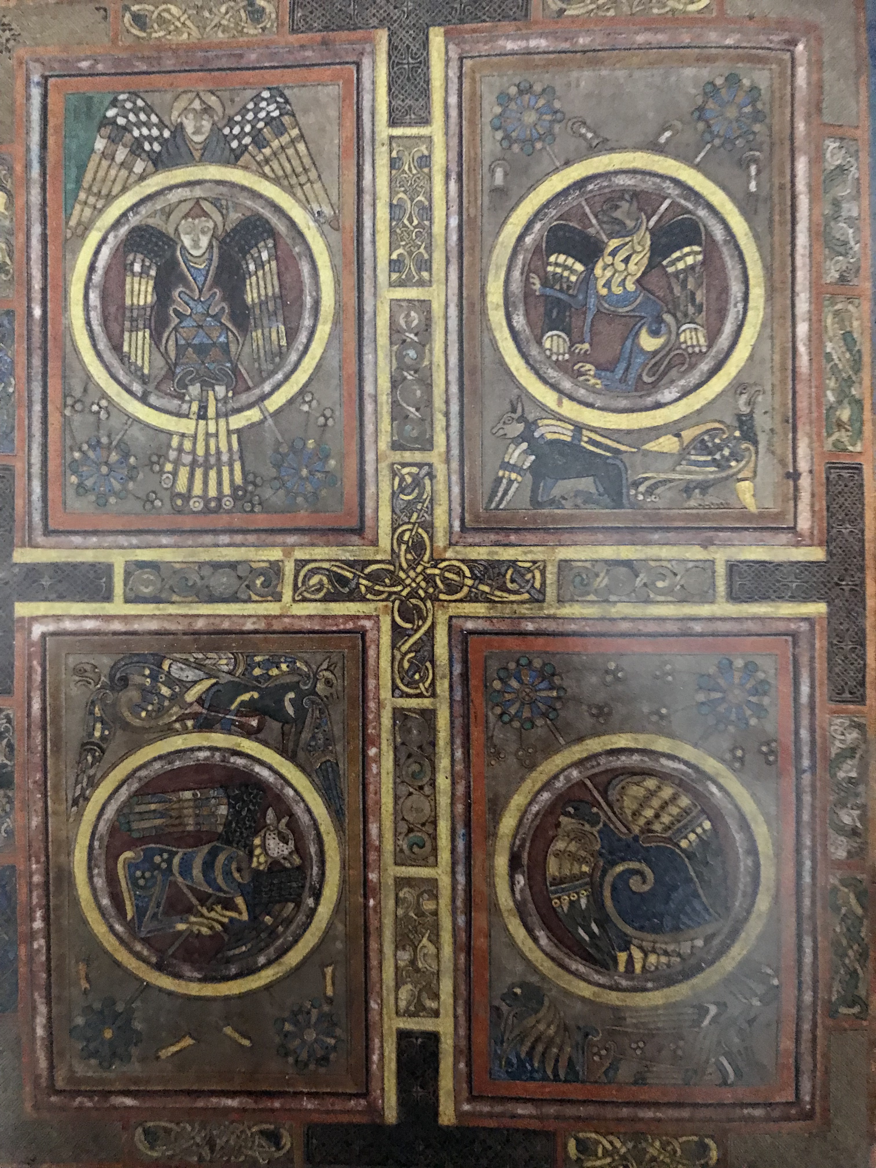


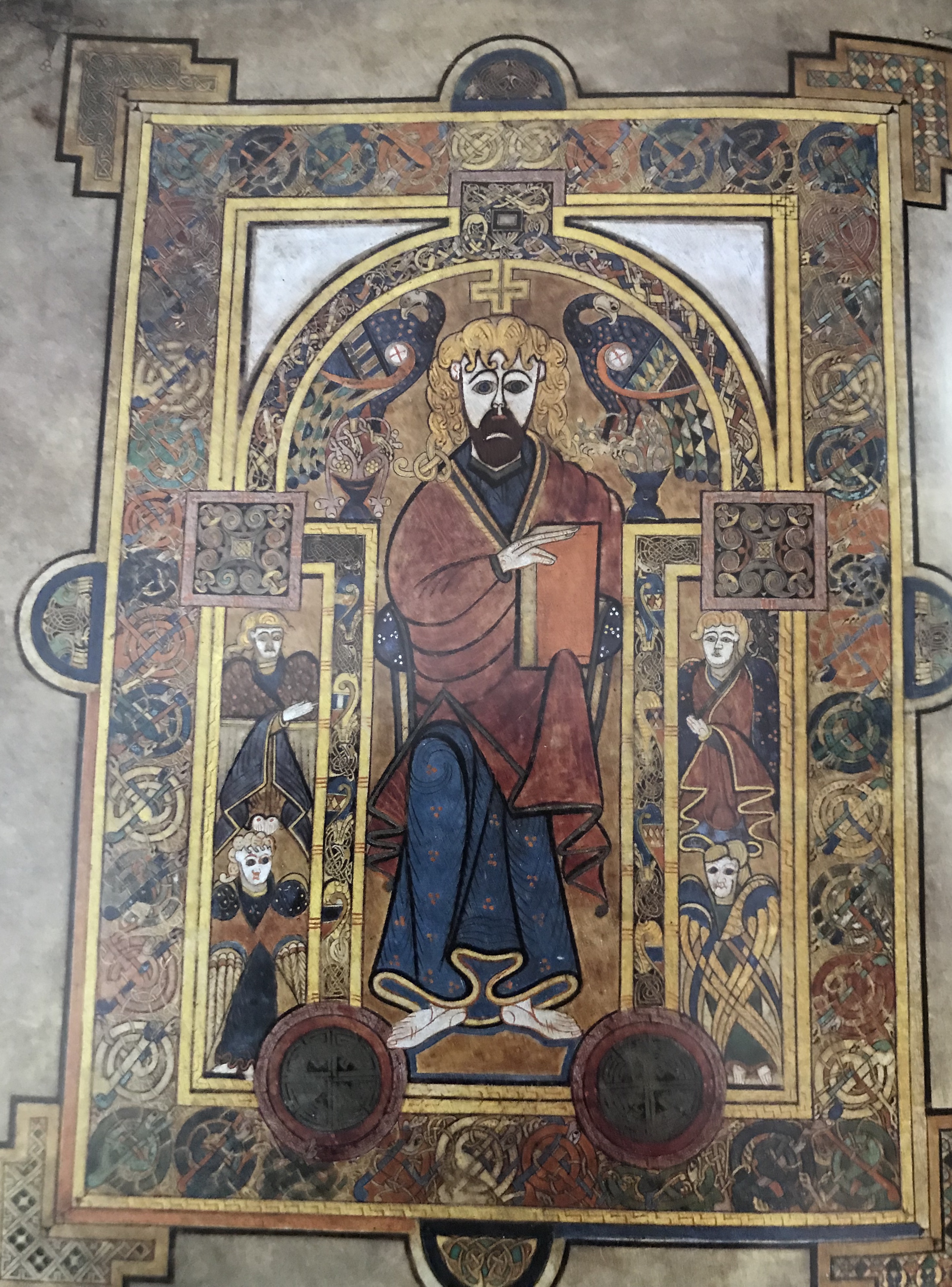


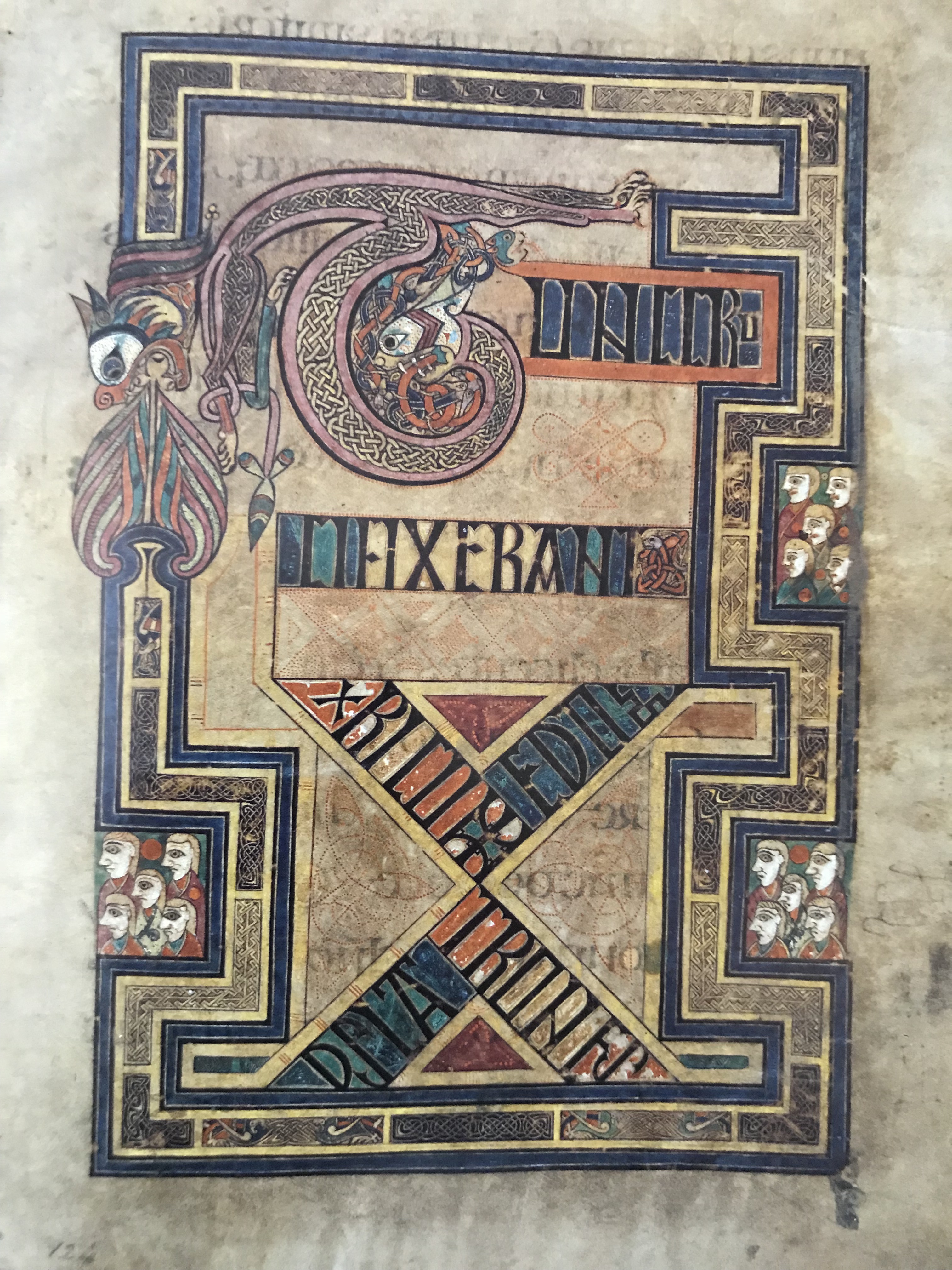
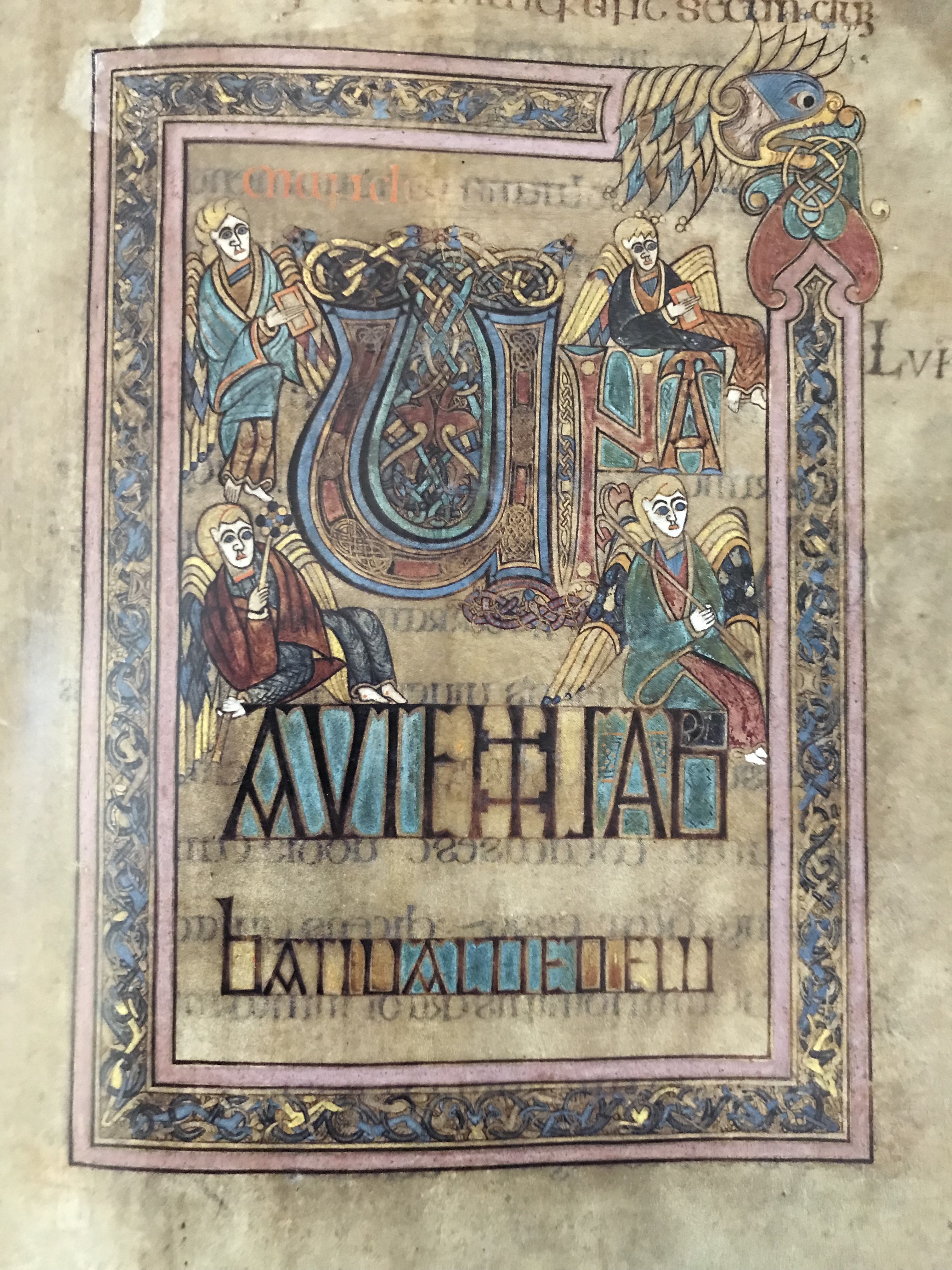


 And it continues to hold a fascination that goes beyond the book and the film. It is a truly majestic place.


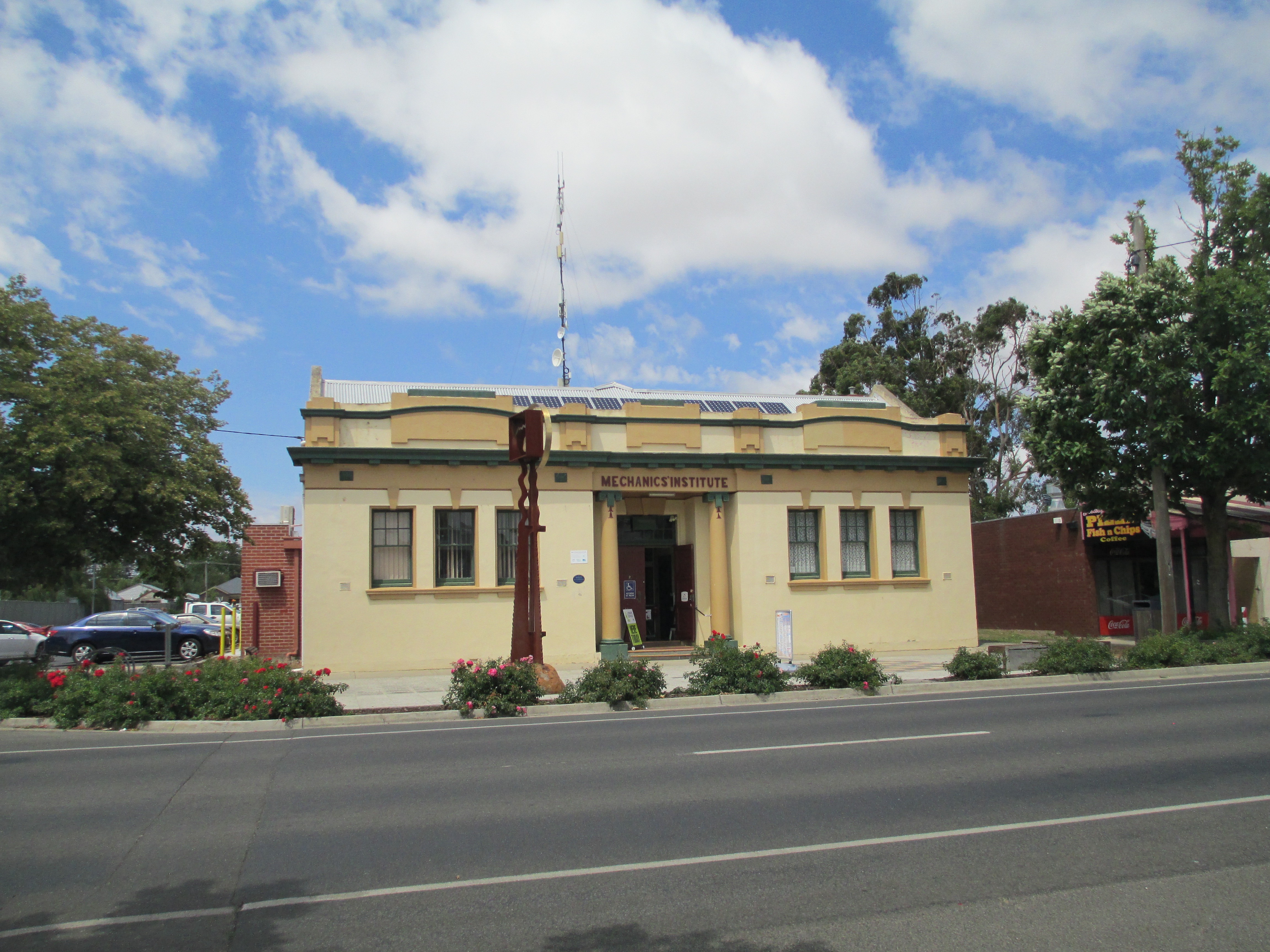
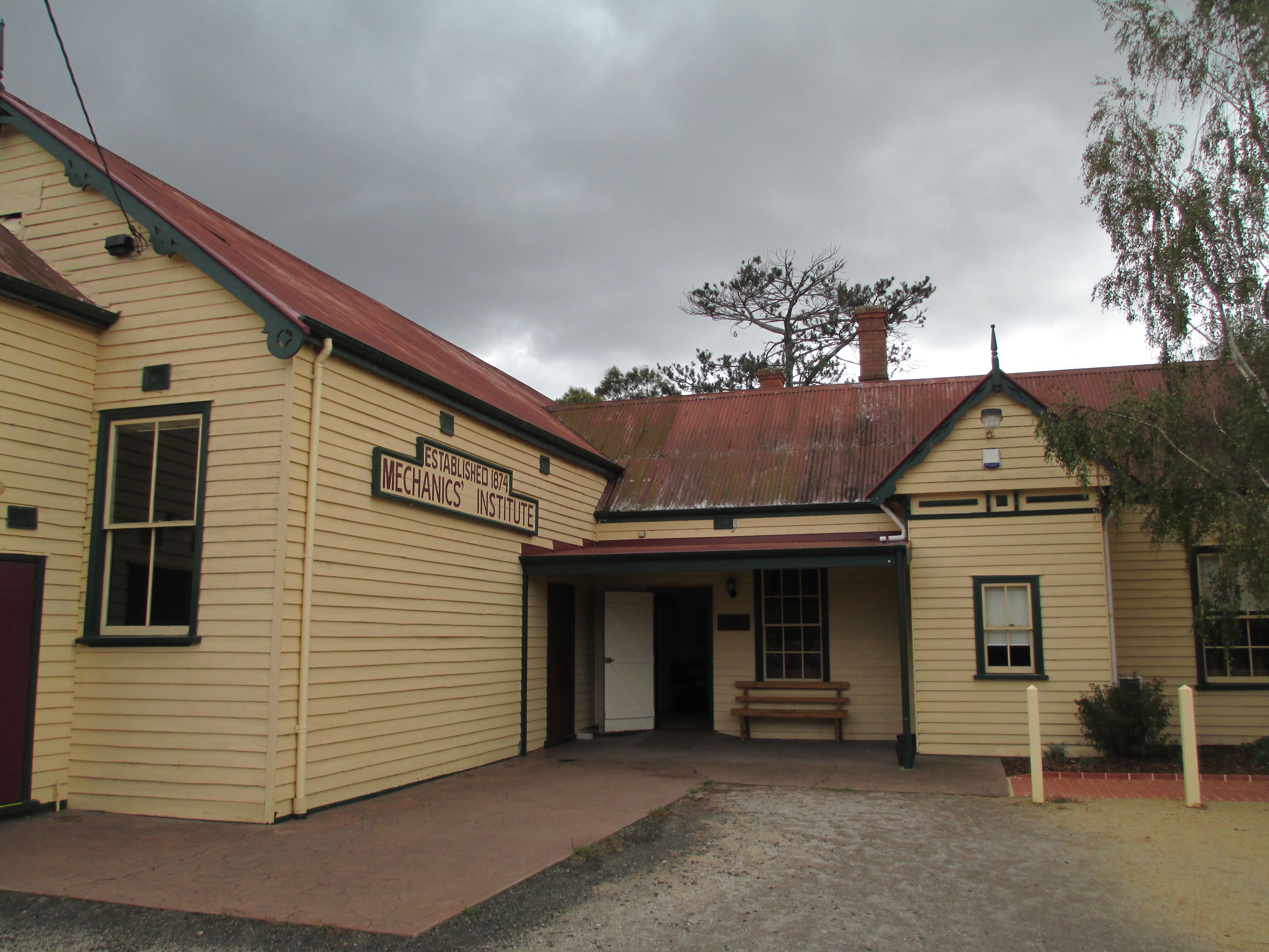
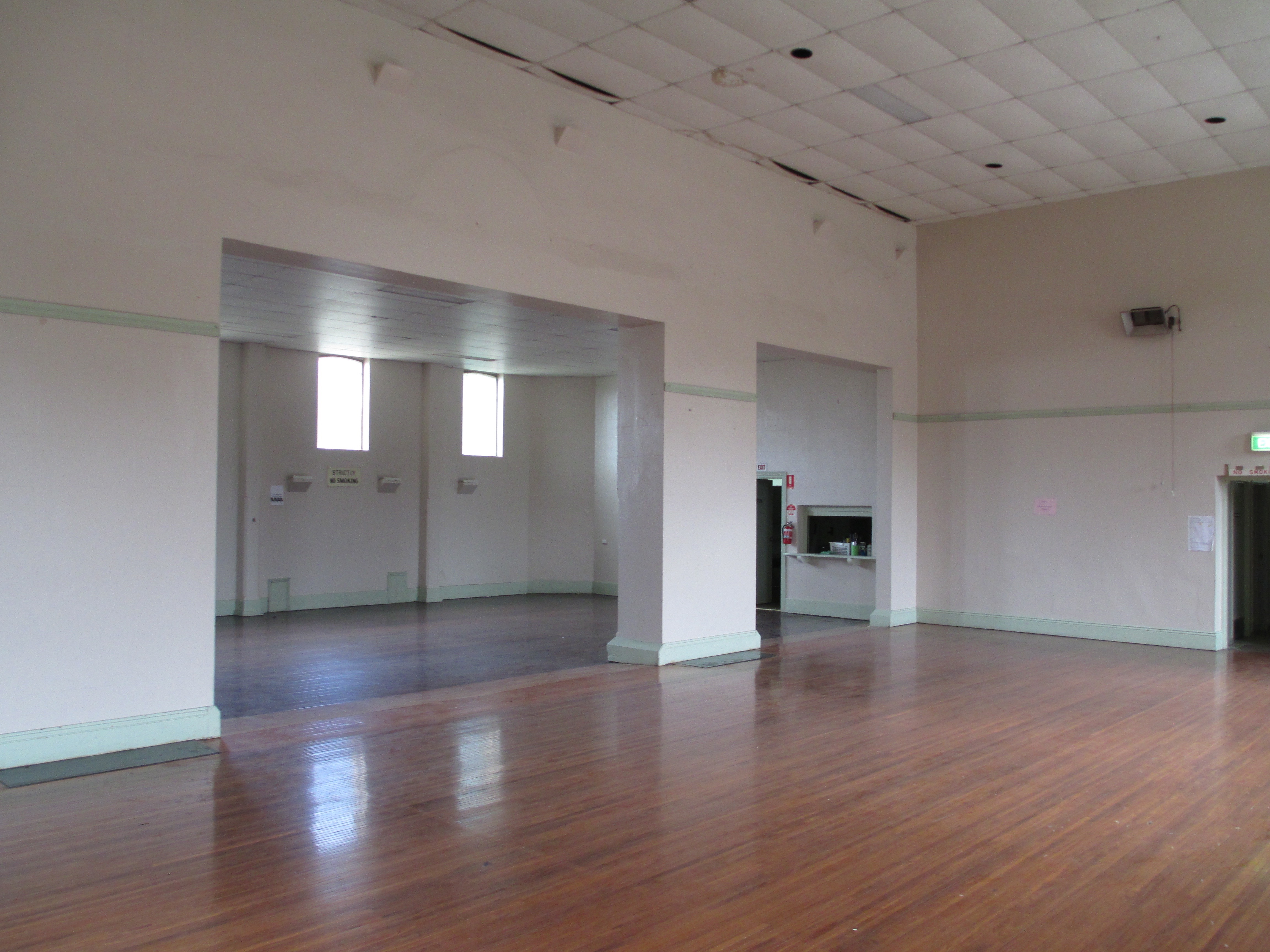
 The Mechanics’ Institute dates to 1905, but the current building was built in 1942. The hall was used for everything from ANZAC celebrations to rollerskating. The hall burnt down in 1940 but it was rebuilt, as you can see it today, by 1942. The new building is built in greek revival style and is under the ownership of the council. Today it is used for everything from tai chi to playgroups.
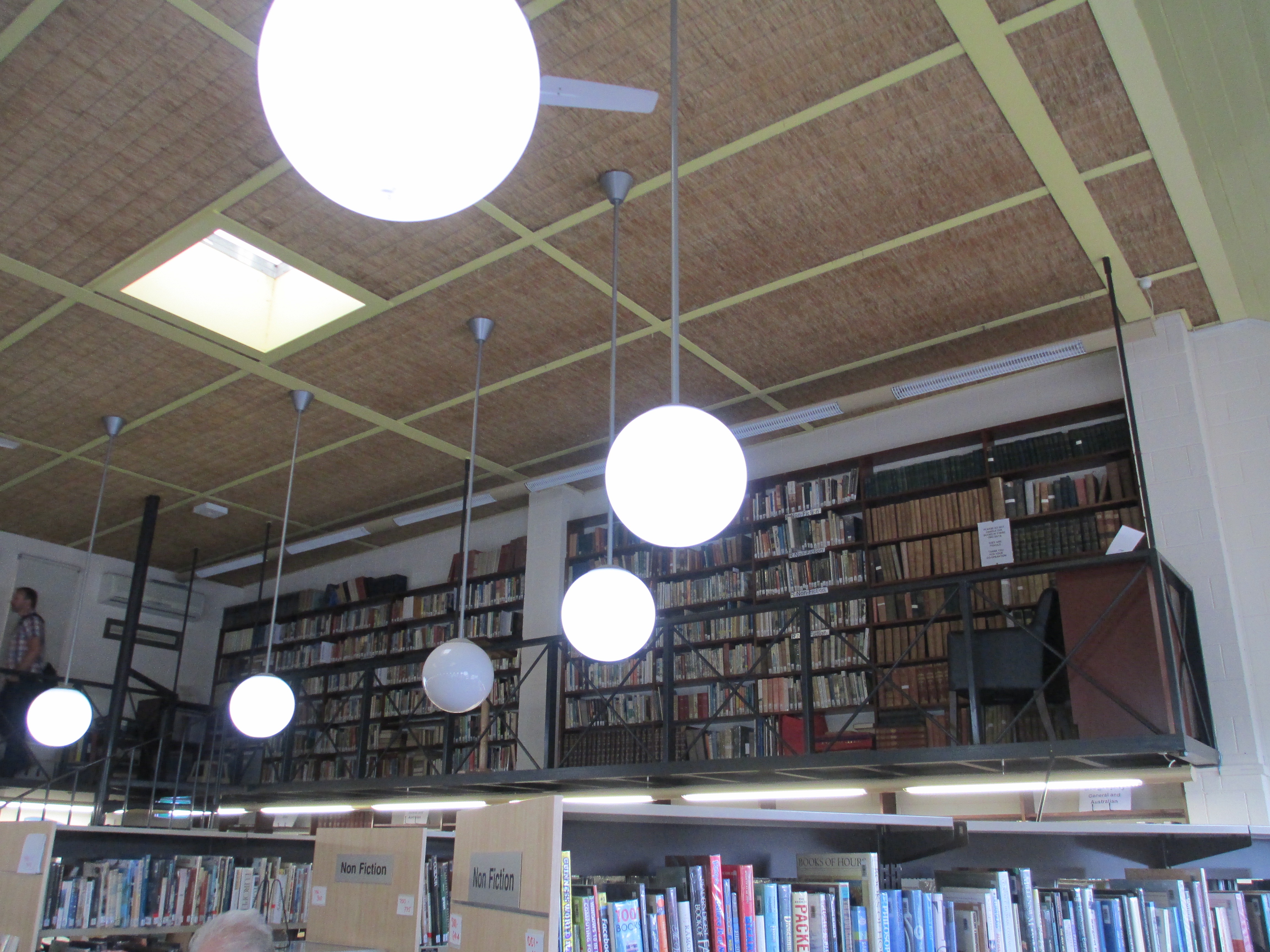
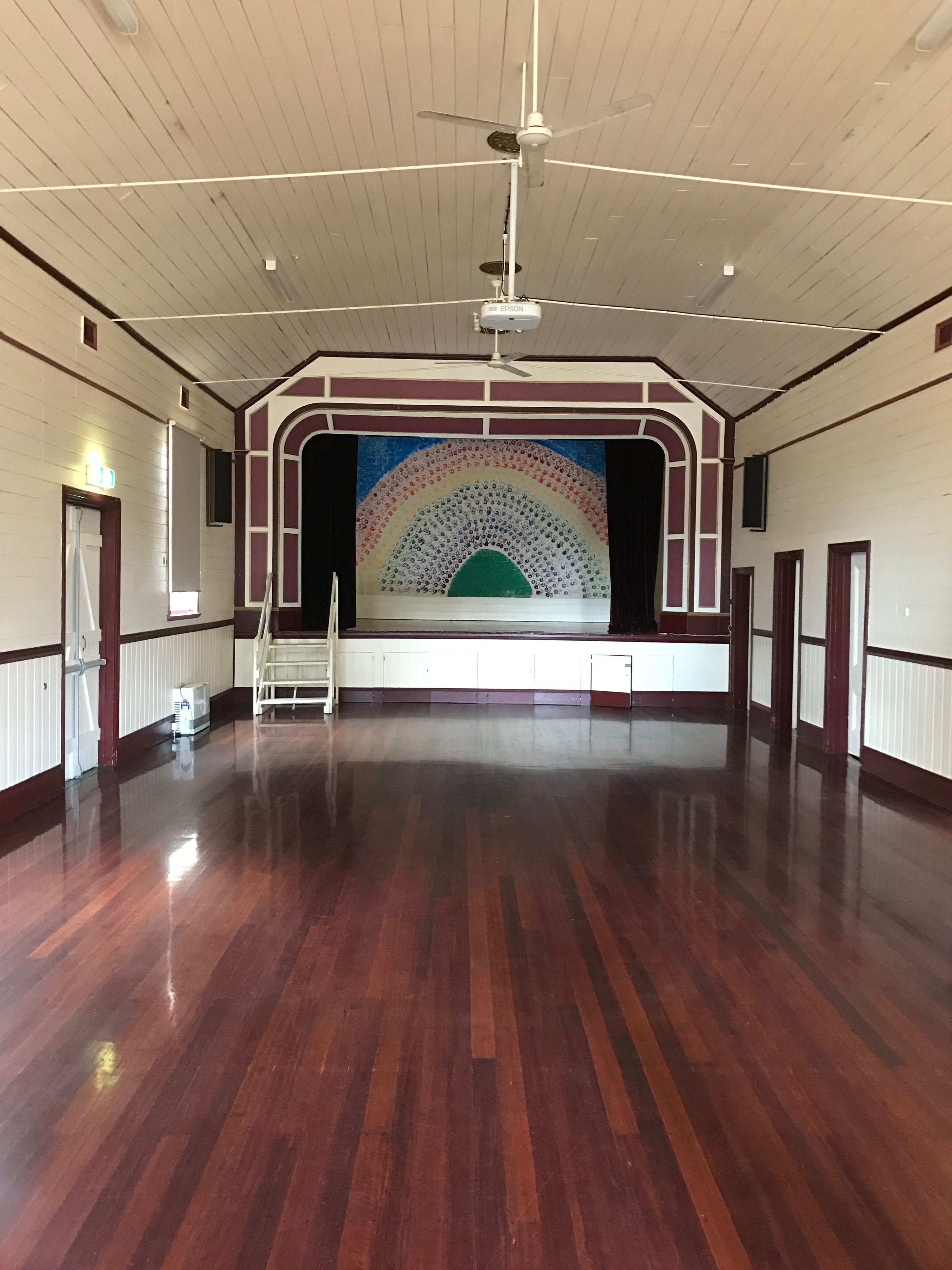
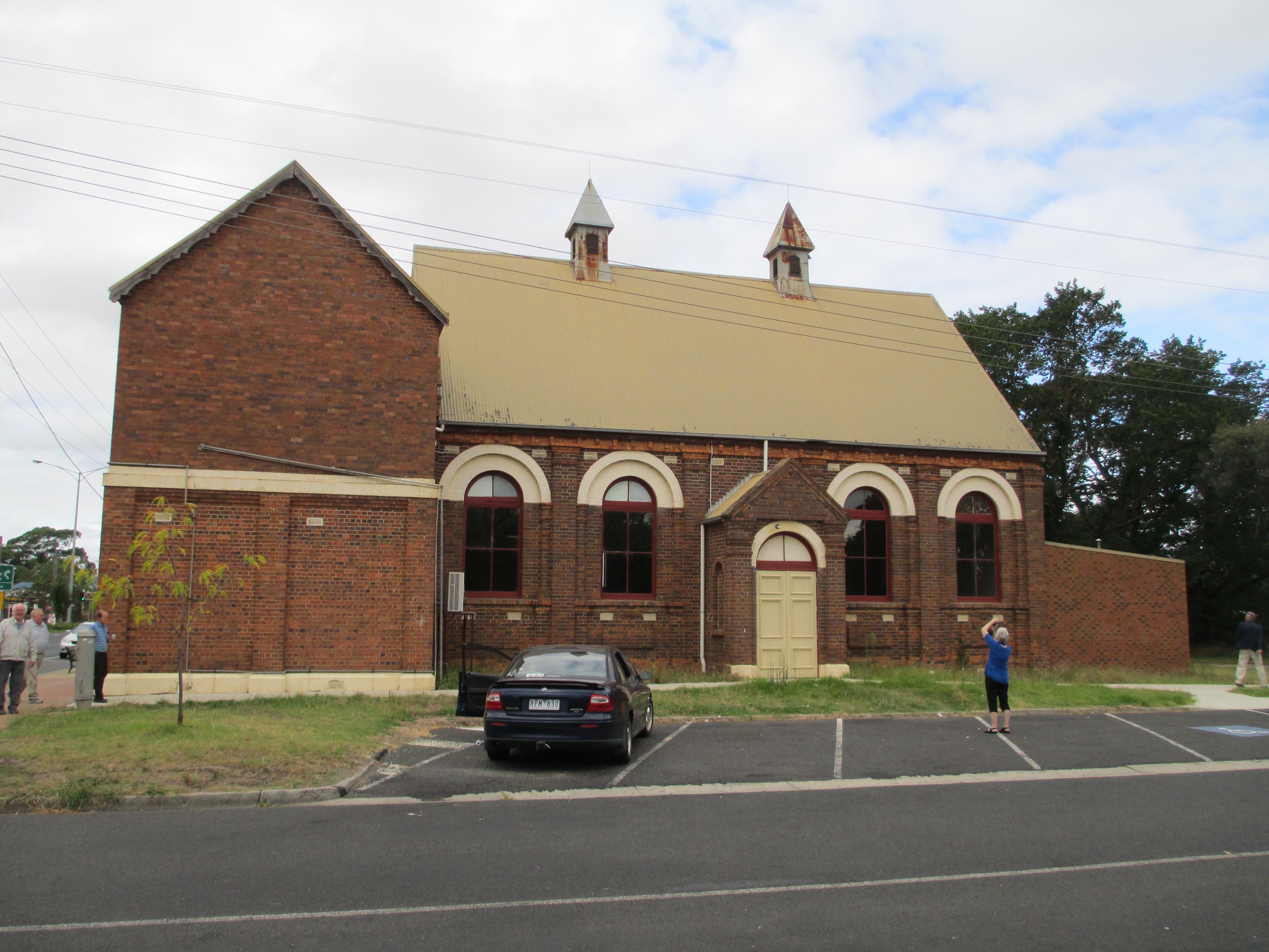
 The Institute was established in 1886 and the current building dates to the 1920s. Glengarry began as a library and was much used with hundreds of people visiting the library every year in the 1800s. When the new hall was opened in 1920, it was moved across the road, it was used as a library, a picture theatre, and by many local organisations. The hall had reached a fairly degraded state, on the outside, by 2013 and funding was raised to restore the outside including the hall roof which was in a perilous state. It is still used extensively by the community today.
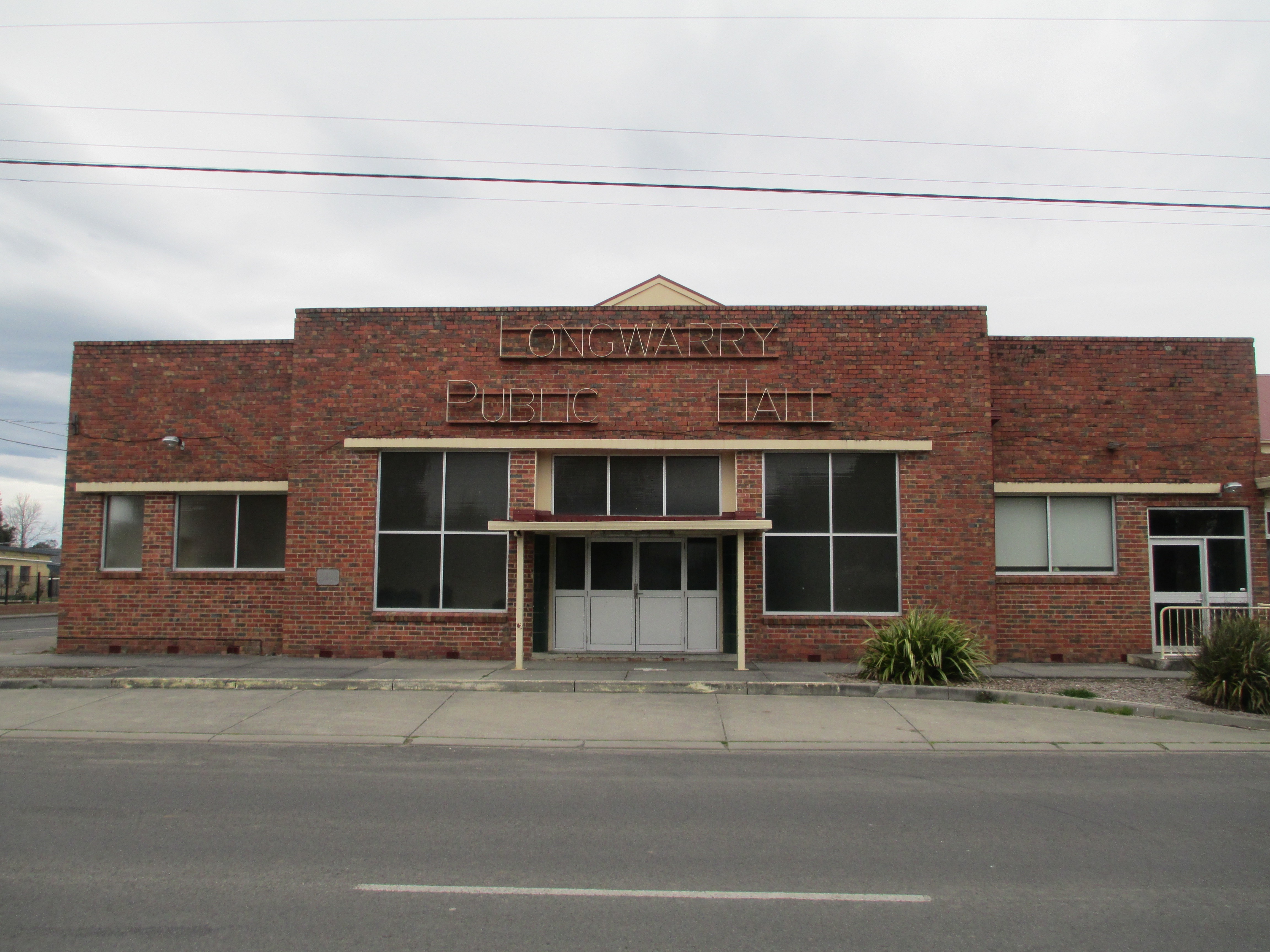 The Longwarry Public hall, formerly Longwarry Mechanics’ Institute and Free Library, was established in 1886, and the first building built in 1889, though the current building dates mainly to the 1950s. Longwarry operated as a free library and lecture hall as well as being the home of the local brass band and health centre in the 1800s and early 1900s. The hall burnt down in the 1950s and the hall you see today was constructed, it was opened in 1953 with additions in the 1960s. In 2009 it was significantly upgraded including a new roof. It is still used by many community groups and an old time dance has been running every Monday evening and every fourth Saturday since, roughly, 1900.
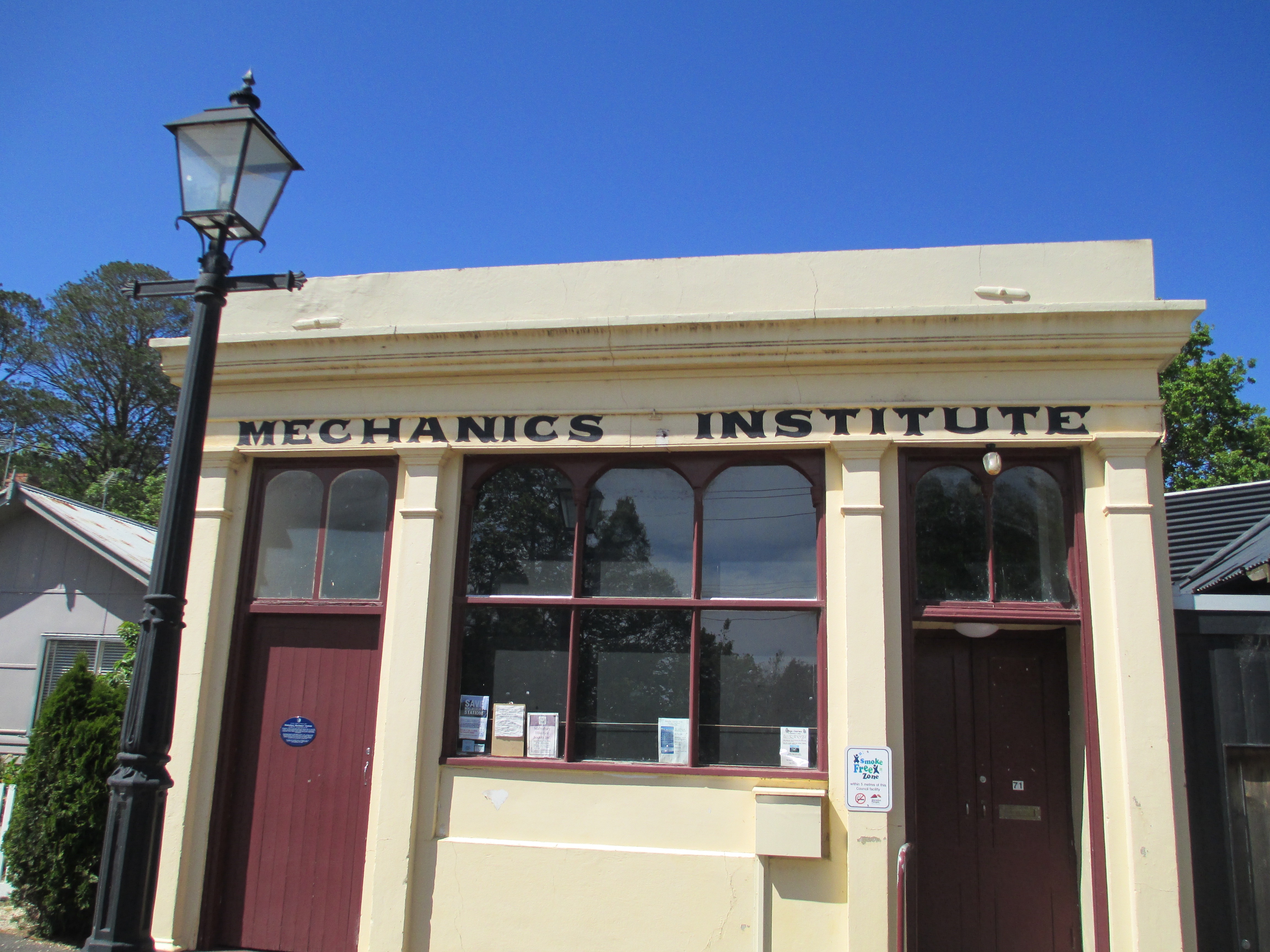
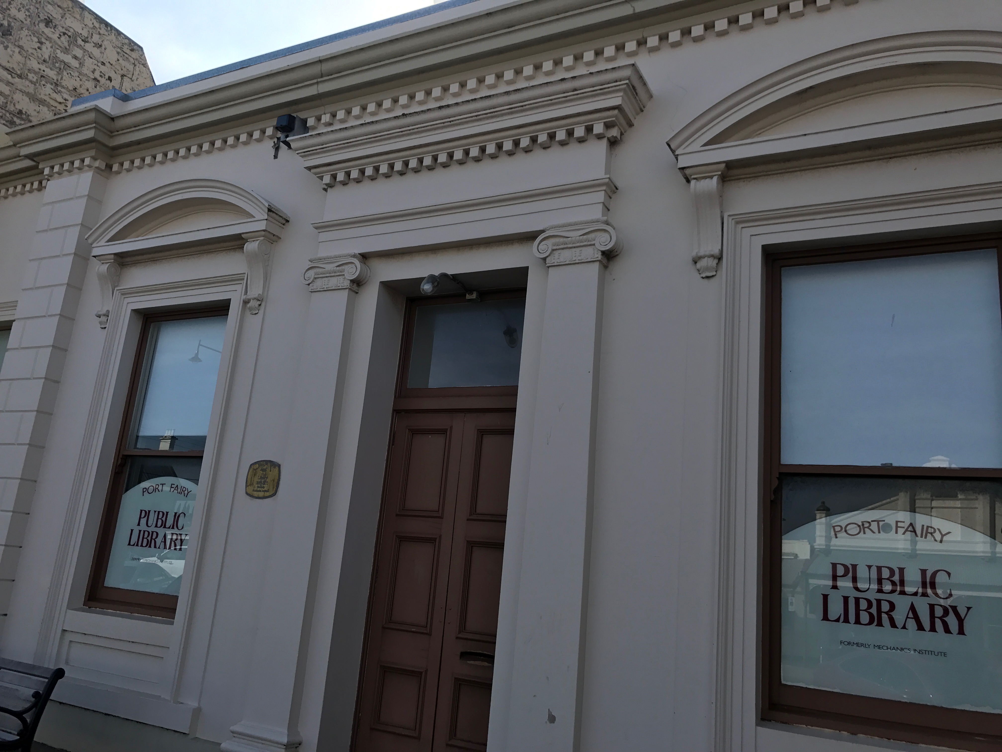
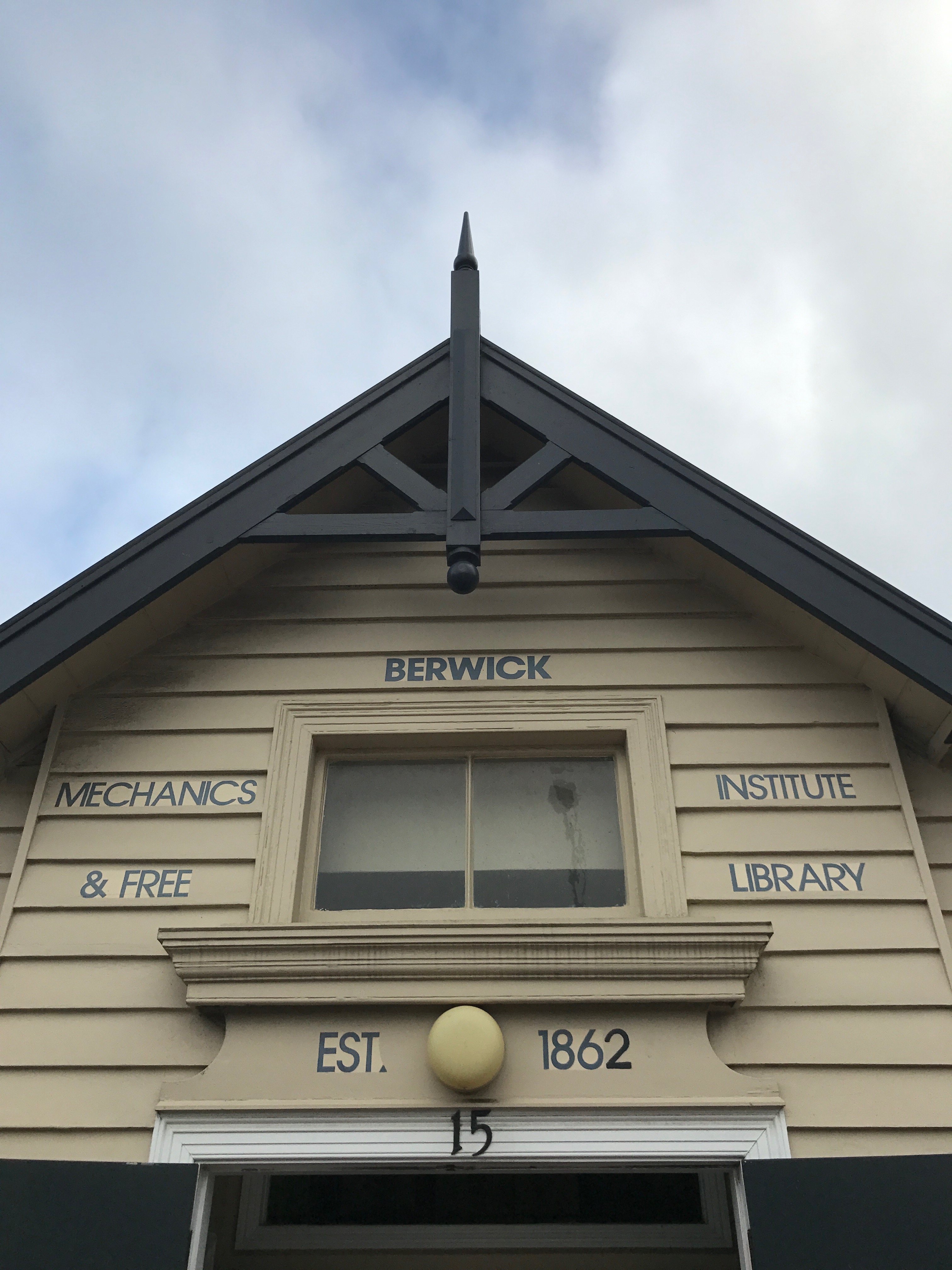
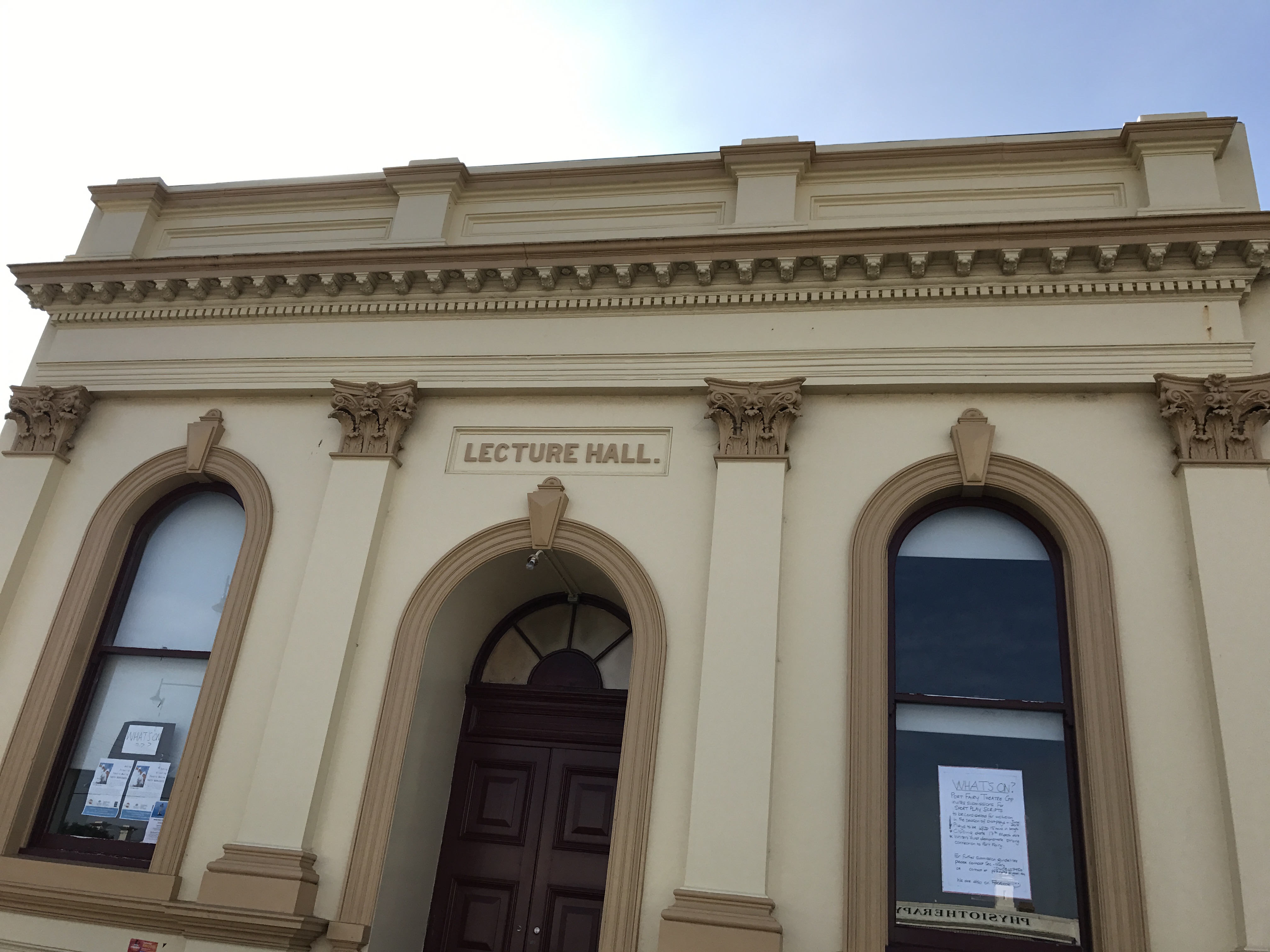 Founded in 1860 and the current building dates to 1865. A library was functioning in Belfast, as it was then known, as early as 1856 but an institute wasn’t officially formed until 1860. In 1864 land was granted by James Atkinson to build a library for Belfast and it has remained in the same position since it was opened in 1865. The Lecture Hall next door was also opened at roughly the same time. The library is now used as the public library, after 120 years of independent operation it joined the Corangamite Shire libraries in 1981. The lecture hall is used by lots of community groups including the local theatre group and the spring festival.


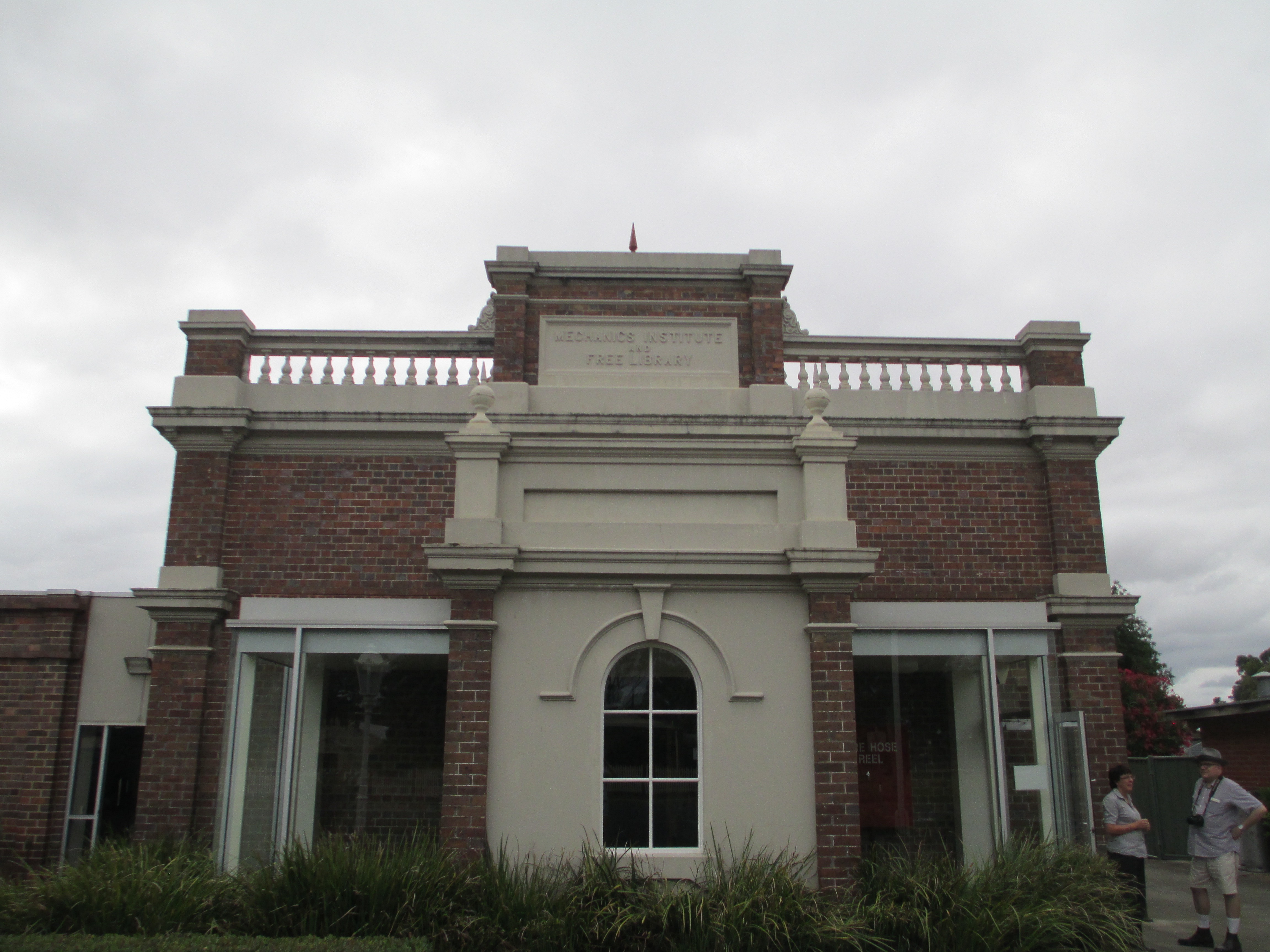
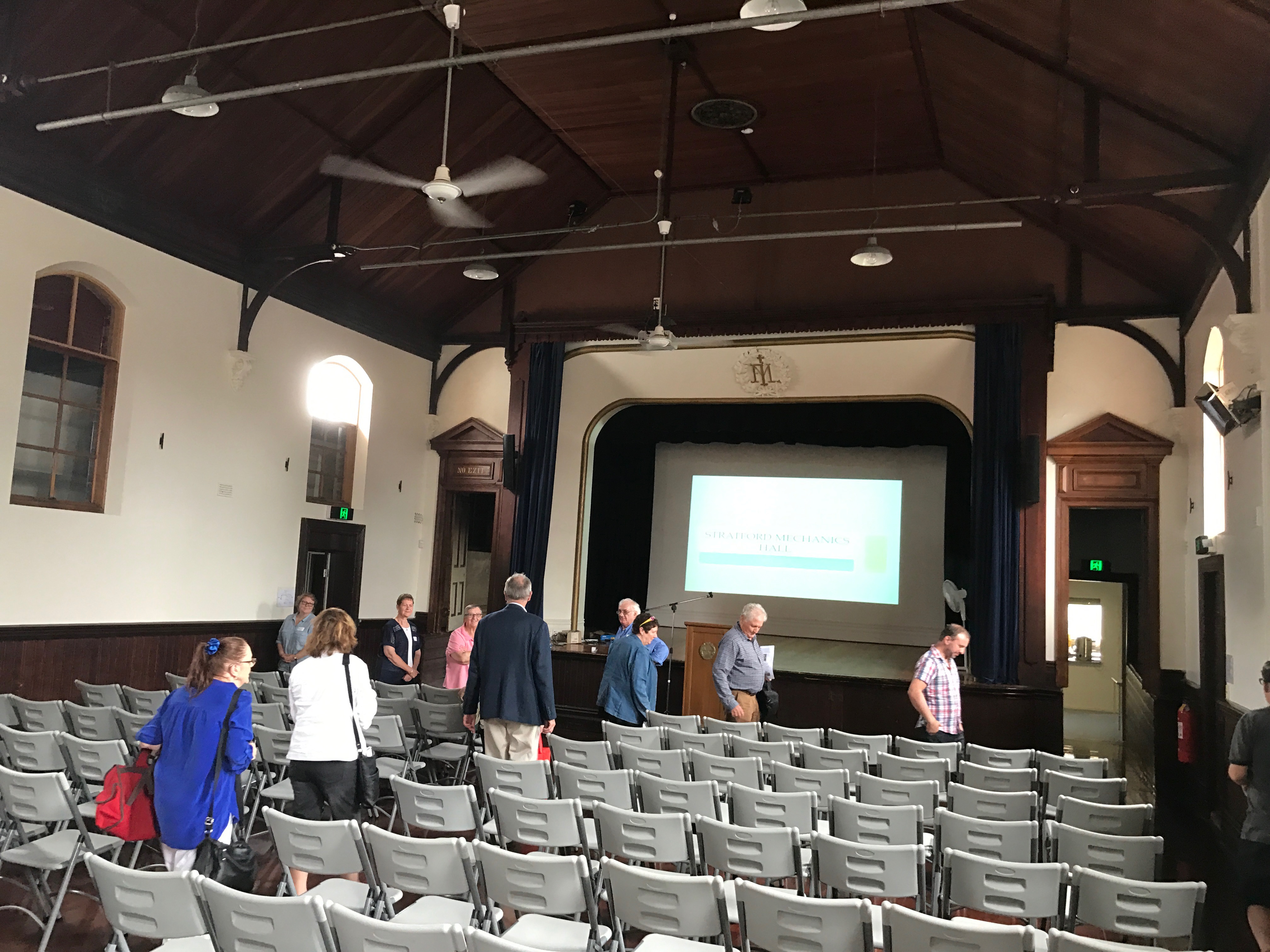 The Stratford Mechanics’ Institute was founded in 1866 and the current building was constructed in 1888. When it was originally founded Stratford lapsed very quickly and another attempt to form a Mechanics’ Institute was tried in 1874, which didn’t work either. However, by 1882 a committee was formed and the library was set up in the shire hall and books bought. By 1888 they’d built the existing hall. In the 1950s a spectacularly ugly addition was built on the beautiful 1800s facade. It mainly housed toilets. In the early 2000s, through fundraising and government grants, the hall was restored to its former 1800s glory. It is run by an active committee and is the home to many local events, including the parts of the Stratford Shakespeare festival.
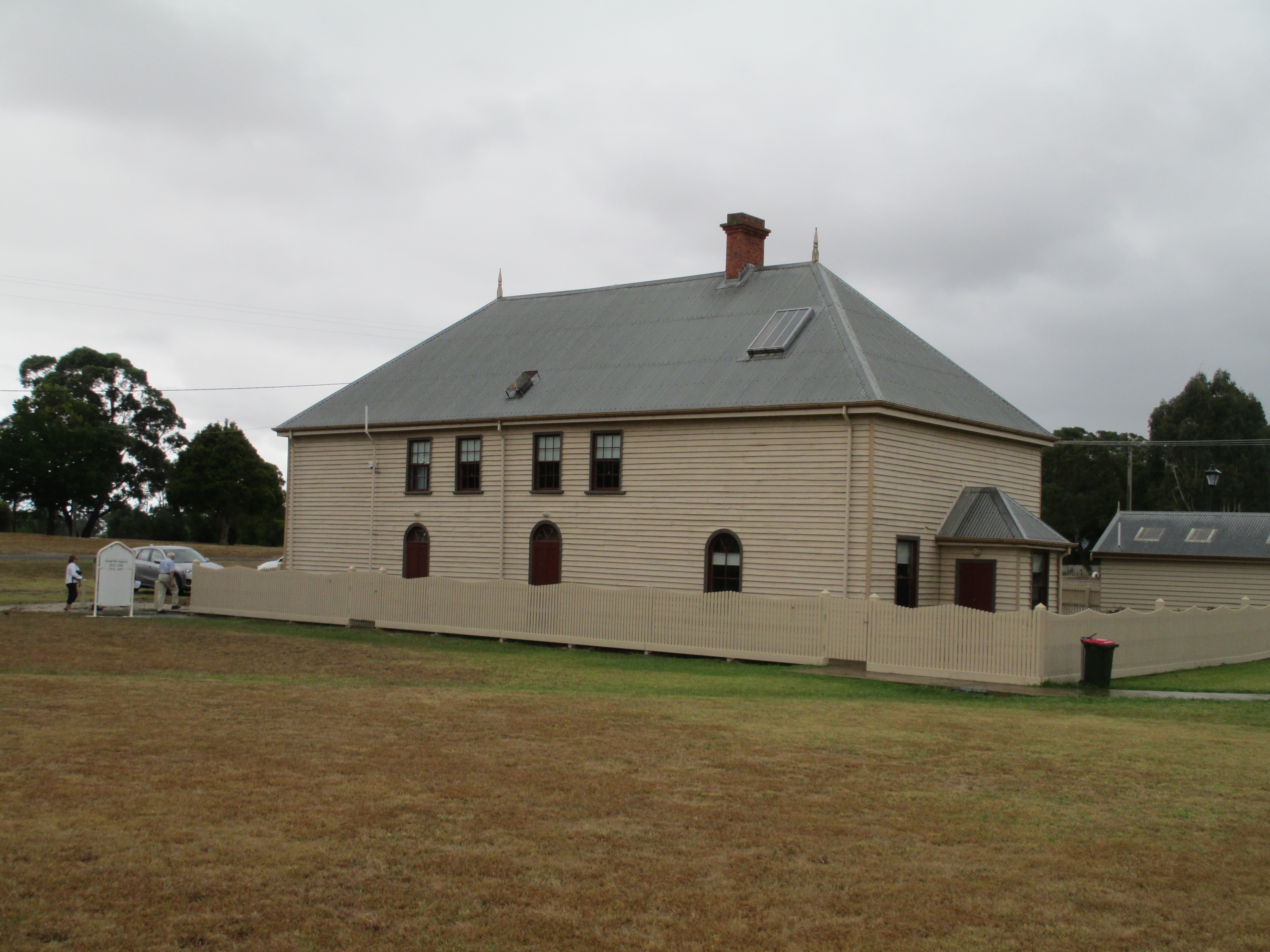


