
Maps show a lot about the way we view the world, whether it is a modern map (even Google Maps) or a 14th century mappa mundi. Maps are not always intended to be accurate geographical depictions of landscape, to be used only for navigation. Of course that is the purpose of some maps, but some are symbolic and all maps illuminate (through what they include and what they don’t, how they are made and who commissioned them) the society in which they were created.
This is not going to be a typical post from me, covering a building, person, area or place. This post is going to examine (briefly) maps and what they can show us about the world, beyond geographical features. It is based around several books on cartography that I already owned as well as some new books on maps and mapping that were released at the end of last year, which I was lucky to be given for Christmas. With these additions my collection of books on maps and mapping is large enough to have a section in my library. In this post I’m going to focus on the general cartography books and part 2 will examine the more specific volumes.
So what sorts of books am I talking about? I currently own a variety and I have written about one before when I first started this blog. The Map Book was my first acquisition on cartography and helped to introduce me to the sheer beauty of maps.
You can see my book selection (including The Map Book) below.
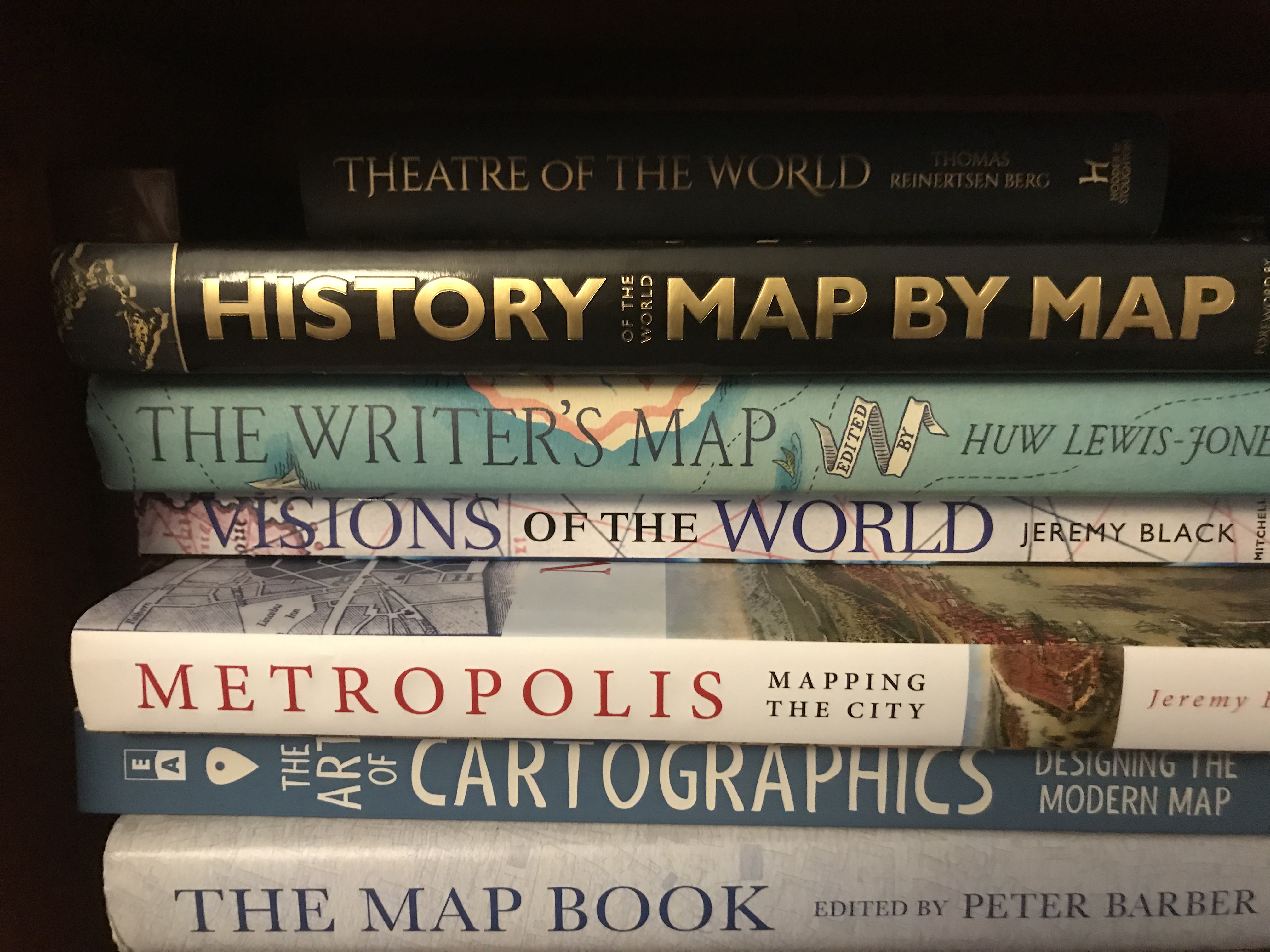
Each of these books outlines something slightly different about cartography. Theatre of the World is the most comprehensive from a western perspective, though it is the least visual.
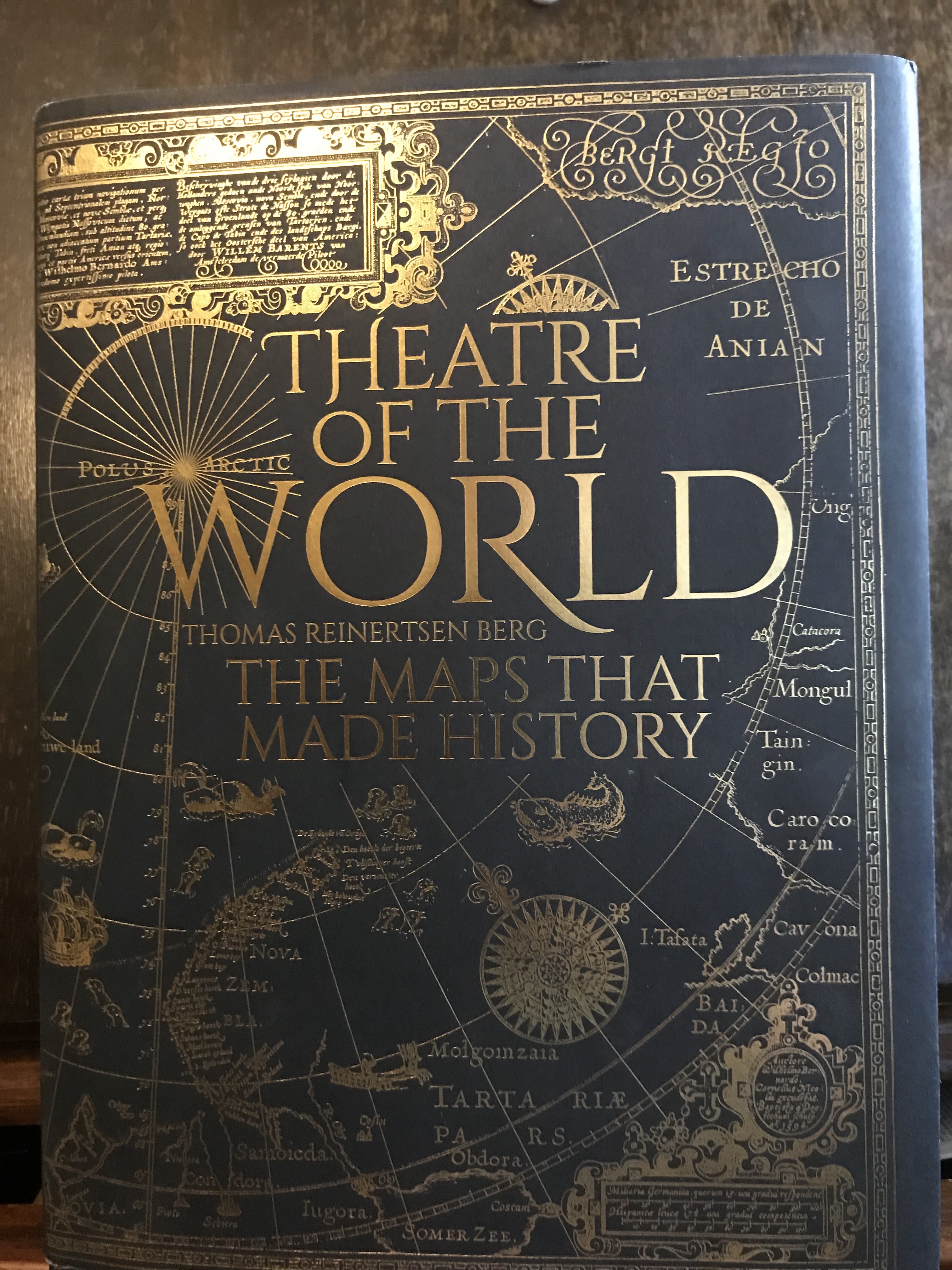
It is written by Thomas Reinerstsen Berg in Norwegian and I read the translated English copy. In fascinating detail it traces the very beginnings of map making (maps carved in stone) through to digital map making and Google Maps.
In this epic journey Reinerstsen Berg takes you through the classical cartography including the work of Aristotle and Plato and Claudius Ptolemy. Around the year 150 CE Ptolemy was working in the Library of Alexandria, drawing on older sources (Roman and Greek) and as many recent observations as he could to create a depiction of the world. He was drawing on sources that have long since been lost – many in the destruction of the Library of Alexandria. His work survived the destruction, mainly through copies, and was rediscovered in the 14th century and helped to shape later ideas about maps and mapping.
Reinerstsen Berg continues through medieval cartography some of which was less focussed on geographical depictions and more on the holy view of the world. An excellent example is the Hereford Mappa Mundi from 1300.
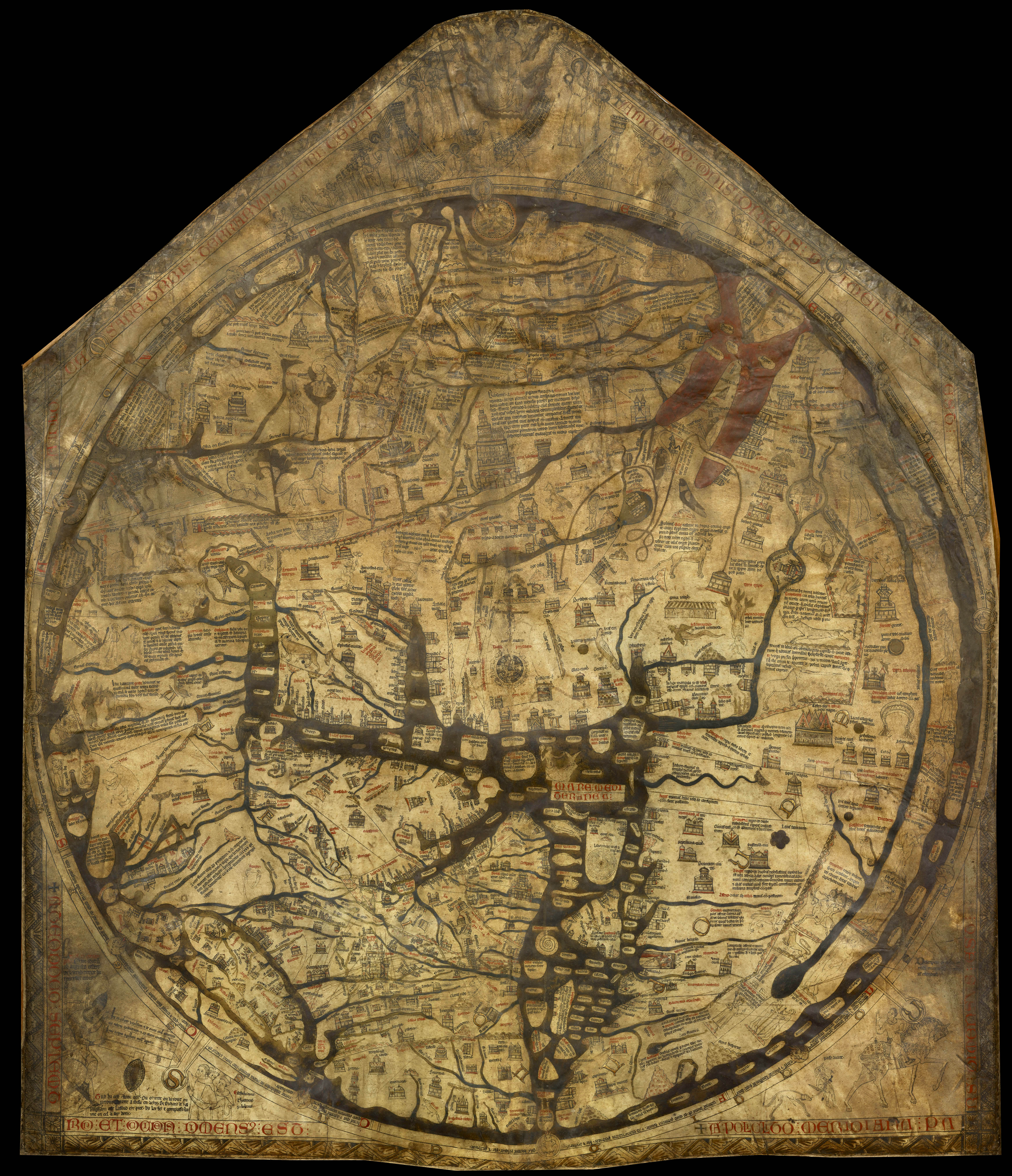
It depicts Jerusalem as the centre of the world, which for medieval christians it was, along with hundreds of towns, figures, animals and mythological sites. It is an illustration of the view of the world, rather than the world itself. It is also really lovely.
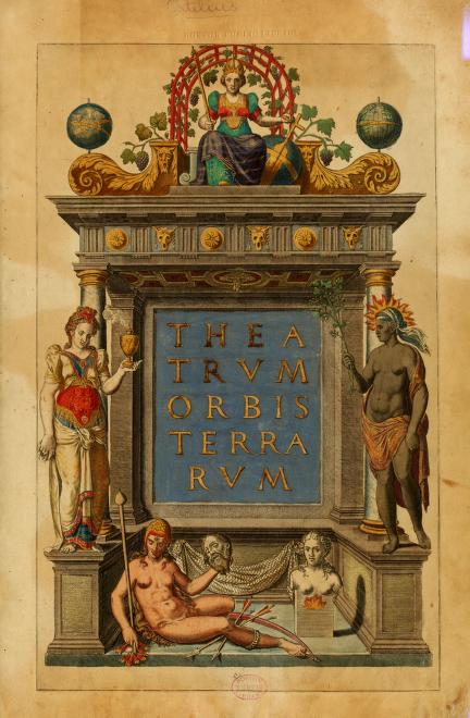
Reinerstsen Berg continues through time, highlighting the importance of the first atlas created in 1570 by Abraham Ortelius of Antwerp- it was called Theatre of the World. It was the conclusion of decades of work collecting the best maps he could find from geographers and cartographers across the known world. He redrew the maps himself for consistency and put them together in an atlas declaiming the importance of cartography for history and, in Reinerstsen Berg’s words, “for the first time, those who could afford it were now able to purchase the whole world, bound within a book” (127).
Reinerstsen Berg concludes with digital mapping and Google Maps and Google earth, which for the first time in the history of mapping have the capacity to create maps that show our world down to the tiniest detail. The problem with Google Maps is the same problem that has haunted all cartography; who controls the information included. Google Maps has the 70% market share of digital mapping and it fundamentally shapes how many people physically view the world in which we live. It is a free service, because businesses can pay to have their businesses displayed and it can collect information about users. The monetary nature of mapping and information provision goes right back to the early cartographers, maps are created (usually) at least partly to make money. This isn’t necessarily a bad thing, but it is one worth keeping in mind. Reinerstsen Berg’s book is extensive and really interesting. I only had two complaints. The first is that it is extremely Western civilisation focussed. He makes very clear at the start that he is writing about mapping from the point of view of his part of the world; Scandinavia. It does mean that there is lot more about Scandinavia that you would normally find in a general mapping history, which is actually really interesting. So as he is upfront about it, I have less of an issue. My main concern is the images. There are many beautiful and illuminating images of maps, but most are not in the section in which they are discussed, I found this quite dislocating.
Problems aside, Theatre of the World is an eye opening book.
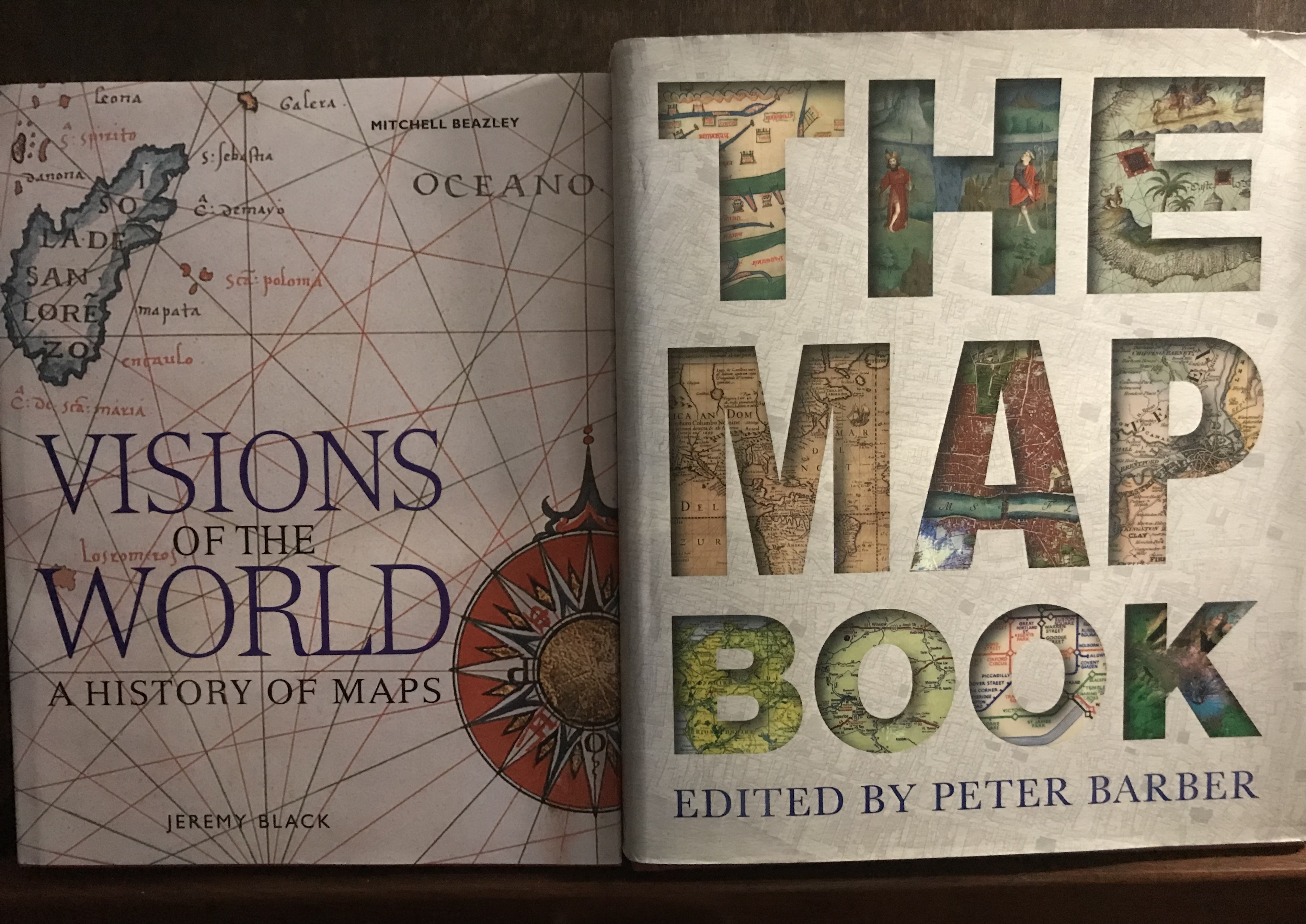
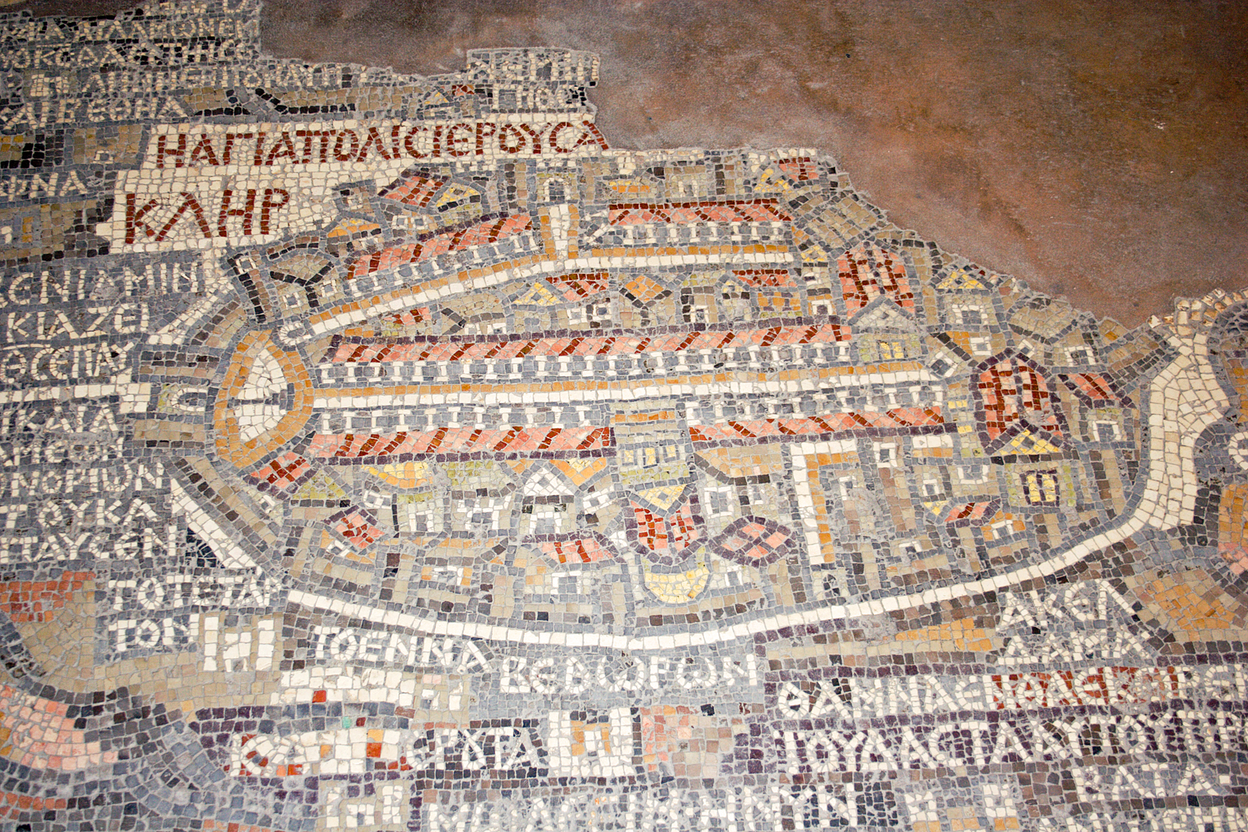
The other two most general books are The Map Book (which I have written about before) and Visions of the World. Both are beautiful books which take an overall and very visual look at maps. The both make a chronological and thematic examination of maps throughout time. They both take a much more worldwide and less euro-centric look than Theatre of the World and they are both much more focussed on the beauty of the maps themselves. They cover everything from Indian mapping to mapping in mosaic in Jordan in 565 CE. The map below was created during the reign of Emperor Justinian.

In 1884 a mosaic map was discovered on the floor of the old church in Madaba. It is somewhat fragmented (the largest surviving portion is 10.5m by 5m) but originally it would have covered the entire width of the nave and depicted the Mediterranean Sea to the Jordan river and Syria and parts of Egypt. The fragment you can see above is Jerusalem. The detail is incredible showing trees, fish, towns, animals and even the ferry to Jordan. It illustrates how the christians in Byzantium would have seen the Holy Land as it began to develop.
The Madaba Map is just one of treasures throughout both books. They also cover the detail of maps, looking not just at broad geographic maps, but maps of specific towns and areas. Both books make clear how political map making can be- often depending on who was doing the mapping and who was paying them to map. They are visual delights, with an immense amount of detail.
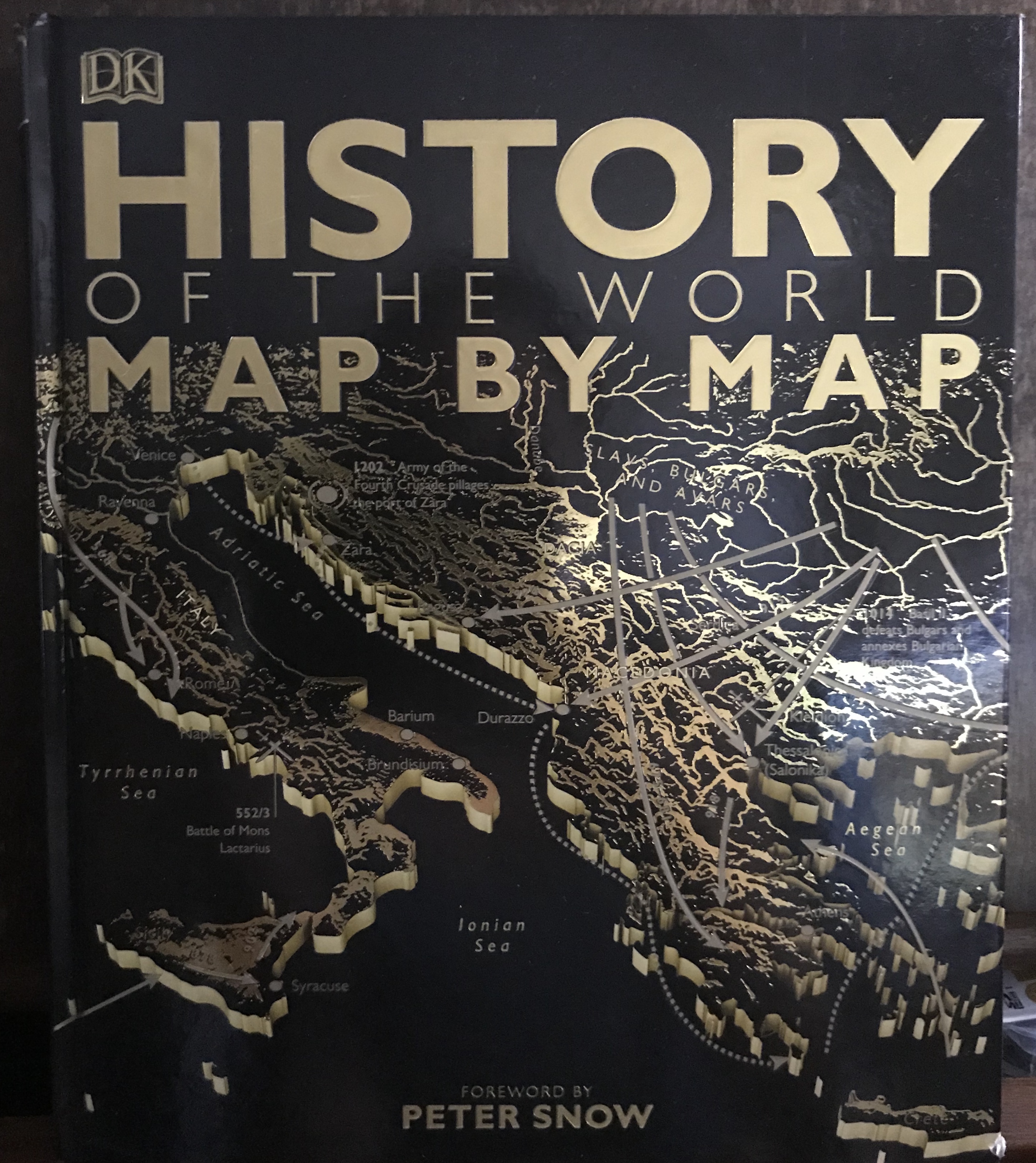
The final book I’m going to discuss in this post is History of the World by Map. This book is quite different to my other general sources. History of the World covers a general history of world through the rise and fall of civilisations across the world, but while it uses maps to do it, the book creates its own maps to explain the movement of civilisations. In its existence it shows just how useful maps can be and what they can illustrate beyond general geography. History of the World is also very impressive in its scope: covering indigenous Australians, imperial china, Africa, Polynesians, Mansa Musa and much more besides. it provide a fascinating window in which to compare what was happening in the same time in totally different parts of the world, both when they affected each-other and when they didn’t. Western centric histories tend to give the impression that the centre of the world was Europe and not much else was happening anywhere else. History of World gives an easily accessible depiction of how interconnected and vast the world has always been, as well as how much was happening beyond the narrow confines of Europe.
Part 2 will continue the story of cartography and my cartography collection, by considering the remainder of the books which all focus on more specific elements of cartography.
References:
The Map Book: edited by Peter Barber ISBN: 9780297843726
Theatre of the World: The maps that made history. By Thomas Reinertsen Berg ISBN: 9781473688629
Visions of the World: A history of maps by Jeremy Black. ISBN: 1840008342
https://archive.org/details/theatrumorbister00orte/page/n4
https://www.themappamundi.co.uk/index.php
Photos:
The pictures of the books are mine.
The Hereford Mappa Mundi is creative commons licensed.
https://commons.wikimedia.org/wiki/Category:Hereford_Mappa_Mundi#/media/File:Hereford-Karte.jpg
as is the Madaba Map
https://upload.wikimedia.org/wikipedia/commons/3/3d/Madaba_Jerusalem_Mosaic.jpg

I love this post. I love maps and have books with all kinds of maps in them. I love old maps too! Thanks for the post!
LikeLike
Thanks Valerie, maps are fantastic aren’t they. Glad you enjoyed the post-stay tuned for part 2 🙂
LikeLiked by 1 person
This blog post sounds like a fascinating exploration into maps beyond their geographical function.
LikeLike
thanks – I’ve always found maps fascinating
LikeLike