
As I said in my, slightly unplanned, video; welcome to the first edition of Ragbag on Road. These entries are going to differ a little from my normal posts, because rather than a detailed history of a person, building, painting, book, topic etc., I’m going to take you on a wander with me through a new place. In this case I’m beginning with Maldon, a town in north central Victoria. This isn’t a full history of the town, but I’ll be talking briefly about several of interesting sights and sites and hope you enjoy this ramble with me.
I want to start by acknowledging both the Dja Dja Waurrung people on whose land Maldon stands and the Bunurong people on whose land I write from. The history of the Dja Dja Waurrung stretches back tens of thousands of years before white colonists arrived and ‘discovered’ gold in the Maldon area. The history of Australia is not new and clean and everything that was ‘discovered’ was already part of the land of the First Nations people. Australia’s First Nations’ history is ancient and in writing about recent history I acknowledge and celebrate a millennia of First Nations’ storytelling and knowledge keeping. The story of the Dja Dja Waurrung is not mine to tell, but I direct you to https://djadjawurrung.com.au/ the Dja Dja Waurrung Land Council which explores their history. I just want to be very clear that Maldon is Dja Dja Waurrung land.
To explore the town itself. This will be a little random because I tend to wander around new places and see what I can find, and I’m hoping to take you on that journey with me. I will give a little history to get us started though.
As I said in my opening video gold was found in Maldon in 1853, but that’s not the beginning of colonial history in the area. In 1836 the area was passed through by surveyor Major Thomas Mitchell. I’ve actually written about Mitchell’s survey of the ‘Australian Felix’ before you can find that post here. The land was soon settled by Europeans, and as pastoralists moved into the region First Nations people were denied access to their food and water sources and eventually forcibly moved on to reserves, including one at near by Loddon, with only a small number remaining in the area.
The Maldon region would have remained as the pastoral run of the 100 000 acre Cairn Curran property if gold hadn’t been found in 1853. The region was quickly flooded with people as part of Victoria’s gold rush with an immediate rush of up to 40 000 people. As you can imagine this massive influx of people only continued to grow and infrastructure was needed. The town as you see it now was laid out in 1856 by Thomas Adair at the behest of the Colonial government. He named it Maldon. The gold in the area proved to be a very rich seam and, while the alluvial gold petered out in about two years, mines were soon being dug. The deepest reached 75 meters and there were roughly 40 mines in the area. It’s believed that over 2 million ounces of gold were produced from the region, which in today’s money would be worth billions of dollars. The town grew quickly after it was declared a municipality in 1858 and this is the streetscape you see today. The photos below give you an idea.
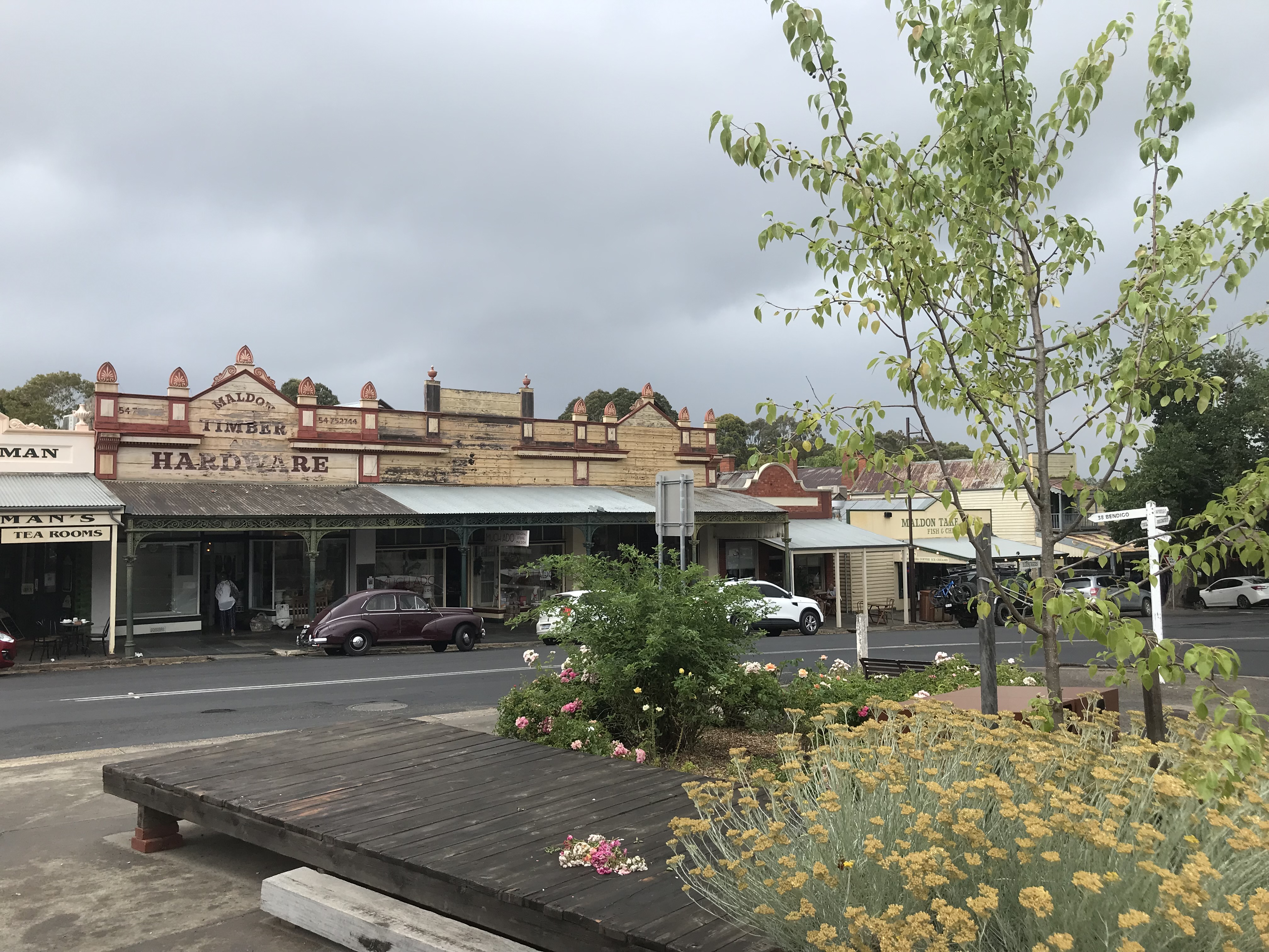


This is the intact street scape that led the National Trust to declare Maldon Australia’s first ‘notable town’ in 1965. So that’s the basic history, now it’s time for our wander.
We begin, down the end of the main street (mainly because that’s where I could find a car park) with the Warnock’s Flour Mill.
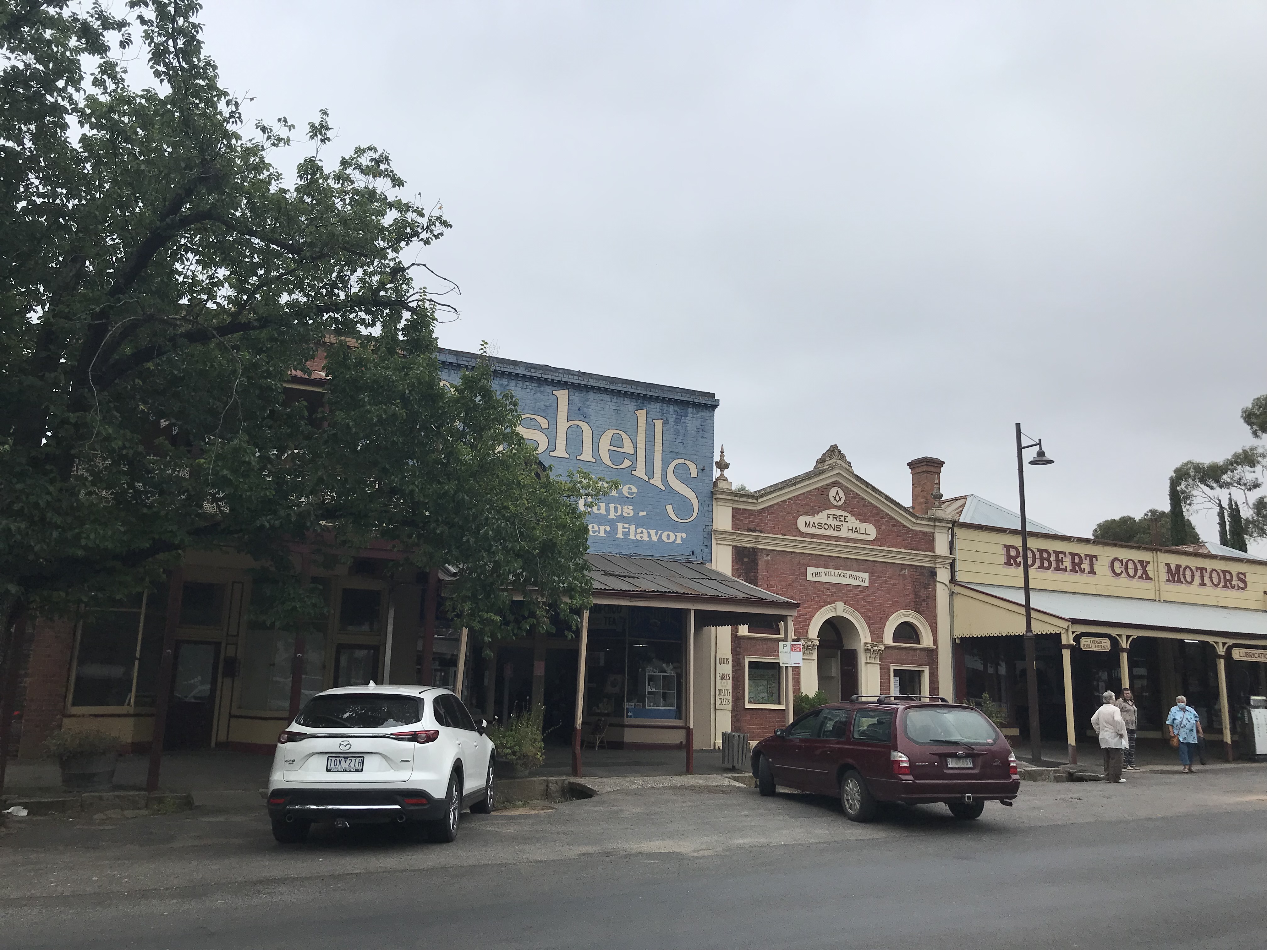
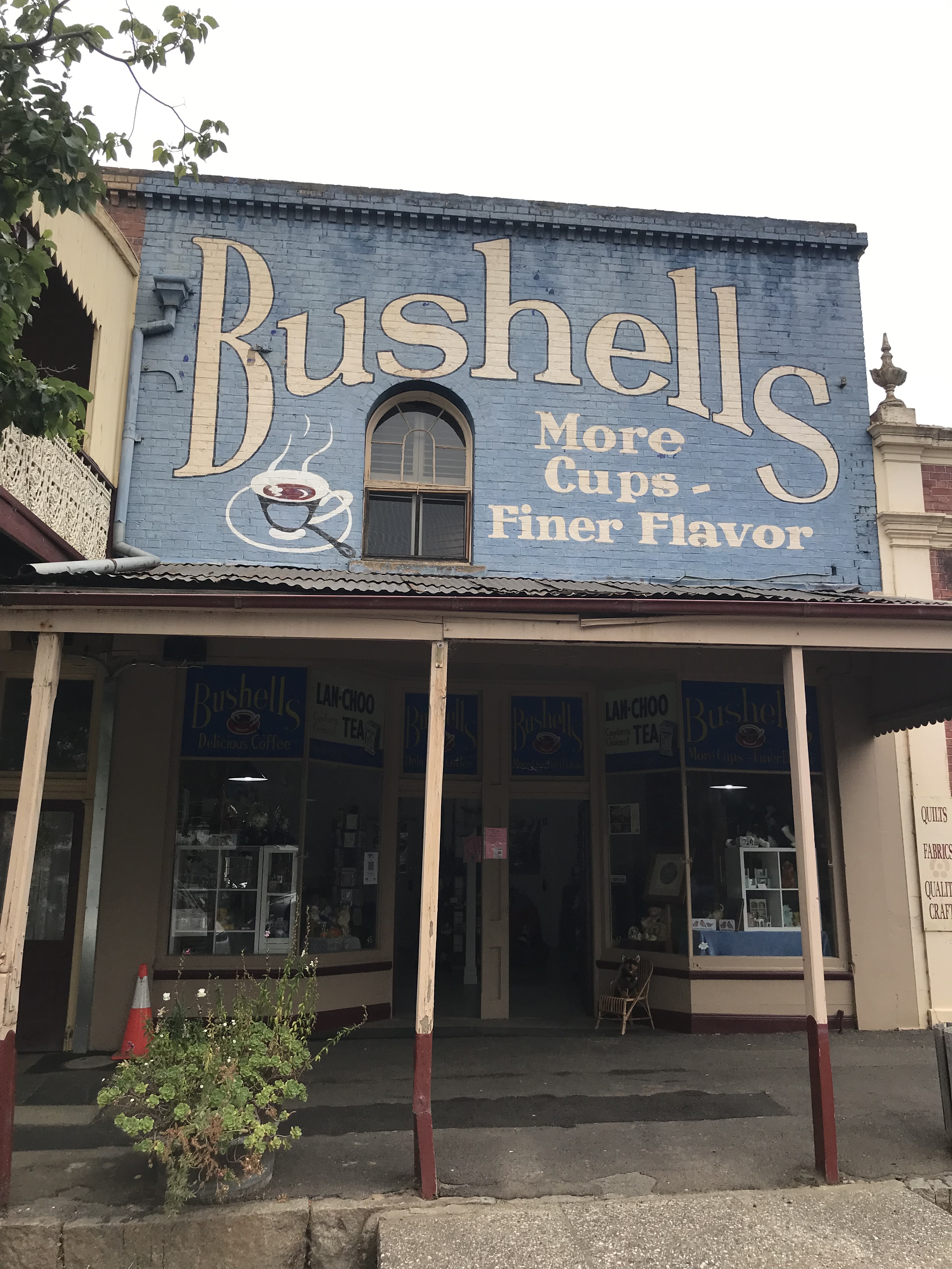
This was the site of the local flour mill run by James and Samuel Warnock (the entrance was via rear lane) it was converted to shops in the early 1900s and is now famous for its Bushells sign. It is technically a ghost sign as Bushells is no longer sold there, but it’s so vibrant it’s hard to see it as especially ghost like.
You’ll have spotted the nice brick building next door. This is the Free Mason’s Hall.
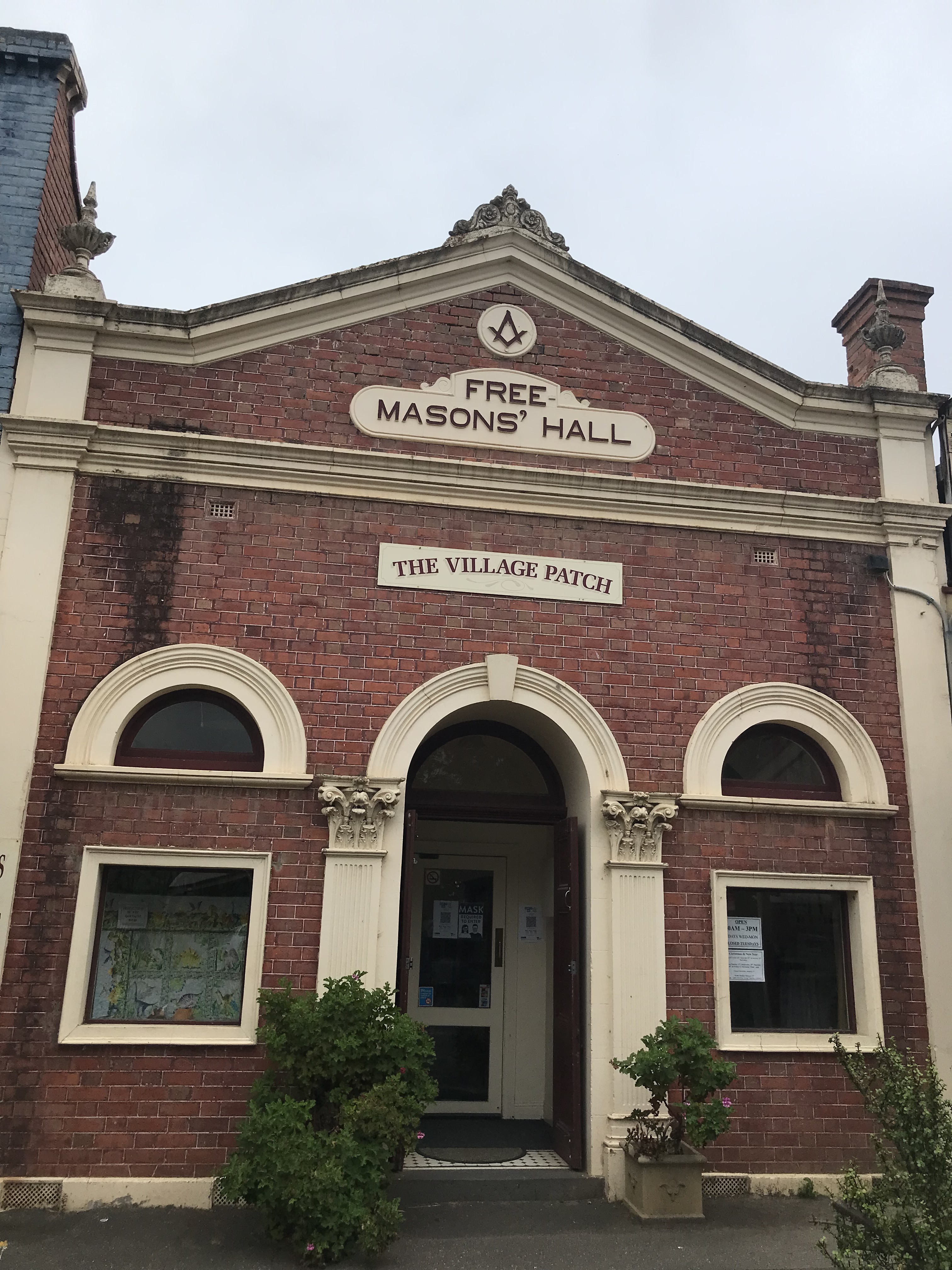
This building was originally part of the Warnock’s store but the facade was added in 1908 and the Freemasons moved in and used it as their hall until the 1980s.
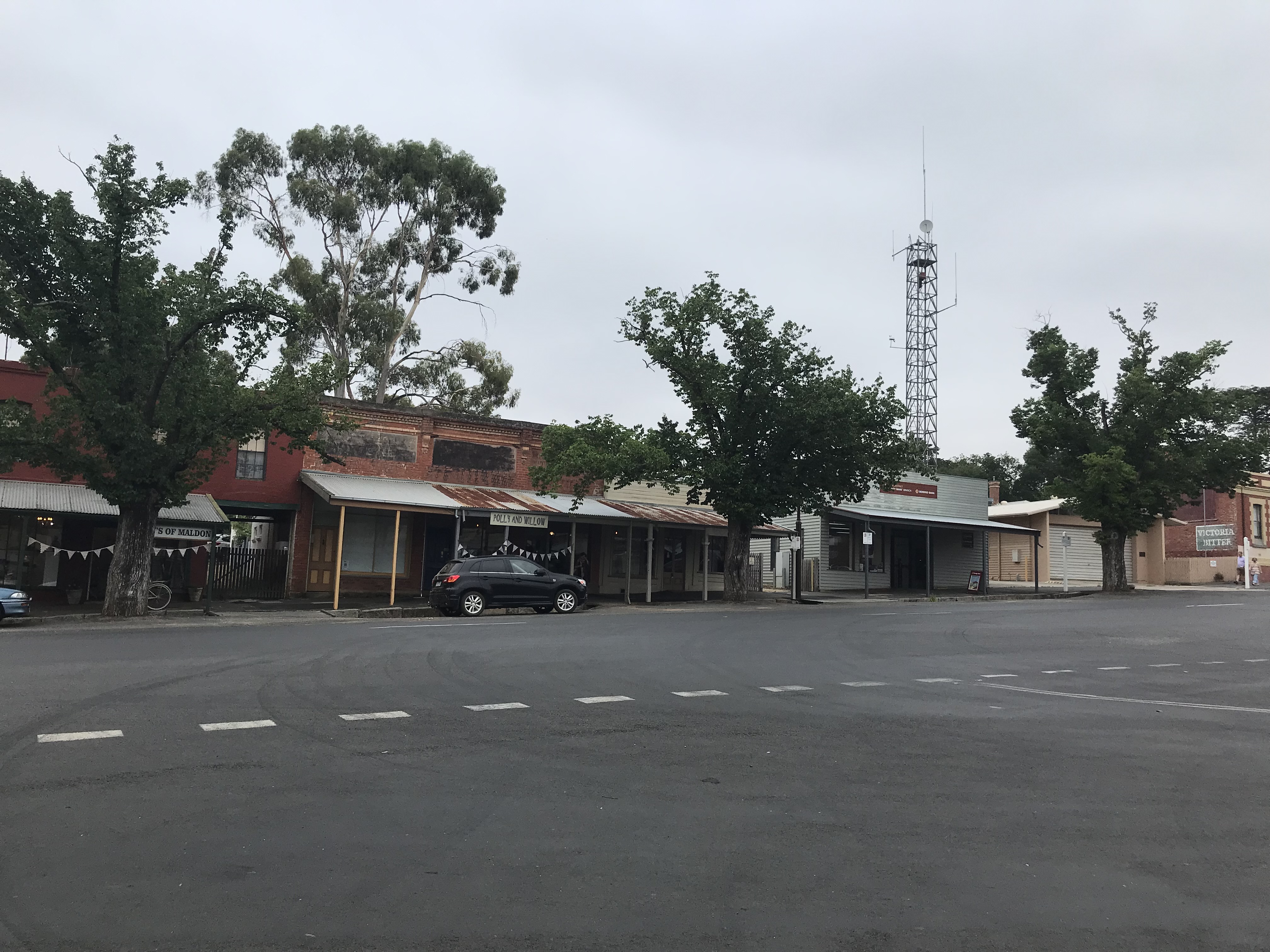
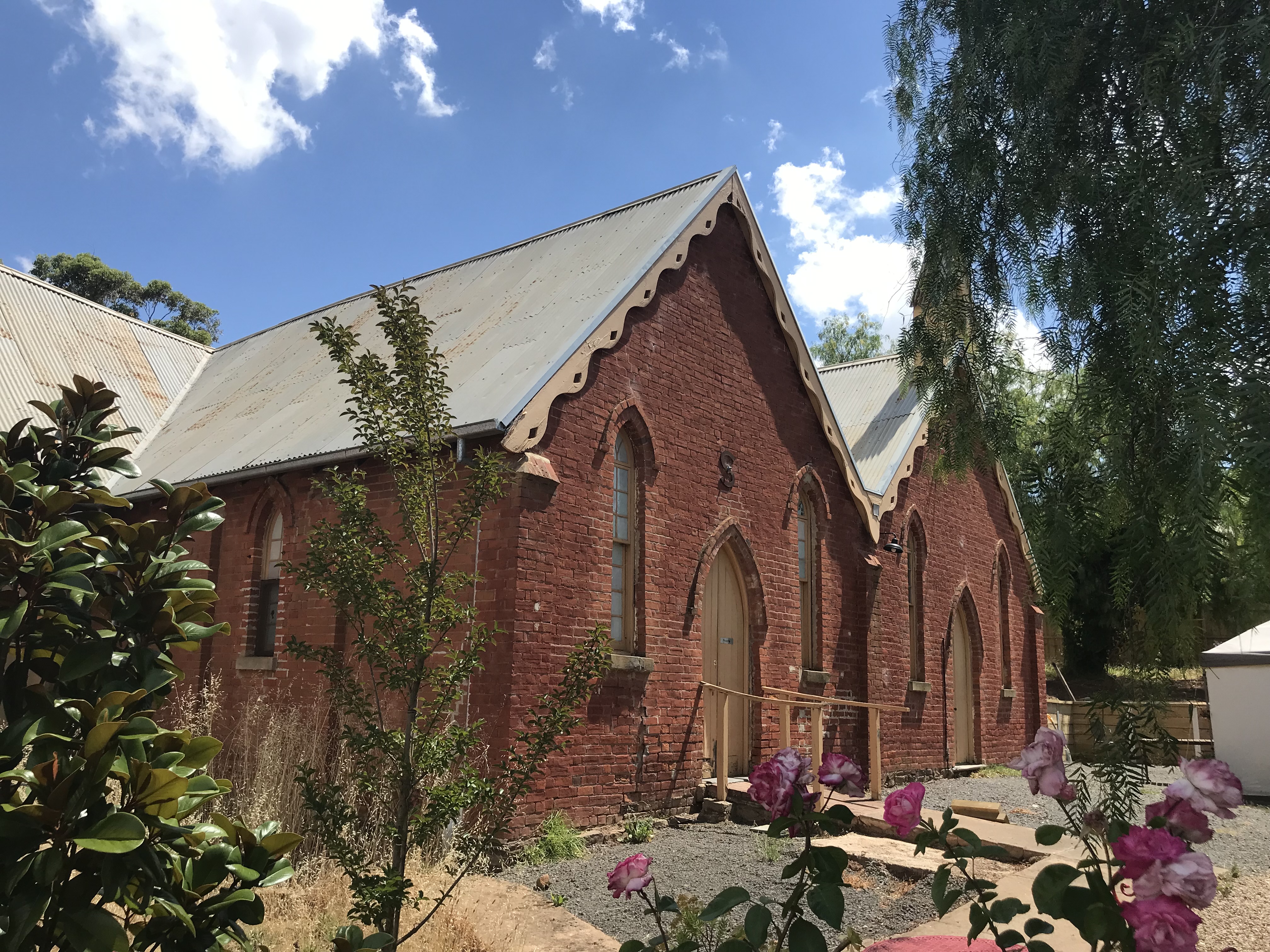
In our first random jump we move past some of the other high street buildings (I’ll return later). One of the key reasons I wanted to visit Maldon is its Athenaeum Library, but as it doesn’t open until the afternoon I have a quick wander to find it before going for lunch and on the way I discover two of Maldon’s many churches on the way. Both in fact Baptist churches.
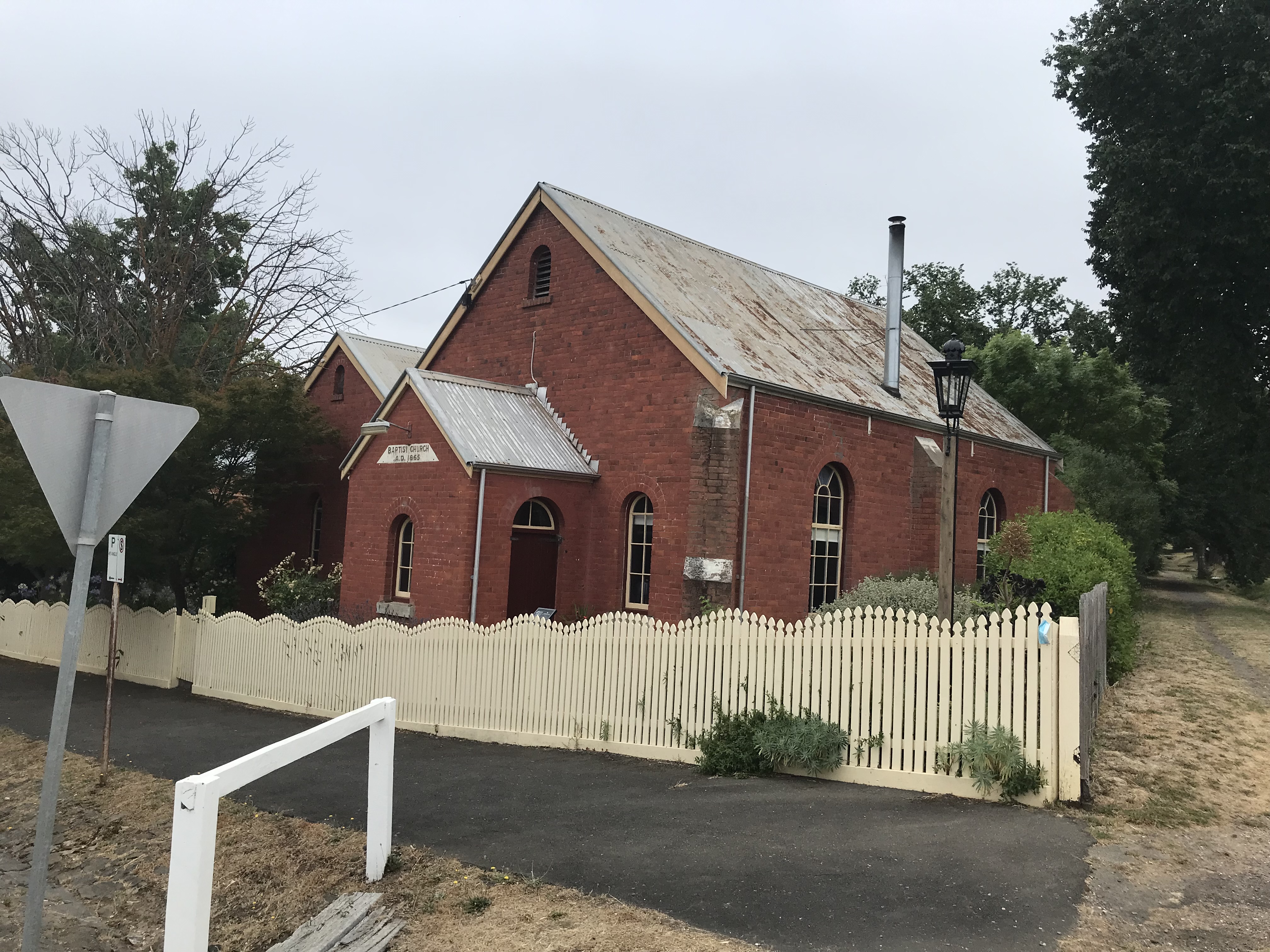
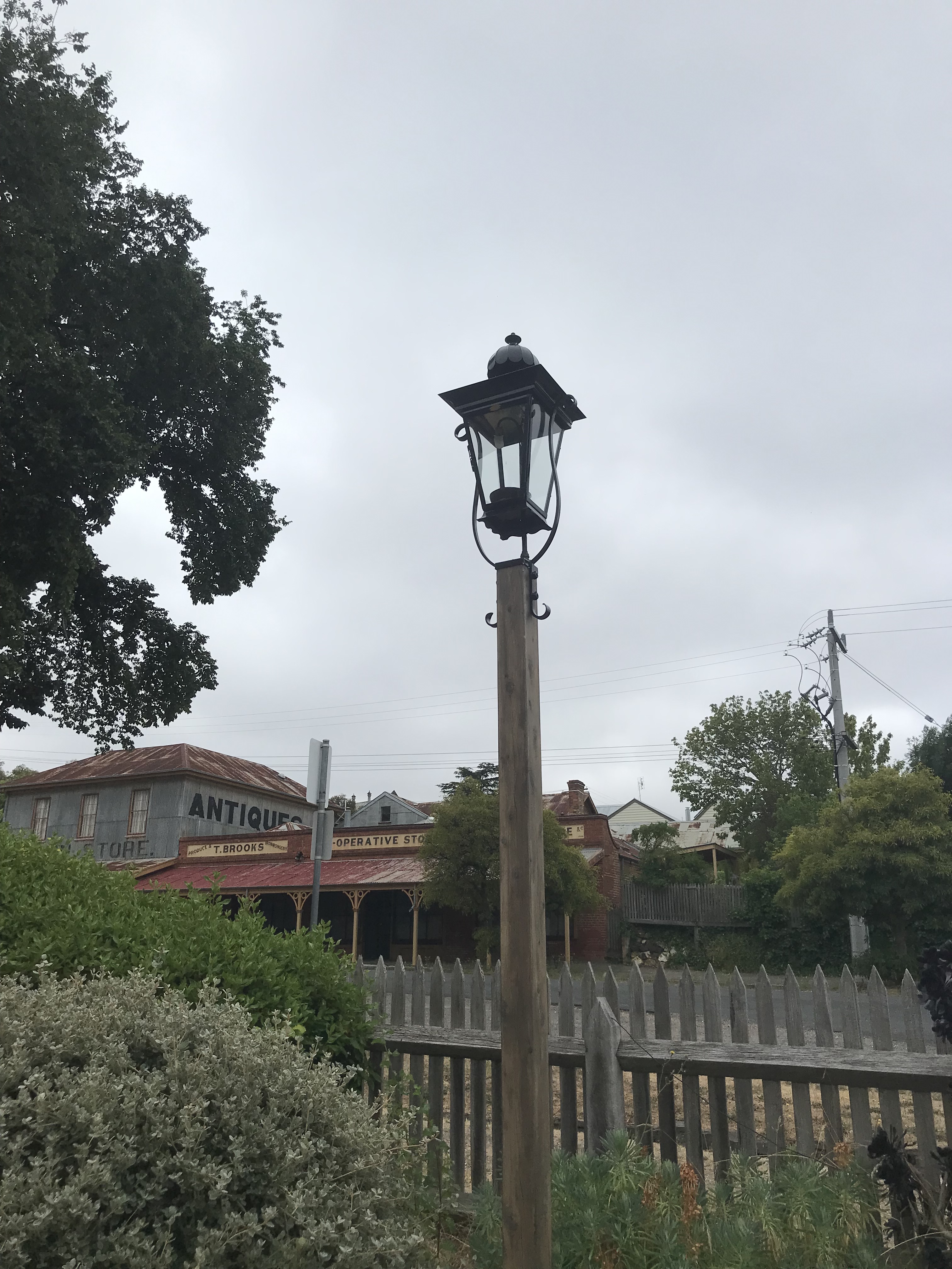
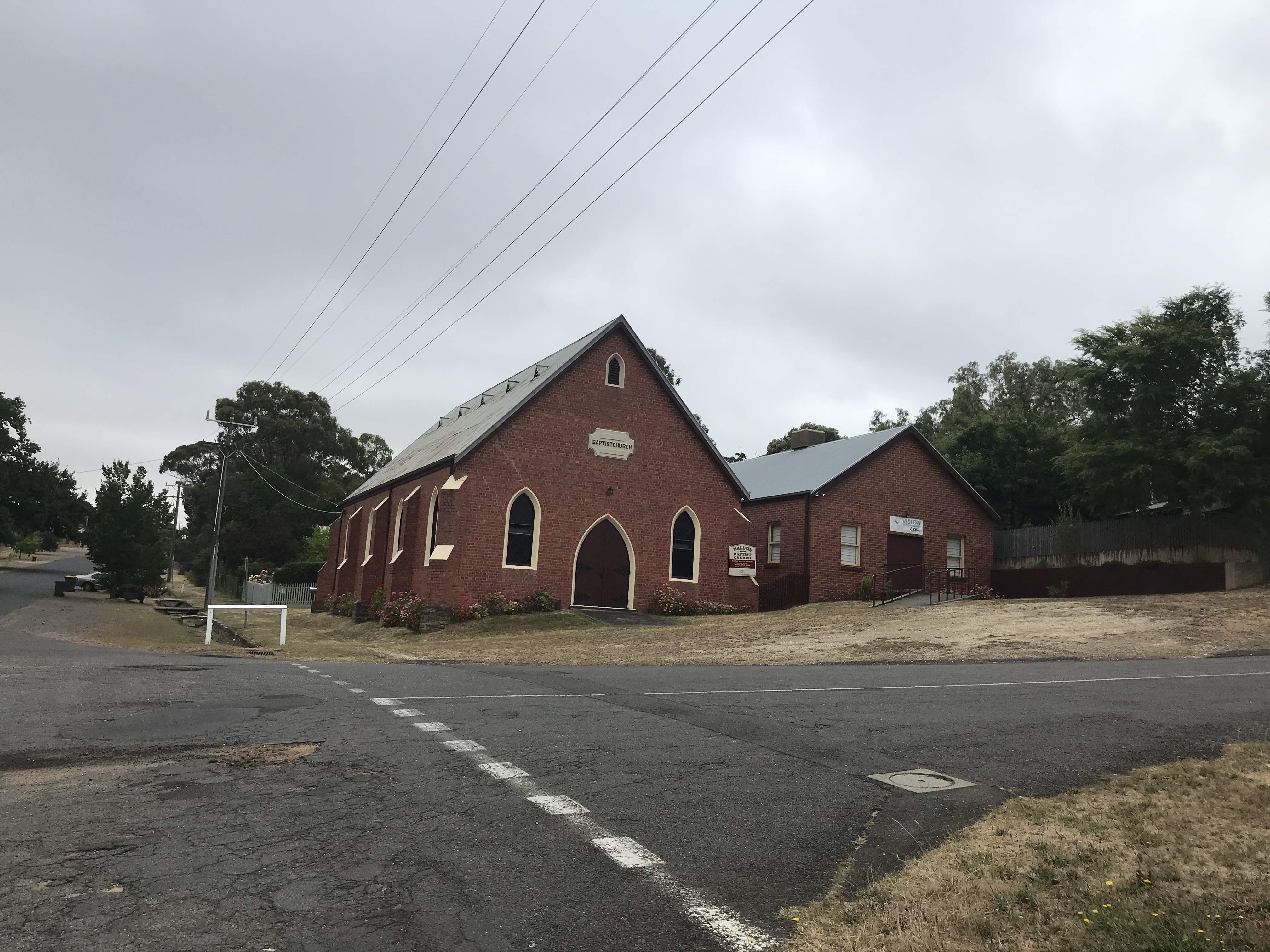
The smaller building is the original church opened in 1865. It began as a Welsh church due to the large number of Welsh miners in the area. There was a division of the congregation which resulted in the construction of the larger church just round the corner in 1895. But eventually the differences were solved and the congregation reunified in 1930 into the larger building, using the small church as the Sunday school. The light you can see next to the original church is a modern replica of the lamp built in the 1880s so that passers by could read the times of upcoming Baptist sermons.
We then wander along to the Maldon Progress Hall. It was opened in 1873 as a Temperance Hall and is now owned by Mount Alexander Shire and used as a community hall.

Looking back we see Brook’s Store which was built in 1866 and run as cooperative store by a shareholding company. The Co-op never really got off the ground and the shares were liquidated in 1872. Brooks took the store over and the Brooks Family ran it until 1986- very little of the building has been changed.

Our next stop on the way to the Athenaeum is the Post Office. It was opened in 1869 and has one really interesting claim to fame. Australian author Henry Handel Richardson grew up there when her mother was post mistress from 1880 to 1886. It features in her work Myself When Young.

Ok, so we have now reached the Athenaeum. It was opened in 1863 though the current building dates to the 1930s

As you can see it is currently closed, so now that I’ve located it I’m headed off for some lunch, exploring a couple more interesting sites on my way back to the main street. Below you can see the Holy Trinity Anglican Church which is just opposite the Athenaeum.


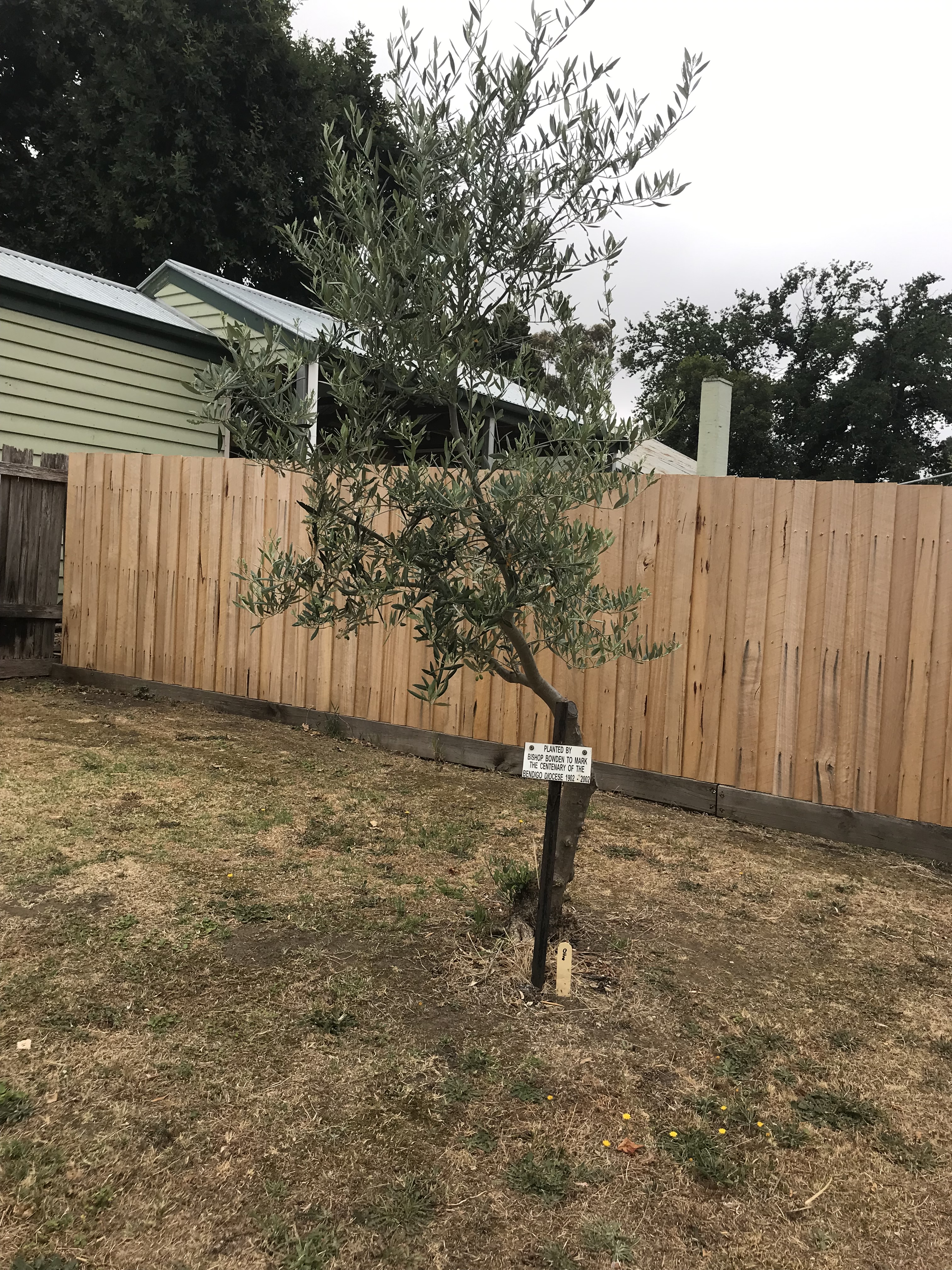
It was built in 1861 of local stone (hornfels), which is known for its hardness. Some of the deep gutters are also built of it. It is the largest stone building in the town. It was designed by D.R Drape. You can see also see one of the outbuildings and an olive tree which was planted by Bishop Bowden to mark the centenary of the Bendigo Diocese in 2002.
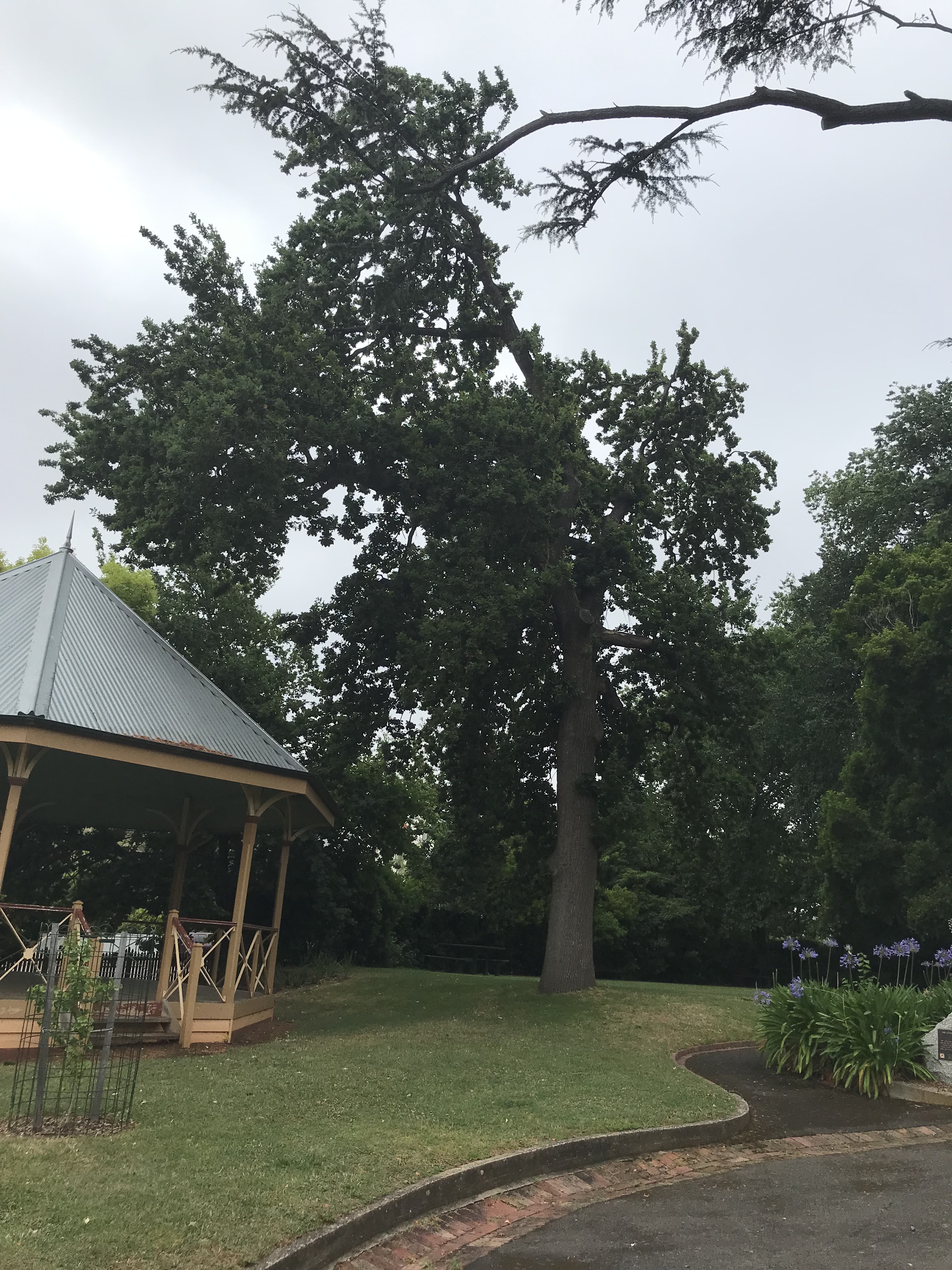
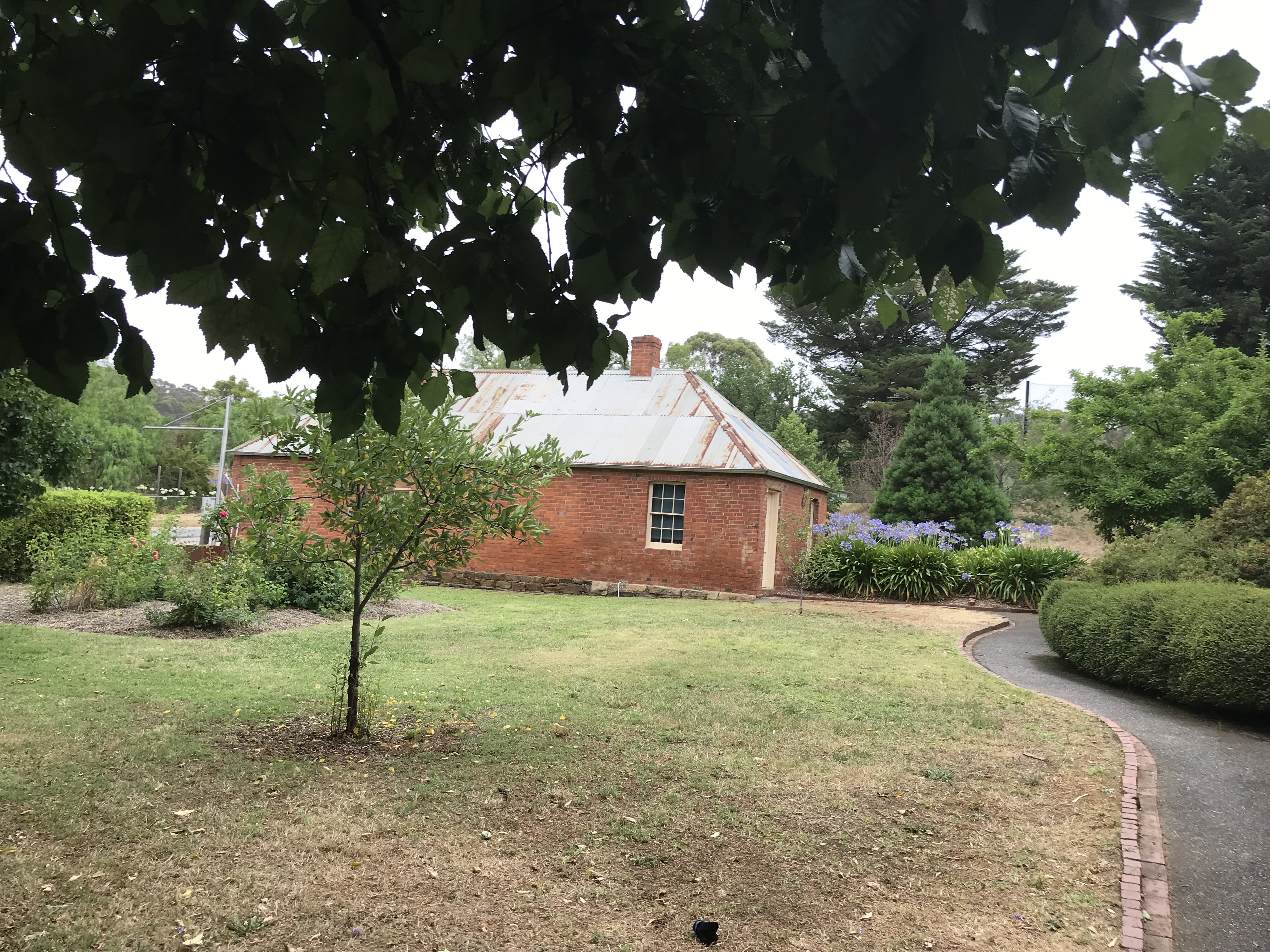
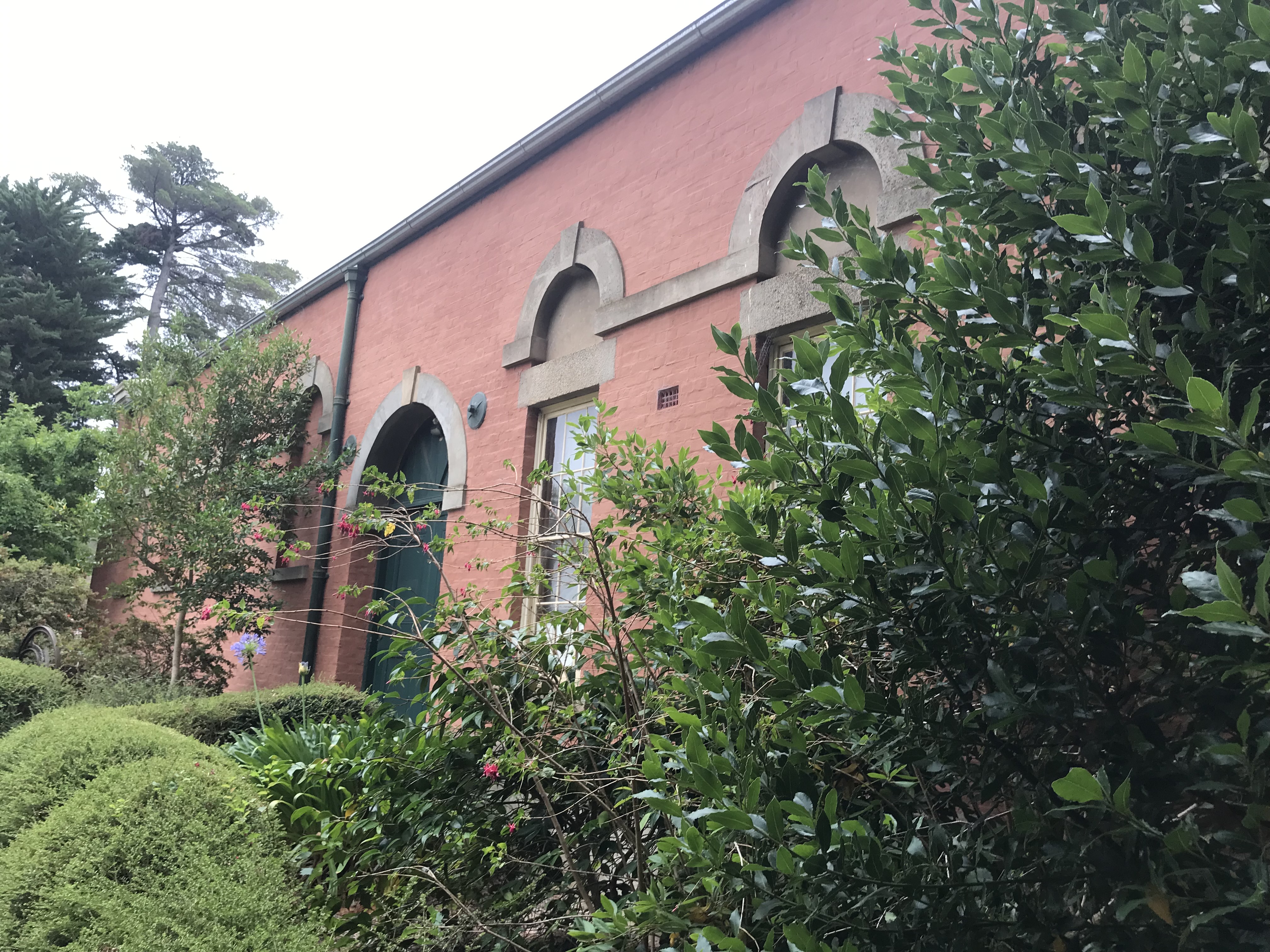
The last building before lunch is the Market Building. It’s now the home of the Maldon Museum (which is closed when I visit but wrote most of the remarkable array of historical brochures which I am basing this post on). The Market was opened in 1859, but closed in 1860 because of a depression. It was converted into the Council buildings in 1865 and they remained there until 1964. In the photos below you can also see grounds around the Market building which contain two English Oaks planted in 1863 to commemorate the marriage of Prince Albert Edward to Alexandra Princess of Denmark. The rotunda dates to 2008 but it is a realisation of a long held dream with the petition to raise funds for a brass band rotunda presented to Council in 1883.


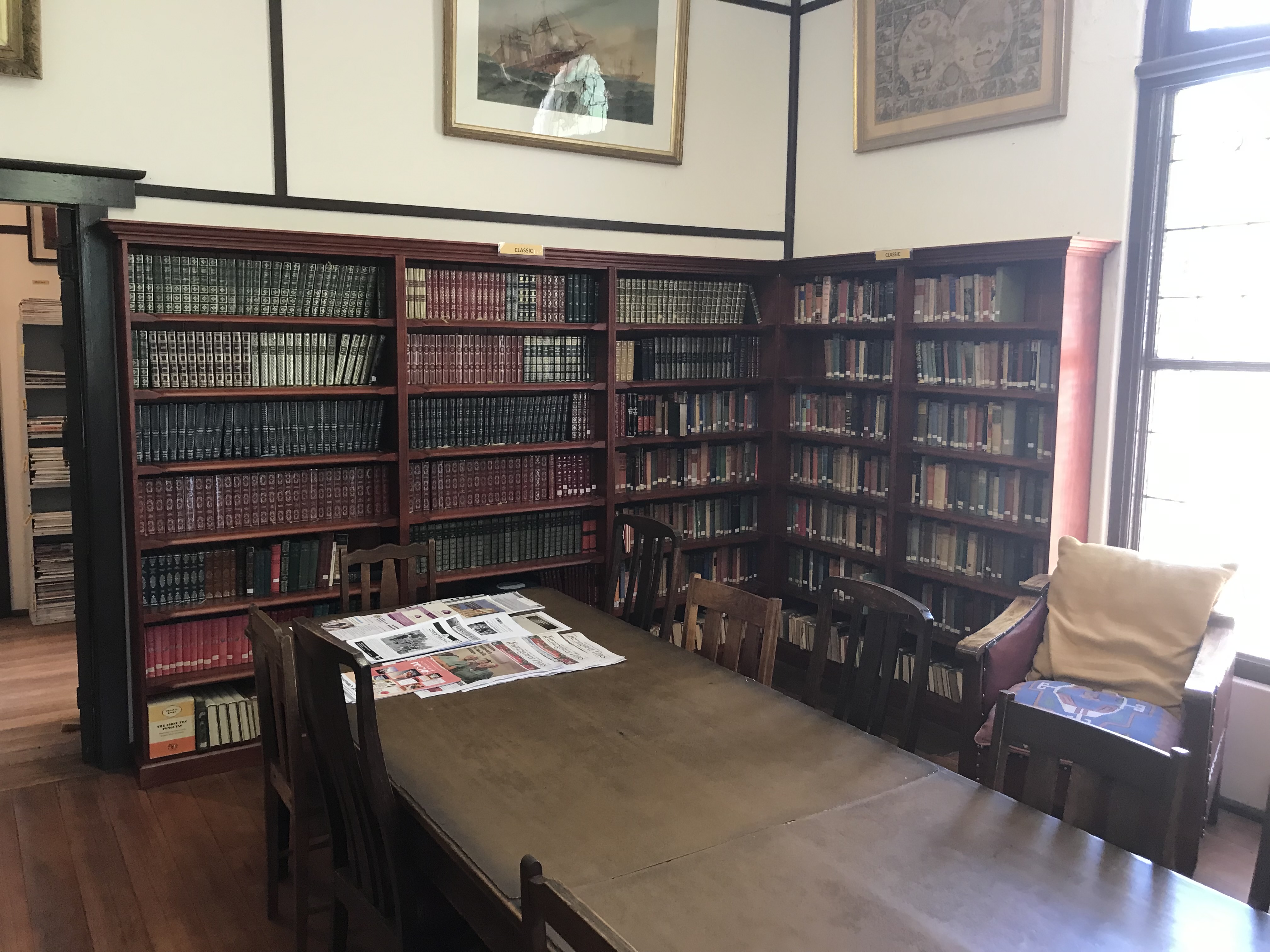
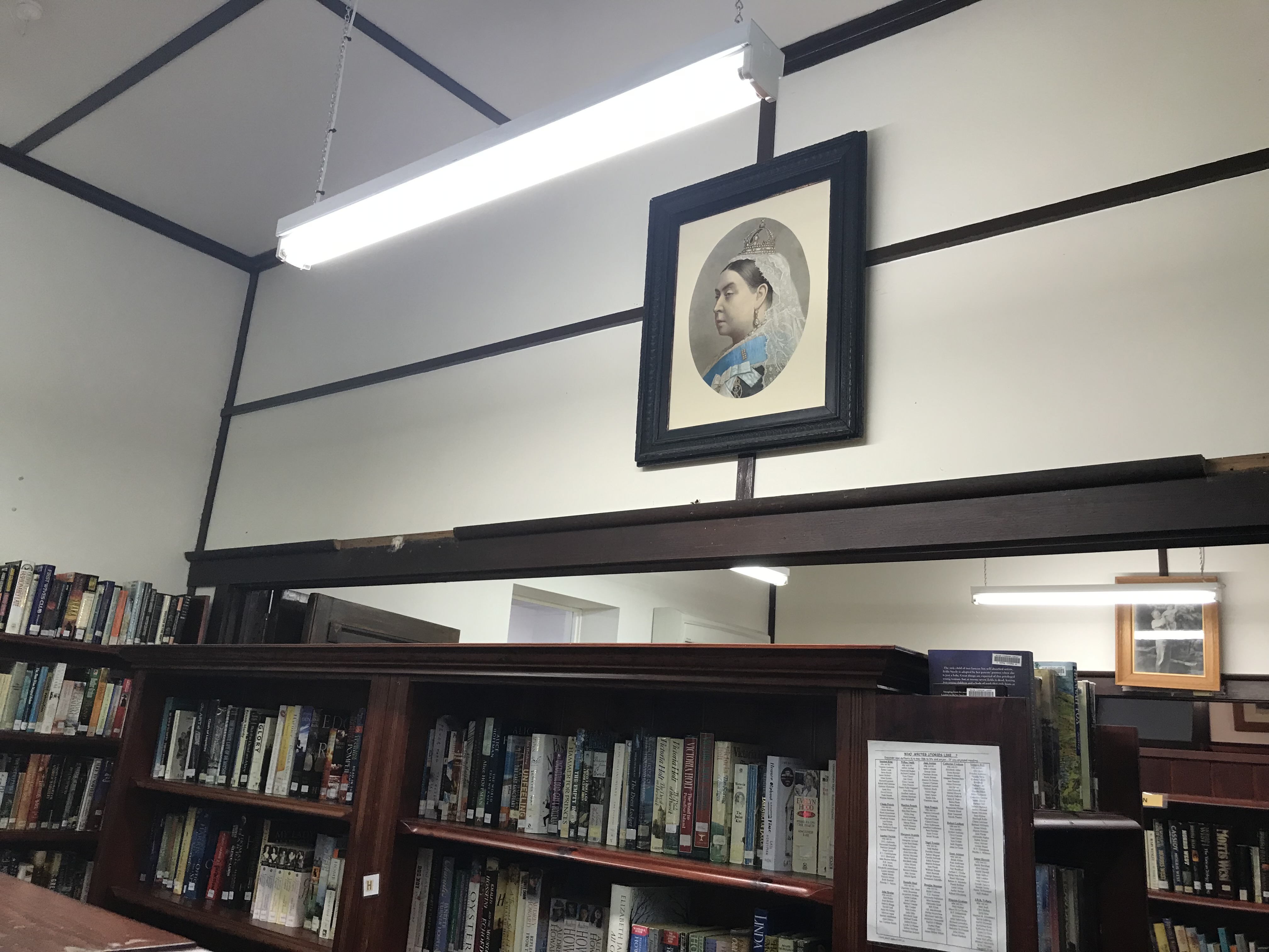
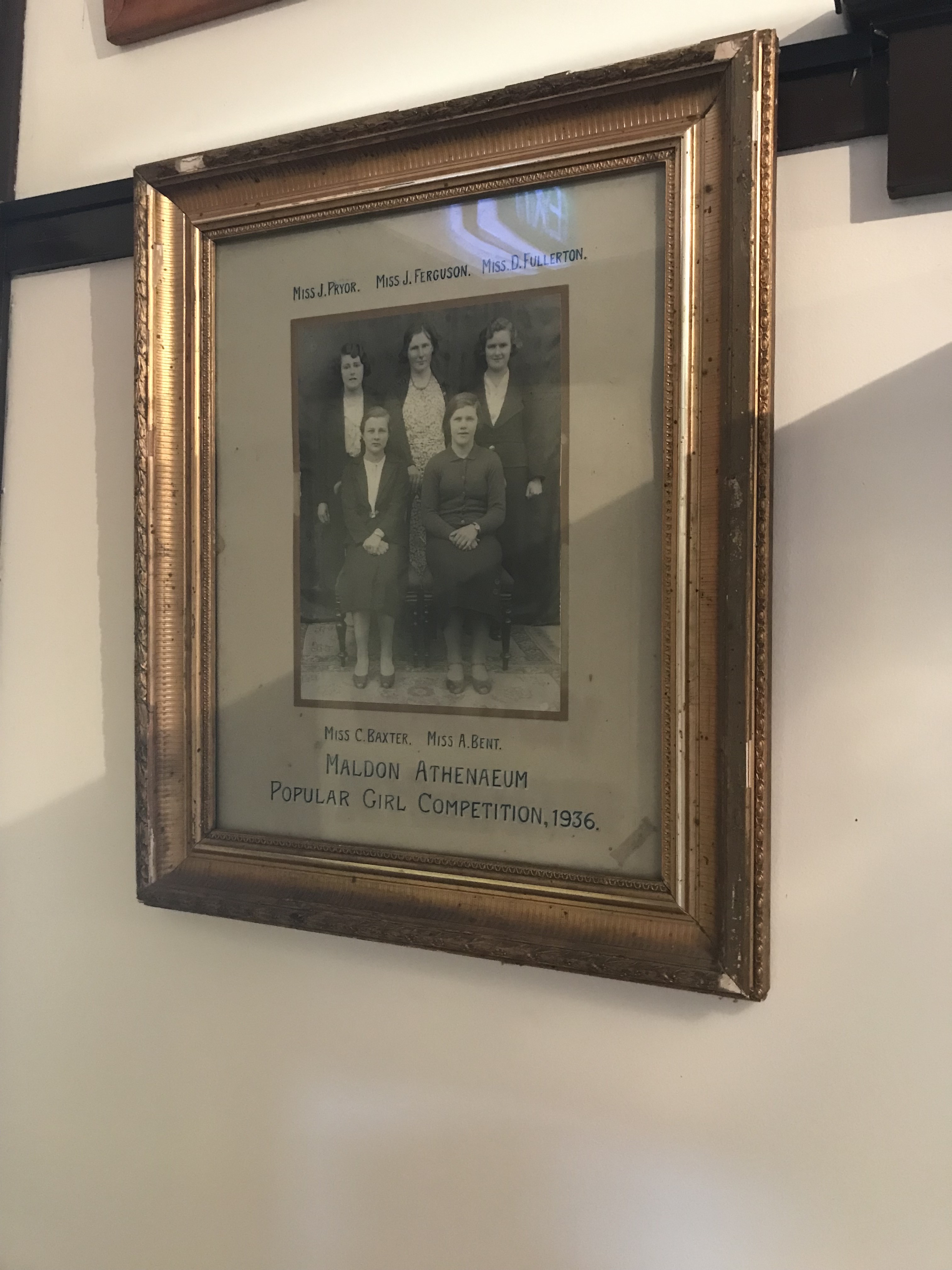
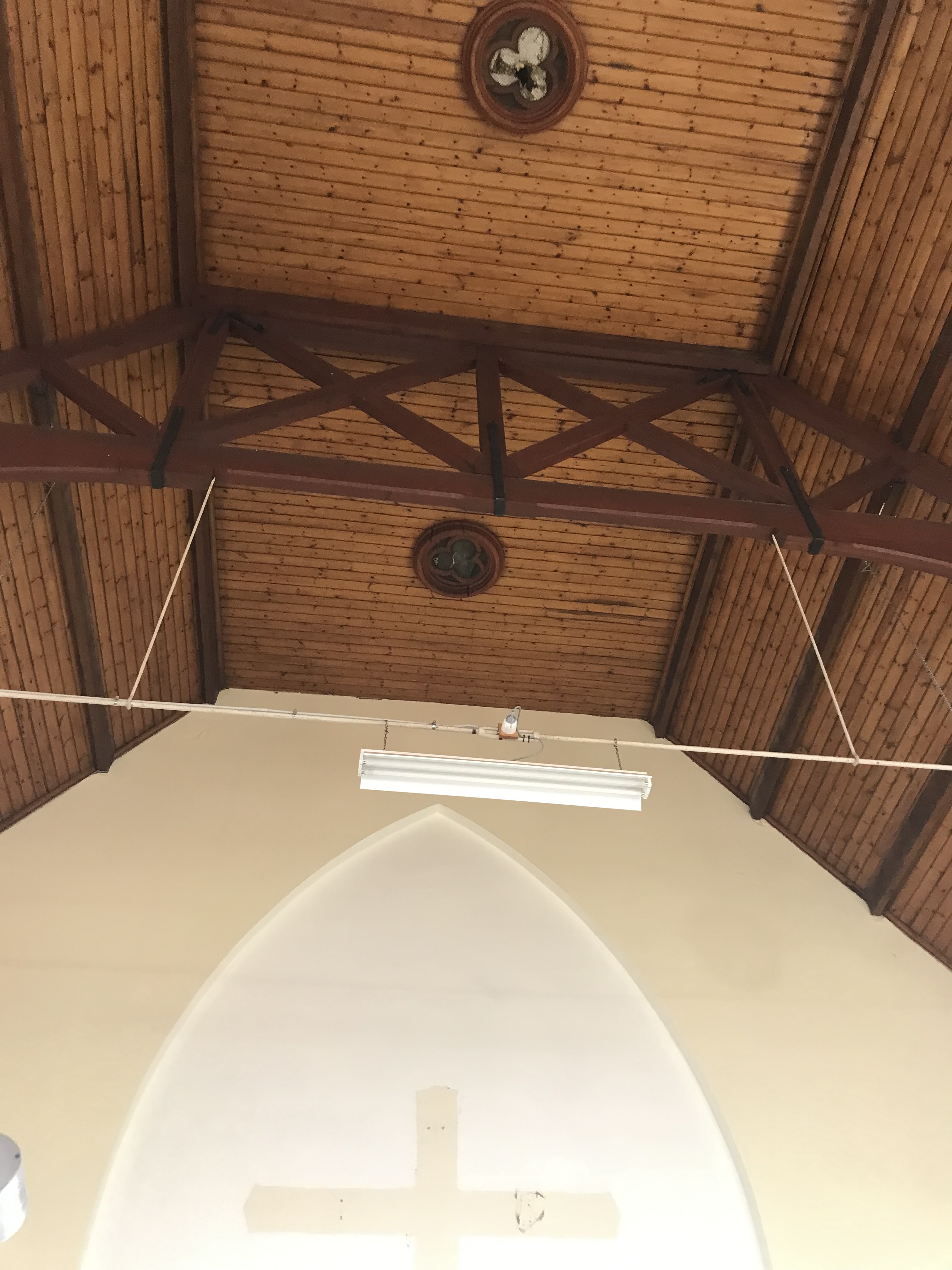
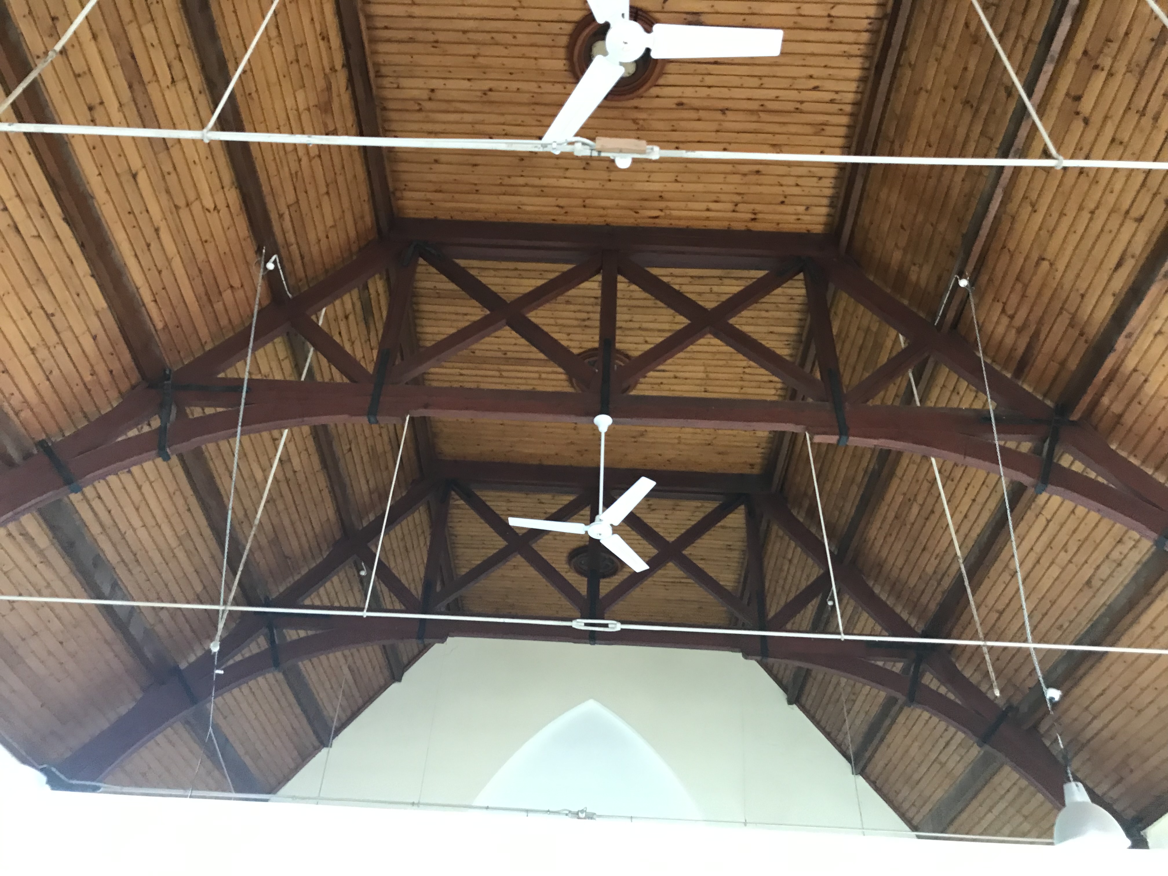
After lunch I go straight back to the Maldon Athenaeum Library and it’s open.

It was opened in 1863. The original wooden building burnt down in early 1900s with all records lost along with, apparently, the stuffed albatross in the window. The building dates to the 1930s and it is still community owned and run. It’s one of only eight mechanics’ institutes in Victorian which still have lending libraries (I work for one of the others). The Athenaeum is volunteer run and it’s a fascinating little building and collection. I hope the below photos give a good overview.


So Athenaeum explored I wander back to the main street via one more church and some hotels.
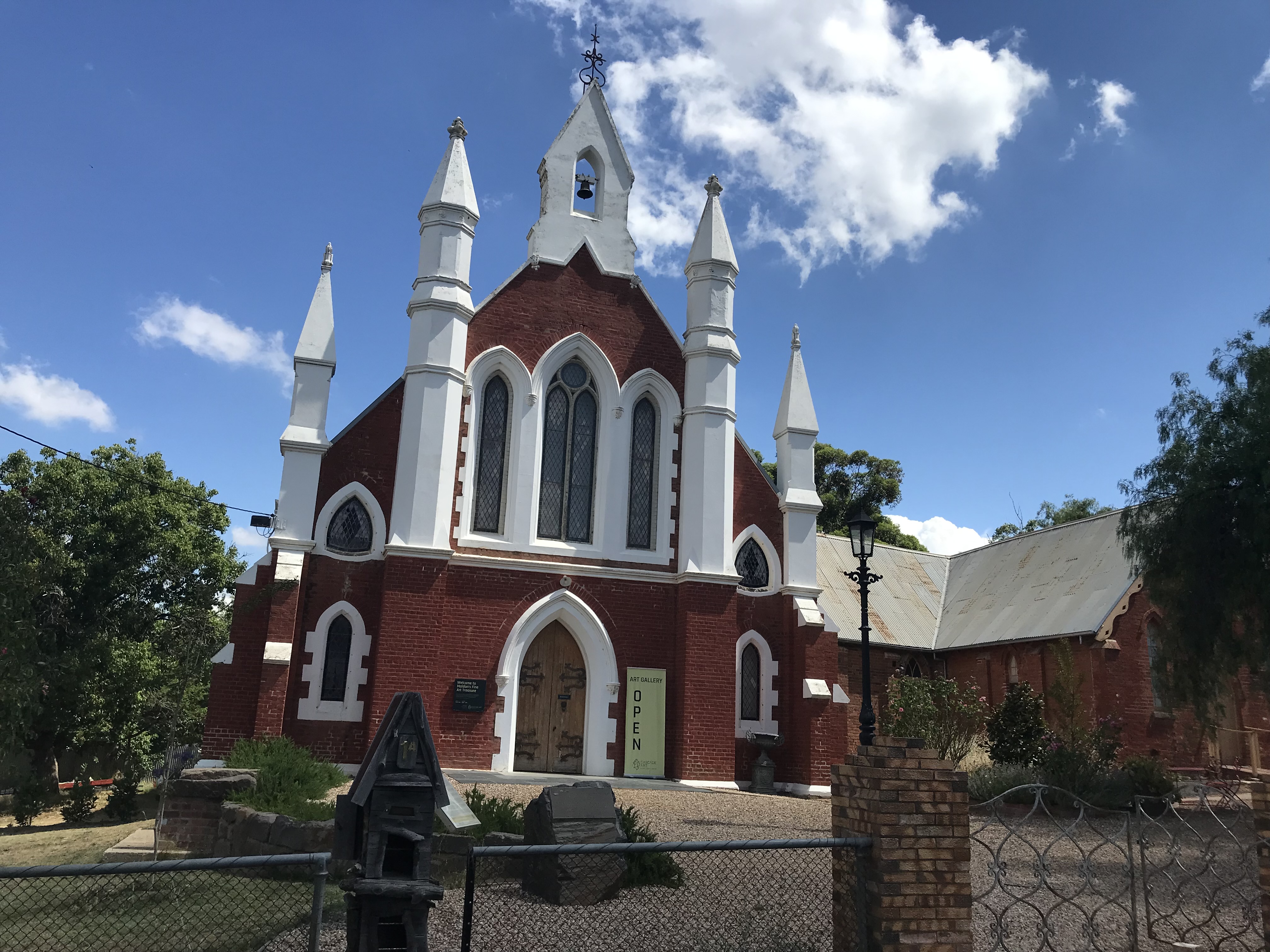

The Wesleyan Church and Parsonage which you can see above dates to 1863, it is the earliest church building still intact in Maldon. The brick chapel behind was probably the first building used as a church in Maldon. There is also a spring on the site and the stories say the minister threatened legal action against anyone who was caught removing more than one bucket of water. The building has been beautifully converted to The Cascade Art Gallery.
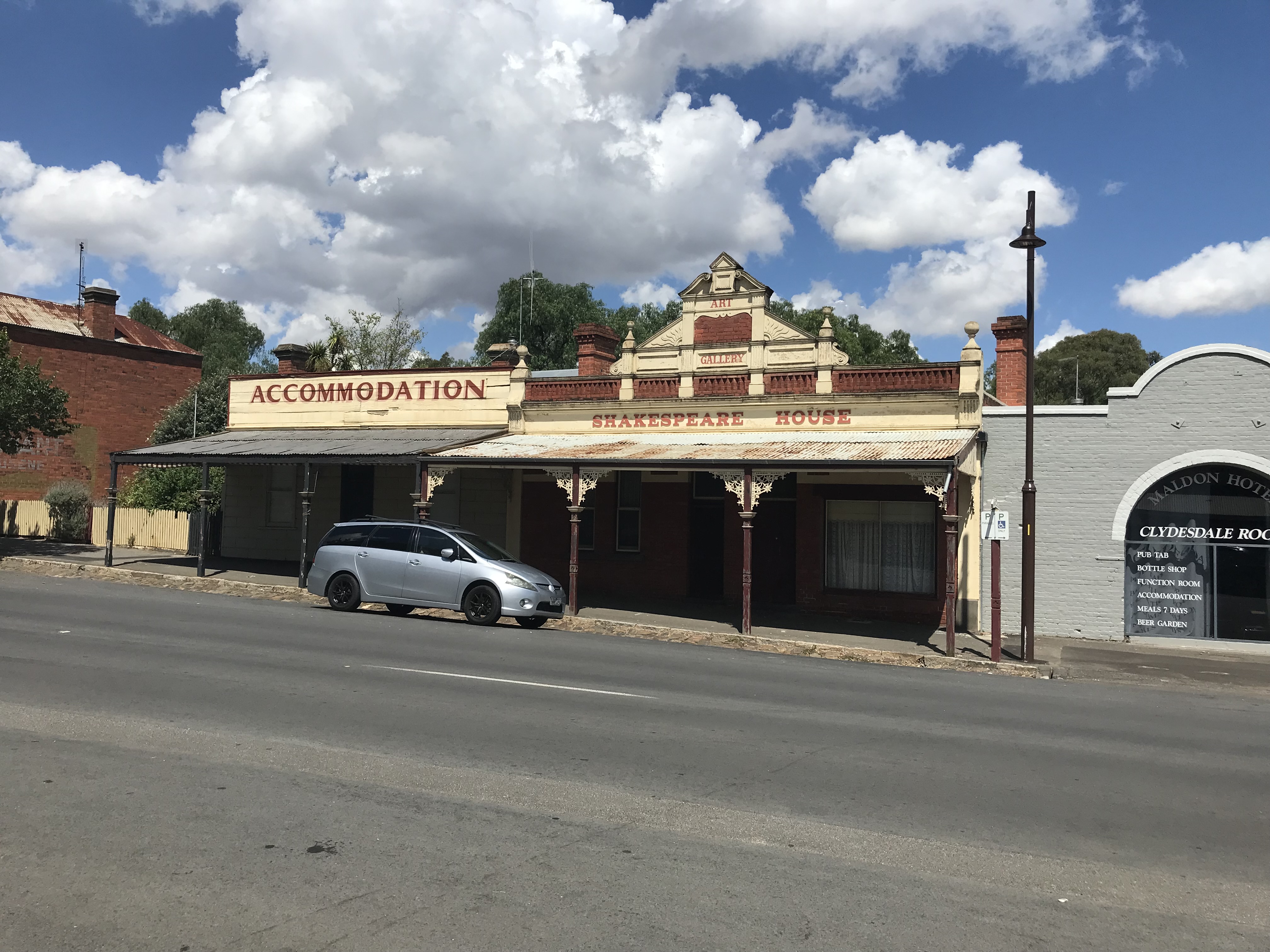
After the church I make my way past a couple of hotels.
Maldon Hotel opened in 1908 by Thomas Butler. Its site was originally a creek bed, but after severe flooding in the 1860s a drain was erected.

Another casualty of the creek bed was Shakespeare House, after the original wooden building was flooded the drain was built. It was delicensed as a hotel in 1910. It remains intact to the period.
At the end of the main street I head up to the Beehive Mine which I shoot my opening video from.


The chimney is 30 metres high and was built in 1863. The mine itself opened in 1859 and operated until 1911. You can see the remains of the building foundations in the second photo.
After a quick wander around the mine I make my way back to my car and drive out to the railway station.


The station opened in 1884 and was closed to passengers in 1941. It now runs as a short tourist heritage railway.
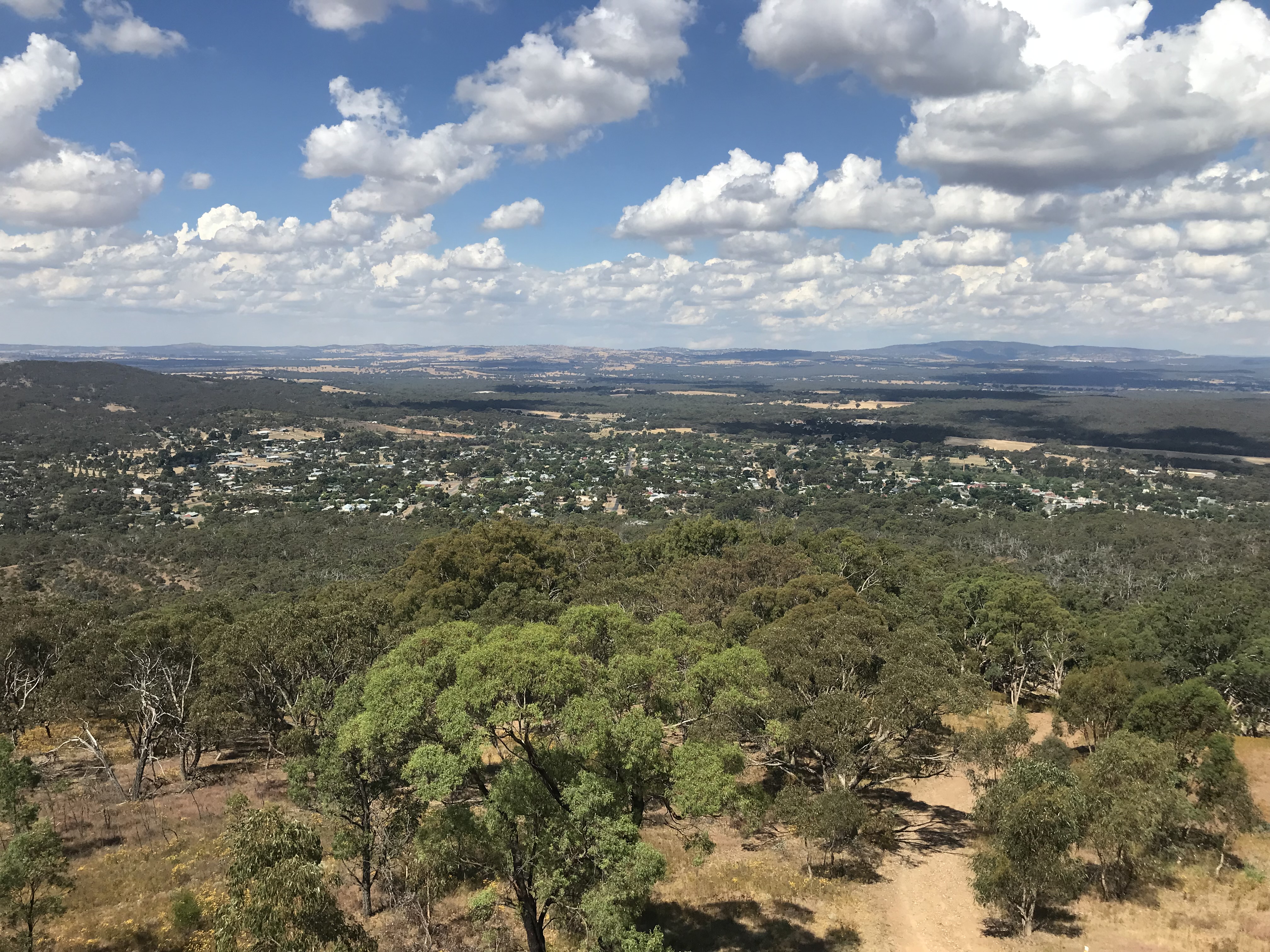
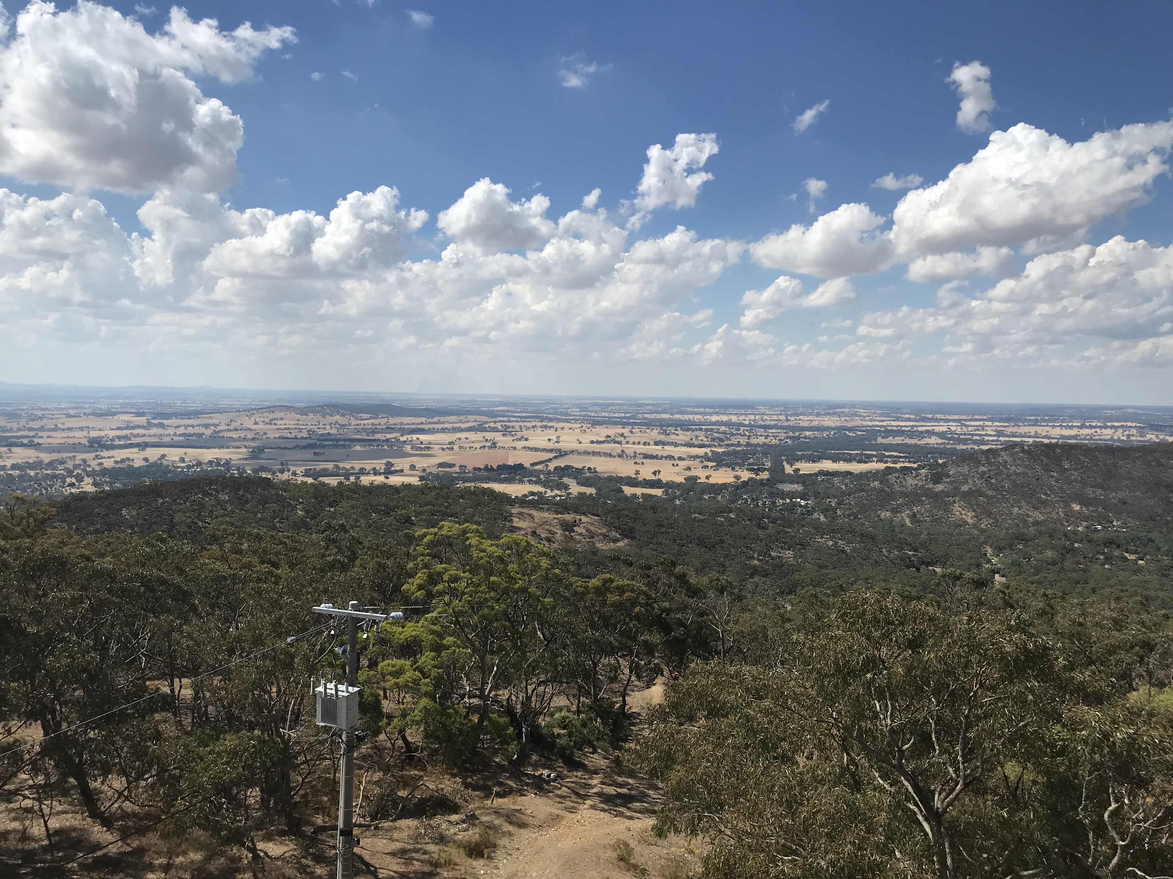
Now I have my car I head for my final stop in my wanderings, the tower at the top of Mount Tarrengower. Part of the tower is an original mine poppet head and it is still used as a fire watching tower today. It has been lit up every Easter since 1926. This was originally done with kerosene lamps but now electric lights are used. Local children grow up with the legend that the tower is the Easter Bunny’s house. The top of Mount Tarrengower is also roughly the centre of Victoria (there is a survey post I just couldn’t find it). The view from the top is incredible.


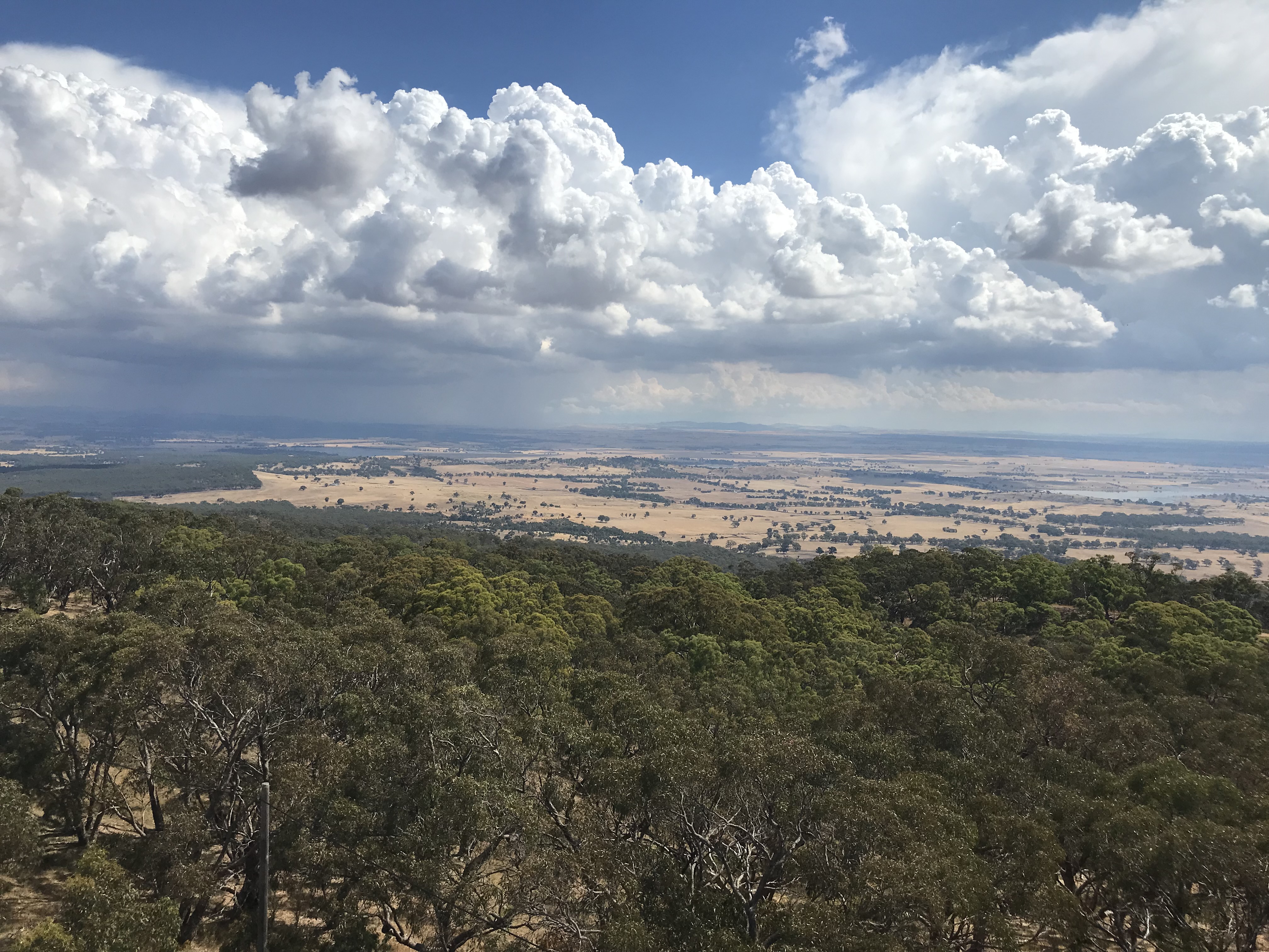
After admiring the view I head for home and the storm you can see in the last photo hits me on the way back. It’s been a fascinating day and I hope you have enjoyed wandering with me.
Ellen
References:
Site visit 2022
A Walk in the Reserve (Booklet)
Maldon’s Historic CBD (Booklet)
Historic Churches of Maldon (Booklet)
The Maldon Athenaeum Library (Booklet)
Historic Town Walk Maldon (Booklet)
History of Maldon (Booklet)
Maldon Historic Drive: Beehive Mine (Booklet)
https://djadjawurrung.com.au/giyakiki-our-story/#malamiya-yu
https://maldonmuseum.com.au/?page_id=368
http://tours.maldonmuseum.com.au/index.php/mobile/walks/4
http://maldonbaptist.org/about-us/#history
https://www.flickr.com/photos/31967465@N04/33925037822/
http://www.vgr.com.au/homepage.php
The photos are all mine.
This post doesn’t cover every heritage building in Maldon by any stretch of the imagination. I recommend a visit and I intend to go back. Contact the Maldon Museum if you would like further information.
