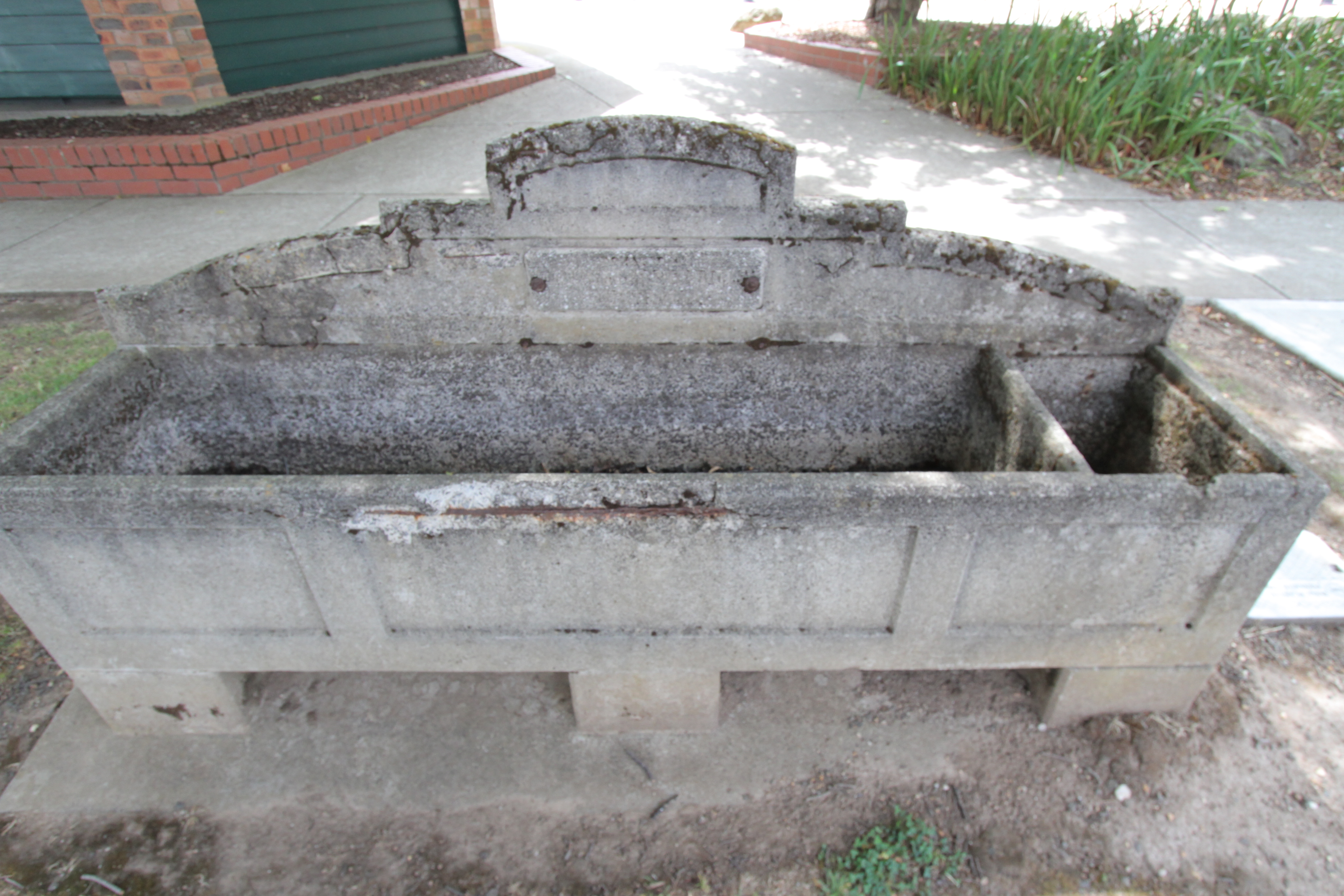
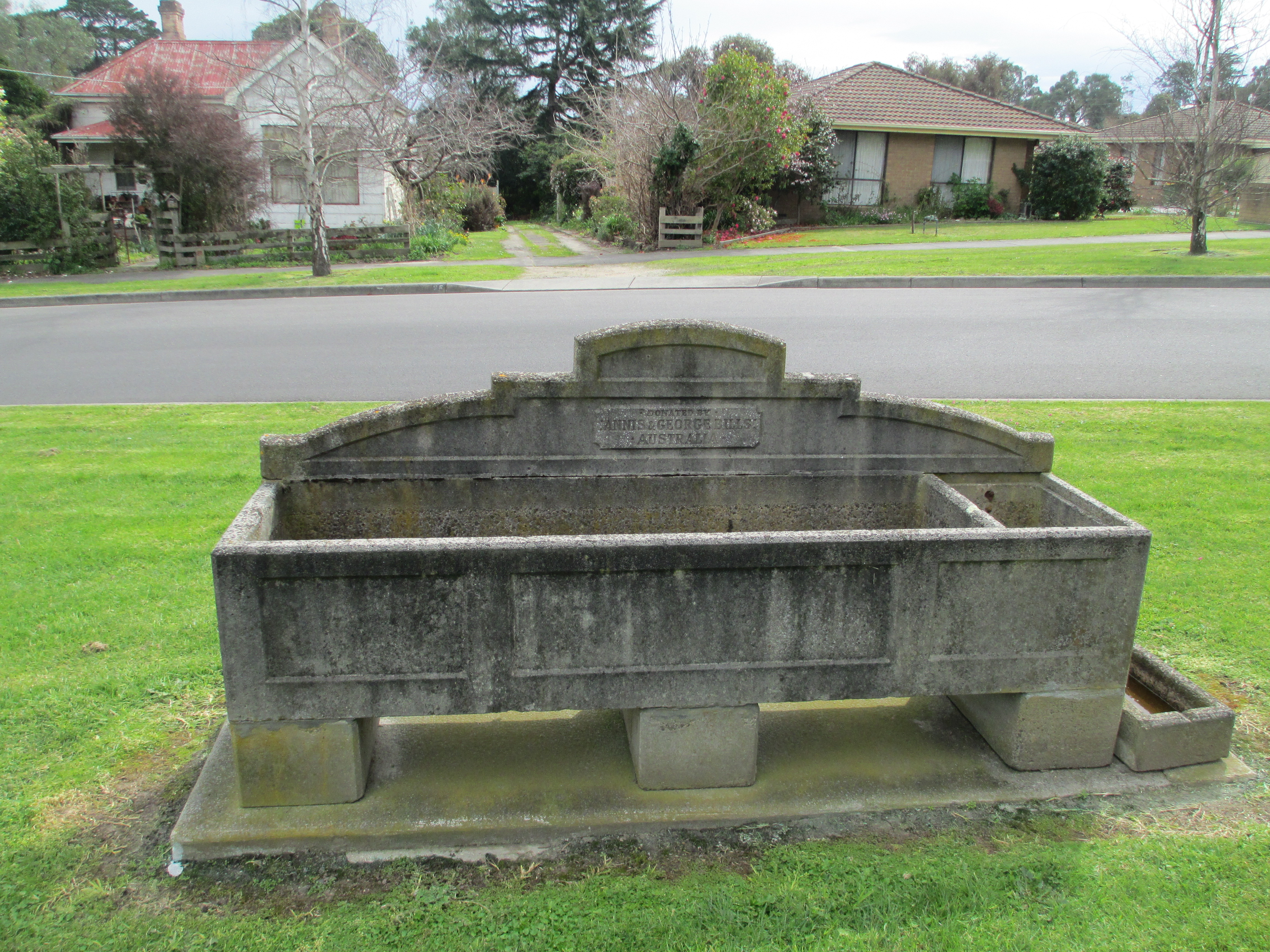
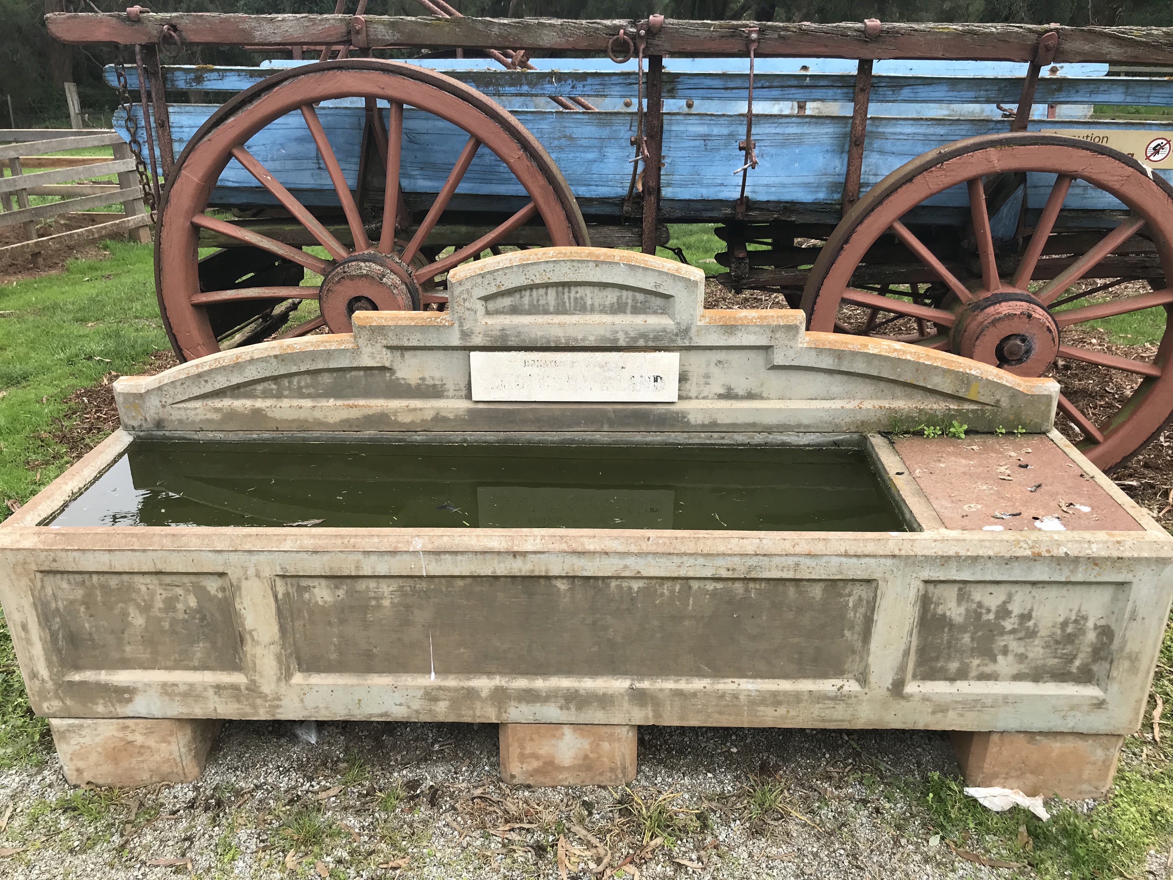
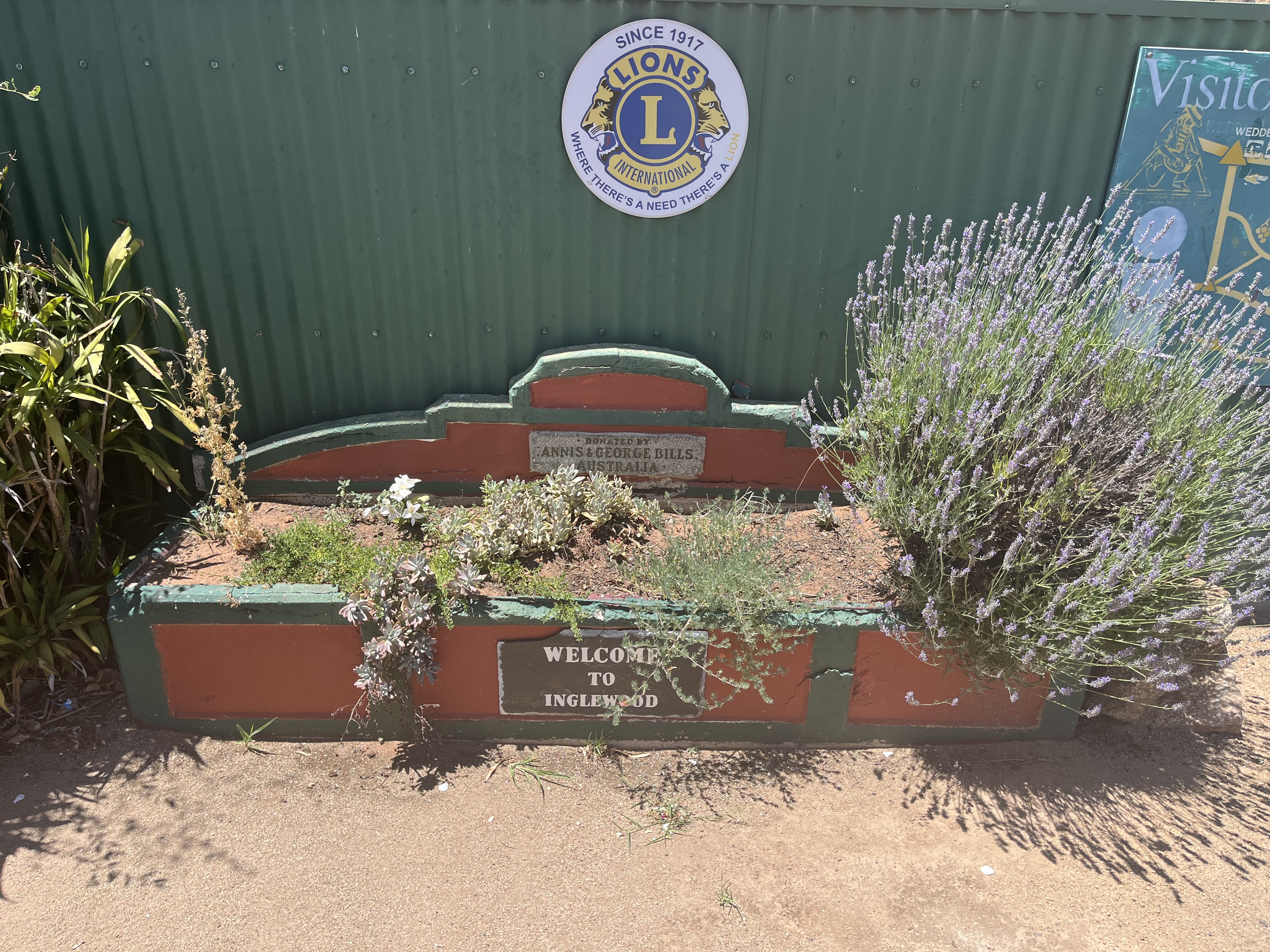
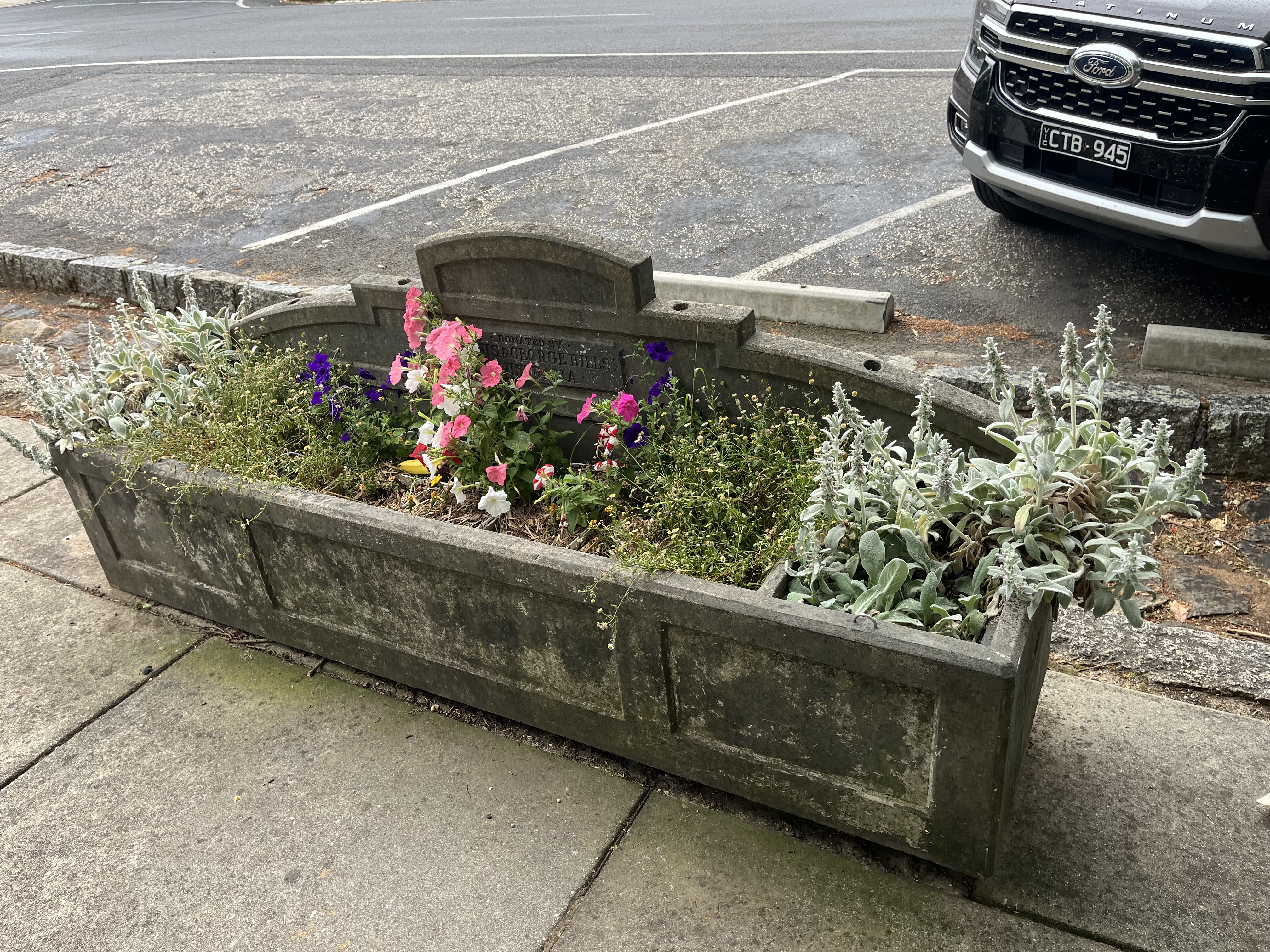
So, this is technically not a new post. It’s an update to an old one. In 2015 I went on a trip the Wimmera in Victoria and came across two horse troughs in two different towns with the same inscription. The inscription read that they had been donated by Annis and George Bills. You can see them in the photos below
Edenhope horse troughBalmoral horse trough
When I got home I did some digging and found that these two troughs were part of an extraordinary bequest, and that they can be found all over Victoria and some of New South Wales. You can read the original post here, but I’ll provide the overall idea here too.
George Bills made his money out of mattresses, first in making them and then in creating and patenting machinery to weave them. His father, who was a naturalist, came to Australia in the 1800s and, as the Horsham Times described it in 1935, “his heart ached to see the sufferings of dumb animals.” This was a concern that he passed on to his son George who also associated himself with the society for the protection of animals in England, New Zealand and Australia. George’s wife died before him and they had no children so he decided to make provision in his will for the future welfare of animals. The residue of his estate, after several personal bequests, was set aside to provide free memorial horse troughs the length and breadth of the British Empire. Towns applied for them to the trust and many such as Horsham actually have more than one. George died in 1927 and approximately 86 000 pounds was left for the provision of horse troughs. Each was made to the same design and carried the inscription ‘Donated by Annis and George Bills Australia.” By 1937, according the the Adelaide Advertiser, the trust had set up more than 400 horse troughs in Victoria and were expanding to New South Wales.
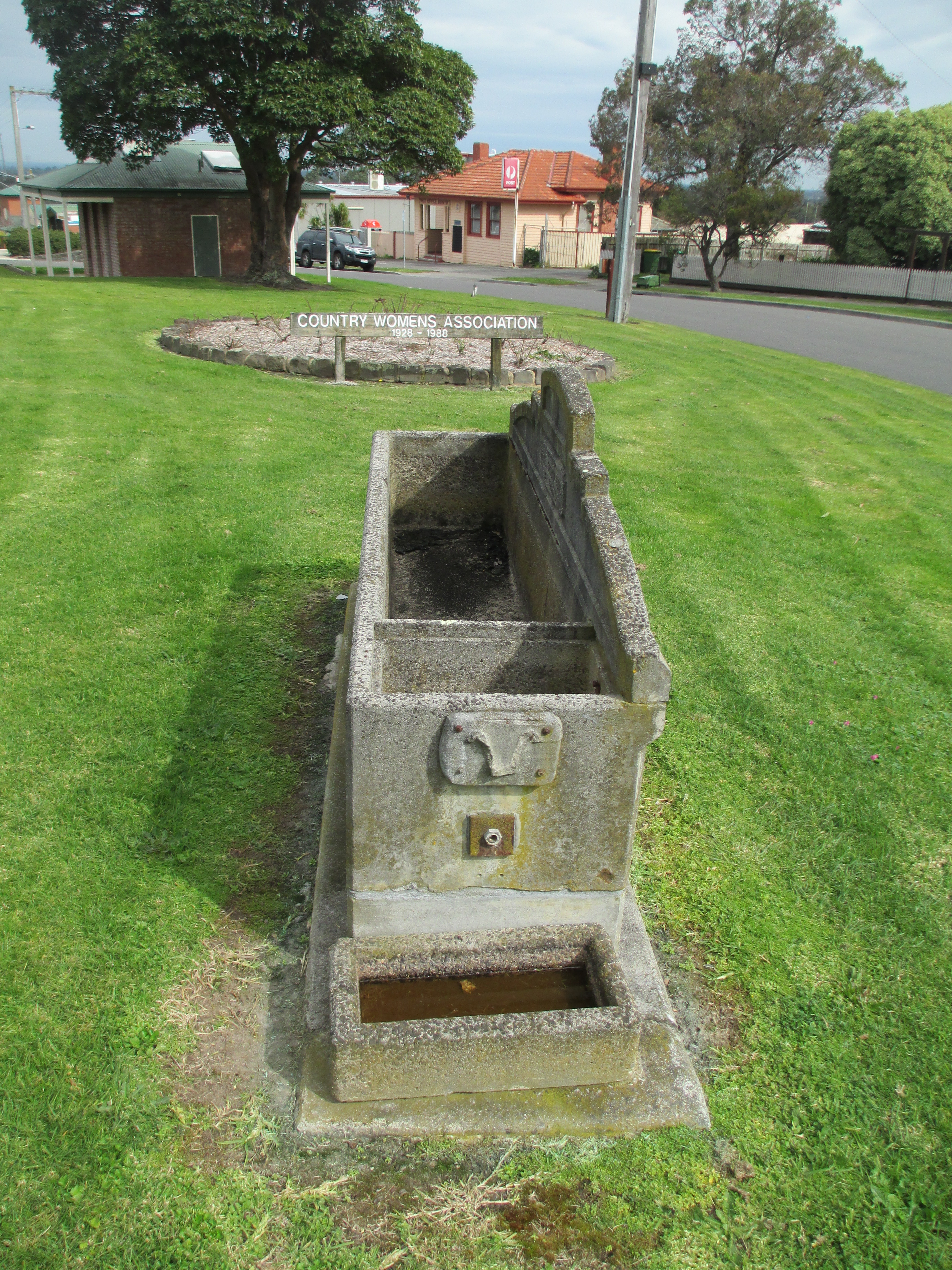
Sometimes they were for more than horses though and issues could arise, as Dubbo found in 1946. In this particular case dogs and humans were catered for as well as horses. Unfortunately the position of the human’s drinking fountain was problematic. As the Dubbo Liberal and Macquarie Advocate said.
“Unfortunately, lack of foresight was shown in the placing of the adjunct for the public. It is immediately over the small concrete basin for dogs, and at the end of the horse-trough. After drinking, horses have been seen slobbering over the faucet, and dogs licking it.”
The drinking faucet was thankfully moved.
The Dubbo paper also adds the interesting detail that the activities of the trust lapsed during the war period, but began again afterwards, which was when Dubbo applied for its second horse trough with the subsequent problems.
So since writing this original post I’ve been keeping an eye out for them and I’ve found another seventeen that I have photos of. So I thought I’d do this update so I can add in my new photos. And it gives me a spot to upload new ones as I find them. It’s such a fascinating piece of Australian history, and every time I spot one it makes me happy and it’s always interesting to see what use, if any, the town is putting them to now. Anyway, here are the rest of the photos
BallanBirchip
Bunyip
Churchill Island- possibly a more modern replicaEssendonHawksdaleInglewoodLake Coorong Station HomesteadMalmsbury
Two different horse troughs, Pioneer Settlement Swan Hill
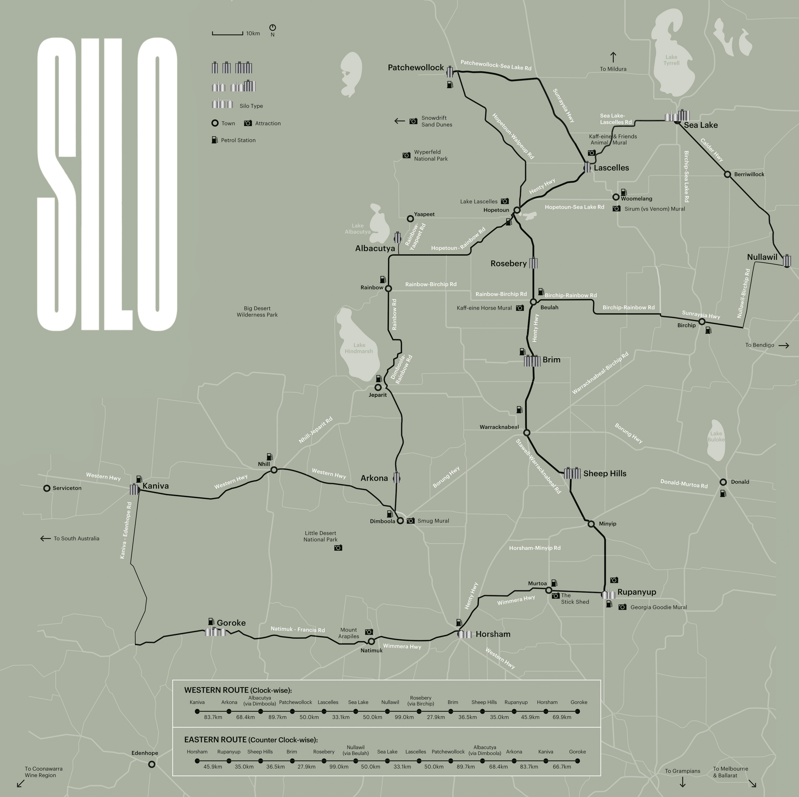
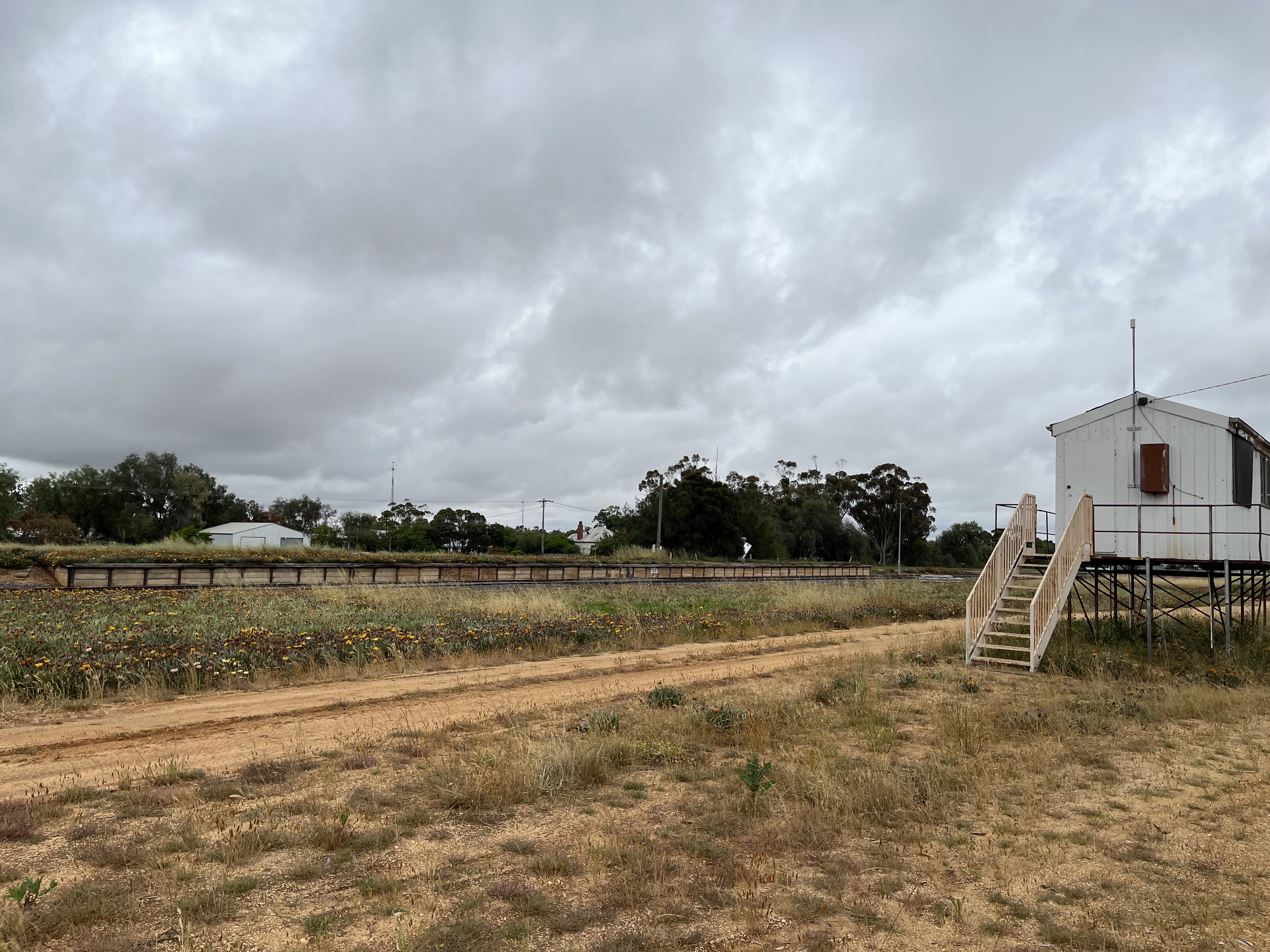
Welcome to another iteration of Ragbag On Road. In this edition, you find me on the incredible Silo Art Trail in Western Victoria. Introduction below.
So, in this post I’m going to take you on a tour of the Silo Art Trail, its history and some of the history of the towns and the silos themselves. This post is part of a longer series, which also explores the integration of art and history. You can see more at the links below:
I won’t be including every piece of silo art in Victoria- as it has spread well beyond the original trail. But I have covered the original trail, with its newest additions.
Before I go anything further- I would like to acknowledge the First Nations people on whose lands these silos were built and art work created. A lot of the history of these towns I’ll be discussing is rooted in pioneers and Europeans discovery. For First Nations people, this is a history of dispossession and colonisation. These lands were not unoccupied with western people moved into them.
But what is the Silo Art Trail?
The Trail started with the painting of one silo in Brim in 2016. The premise was a local art project, with the collaboration of both the local community and an artist, to paint the silo to reflect the community. The project was so popular that the Silo Art Trail was conceived and now stretches over 600 km, linking small towns across the Wimmera and Mallee regions of Victoria and creating the largest outdoor gallery in Australia. I’d heard of the Silo Art Trail, but when I was in the Wimmera in August I was unexpectedly impressed by both the sheer grandeur and size of these art works (some are as much as 30 m high) but also how reflective of the local communities they really are. Each artist (and every silo is done by a different artist) worked with, and in many cases lived with, the local community to create something that helps to tell their story. Following the Trail is also a great opportunity to explore these fascinating little towns. So as well as the silos themselves, I’ll be including something about the local history of each town.
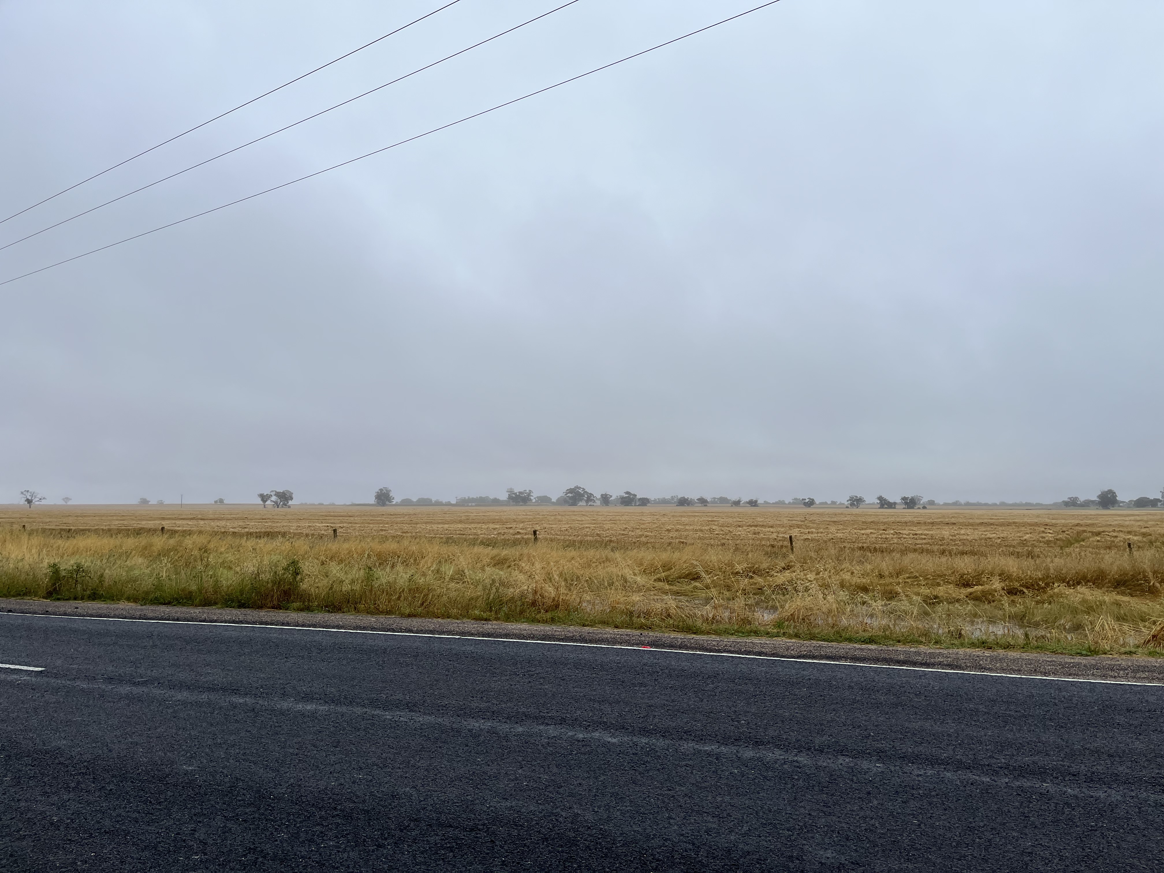
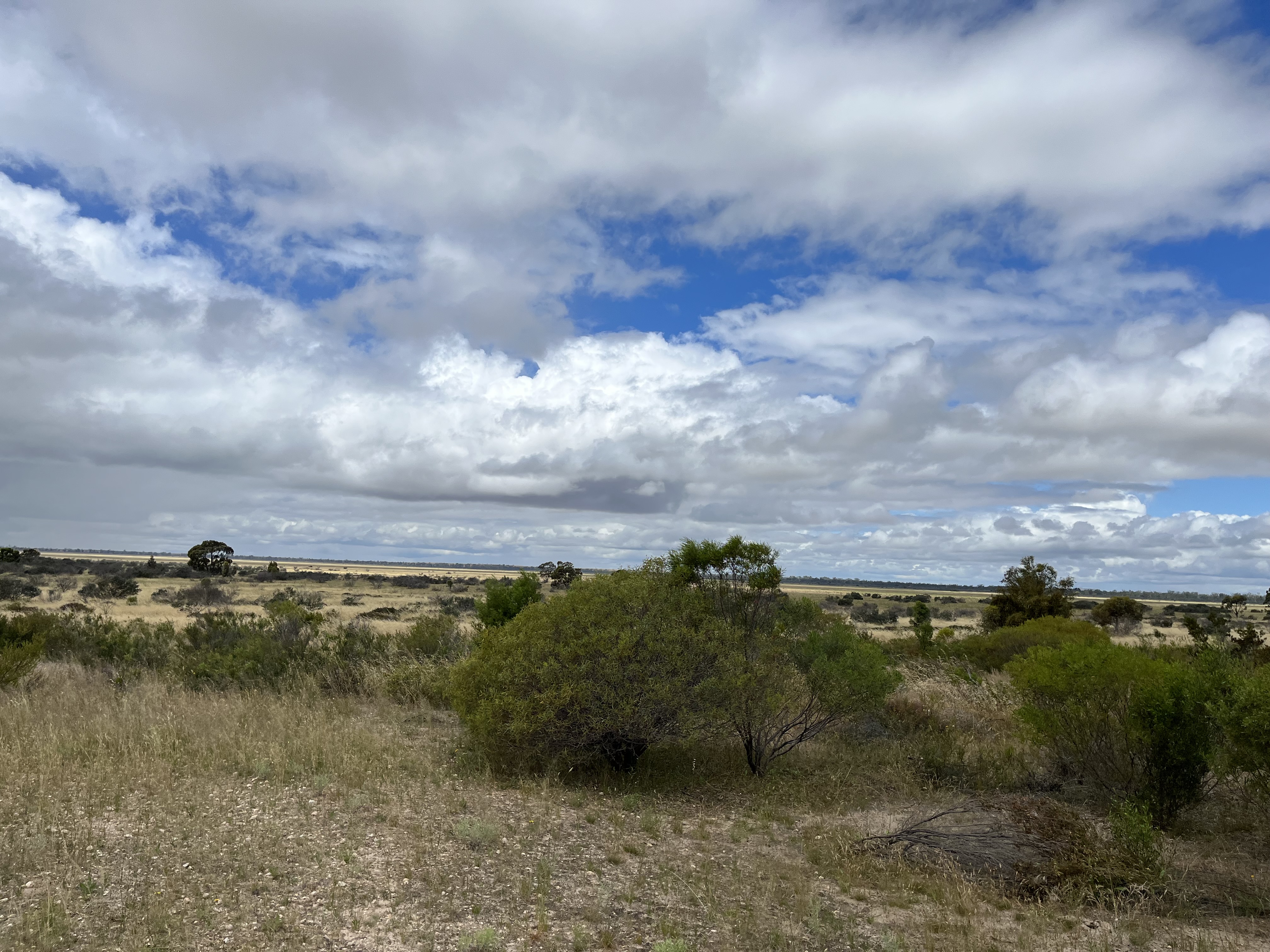
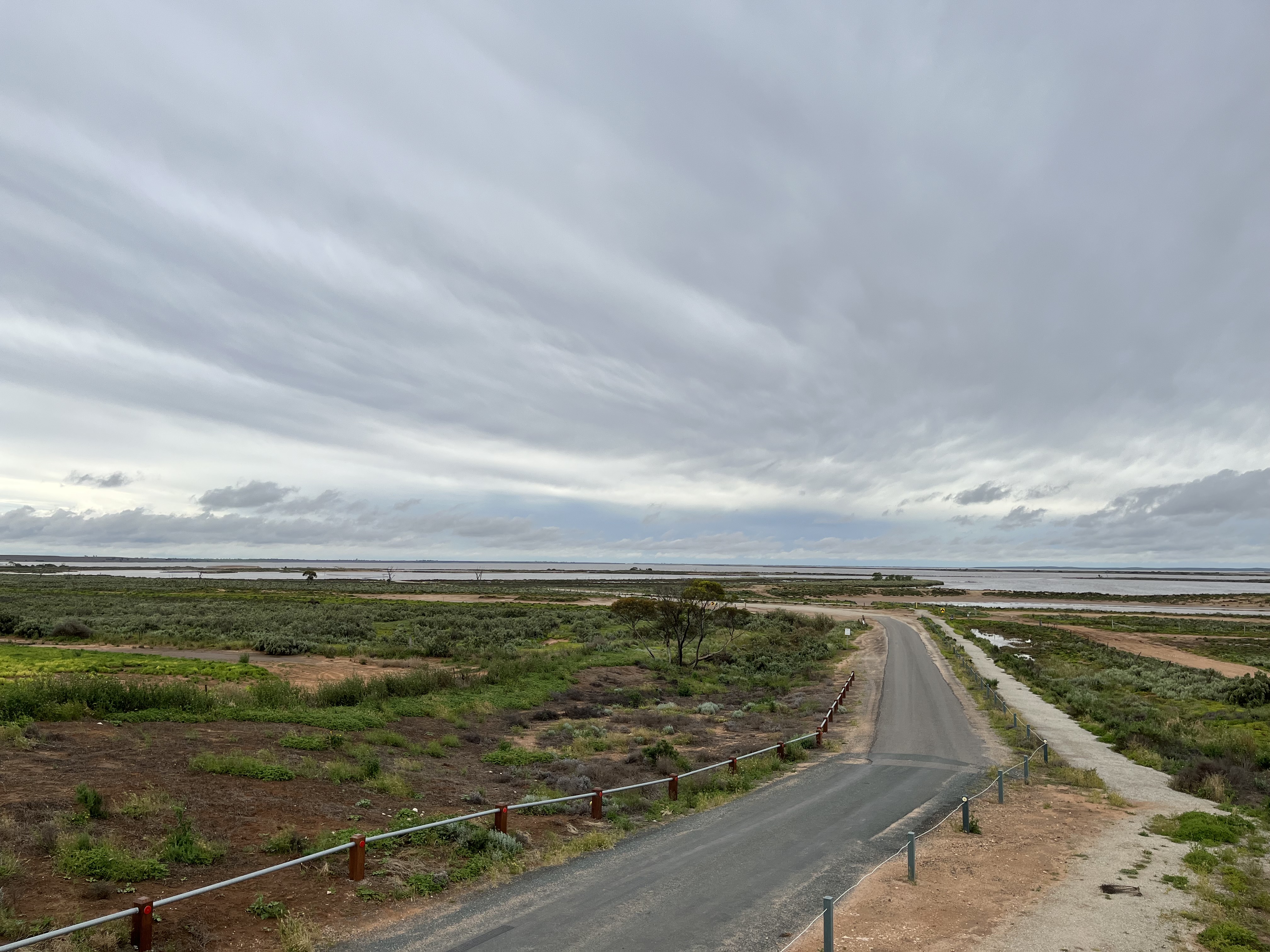
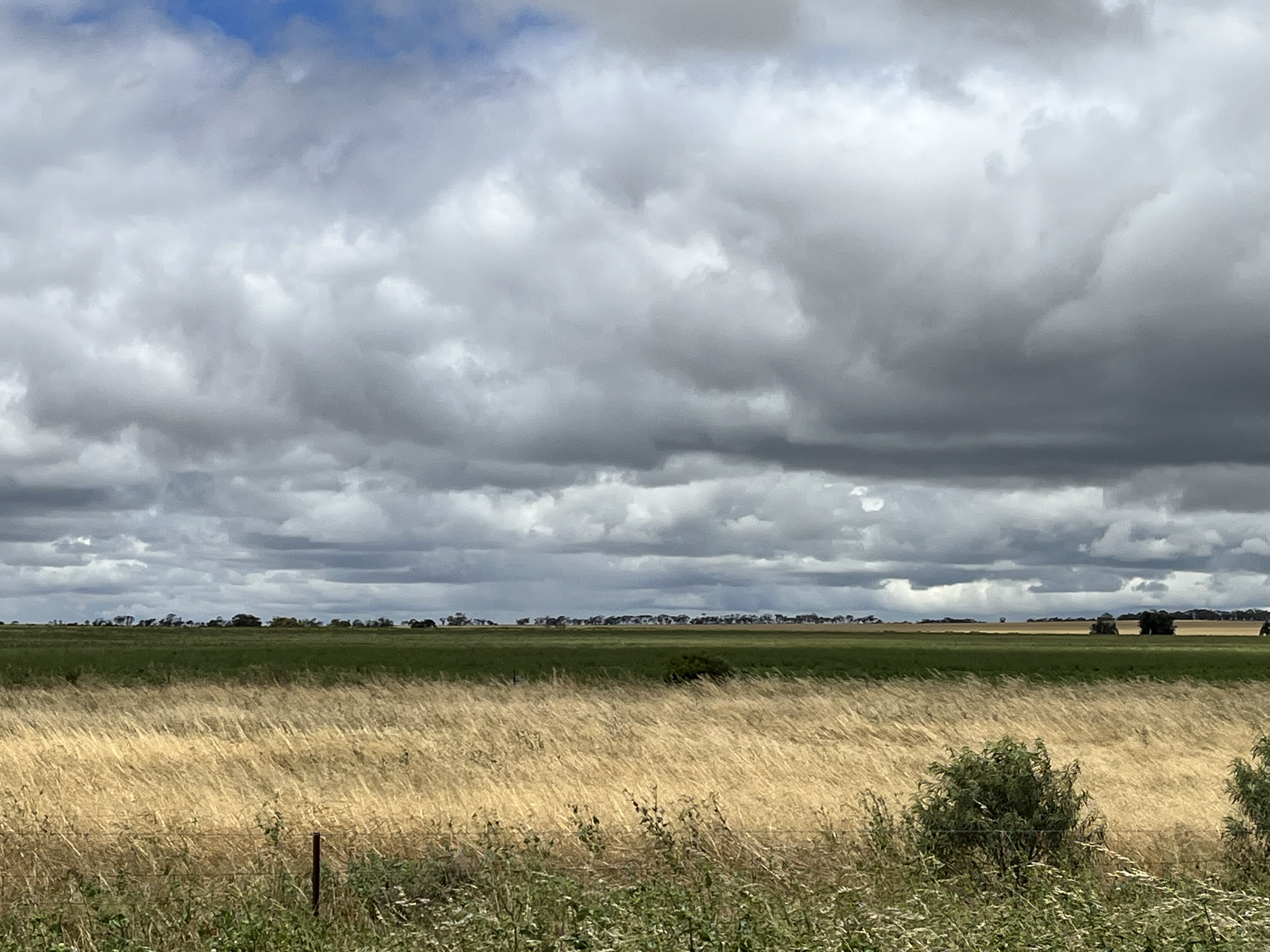
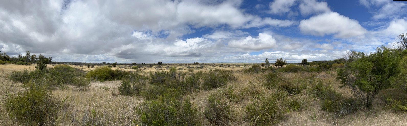
And to give you an idea of the landscape of the Malle and the Wimmera- you can see some photos below.
As you can see- it’s a land of big skies, agriculture and desert. There was a lot (and I mean a lot) of water when I was exploring, due to an unusually heavy rainfall. Though the large body of water you can see is Lake Tyrell (more on that later).
So the silos are- mostly- working agricultural sites. I’ll be leading you through them, much as I visited them because following the trail itself is half the fun.
So…
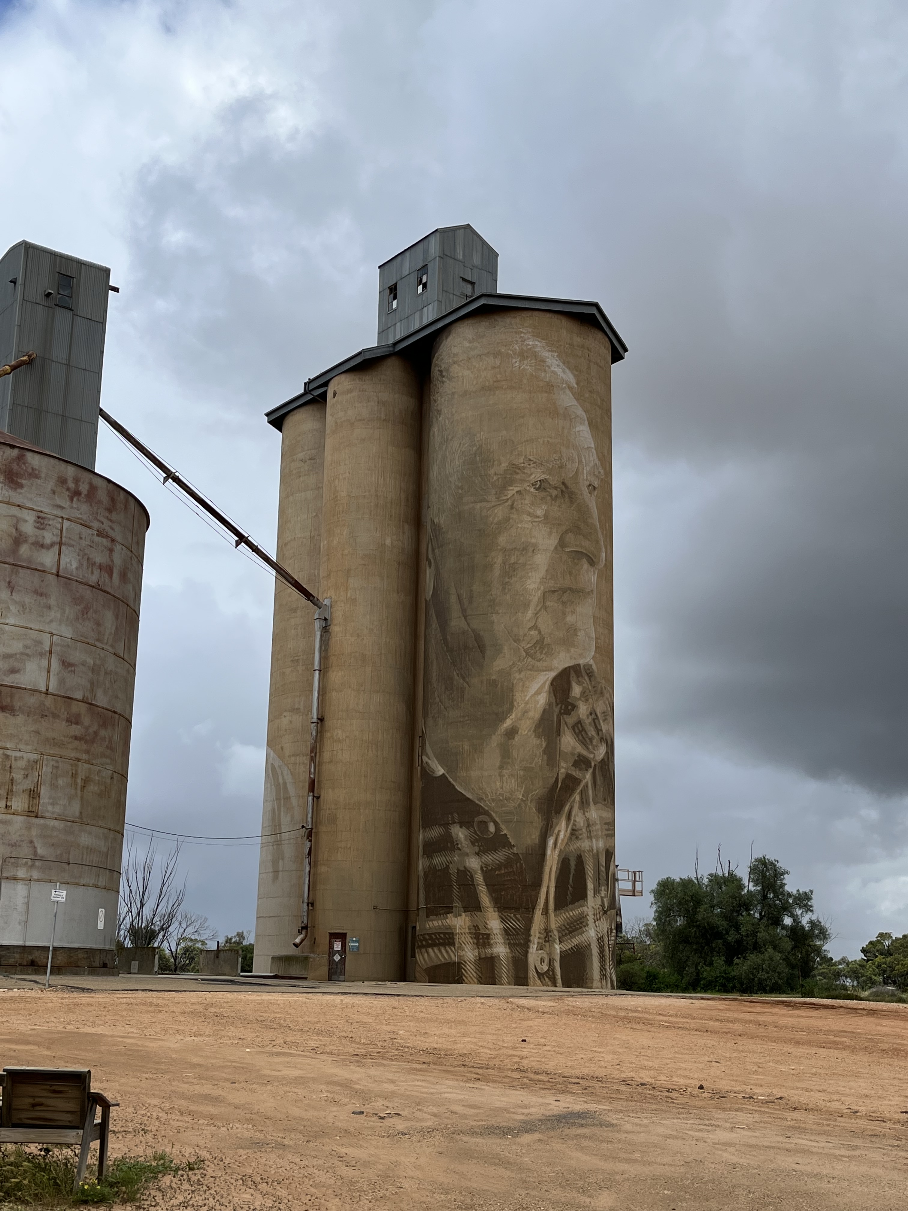
St Arnaud
The St Arnaud silos were painted in 2020 by Kyle Torney. Torney is a St Arnaud’s local and spent 200 hours on the work which is entitled ‘Hope’. It depicts a miner hoping to find gold, as his wife hopes to find the food to feed them all and the hope of the future of their child. The silos themselves are still commercially run and owned by Ridley Agricultural Products.
St Arnaud actually began life as a gold mining town. In 1855 a group of prospectors travelled to the area in search of a ‘new Bendigo’. And on a knoll in what became St Arnaud they found gold. The town grew rapidly with the registration of the claim, with people coming in from all over the world. Which can be seen in the Chinese garden which is part of the town, built in memory of the Chinese miners who came seeking their fortunes in St Arnaud. You can see it below
Over 20 000 people came to the goldfield that was (at the time) only 40 acres, much of it without any alluvial gold. Most were disappointed, but as the gold field was expanded, some were successful and these prospective miners needed supplies and thus the town began to grow.
Rupanyup
The Rupanyup silo was painted by Julia Volchkova in 2017. It’s reflective of the young people of the Rupanyup area, and their commitment to community through sport. The images are of locals Ebony Baker and Jordan Weidemann. Volchkova wanted to celebrate the community and the hope, strength and camaraderie of their young people. The silos belong to Australian Grain Export and are still in active use.
Another piece of fascinating Wimmera history is nearby Rupunyup too. The Murtoa Stick Shed (which you can see in the photo below) is an amazing survival of World War II grain surplus storage. I have written an earlier post about it too- which you can see here: https://historicalragbag.com/2022/08/15/ragbag-on-road-murtoa-stick-shed
The town of Rupanyup itself has its roots in agriculture. Settlers began to move into the area in the 1870s, taking advantage of the rich soil and flat plains to plant crops and run livestock. They also worked hard to fence what they saw as virgin territory as they laid claim to these new lands. It is worth pointing out again, that the lands were not in any way unoccupied. The settlers lived a remote existence, troubled by the lack of reliable water sources as well as the tyranny of distance. But eventually a town grew up, and Rupanyup remains very much an agricultural community today.
Sheep Hills
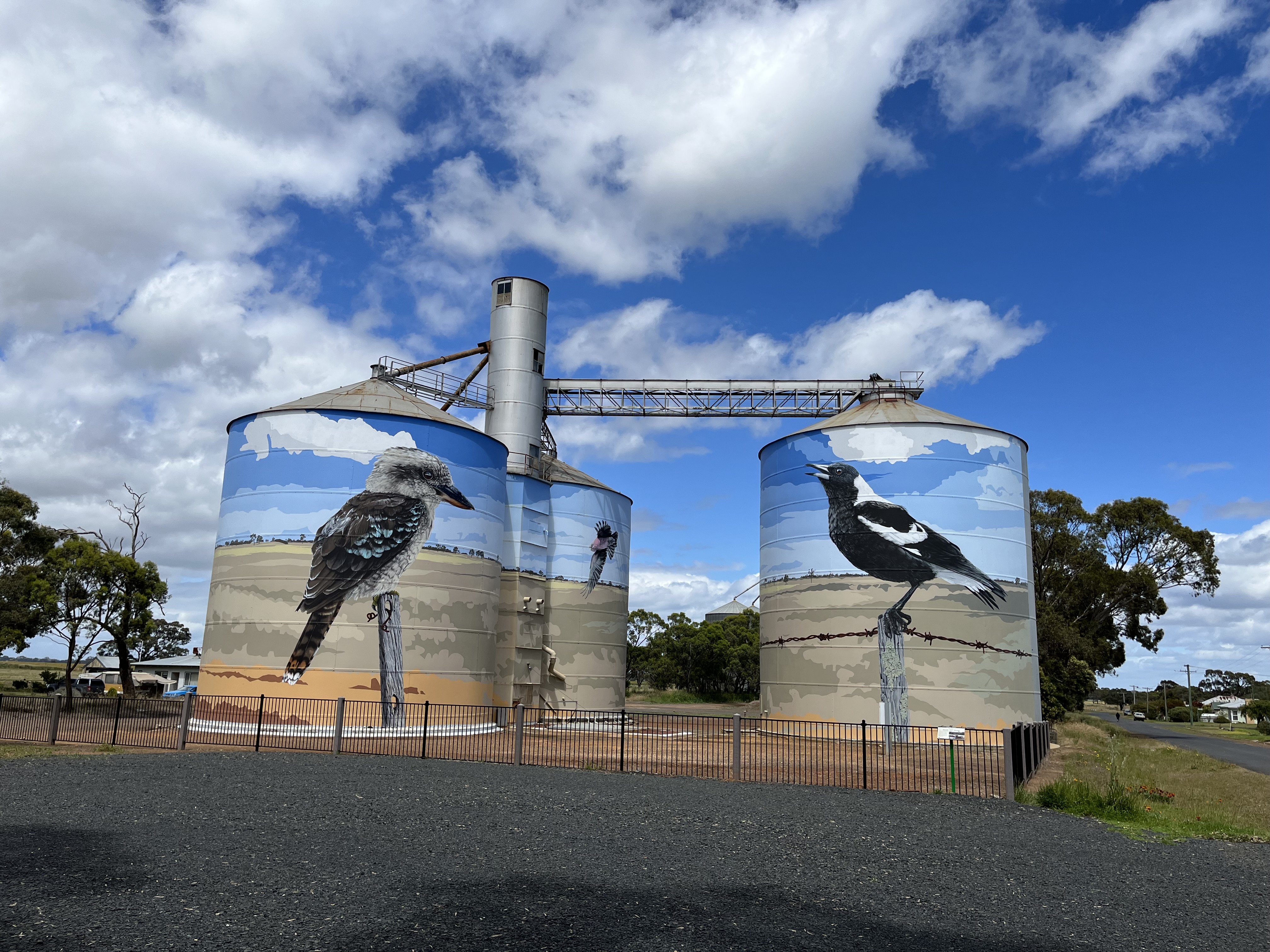
So we reach the silos featured in the video. Sheep Hills are GrainCorp Silos, which were built in 1938 and were painted in 2016 by Matt Adnate. Adnate wanted to illustrate the local First Nations young people and their connection to elders, community and country. He worked closely with the Wergaia and Wotobaluk communities and painted on the silo are Wergaia elder Uncle Ron Marks and Wotobaluk elder Aunty Regina Hood. The two children are Savannah Marks and Curtly McDonald.
The night sky represents elements of local dreaming and, overall, the silos tell the story of the transfer of knowledge from one generation to the next.
Sheep Hills itself is a farming community. By 1900 there was a thriving town, with a contemporary map showing: a school, four churches, sale yards, cemetery, dressmaker and boot maker, banks, blacksmith, green grocers, hotels, timber yard, butchers and the creamery. It’s also adjacent to Sheep Hills Station which was bought by the McMillan brothers in 1855 and in 1860 George McMillan built a homestead which he called Kingungwell (a name he apparently derived from the ‘king’ of the local first nations people- Aungwill). The homestead was a lavish affair, so much so that many local people called McMillan mad for doing things like: building entirely from Oregen timber and installing cedar cupboards, and constructing a tower and a croquet lawn. The homestead was demolished after WWII. Today Sheep Hills is a much quieter affair- but you can see the mechanics’ institute below.
Brim
The silos that started it all. Guido Van Helten’s multigenerational depiction was completed in 2016. Van Helten wanted to highlight the generations, both male and female, who have farmed this land and will farm it into the future. By rendering the figures as not entirely substantial Van Helten wanted to explore the shifting ideas of community identity and the difficulties faced by rural communities, especially in the face of climate change. The final message really hit home for me, as I was travelling through the area in a time of unprecedented, unseasonable rain levels. The interest that this silo sparked, was the flame that lit the Silo Art Trail, drawing people from all over the world to the Wimmera and Mallee regions.
Van Helten specialises in the painting of everyday figures in forgotten places and won the Sir John Sulman prize from the Art Gallery of NSW in 2016 for his work in Brim.
Brim itself is a rural community- with deep roots in community organisation. With active local sport clubs and community groups. One of the interesting historical markers just up the road is the netting fence which was erected in 1885 to stop rabbits and dingoes overrunning agricultural land to the south. The fence stretched to the South Australian border and the marker can be seen below.
Rosebery
The Rosebery Silos were painted by artist Kaff-eine in 2017. The silos themselves are GrainCorp and date back to 1939. Before she started painting, Kaff-eine spent time with Rone at the Lascelles silos (coming up soon) and touring the local towns and getting to know the communities. Depicted in the art work is firstly- the sheer grit and determination of the young female farmers of the region as they face fire, flood and drought, symbolising the future and, secondly, the close friendship between a farmer and his horse- symbolising the connection between the humans and the animals of these regional communities.
Rosebery itself is named after Archibald Philip Primrose the 5th Earl of Rosebery who became Prime Minster of the UK in 1894. Settlers arrived in the area from the mid 1800s and by 1895 Rosebery had a school, butcher, churches, greengrocer, undertake, saddler, foundry, billiard room and a wine saloon. Today Rosebery is a much quieter town, but it is still the heart of a strong farming community.
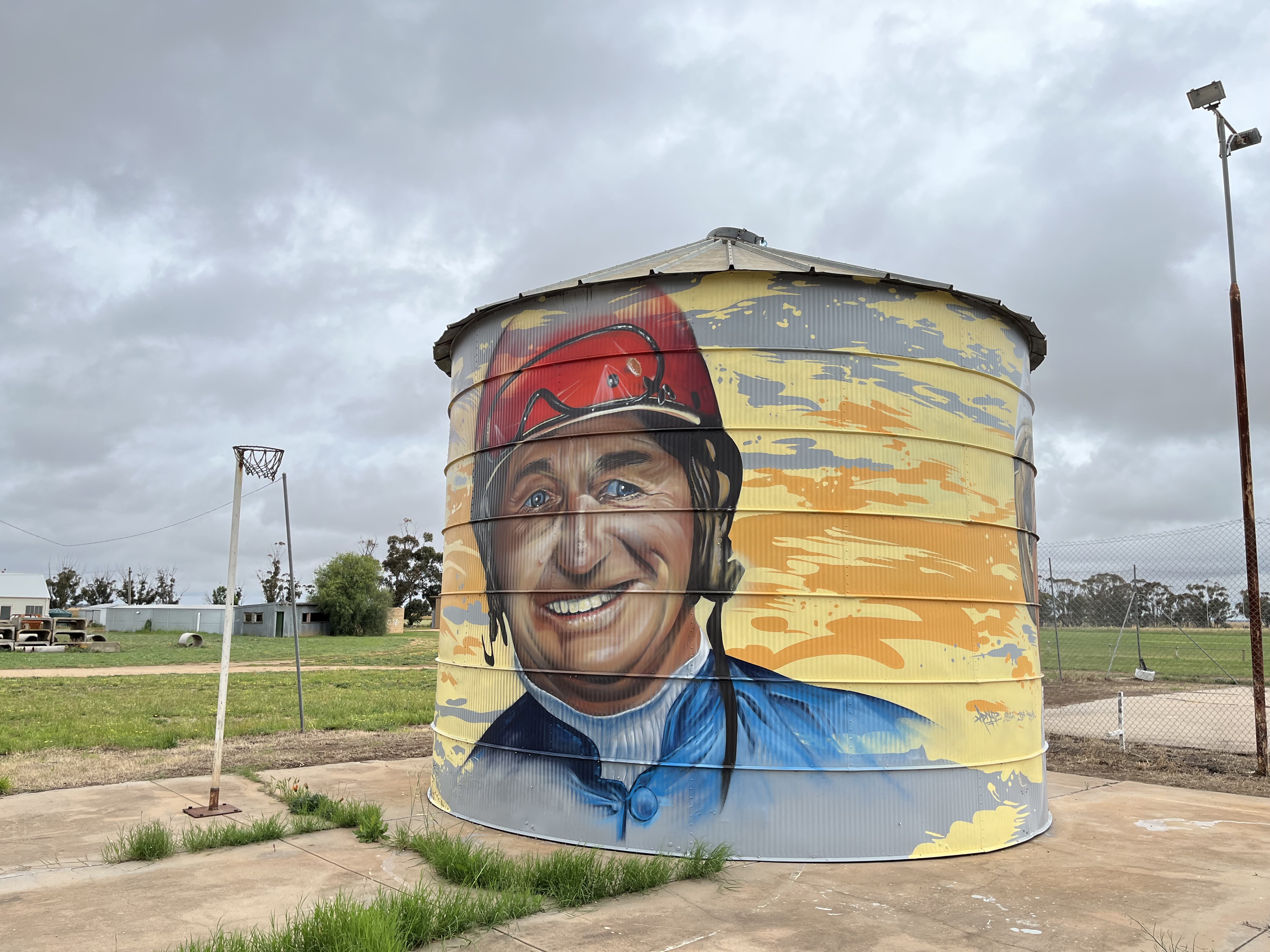
Watchem
Watchem is one of the newest additions to the Silo Art Trail completed by Adnate and Jack Rowland in March 2022. The artwork depicts two renowned harness racers- Ian “Maca” McCallum and Graeme Lang. McCallum drove 16 winners in one program in Mildura in 1985, making him a local legend, and Lang was sport’s best from the late 1960s onwards and trained the legendary horse Scotch Notch. The silo is currently in the middle of the disused basketball court- but will be moved to the main street.
Watchem itself has a slightly ghostly presence. It’s quite clear that it was originally a much larger town. Along with the abandoned basketball court, there is an abandoned oval, school and train station, as well as a very impressive church (not abandoned).
Watchem has been the victim of the need for more land to make farming profitable which has reduced the number of people in these off the highway settlements. Also as the population has continued to age, the amount of people living in Watchem has continued to shrink. The situation is was not helped by the drought years, which saw Watchem Lake (which attracted campers) dry up. Watchem began as a community serving settlers setting up farms and livestock runs. No one really knows exactly where the name came from, it was thought that it might have been a First Nations word, but no link had been found.The first official mention was in 1864 when the Land Board instructed the Surveyor to “lay off a direct line to Watchem.” Today there is still a community at Watchem, one that is proud of its heritage and hopefully the Silo Art Trail can help being people back to the town.
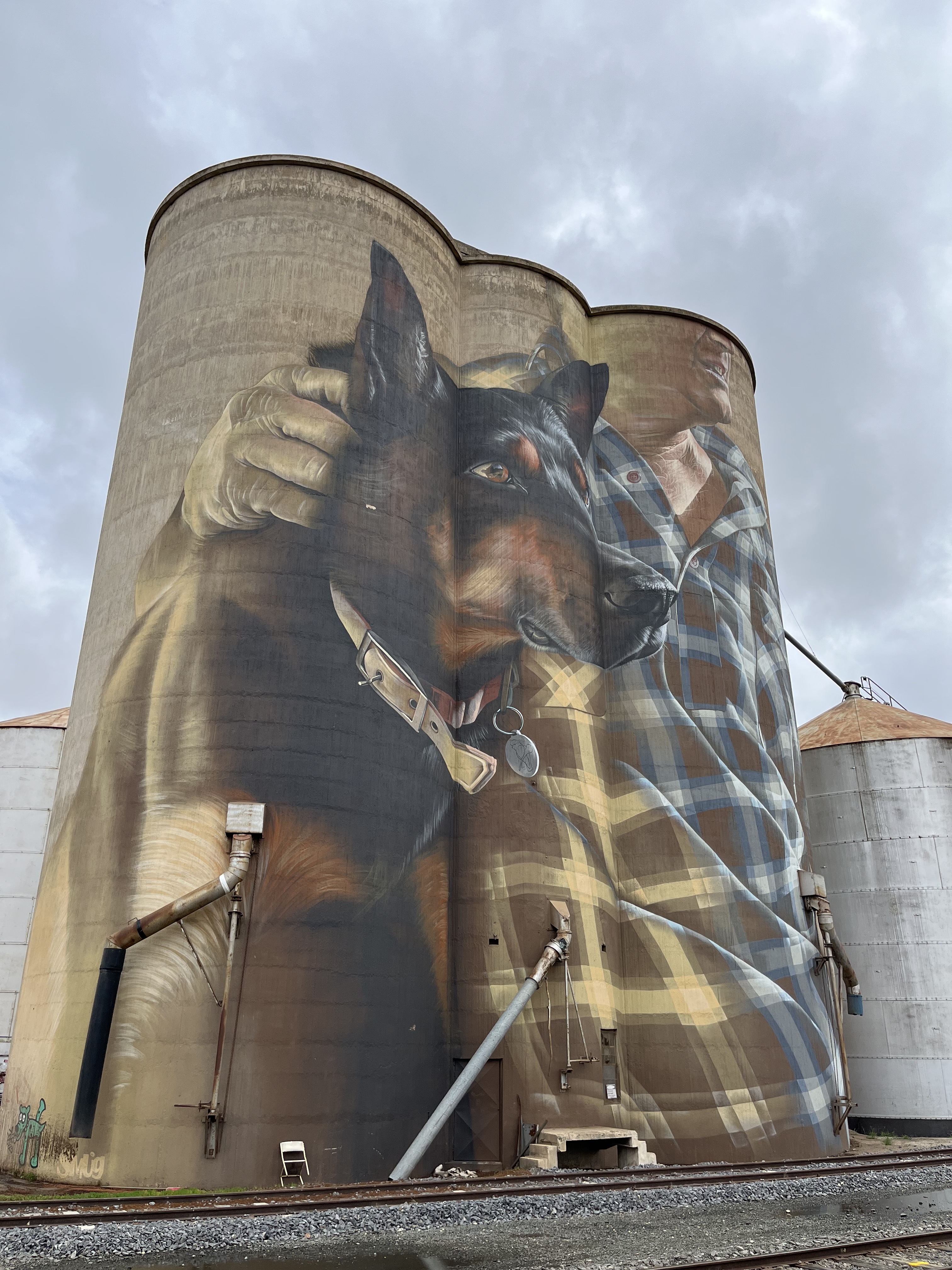
Nullawil
Nullawil silo was painted in 2019 by the artist Smug. Smug painted the work over two weeks in difficult wet and windy conditions. Made especially hard by the fact he was working on a cherry picker (as did most of the artists). You can get a feel for what the conditions might have been like when you look at the carpark during my visit.
Smug’s work depicts a farmer and his faithful kelpie. The work doesn’t depict a specific person, rather an amalgam- standing in for farmers across the region and their connection to their animals and the land.
The silos themselves were built in early 1940s and remain operational today along with the railway line which runs up to them.
Nullawill itself began as pastoral leases in 1849, the town now stands on what was the junction of the Knighton and Lansdowne runs. It was later divided into lots of 500-600 acres and they were leased for 2 pounds a year in 1891. The town grew out of the settlers moving to the areas to take up these leases. It was proclaimed a township in 1898 and you can see its immaculately kept central part below.
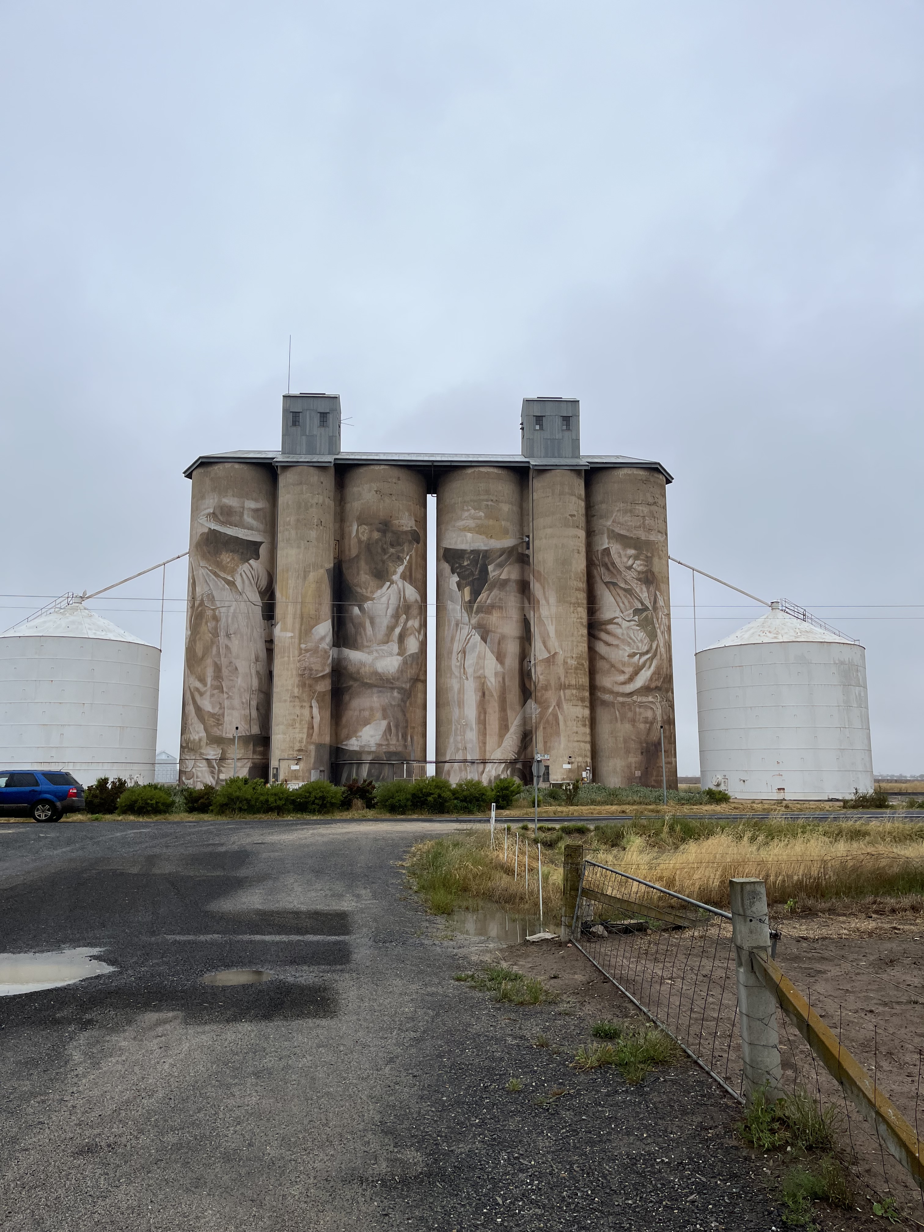
Sea Lake
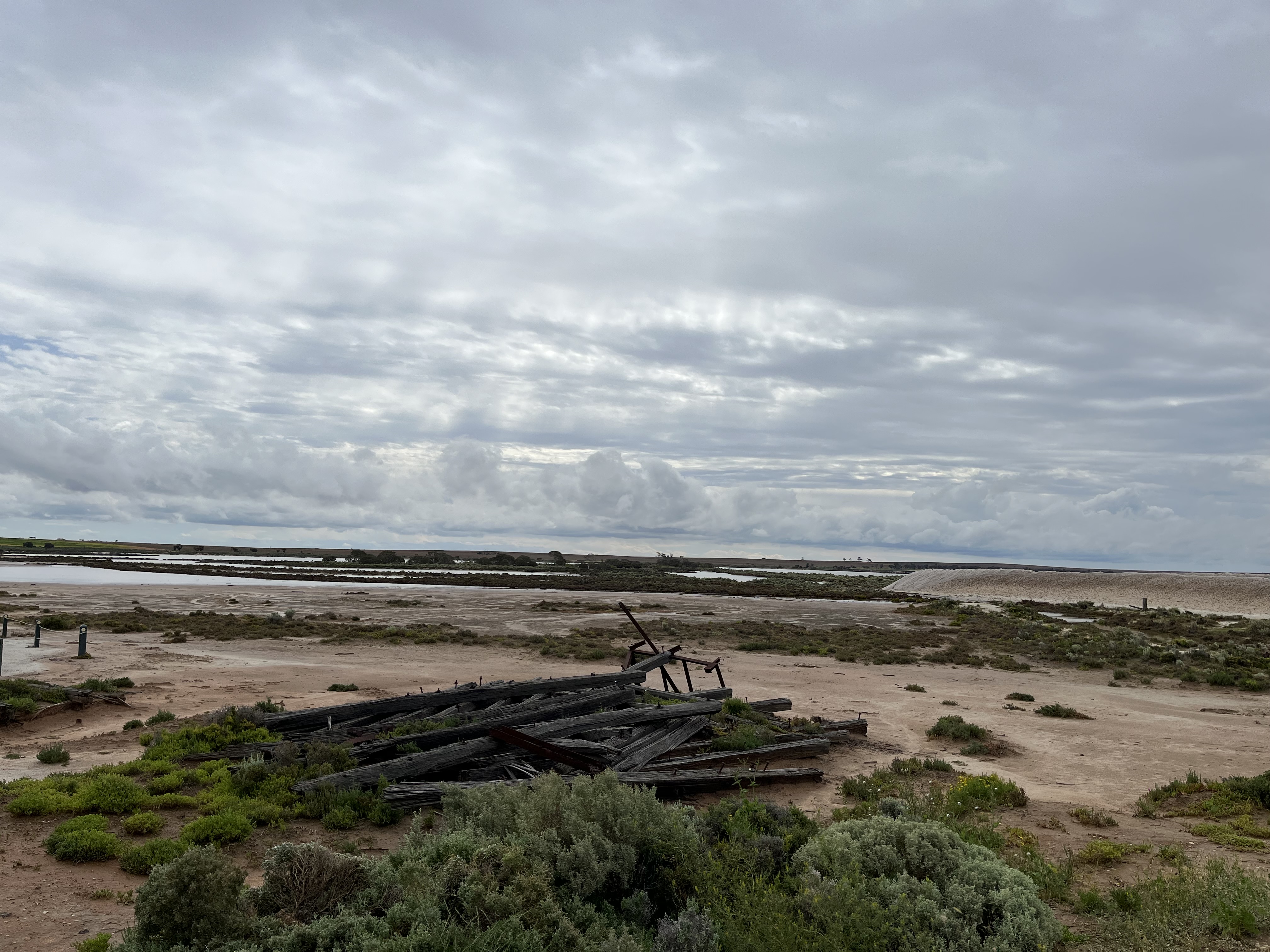
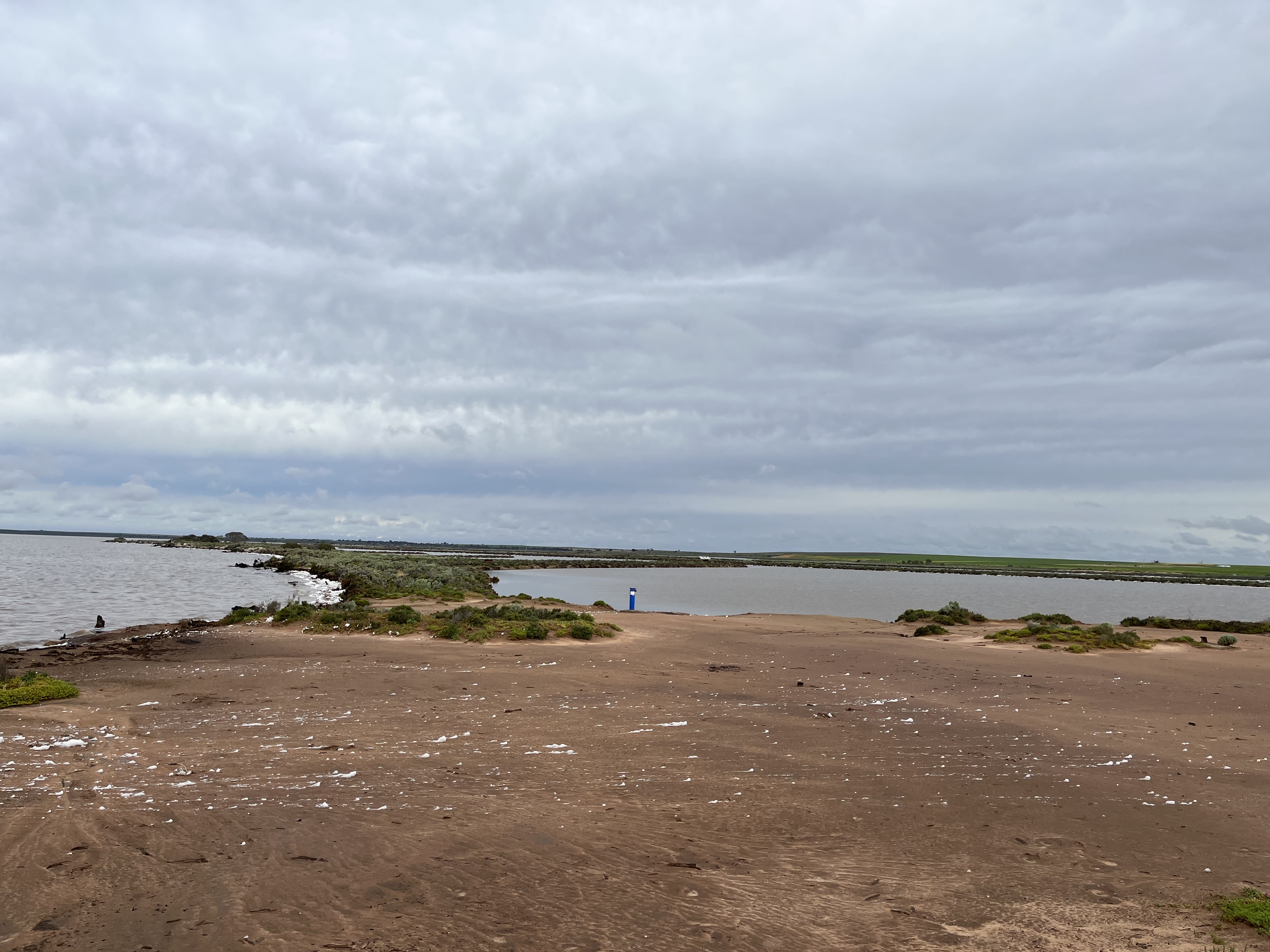
Sea Lake’s silos were painted by Travis Vinson and Joel Fergie in 2019. The artwork is entitled ‘The Space In Between’ and tells the story of a young girl swinging from a eucalyptus over Lake Tyrell. They also link to the First Nations knowledge of astronomy, that has been recorded in detail in this area. Lake Tyrell is a special spot for astronomy and stargazing due to the lack of light pollution from nearby towns and the completely clear access to the sky (when there aren’t any clouds-which there were the night I was there). The art work also pays homage in colour to the vibrant sunrises and sunsets the region is known for.
The town of Sea Lake takes its name from its proximity to Lake Tyrell. Lake Tyrell’s name comes from the First Nations word ‘direl’ meaning sky. And sky is what you get. Lake Tyrell is the largest inland salt lake in Victoria- covering an insane 20, 800 hectares. It has been used for commercial salt production since the 1800s and is still today (though much more sustainably). The lake itself is thought to be the remains of when the seas rose many thousands of years ago and flooded what is now the Murray-Darling basin. When they retreated, Lake Tyrell was left behind. The lake is known for its reflective surface, mirroring the sky back up. When I visited it was very full of water and windy, so while I was able to appreciate the vastness and its beauty, especially with how much of the sky you can see unobstructed by land, I didn’t see the mirror affect.
Sea Lake was formed both from use of Lake Tyrell, but also from Tyrell Station which ‘taken up’ in 1847 by W.E Standbridge. It remains an agricultural community, with close ties to the lake.
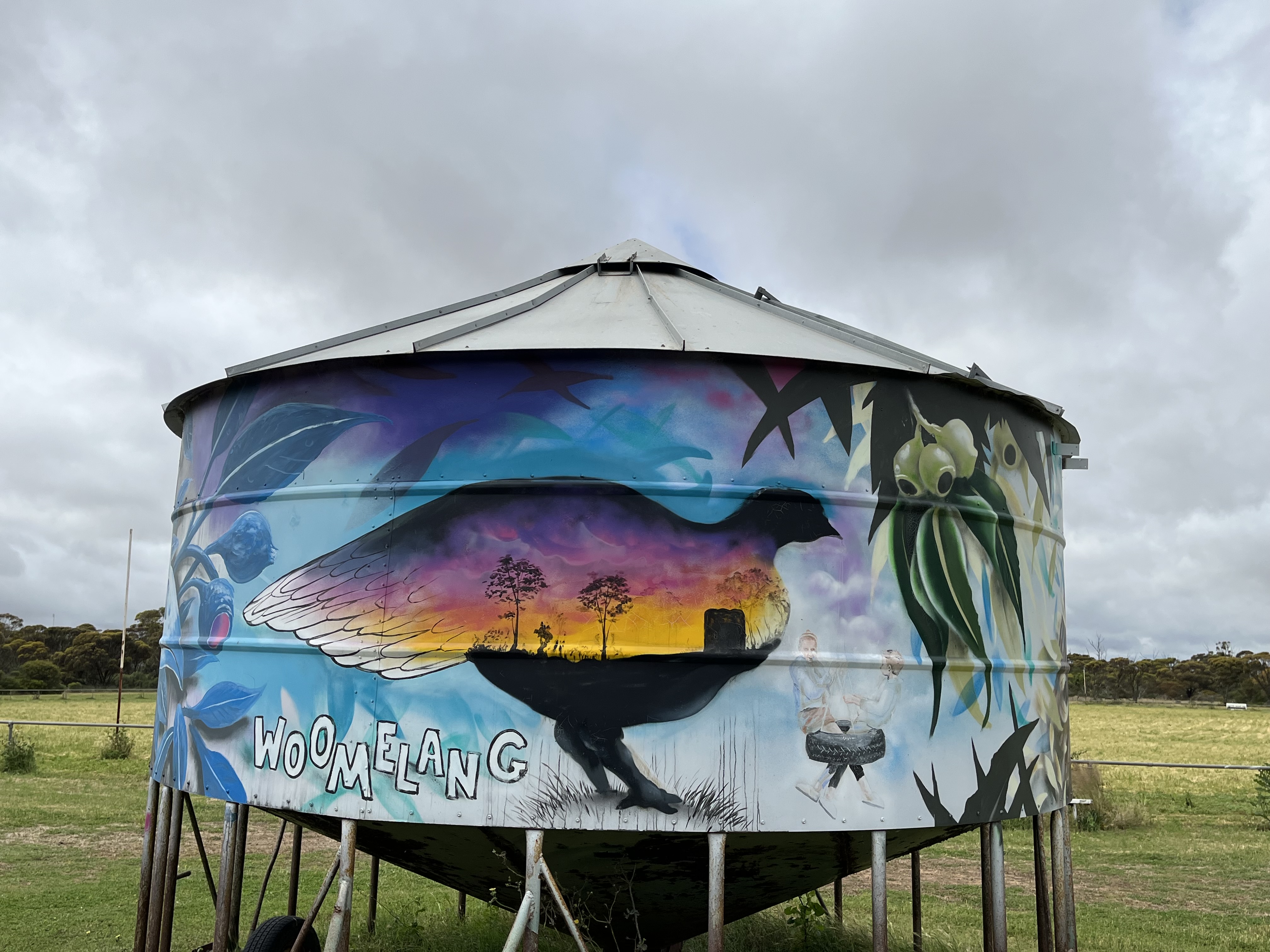
Woomelang
I’m going to depart a little from my format so far for this section, because Woomelang does not have one large silo painted. They elected to have eight grain bins painted by different artists instead, creating their own little silo art trail, within the Silo Art Trail. So i’m going to go through each grain bin individually. They all reflect some of the local wildlife and were painted in 2020.
This bin was painted by Bryan Itch and depicts the pygmy possum. Pygmy possums are tree dwelling marsupials, who are nocturnal and so small they are very hard to spot. The main threat, even above introduced predators, is land clearance for agriculture. Itch says he chose the pygmy possum because he loves painting the hidden beauty of small things.
This bin was painted by Andrew J Bourke and depicts Rosenberg’s heath monitor, a terrestrial predator who lay their eggs in termite mounds and eat carrion, small birds, eggs, small reptiles and insects. Like the pygmy possum their main threat is land clearance. Bourke chose the heath monitor because they are inquisitive, confident and extremely intelligent.
This bin depicts the western whipbird and was painted by Chuck Mayfield. The whipbird, has a distinctive call like a squeaking gate- they have sadly been almost wiped out from the Mallee. Mayfield painted the whipbird to give it a bigger stage as so few people will have seen one in real life.
This bin depicts the spotted-tailed quoll and was painted by Kaff-eine who also did the Rosebery Silo. The spotted-tailed quoll is a mostly nocturnal predator who mainly hunts medium marsupials. Like the other animals so far, they are at great risk from habitat fragmentation. Kaff-eine chose the spotted-tailed quoll because she wanted to paint it with humans to illustrate the both the playful nature of the quolls but also the important human role in protecting the quolls.
This bin depicts the malleefowl. A uniquely Mallee bird, which is a ground-dwelling, shy, and seldom seen bird which mates for life. Artist, Mike Makatron, wanted to depict the life cycles of the malleefowl.
This bin depicts the lined earless dragon, a small mottled lizard who communicates with head nods and pushups. The dragon was painted by artist Goodie, who chose it because she has always loved reptiles, especially painting their scaled texture and she thought the dragon would sit well on the bin.
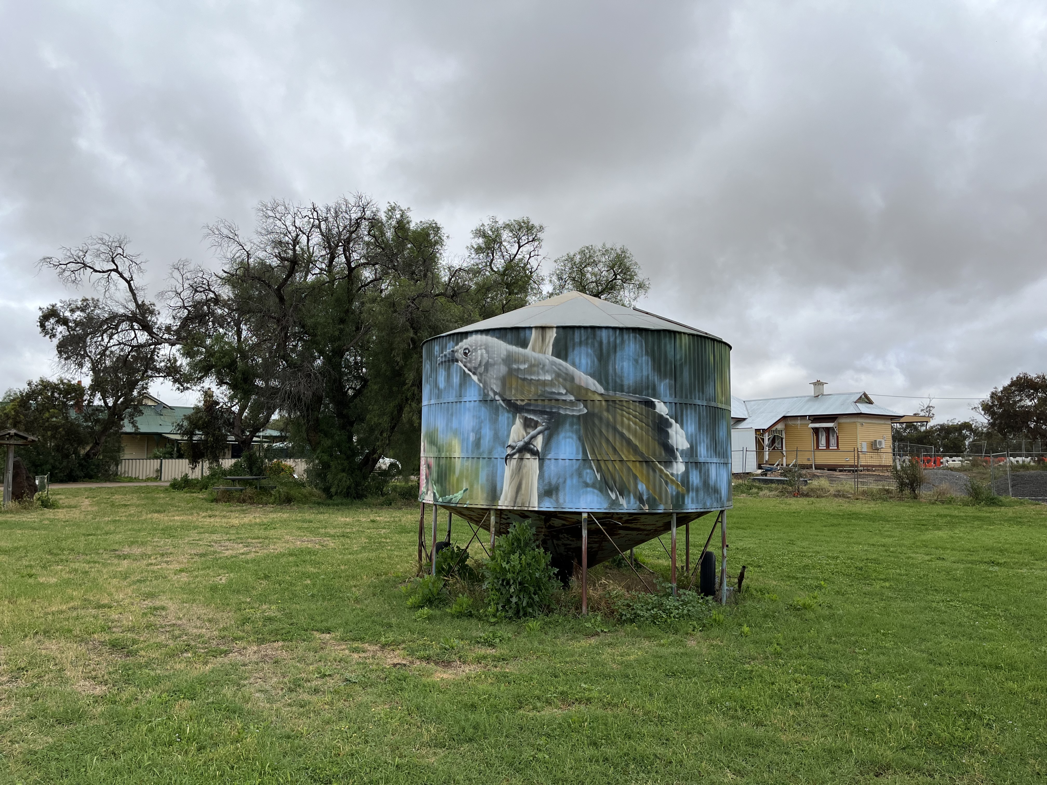
This bin depicts the Mallee emu wren, a diminutive bird native to the Mallee. It was painted by Jimmy Dvate.
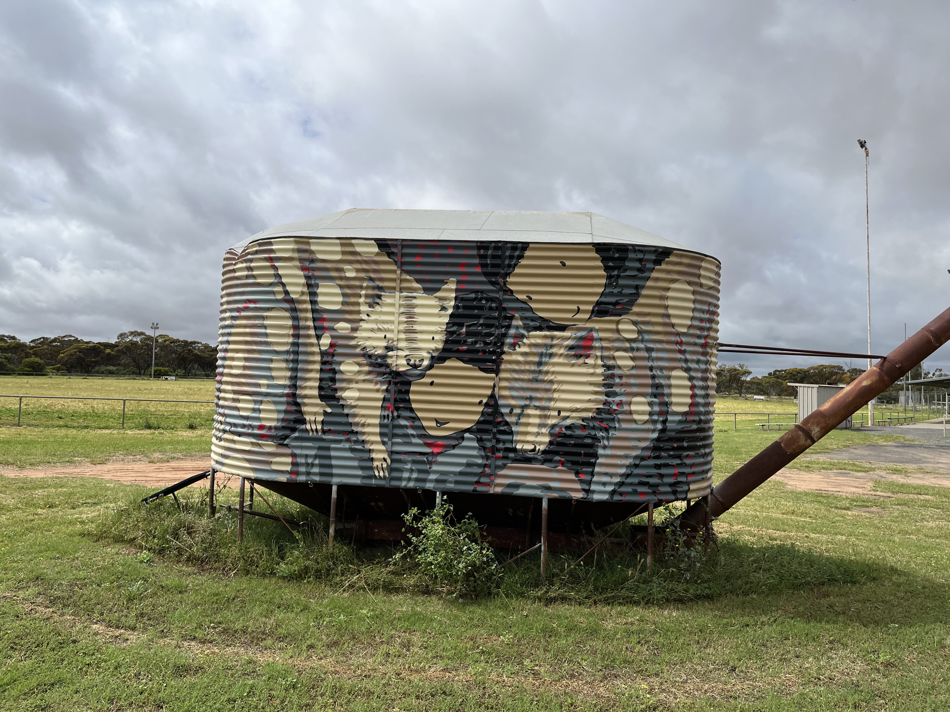
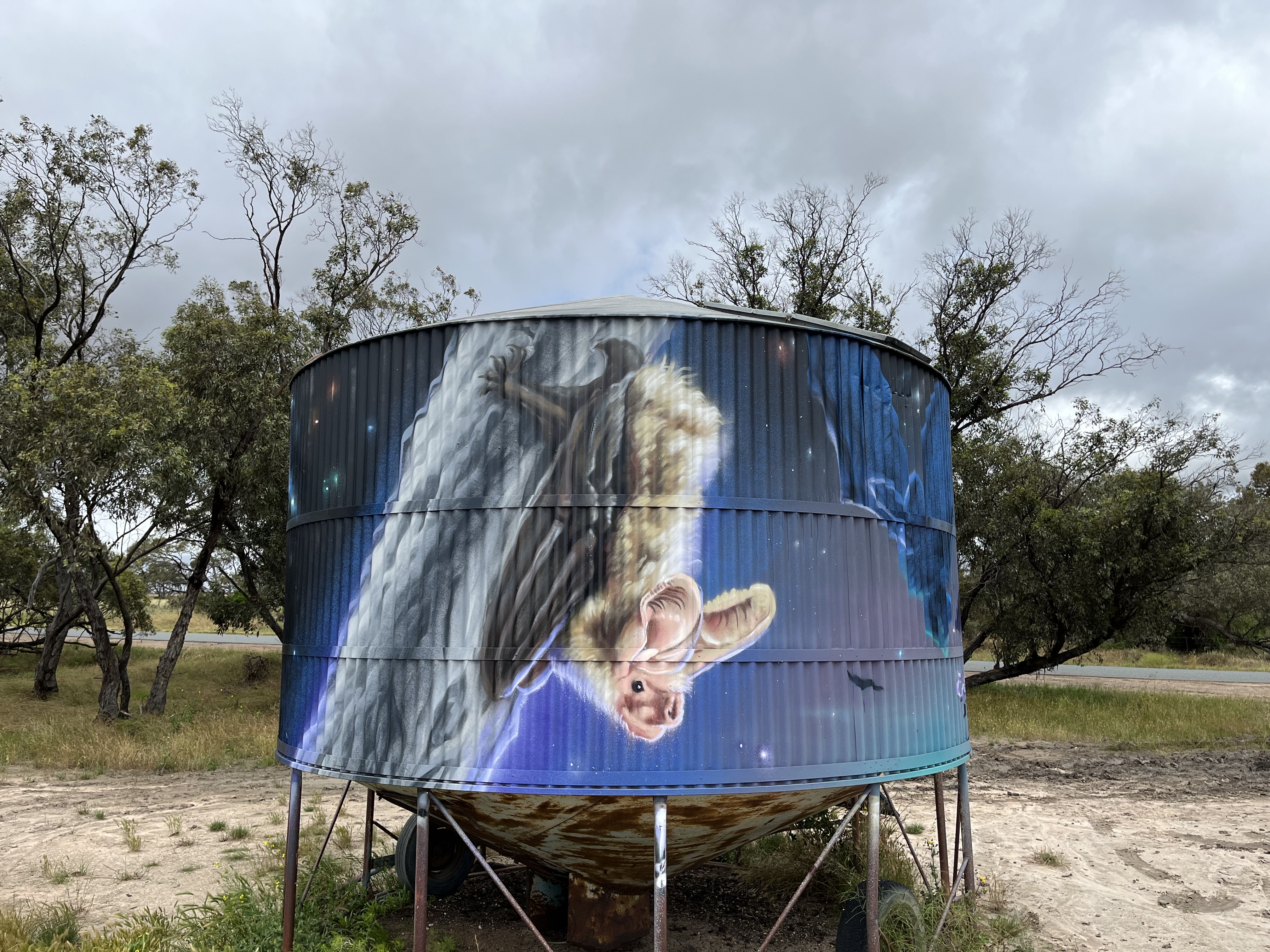
This bin depicts both the Major Mitchell’s cockatoo and the south-eastern long eared bat. The cockatoo was painted by Bryan Itch and the bat by Chuck Mayfield. Major Mitchell’s cockatoo is an iconic Australian bird, now in decline (again largely due to habitat destruction). Itch jumped at the chance to paint it, to capture its feathers emblematic of the dusky Australian sunset. The bat is a micro-bat active at night, hunting with echo-location and roosting during the day in crevices and under tree bark. Mayfield wanted to paint the bat on such a large scale as they are so elusive to find.
So that’s Woomelang’s silos- the town itself? The earliest map dates to 1899 and by this time the town had a railway line, a hotel, a store, churches, and a school was being built. Today it remains a mid sized rural town.
Lascelles
Lascelles was painted in 2017 by Rone- who I have written about briefly in my look at his transformation of the Flinders Street Ballroom in 2022. You can read that here:
The GrainCorp silos at Lascelles were built in 1939. Rone worked specifically with the colours of the silos themselves to make it look like the figures are emerging from the concrete. Depicted are Geoff and Merrilyn Horman who are part of a farming family who have farmed the land for four generations.
Lascelles was originally called Minapre but the name was changed to honour of EH Lascelles of Messers Dennys, Lascelles, Austin and Co. from Geelong, who were seen as a mainstay of the local community. In 1911 an article called “the Progress of Lascelles” highlighted the town’s rifle club, theatre club, hotels, station, school, churches, banks, races, stores, sale yards, livery stables and coffee palace. Like most of the other Mallee towns discussed it rose to support the local farms and community.
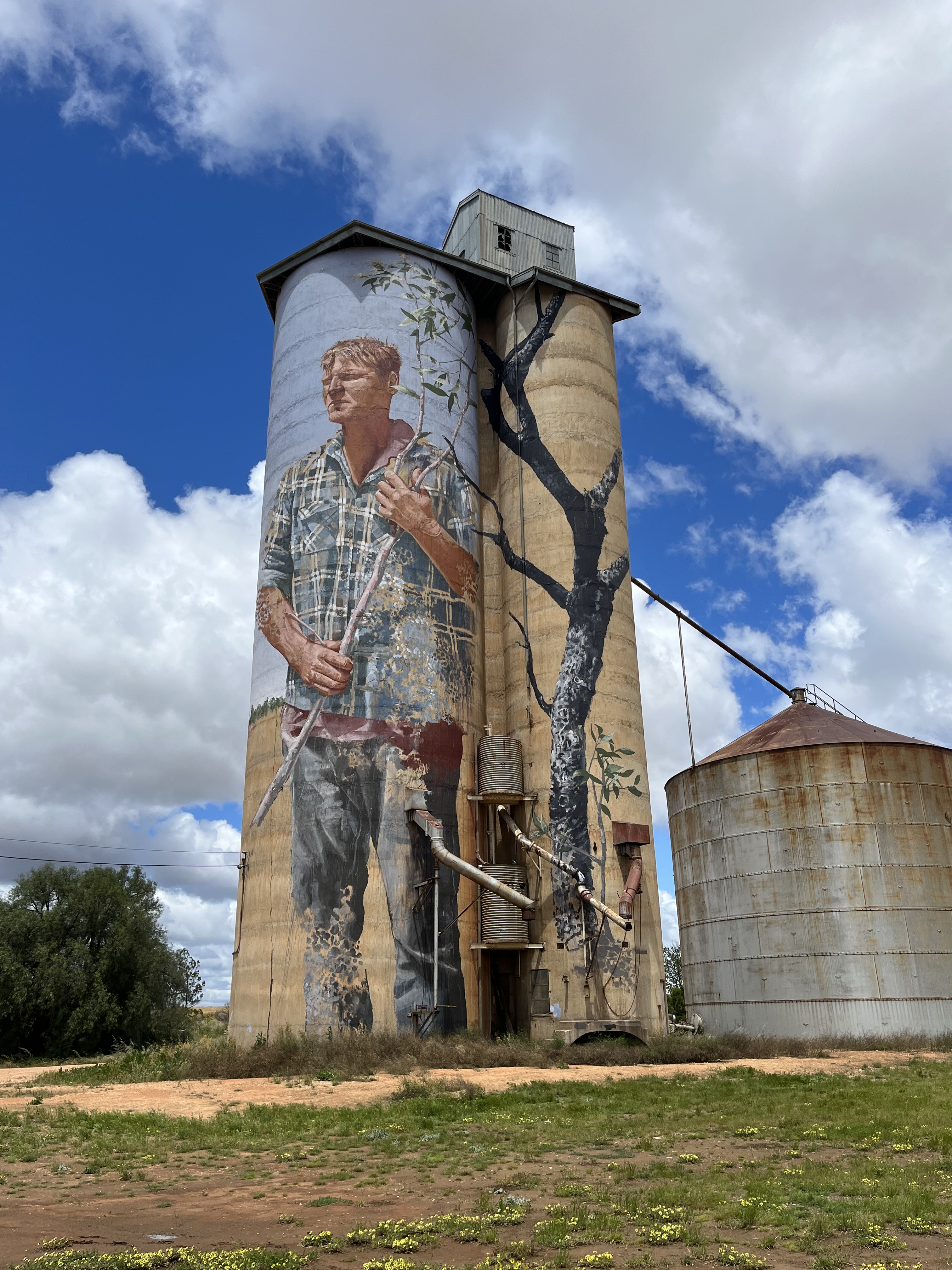
Patchewollock
Painted in 2016 by Brisbane artist Fintan Magee- the 1939 GrainCorp silos show local man, and grain farmer, Nick “Noodle” Hulland. Magee lived at the local pub while painting and chose Hullund because he typified the no-nonsense hard working farmers and spirit of the region. He also had the tall and lanky build to fit well on the 35m high silos. As he squints into the distance, he is looking at the challenges of the life of a Mallee-Wimmera farmer.
Patchewollock itself was one of the, comparatively, later subdivisions of the Mallee lands. In 1910 the first areas of the Patchewollock district were made available for selection. A total of 55 blocks were on offer and the cost of water supply and clearing roads was added to the cost of the blocks. There were 240 applicants for the 55 blocks who had to go before a land board and explain why they thought they were eligible to be selected.
The name comes from two First Nations words putje meaning plenty and wallah meaning porcupine grass. So that gives you an idea of the landscape the first selectors were seeing.
Albacutya
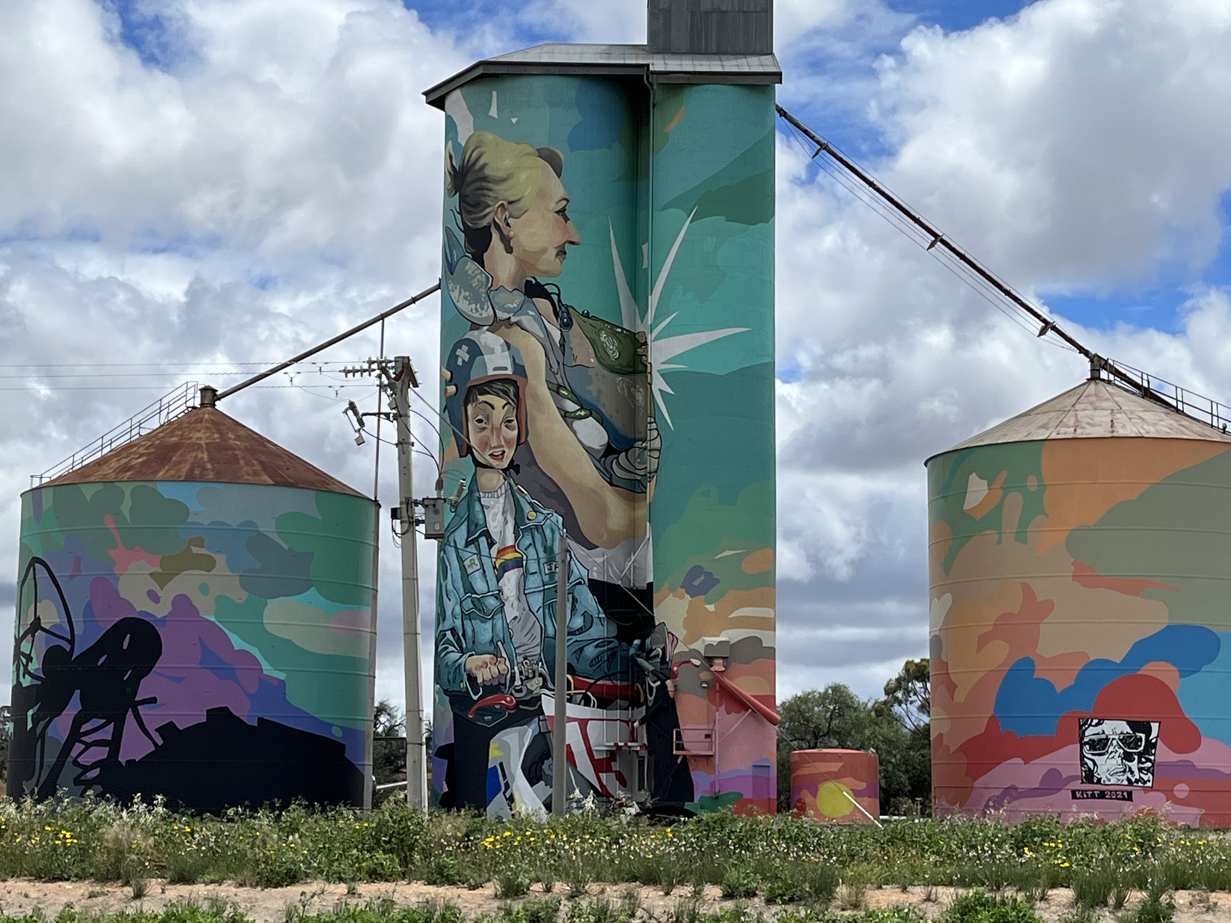
Albacutya is one of the newest additions to the Silo Art Trail. It was painted by Kitt Bennett in 2021. He wanted to tell a story of growing up in the country. The boy depicted is the son of the owner of the silos and the woman is yabbying, a common pastime in Bennett’s own country childhood. The vibrant colour is partly in homage to the nearby town of Rainbow. Albacutya silos themselves are very remote, you can see the view opposite in the image below.
But the community of Rainbow is about twelve km away and it was this community that Bennett took his inspiration from. Rainbow itself is vibrant agricultural hub. The name comes from the hill that was covered in colourful wildflowers in springtime. It was originally called Rainbow Rise, but when the town was surveyed in 1900 it was shortened to Rainbow. You can see it in the photos below.
The name Albacutya comes from the nearby Lake Albacutya- which is one of Victoria’s largest ephemera lakes.
Arkona
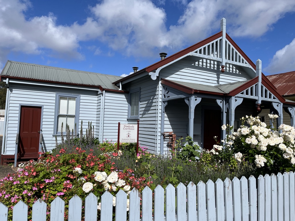
Arkona is very newly finished- hence the awkward photo because it is on the edge of the highway on the edge of Dimboola with no signs or parking. It has been painted by Smug and is a photo-realistic portrait of local legend Roy Klinge who died in 1991. You can see Dimboola Court House- home of the Dimboola Historical Society in the photo below.
Goroke
Finished in 2020 the Goroke GrainCorp silos were painted by Geoffrey Carran. The word goroke means magpie in local First Nations language- so it was a natural choice for the artwork. He worked closely with the local community to decide what else to include and settled on the the kookaburra and galah- in front of a typcial West Wimmera landscape.
Goroke is the gateway to the Little Desert National Park. The first official selector arrived in the area in November 1874 with the lease of Allotment 1 of the Parish of Goroke for 192 acres. The town sprang from this. The rail line extension in the 1890s greatly helping its foundation. Today you can see the remains of Goroke’s 19th and 20th century heritage throughout the town.
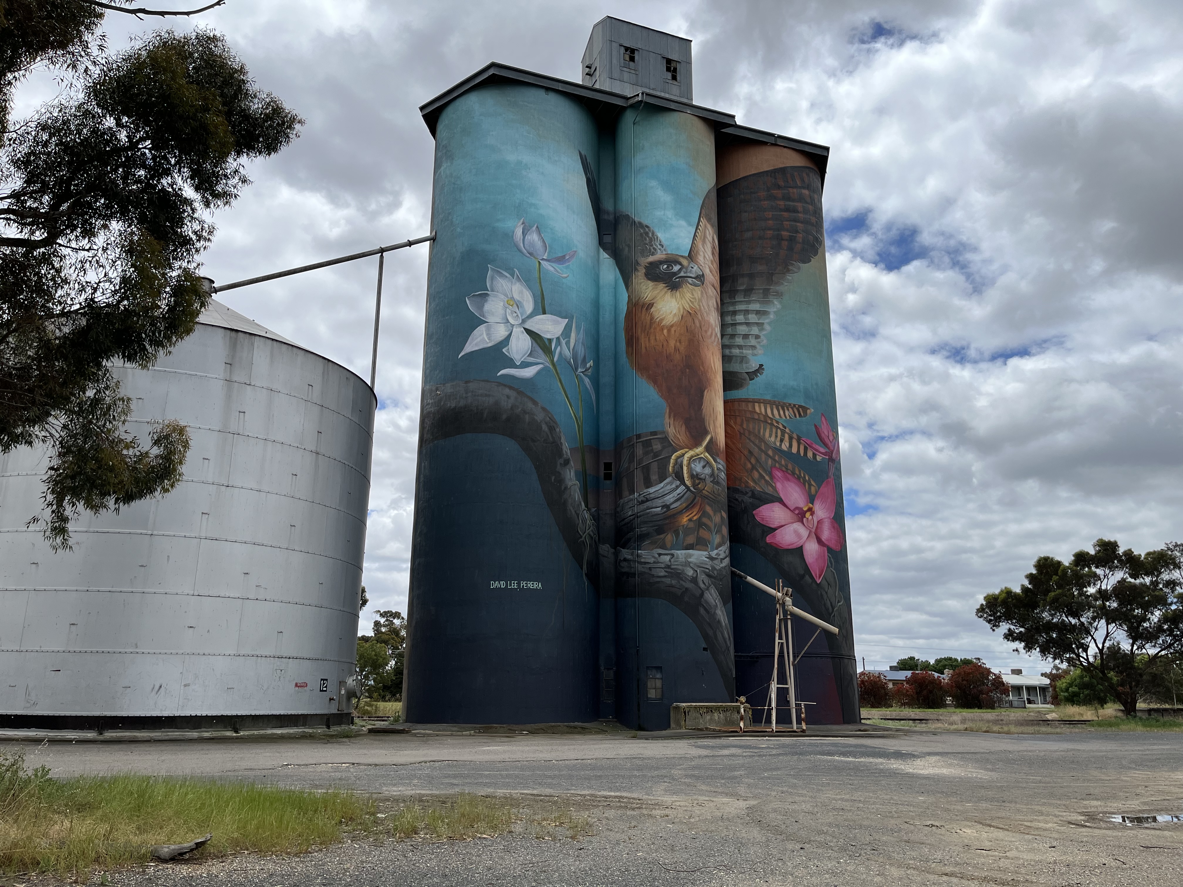
Kaniva
We have reached the end of the trail. Kaniva is only a short distance from the South Australian border. The GrainCorp Silos were painted by David Lee Pereira in 2020. The Australian hobby bird (a type of falcon) and the plains sun orchid and the pink sun orchid (which generally only open on humid days) shine as examples of the desert flora and fauna surrounding Kaniva.
Kaniva itself is a border town, and that is the key origin of its foundation. Today as well as the silos it is home to an amazing sheep art trail, which encompasses sheep painted by the local community organisations. You can see them below.
And that brings me to the end of the Silo Art Trail. I hope you have enjoyed the journey along they way. And stayed tuned for future additions of Ragbag on Road.
I write this blog for free- but it isn’t free to run. If you are able to, I’d really appreciate it if you can make a small donation below to its upkeep.
I’d like to begin this post by acknowledging that Murtoa, the town I’ll be talking about, is on the lands of the Jadawadjali people. It always was and always will be Aboriginal land.
Welcome to another addition of Ragbag on Road. As you can see from the above video- in this iteration you find me in the incredible Murtoa Stick Shed.
To give you some context, Murtoa is a town in the Wimmera region of Victoria. You can see it on the map below.
And as you can see from the photos below it isn’t a large town.
The Stick Shed from the outside is certainly not remarkable.
But inside it is glorious
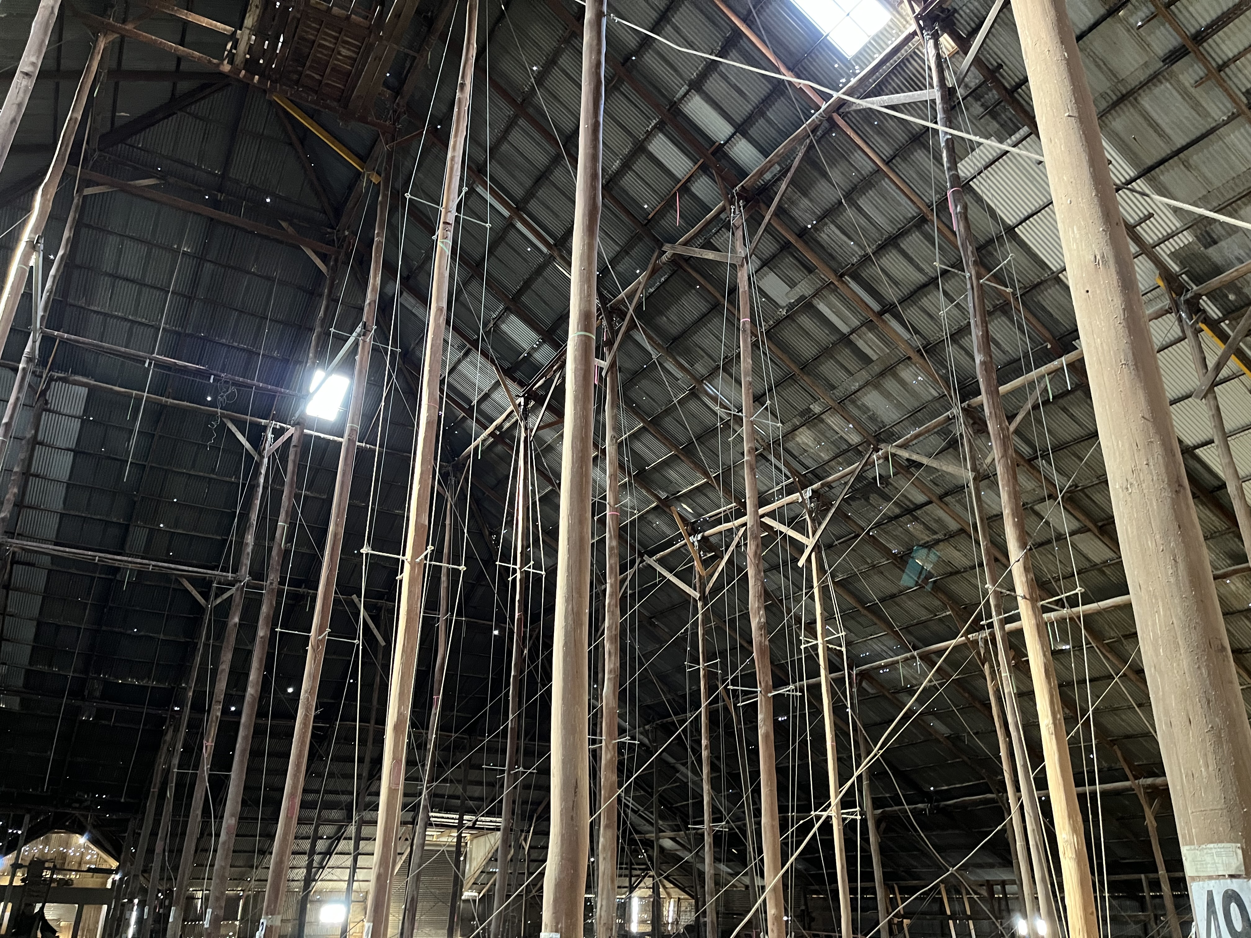
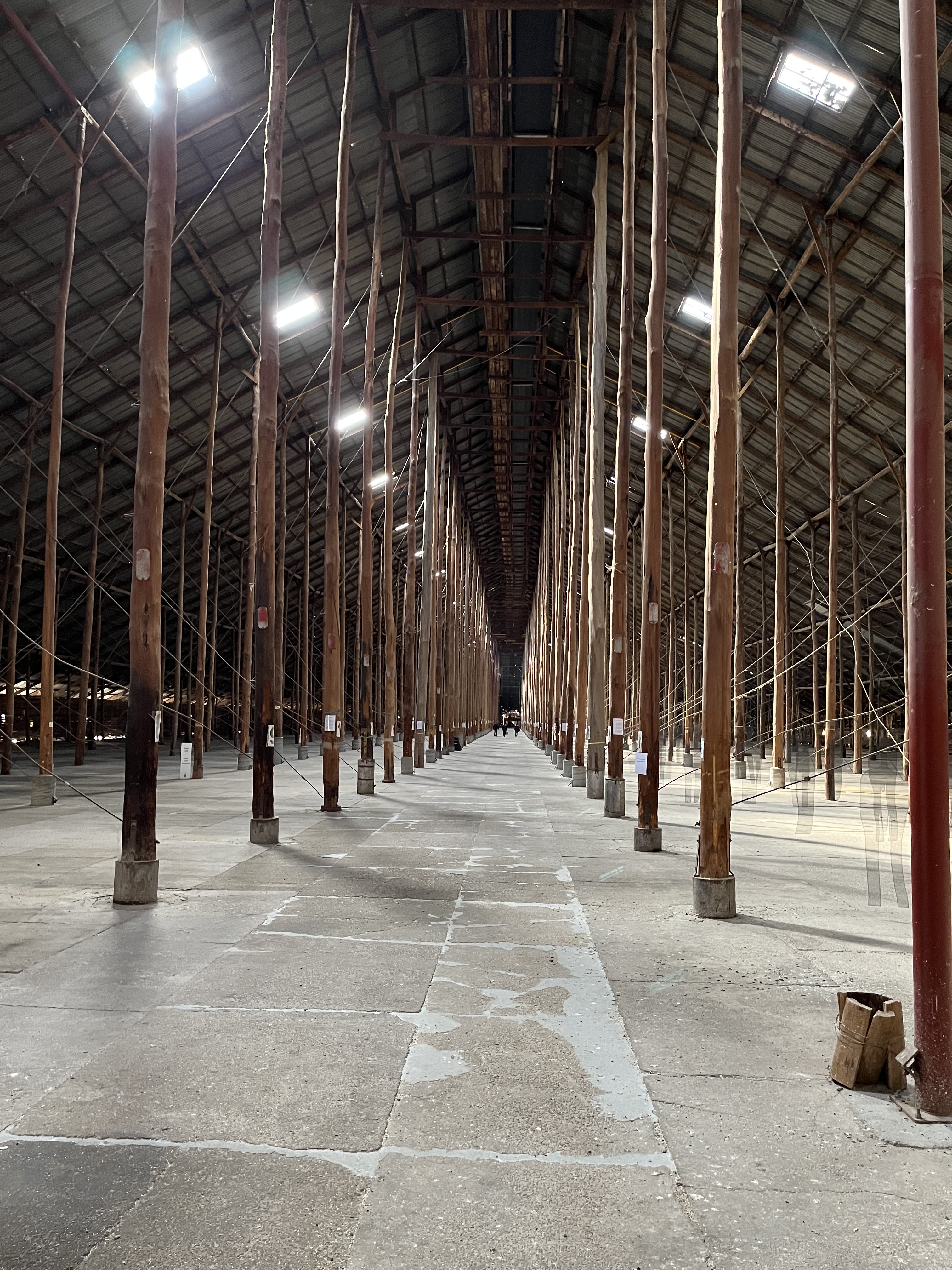
What makes the Stick Shed so remarkable visually is its sheer size (which doesn’t quite translate in photos). It’s 270m long, 60 m wide and 19 m high, and it is made up of 560 unmilled poles, hence the name ‘Stick Shed’, officially it is called the The Murtoa No.1 Store. You can see a photo of me in the Shed below to give you some concept of scale.
But the Stick Shed is more than a folly of sticks. It had a purpose and stands at the heart of the agricultural history of the region, which is why it was added to the Victorian Heritage Register as number 101 in 1990.
So what is that history?
For that we’ll need to go back to the beginning.
The genesis of the Stick Shed lies in World War Two.
Prior to the war, Australia’s main grain export market was Europe, and Great Britain specifically. With the advent of war, and subsequent threat to shipping, this market dried up and when Japan joined the war in 1941 any attempts to expand into the Asian market was kiboshed completely. The situation wasn’t helped by the fact that there was a wheat glut as well, especially in Western Australian, so the wheat could not even be used domestically.
So the Australian Wheat Board was faced with the question of what to do with all the extra wheat? The silos were already full, they needed another option. So they started building massive grain sheds in WA (the glut reached capacity there first). They were successful, so the local Grain Elevator Boards in Victoria decided that they needed one too. Murtoa was selected as the best site. This form of mass storage wasn’t a universally popular decision, with opposition from some labour forces and the (surprisingly) influential jute bag industry.
But why Murtoa?
It’s actually a fairly simple answer: Murtoa was in the middle of a wheat producing region, it had major rail and road connections, the local town conveniences needed and was at the confluence of another rail line that fed grain to the North.
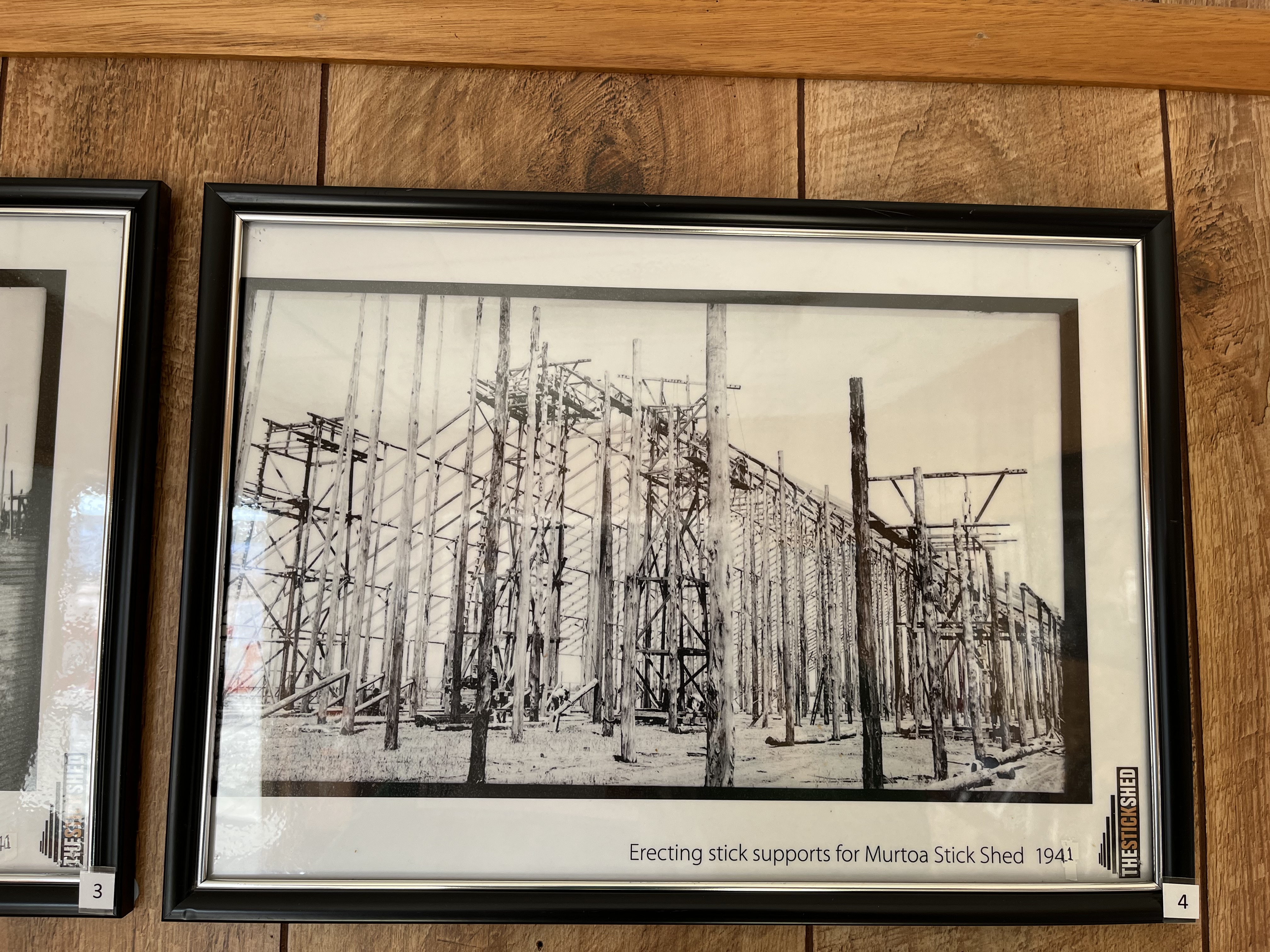
Alright, so we know what the point of the Stick Shed was, and why in Murtoa, but how did something so practical come to be so remarkable? The first reason is the sheer size needed, as discussed above, and the second is the decision to use unmilled timbers. The choice of timber was determined by a shortage of steel. The timber is mountain ash hardwood, and it all comes from Victoria. Mainly the Otways, Gippsland and the Dandenong Ranges. There is an astonishing 2000 tonnes of timber in the structure. What is even more astonishing is the speed with which the Shed was constructed. It was built in only 4 months, starting at the end of 1941 and opening on the 22nd of January 1942 when the first bags of wheat were deposited by local farmer Maurice Delahunty. The first railway load of wheat arrived in February and by May/June the Stick Shed was filled with 3,381,600 bushels of wheat. The wheat remained undisturbed until 1944.
The Shed was built largely by hand (it’s a testimony to its importance that the government managed to provide a large workforce in war time). The poles were carted in from all over the state and erected in the hard Wimmera clay largely using trucks and A-frames- no big machinery. You can see some photos below that give you an idea of the process.
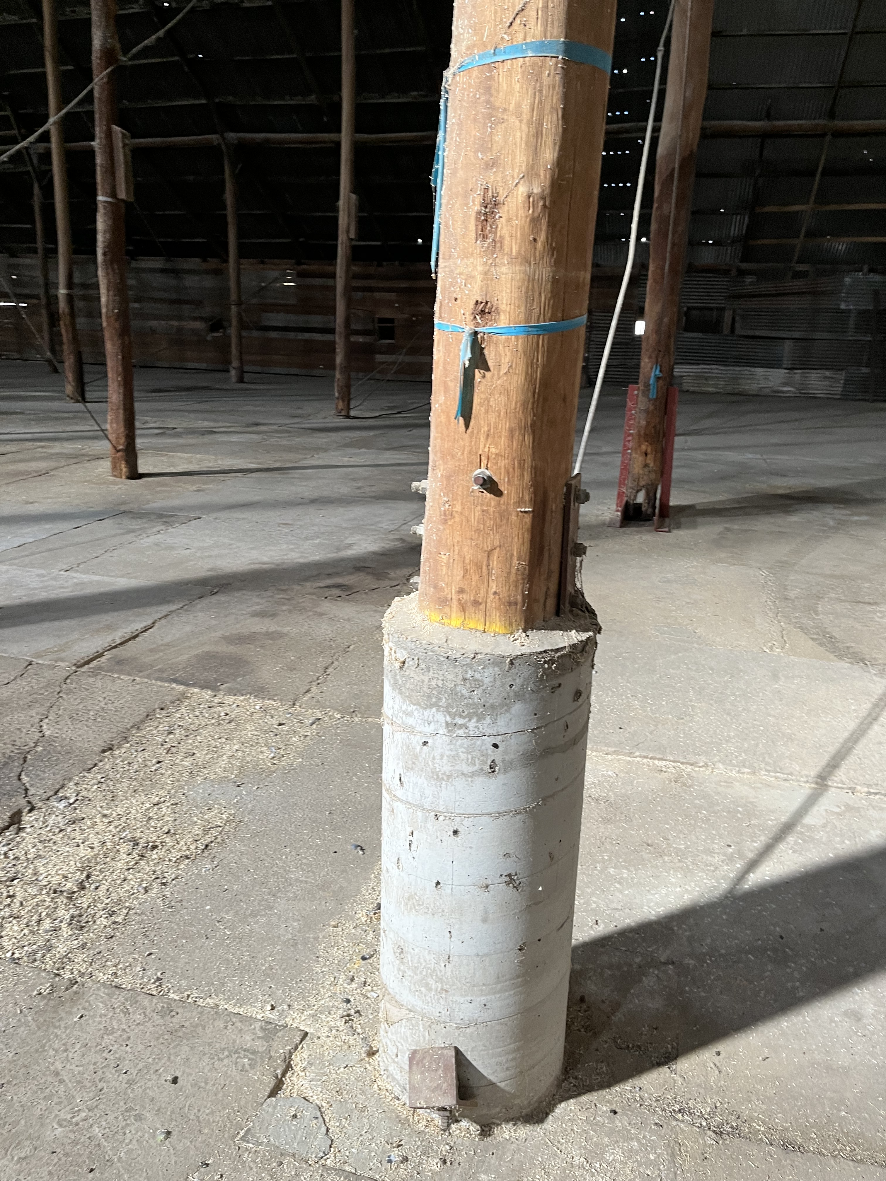
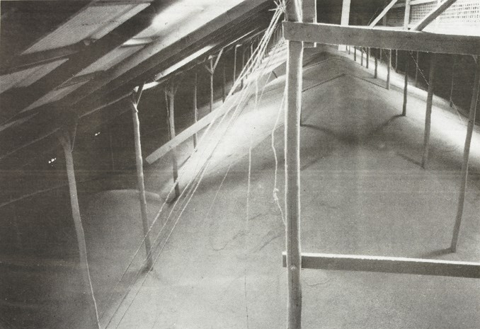
One of the key features that differentiated the Shed from others was the concrete floor, others had tin that failed to keep out the vermin and was impossible to keep clean. The floor contributed significantly to the Shed’s longevity. The floor is nearly 4 acres and was laid around the poles first. As the poles were put in the 4 foot deep holes, the aggregate concrete was poured around them at about 4 inches thick, this was continued as the Shed was constructed. You can see the result below.
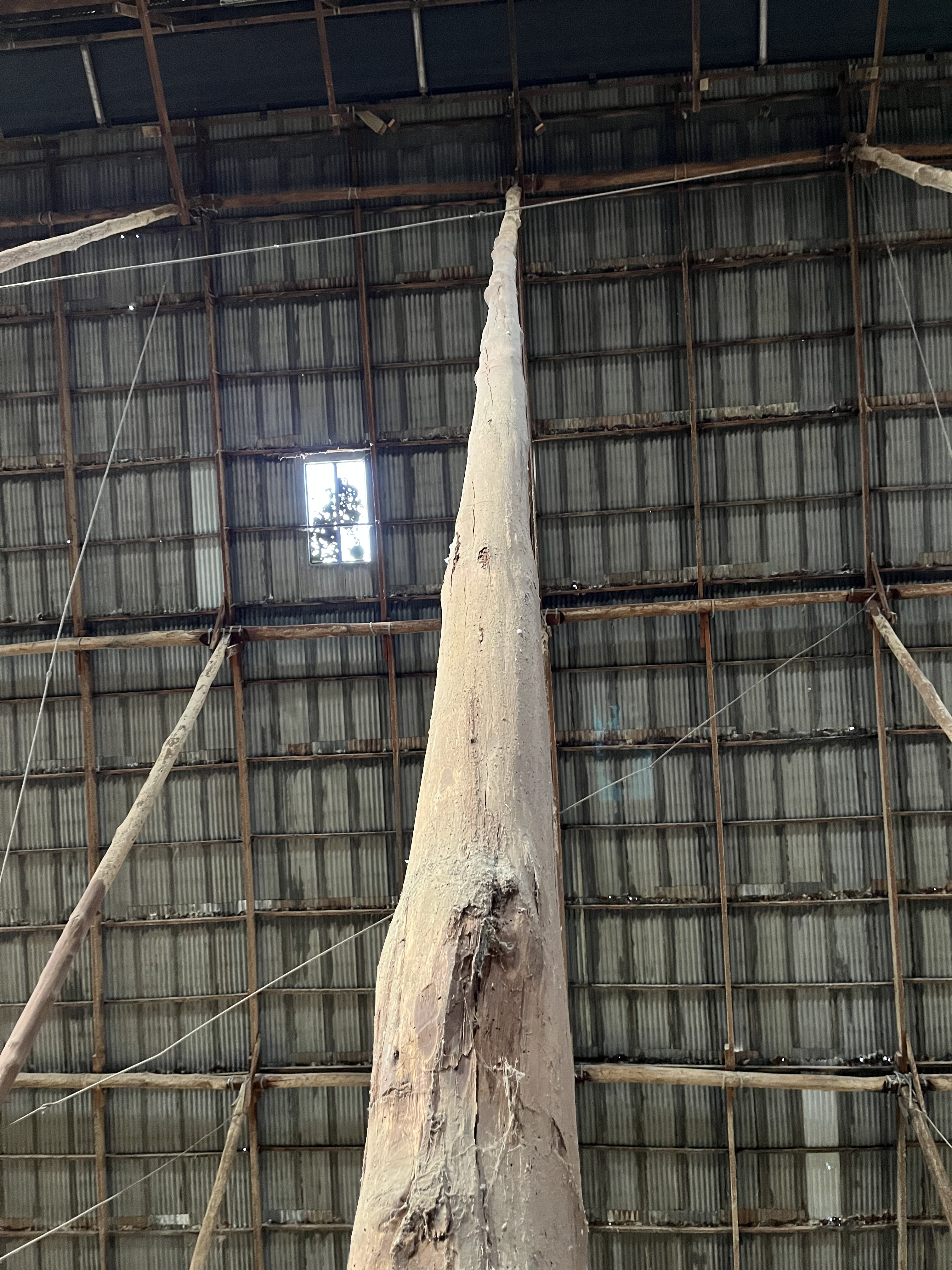
At this point I’d like to cycle back to the poles themselves. The ‘sticks’ that give the Shed its name. As I said they are mountain ash hardwood and unmilled, but they are also largely original. You can see their very tree like nature below.
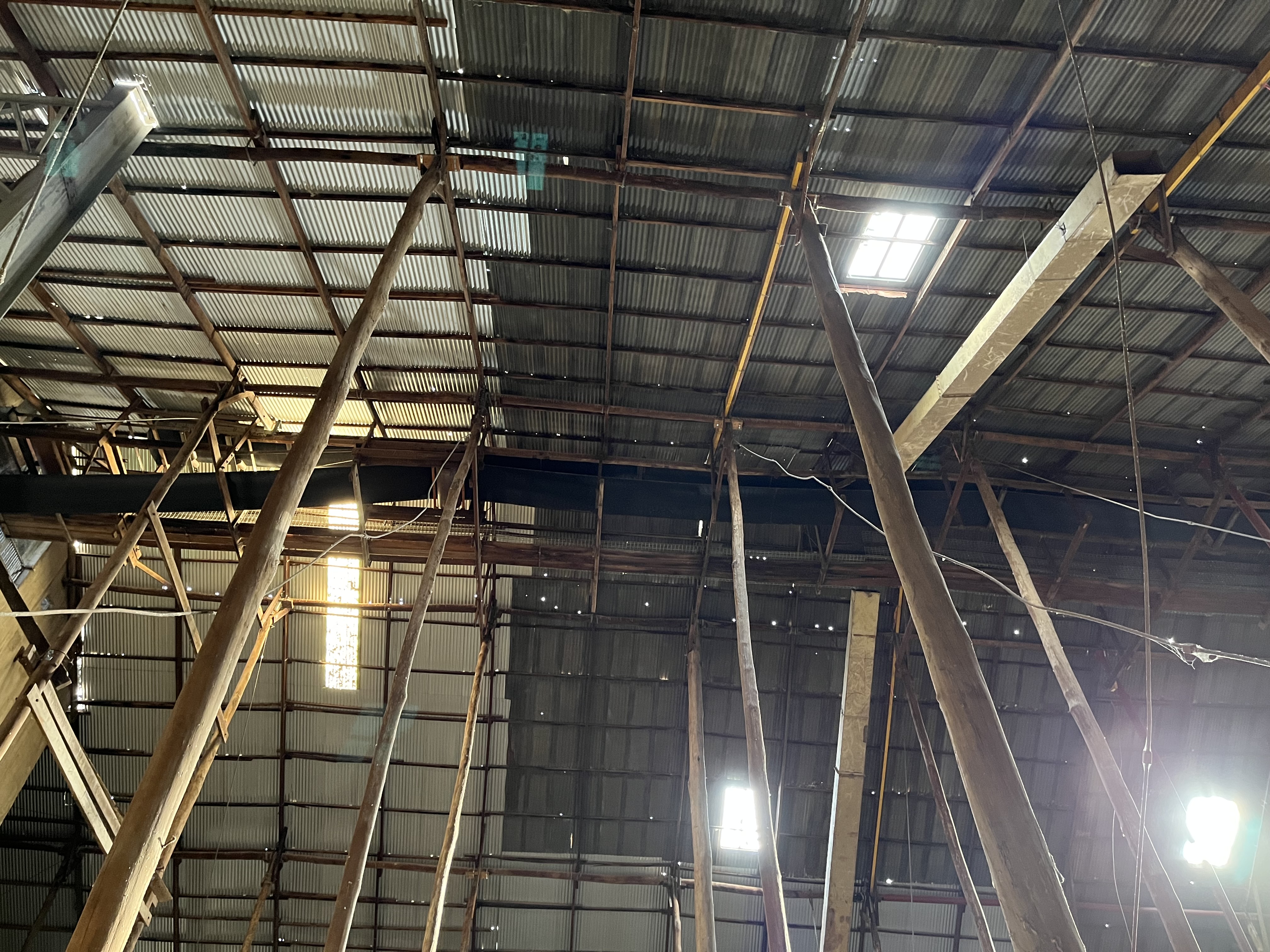
Some have been shored up with bow trusses, that effectively act as bracing the same way that rigging helps brace a ship’s mast.
The footings have had to be replaced in some
And sadly a few have had to be replaced with metal, for safety reasons. There really aren’t many though.
I also really like that you can see the notes on the poles for their maintenance.
Overall the effect is mind-blowing.
It isn’t only the floor and the sticks, the roof is also fairly astonishing
The roof is iron, and covers 1.5 hectares, with over two hectares of actual iron when you take into account the roof slope.
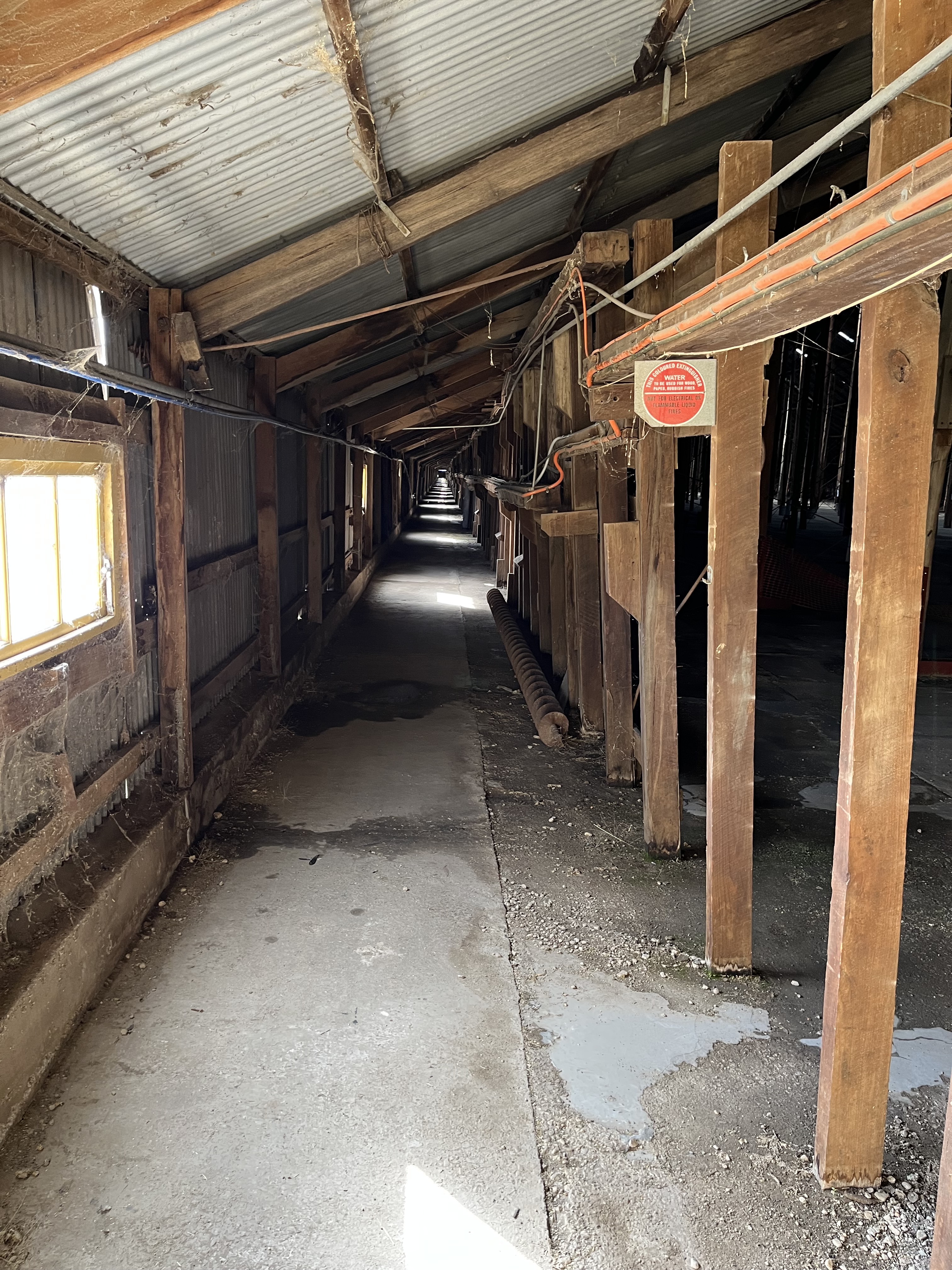
The side walls are also made of iron, with over all nearly five acres of iron going into the Shed. And remember this was WW2 where metal was scarce, which just exemplifies the importance of the Shed. You can see some of the walls below.
That’s the bones of the Shed, how it was built and why. But let’s have the body, how was it used?
The above photo gives you an idea of how the wheat was piled up, but how did it get in there?
It’s actually a fairly simple process. Most of the wheat came in by train, and it was loaded from the sidings. The photo below is the current Murtoa station, you can see the Shed on the far left in the distance.
The grain was loaded on to an elevator which fed the grain into the Shed- you can see the elevator below.
Once in the Shed it was fed onto a conveyer belt that ran the length of the Shed.
Once on the conveyer belt, simple barriers pushed the wheat off into the area of the Shed it was needed. Some people power was required too. There was a worker on the walkway next to the conveyor belt to make sure the wheat was going to where is was supposed to be and one on the floor. The Shed could also be filled by individual farmers from a hopper at the opposite end to the elevator.
The pit was finished in 1947 and extends under the Shed a bit. Farmers could dump wheat either by hand or from a grain truck if they had one, it was then moved into the Shed proper.
Once the grain was in the Shed (it could take an astounding 92000 tonnes) it was largely left alone. It was treated with insecticides by people walking on the top of it when there was an infestation, but it is specifically built with the concrete floor and windows all along the side alleys and ventilators in the roof, to keep infestations to the minimum.
But the wheat didn’t stay in the Shed indefinitely. It was emptied (when needed) with sort of a reversal of the whole process. There were horizontal conveyer belts which helped move the wheat to the side of the building. People were also on hand to operate these belts.
The wheat was conveyed to the south wall, where a belt ran the length of the Shed and trundled it back out of the Shed and on to trains to be sent wherever it was needed.
The wheat in the Shed, as it came from so many sources, was classed and sold as Fair to Average Quality (FAQ).
The Shed was used until 1989, when the Grain Board declared it uneconomical. It was added to the Victorian Heritage Register in June 1990.
So now you know the story of the Stick Shed. Although it is no longer used for the purpose it was intended for, it not only stands as a monument to the history of agriculture in the area, it is a truly spectacular building in its own right.
One thing you do really notices standing in the Shed, is that it is not a silent building. Part of this is because it is still very much in a working agricultural area.
But it is also because the Shed moves, you can hear it shifting and settling, it’s almost elemental.
The Stick Shed is also not the only historically interesting feature of Murtoa. The Murtoa and District Historical Society is housed in the old water tower.
The water tower was built in 1886 for the nearby rail line. It now houses an eclectic museum, the unexpected highlight of which is a remarkable taxidermy collection. It is the work of local minister James Hill and spans 1875-1932. Hill had contacts with missions in Africa, Brazil, India and New Guinea and asked for specimens in return for donations to the missions. He also swapped with other collectors, as far away as Africa. There are over 600 specimens, and it’s one of the largest collections of its type in Victoria outside of Melbourne Museum.
So the Stick Shed does not stand alone. I just wanted to finish with the note that the Stick Shed’s survival, when other large grain stores were demolished long ago, is down to intensive effort by individuals and committees. It has survived, in-spite of the odds against it. And I think we can all agree it was definitely worth saving.
As I said in my, slightly unplanned, video; welcome to the first edition of Ragbag on Road. These entries are going to differ a little from my normal posts, because rather than a detailed history of a person, building, painting, book, topic etc., I’m going to take you on a wander with me through a new place. In this case I’m beginning with Maldon, a town in north central Victoria. This isn’t a full history of the town, but I’ll be talking briefly about several of interesting sights and sites and hope you enjoy this ramble with me.
I want to start by acknowledging both the Dja Dja Waurrung people on whose land Maldon stands and the Bunurong people on whose land I write from. The history of the Dja Dja Waurrung stretches back tens of thousands of years before white colonists arrived and ‘discovered’ gold in the Maldon area. The history of Australia is not new and clean and everything that was ‘discovered’ was already part of the land of the First Nations people. Australia’s First Nations’ history is ancient and in writing about recent history I acknowledge and celebrate a millennia of First Nations’ storytelling and knowledge keeping. The story of the Dja Dja Waurrung is not mine to tell, but I direct you to https://djadjawurrung.com.au/ the Dja Dja Waurrung Land Council which explores their history. I just want to be very clear that Maldon is Dja Dja Waurrung land.
To explore the town itself. This will be a little random because I tend to wander around new places and see what I can find, and I’m hoping to take you on that journey with me. I will give a little history to get us started though.
As I said in my opening video gold was found in Maldon in 1853, but that’s not the beginning of colonial history in the area. In 1836 the area was passed through by surveyor Major Thomas Mitchell. I’ve actually written about Mitchell’s survey of the ‘Australian Felix’ before you can find that post here. The land was soon settled by Europeans, and as pastoralists moved into the region First Nations people were denied access to their food and water sources and eventually forcibly moved on to reserves, including one at near by Loddon, with only a small number remaining in the area.
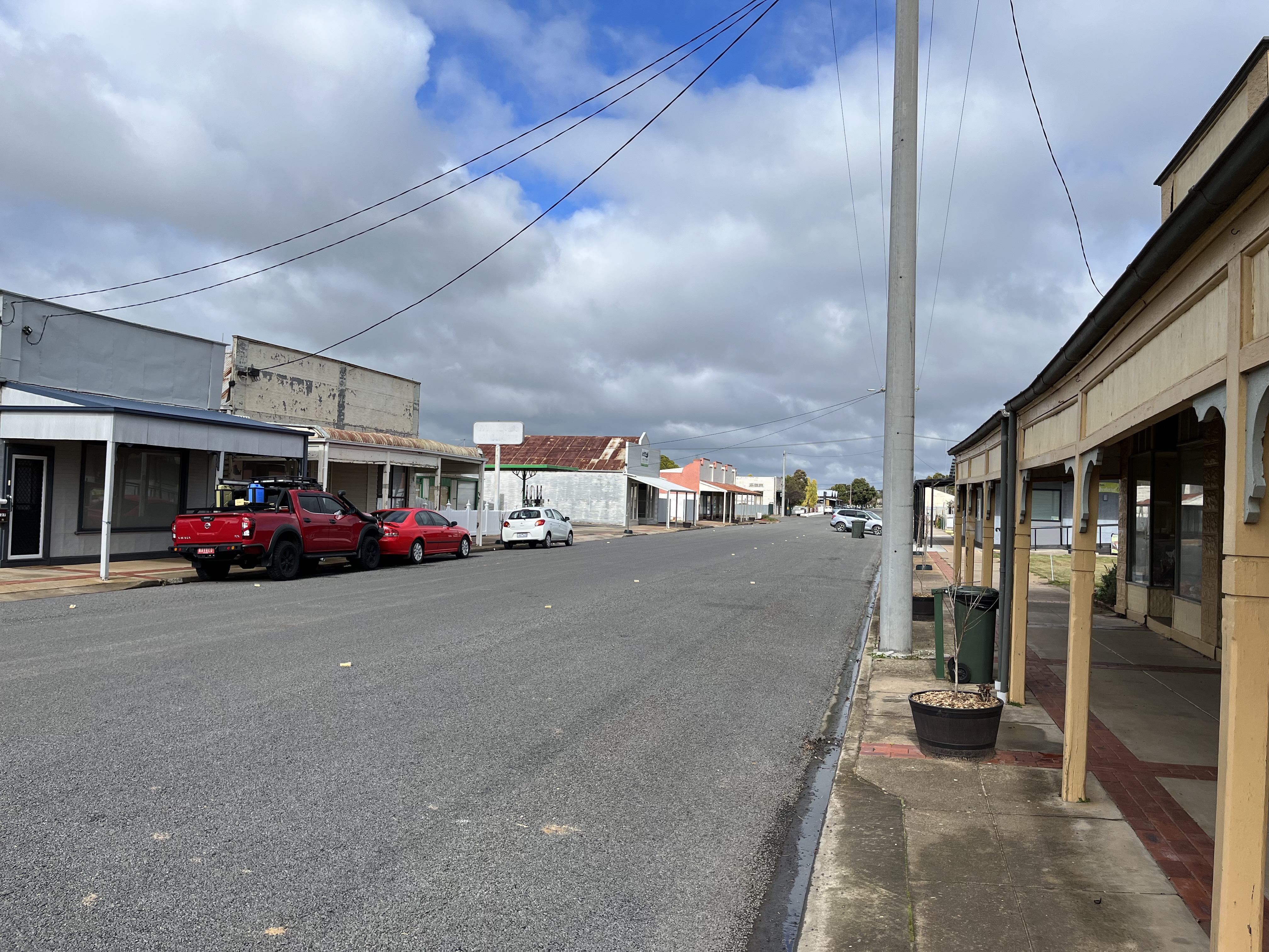
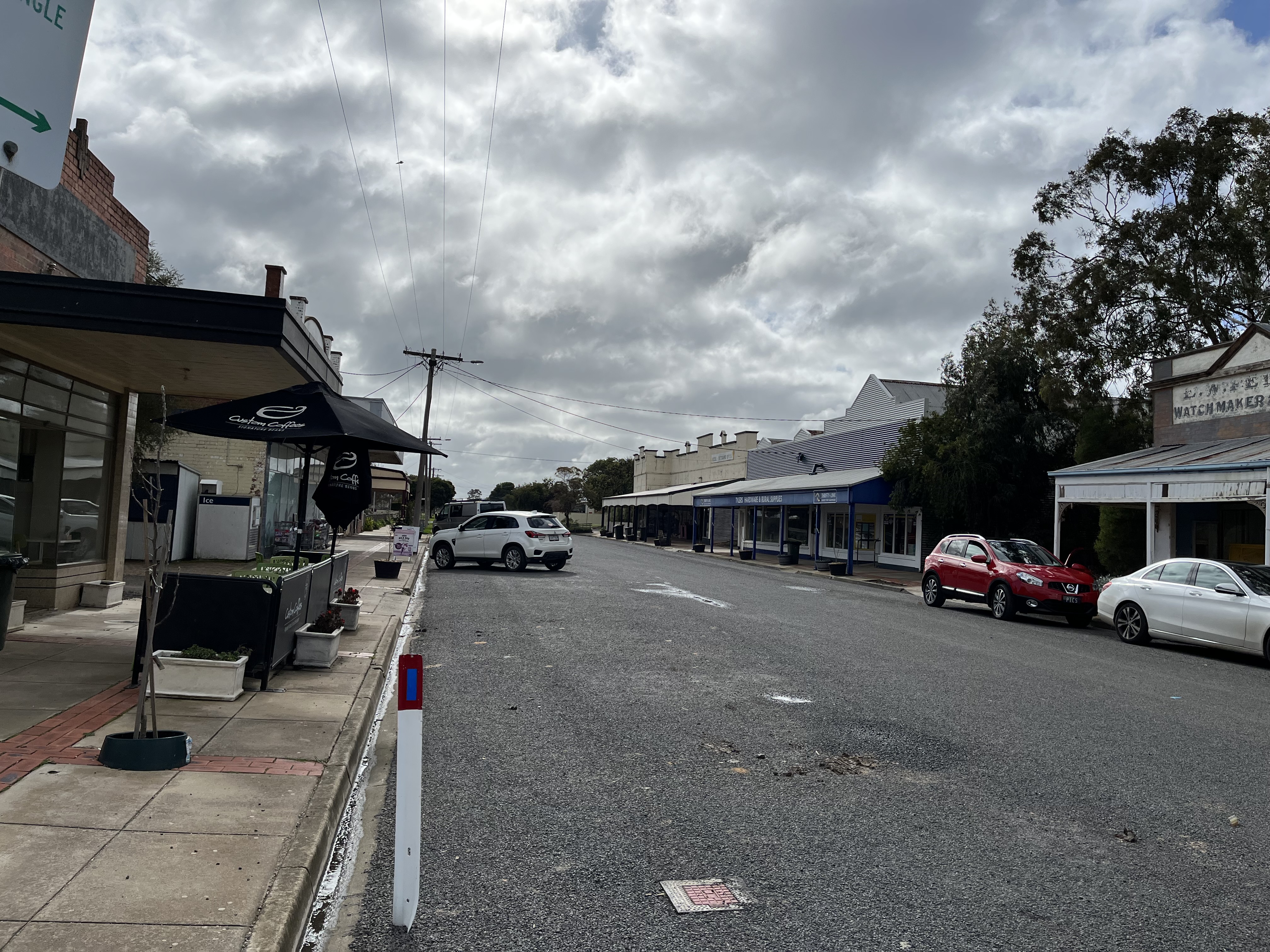
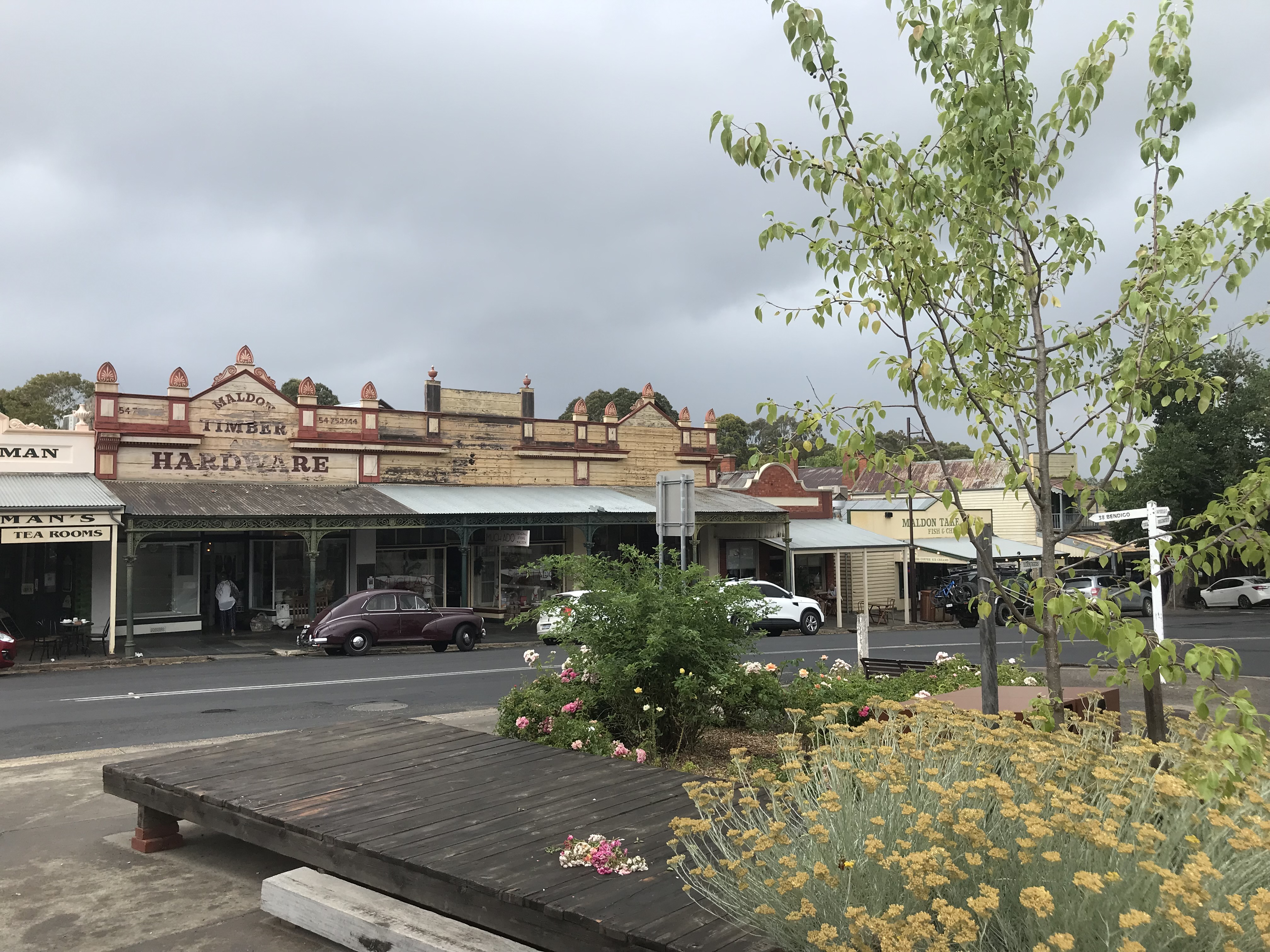
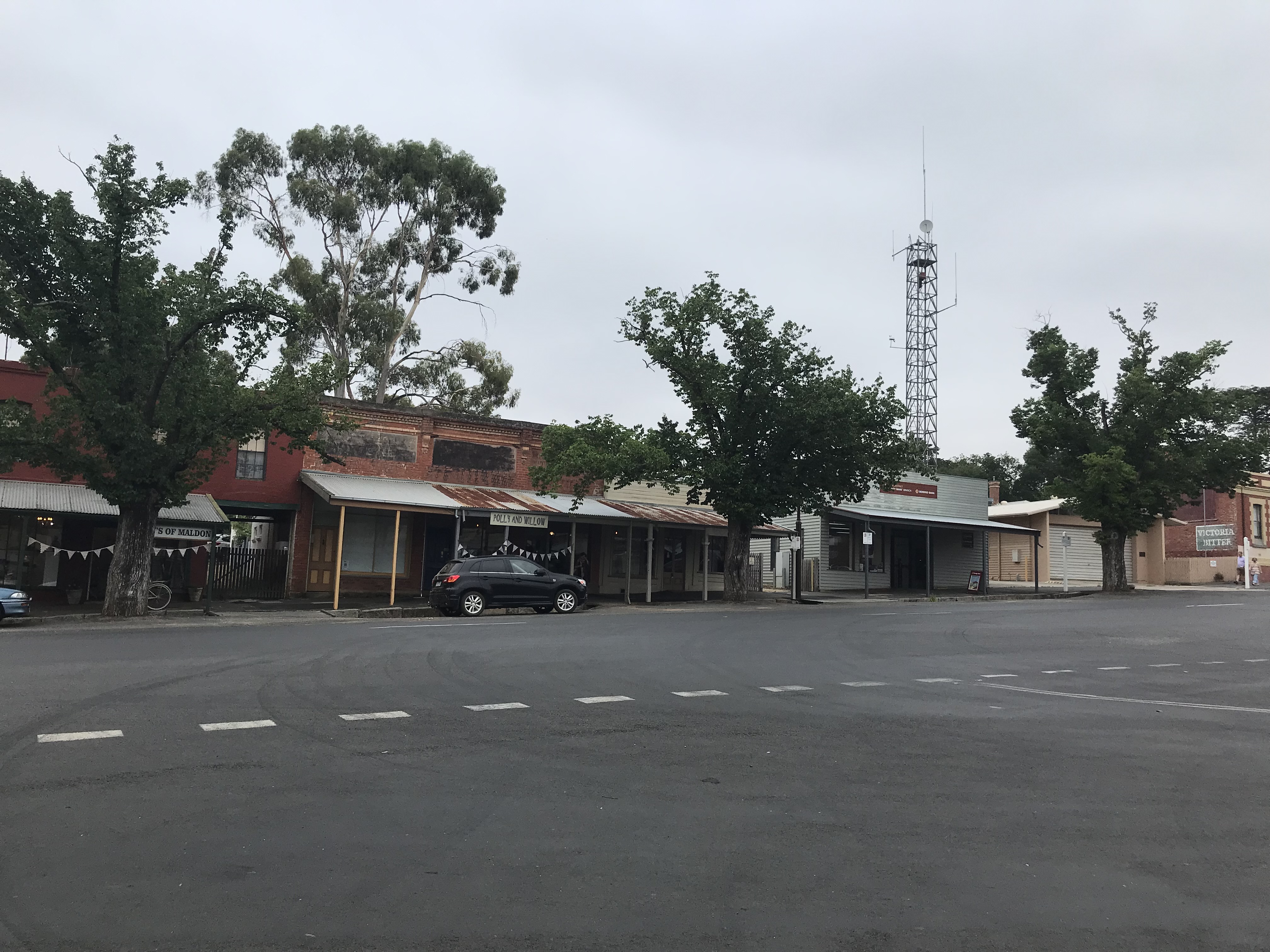
The Maldon region would have remained as the pastoral run of the 100 000 acre Cairn Curran property if gold hadn’t been found in 1853. The region was quickly flooded with people as part of Victoria’s gold rush with an immediate rush of up to 40 000 people. As you can imagine this massive influx of people only continued to grow and infrastructure was needed. The town as you see it now was laid out in 1856 by Thomas Adair at the behest of the Colonial government. He named it Maldon. The gold in the area proved to be a very rich seam and, while the alluvial gold petered out in about two years, mines were soon being dug. The deepest reached 75 meters and there were roughly 40 mines in the area. It’s believed that over 2 million ounces of gold were produced from the region, which in today’s money would be worth billions of dollars. The town grew quickly after it was declared a municipality in 1858 and this is the streetscape you see today. The photos below give you an idea.
This is the intact street scape that led the National Trust to declare Maldon Australia’s first ‘notable town’ in 1965. So that’s the basic history, now it’s time for our wander.
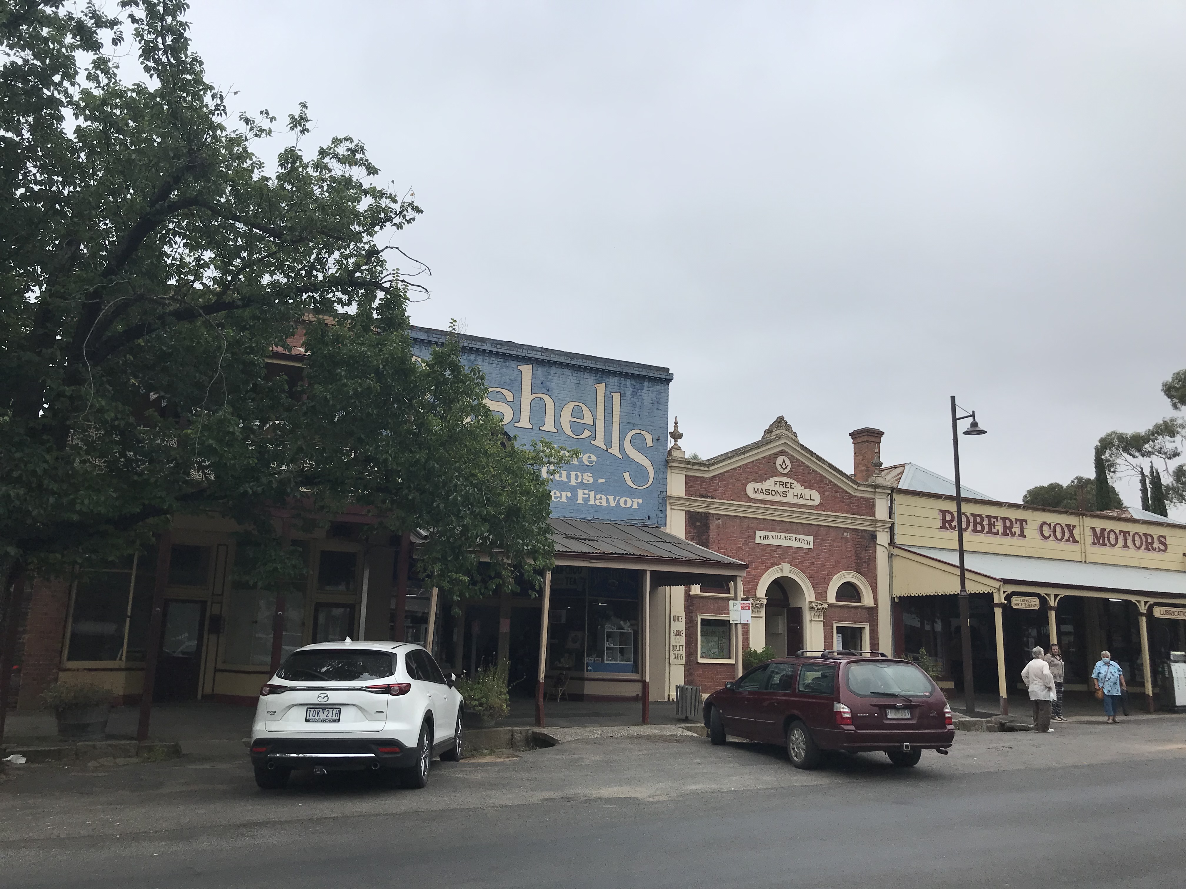
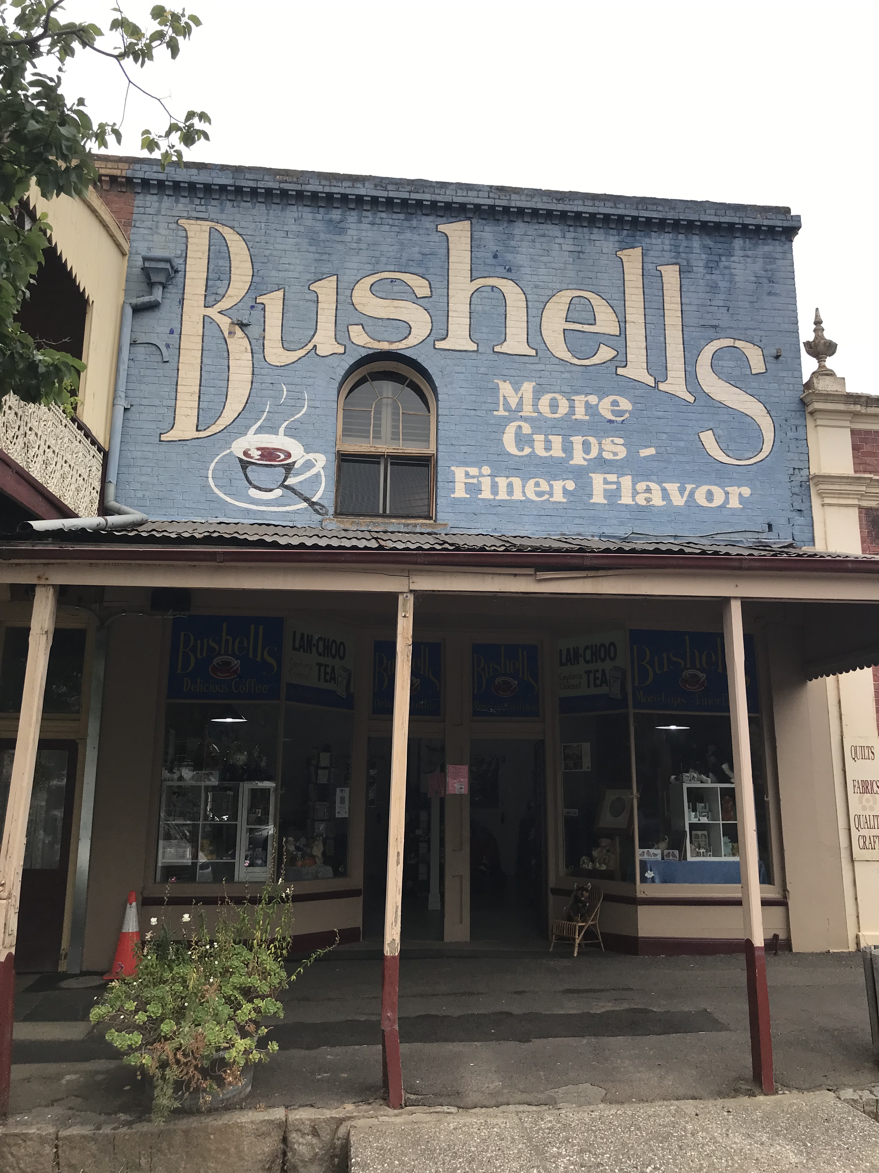
We begin, down the end of the main street (mainly because that’s where I could find a car park) with the Warnock’s Flour Mill.
This was the site of the local flour mill run by James and Samuel Warnock (the entrance was via rear lane) it was converted to shops in the early 1900s and is now famous for its Bushells sign. It is technically a ghost sign as Bushells is no longer sold there, but it’s so vibrant it’s hard to see it as especially ghost like.
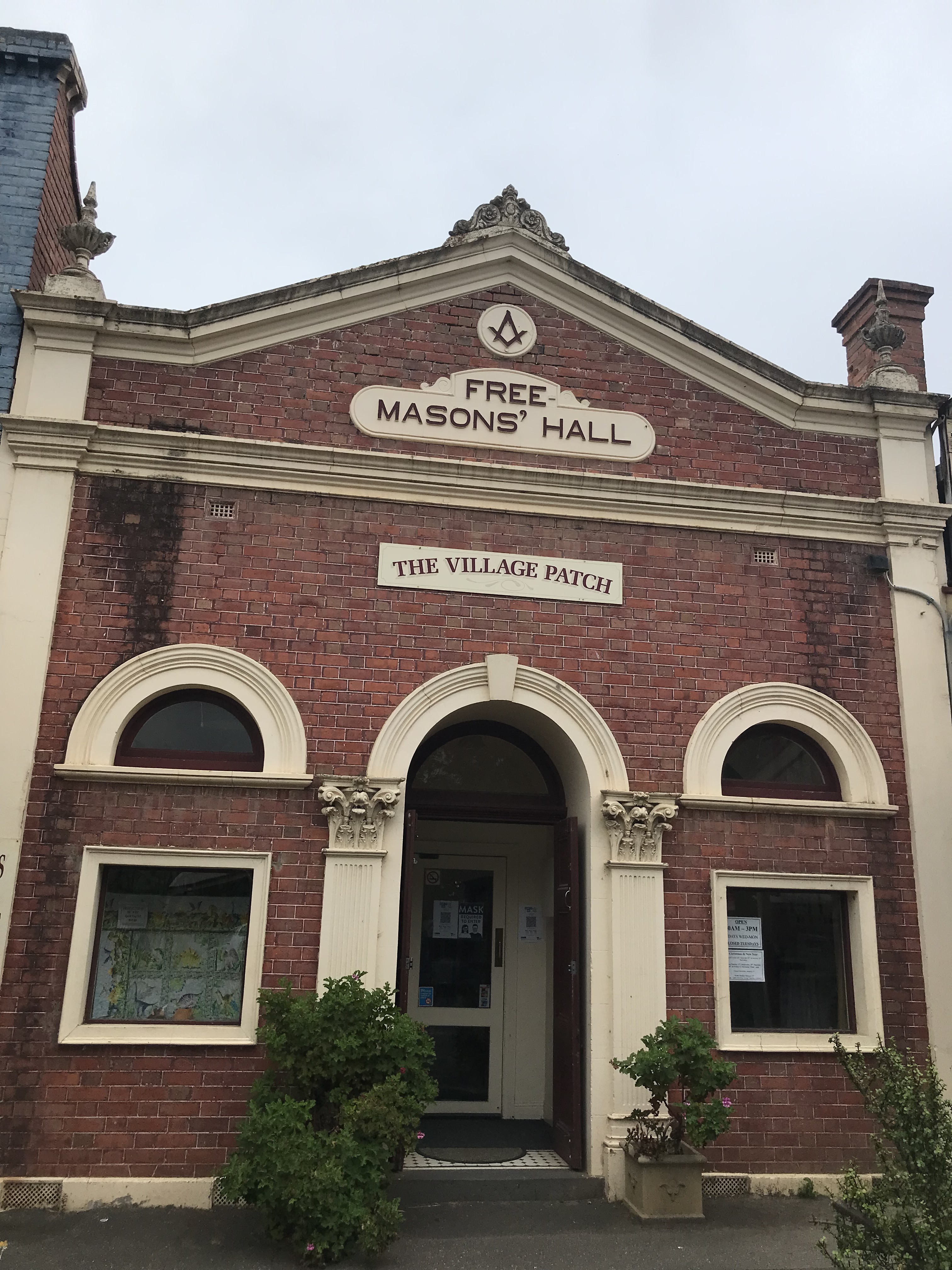
You’ll have spotted the nice brick building next door. This is the Free Mason’s Hall.
This building was originally part of the Warnock’s store but the facade was added in 1908 and the Freemasons moved in and used it as their hall until the 1980s.
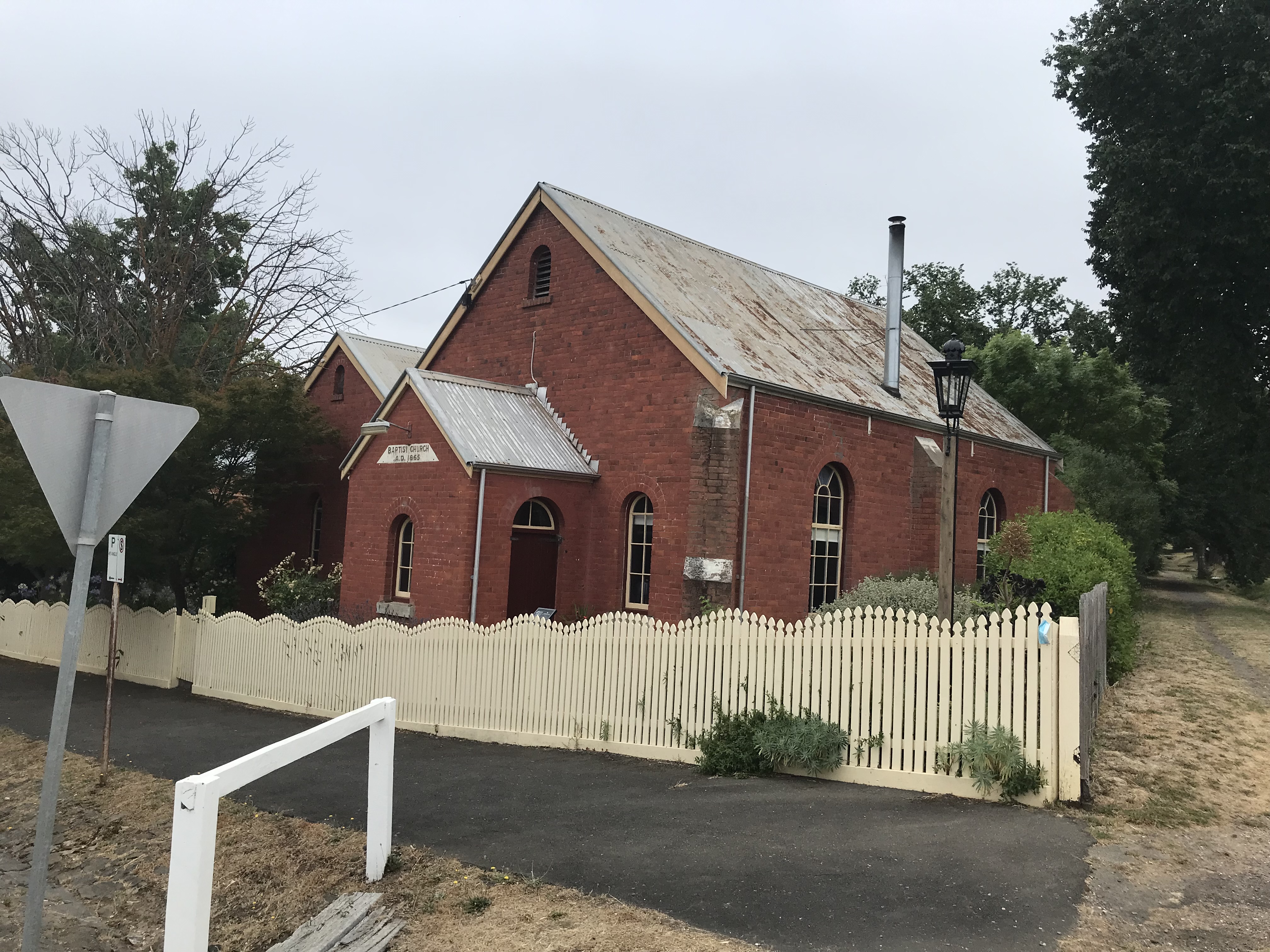
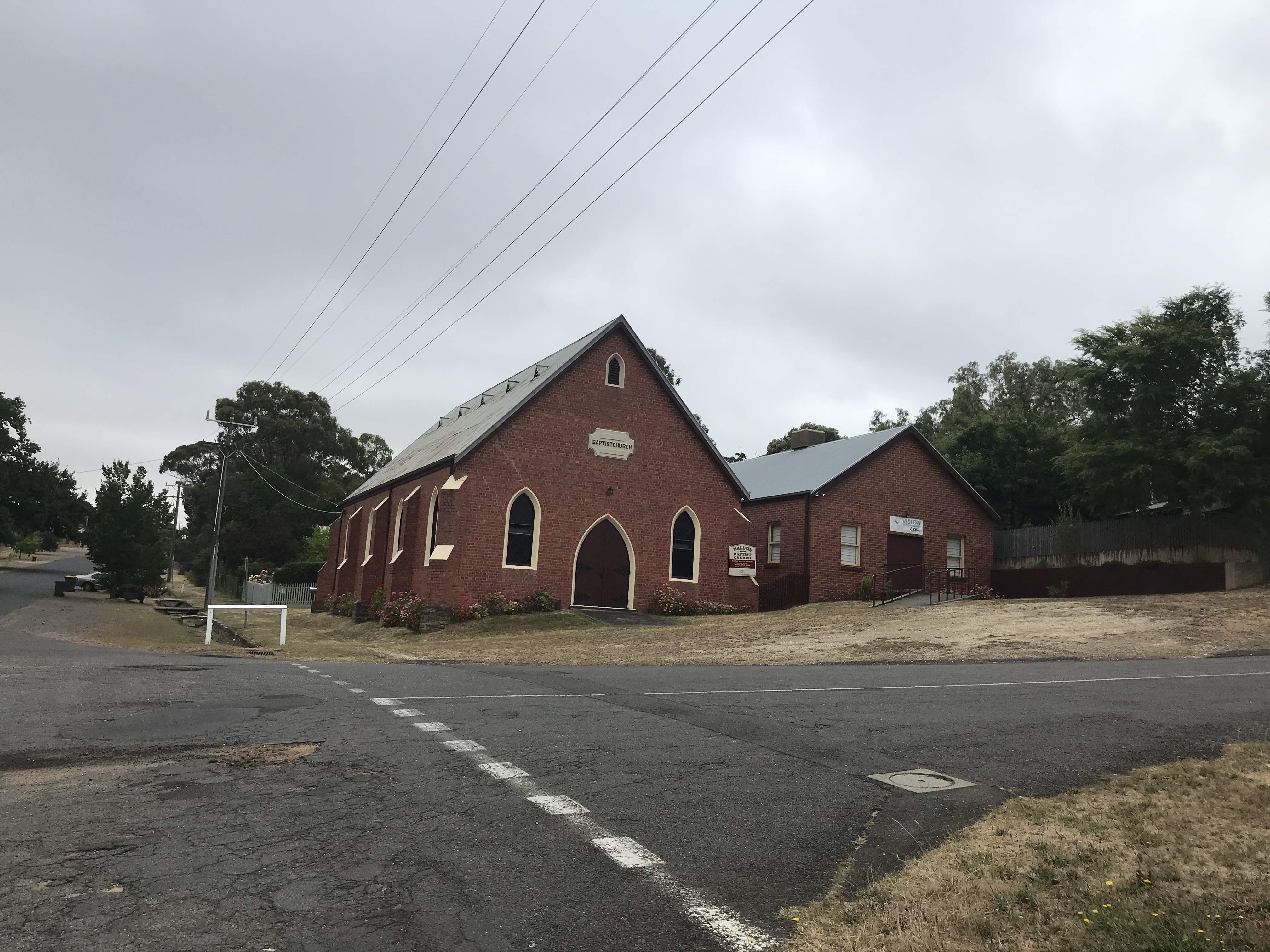
In our first random jump we move past some of the other high street buildings (I’ll return later). One of the key reasons I wanted to visit Maldon is its Athenaeum Library, but as it doesn’t open until the afternoon I have a quick wander to find it before going for lunch and on the way I discover two of Maldon’s many churches on the way. Both in fact Baptist churches.
The smaller building is the original church opened in 1865. It began as a Welsh church due to the large number of Welsh miners in the area. There was a division of the congregation which resulted in the construction of the larger church just round the corner in 1895. But eventually the differences were solved and the congregation reunified in 1930 into the larger building, using the small church as the Sunday school. The light you can see next to the original church is a modern replica of the lamp built in the 1880s so that passers by could read the times of upcoming Baptist sermons.
We then wander along to the Maldon Progress Hall. It was opened in 1873 as a Temperance Hall and is now owned by Mount Alexander Shire and used as a community hall.
Looking back we see Brook’s Store which was built in 1866 and run as cooperative store by a shareholding company. The Co-op never really got off the ground and the shares were liquidated in 1872. Brooks took the store over and the Brooks Family ran it until 1986- very little of the building has been changed.
Our next stop on the way to the Athenaeum is the Post Office. It was opened in 1869 and has one really interesting claim to fame. Australian author Henry Handel Richardson grew up there when her mother was post mistress from 1880 to 1886. It features in her work Myself When Young.
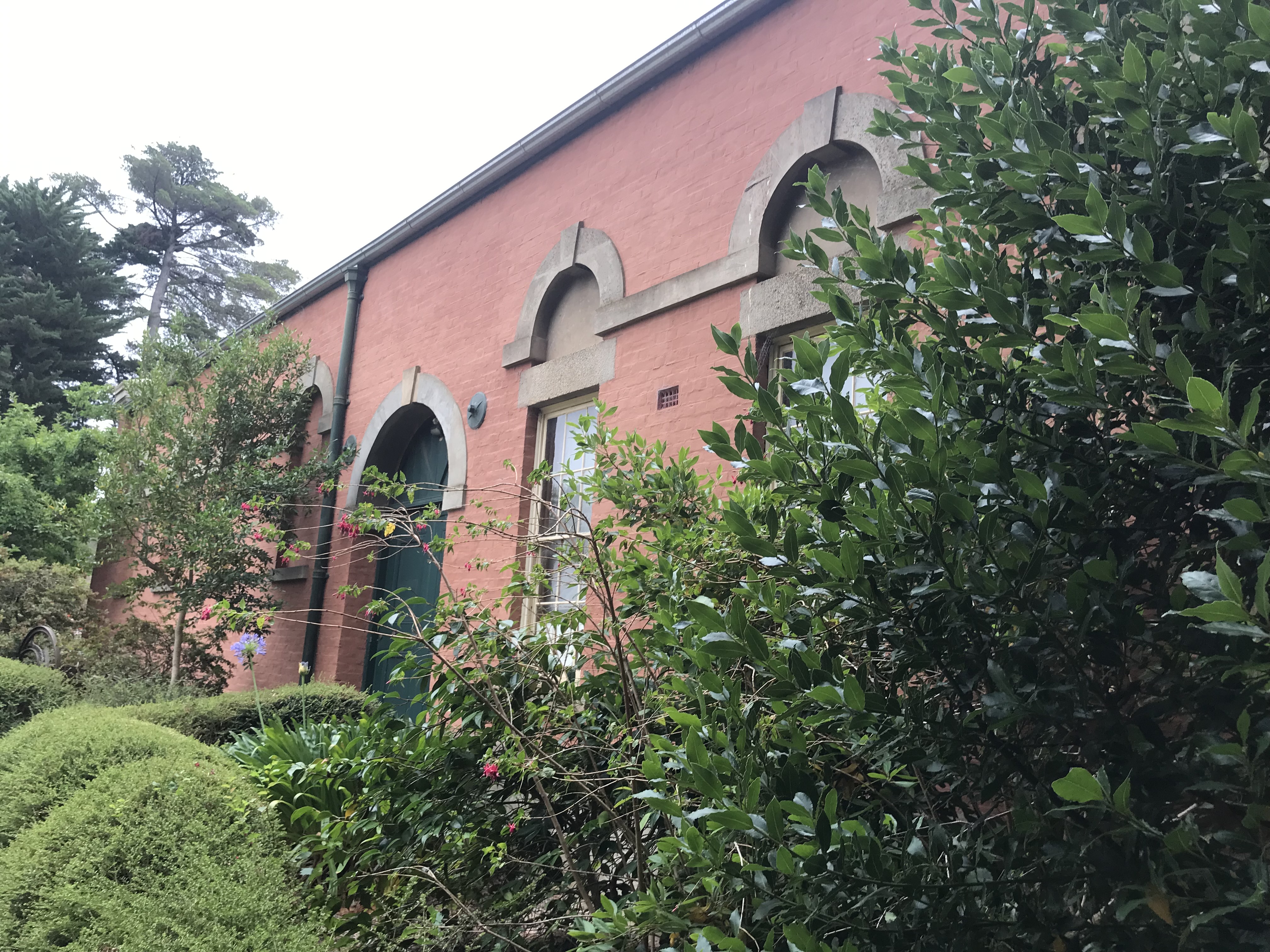
Ok, so we have now reached the Athenaeum. It was opened in 1863 though the current building dates to the 1930s
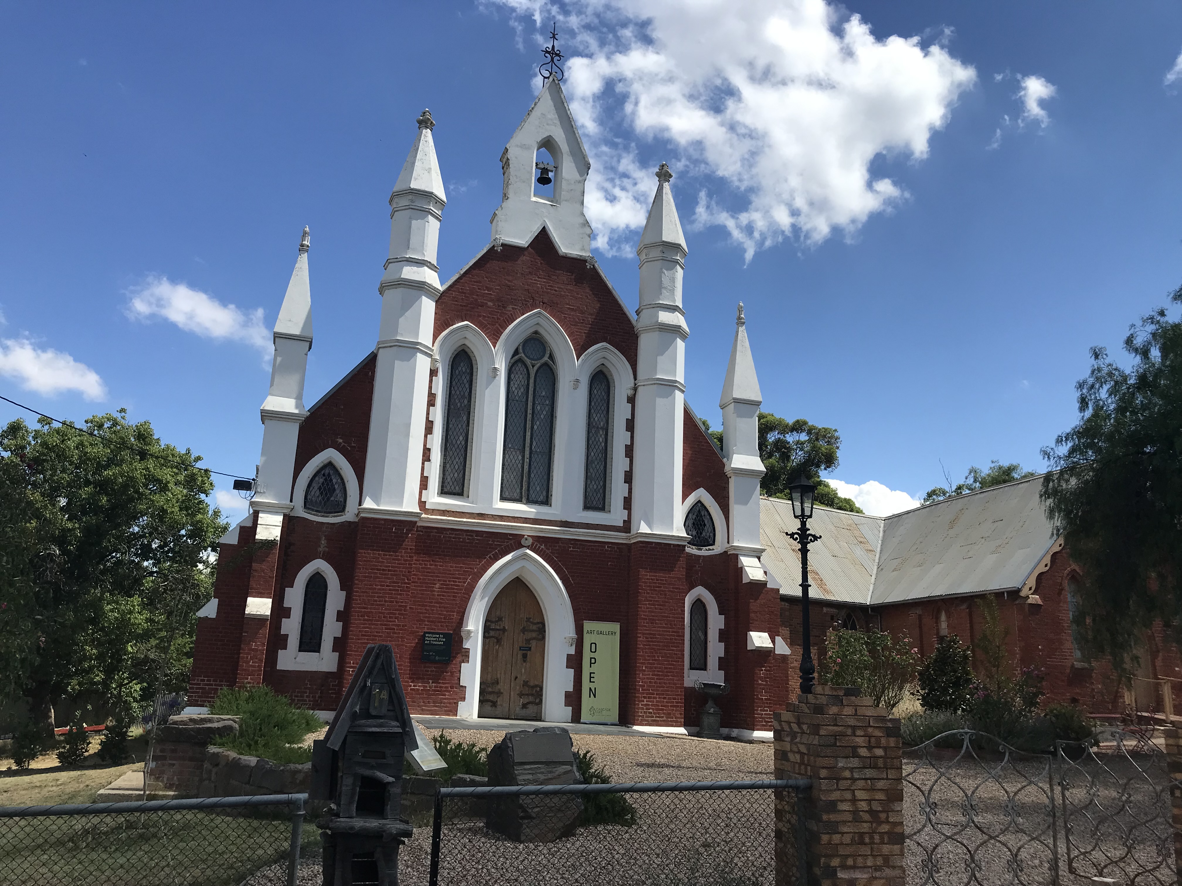
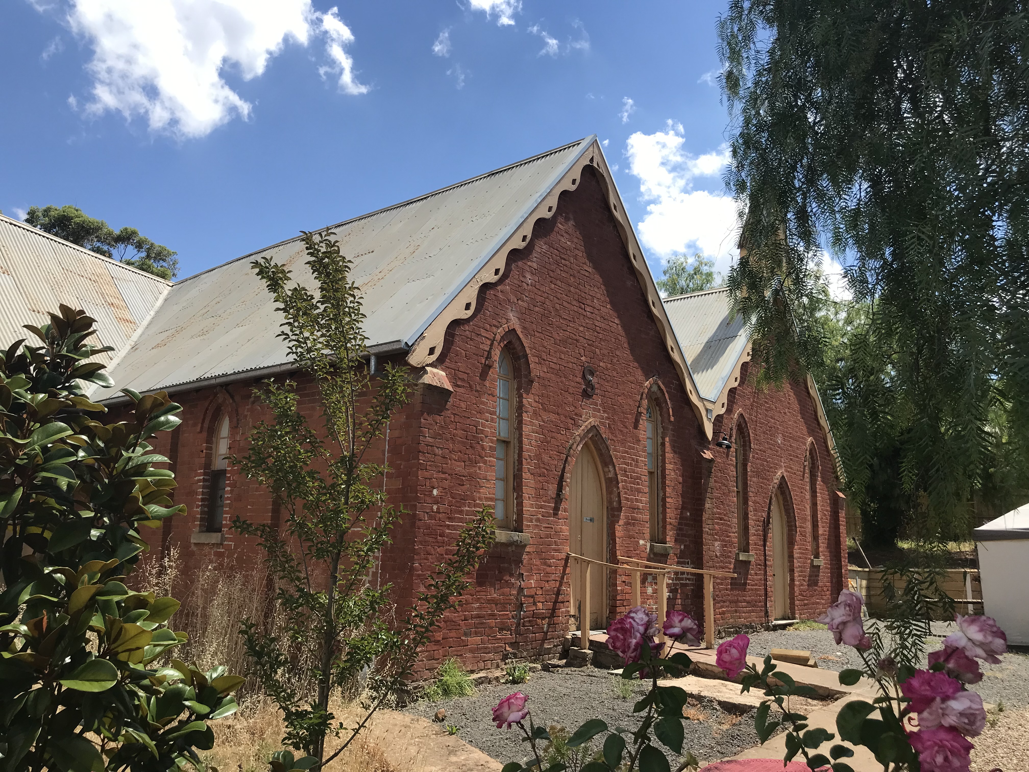
As you can see it is currently closed, so now that I’ve located it I’m headed off for some lunch, exploring a couple more interesting sites on my way back to the main street. Below you can see the Holy Trinity Anglican Church which is just opposite the Athenaeum.
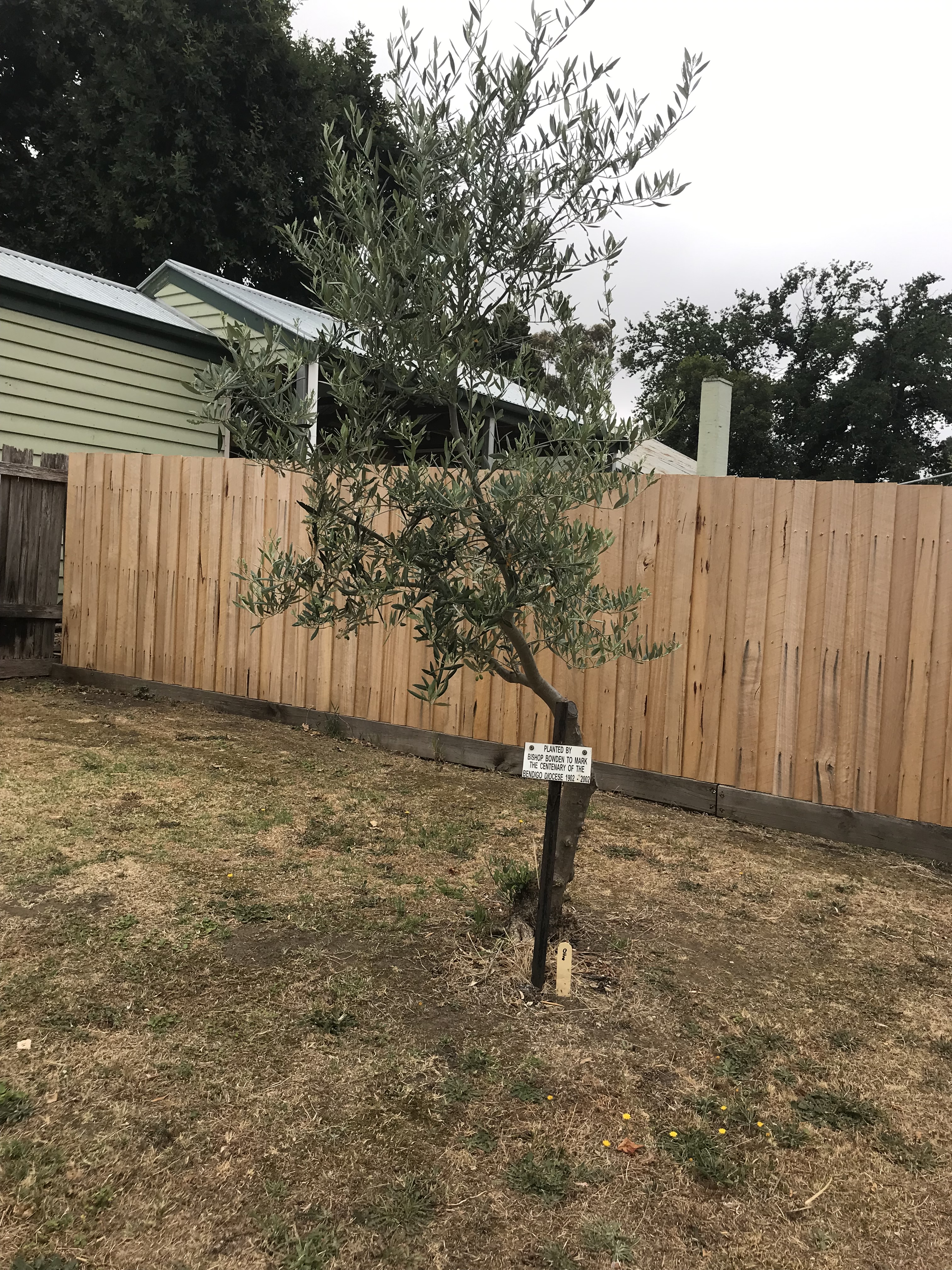
It was built in 1861 of local stone (hornfels), which is known for its hardness. Some of the deep gutters are also built of it. It is the largest stone building in the town. It was designed by D.R Drape. You can see also see one of the outbuildings and an olive tree which was planted by Bishop Bowden to mark the centenary of the Bendigo Diocese in 2002.
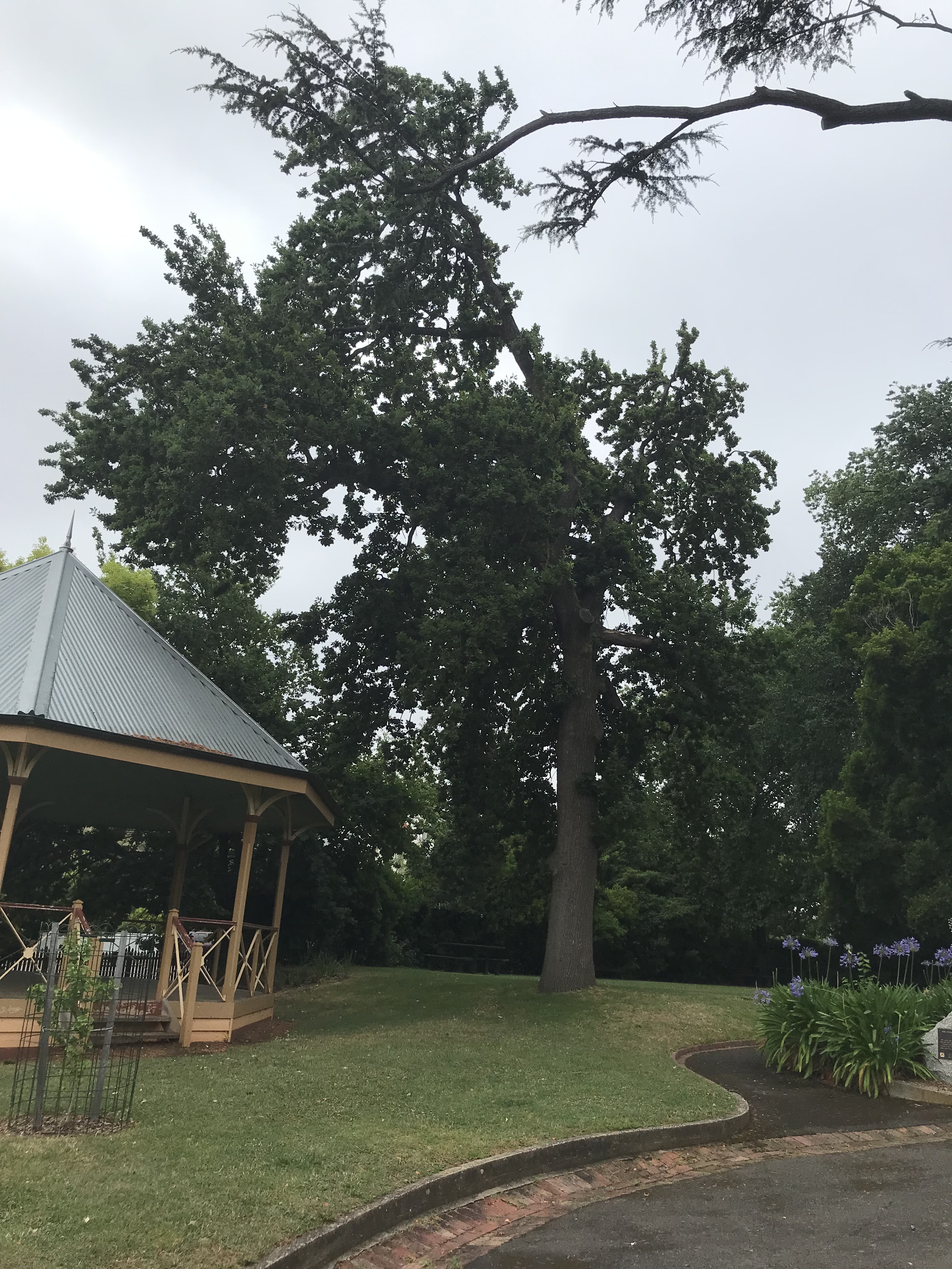
The last building before lunch is the Market Building. It’s now the home of the Maldon Museum (which is closed when I visit but wrote most of the remarkable array of historical brochures which I am basing this post on). The Market was opened in 1859, but closed in 1860 because of a depression. It was converted into the Council buildings in 1865 and they remained there until 1964. In the photos below you can also see grounds around the Market building which contain two English Oaks planted in 1863 to commemorate the marriage of Prince Albert Edward to Alexandra Princess of Denmark. The rotunda dates to 2008 but it is a realisation of a long held dream with the petition to raise funds for a brass band rotunda presented to Council in 1883.
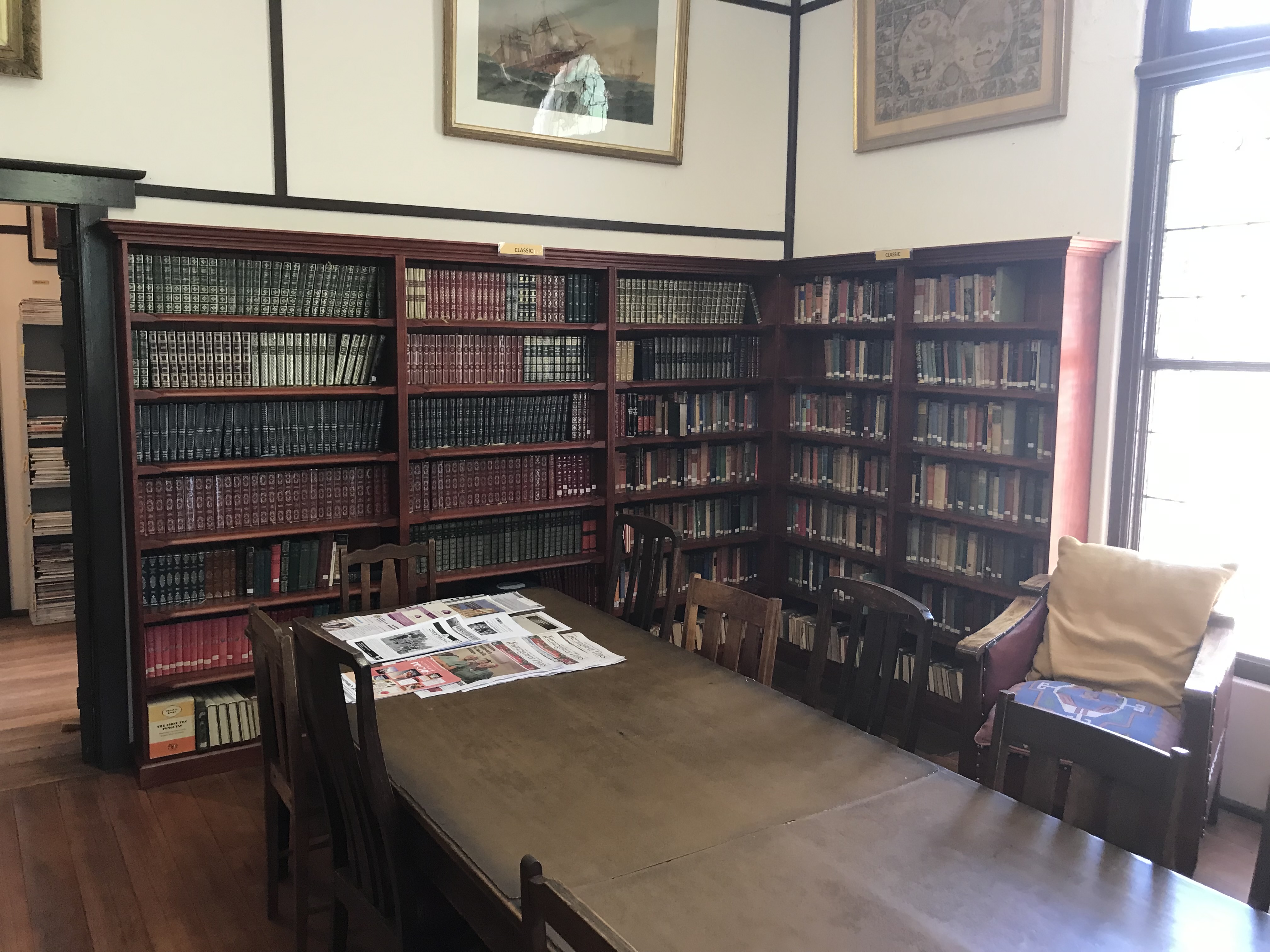
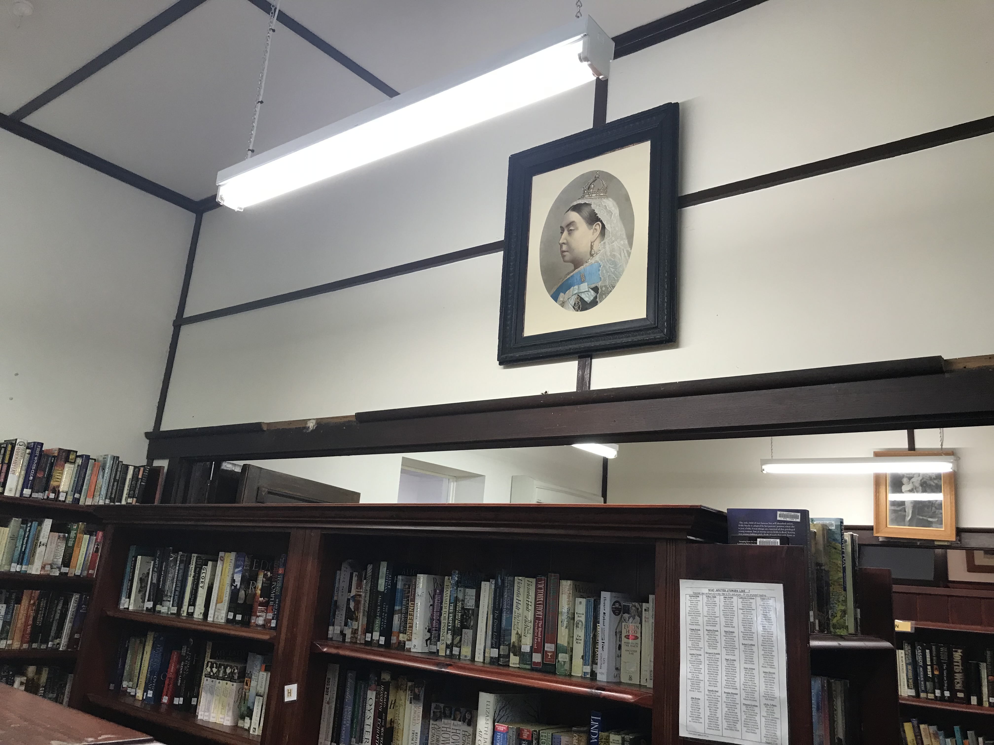
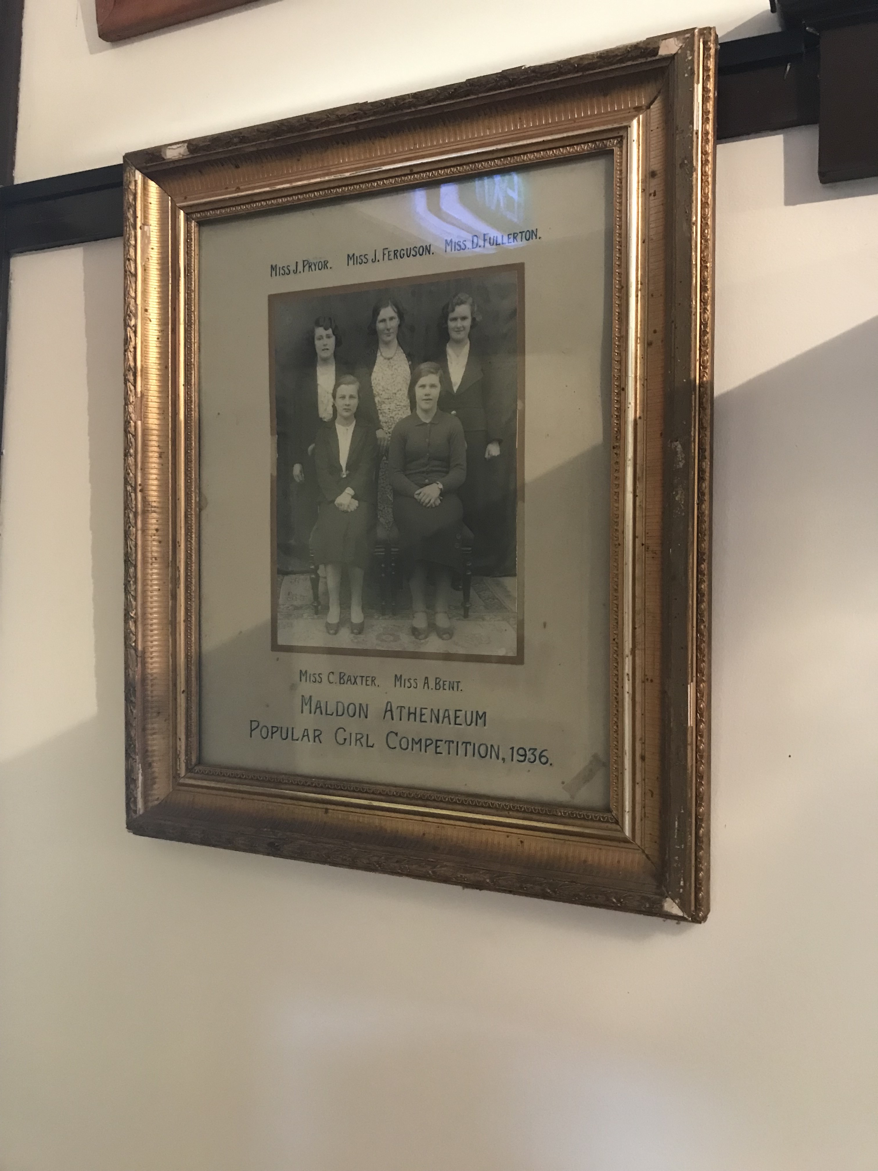
After lunch I go straight back to the Maldon Athenaeum Library and it’s open.
It was opened in 1863. The original wooden building burnt down in early 1900s with all records lost along with, apparently, the stuffed albatross in the window. The building dates to the 1930s and it is still community owned and run. It’s one of only eight mechanics’ institutes in Victorian which still have lending libraries (I work for one of the others). The Athenaeum is volunteer run and it’s a fascinating little building and collection. I hope the below photos give a good overview.
So Athenaeum explored I wander back to the main street via one more church and some hotels.
The Wesleyan Church and Parsonage which you can see above dates to 1863, it is the earliest church building still intact in Maldon. The brick chapel behind was probably the first building used as a church in Maldon. There is also a spring on the site and the stories say the minister threatened legal action against anyone who was caught removing more than one bucket of water. The building has been beautifully converted to The Cascade Art Gallery.
After the church I make my way past a couple of hotels.
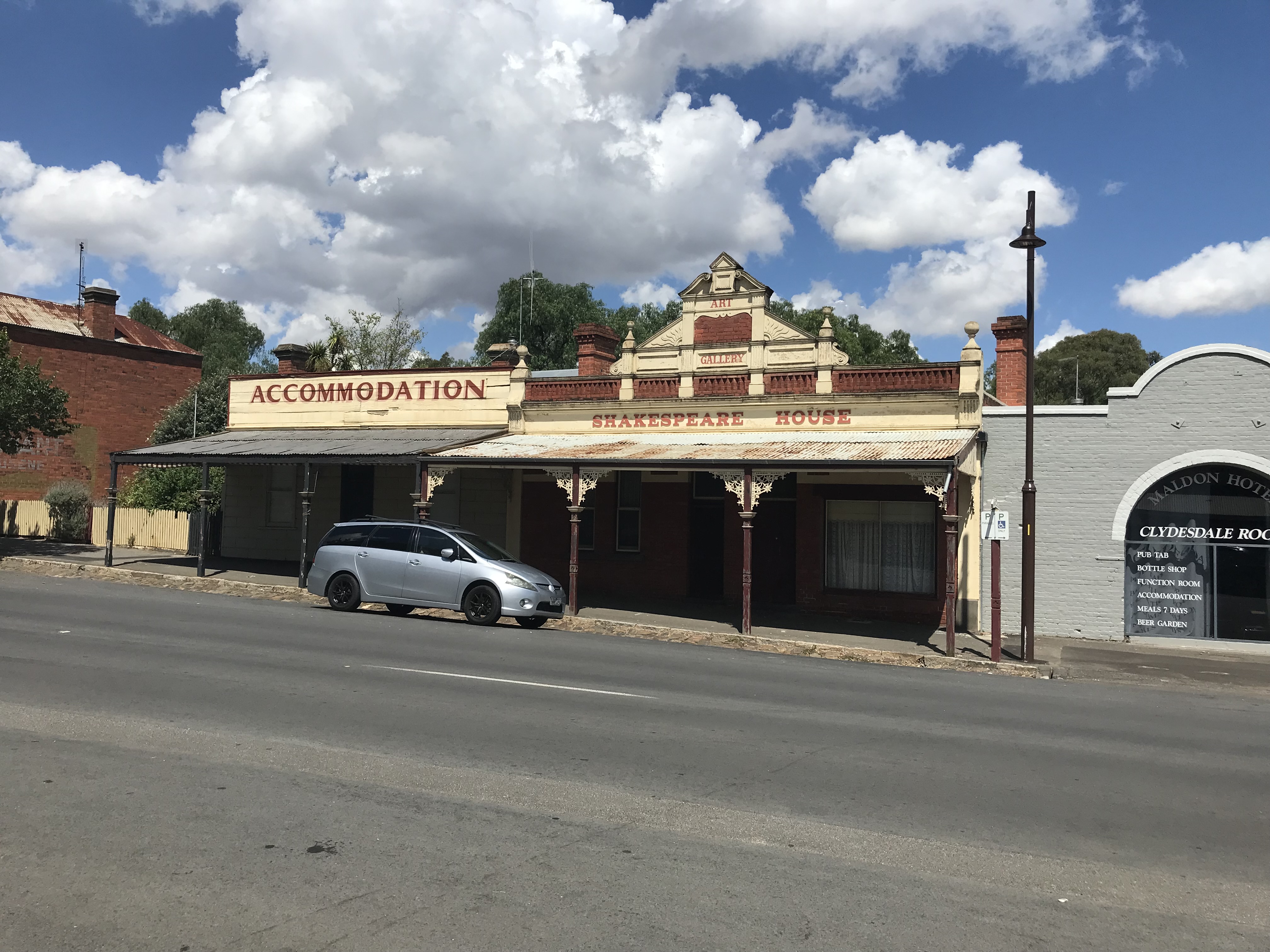
Maldon Hotel opened in 1908 by Thomas Butler. Its site was originally a creek bed, but after severe flooding in the 1860s a drain was erected.
Another casualty of the creek bed was Shakespeare House, after the original wooden building was flooded the drain was built. It was delicensed as a hotel in 1910. It remains intact to the period.
At the end of the main street I head up to the Beehive Mine which I shoot my opening video from.
The chimney is 30 metres high and was built in 1863. The mine itself opened in 1859 and operated until 1911. You can see the remains of the building foundations in the second photo.
After a quick wander around the mine I make my way back to my car and drive out to the railway station.
The station opened in 1884 and was closed to passengers in 1941. It now runs as a short tourist heritage railway.
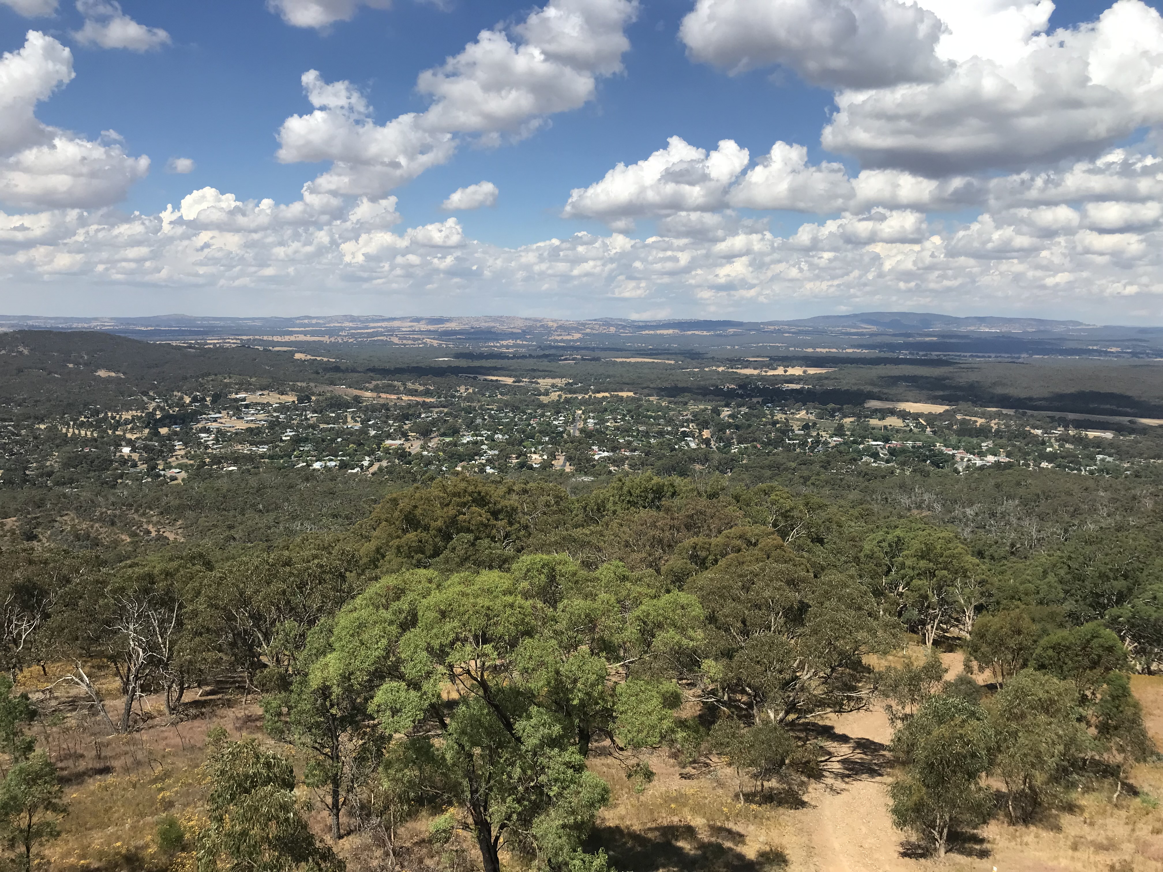
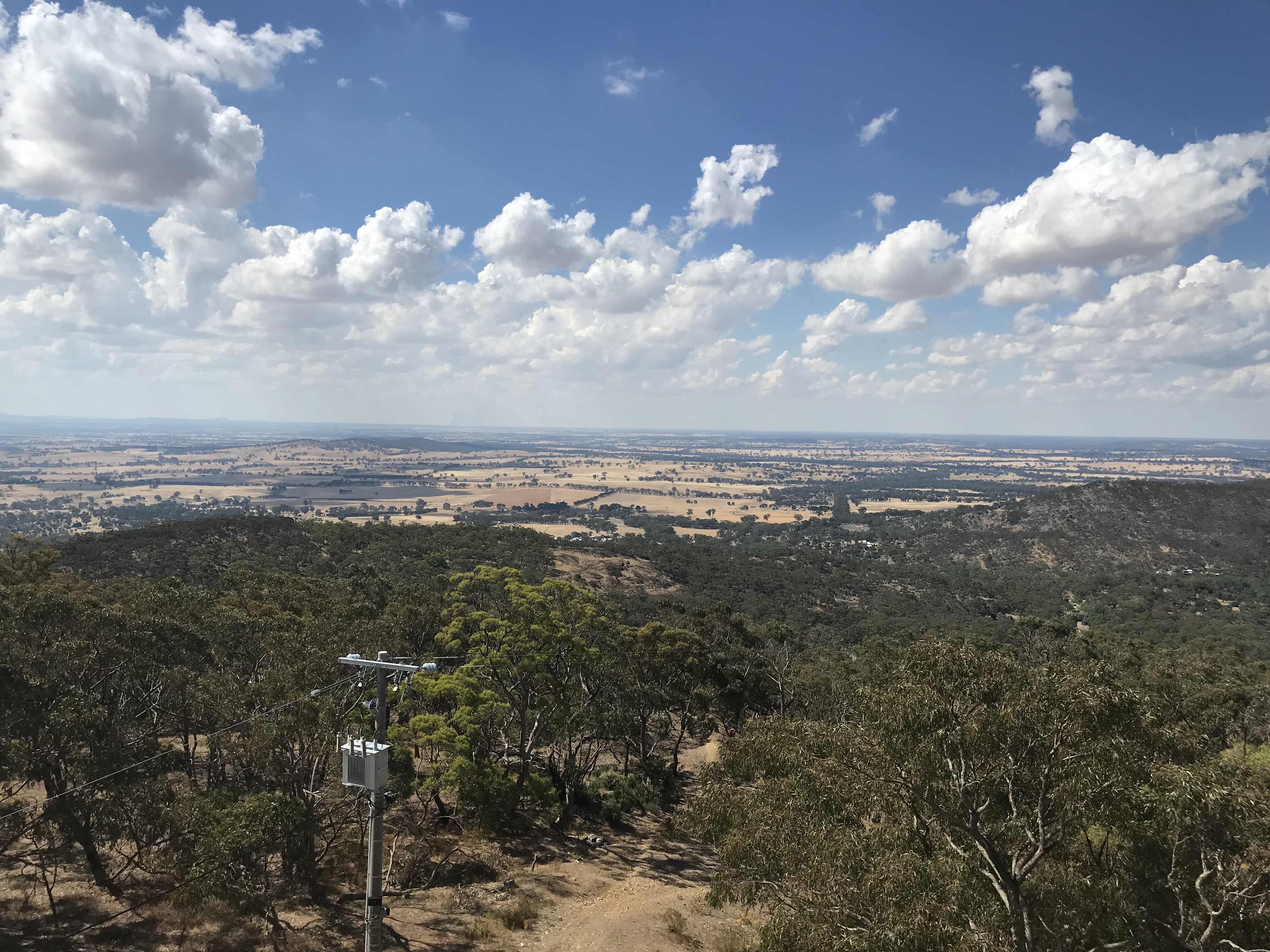
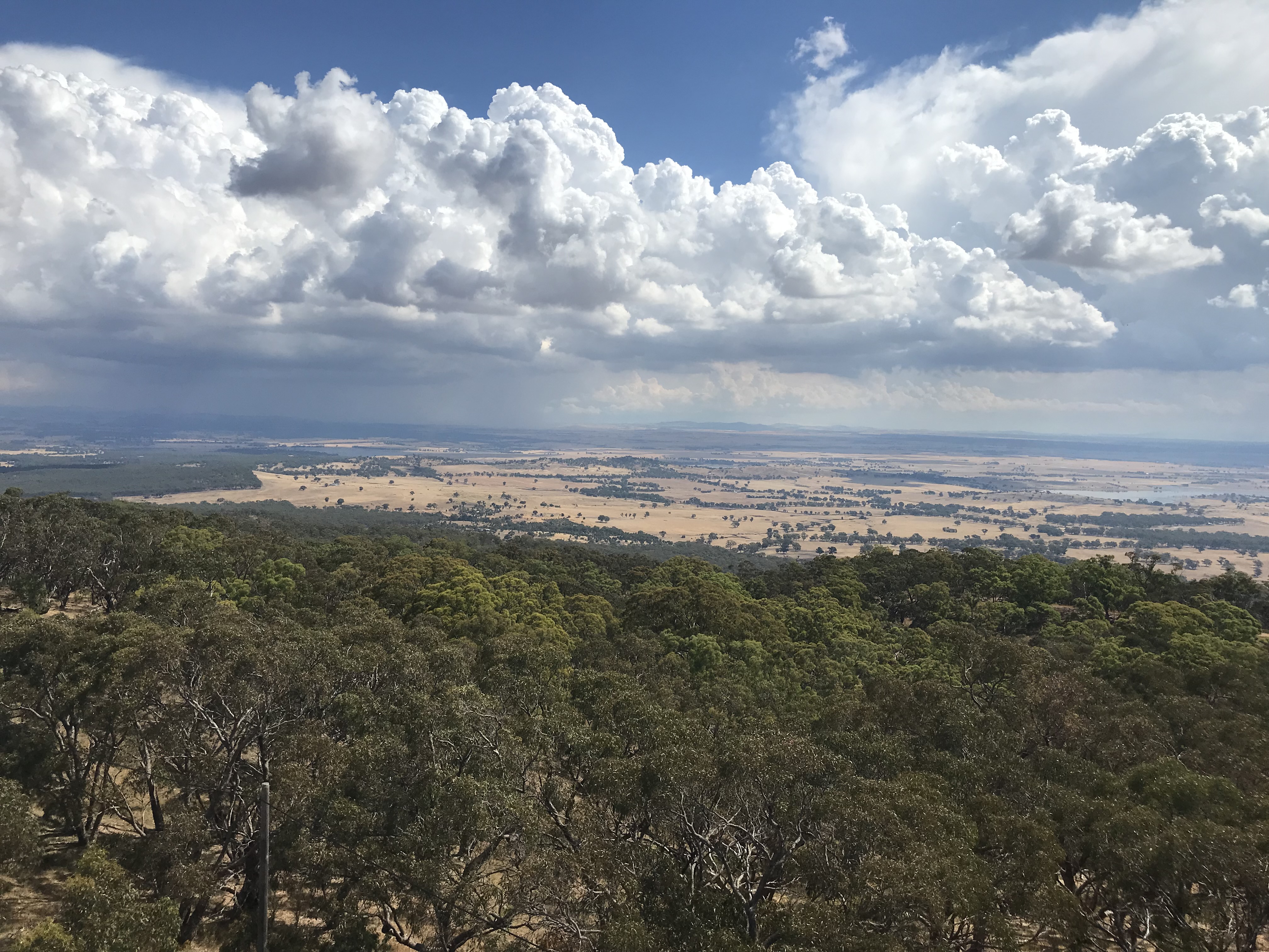
Now I have my car I head for my final stop in my wanderings, the tower at the top of Mount Tarrengower. Part of the tower is an original mine poppet head and it is still used as a fire watching tower today. It has been lit up every Easter since 1926. This was originally done with kerosene lamps but now electric lights are used. Local children grow up with the legend that the tower is the Easter Bunny’s house. The top of Mount Tarrengower is also roughly the centre of Victoria (there is a survey post I just couldn’t find it). The view from the top is incredible.
After admiring the view I head for home and the storm you can see in the last photo hits me on the way back. It’s been a fascinating day and I hope you have enjoyed wandering with me.
This post doesn’t cover every heritage building in Maldon by any stretch of the imagination. I recommend a visit and I intend to go back. Contact the Maldon Museum if you would like further information.
Bunyip is a small town in Victoria about 84km from Melbourne. The name comes from a creature of aboriginal myth. A bunyip like creature was said to live beneath the waters of the swampland below Bunyip and prey on humans who ventured into the water after nightfall. The area that Bunyip now stands on is the land of the Bunurong people of the Kulin nation and it was very much inhabited when Europeans settled there and claimed it.
When the Europeans arrived they changed the surrounding land, including draining the swamp. While the area was surveyed and the name first used in the 1850s it wasn’t until the 1860s that the present iteration of the town was surveyed and established. The railway arrived in 1877, it remains today.
View down the hill at Bunyip.
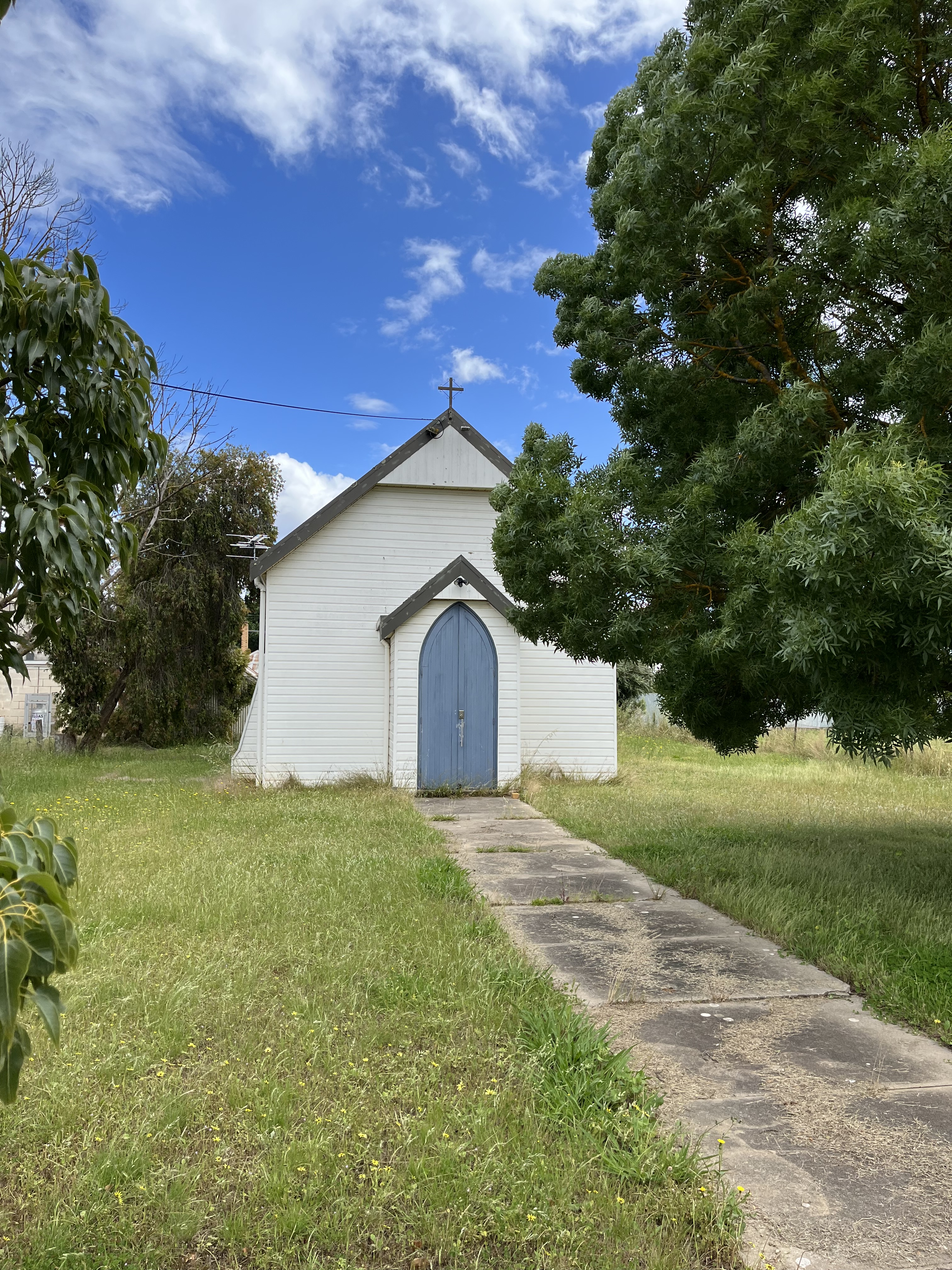
This is the first of an ongoing series of posts I’m going to do on rural buildings, churches, halls etc in Australia.
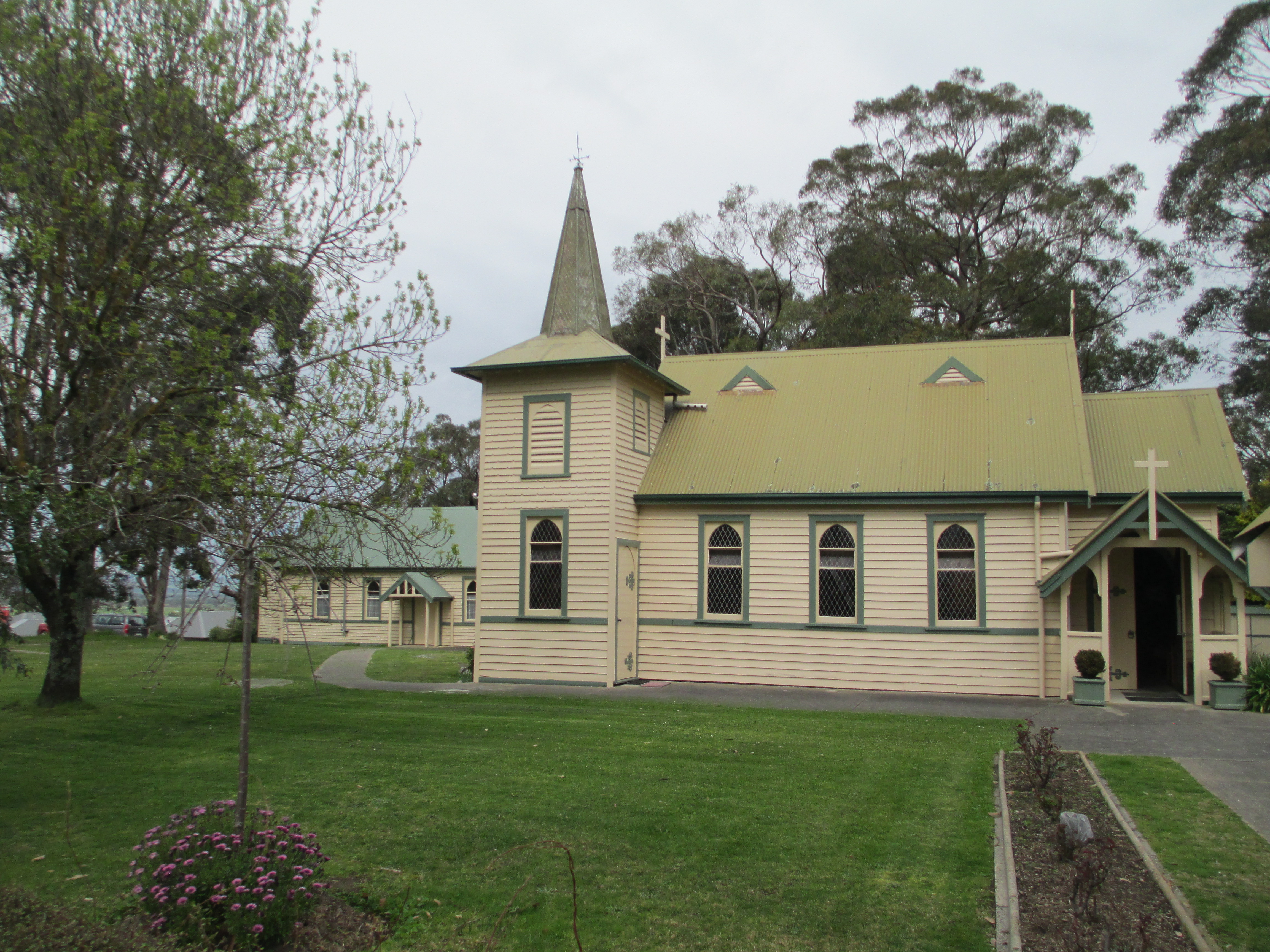
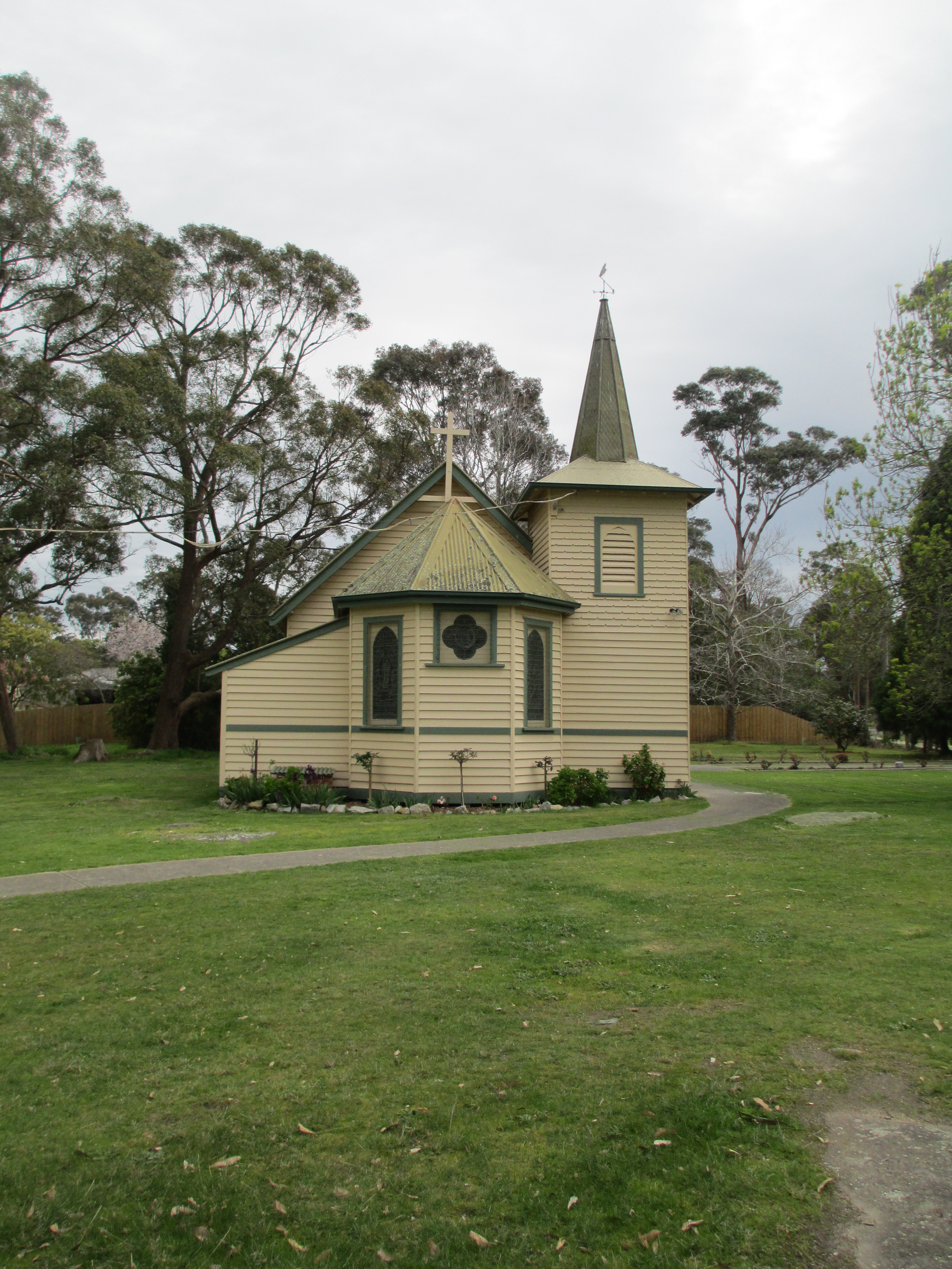
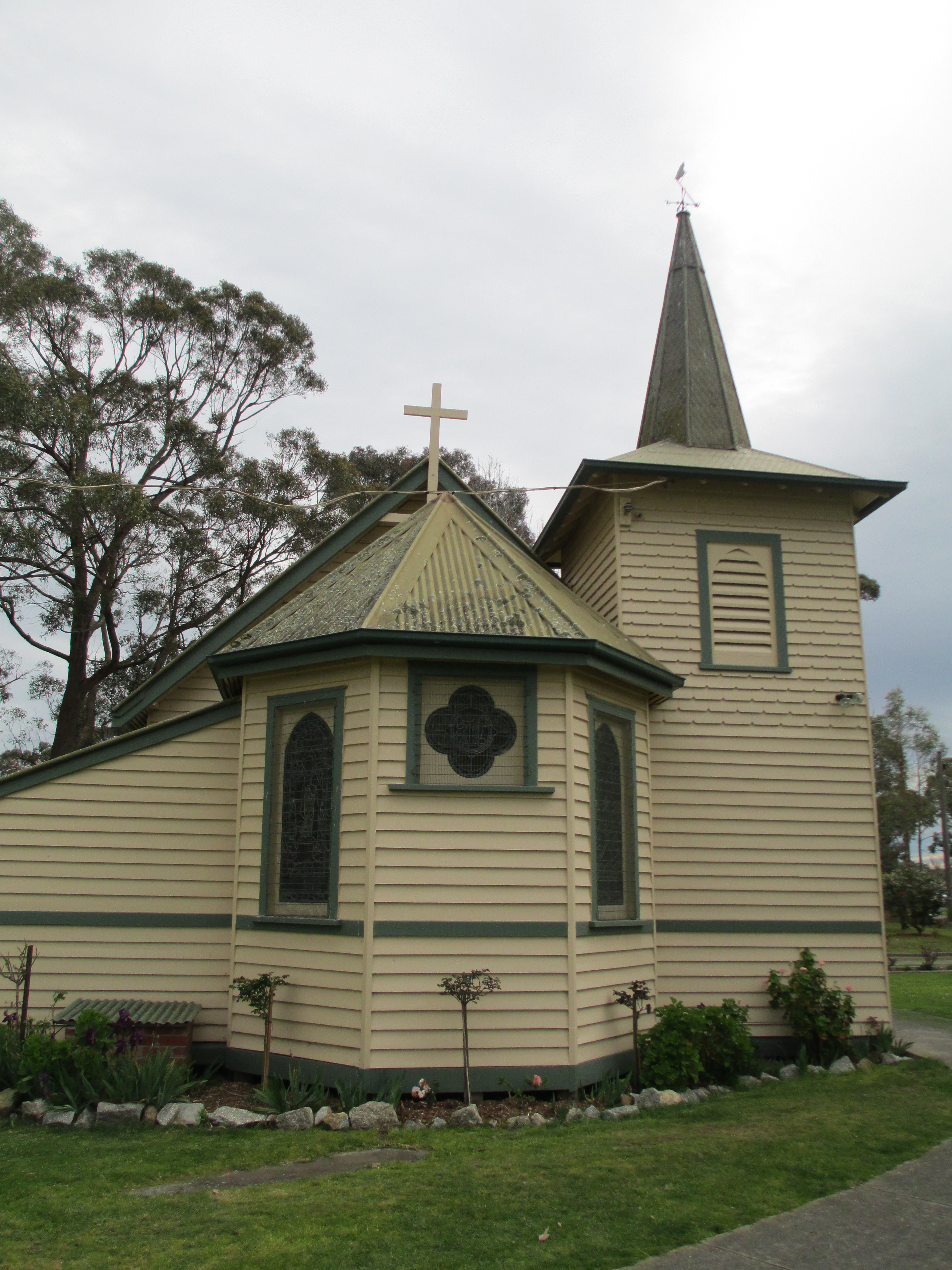
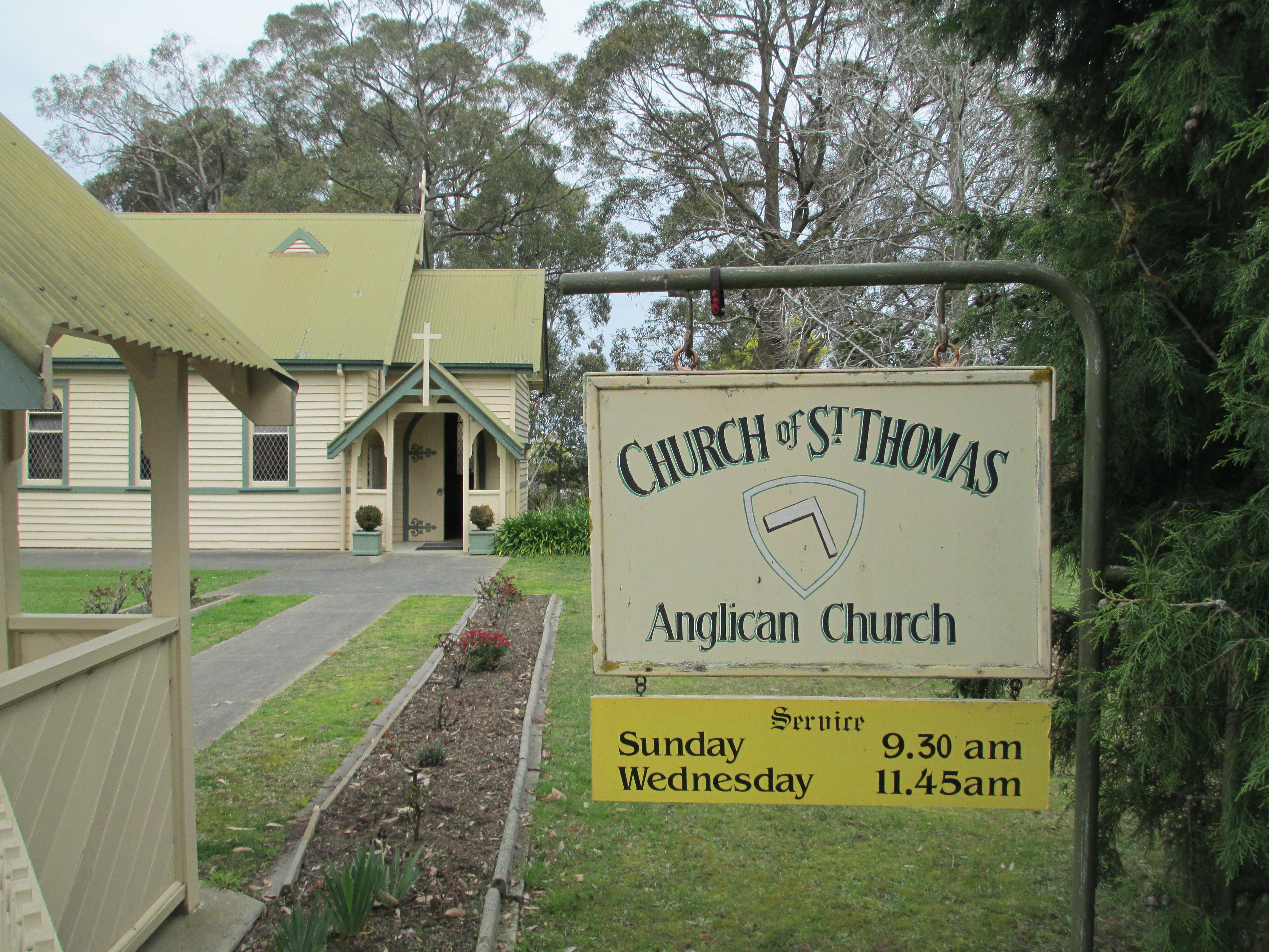
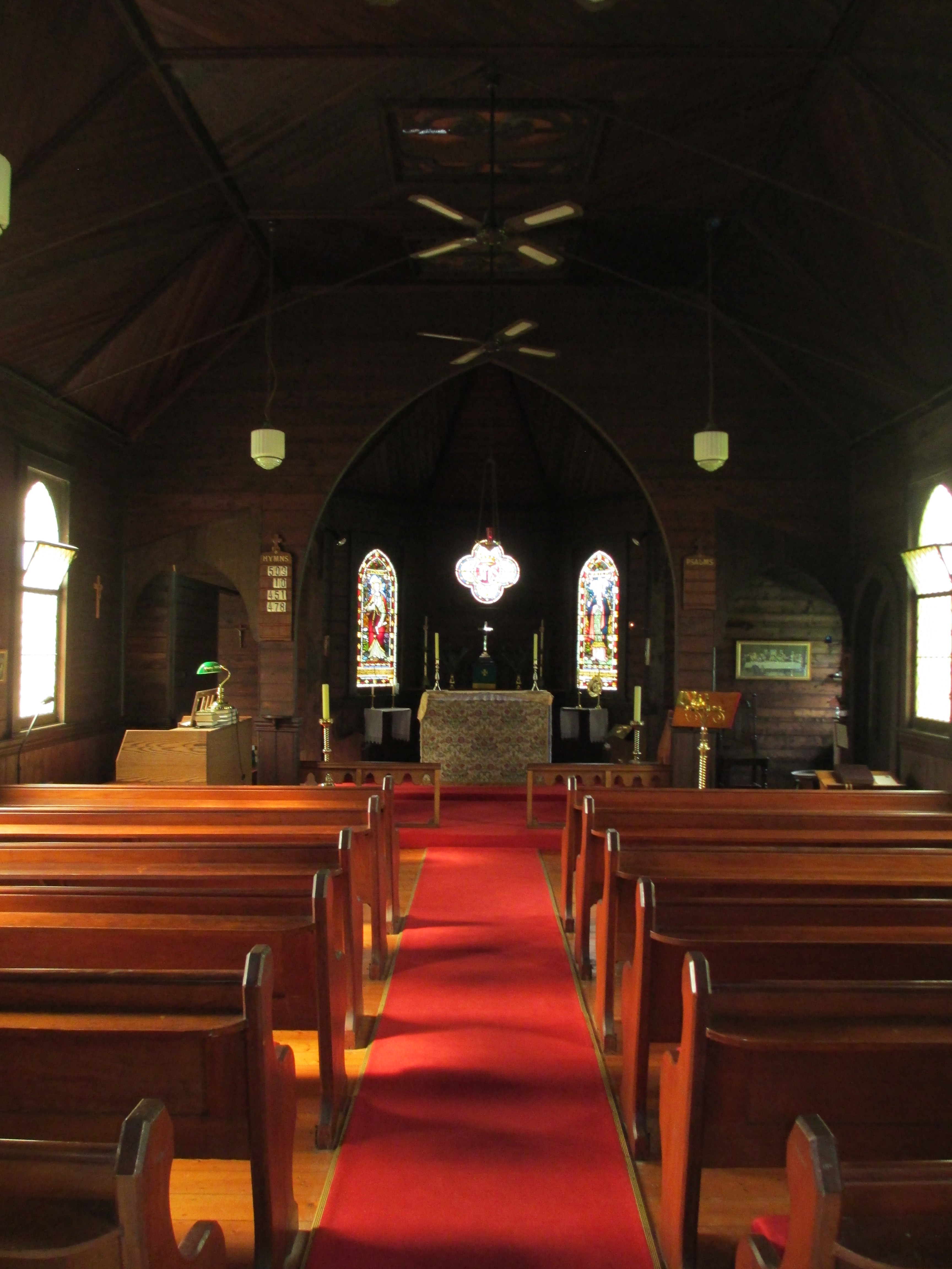
The foundation of St Thomas’ Church was laid in 1902
St Thomas’ is a Church of England church and an excellent example of a turn of the century Arts and Crafts church. It’s built of weatherboard and was designed by Frederick Klingender and has remained in near original condition.
The total cost of the building was over 377 pounds and when it was opened by Rev Bishop Pain on the 29th of December 1902 approximately 400 people attended the service and 14 baptisms were registered.
Alterations to the church were needed in 1919 because of white ant damage and an entrance gate to the church ground was erected in 1943. The lych gate you can see in the photos below was erected much more recently and is modelled on the original church porch.
The Sunday School building was erected in 1906 to meet the increasing demand of pupils attending.
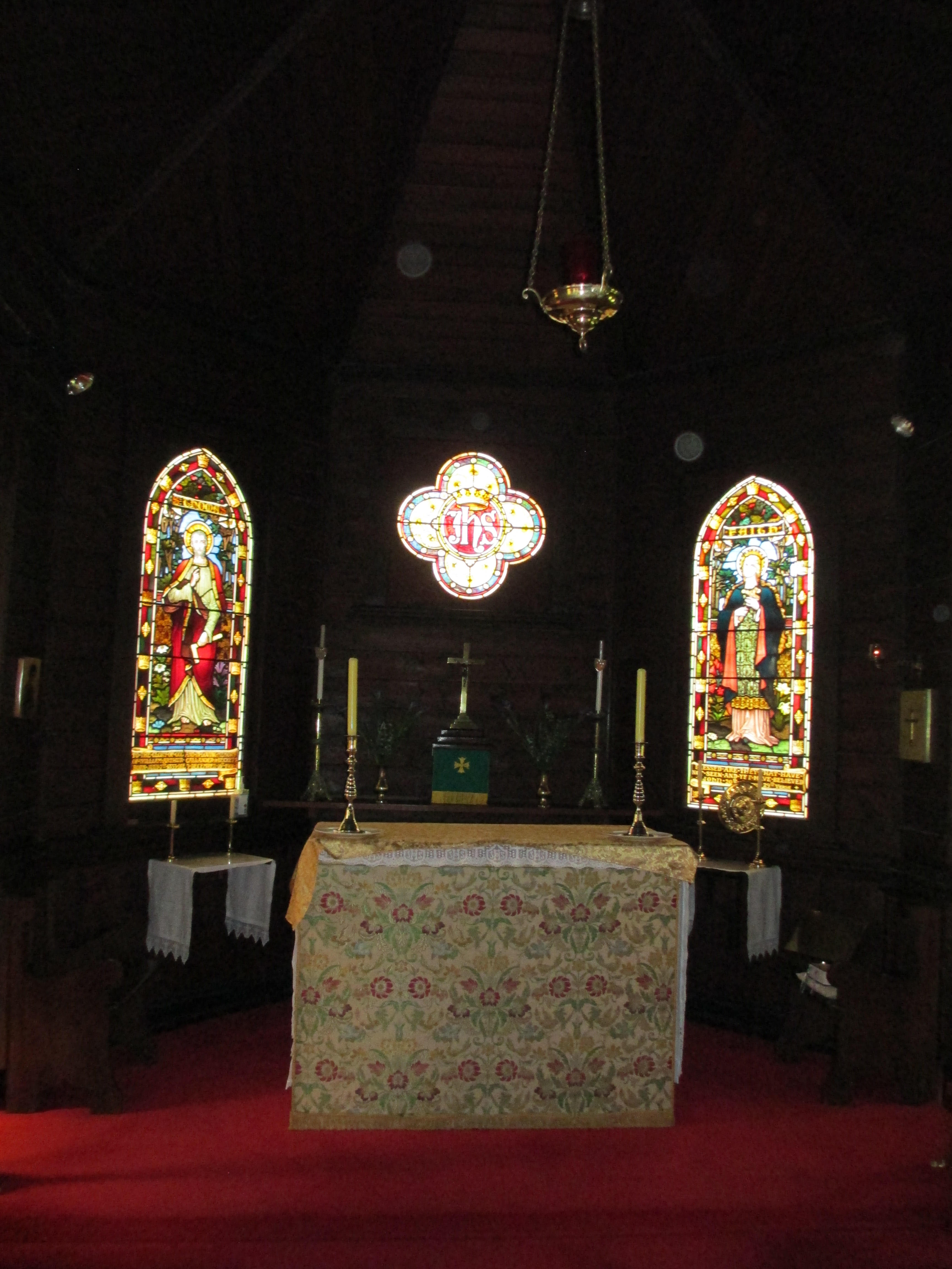
The interior of the church continues the Arts and Crafts style, and is augmented by a number of lovely stain glass windows.
The stain glass window dedicated to St Thomas also carried a dedication for the A’Beckett family on its base
The A’Becketts were a prominent district family and the font is also dedicated to one of their number.
St Thomas’ is a beautifully preserved example of a rural Victorian church and is still an important part of life in Bunyip.
Mechanics’ Institutes are something that most people will be vaguely familiar with. They’ll have some idea of halls in country towns, possibly something to do with cars? But the concept of Mechanics’ Institutes is much more than this. This post is not intended to be an exhaustive history of Mechanics’ Institutes, but rather an introduction to the concept and the ideals, a little of their origin and a brief run through some examples of Mechanics’ Institutes that still exist today in Victoria, Australia.
To begin with, the term mechanics in this case has nothing to do with cars. In the sense that it was used in the early 1800s it simply meant ‘worker’. Sort of the equivalent of blue collar workers today. The basic concept of a Mechanics’ Institute is usually a member owned and run group, set up by the community that provides self educational opportunities. These opportunities were normally through lectures, entertainments and often through the provision of a lending library. These were institutions that were run for members, providing free, or largely free, educational opportunities at a time when formal education was for the wealthy and the clergy. The lectures were usually run in the evenings to allow workers to attend. These were not government run institutions, they were started by local communities and had no centralised control, which makes their prevalence and ongoing existence even more remarkable.
The first Mechanics’ Institute was begun in Glasgow in c.1800 with Dr George Birkbeck of the Andersonian Institute in Scotland when he gave a series of lectures to local workers. The lectures proved to be very popular and the Edinburgh School of Arts was formed in 1821 and the London Mechanics’ Institute in 1823.
The movement spread quickly to Britain’s colonies and they were extremely prevalent in Australia, which is where I’m going to be focusing. The first Mechanics’ Institute in Australia formed in Hobart 1827, but it wasn’t long before they reached Victoria. It is worth pausing here to note that these institutions weren’t always known as Mechanics’ Institutes. They usually were in Victoria, but in New South Wales School of Arts is the more common name. They have many other names though, from Athenaeum through to Temperance hall, through to Agricultural Institute. They all held to the same principle of the provision of opportunities for self education.
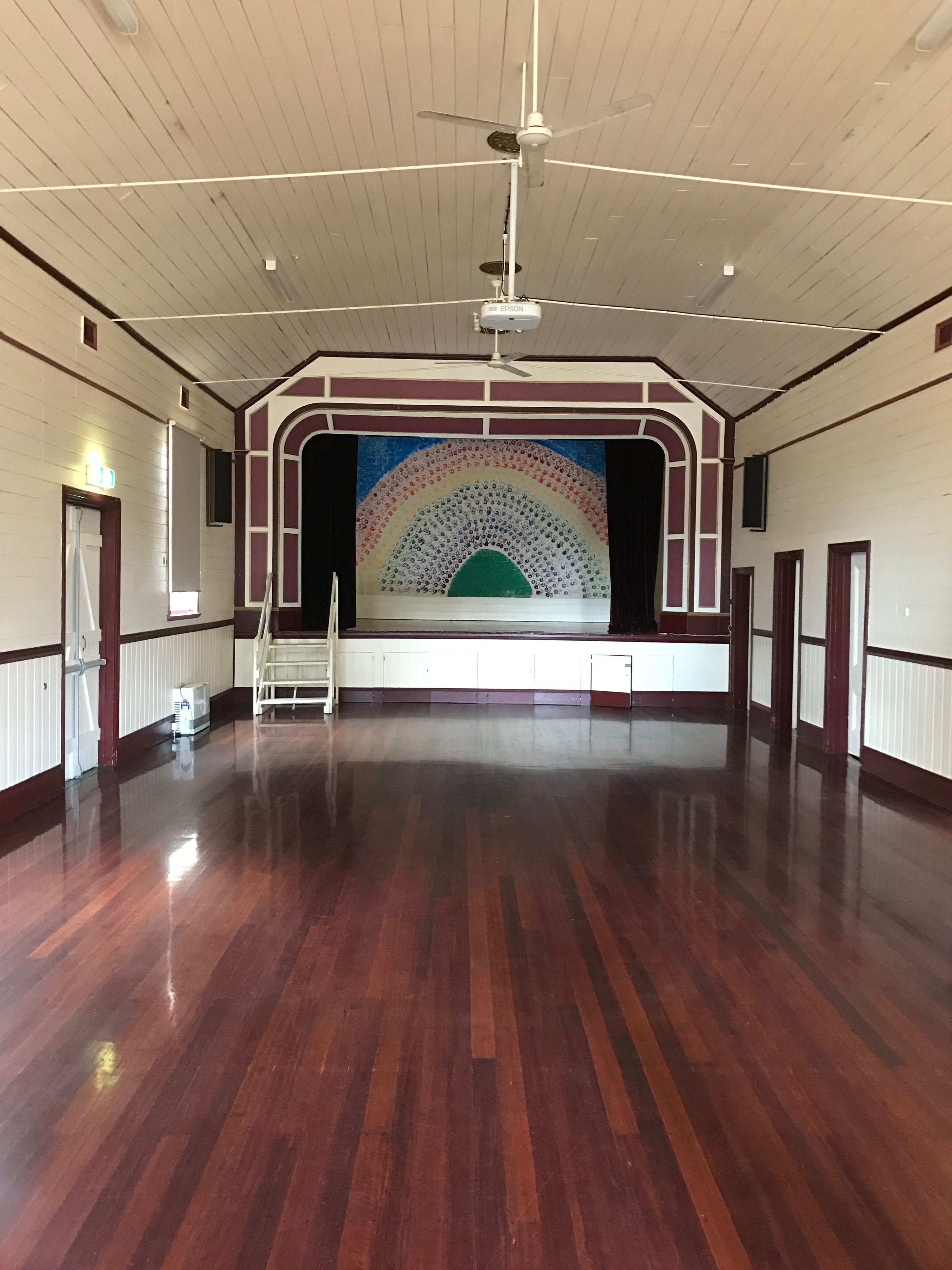
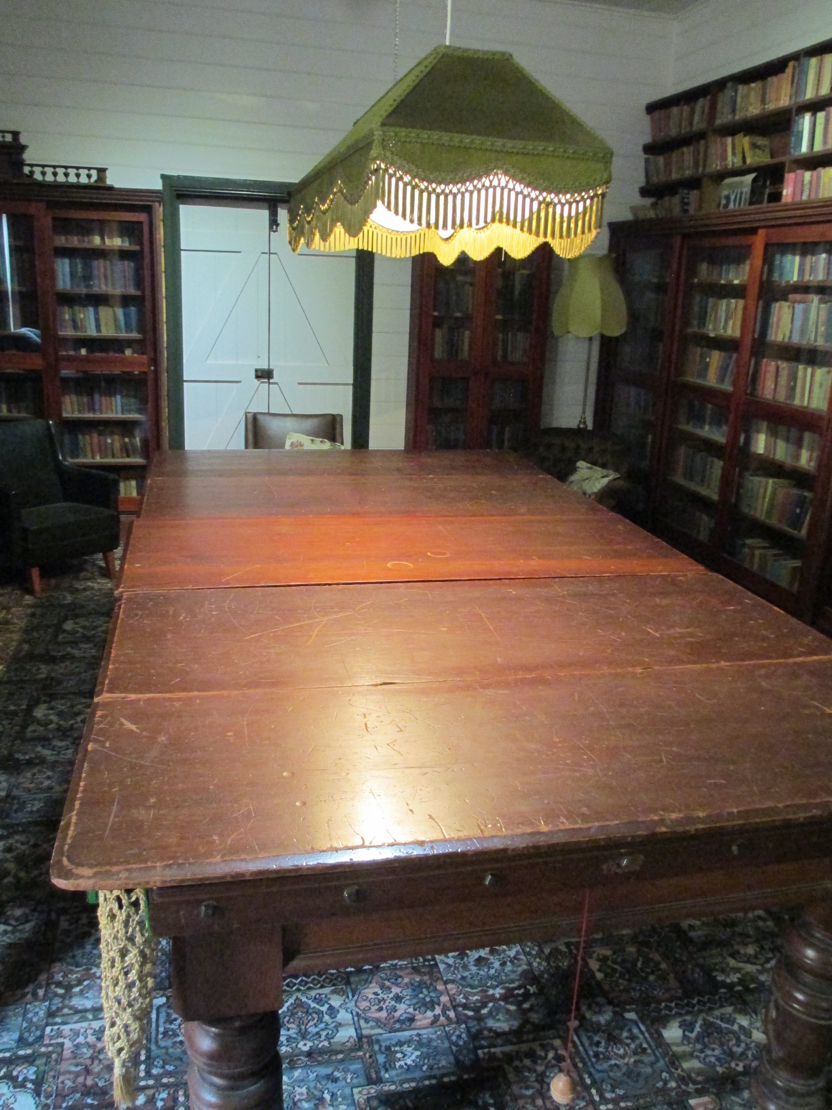
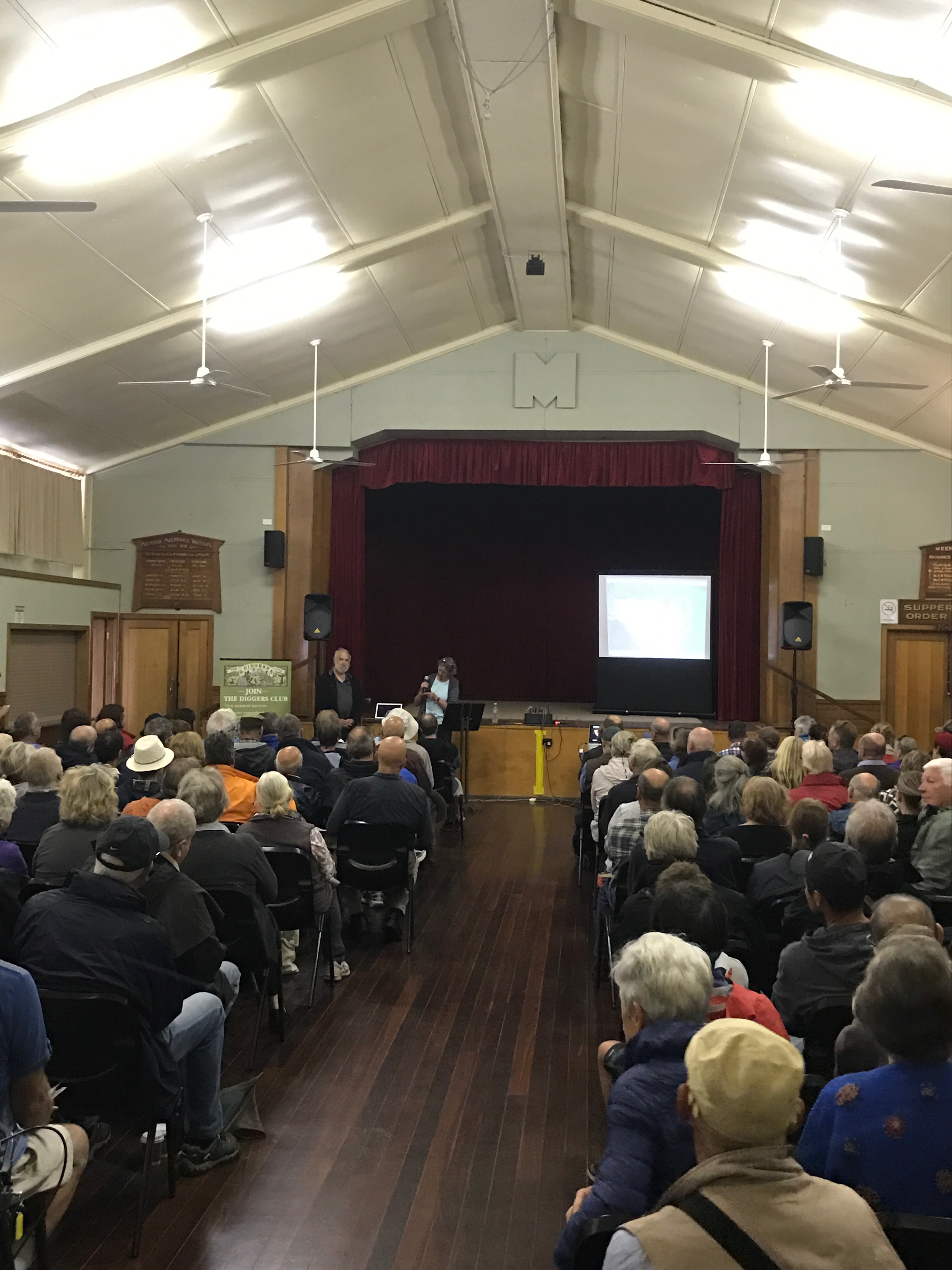
The first Mechanics’ Institute in Victoria Australia was the Melbourne Mechanics’ Institute, which was founded in 1839 and is now known as the Melbourne Athenaeum (the name was changed in 1872). Ultimately there were over 1000 Mechanics’ Institutes in Victoria at their peak, which is truly remarkable given that there was not a centralised organisation setting them up, though many did receive government funding. Most of these were in country towns and most held: a hall, a library, reading rooms, facilities for games and programs for educational activities. More than 500 remain physically, with the halls used by the local community. There are only a handful though that continue to operate as Mechanics’ Institutes. 12 are still operating from their original buildings, 10 have their original library collections, and four others exist on other sites with their collections. Roughly 6 are still operating as a lending library service. There is even one that is still incorporated with its own act of parliament.
With this number of Mechanics’ Institutes there is no way I am going to cover them all, but I have visited quite a few and I thought I’d go through and provide a few photos and a bit of history on each of them. I am using the remarkable book These Walls Speak Volumes for the majority of the history for these sites, so if you want to know more get your hands on a copy. It covers all the Mechanics’ Institutes in Victoria. The below list is alphabetical and is only based on Institutes I have been to and have photos of.
Ballan Mechanics Institute.
Ballan Mechanics’ Institute. The institute was established in 1860, though the current building dates to 1887. The ‘new’ building was erected in 1887 because the previous 1860 site was not central enough. In 1894 the Mechanics’ Institute had 1680 books. The building was fully renovated in 1922. Today the building is used as the local council library as well as being used by many community groups.
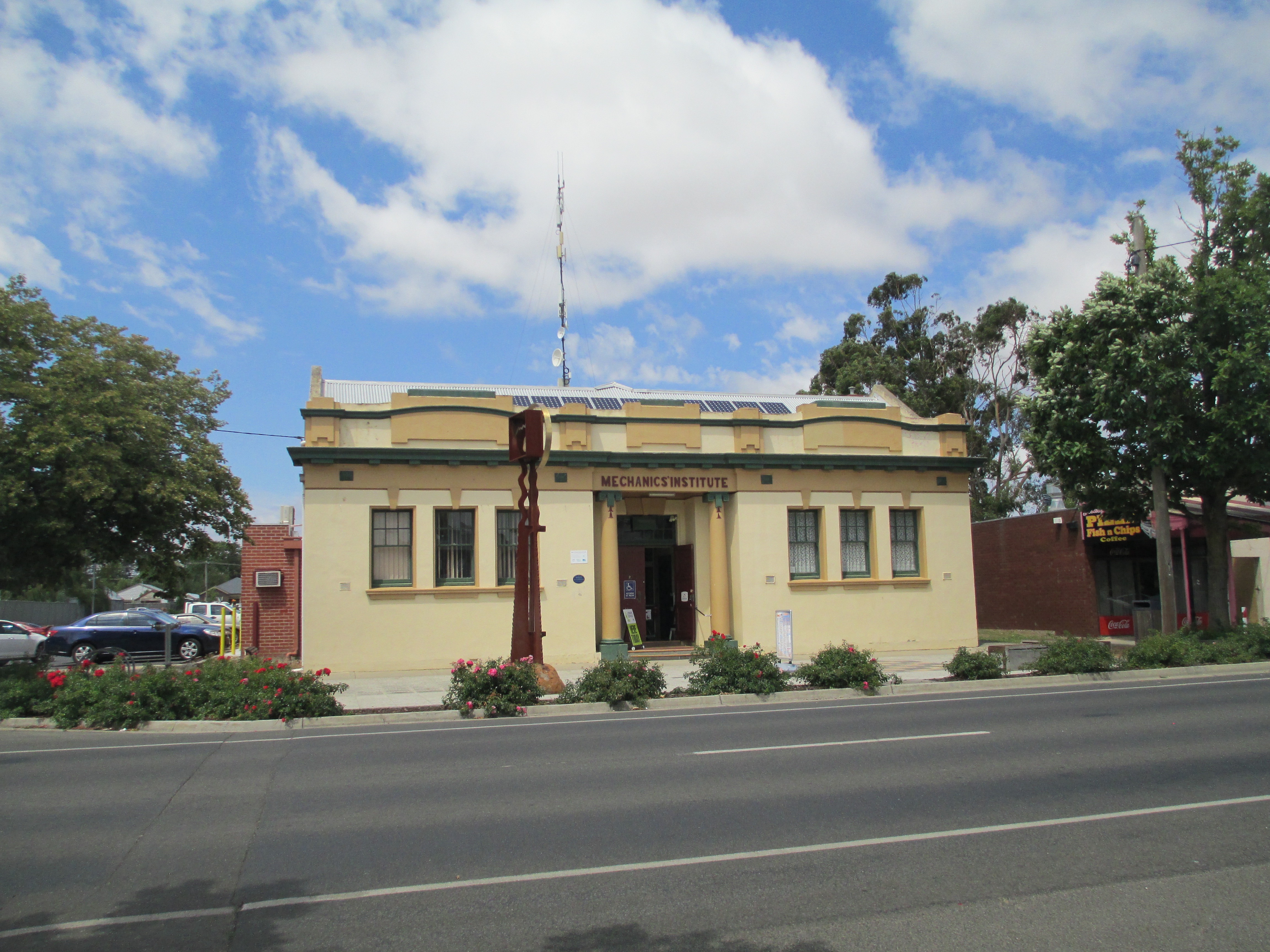
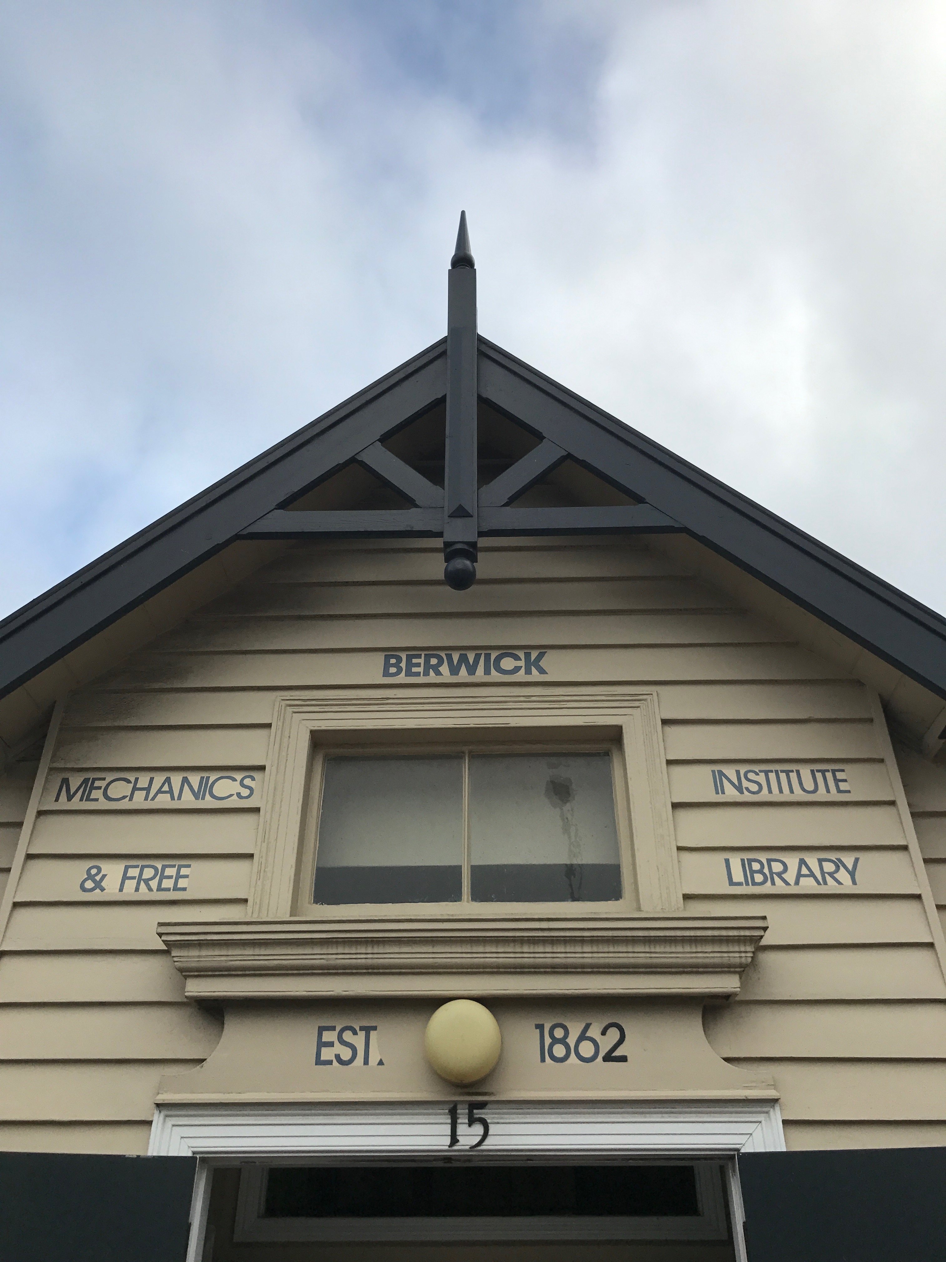
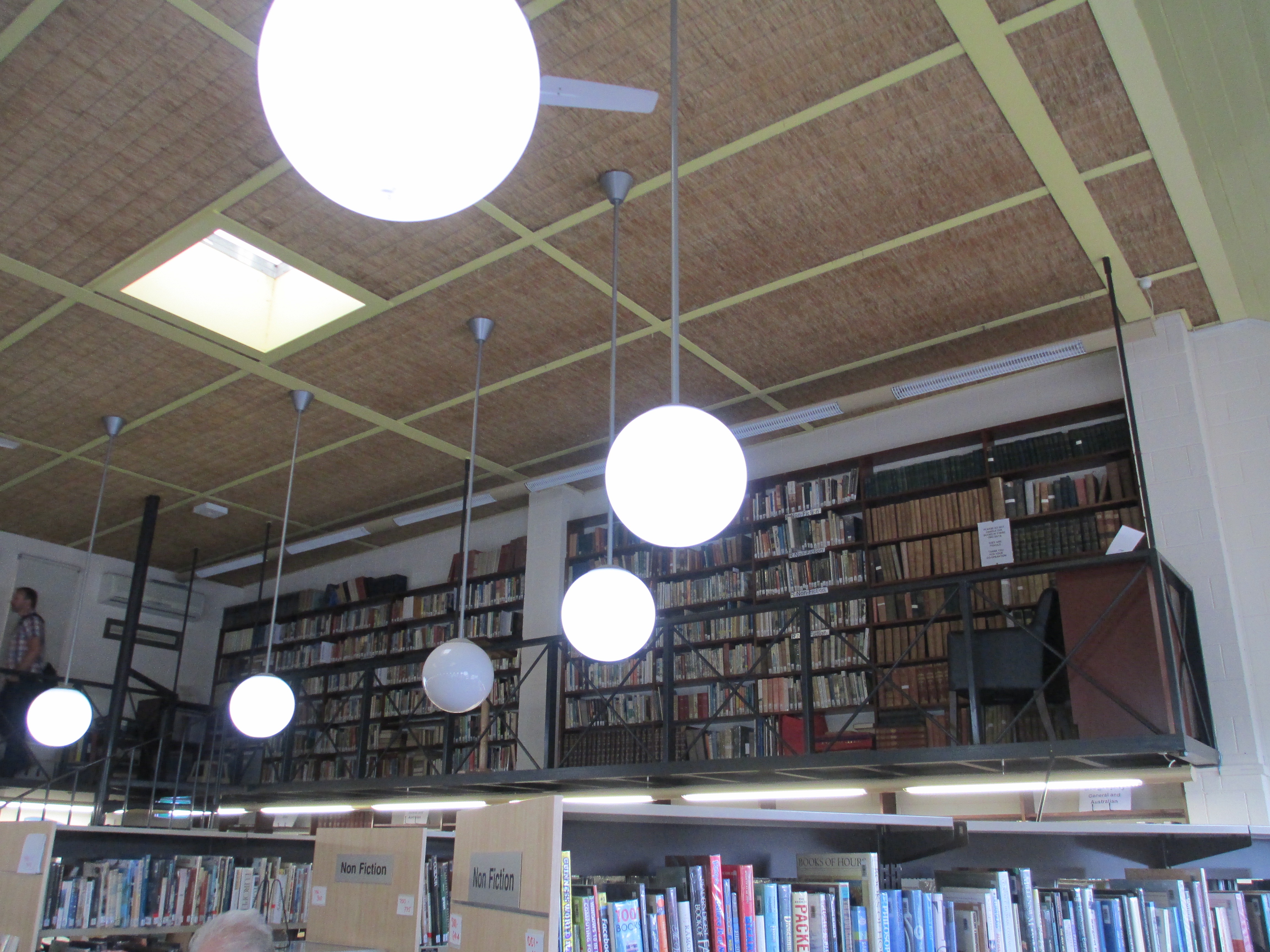
Berwick Mechanics’ Institute and Free Library.
Berwick Mechanics’ Institute and Free Library was founded in 1862, though the current building dates to the 1980s. Berwick didn’t have a substantial hall the way other Mechanics’ Institutes did, but they still hosted events. After the early 1900s the focus shifted to the library, a function it maintains to this day. In the 1980s Lady Casey provided funding for the construction of the new building which was completed in 1982 and the pre existing 500 year lease was extended. Berwick holds the private library of Lord and Lady Casey as well as some of their art and an extensive general collection. It operates as a public library. You can search their collection here.
Briagolong Mechanics’ Institute Hall.
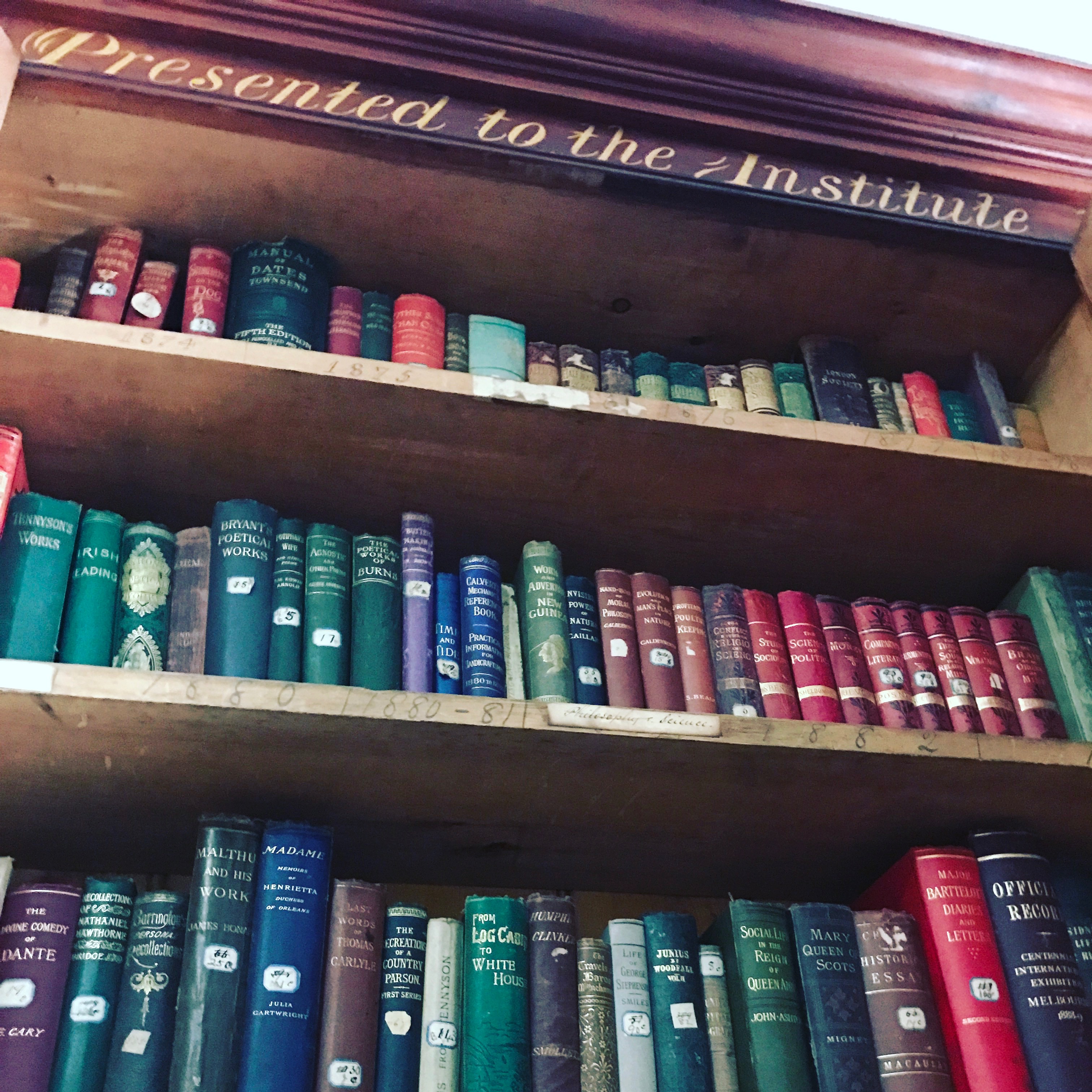
Briagolong Mechanics’ Institute Hall was established in 1874 and still stands in its original building. The hall was the first part built with the reading room and kitchen added in 1879, the third addition, including the stage, was opened in 1887. There were further additions as time went on including a 1999 addition which houses the Briagolong Community House. The library ran from 1874 for 90 years. The fact that a significant part of the original library collection survives intact is because the doors to the library were locked for some time and the books just left in there. You can see some of the remaining collection, which is housed in what was for a time the billiard room, in the photos above.
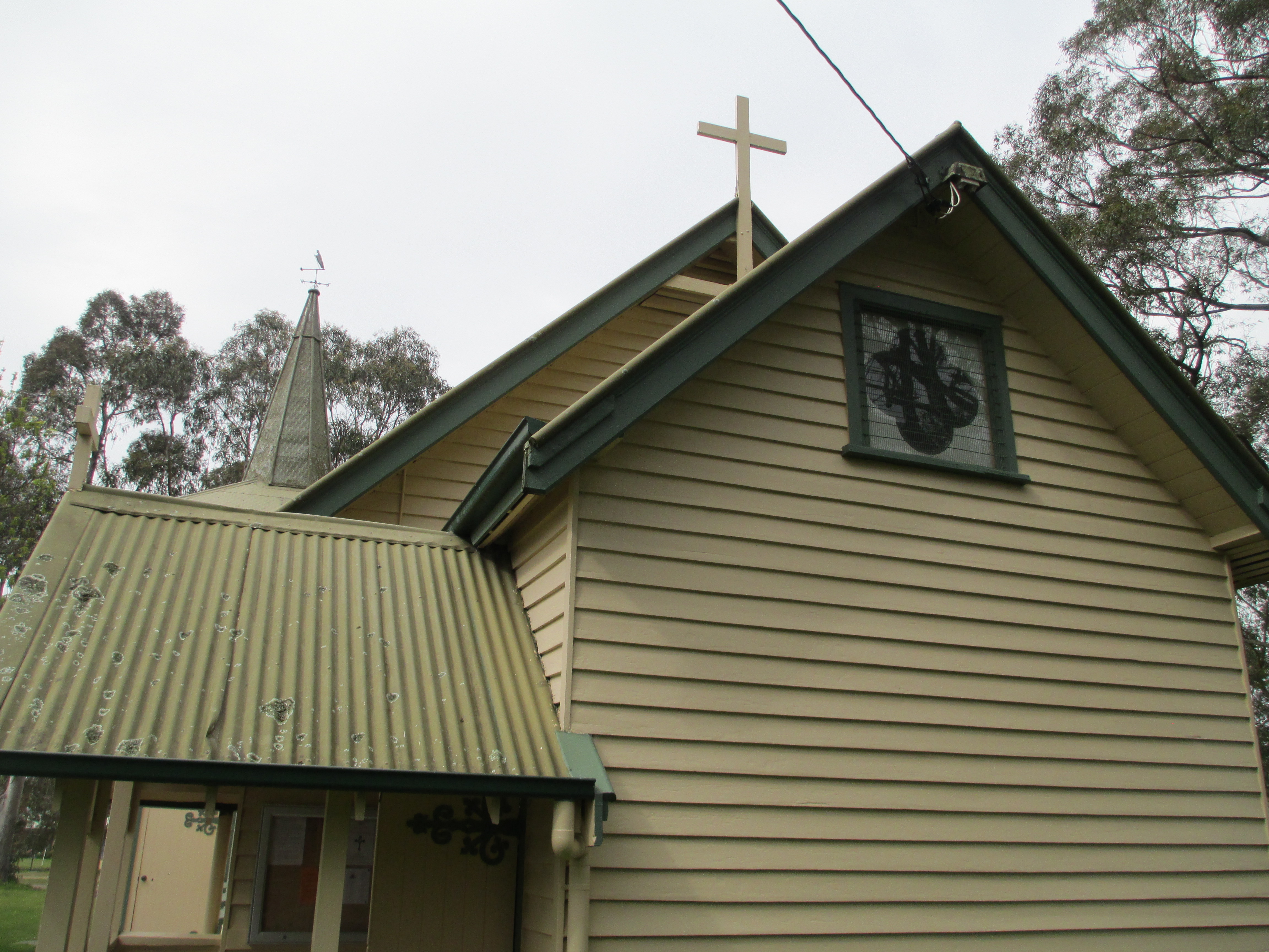
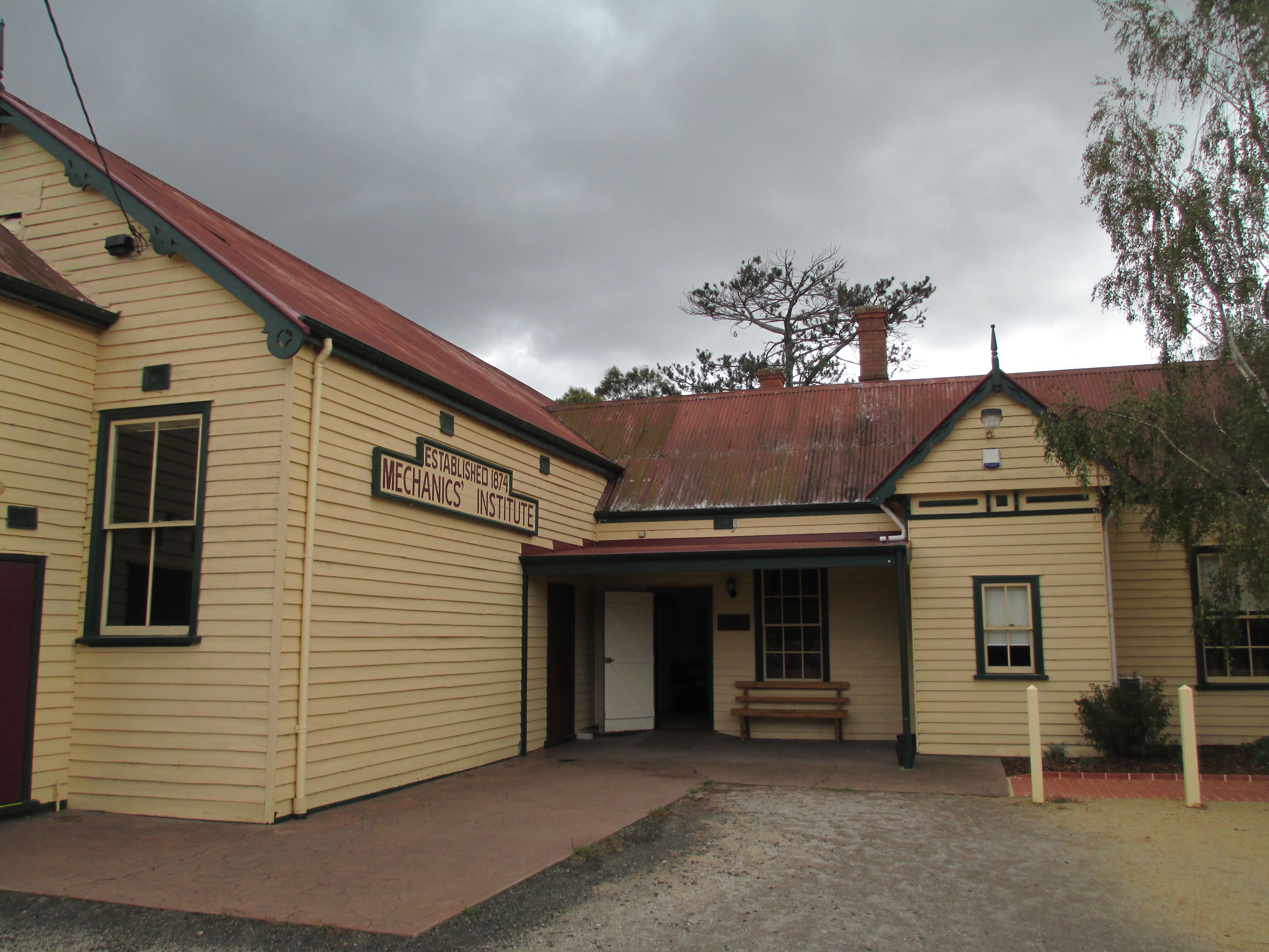
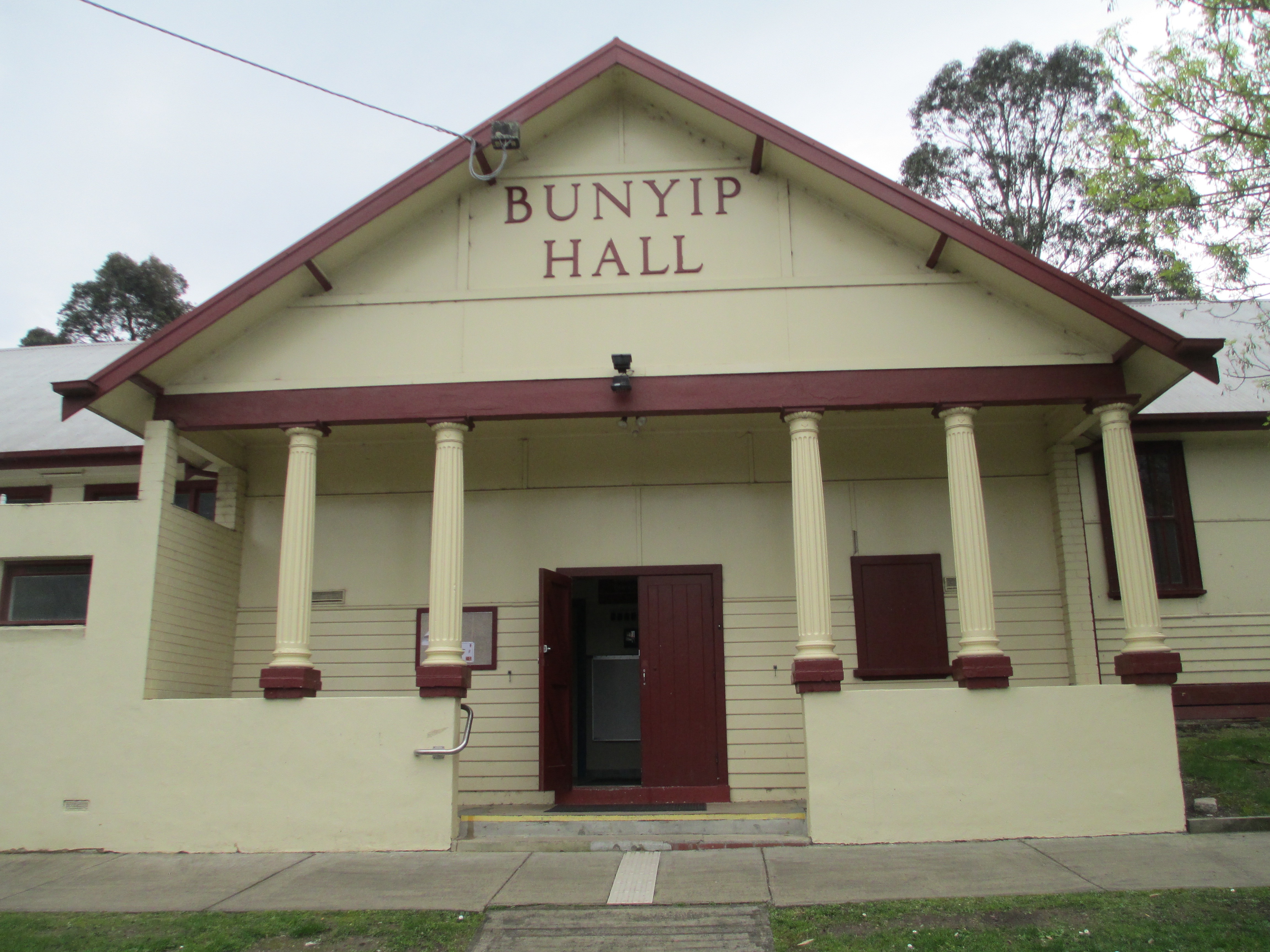
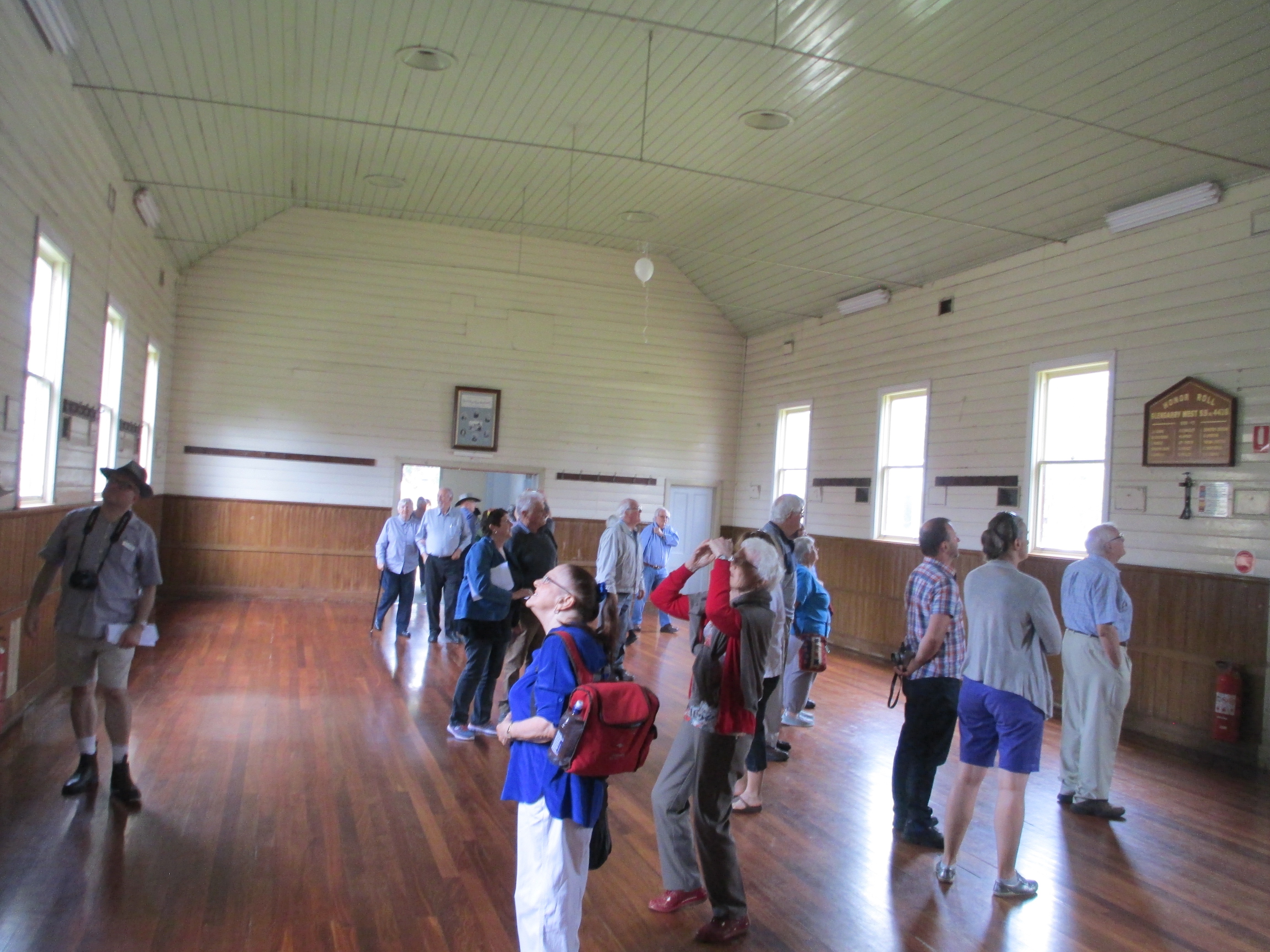
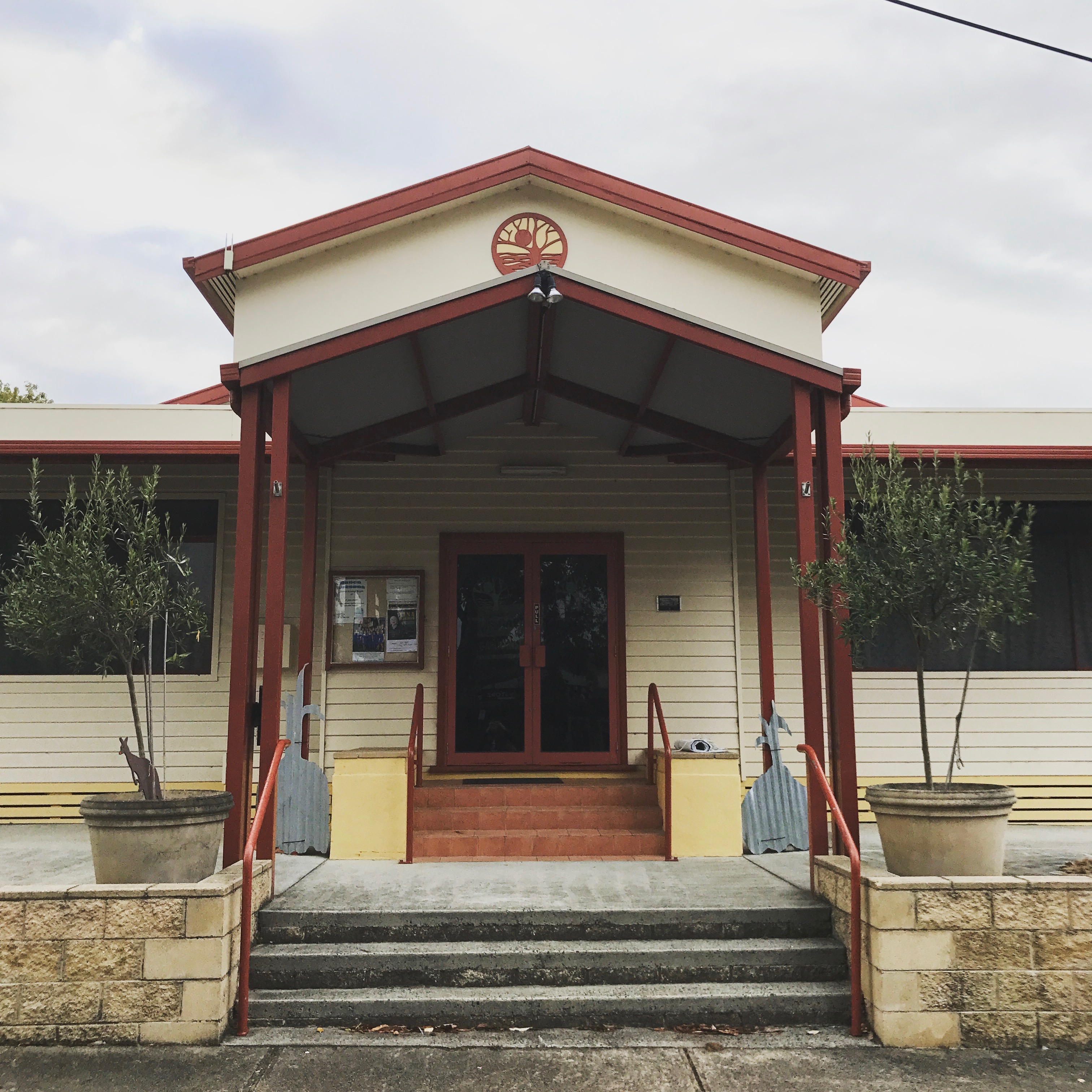
Bunyip Public Hall
The Mechanics’ Institute dates to 1905, but the current building was built in 1942. The hall was used for everything from ANZAC celebrations to rollerskating. The hall burnt down in 1940 but it was rebuilt, as you can see it today, by 1942. The new building is built in greek revival style and is under the ownership of the council. Today it is used for everything from tai chi to playgroups.
Glengarry Mechanics’ Institute
The Institute was established in 1886 and the current building dates to the 1920s. Glengarry began as a library and was much used with hundreds of people visiting the library every year in the 1800s. When the new hall was opened in 1920, it was moved across the road, it was used as a library, a picture theatre, and by many local organisations. The hall had reached a fairly degraded state, on the outside, by 2013 and funding was raised to restore the outside including the hall roof which was in a perilous state. It is still used extensively by the community today.
Longwarry Public Hall
The Longwarry Public hall, formerly Longwarry Mechanics’ Institute and Free Library, was established in 1886, and the first building built in 1889, though the current building dates mainly to the 1950s. Longwarry operated as a free library and lecture hall as well as being the home of the local brass band and health centre in the 1800s and early 1900s. The hall burnt down in the 1950s and the hall you see today was constructed, it was opened in 1953 with additions in the 1960s. In 2009 it was significantly upgraded including a new roof. It is still used by many community groups and an old time dance has been running every Monday evening and every fourth Saturday since, roughly, 1900.
Malmsbury Mechanics’ Institute
Founded in 1862, the current building dates to 1876. This is the original Malmsbury building though. Due to various factors, including lack of funds and council involvement, the building wasn’t completed till 1876 despite the institute being founded years earlier. Malmsbury was still functioning as a Mechanics’ Institute in 1919, including a library, but by World War II the building had largely fallen into disuse and for a while it was used as a bank branch. The Shire now owns the building and it is the home of the historical society, as well as various community events.
Meeniyan Hall
Meeniyan Hall, formerly Meeniyan Mechanics’ Institute, was established in 1892, but the current building dates to 1939. The hall was never a library and it was mainly used for visiting entertainers and for music lessons. The building burnt down in 1938, but a new hall was built and opened in 1939. It was used for local dances in 1960s often holding as many as 600 people. It is currently used for a wide variety of community programs, including the inaugural Meeniyan Garlic Festival in 2017. The hall was the home of the Garlic institute and you can see the crowds attracted in the photo above.
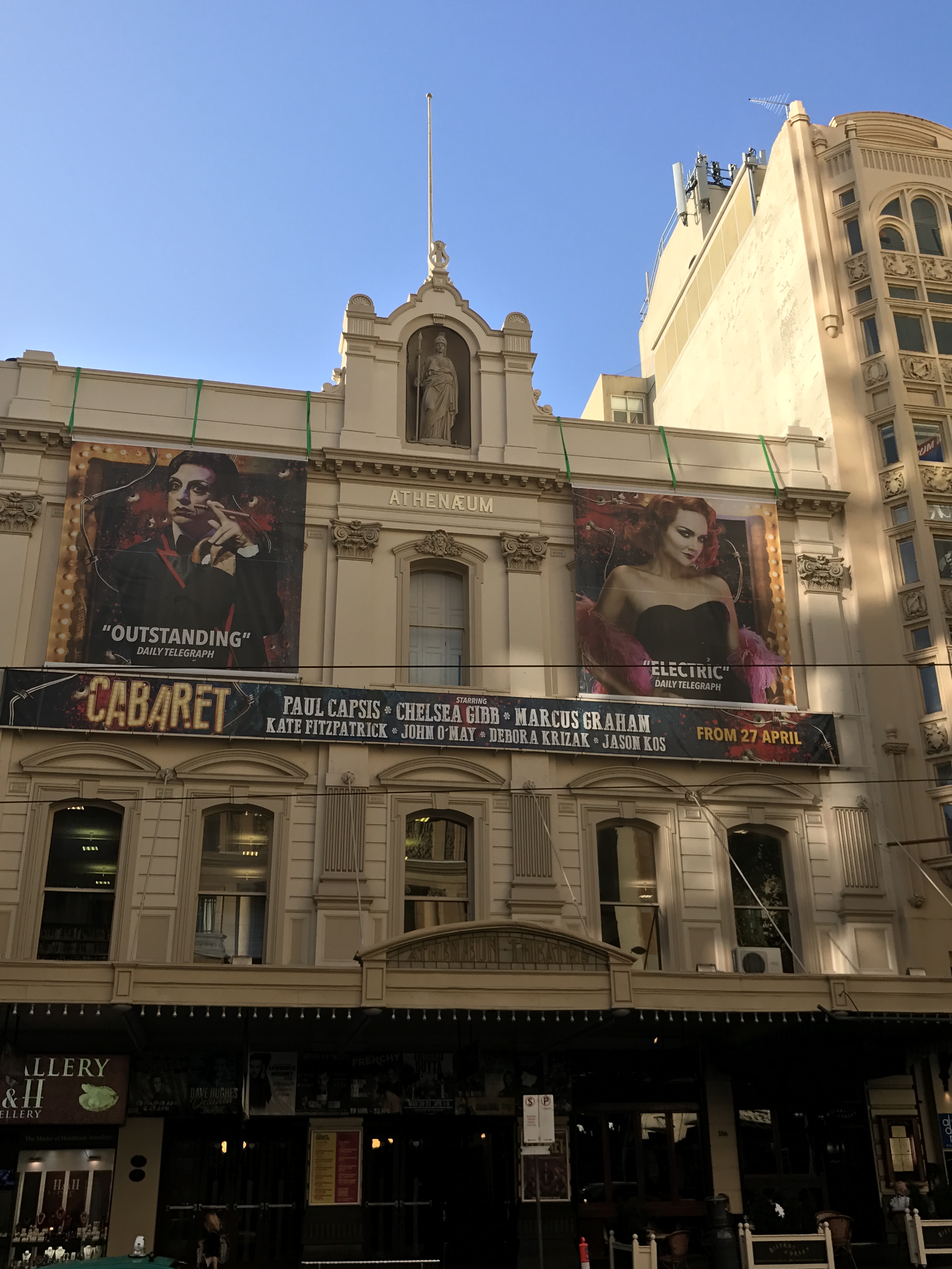
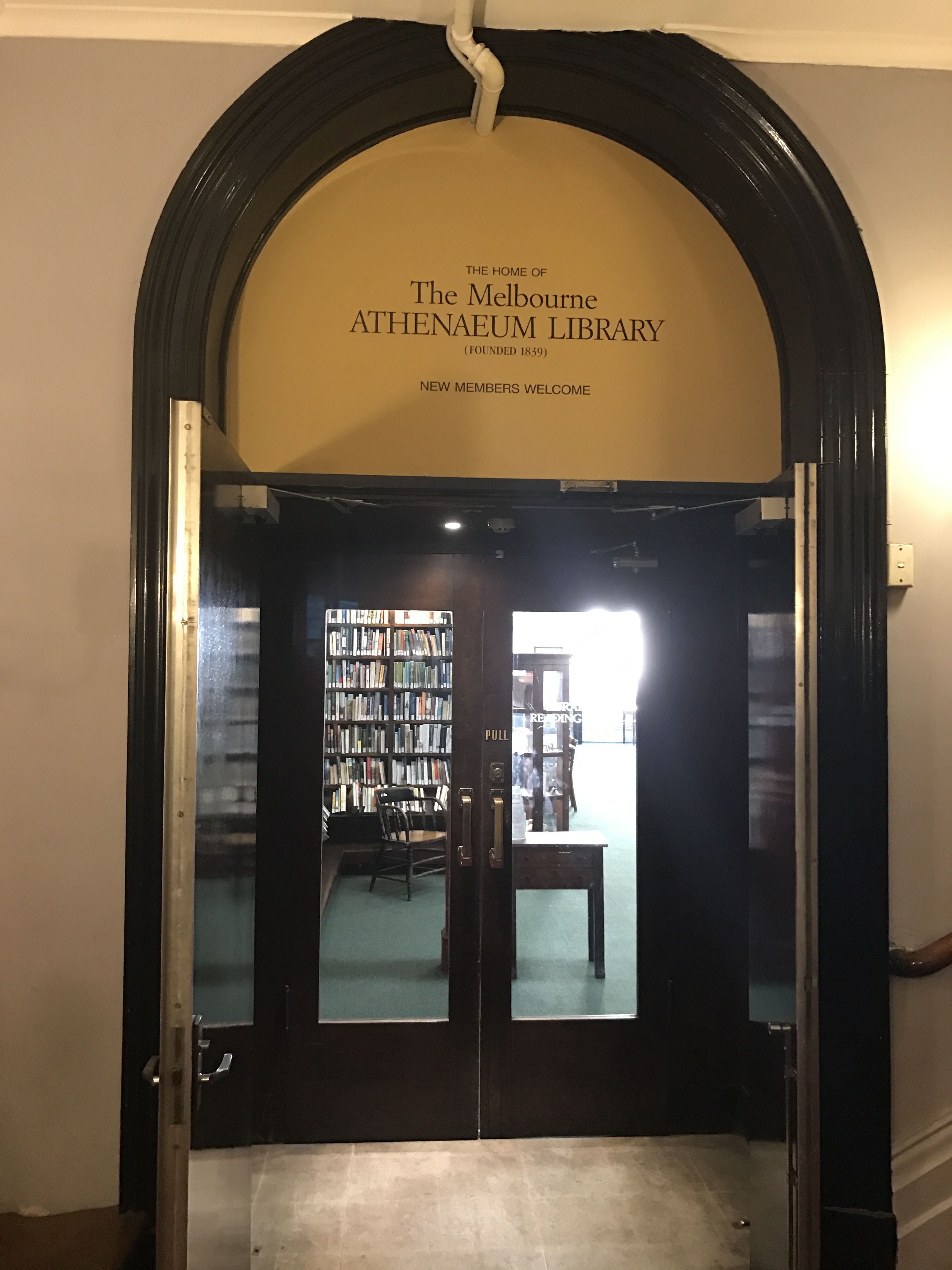
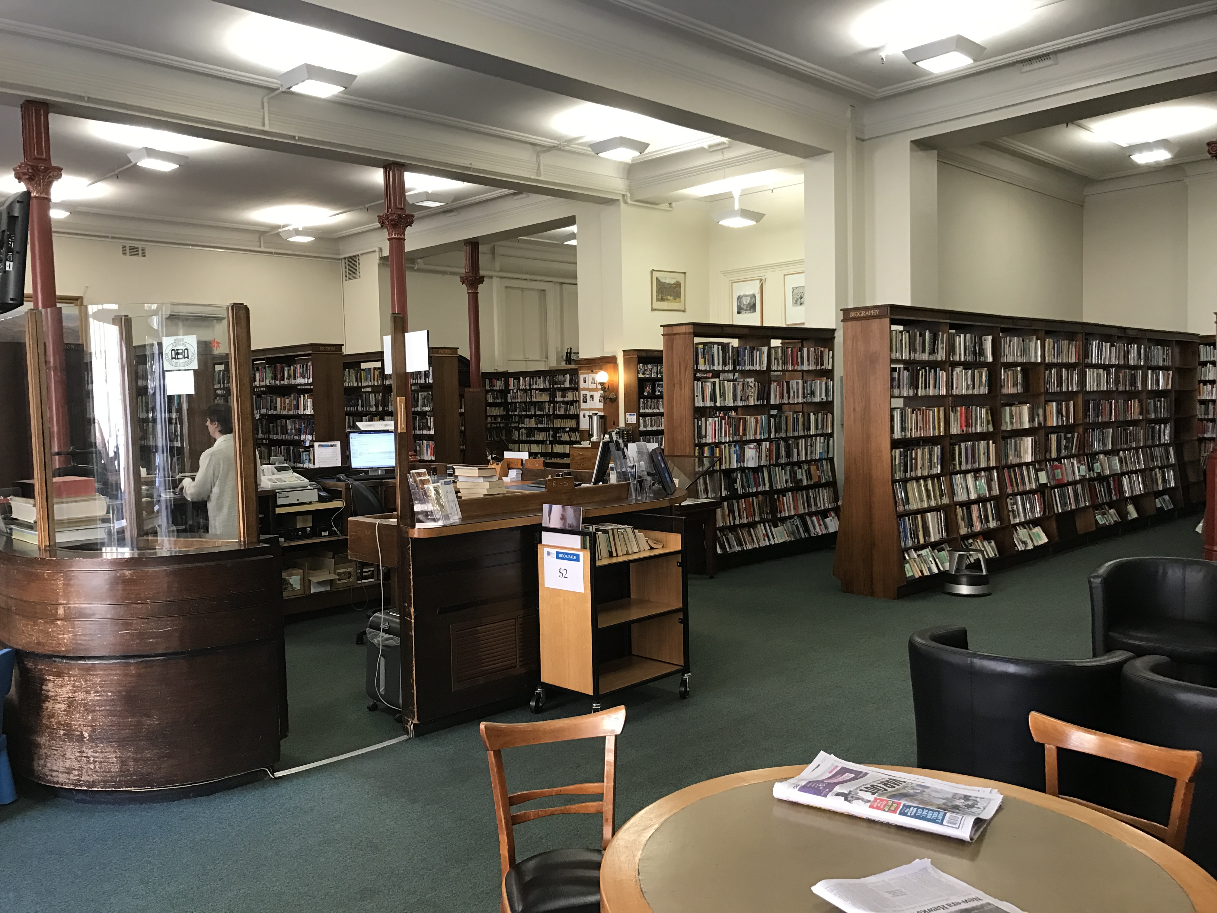
Melbourne
The earliest Mechanics’ Institute in Melbourne. The Melbourne Mechanics’ Institute was founded in 1839 and the current building dates to 1886. The original library, and collection of scientific specimens, was housed in rented accommodation. A permanent hall was built in 1842, but the programs offered including: entertainments, political and business meetings, social gatherings and church services proved to be so popular that it was decided that a bigger building was needed. The funds weren’t found until the 1870s and in 1872 the new facilities were opened, including a 100 foot long hall and significant space for the library upstairs. At the same time it was decided to change the name to the Melbourne Athenaeum. In 1886 the building was significantly remodelled, including the facade, which you can see today. In the early 1900s it was determined that a theatre was needed and the Athenaeum Theatre, built inside the old hall, was completed in 1924. The theatre is still very much in use today by acts from all over the world and is one of Melbourne’s most popular venues. The library is also still in existence and runs as a subscription library. You can search their collection here.
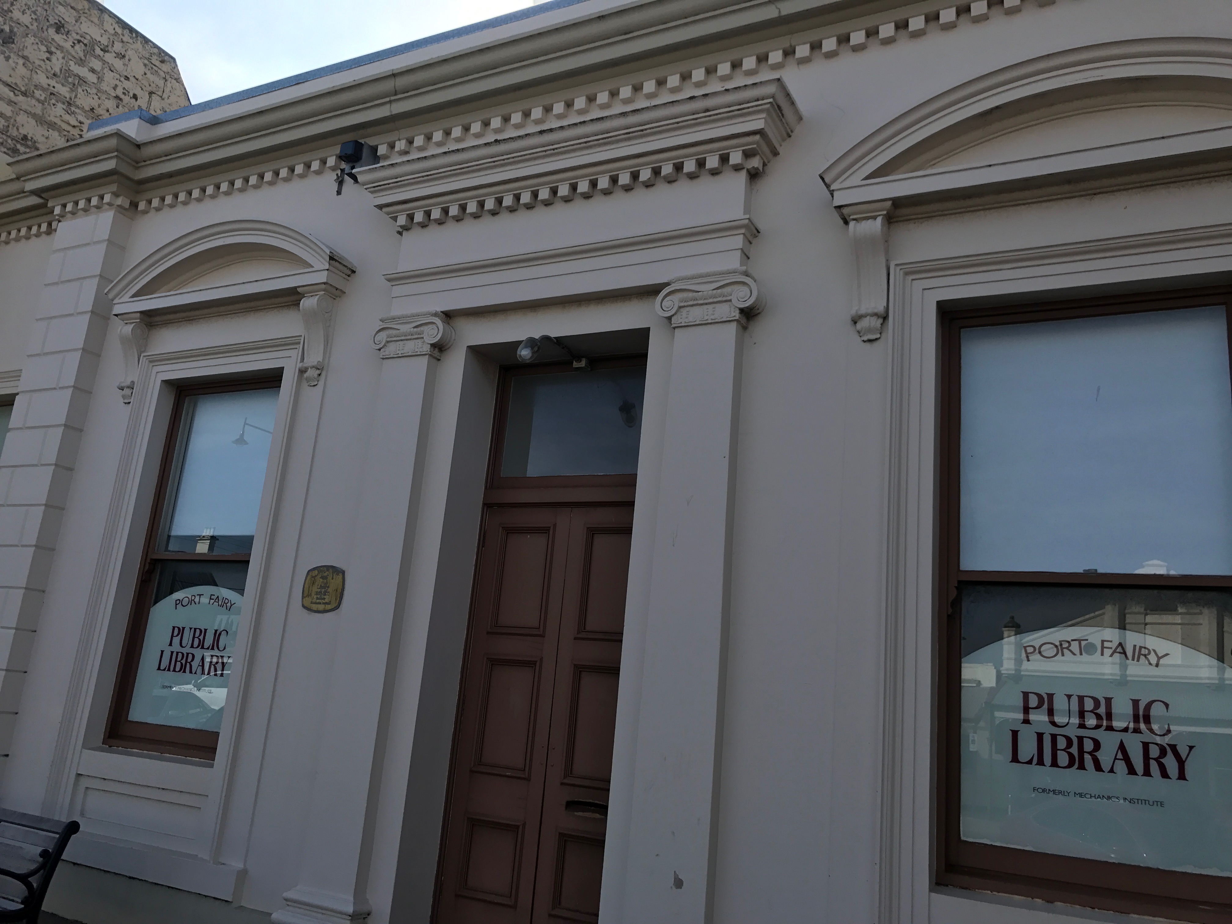
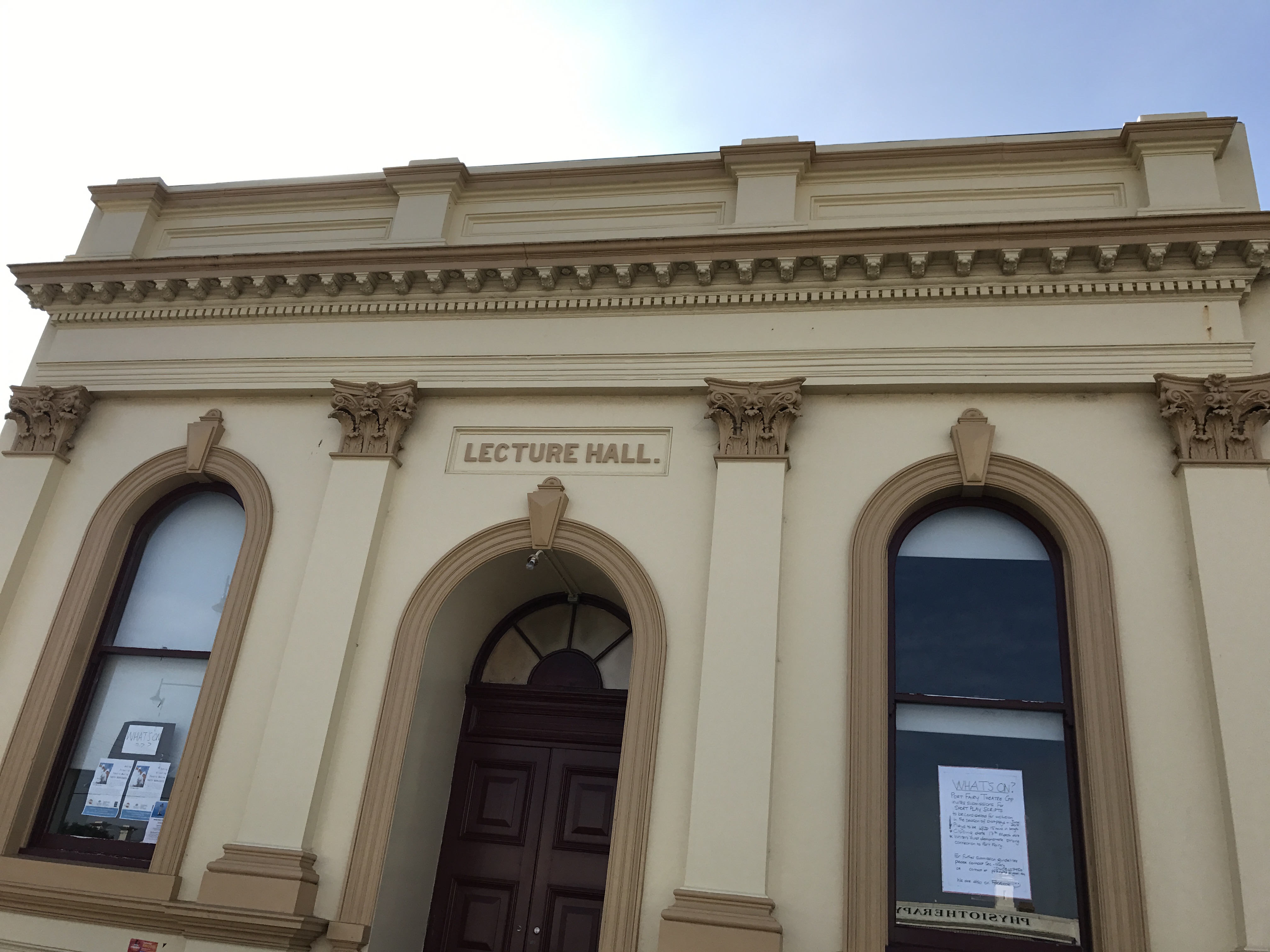
Port Fairy Library and Lecture Hall
Founded in 1860 and the current building dates to 1865. A library was functioning in Belfast, as it was then known, as early as 1856 but an institute wasn’t officially formed until 1860. In 1864 land was granted by James Atkinson to build a library for Belfast and it has remained in the same position since it was opened in 1865. The Lecture Hall next door was also opened at roughly the same time. The library is now used as the public library, after 120 years of independent operation it joined the Corangamite Shire libraries in 1981. The lecture hall is used by lots of community groups including the local theatre group and the spring festival.
Prahran Mechanics’ Institute.
The Prahran Mechanics Institute was founded in 1854 though the building they currently reside in, a converted 1960s fabric factory, was not their home until 2015. The original building was in Chapel Street and is still owned by the institute, though it is rented out as shops.
The PMI started as a lending library and as an institute for education and lectures. Due to a dispute with the the Secretary/Librarian in the mid 1800s (he wouldn’t vacate the building and the roof of the institute was removed to force him to leave) and the neglect of another secretary/librarian in the late 1800s the PMI building was rebuilt onsite in 1900. However there was not enough space, so in 1915 they moved to High Street in Prahran, also starting the Prahran Technical School (this building can be seen in the photo above). In the 1980s a decision was made to move away from being simply a general collection library to being a library which specialised in Victorian history.
This specialisation continues today with the PMI holding a collection of over 30 000 books and being dedicated to preserving the history of Victoria. In 2009 space was desperately need for the rapidly expanding collection. So the PMI sought to end the 99 year peppercorn lease which allowed to Minister for Education to use the buildings that formerly held the Prahran Technical School, which was now being used by Swinburne University. The Minster agreed to relinquish the lease if the PMI sold their High Street building to Swinburne University. They did and moved around the corner to St Edmonds Road into a more modern building with the extensive space that the collection needed (you can see the exterior and interior of the new building in the photos above). The PMI is still functioning under its original rules and incorporation and is the only Mechanics’ Institute in Victoria which has its own Act of Parliament for its incorporation. It is run by a committee with four professional staff running the library. You can check out their catalogue here
Rosedale Mechanics’ Institute Hall
The Rosedale Mechanics’ Institute was established in 1863 and the current building dates to 1874. Rosedale began operating in 1868 in rented premises and the original form of the current building was built in 1874 after being designed by William Allen. Rosedale was originally called The Mechanics’ Institute and Library and Scientific Association. It contained a surprisingly large hall, a stage, a supper room, several meeting rooms and a library. The stage was removed at some point and an extension with toilets added in roughly the 1950s. The hall was also extended fairly early in the process, you can see the addition in the photo above, and much later a floating ceiling was added. The hall used to house the public library, but it was moved. It is now home to the op shop and is used by community groups.
Stratford Mechanics’ Institute.
The Stratford Mechanics’ Institute was founded in 1866 and the current building was constructed in 1888. When it was originally founded Stratford lapsed very quickly and another attempt to form a Mechanics’ Institute was tried in 1874, which didn’t work either. However, by 1882 a committee was formed and the library was set up in the shire hall and books bought. By 1888 they’d built the existing hall. In the 1950s a spectacularly ugly addition was built on the beautiful 1800s facade. It mainly housed toilets. In the early 2000s, through fundraising and government grants, the hall was restored to its former 1800s glory. It is run by an active committee and is the home to many local events, including the parts of the Stratford Shakespeare festival.
Toongabbie Mechanics’ Institute.
Toongabbie Mechanics’ Institute was established in 1883 and the building you see today was also constructed in 1883. It was a fascinating example of a two story weatherboard construction from this period. The second story was a 1890s rear extension. The hall contains a stage, where many local performances were held, and was home to a library. There are also a number of smaller rooms in the two story extension. It was used as the local Court of Petty Sessions and as a bank. By 1983 the building was in extremely poor condition and it had been suggested that burning it down was the best option. Thankfully the local community rallied and with government funding it was saved. Now it is used for everything from weddings, to school concerts, to old time dances.
Trafalgar Public Hall
The Trafalgar Public Hall, formerly the Trafalgar Mechanics’ Institute and Free Library, was founded in 1889, though the current building dates to 1935. The original hall operated as free library and it was rebuilt in 1908 when it became the home of the Naracan Shire. The hall became the focus of the community with traveling shows performing there and it was used as a library and a dance hall. The hall and all its contents were destroyed in a massive fire in 1934 and a new hall was finished by 1935. The new hall contained a bio cabin for the showing of movies. There was also a library, but by 1957 this had become a kiosk, and by 1964 a ladies toilet. The hall was used for everything from badminton to school concerts and is now the home of the local amateur dramatic society as well a number of other community uses including weddings and family reunions.
So that’s the end of my collection of Mechanics’ Institute photos and information. As I stated, this is by no means anywhere near all the Mechanics’ Institutes in Victoria and they can be found in other states as well as all over the United Kingdom and in Canada and America. As a concept they are a fascinating example of communities helping themselves and coming together. Even if many of the institutes themselves don’t survive today the halls are still very much at the heart of the community.
These Walls Speak Volumes: A history of Mechanics’ Institutes in Victoria by Pam Baragwanath and Ken James ISBN: 9780992308780 you can borrow it from the Prahran Mechanics’ Institute Victorian History Library here library.pmi.net.au/fullRecord.jsp?recno=23726
The photos are all mine.
Disclaimer: I work at the PMI Victorian History Library.
Port Fairy is a town in Western Victoria that was founded as a town in 1843. There were settlers in the area before this date, and the current name for the town comes from the ship the Fairy which is believed to have arrived in the area in c.1828. The area was also regularly visited by whalers and sealers. The date of 1843 comes from the special survey which was granted to James Atkinson at that time. The special surveys were a system where the government of the Colony of New South Wales was able to control ownership of the land in the Port Phillip District. This was well before federation of Australia as a country in 1901, but also before Victoria became a colony independent from New South Wales which happened in 1851. The basic premise behind the special survey system was to stop squatters just claiming land, because when they did there was little ability to regulate it and there was no fee for the government.
Atkinson arrived in Sydney in 1830 from Ireland and became a prominent and well connected member of Sydney society, at least partly due to his family connections to Colonel Charles Wall of the 3rd Buff regiment who was married to his sister. As he had a high social standing he couldn’t use trade to make money, so he turned to land. He was granted the right to the special survey of the Port Fairy region in 1843. He worked with the existing settlers, but also moved to attract new settlers to the town he named Belfast. He most likely applied for the special survey rights to the land without ever seeing it, as there is no evidence he set foot there before arriving in 1846 with his wife and seven children. He offered very long term leases for land in the town he established, but while he was definitely trying to encourage settlement he was not immediately successful. In 1848 he appointed his nephew (and my great, great, great, grandfather) Robert Henry Woodward, who was farming in the area, as his land agent. Woodward was 25 and oversaw the majority of the establishment of the town proper. It was also Woodward who oversaw, with the blessing of Atkinson, the gifting of parcels of land within the town for churches of different denominations and for community purposes, such as a post office, a hospital, government offices, public wharves, a savings bank, a town hall, public meeting places and a cemetery.
St John’s Anglican Church Port Fairy built between 1854 and 1856. It was the first church in Victoria to have a chancel. The tower was added later in the 1950s.
Atkinson did not remain in Belfast, returning to Sydney and to Ireland, but he did visit to survey the progress of the town in 1859, 1861 and 1864. Atkinson died in Sydney in 1864, though Woodward continued to administer the lands until 1869. The town petitioned, successfully, to change its name to Port Fairy in 1886
Before continuing to discuss the cemetery I would also like to acknowledge the indigenous people of the land which Atkinson bought as the special survey. This area was the land of the Gunditjmara people. If, when Atkinson arrived, there seemed to be a lack of indigenous inhabitants it is not because there wasn’t any ever, but because between the 1830s and the 1840s the indigenous population of the area was destroyed by settlers. A monument to them now stands in Port Fairy on Bank Street. It reads:
In memory of the thousands of aboriginal people who were massacred between 1837 and 1844 in this area of Port Fairy.
Today we pay our respects to them for the unnecessary sacrifices they made.
Your spirit still lives on within our people. Wuwuurk
This was not isolated to the Port Fairy area. The early history of Western Victoria is mired in bloodshed. A list of the frontier wars in which the indigenous population were by and large overwhelmed and destroyed by superior western weaponry can be seen here.
It was also a time of severe retaliations against any interference with livestock and systematic killings, taking of land of the beginning of the removal of children. Not to mention the introduction of alcohol and western disease and their long term affects. This article from the Warrnambool local paper The Standard out lines clearly the actions against the local indigenous population
It is essential that the past of indigenous Australians and the brutal suppression of them is recognised as part of the history of Victoria and Australia. This is especially true when discussing somewhere like a cemetery which provides concrete and tangible records of the deaths of early pioneers, a record that is not available for the deaths of the indigenous population.
Port Fairy cemetery was founded in the 1850s. There is confusion as to whether it is the ‘old’ or ‘new’ cemetery as many descriptions seem to use the term interchangeably. The other cemetery at Port Fairy was laid out by Robert Hoddle, famous for Melbourne’s CBD grid, at the orders of Governor La Trobe. This other cemetery was in the sand hills out of town, was discontinued and little survives today. The current Port Fairy cemetery has many very early burials and is believed to be one of the first cemeteries in Victoria to have adopted the concept of a lawn cemetery.
The earliest burials in the cemetery are of the local pioneers and their families. These people are often listed as from a local ‘station’ on their tombstones. The pioneers of the area did not have an easy life and as such there are a high number of young burials, very few survived to old age. One of the earliest and one of the youngest is the grave of Harold Woodward, a son of Robert Henry Woodward and his wife Letitia Wall (daughter of Colonel Wall). Harold died on the 8th of October 1856, but was only born on the 4th of December 1855.
Of Robert Henry and Letitia Woodward’s 11 children Harold was the only one to meet such an early end. I am descended from his brother Albert William Woodward, the youngest of Robert Henry and Letitia’s children. Robert Henry and Letitia are buried in St Kilda Cemetery.
Much of the stone in the cemetery displays intricate examples of early stone masonry. The best example of which is probably the tomb of Abijah Brown.He died in 1862 at the age of 40 and the tomb reads:
In affectionate memory of Abijah John Brown who departed this life July 19th 1862 aged 40 years. Watch for ye know not what hour your Lord doth come.
It is an interesting monument because it does not fit any regular pattern seen in Victorian era funeral monuments. It is a, sadly much worn, figure of a young man looking skywards. This man is not an angel or a cherub but a person. It is also a remarkable piece of sculpture in its own right. The Brown tomb is not alone is being striking in the cemetery. The older section of the cemetery is a combination of plain and ornate funeral monuments. Some can be seen in the photos below.
There are more people buried in the cemetery than are known about. Many of the early burials would have been laid to rest under simple wood crosses and these simply wouldn’t have survived the harshness of Port Fairy’s coastal weather. Despite this, the surviving burials provide a fascinating record of the life and death of the early inhabitants of the district.
Major Mitchell was born in 1792 in Stirlingshire Scotland. He was a surveyor and in 1827 he took up the position of Surveyor-General of NSW. In 1836 Major Mitchell became the first European to travel across the plains of Western Victoria.
Just out of Dunkeld
The purpose his mission was to follow the Darling River to discover if it flowed into sea or into the Murray. He was then instructed to follow the most promising stream from the Murray and see in which direction it went. This resulted in him crossing Victoria’s western plains. Which is described in his diary thus:
“The scene was different from any I had seen in New South Wales or elsewhere. A land so inviting, and still without inhabitants. As I stood, the first European intruder of the sublime solitude of these verdant plains, as yet untouched by flocks and herds; I felt conscious of being the harbinger of mighty changes; and that our steps would soon be followed by the men and animals for which it seemed to have been prepared.” In fact he thought the land was so good he called it the Australian Felix
I would like to take this moment to point out that the land was far from uninhabited as it was home to several groups of indigenous Australians. In fact Mitchell certainly encountered some of them because in “December 1836 the Executive Council conducted an inquiry into the killing of Aborigines near Mount Dispersion. It regretted that Mitchell had not made sufficient efforts to conciliate the natives, but in view of their numbers and threatening aspect the council could not severely blame ‘a want of coolness and presence of mind which it is the lot of few men to possess’.”[1] From records it seems that Major Mitchell’s group was followed by a group of Aboriginal people and they felt threatened so they planned an ambush in which 7Aboriginal people were killed. While he was acquitted by an enquiry, as explained above, the incident tarnished his reputation for the rest of his career.
Mitchell’s names for many of the places in the area are still used today and many of them still carry a certain Scottish flavour.
The Grampians
Grampians from a distance
Half way up one of The Grampians
Lake Linlithgow
A very dry Lake Linlithgow
Mount Rouse
The side of Mount Rouse Mount Rouse from the road
Mount Abrupt
Mount Sturgeon and Mount Abrupt
Mitchell was also the first European to truly explore the Glenelg river.
The Glenelg in mid western Victoria near Harrow.
The Glenelg much further down stream near Nelson on the Sth Australian border
Mitchell surveyed the area as he went and this resulted in what was known as Major Mitchell’s trail. You can still follow the trail today, there are marked points and a map.
Monument just out of Dunkeld
Monument just out of Harrow
Other settlers soon followed Mitchell and the European colonisation of western Victoria had begun. Today it is still very much farming country with small towns often bearing very European names, as is true of much of Australia.Balmoral
Harrow
Avoca
Rail bridge over the Wannon in Cavendish
While Major Mitchell’s trek heralded the influx of European settlement to this part of Victoria, he was a skilled surveyor and his diaries give an extraordinary glimpse into what the country would have been like in the mid 1800s.


 The stain glass window dedicated to St Thomas also carried a dedication for the A’Beckett family on its base
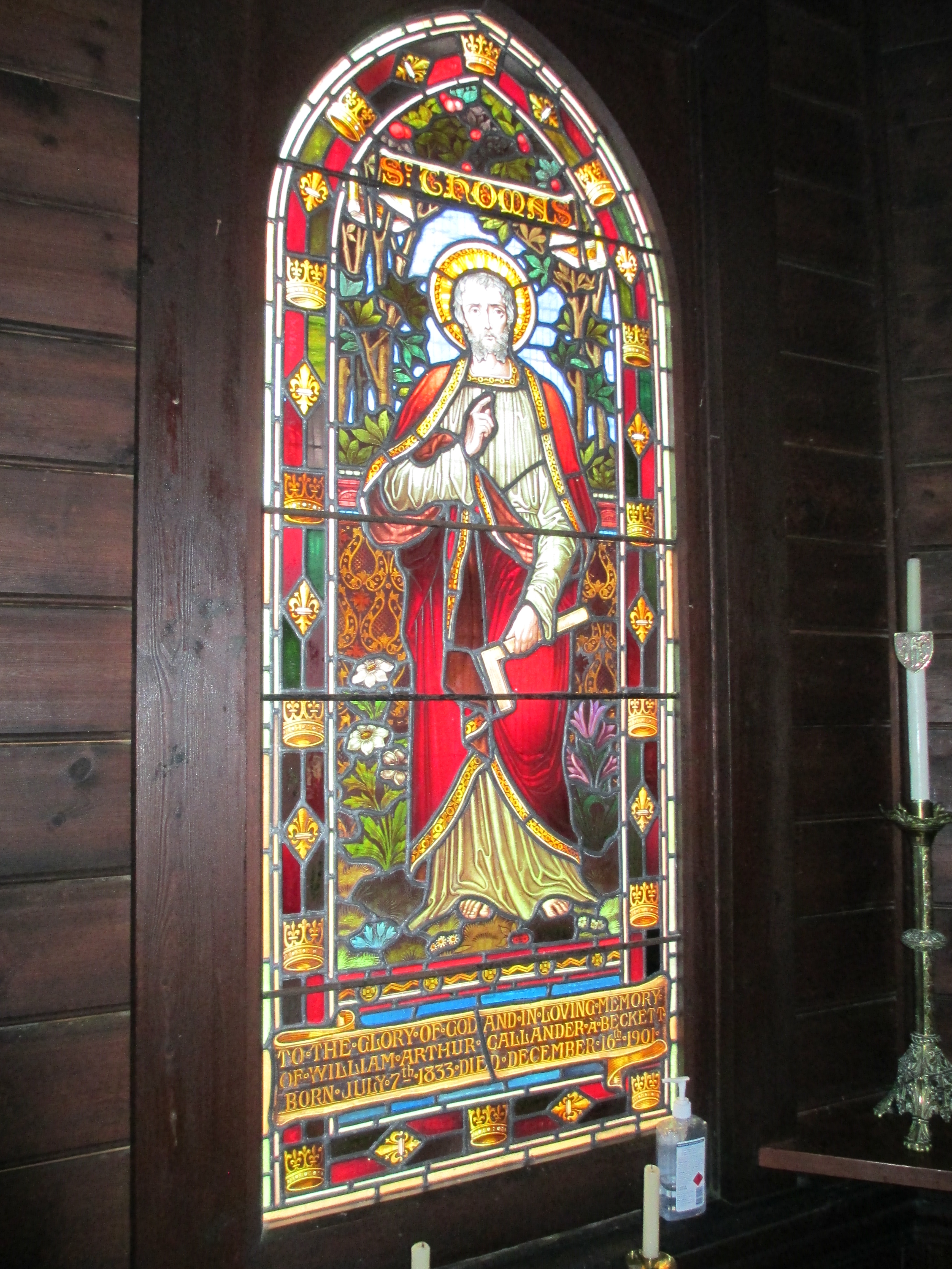 The A’Becketts were a prominent district family and the font is also dedicated to one of their number.
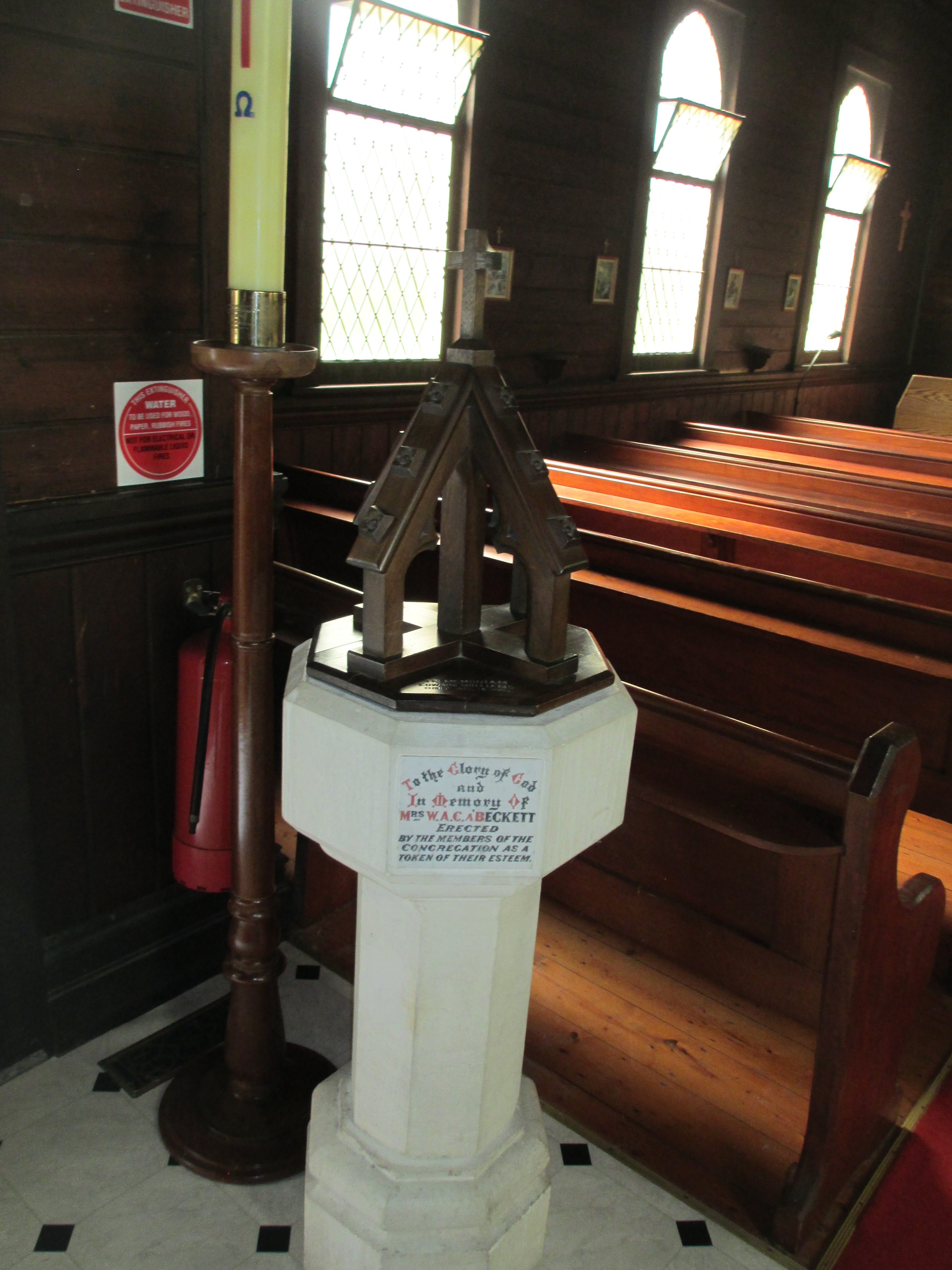
 The Mechanics’ Institute dates to 1905, but the current building was built in 1942. The hall was used for everything from ANZAC celebrations to rollerskating. The hall burnt down in 1940 but it was rebuilt, as you can see it today, by 1942. The new building is built in greek revival style and is under the ownership of the council. Today it is used for everything from tai chi to playgroups.
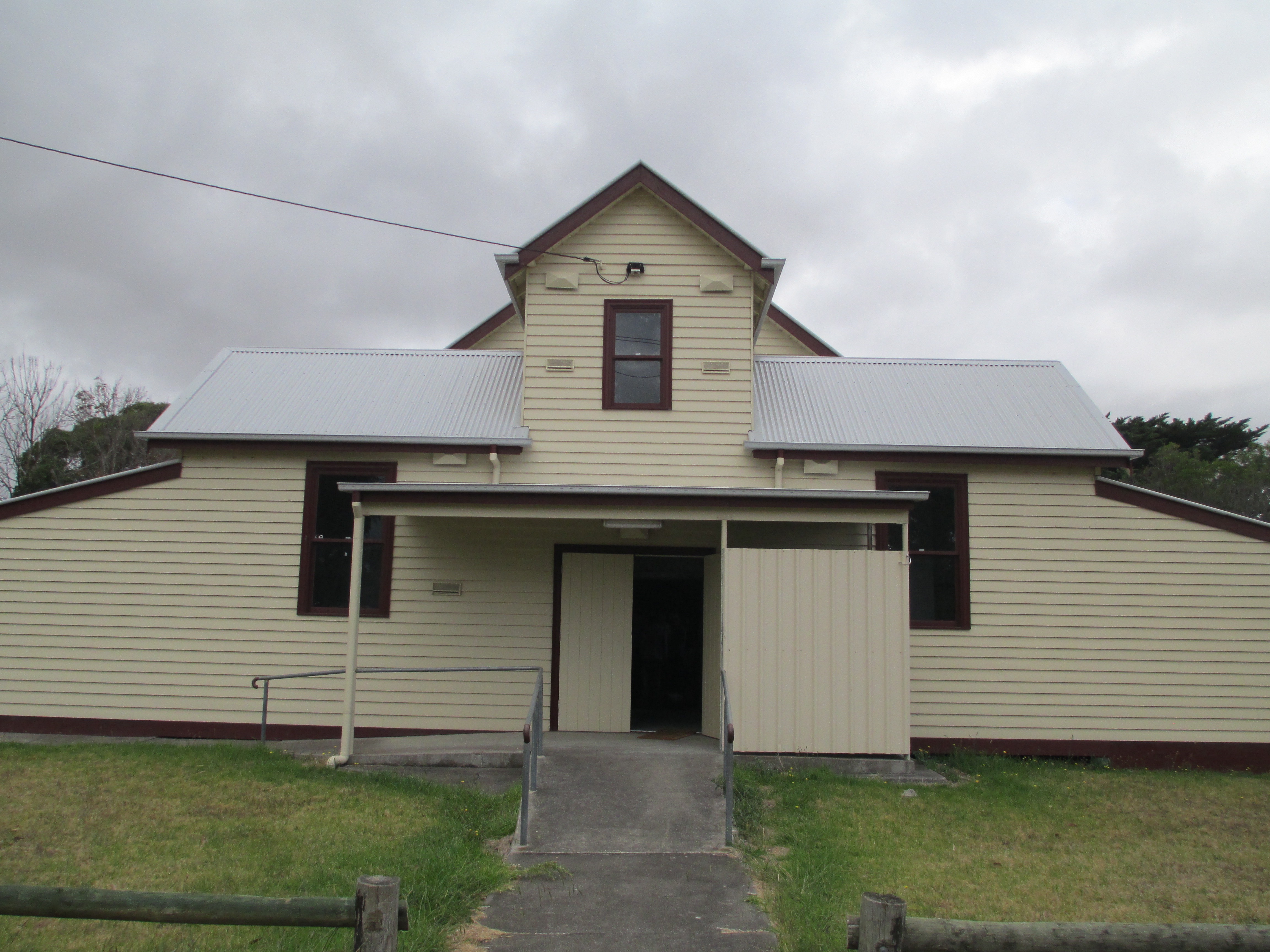
 The Institute was established in 1886 and the current building dates to the 1920s. Glengarry began as a library and was much used with hundreds of people visiting the library every year in the 1800s. When the new hall was opened in 1920, it was moved across the road, it was used as a library, a picture theatre, and by many local organisations. The hall had reached a fairly degraded state, on the outside, by 2013 and funding was raised to restore the outside including the hall roof which was in a perilous state. It is still used extensively by the community today.
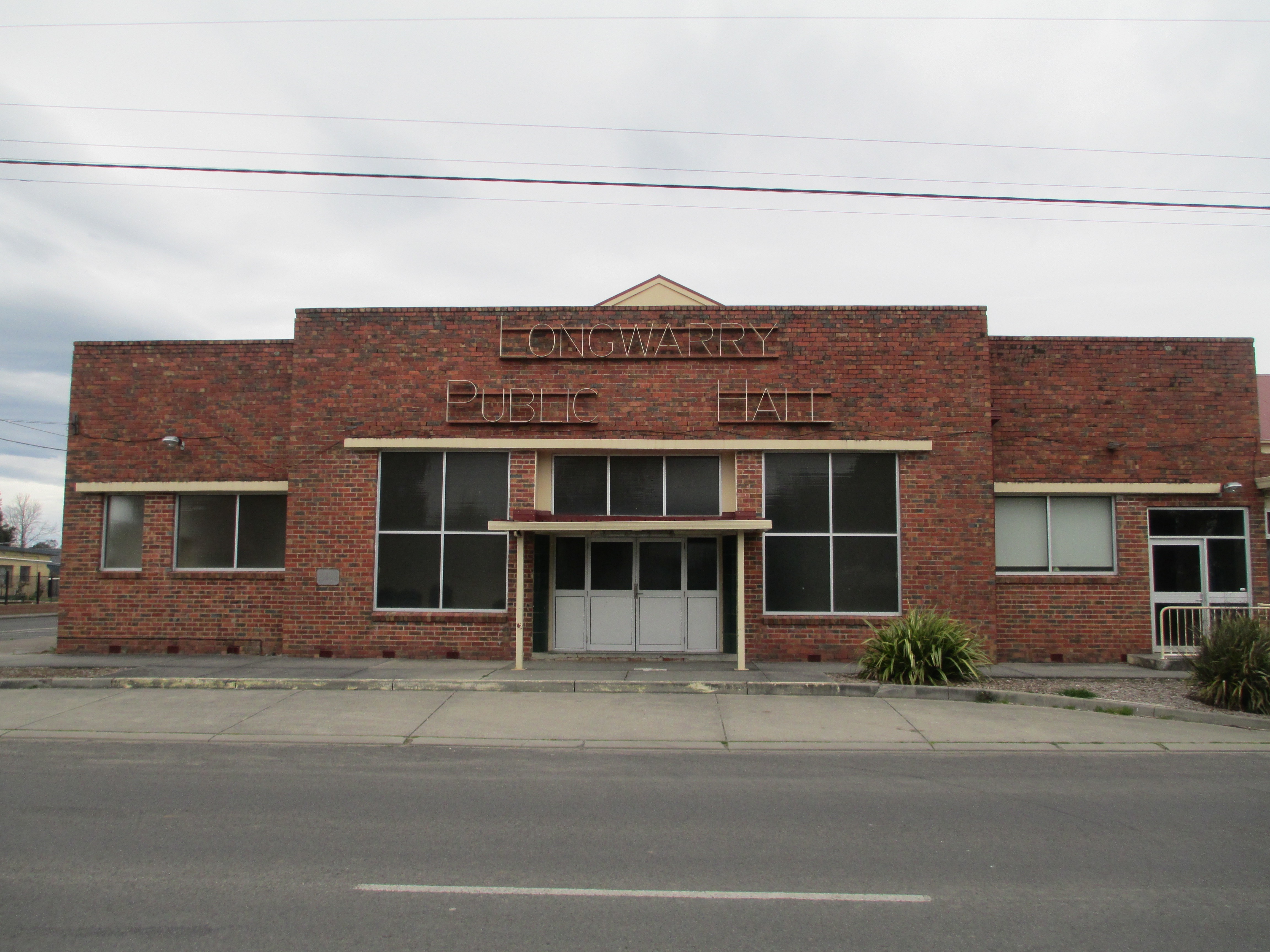 The Longwarry Public hall, formerly Longwarry Mechanics’ Institute and Free Library, was established in 1886, and the first building built in 1889, though the current building dates mainly to the 1950s. Longwarry operated as a free library and lecture hall as well as being the home of the local brass band and health centre in the 1800s and early 1900s. The hall burnt down in the 1950s and the hall you see today was constructed, it was opened in 1953 with additions in the 1960s. In 2009 it was significantly upgraded including a new roof. It is still used by many community groups and an old time dance has been running every Monday evening and every fourth Saturday since, roughly, 1900.
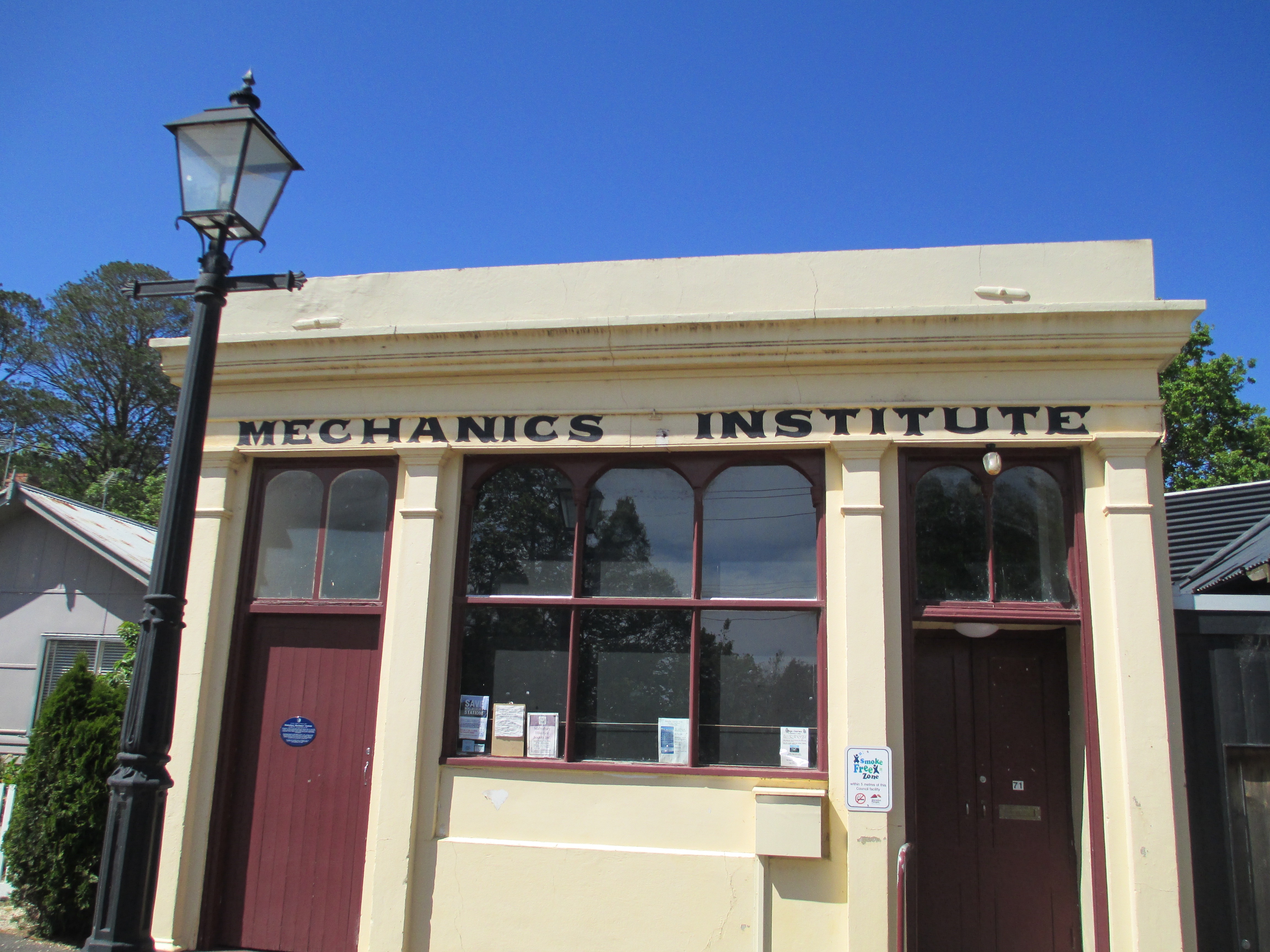
 Founded in 1860 and the current building dates to 1865. A library was functioning in Belfast, as it was then known, as early as 1856 but an institute wasn’t officially formed until 1860. In 1864 land was granted by James Atkinson to build a library for Belfast and it has remained in the same position since it was opened in 1865. The Lecture Hall next door was also opened at roughly the same time. The library is now used as the public library, after 120 years of independent operation it joined the Corangamite Shire libraries in 1981. The lecture hall is used by lots of community groups including the local theatre group and the spring festival.
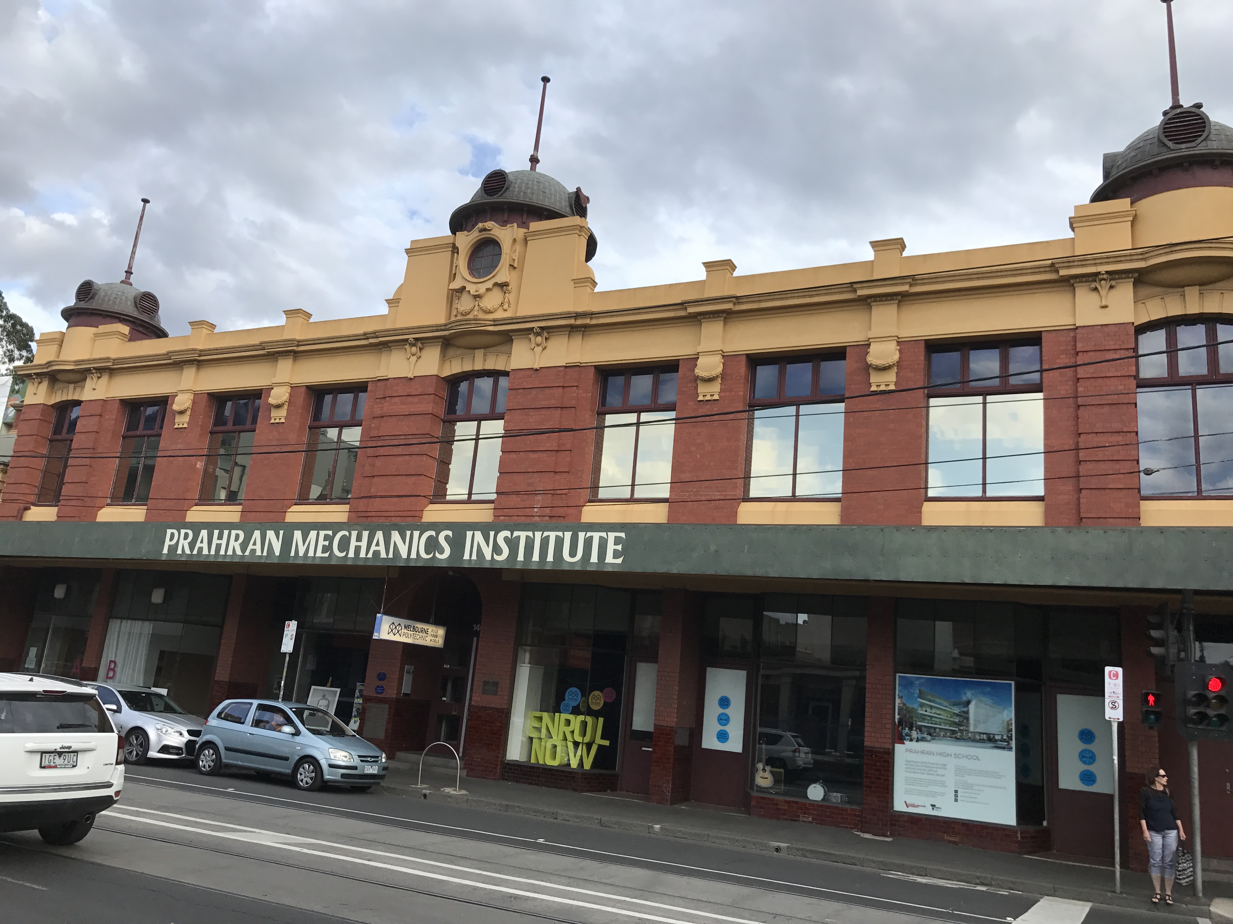
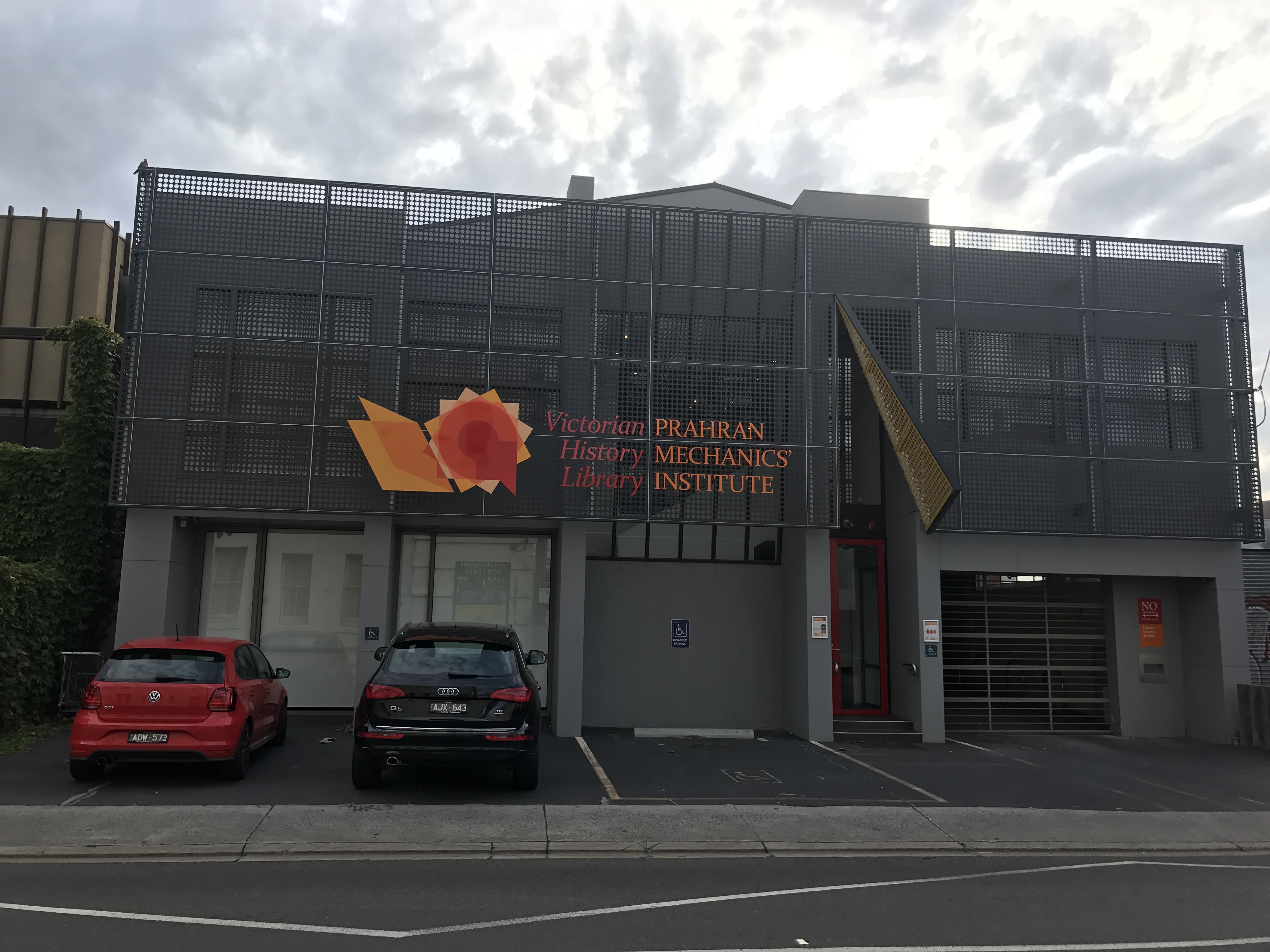
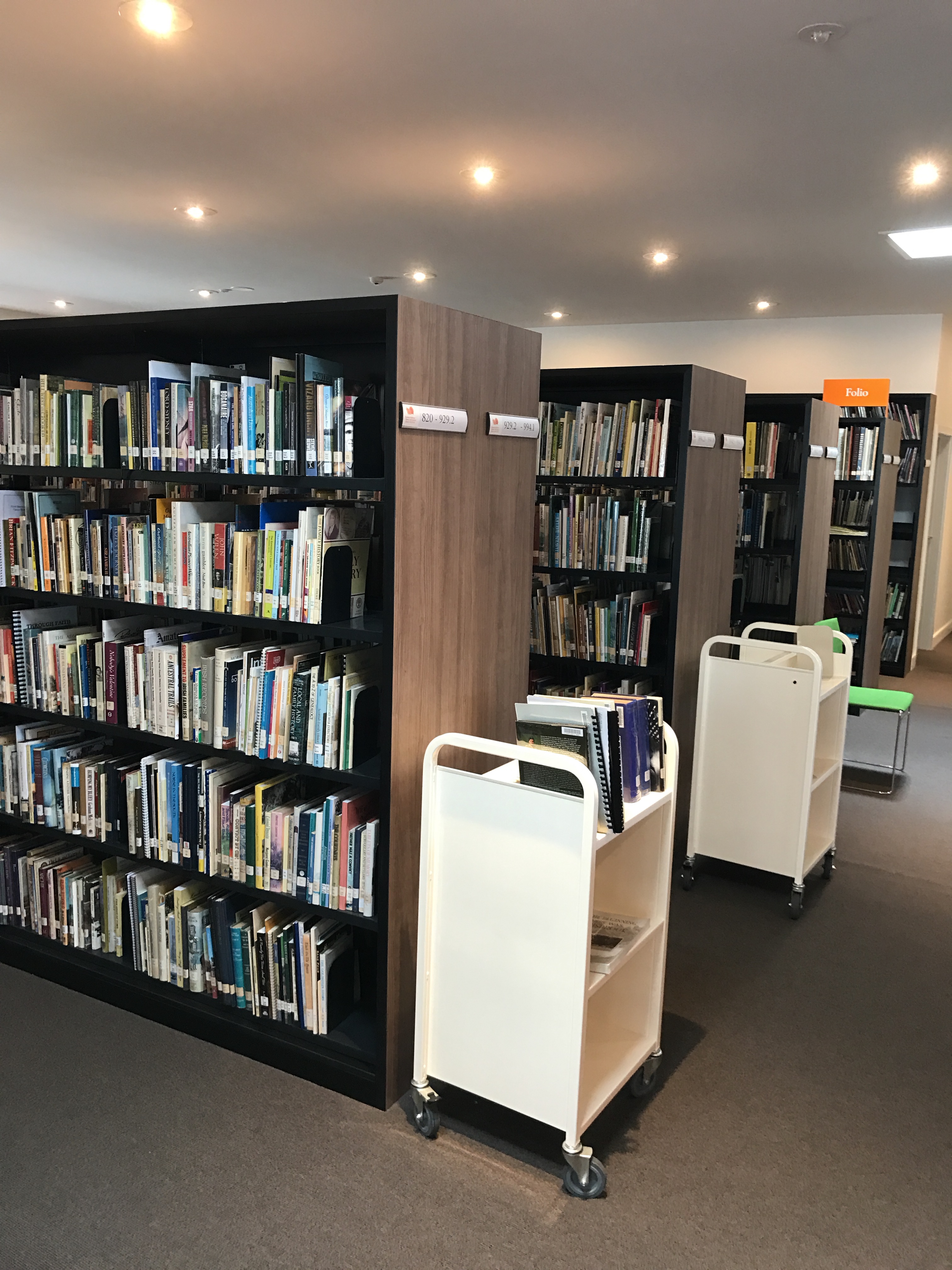
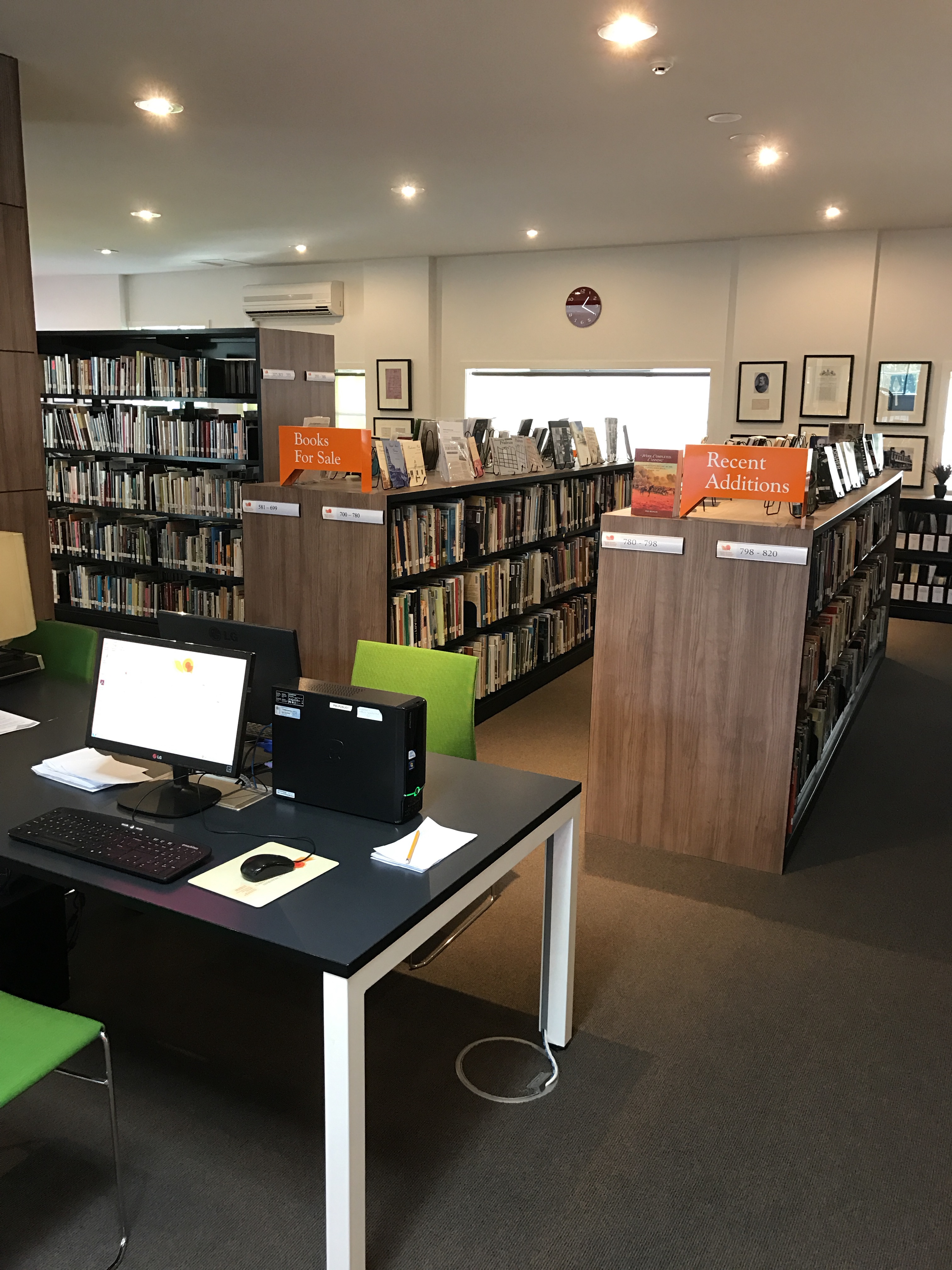
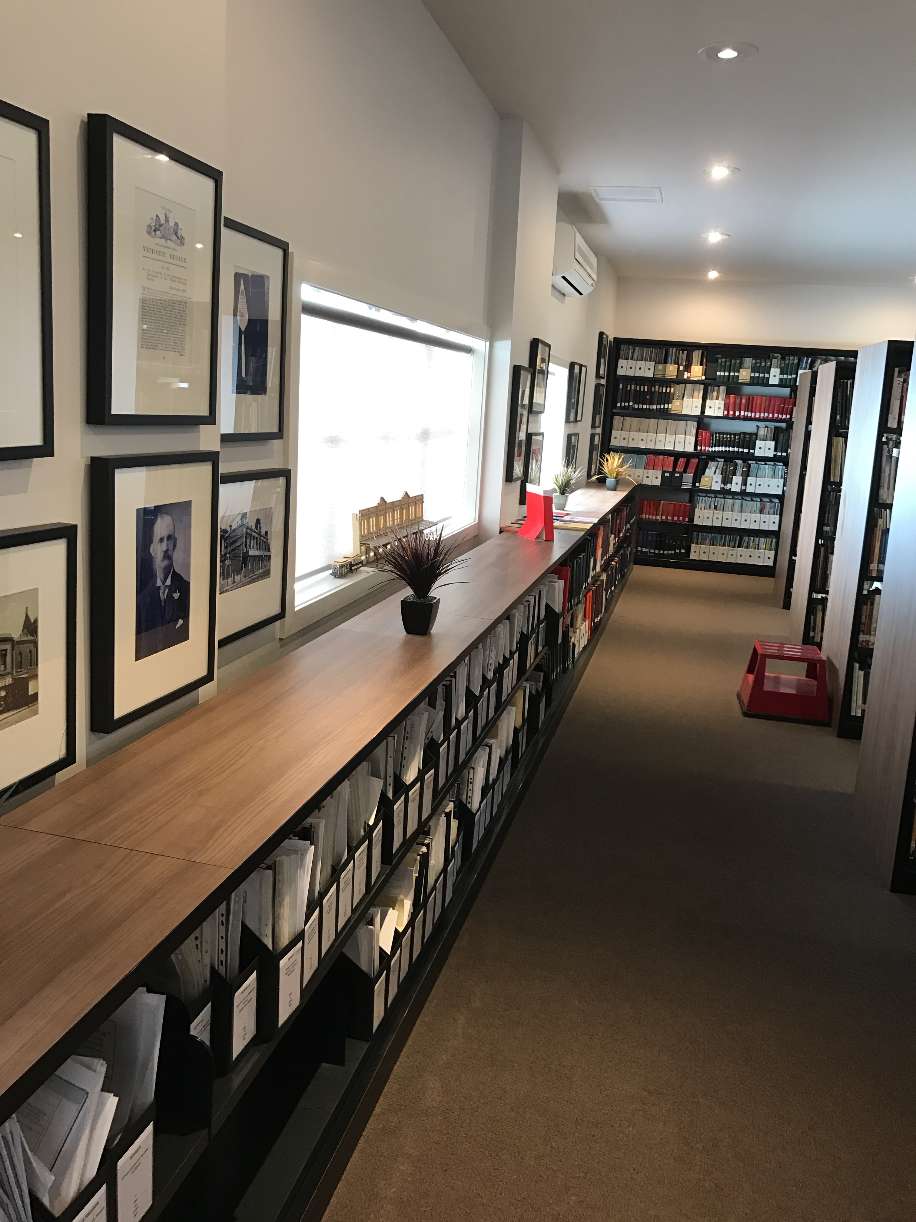
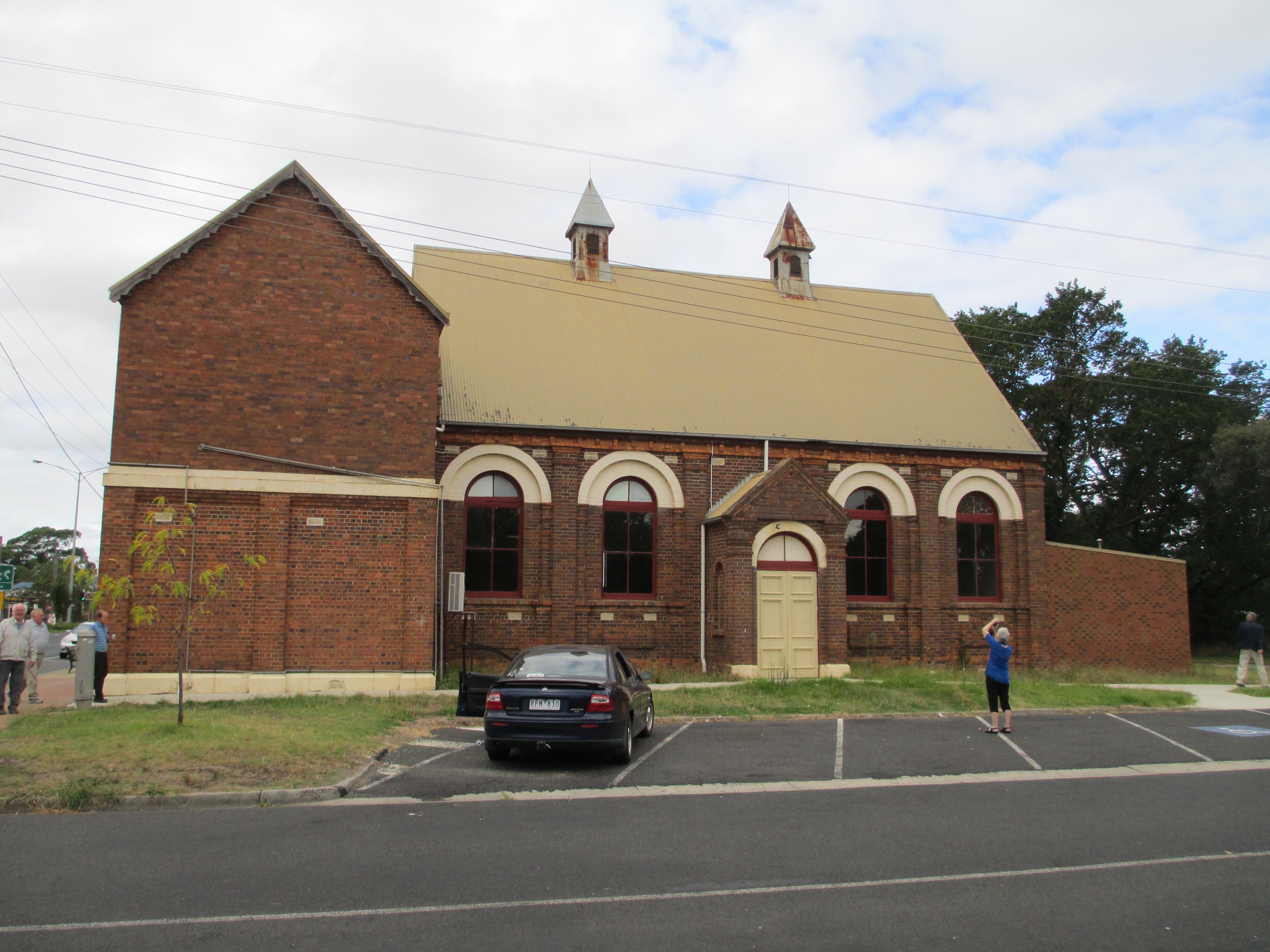
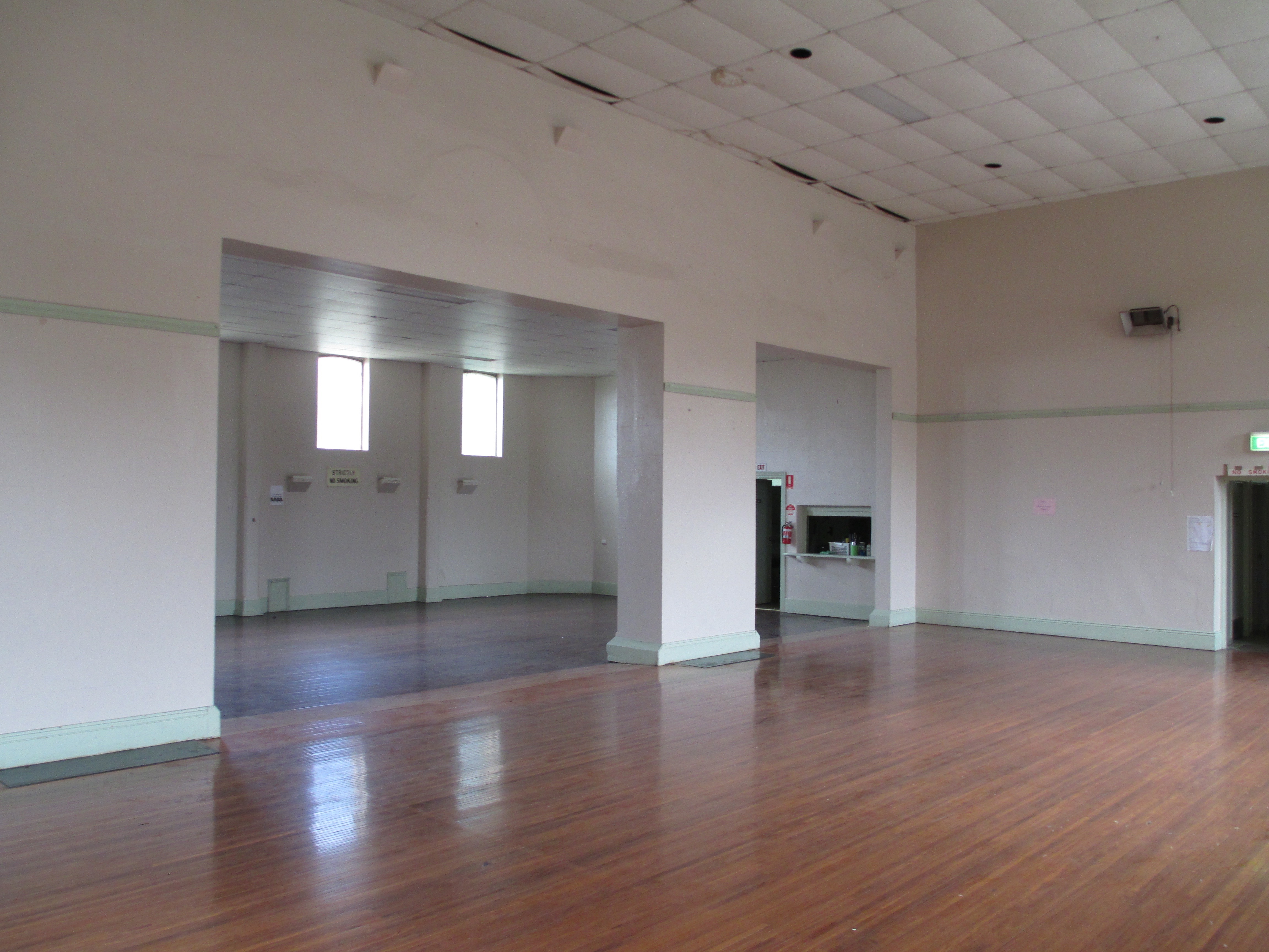
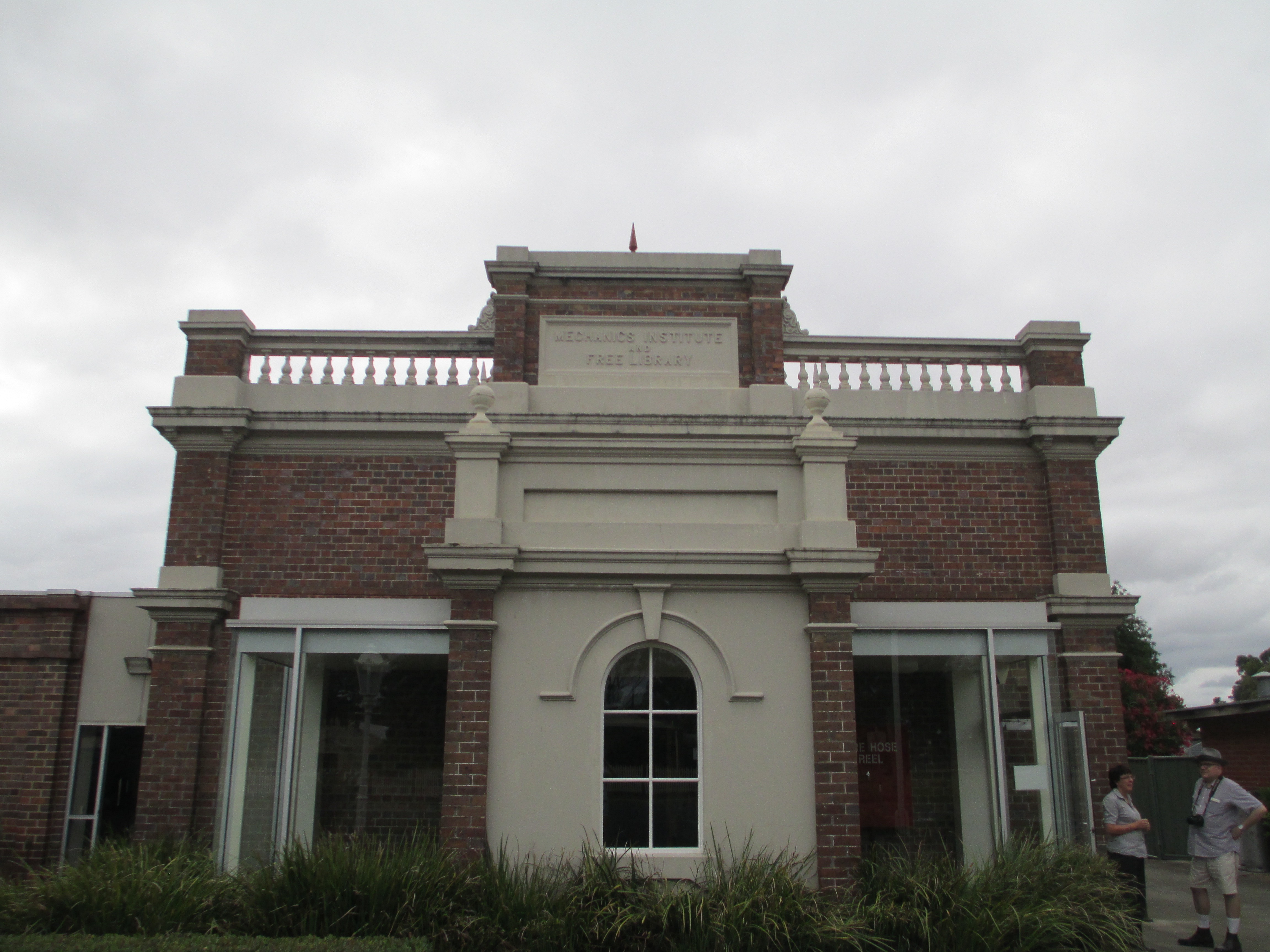
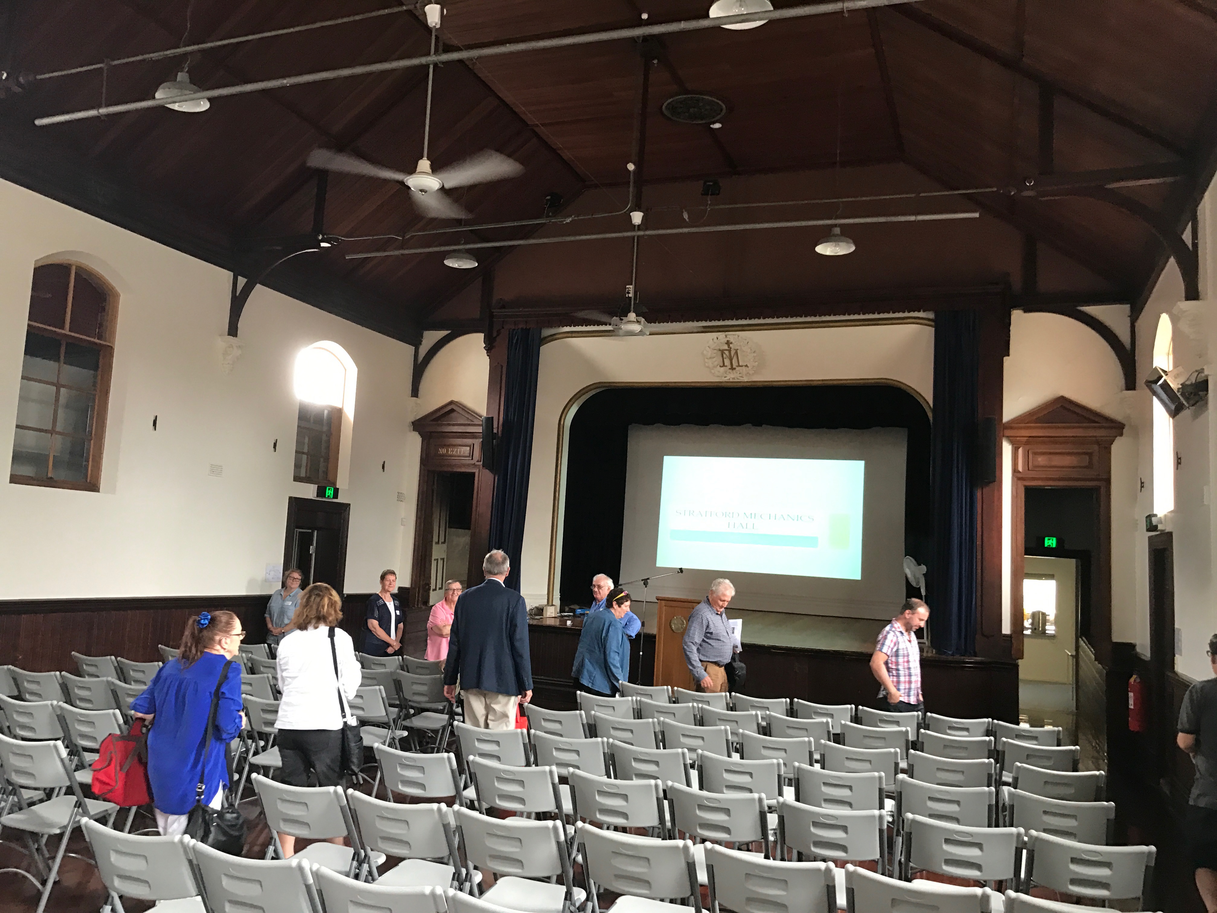 The Stratford Mechanics’ Institute was founded in 1866 and the current building was constructed in 1888. When it was originally founded Stratford lapsed very quickly and another attempt to form a Mechanics’ Institute was tried in 1874, which didn’t work either. However, by 1882 a committee was formed and the library was set up in the shire hall and books bought. By 1888 they’d built the existing hall. In the 1950s a spectacularly ugly addition was built on the beautiful 1800s facade. It mainly housed toilets. In the early 2000s, through fundraising and government grants, the hall was restored to its former 1800s glory. It is run by an active committee and is the home to many local events, including the parts of the Stratford Shakespeare festival.
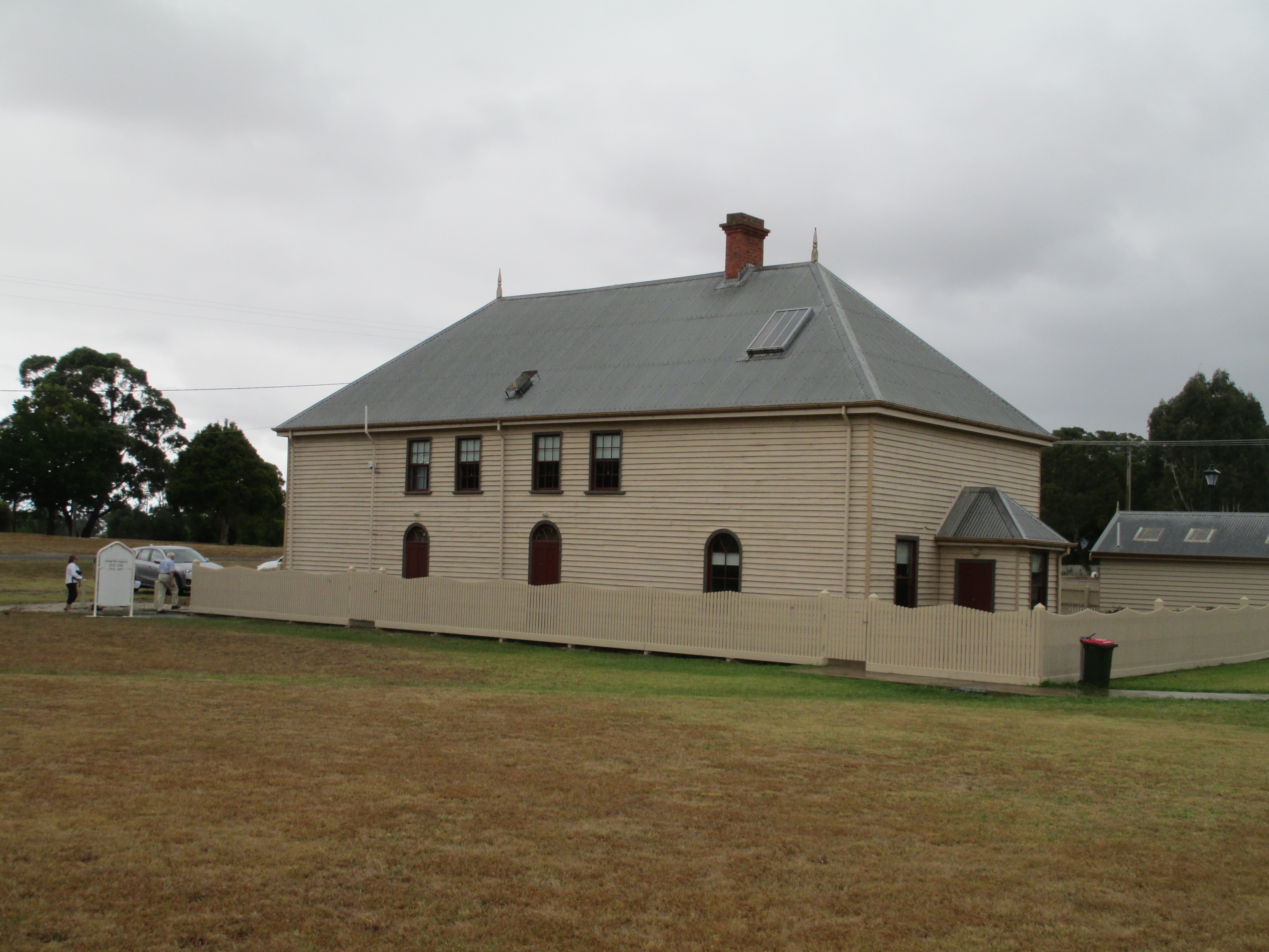
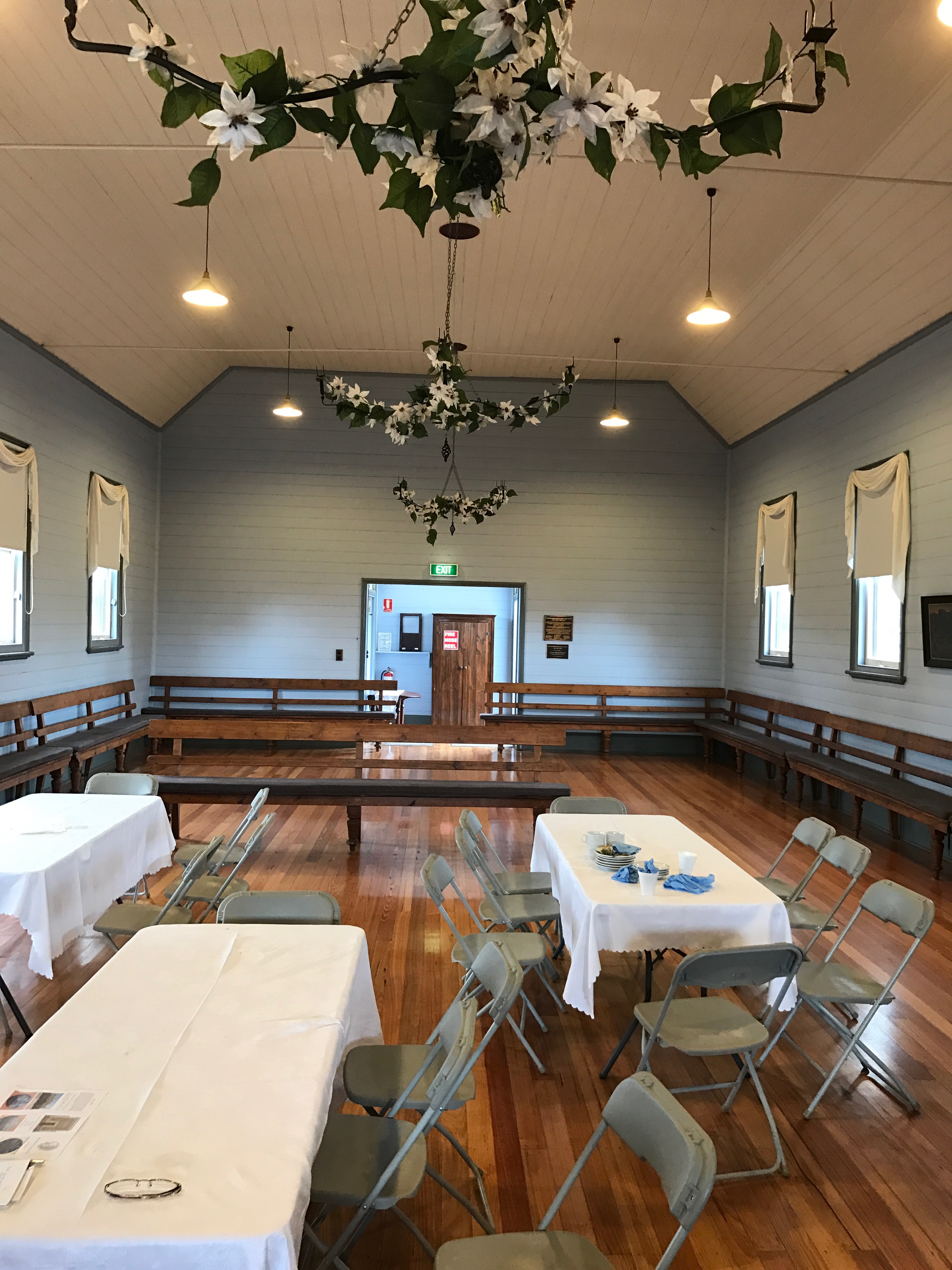
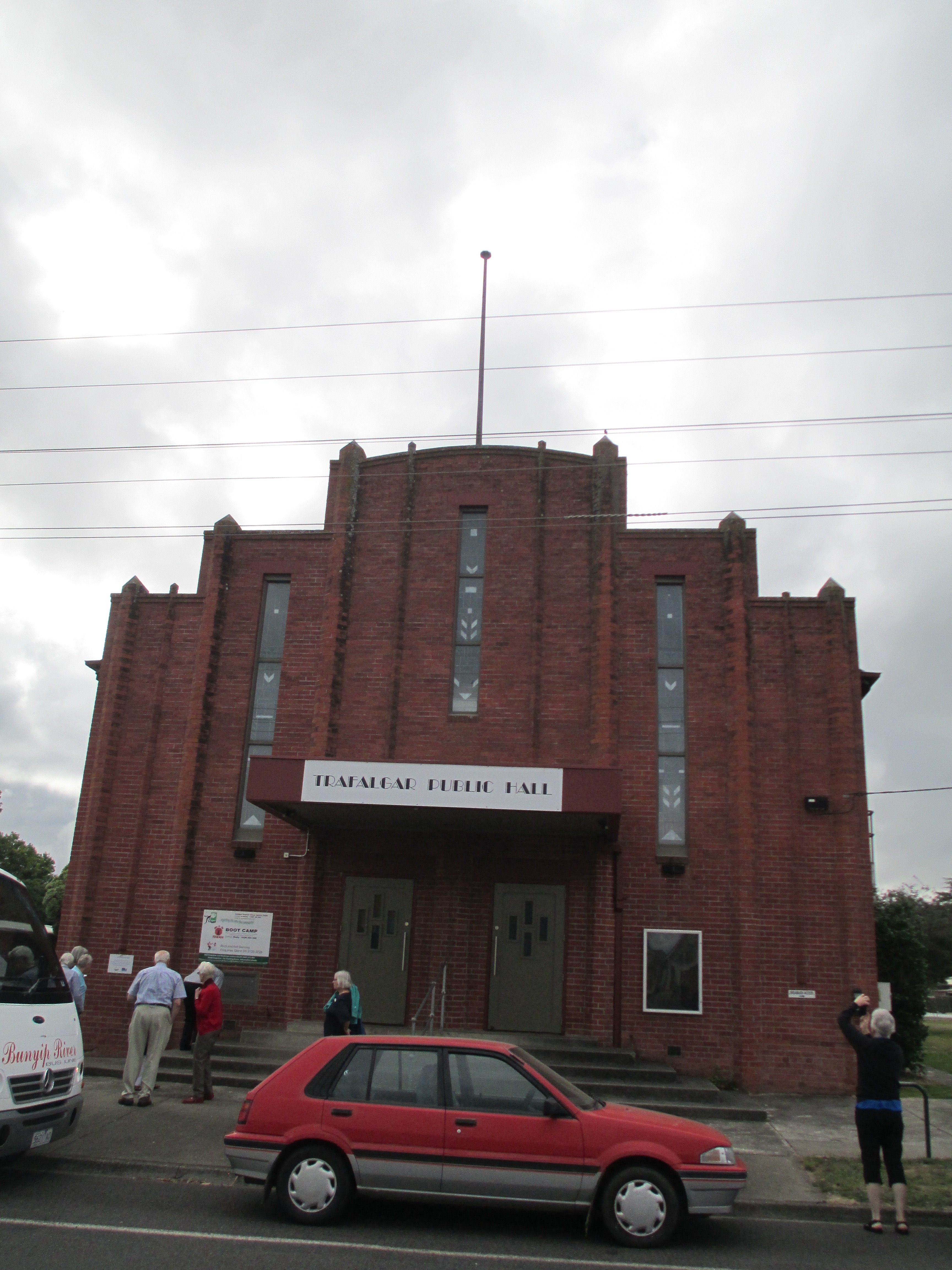
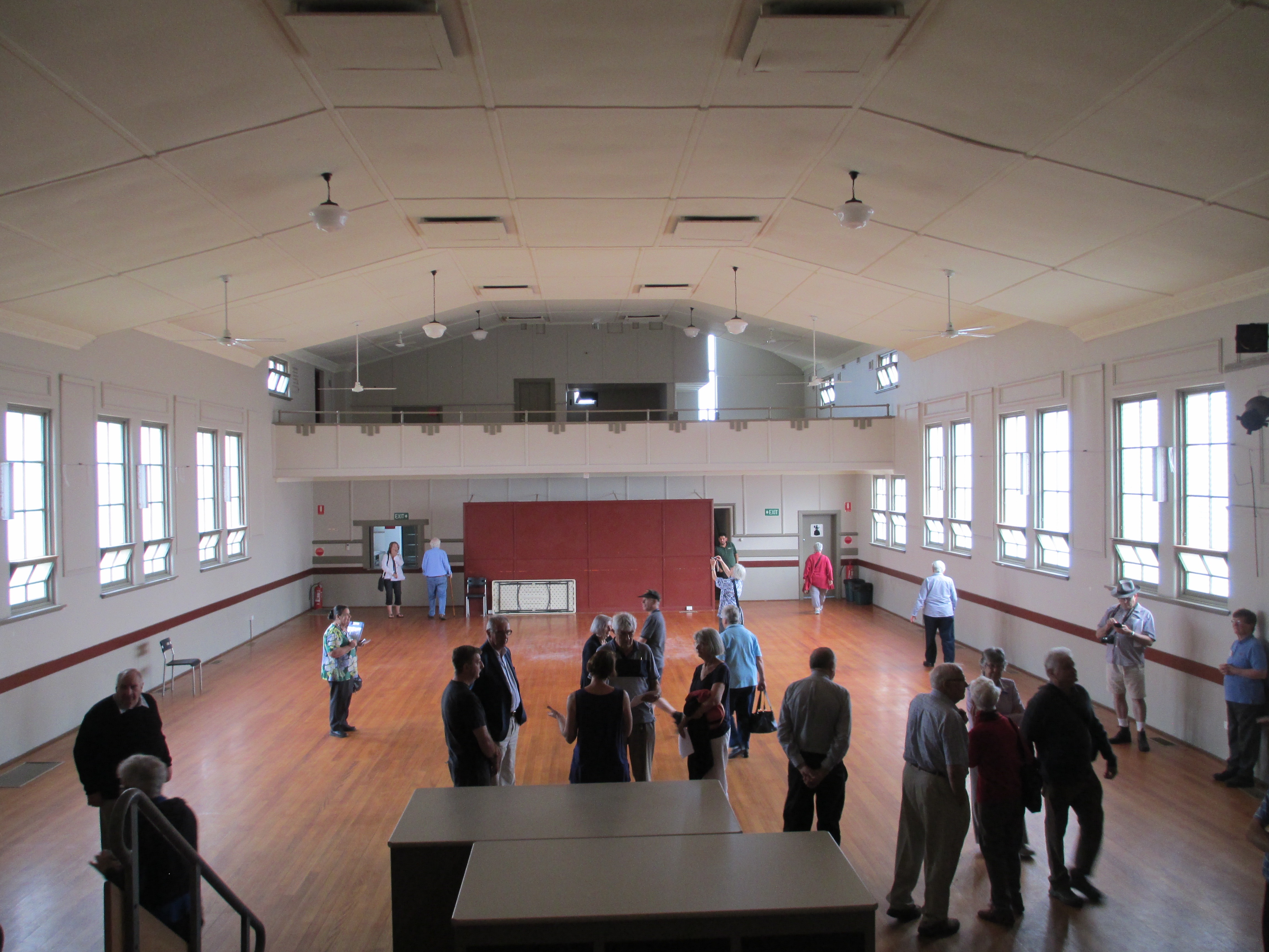
 Port Fairy is a town in Western Victoria that was founded as a town in 1843. There were settlers in the area before this date, and the current name for the town comes from the ship the Fairy which is believed to have arrived in the area in c.1828. The area was also regularly visited by whalers and sealers. The date of 1843 comes from the special survey which was granted to James Atkinson at that time. The special surveys were a system where the government of the Colony of New South Wales was able to control ownership of the land in the Port Phillip District. This was well before federation of Australia as a country in 1901, but also before Victoria became a colony independent from New South Wales which happened in 1851. The basic premise behind the special survey system was to stop squatters just claiming land, because when they did there was little ability to regulate it and there was no fee for the government.


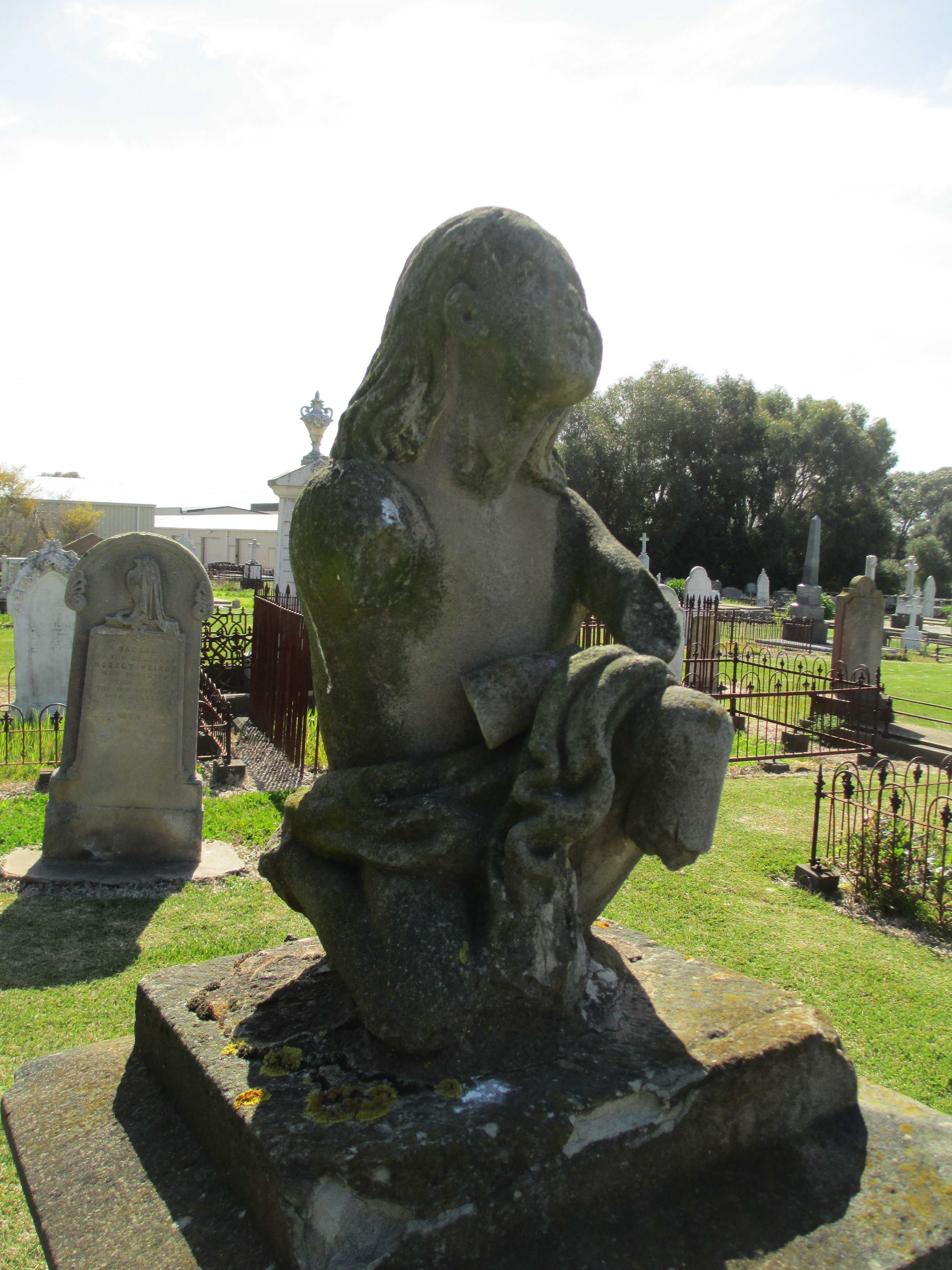
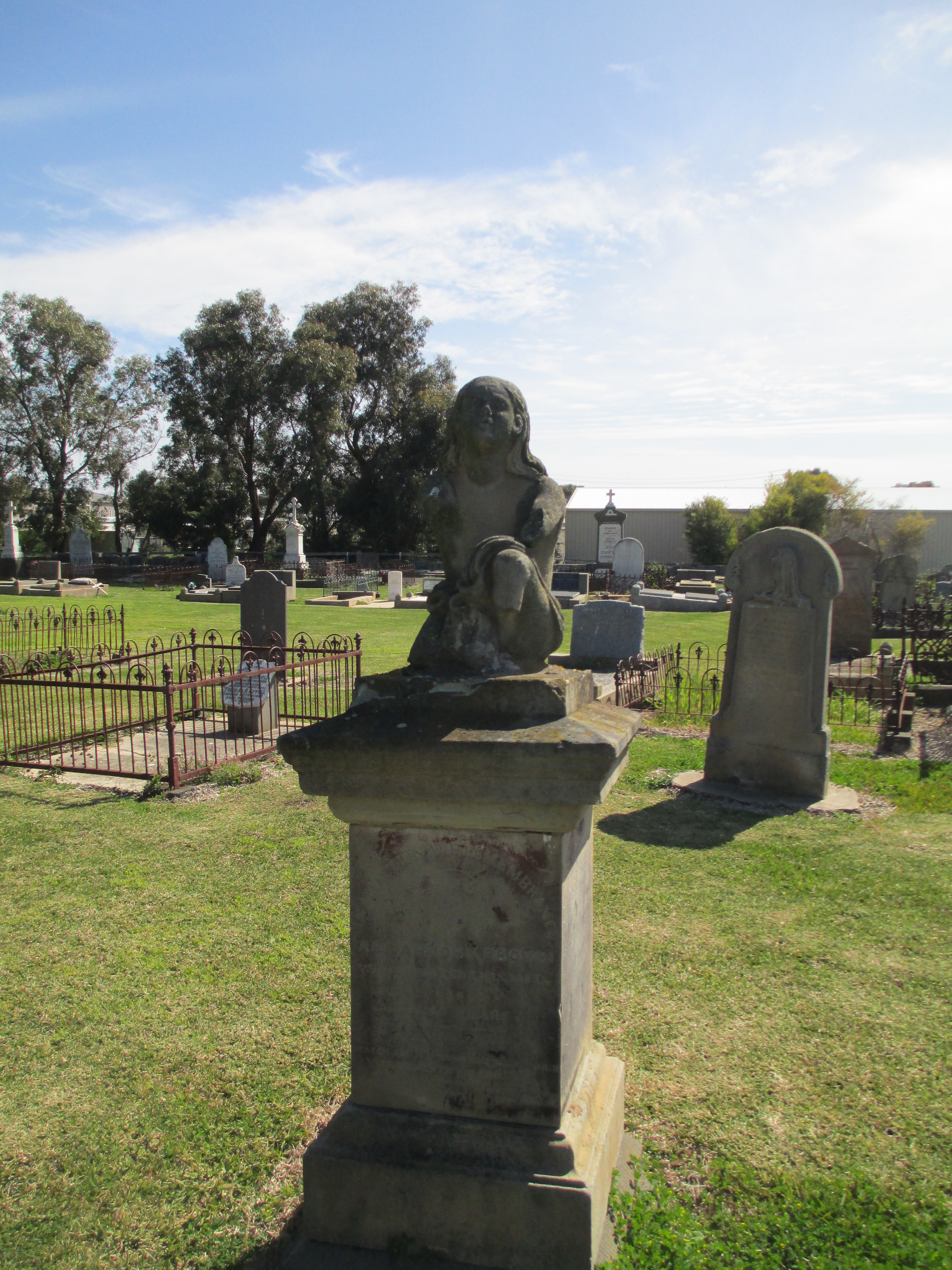 He died in 1862 at the age of 40 and the tomb reads:
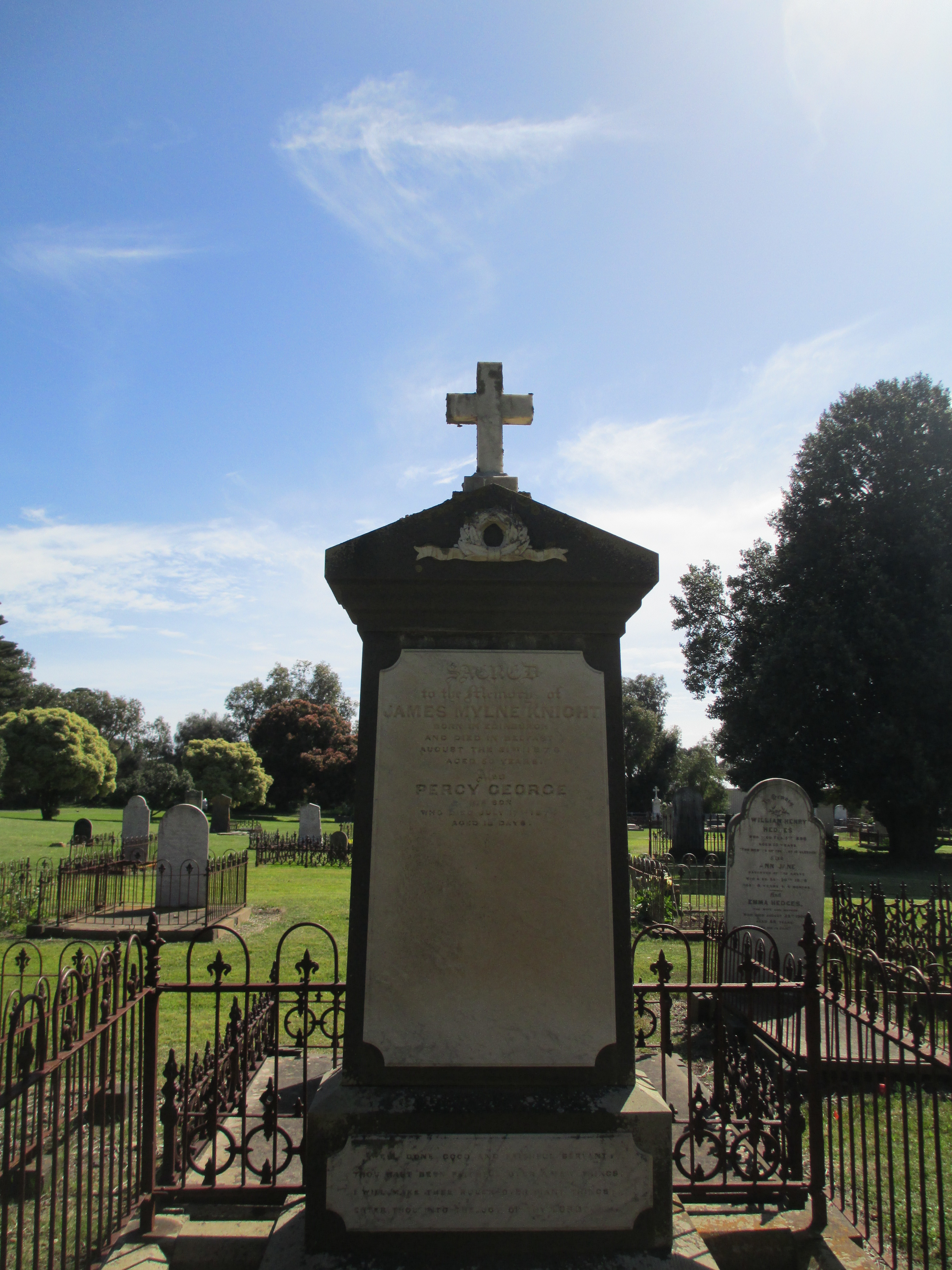

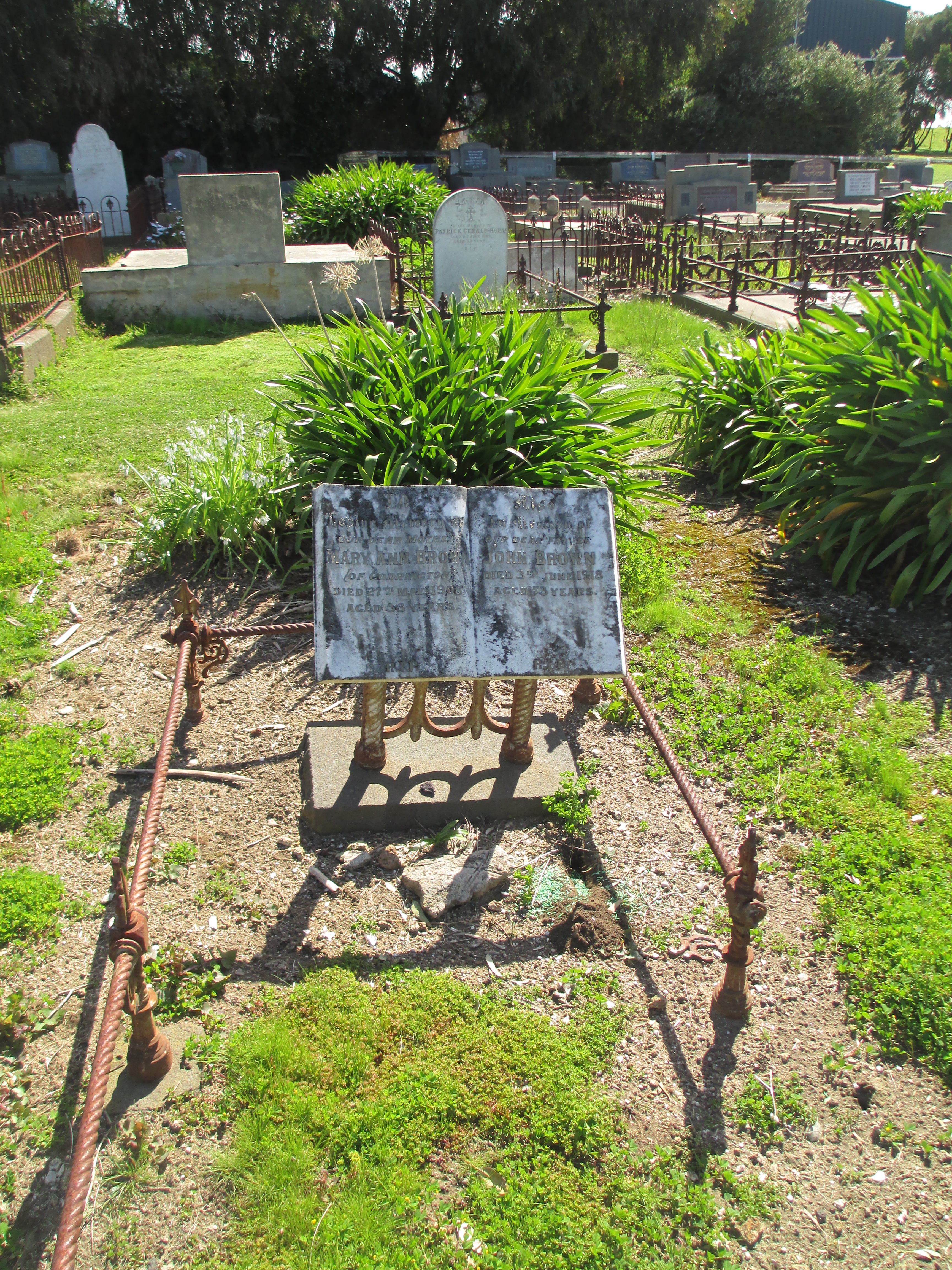
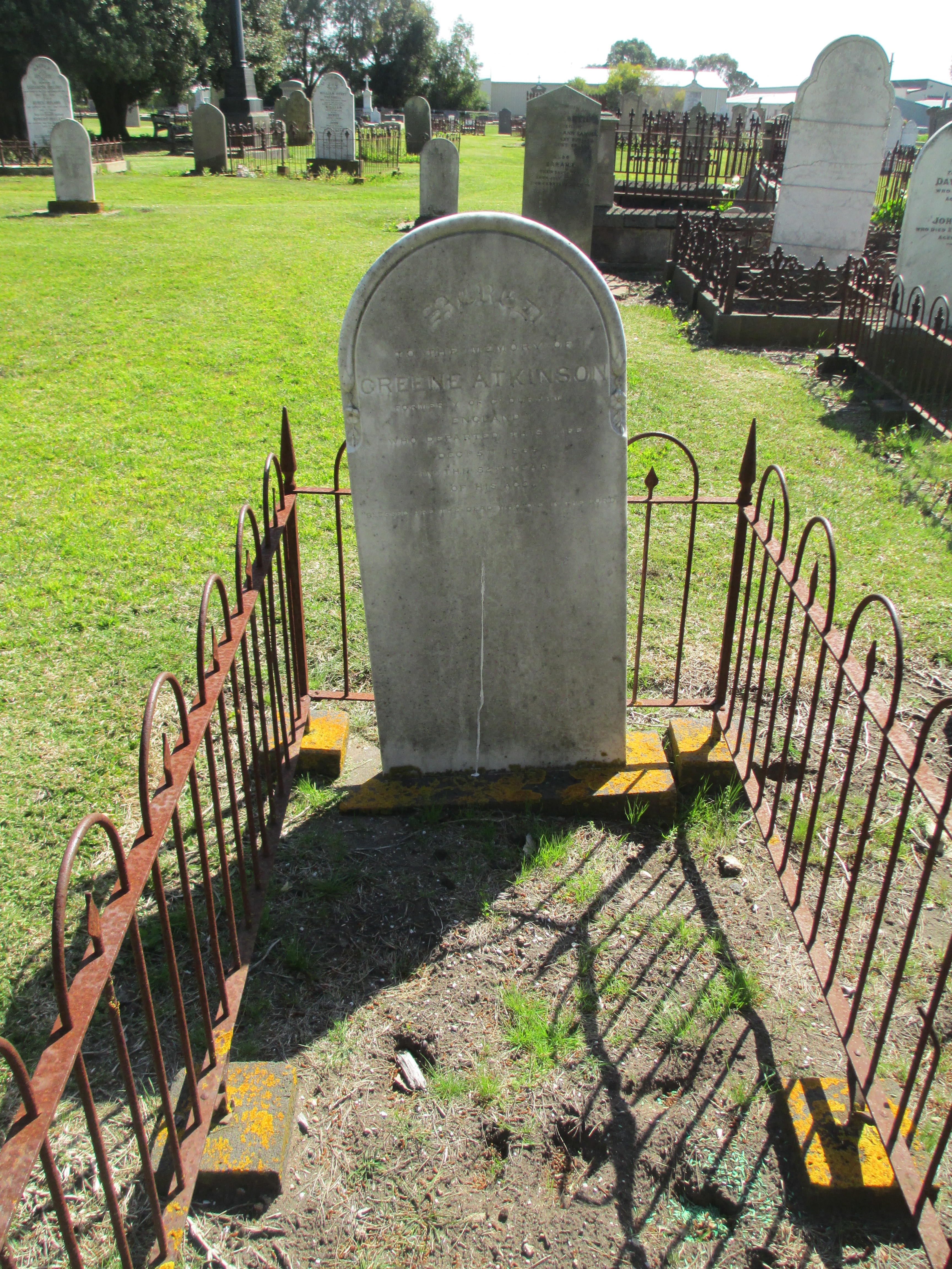 There are more people buried in the cemetery than are known about. Many of the early burials would have been laid to rest under simple wood crosses and these simply wouldn’t have survived the harshness of Port Fairy’s coastal weather. Despite this, the surviving burials provide a fascinating record of the life and death of the early inhabitants of the district.
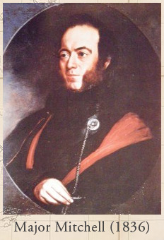
 Just out of Dunkeld
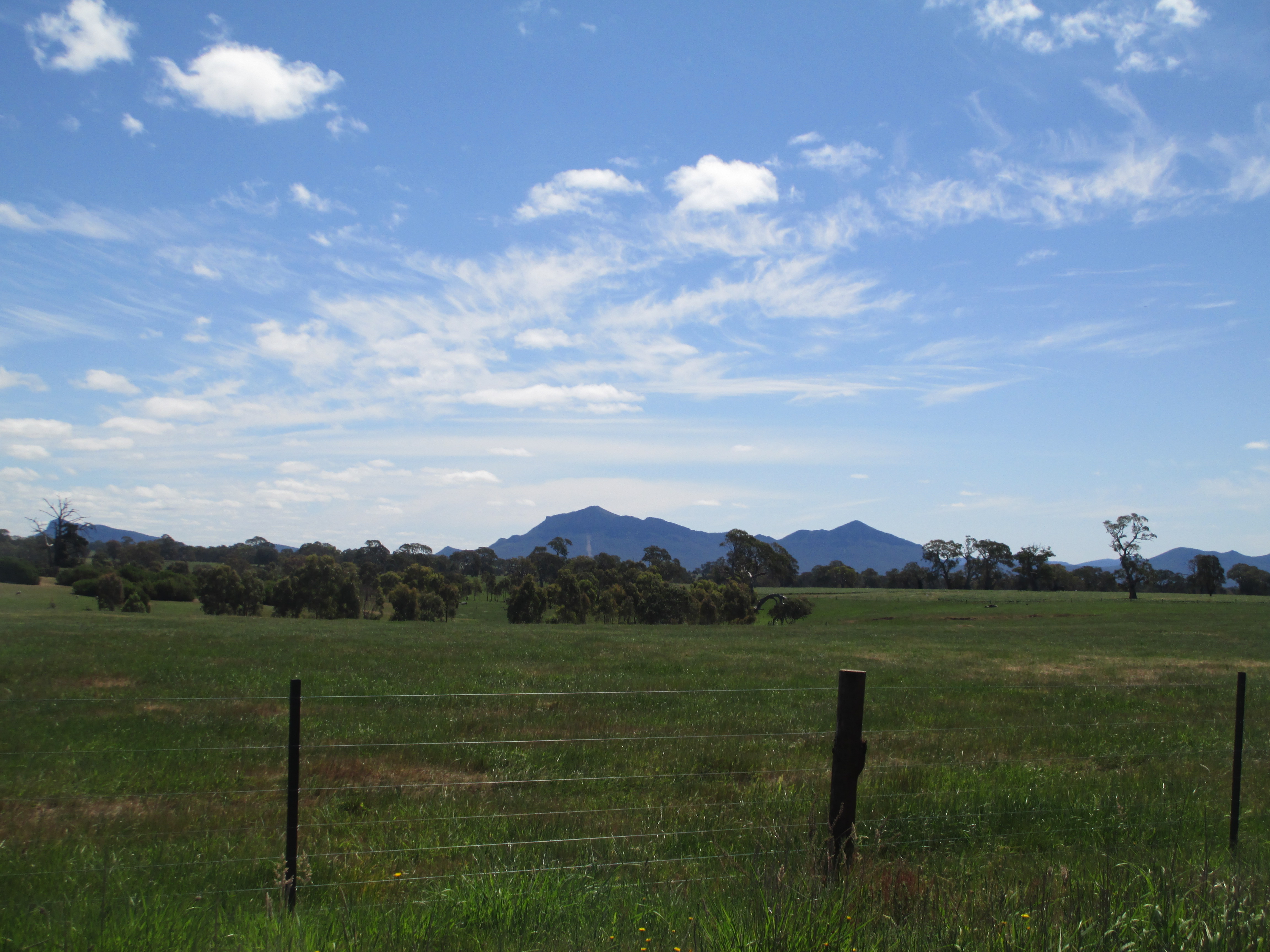

 Grampians from a distance
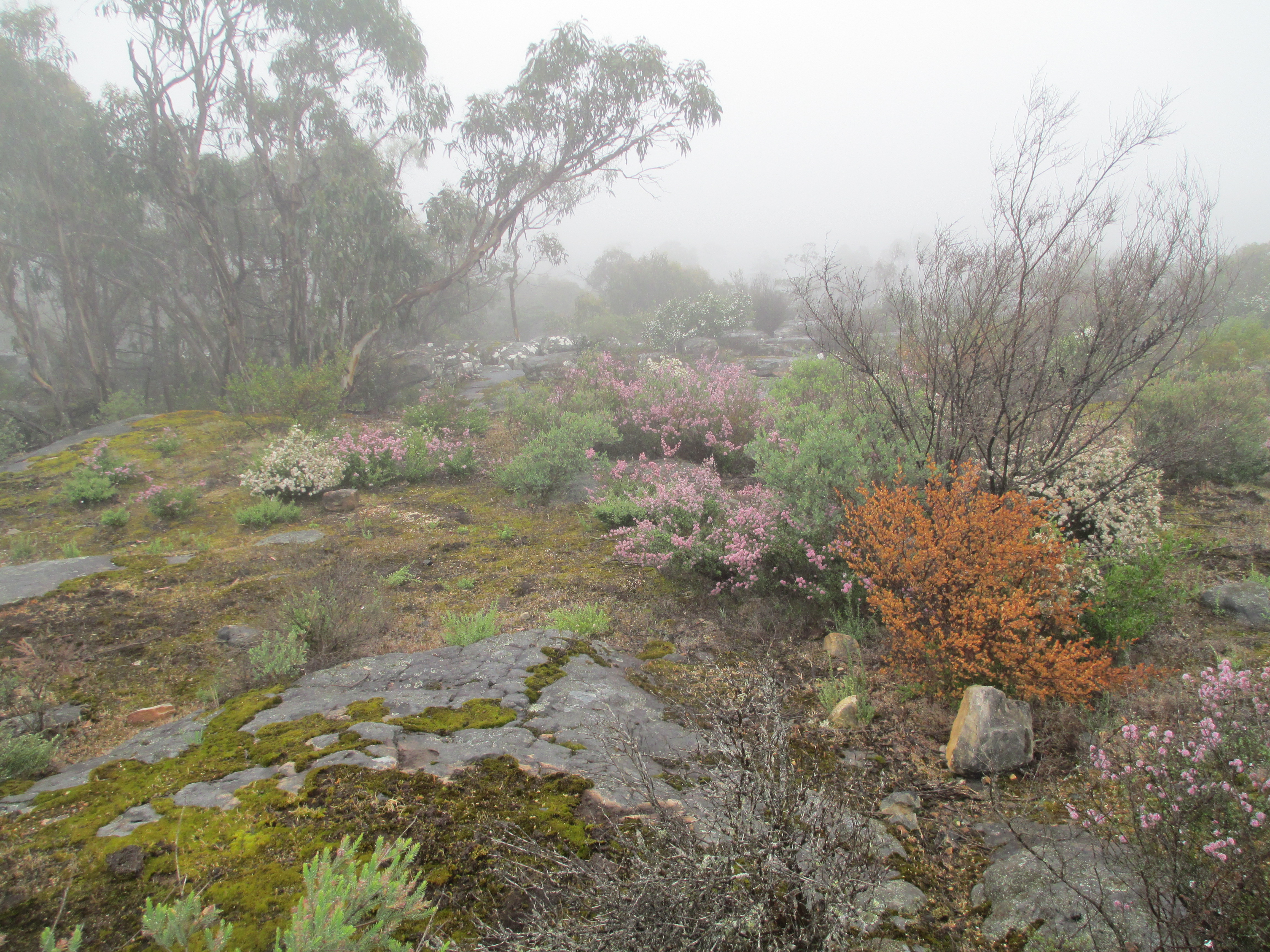 Half way up one of The Grampians
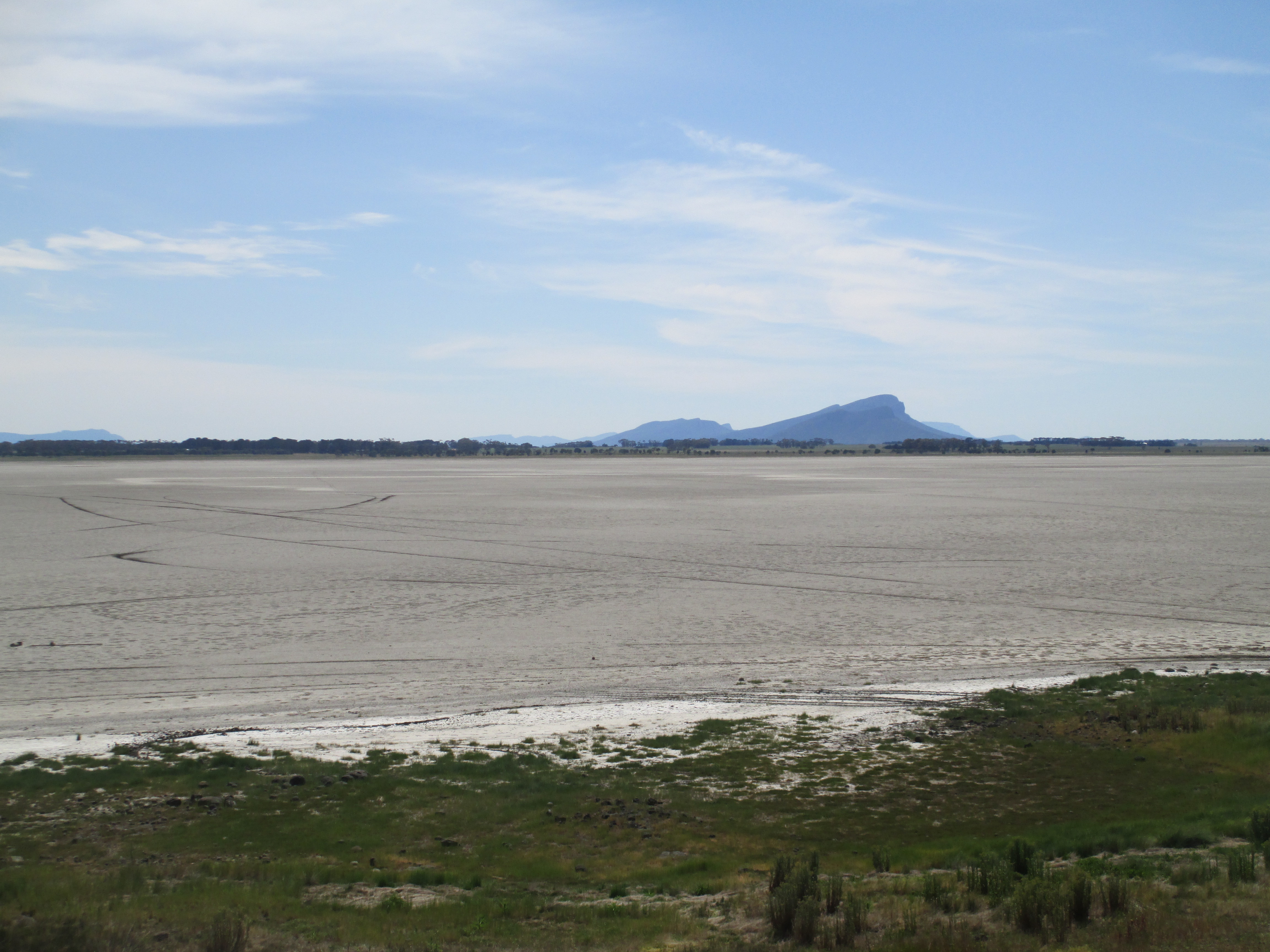


 A very dry Lake Linlithgow
 The side of Mount Rouse
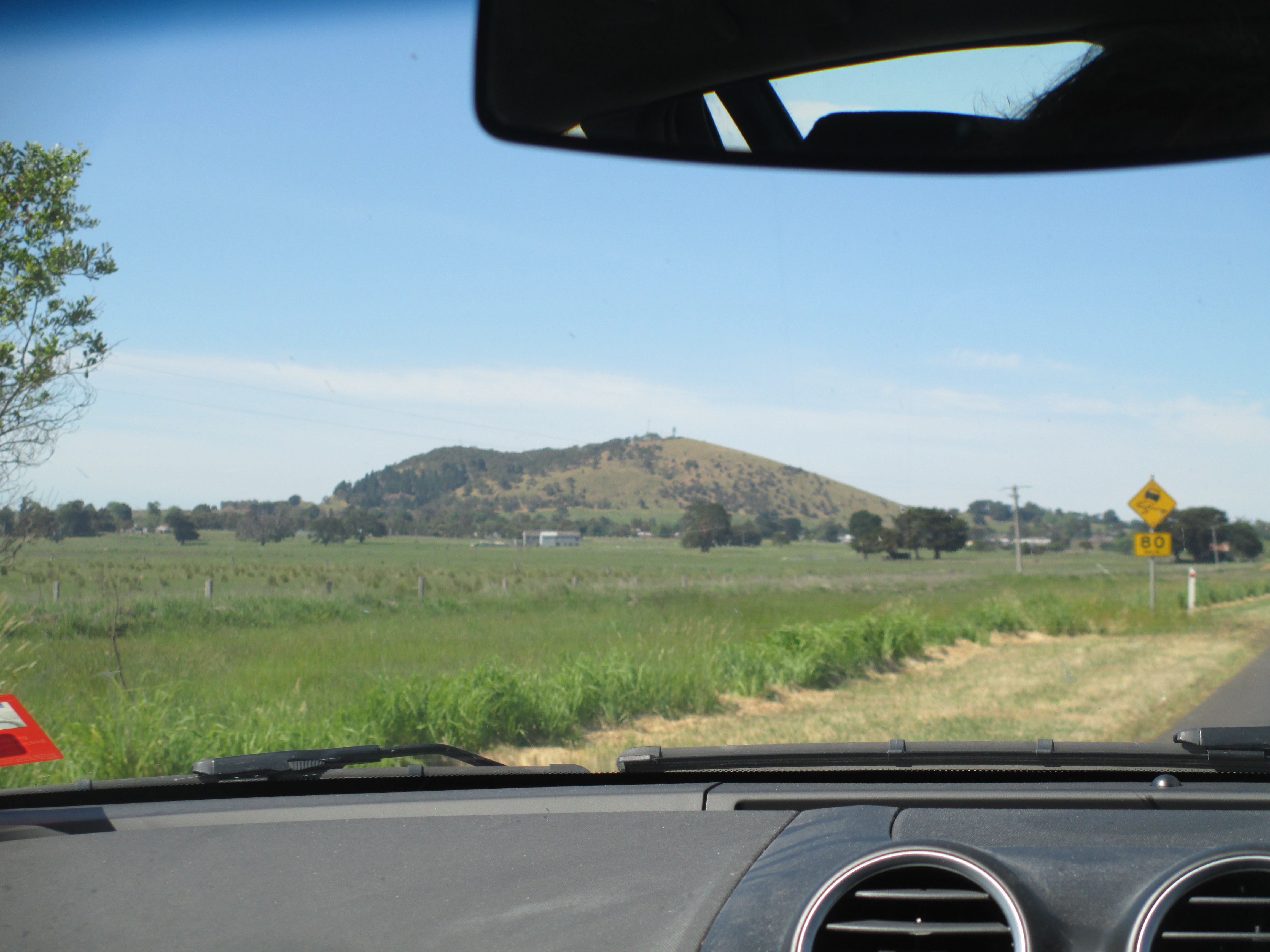 Mount Rouse from the road
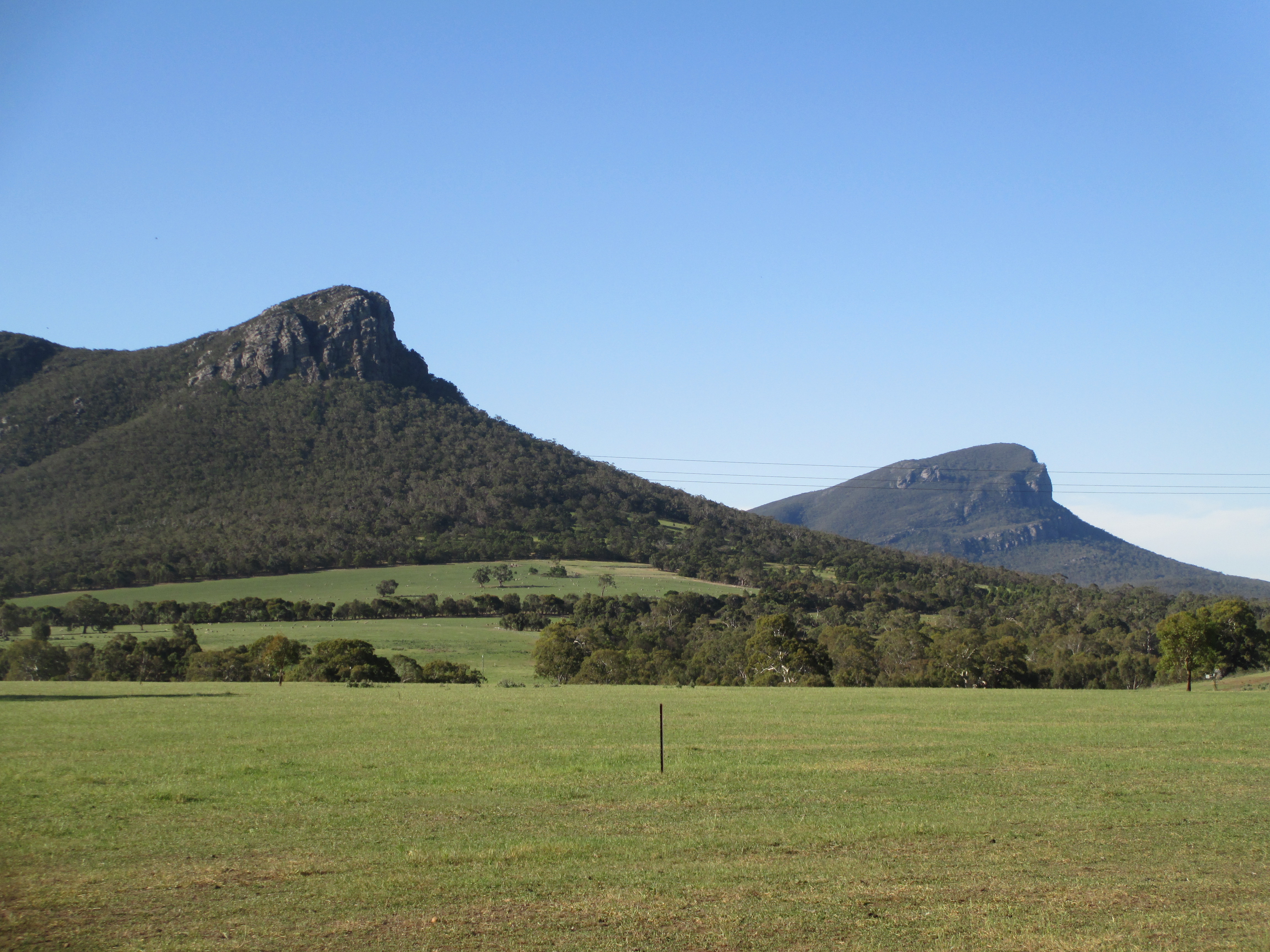 Mount Sturgeon and Mount Abrupt
 The Glenelg in mid western Victoria near Harrow.
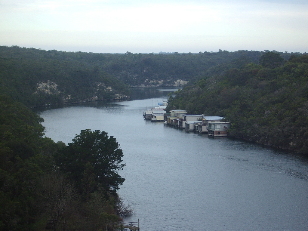 The Glenelg much further down stream near Nelson on the Sth Australian border
 Monument just out of Dunkeld
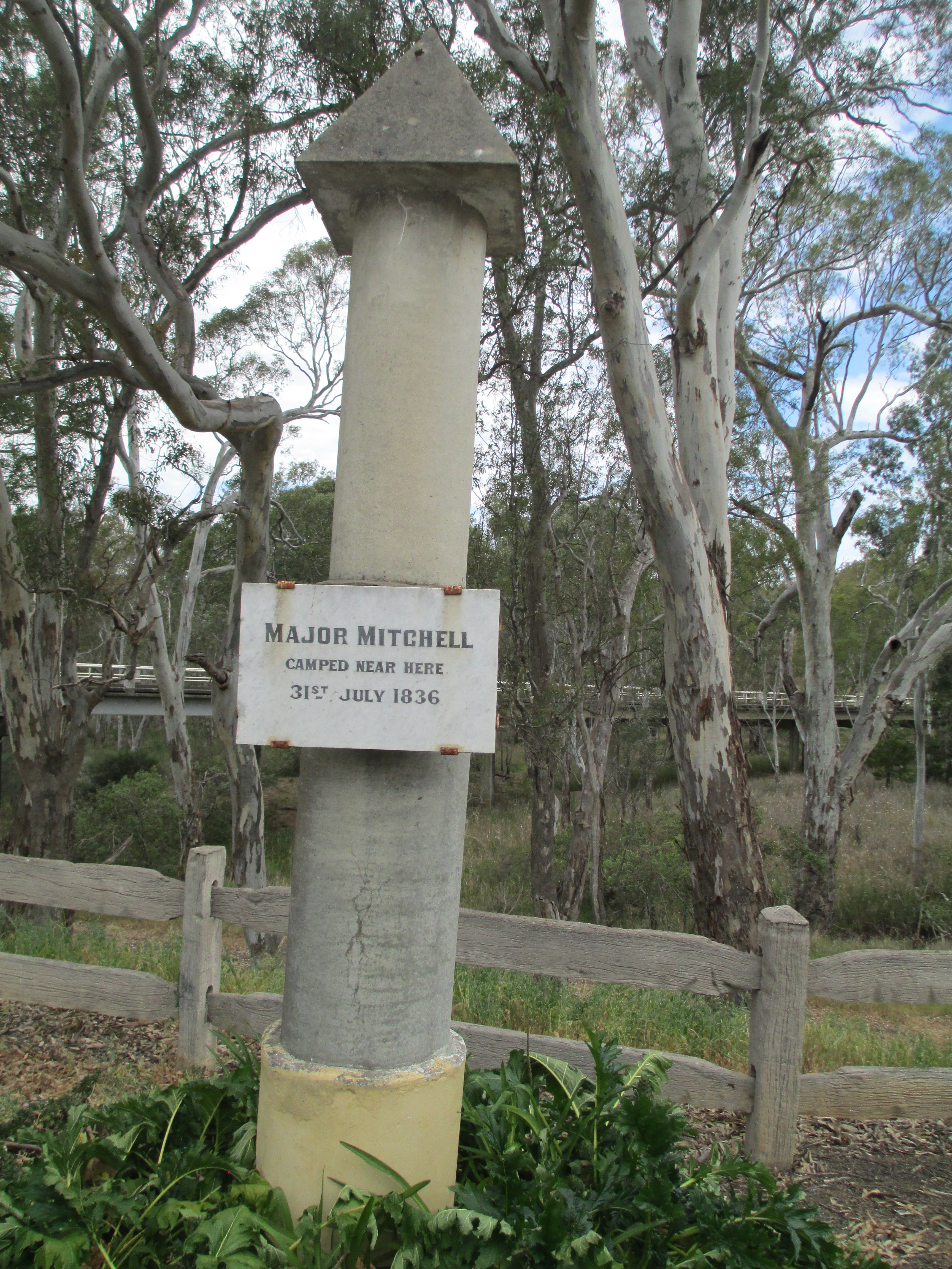 Monument just out of Harrow
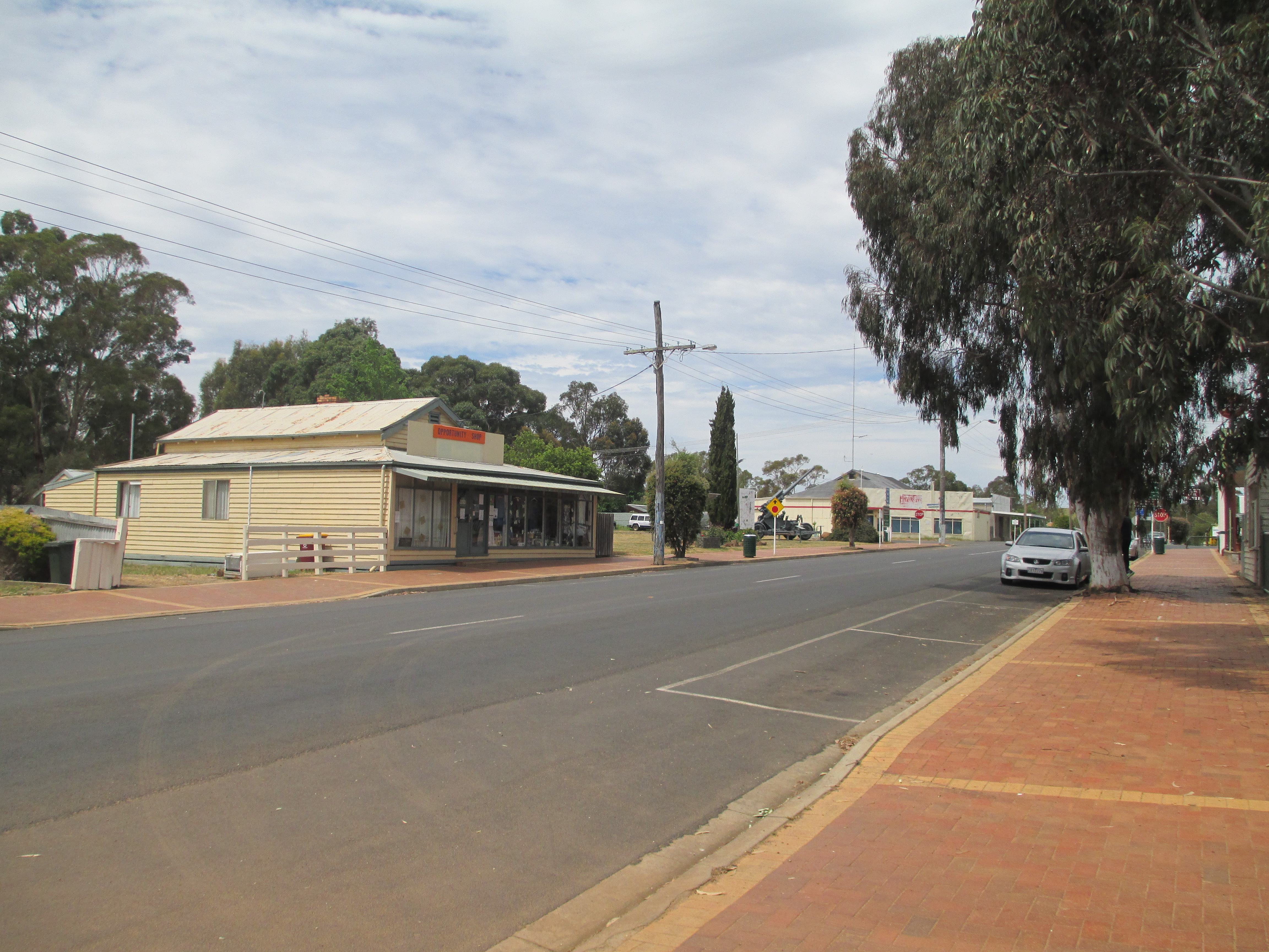 Balmoral
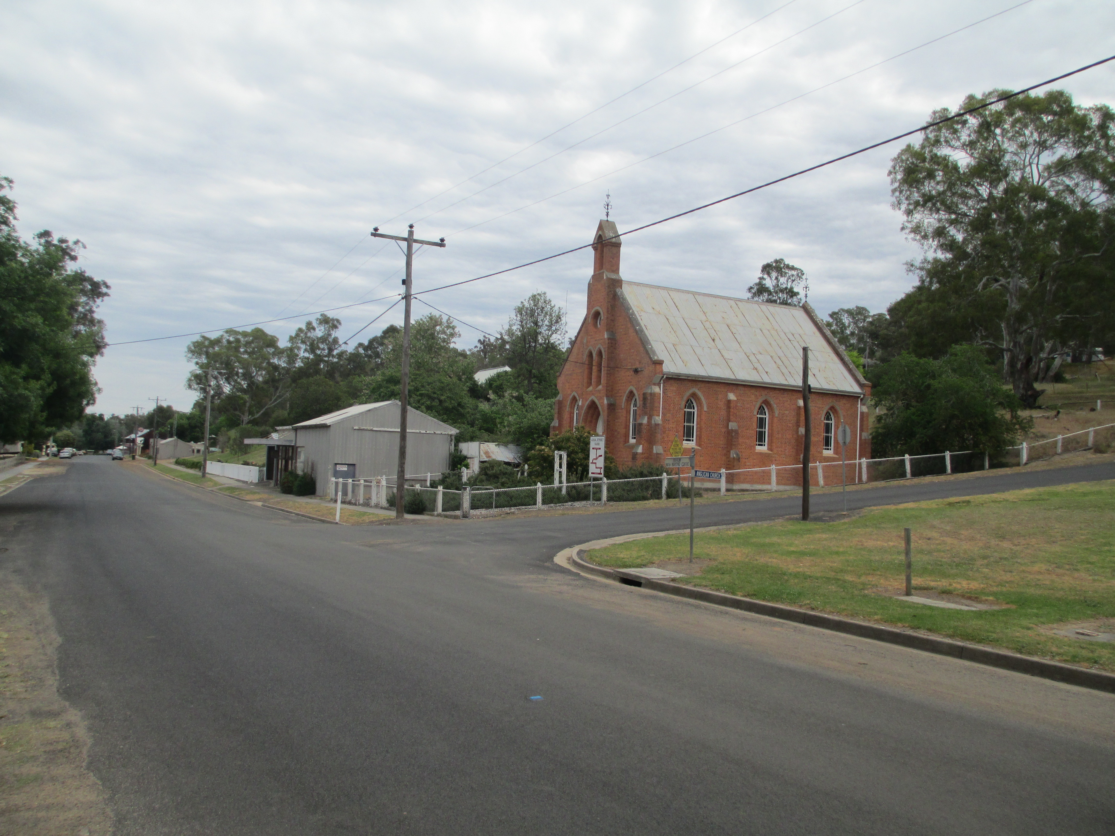 Harrow
 Avoca
Avoca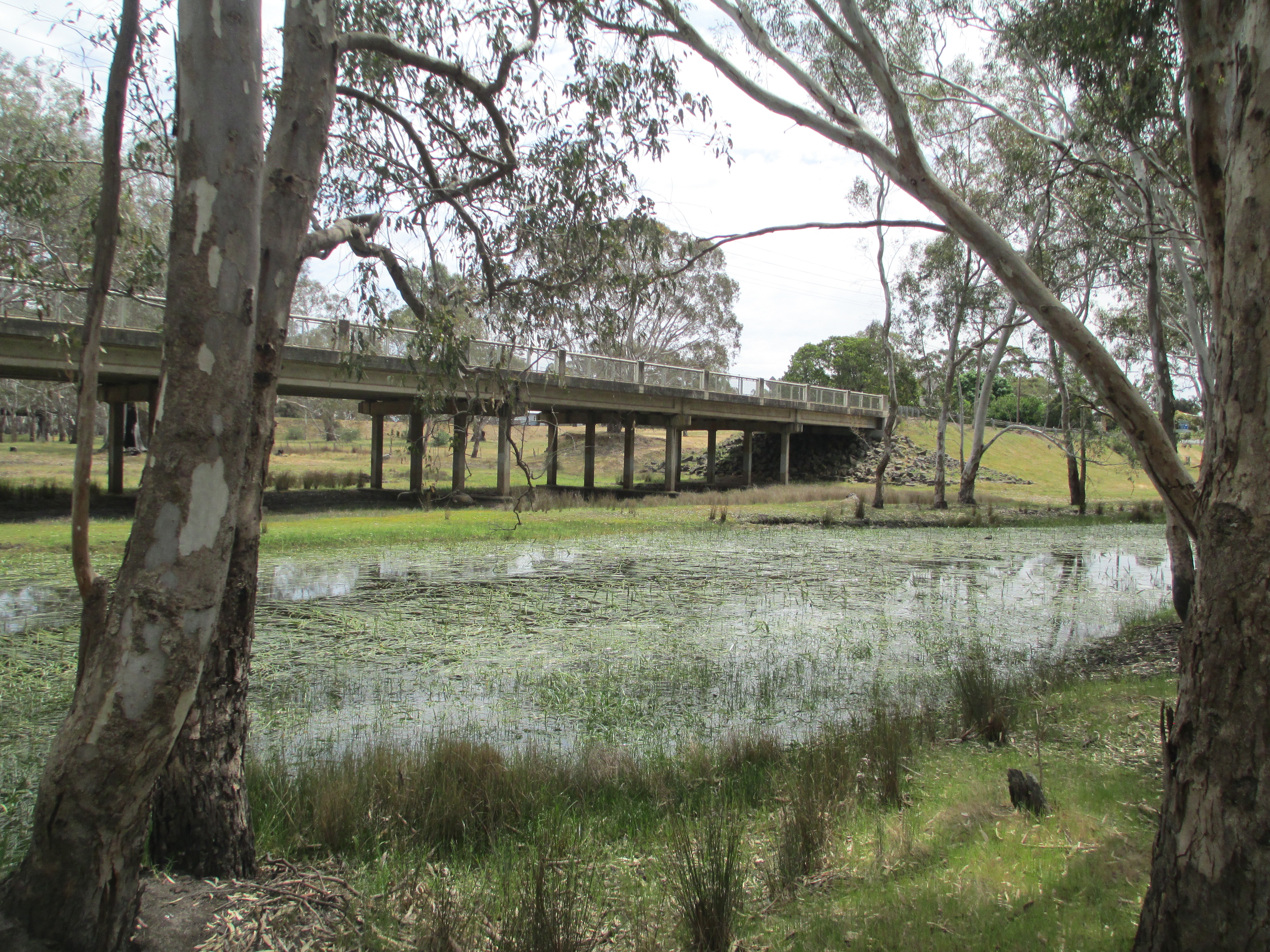 Rail bridge over the Wannon in Cavendish