So, this is technically not a new post. It’s an update to an old one. In 2015 I went on a trip the Wimmera in Victoria and came across two horse troughs in two different towns with the same inscription. The inscription read that they had been donated by Annis and George Bills. You can see them in the photos below
Edenhope horse troughBalmoral horse trough
When I got home I did some digging and found that these two troughs were part of an extraordinary bequest, and that they can be found all over Victoria and some of New South Wales. You can read the original post here, but I’ll provide the overall idea here too.
George Bills made his money out of mattresses, first in making them and then in creating and patenting machinery to weave them. His father, who was a naturalist, came to Australia in the 1800s and, as the Horsham Times described it in 1935, “his heart ached to see the sufferings of dumb animals.” This was a concern that he passed on to his son George who also associated himself with the society for the protection of animals in England, New Zealand and Australia. George’s wife died before him and they had no children so he decided to make provision in his will for the future welfare of animals. The residue of his estate, after several personal bequests, was set aside to provide free memorial horse troughs the length and breadth of the British Empire. Towns applied for them to the trust and many such as Horsham actually have more than one. George died in 1927 and approximately 86 000 pounds was left for the provision of horse troughs. Each was made to the same design and carried the inscription ‘Donated by Annis and George Bills Australia.” By 1937, according the the Adelaide Advertiser, the trust had set up more than 400 horse troughs in Victoria and were expanding to New South Wales.
Sometimes they were for more than horses though and issues could arise, as Dubbo found in 1946. In this particular case dogs and humans were catered for as well as horses. Unfortunately the position of the human’s drinking fountain was problematic. As the Dubbo Liberal and Macquarie Advocate said.
“Unfortunately, lack of foresight was shown in the placing of the adjunct for the public. It is immediately over the small concrete basin for dogs, and at the end of the horse-trough. After drinking, horses have been seen slobbering over the faucet, and dogs licking it.”
The drinking faucet was thankfully moved.
The Dubbo paper also adds the interesting detail that the activities of the trust lapsed during the war period, but began again afterwards, which was when Dubbo applied for its second horse trough with the subsequent problems.
So since writing this original post I’ve been keeping an eye out for them and I’ve found another seventeen that I have photos of. So I thought I’d do this update so I can add in my new photos. And it gives me a spot to upload new ones as I find them. It’s such a fascinating piece of Australian history, and every time I spot one it makes me happy and it’s always interesting to see what use, if any, the town is putting them to now. Anyway, here are the rest of the photos
BallanBirchip
Bunyip
Churchill Island- possibly a more modern replicaEssendonHawksdaleInglewoodLake Coorong Station HomesteadMalmsbury
Two different horse troughs, Pioneer Settlement Swan Hill
It’s been a while, life, work and other writing are basically the reasons. But I’m hoping to get back into a slightly more regular blog schedule, as there’s a backlog of, I hope, interesting things I want to write about. But back to the buried village. The village in question is Te Wairoa, just out of Rotorua on Aotearoa New Zealand’s North Island. The remains of the village sit in a really beautiful dip in a complex volcanic landscape. The map below gives you an idea of both the location of the village and the volatility of the landscape
As you might have gathered from the name, the fate of the village is not a happy one, but although one night of 1886 saw the end of the village, it did have a beginning. So we’re going to start there.
Maori people had been living in the area for generations, but Europeans moved into the area in the early 1800s. The foundations of the town itself are actually, interestingly, rooted in tourism. In the 1850s the local Tarawera iwi began guiding tourists to the magnificent Pink and White Terraces. A tradition that continues with the thermal landscape around Rotorua today. The guides were mainly women, including Guide Sophia who was described as an intelligent and pleasant woman and who bore 15 children. And Guide Kate, who was described as Amazonian. The Pink and White Terraces were extraordinary geological formations of hot and cold sinter baths, described as the 8th wonder of the world. You can see contemporary images of them below.
Victorians (the era not the state) came over long distances to visit these terraces. They were formed over 600 years ago when silica rich residue called sinter, originating from geysers, cascaded down and left thick silica deposits which, when they cooled, built these giant staircases as well as large pools of clear water. The White Terraces were about 280 metre wide and 30 m high, the Pink Terraces were a bit smaller and their colour came from the feric rich waters. You can get an idea of the colour in the painting below.
Objects became petrified by these silica rich waters. You can see a petrified hat below, that maybe a tourist left behind.
Some of the items were intentionally petrified for the tourists, including this toy cot and dog made out of newspaper.
By the 1880s Te Wairoa itself had become the hub of this tourist trade, boasting two hotels: McRae’s Rotomahana Hotel and the unliscenced Terrace Hotel. The village was home to Maori and Europeans and included a school, a church, a meeting house, blacksmith’s, a store, flour mill and houses and whares (Maori dwelling – usually steep roofed). You can see it in the image below.
As you’ll see in the caption above, this was Te Wairoa before the eruption. Which brings us to the night of the June 9th 1886. There were warnings : on May 31st the creek was suddenly dry and then water surged filling the creek towards the lake, but then quickly drained away again. This was noted by Guide Sophia as she led tourists out to the lake. Then when they were crossing the lake in a boat towards the terraces, European and Maori people on the boat saw a Maori waka (war canoe) bigger than any known on the lake, and the men rowing the waka didn’t respond to any calls, so they were thought to be spirits. When the boat arrived at the Pink Terraces they found that a geyser had ejected mud much further than usual. These all together provoked unease across the valley, but there wasn’t really anything that could be done.
All remained calm until the 9th of June.
Shortly before midnight the earthquakes began. By 2:30 am craters were starting to open and erupting with larva along an 8 km rift north east towards the lake. A vast column of ash 9.5 km high rose from the direction of Lake Tarawera, there was a freezing wind, roaring and an eerie red glow. By about 3:20 the destruction had spread. Violent steam eruptions (when molten rock encountered water) sent ash and mud into the sky that blanketed the surrounding area. Debris continued to fall until about 6:00 am and when the dust has settled, the villages of Te Ariki, Moura, Tokiniho, Totarariki, Rotomahana and Waitngongongo were either buried completely or had been on the site of active craters, there were no survivors. In Te Wairoa much of the town was buried and 17 people killed, though amazingly most of the people managed to escape. The landscape was was irrevocably changed. Not only were the Pink and White Terraces obliterated, there was a 16 kilometre rift across the mountain from Tarawera that had opened into the Waimangu valley. You can see the valley below, all the vegetation, apart from a few of the larger trees, has grown since the 1886 eruption.
The eruption was felt all over Aotearoa New Zealand. In nearby Rotorua new hot springs opened up, jets of steam issued from the rocks and geysers spurted along the shore edge of Lake Rotorua. Many people thought the world was ending. You can see a near contemporary painting of the eruption below.
It really gives a sense of the extreme violence. More than 150 people were killed in the eruption, as well as kilometres of land devestated. For the local Tuhorangi, Maori, it also meant the destruction of the remains of their ancestors, many of whom had been entombed on the mountain itself. Most of the victims of the eruption were also Maori.
As the eruption settled rescue groups went out from Rotorua and Ohinemutu to try to find survivors, they met with limited success, especially in the towns closest to the eruption. The higher survival rate in Te Wairoa, though most of the town itself was buried, was partly because it was a little further from the eruption so it wasn’t immediately subsumed. About fifty people made it through the flaming debris to Guide Sophia’s whare, the sloped roof meant that the debris slid off rather than collecting like they did on the European houses and hotels. This meant that the whare stayed standing where as the European buildings collapsed under the weight. This was also true of the Hinemihi meeting house. Of the 17 people who died in the town some died outside, either struck by debris or suffocated from the ash, or they died inside collapsed or burnt buildings.
We have some incredible first hand accounts of the eruption, for example Mr McCrae from the Roromahana Hotel described it as. “We saw a sight that no man who saw it can ever forget. Apparently the mount had three craters, and flames of fire were shooting up fully a thousand feet high. There seemed to be a continuous shower of balls of fire for miles around.” McRae and his guest, staff and several other locals made their way to Guide Sophia’s whare, and all, apart from the one tourist Edwin Bainbridge, survived. Bainbridge died when the hotel’s balcony fell on him when they were trying to escape.
After the eruption no one recieved any government compensation for their destroyed buildings, and insurance companies refused to pay out because people were not covered for volcanic eruption. Ultimately Te Wairoa was abandoned and left buried. It has been the site of a number of archaeological digs over the years, with many 19th century artefacts recovered that paint a picture of life in the lost village.
The last image above is testament to the power of the eruption. It’s a chain found on the site that might have been used to secure the blacksmith’s, it is completely encrusted with volcanic mud which has bound it all up into one solid clump
As part of the digs over the years, sections of the village have been unearthed and can also be explored now. What’s most striking about them for me is just how layered and solid the mud is. It’s hard to imagine that it wasn’t always there.
The last two photos are the remains of stone pataka (store house), it would have been lined with ferns and rushes and used to store potatoes and other crops. It was actually one of the first pieces of the village excavated, a woman called Vi Smith was picnicking beside the stream in the early 1930s and she noticed a stone in the bank and scraped back to the mud to reveal one of the carved stones.
The remains of the buried buildings are not the only artefacts that you can see at the Te Wairoa site. There’s other, in some ways, more unsual items. Including the below carronade. It was found in the stream in the 1930s at the bottom of the waterfall (I’ll come back to the waterfalls in a moment). It’s thought it was brought to Te Wairoa from the coast by the Maori as possible defence against another tribe in the 1860s.
Another interesting artefact is the bow section of the waka tuau, which would have been 30 feet originally. It was used originally in the invasion of the Lake District in early 1800s but, after the invasion, it was used for conveying tourists on Lake Tarawera. Its remains were uncovered below the waterfalls in 1927
The final really interesting artefact was the remains of some wooden posts. This might seem like an odd one, but this row of poplar fence posts survived the eruption with just their tops poking out of the mud. The posts then sprouted and, over the next 126 years, 30 to 40 of them grew to roughly 40 metres. The trees sadly began to fall down from 2010 onwards, and were eventually felled in the late 2010s. You can still see the area where they grew though
The Tarawera eruption was utterly devastating to the landscape, but what feels almost counter intuitive when you’re visiting is how quiet and lush and peaceful the landscape is now. The native bush has magnificently colonised the ‘new’ landscape created by the eruption. And nowhere is this more evident that around the beautiful waterfalls, you can see on the river walk right next to the remains of Te Wairoa.
The story of Te Wairoa and the Mount Tarawera eruption is not complete. Mount Tarawera is still an active volcano that is part of a very active volcanic landscape. Tarawera has erupted at least five times in the last 20,000 years, and the 1886 eruption was actually small compared to earlier eruptions. There is in fact a high likelihood that there will be another larger eruption, the only question really is when, and it may not be for thousands of years. Scientists monitor the volcano and the area for precursors like earthquakes, ground deformation and new or increasing hot spring flow, but ultimately, as with all volcanoes, if another eruption does happen we are as at the mercy of the volcano now as we were in 1886. It’s a landscape that really makes you think.
References:
Site visit 2024 – a lot of the information has come from the excellent signs in the buried village itself
This is a slight departure for Historical Ragbag, as I’ll be looking at a mythical figure. But it still involves research and a good story so I decided it still fit.
In researching for my novel, it’s contemporary and with merpeople but based on Welsh history and mythology, I came across a figure who gets one tantalising mention in the Mabinogion. Dylan of the Wave. The Mabinogion is a series of Welsh stories that are the foundation of much Welsh mythology. I won’t go into great detail about them here, because that is a post in and of itself, but they’re well worth a read if you get the chance. In many ways they’re even more off the wall than Greek mythology, and you can see how much some of them have seeped through into Western concepts of folklore and fairytales. You can read a free version at Project Gutenberg here but I read was the Oxford edition. You can see it in the references at the end.
Anyway, who is Dylan and why did he catch my attention?
To answer that we need to look at the Fourth Branch of the Mabinogion.
The Fourth Branch is broadly the story of Math son of Mathonwy. Math is the Lord of all Gwynedd (Northern Wales today). I’ll provide a brief summary of the story as a background. There will be bits that seem like leaps in logic and that’s because they are. You have to remember that this is a medieval text and the medieval mindset can seem impenetrable to us. This isn’t an overhang of a lost pre-christian mythology, the Mabinogion is very much a Christian text and of its time.
The story kicks off with Math’s nephew Gilfaethwy in love with Math’s foot-maiden Goewin who Math won’t part with. Gilfaethwy is concerned because Math can hear everything that’s said. Math’s other nephew Gwydion (who is a magician) suggests starting a war with Powys and Deheubarth (both kingdoms in Southern Wales) so Gilfaethwy can have Goewin. There’s magical pigs involved, but a war is started and while Math is away Gilfaethwy rapes Goewin in Math’s bed.
When Math returns he discovers the rape because he can only place his feet in the lap of a virgin and Goewin is no longer one. She tells Math of Gilfaethwy’s actions. Math changes Gilfaethwy and Gwydion into a hind and a stag and binds them to mate with each other and take on the nature of the two animals for a year. At the end of the year the hind and stag return with a fawn, Math changes them into a boar and a sow and sends them out again (though he fosters the boy who had been a fawn). At the end of another year the sow and the boar are back with a young one. Math then changes them into a wolf and a she-wolf and sends them out again. Again he fosters the boy who had been the piglet. At the end of that year the wolf and she-wolf return with a cub. Math considers his nephews punished enough and restores them to men, telling them of their fine sons.
Math then asks his nephews about finding another virgin to be his foot-maiden and they suggest their sister Arianrhod. Math uses his magic to test Arianrhod’s virginity and as she steps over Math’s magic wand a large sturdy yellow haired boy drops from her, Arianrhod gives a cry and runs away but as she does something small falls from her and Gwydion gathers it in brocade and hides it in a small chest at the foot of his bed. Math take the yellow haired boy and says “I will have this one baptised. I will call him Dylan.” And he is baptised.
The Mabinogion goes on to say
As soon as he was baptised he made for the sea. And there and then, as soon as he came to the sea, he took on the sea’s nature and swam as well as the best fish in the sea. Because of this he was known as Dylan Eil Ton- no wave ever broke beneath him. The blow which killed him was struck by Gofannon, his uncle and it was one of the Three Unfortunate Blows.
This is the introduction of Dylan of the Wave.
The Fourth Branch of the Mabinogion continues with the scrap in the chest – who turns out to be a child who came to be called (after some trickery) Lleu Llaw Gyffes and Gwydion who helps him overcome various obstacles including making a wife for him out of flowers- Blodeuwedd (who gets a very unfair hand and who I’ll write something about later). But this is the only mention of Dylan in the whole of the Fourth Branch.
So why did this get me interested? Firstly because the book I’m working on is about mer people and the sea, so having a Welsh mythological figure tied to the sea so explicitly was very useful from a narrative perspective. Secondly, because in a panoply of the extraordinary Dylan sort of pops up and vanishes again, and some quick Googling doesn’t turn up masses. So I did some more digging. I started with the Three Unfortunate Blows.
This is a triad. Triad’s are a key to mythology. I’m still getting my head around them, but essentially they are circumstances or thematic instances that come in threes. They can be found throughout Welsh folklore and belief systems, as well as legal codes. They are also often reflected in bardic works and poetry, including the metre of some poetry. They are found in several surviving Welsh manuscripts and referenced in most Welsh mythology, often the same ones, they are cross referential. A good example are the three arrogant men of the island of Britain: Sawyl High Head, Pasgen son of Urien and Rhun son of Einiawn. So in the case of Dylan what were the Three Unfortunate Blows? I spent quite a bit of time trying to find the listing for them, but then worked out that unfortunately they are one of the lost triads. This means that all that has survived is mentions of them, rather than the triads themselves. One of these mentions is from the Book of Taliesin which refers to Dylan’s end, and tells us a bit more about Dylan himself as well as Gofannon who struck the blow. It’s called the Elegy of Dylan, Son of the Sea:
“One highest God, wisest of sages, greatest in might –
Who was it held the metal, who forged its hot blows?
And before him, who held still the force of the tongs?
The horsemaster stares – he has done lethal hurt, a deed of
outrage,
Striking down Dylan on the fatal strand, violence on the
shore’s waters,
The wave from Ireland, the wave from Manaw, the wave from the North,
And fourth, the wave of Britain of the shining armies.
I plead with God, God and Father of the Kingdom that knows no refusal,
The maker of Heaven, who will welcome us in his mercy.
The details about Gofannnon that the Elegy is alluding to are that Gofannon was a smith endowed with supernatural powers. Again another character embedded in a the broader mythological landscape.
This isn’t Dylan’s only mention in the The Book of Taliesin. He’s also referenced in the legendary dramatic poem The Battle of the Trees. Which is worth reading in its own right as it (at face value) tells the story of Gwydion animating the trees of a forest to fight for him. It also covers Taliesin’s creation, and this is where the line about Dylan appears. The line is a short one “I was in the citadel with Dylan, Son of the Sea.”
The Book of Taliesin is itself an astounding survival. It’s a manuscript dating from the first half of the fourteenth century and is a collection of poems and similar works supposedly by or about the great bard Taliesin. It’s arguable if Taliesin was a real person or not but he is the greatest of the Welsh bards, and could be a conflation of a real person from the 6th century with a mythological figure.
But, to not sidetrack myself (or not too much anyway). The Elegy presents Dylan as someone worth having an elegy written about. It and the line in The Battle of the Trees also situates him as an important being in Welsh mythology and belief, someone who appears in more than one text and someone who was well enough known to be understood from just one line.
Dylan also appears briefly in the Black Book of Camarthan too (another amazing medieval survival) where his grave is mentioned as “Where the wave makes a noise, the grave of Dylan is at Llanfeuno.” This is probably a peninsula in South Wales.
These are not the only mentions of Dylan in Welsh texts, but they give the context.
What all this means, is that there were more stories about Dylan and his exploits but they haven’t survived. Some of this is because the written sources that have survived have largely been by chance, and partly because some were certainly oral traditions and might not have been written down. Dylan does survive in odd places though, aside from all these mentions. His name is incorporated into a couple of place names, though tangentially, and rough seas and the roar of the tide at the mouth of the river Conwy is said to be the death groan of Dylan.
You can see the Conwy estuary below
There is also a school of thought that Dylan is the remnant of a lost sea divinity, and or that he was an early iteration of a merperson. While both are certainly a possibility (and something that we’ll never know), what it means for me is that I have a fairly blank slate to work from. So Dylan has become part of my world a ‘real’ building block to layer a new story on, and I kind of like that.
References:
Books:
Book of Taliesin: Translated by Gwyneth Lewis and Rowan Williams: 9780241381137
The Mabinogion: A new translation by Sioned Davies 9780199218783
Trioedd Ynys Prydein: The triads fo the Island of Britain edited by Rachel Bromwich
9781783163052
The Celtic Myths That Shape The Way We Think by Mark Williams 9780500252369
The story behind this post comes from a couple of pages of Dr Clare Wright’s excellent book The Forgotten Rebels of Eureka. It’s a fascinating read with lots of really interesting information, but there was one aside apart from the broader narrative that, when I read it a few years ago, made me go, ‘wait, what?’ It describes a night in September in 1854 when Melbournians flocked to the port with makeshift weapons at the ready, convinced that the Russians were invading.
This might seem utterly ludicrous and, spoiler alert, it turned out to be a hoax, but In 1854 the Crimean War was raging and as an outpost of the British Empire Melbourne considered itself at risk. I was officially interested enough to do some more digging. I actually wrote a short story about it a couple of years ago, but I thought a factual look at the situation was worthwhile too. Hence this blog.
So to start at the beginning. What was Melbourne like in 1854? The city was in the midst a massive boom, with the gold rush in full swing. This meant an incredible influx of people from all over the world. In 1851 the population was 77 000, by 1854 it was 237 000 and 411 000 by 1857. This was a city growing and changing rapidly, and expanding, trying to find places for all the new people to live and resources to support them.
I also want to pause the discourse to acknowledge that this mass immigration was not to an unoccupied country. The land Melbourne stands on was known as Naarm and was, and is, home to the Bunerong people and the Wurundjeri Woi Wurrung people of the Kulin Nation. The colonisers moving in were actively stealing the land from the First Nations people. They, and the government, also worked to systematically kill, oppress and stamp out both First Nations people and their culture. So while Melbourne was a fantastic melting pot of a town that was growing seemingly exponentially, it was also a city of death and oppression. Importing the history of wars half way around the world, along with disease and death, for First Nations people.
So Melbourne was growing and lot of European ‘civilisation’ was imported with all the people. This included Britain’s enemies, and this is what gave rise to panic about the possibility of Russian invasion. The furore was enough that battalions were formed. In Geelong a rifle corps was organised, and a regular half holiday was declared (it didn’t last long) for men to train to fight if needed. There was genuine concern, with newspapers publishing lists of the Russian ships that had been in the Pacific.
The situation was perfectly encapsulated by Celeste de Chabrillan who was the wife of the French Consul in Melbourne and a fascinating lady in her own right as she was a former circus performer, dancer and courtesan. She described the time as “Since the Crimean War, which is always on their minds, and because there is not a single warship in the Melbourne harbour, they are always imagining that the Russians are going to attempt an invasion to pillage the gold of the whole of Australia.”
This fear was also recorded in the papers of the time. In May 1854 The Adelaide Observer, observed that “It may be that there are no real grounds for the serious apprehensions entertained at Sydney and Melbourne of a sudden attack on these places by a Russian Force, and it may be, also, that there are good and sufficient reasons for anticipating a sudden onslaught on the gold colonies by an enemy’s force of superior power, and tempted, perhaps, by the feeling that no sufficient preparations to repel an attack have been made.”
So this was the atmosphere that reached a boiling point on the 8th of September 1854. It was a hot night, and the inhabitants of Melbourne were restless. In this already on edge city, cannon-fire was heard from the bay, and rockets were seen in the sky. The Geelong Advertiser and Intelligencerset the scene: “all sorts of conjectures were flying around as to the cause of these demonstrations, some said it was the Russians come at last and nothing short of a fight or bombardment was expected to take place.” Soon “thousands of people were hurrying from all directions down the road to Sandridge [Port Melbourne], determined to see what was up and by no means inclined to turn tail upon the Russians even if they were there. Should it ever happen that an enemy were to enter our Port the people, if armed, would fight like tigers.“
Celeste de Chabrillan’s husband Lionel was one of the men who followed Governor Hotham, who had arrived from Toorak, to the port. “They follow him, they run towards the habour. Lionel does likewise. The sky is red and all the ships in port seem to be on fire.”
But Lionel is soon back. “Drenched in perspiration. He falls into a chair and laughs so much he can’t say a word to me. It was all a practical joke.”
So what had actually happened? The ship The Great Britain had been released from quarantine that night and, either to celebrate being released from quarantine or to get back at Melbourne for being put in quarantine in the first place, the captain decided to fire his cannons and fire rockets into the air. Whether it was celebration, or a practical joke depends on which version you read. Celeste went on to say that the captain of The Great Britain “simulated naval combat” to “get his own back for having been put in quarantine.” Some of the papers reported that “the firing of rockets and guns was but a demonstration of joy and self-congratulation indulged in by the Commander of the liberated ship to gratify his passengers.”
Interestingly there was a letter to the paper about ten days after the incident saying that if the passengers had been vaccinated for smallpox in the first place they wouldn’t have had to quarantined so the ‘battle’ would never have happened. Which feels incredibly contemporary- it’s always fascinating to see how little things change sometimes.
Whatever the reason the captain decided to fire his cannons and rockets, the furore died down quickly, though Governor Hotham was not impressed. In the immediate aftermath there was a lot of commentary in the press and in Punch, and amazingly a play called “the Battle of Melbourne” written about the incident.
The play came together incredibly quickly. It was in “active preparation” by the 14th of September according to the Argus, which described the ‘battle’ as “the great public farce of Thursday last.” When it actually opened in October 1854 the Argus described the theatre as “crowded to the point of suffocation.” I haven’t been able to find a copy of the play unfortunately.
While the memory of the night Melbourne thought it was being invaded by Russia has largely faded, there is a surprisingly tangible legacy of the fear that led to it all over Victoria. Have you ever seen cannons in a public park or foreshore in Victoria? Maybe climbed on them as a child? Ever wondered why they’re there? There’s a pretty good chance they were installed out of fear of Russian invasion in the 19th century. An excellent example are the cannons currently at Hopetoun Gardens in Elsternwick. You can see them below.
Both of these cannons are from the 1860s. The Russians had lost the Crimean War by then but there was still the fear they were looking for new territories. So the Victorian Government negotiated with the Royal Arsenal in Woolwich to purchase cannons to protect Melbourne if they were needed. These are 80 pound guns, meaning they were made to fire projectiles of 80 pounds. Each weighed more the 4000 kgs and thus were mounted on moveable carriages. These two cannons were originally installed at Fort Gellibrand in Williamstown, but military machinery was moving so quickly they were soon superseded. But how did these two end up in a garden in inner suburban Melbourne? Well, in 1908, when the gardens were being built, the local council decided that obsolete military machinery would not only be a point of difference, but would inspire a sense of ‘naval spirit’ in the local boys so they would ‘learn the necessity for being prepared for the defence of the country.’
Even though the threat of Russian invasion, well land invasion anyway, now seems faintly ludicrous, it was for a time believed to be a genuine threat and for one farcical night, Melbournians massed at the port, ready to fight for their new city. And today we have the cannon to remember it by.
References:
The French Consul’s Wife: Memoirs of Celeste de Chabrillan in gold rush Australia by Patricia Clancy
Bear’s Castle is an enigma. There is little agreement over why it was built, or its purpose, but it truly captures the imagination.
Bear’s Castle stands on the edge of the Yan Yean Reservoir, just out of Whittlesea. It’s one of those places I’d only seen photos of, so to say I was pleased to have a chance to visit earlier this year is an understatement.
Bear’s Castle is on lands run by Melbourne Water, due to the proximity of Yan Yean Reservoir, and it has gone through many uses in its life since it was built probably in the 1840s. So let’s start at the beginning, this is going to be a post with a lot of ‘possibles’ because so much is not known.
The best place to begin is with the man who gave his name to castle, John Bear. So who was John Bear?
John Bear came from a landed family in Devon. He emigrated to Australia with his entire family, servants, livestock and a few friends (they chartered a whole ship) in 1841. They arrived in Williamstown on the 20th of October 1841. Once arrived he set up as a stock and land merchant and then purchased land from the crown, an extensive 935 acres at Yan Yean (the reservoir was not built then). He built a homestead, and planted vines (one of the earliest vineyards in Victoria) and raised cattle. However, as a stock and land agent he worked mostly in the city so, somewhat unbelievably, he commuted back to Yan Yean on the weekends, leaving his younger son to run the farm.
I’d like to pause here to acknowledge that John Bear didn’t purchase uninhabited land. The lands around Yan Yean have been the home of the Wurundjeri Woi Wurrung people for thousands of years before colonisers like Bear arrived and claimed them. As far as I can find Bear was not involved in specific massacres, but by moving into the land and turning its use over to cattle and crops, he was dispossessing the Wurundjeri Woi Wurrung people. This is true of any Europeans, including my own family, who arrived in Victoria in the 19th century and began to acquire vast tracts of land.
We know Bear had a house built by 1842 because the family was held up by bushrangers that year. John Bear was away, but his wife and daughter were at the house and forced to cook the bushrangers dinner. They also apparently stole Bear’s best port. This incident leads to the first suggested reason for the construction of Bear Castle, as a refuge from bushrangers or even First Nations people (who it was feared may attack the new house and not without reason). There are a few reasons against this theory, the key of which is the distance between the house site and Bear’s Castle. It would have been a long dash through often hostile bush to reach the castle, not ideal as a quick refuge.
The most bandied about theory is that the castle was built due to an offhand remark by John Bear. The story is that two of his stockmen, possibly John Edwards and Thomas Hannaford- both from Devon, asked him what they should do while he was away for some months, and he flippantly replied, ‘build me a castle’. And thus they did just that. This is a story has been handed down, and is frequently accepted as the most likely reason for the construction of Bear’s Castle. It is definitely possible, as the castle is built out of cob, a traditional mud and straw building method from Devon, and it resembles follies that might have been a familiar site in Devon. You can see what it looked even more castlely in the c.1870 photo below. The people standing on the battlements are thought to be John Bear’s descendants.
Against this theory is how much time and effort the construction of Bear’s Castle would have likely taken. It seems extravagent to build on a whim. Additionally his family would have remained at the farm, it seems unlikely they would have been alright with their workmen building a castle when they could be undertaking more useful work. It could absolutely be a contributing factor though.
The castle was definitely finished by 1851 because the farm was renamed Castle Hill after devastating bushfires ravaged the area. These fires indicate another possible reason for the construction of the Castle, as a look out tower. This is probably the most plausible, the castle is clearly not built to be lived in long term (though the Duffy Family did occupy the castle for a short time in 1865 while a house was being built for them). But the top would have given commanding views across the landscape to watch for threats. Originally the battlements would have been reached by a ladder probably from the first floor. This first floor was probably no more than a mezzanine level that was used to access the battlements (which are no longer there) rather than a floor that was actually used as another storey. There isn’t really anything left of the floor, but there is a couple of piece of sugar gum which were most likely installed by Melbourne Water in the 1970s. They never finished installing anything more permanent.
The mezzanine was reached by stairs built into the castle wall.
So regardless of whether the castle was built as a refuge, a watch tower, a folly, or a combination there of, it was built and the history of the building itself is somewhat circumstantial but still interesting. It was probably built in the 1840s, most likely the late 1840s. It’s gone through many iterations. The walls are mainly cob, though what you see now as the exterior walls was done as a render with mud and chicken wire in the 1970s in an attempt to protect the building. You can see some of the exposed wire below.
The pitched roof that you can see now, appeared in a thatched form in the 1920s, but it was soon in extensive disrepair.
The roof was re-clad in timber shingles in the 1940s
Although the above photos are black and white, before its 1970s render the castle would have been grey from the clay it was built out of. Hidden beneath the 1970s render, as well as the original building material, are small details such as that the lancet windows were formed from inverted forks of gum trees. You mostly can no longer see the gums, but the inverted shape is distinctive.
You can see original materials peaking out from the 1970s render as well.
There is also a fireplace in Bear’s Castle
The chimney tower was built in the 1870s you can see how different it is from the other towers below
It’s the only extensive use of the bricks in the building.
Bear’s Castle’s survival is at least partly because it sits next to Yan Yean Reservoir which was constructed in the 1857 and is Victoria’s oldest water supply. When the reservoir was built it was the largest artificial reservoir in the world.
It was designed by James Blackburn, who was a civil engineer from England transported for embezzlement. It took four years to build, cost 750 000 pounds and has a capacity of 30 000 megalitres. Its status as a major source of water supply means that public access to Bear’s Castle has been restricted to protect the purity of the water. This probably contributed to both its survival, no chance to loot materials, and it’s obscurity; as even today you have to go on an organised, weather dependant tour to visit it.
Bear’s Castle is a unique survival, it’s the only cob building left in Victoria and is one of the state’s oldest. It stands for what were probably many cob buildings in the Yan Yean and Whittlesea area which have not survived. Whatever its purpose, it tells a story of an early pastoralist family bringing their history and traditions with them. Its very castle like nature tells of the hundreds of years of Eurpoean history imposed on the land. And if nothing else it is a mesmerising building.
Tae Rak, a wetlands environment which is part of the World Heritage Listed Budj Bim Landscape, is a remarkable place. Not only is it a place of evident beauty, but it a landscape that has been actively cultivated for thousands of years by the Gunditjmara people. The presence not only of eel traps, but the remains of dwellings, makes Tae Rak (and the surrounding Budj Bim landscape) one of the oldest examples of aquaculture in the world. This post is going to look at Tae Rak, the life cycle of the kooyang, or short-finned eel, and the Gunditjmara use of the land. There will as always be photos.
I want to stop here to discuss the privileges I am bringing to writing this post. As with other posts about Australia’s First Nations’ history and the landscapes that reflect it, it is important to understand two things. Firstly that I am not a First Nations Australian. I write these posts with no claim to special knowledge, I am reiterating the information from the guides on the day as well as some external research (see the references listed at the end). Secondly, that I am in the position of having benefited from the invasion and colonisation of Victoria’s First Nations people, both from my heritage and my job. The first of this is especially true when looking at Tae Rak, as it’s less than an hour’s drive from Port Fairy, a town that my ancestors founded on land that was stolen from the Gunditjmara. My ancestors were not specifically involved in massacres in the area, but that was largely a result of timing, they arrived too late, but they were definitely active recipients of the immediate dispossession of land. I am fifth generation Australian on both sides of my family, most of my ancestors arrived in the 1850s, and thus my ability to sit here comfortably on my laptop and write this post is a privilege inherited from 200 years of dispossession. I also work for a library, which are inherently colonial organisations, that privilege a western system of knowledge keeping and knowledge management. While we are doing what we can to rebalance those scales, it is a not a simple process.
So having said all that, why am I writing this post at all? The answer is because the history is fascinating and deserves to be more widely known, and if I can contribute to that even a little then that is worth it. Also the landscape is so lovely, and the stories so interesting that I wanted to have a chance to tell them.
The final disclaimer is that there is a lot that is not known. This is common across First Nations groups across Australia, due to colonisation, invasion and quite intentional destruction of knowledge. In Victoria is is especially true as First Nations people were forced off country into missions in the 1860s, and language and culture were actively banned.
So what is Tae Rak? It is the wetlands system known as Lake Condah to the Europeans. It is part of the broader Budj Bim Landscape in Western Victoria, which includes the (probably) extinct volcano Budj Bim. The landscape was cultivated and shaped by First Nations peoples for thousands of years before the invasion by Europeans. In recognition of this, it was World Heritage listed in 2019.
I wanted to begin by giving an idea of what the landscape looks like. It is volcanic, which is a key point. This whole area of Victoria was shaped from the eruptions that gave rise to Budj Bim about 27 000 years ago. Though Tae Rak was created by larva flow from an eruption about 8000 years ago. This all gave rise to the basalt landscape that you can see in the photos below.
Bud Bim is actually one of Victoria’s newest volcanoes. First Nation belief systems record the eruption, with Budj Bim being the head of the ancestral being who left behind part of themselves at the end of their dreaming journey, and the larva flow being the teeth. The same belief system tells of journeys of creator beings to near by landmarks, including to the south where Deen Maar (Lady Julia Percy Island) guards the final resting place of the Gunditjmara people when they die. You can see Deen Maar on the horizon below.
Essentially the Gunditjmara belief systems speak of a landscape, described by Eileen Alberts from the Gunditjmara, as left to them by the ancestral beings, with the resources to live a settled lifestyle. They had the dammed waterways, the stones and the rocks to build aquaculture systems and wetlands where reeds grew to make baskets, and the food enriched landscape to survive.
This was a land that was shaped and cultivated, lived on for thousands of years.
Geologically, what the eruption of Budj Bim 8000 years ago did was to dam the Darlot Creek, which through time and, what is now called Condah swamp working its way through the larva flow, created Tae Rak.
What you see today is only a fraction of the size of the original wetlands that the Gunditjmara used for everything. But, conversely, it is much bigger than what you would have seen even fifteen years ago. This is because the decision was taken to drain Tae Rak following severe flooding in 1946, work was completed in the 1950s, and Tae Rak became largely farming land. In 2010 a new weir was built to again create a facsimile of the dam created by larva flow thousands of years ago, and water was returned to the wetlands, though nothing to the capcity it would have once held. You can see the weir below.
First, though, to return to the purpose of the aquaculture systems that were constructed. And to understand this, I need to properly introduce an extraordinary creature- the kooyang, or short-finned eel. You can see some in the tank in the video below.
Now, saying eels are fascinating is not something I thought I’d ever be saying, but their lifecycle is truly extraordinary. The kooyang you see in the tank above are somewhere in the middle ish of this cycle. They can grow up to 1.1 meters long and live for 14 years for males and 18 years for females. They’ll eat most things, including any carrion that ends up in the water. When they are headed towards the end of their life cycle, they close over their anus to ensure they keep all their nutrition in, then they fin their way out of the wetlands, through river systems, and mud sometimes, out into the ocean. From here they fin their way up the east coast of Australia to the coral sea, a journey of thousands of kilometres, when there they, probably, dive down to the depths, explode, all the eggs and the sperm mix in the warm water and new eels are spawned. These tiny glass eels begin to make their way back down the coast of Australia where they follow the smell of freshwater back to Tae Rak, often climbing weirs, dams and waterfalls to make it, growing as they do so, to become a yellow eel and then ultimately a silver eel, before starting the whole process again when they’re ready to spawn.
These incredible creatures also make incredible nutritious food, and are the reason for the Tae Rak eel traps, though other things were caught in them too. Essentially the larva flows from Budj Bim created pockets in the ground which became pools and the Gunditjmara created channels between them to take advantage of seasonal changes in water height. They created these connecting channels between the pockets to move eels around to where they wanted them. These channels were created through solid basalt, probably through a combination of digging it out and setting it on fire and rapidly cooling it to make it crack and easy to remove. Some channels are more than 50 m long. They also made weirs to control the velocity of the flow of the water. There are deliberate narrowing points in channels, where traps made from reeds were placed to force an eel through a V which they couldn’t swim out of, and from where they could be easily harvested. These aquaculture systems were also used to ferry eels into larder pools where they would be kept for later harvesting. You can see one of the latter systems below.
The final image is the channel between the pools.
So, with this incredible food source, and aquaculture system, you needed somewhere to live. There are remains of permanent dwellings at Tae Rak. They were often built on the ridges, for the advantage of the vantage point. You can see the foundations of one below.
This particular house would probably not have been lived in all year round, but would have been occupied by the Gunditjmara when they were using the resources at Tae Rak, though this isn’t true of all First Nations dwellings in the area. They would not have been built entirely of stone. These domed dwellings would have been a stone wall topped with wattle and daub, and reeds. You can see some modern interpretations below (admittedly in a slightly decrepit state).
The image above is from the near by Tyrendarra Indigenous Protected area, which is about half an hour from Tae Rak and would have been a meeting and gathering place for the Gunditjmara. You can see one of the gathering place below with the foundations of dwellings, which unlike image from Tae Rak would have been communal and interconnected.
At Tyrendarra you can also see a further extension of the wetlands and the remains of the formerly vast reed beds.
I am aware I have been using the word ‘remains’ a lot, that is because quite often that is all we have left. The basic question of ‘what happened to all the stone dwellings’ is answered by the photos below.
Most of the stone was appropriated for use by the invaders, including through stone walls to mark out the boundaries of this land they were now claiming to be theirs. The wall you can see above is about 10 m from the first house. Now taking stone from old dwellings and repurposing it is something done the world over, there’s plenty of buildings constructed from Hadrian’s wall for example. The key difference here is that these dwellings didn’t just fall into disuse, the people who had been using them were killed or forced off their land, and no one ever tried to deny that Hadrian’s wall existed in the first place. Even today with mounting archaeological evidence, accounts from early pastoralists and surveyors describing large groups of Gunditjmara living in permanent structures, and the Gunditjmara’s own belief system and oral tradition, which is just as valid as any western version of history, the existence of these dwellings is denied, sometimes actively.
This sadly brings me back to where I began, the dispossession of the Gunditjmara. This isn’t intended to be a history of dispossession, invasion and colonisation of the Gunditjmara, as that would be a whole post on its own and I can not do it justice here. But have a look at my reference list at the end for more information. I will however give an overview. The key fact is that the Gunditjmara didn’t magically vanish, they fought for their land, their lifestyle and their people as did all First Nations people in Australia.
Invasion happened quickly. Major Thomas Mitchell (who I have written about before here) surveyed the Western District in 1836, and whalers and sealers had been moving up and down the coast. As more colonisers moved in, there was more conflict with First Nations people and more were killed, and more women were attacked. ‘Protector’, and not very nice man but avid diary keeper, George Augustus Robinson noted that some shepherds ‘appeared to devote more time to the native women than to their sheep’. The best known of these massacres in the area was a bit south and west of Tae Rak, where 20 Gunditjmara people were killed in 1834, known as the Convincing Ground Massacre. But this was not an isolated incident and violence did not remain the realm of whalers, sealers and surveyors. Pastoralists moved in and, by 1841, there were more than 88 stations between Geelong and Portland, many covering vast areas of land. And with the pastoralists came sheep and cattle who destroyed the natural ecosystems and the soil in their wake. The land that had been cared for by First Nations people for thousands of years was irrevocably damaged, as well as being stolen. This wasn’t a passive resistance to this invasion either, the Eumerella Wars fought in the 1840s were a sustained campaign by the Gunditjmara against invasion. The rocky Budj Bim landscape was an ideal place to wage war from. It was the use of native police, brought in from other parts of the country, that ultimately turned the tide against the Gunditjmara.
Physical violence was not the limit of the influence of the colonisers. The place names changed too, and the colonisers laid their own belief and world views and history across the landscape, shaping it culturally to match. The western name for Budj Bim is especially galling, as it began a Mount Eeles after a British aristocrat, but was bastardised to Mount Eccles which means absolutely nothing. By the 1860s First Nations people were being herded into missions, often not on their own country, and language and culture was being banned. It’s the equivalent in the Western world of burning the library and the museum to the ground.
For the Gunditjmara this mission was the Lake Condah mission, and while ultimately in some ways it became a place of community, it was in essence a place of control and many times punishment.
So this is a brief overview of the tangled web we are only just starting to beginning to untangle today. This brutal history must be understood and recognised as part of our own foundation myth. And First Nations histories and stories and perspectives must always be at the heart of it.
Today Tae Rak stands as a symbol of this. It is owned now by Gunditjmara, though they are still trying to buy back more of the surrounding land. This came about through a series of land mark native title cases, which sadly I don’t have the space to discuss here- again that might be another post. The Tae Rak Aquaculture Centre, again run by the Gunditjmara, is a starting point for cultural tours of this unique landscape, so the story of Tae Rak can continue to be told.
References:
Site Visit 2023
The People of Budj Bim: Engineers of aquaculture, builders of stone house settlements and warriors defending country / Gunditjmara People with Gib Wettenhall
Welcome to another iteration of Ragbag On Road. In this edition, you find me on the incredible Silo Art Trail in Western Victoria. Introduction below.
So, in this post I’m going to take you on a tour of the Silo Art Trail, its history and some of the history of the towns and the silos themselves. This post is part of a longer series, which also explores the integration of art and history. You can see more at the links below:
I won’t be including every piece of silo art in Victoria- as it has spread well beyond the original trail. But I have covered the original trail, with its newest additions.
Before I go anything further- I would like to acknowledge the First Nations people on whose lands these silos were built and art work created. A lot of the history of these towns I’ll be discussing is rooted in pioneers and Europeans discovery. For First Nations people, this is a history of dispossession and colonisation. These lands were not unoccupied with western people moved into them.
But what is the Silo Art Trail?
The Trail started with the painting of one silo in Brim in 2016. The premise was a local art project, with the collaboration of both the local community and an artist, to paint the silo to reflect the community. The project was so popular that the Silo Art Trail was conceived and now stretches over 600 km, linking small towns across the Wimmera and Mallee regions of Victoria and creating the largest outdoor gallery in Australia. I’d heard of the Silo Art Trail, but when I was in the Wimmera in August I was unexpectedly impressed by both the sheer grandeur and size of these art works (some are as much as 30 m high) but also how reflective of the local communities they really are. Each artist (and every silo is done by a different artist) worked with, and in many cases lived with, the local community to create something that helps to tell their story. Following the Trail is also a great opportunity to explore these fascinating little towns. So as well as the silos themselves, I’ll be including something about the local history of each town.
And to give you an idea of the landscape of the Malle and the Wimmera- you can see some photos below.
As you can see- it’s a land of big skies, agriculture and desert. There was a lot (and I mean a lot) of water when I was exploring, due to an unusually heavy rainfall. Though the large body of water you can see is Lake Tyrell (more on that later).
So the silos are- mostly- working agricultural sites. I’ll be leading you through them, much as I visited them because following the trail itself is half the fun.
So…
St Arnaud
The St Arnaud silos were painted in 2020 by Kyle Torney. Torney is a St Arnaud’s local and spent 200 hours on the work which is entitled ‘Hope’. It depicts a miner hoping to find gold, as his wife hopes to find the food to feed them all and the hope of the future of their child. The silos themselves are still commercially run and owned by Ridley Agricultural Products.
St Arnaud actually began life as a gold mining town. In 1855 a group of prospectors travelled to the area in search of a ‘new Bendigo’. And on a knoll in what became St Arnaud they found gold. The town grew rapidly with the registration of the claim, with people coming in from all over the world. Which can be seen in the Chinese garden which is part of the town, built in memory of the Chinese miners who came seeking their fortunes in St Arnaud. You can see it below
Over 20 000 people came to the goldfield that was (at the time) only 40 acres, much of it without any alluvial gold. Most were disappointed, but as the gold field was expanded, some were successful and these prospective miners needed supplies and thus the town began to grow.
Rupanyup
The Rupanyup silo was painted by Julia Volchkova in 2017. It’s reflective of the young people of the Rupanyup area, and their commitment to community through sport. The images are of locals Ebony Baker and Jordan Weidemann. Volchkova wanted to celebrate the community and the hope, strength and camaraderie of their young people. The silos belong to Australian Grain Export and are still in active use.
Another piece of fascinating Wimmera history is nearby Rupunyup too. The Murtoa Stick Shed (which you can see in the photo below) is an amazing survival of World War II grain surplus storage. I have written an earlier post about it too- which you can see here: https://historicalragbag.com/2022/08/15/ragbag-on-road-murtoa-stick-shed
The town of Rupanyup itself has its roots in agriculture. Settlers began to move into the area in the 1870s, taking advantage of the rich soil and flat plains to plant crops and run livestock. They also worked hard to fence what they saw as virgin territory as they laid claim to these new lands. It is worth pointing out again, that the lands were not in any way unoccupied. The settlers lived a remote existence, troubled by the lack of reliable water sources as well as the tyranny of distance. But eventually a town grew up, and Rupanyup remains very much an agricultural community today.
Sheep Hills
So we reach the silos featured in the video. Sheep Hills are GrainCorp Silos, which were built in 1938 and were painted in 2016 by Matt Adnate. Adnate wanted to illustrate the local First Nations young people and their connection to elders, community and country. He worked closely with the Wergaia and Wotobaluk communities and painted on the silo are Wergaia elder Uncle Ron Marks and Wotobaluk elder Aunty Regina Hood. The two children are Savannah Marks and Curtly McDonald.
The night sky represents elements of local dreaming and, overall, the silos tell the story of the transfer of knowledge from one generation to the next.
Sheep Hills itself is a farming community. By 1900 there was a thriving town, with a contemporary map showing: a school, four churches, sale yards, cemetery, dressmaker and boot maker, banks, blacksmith, green grocers, hotels, timber yard, butchers and the creamery. It’s also adjacent to Sheep Hills Station which was bought by the McMillan brothers in 1855 and in 1860 George McMillan built a homestead which he called Kingungwell (a name he apparently derived from the ‘king’ of the local first nations people- Aungwill). The homestead was a lavish affair, so much so that many local people called McMillan mad for doing things like: building entirely from Oregen timber and installing cedar cupboards, and constructing a tower and a croquet lawn. The homestead was demolished after WWII. Today Sheep Hills is a much quieter affair- but you can see the mechanics’ institute below.
Brim
The silos that started it all. Guido Van Helten’s multigenerational depiction was completed in 2016. Van Helten wanted to highlight the generations, both male and female, who have farmed this land and will farm it into the future. By rendering the figures as not entirely substantial Van Helten wanted to explore the shifting ideas of community identity and the difficulties faced by rural communities, especially in the face of climate change. The final message really hit home for me, as I was travelling through the area in a time of unprecedented, unseasonable rain levels. The interest that this silo sparked, was the flame that lit the Silo Art Trail, drawing people from all over the world to the Wimmera and Mallee regions.
Van Helten specialises in the painting of everyday figures in forgotten places and won the Sir John Sulman prize from the Art Gallery of NSW in 2016 for his work in Brim.
Brim itself is a rural community- with deep roots in community organisation. With active local sport clubs and community groups. One of the interesting historical markers just up the road is the netting fence which was erected in 1885 to stop rabbits and dingoes overrunning agricultural land to the south. The fence stretched to the South Australian border and the marker can be seen below.
Rosebery
The Rosebery Silos were painted by artist Kaff-eine in 2017. The silos themselves are GrainCorp and date back to 1939. Before she started painting, Kaff-eine spent time with Rone at the Lascelles silos (coming up soon) and touring the local towns and getting to know the communities. Depicted in the art work is firstly- the sheer grit and determination of the young female farmers of the region as they face fire, flood and drought, symbolising the future and, secondly, the close friendship between a farmer and his horse- symbolising the connection between the humans and the animals of these regional communities.
Rosebery itself is named after Archibald Philip Primrose the 5th Earl of Rosebery who became Prime Minster of the UK in 1894. Settlers arrived in the area from the mid 1800s and by 1895 Rosebery had a school, butcher, churches, greengrocer, undertake, saddler, foundry, billiard room and a wine saloon. Today Rosebery is a much quieter town, but it is still the heart of a strong farming community.
Watchem
Watchem is one of the newest additions to the Silo Art Trail completed by Adnate and Jack Rowland in March 2022. The artwork depicts two renowned harness racers- Ian “Maca” McCallum and Graeme Lang. McCallum drove 16 winners in one program in Mildura in 1985, making him a local legend, and Lang was sport’s best from the late 1960s onwards and trained the legendary horse Scotch Notch. The silo is currently in the middle of the disused basketball court- but will be moved to the main street.
Watchem itself has a slightly ghostly presence. It’s quite clear that it was originally a much larger town. Along with the abandoned basketball court, there is an abandoned oval, school and train station, as well as a very impressive church (not abandoned).
Watchem has been the victim of the need for more land to make farming profitable which has reduced the number of people in these off the highway settlements. Also as the population has continued to age, the amount of people living in Watchem has continued to shrink. The situation is was not helped by the drought years, which saw Watchem Lake (which attracted campers) dry up. Watchem began as a community serving settlers setting up farms and livestock runs. No one really knows exactly where the name came from, it was thought that it might have been a First Nations word, but no link had been found.The first official mention was in 1864 when the Land Board instructed the Surveyor to “lay off a direct line to Watchem.” Today there is still a community at Watchem, one that is proud of its heritage and hopefully the Silo Art Trail can help being people back to the town.
Nullawil
Nullawil silo was painted in 2019 by the artist Smug. Smug painted the work over two weeks in difficult wet and windy conditions. Made especially hard by the fact he was working on a cherry picker (as did most of the artists). You can get a feel for what the conditions might have been like when you look at the carpark during my visit.
Smug’s work depicts a farmer and his faithful kelpie. The work doesn’t depict a specific person, rather an amalgam- standing in for farmers across the region and their connection to their animals and the land.
The silos themselves were built in early 1940s and remain operational today along with the railway line which runs up to them.
Nullawill itself began as pastoral leases in 1849, the town now stands on what was the junction of the Knighton and Lansdowne runs. It was later divided into lots of 500-600 acres and they were leased for 2 pounds a year in 1891. The town grew out of the settlers moving to the areas to take up these leases. It was proclaimed a township in 1898 and you can see its immaculately kept central part below.
Sea Lake
Sea Lake’s silos were painted by Travis Vinson and Joel Fergie in 2019. The artwork is entitled ‘The Space In Between’ and tells the story of a young girl swinging from a eucalyptus over Lake Tyrell. They also link to the First Nations knowledge of astronomy, that has been recorded in detail in this area. Lake Tyrell is a special spot for astronomy and stargazing due to the lack of light pollution from nearby towns and the completely clear access to the sky (when there aren’t any clouds-which there were the night I was there). The art work also pays homage in colour to the vibrant sunrises and sunsets the region is known for.
The town of Sea Lake takes its name from its proximity to Lake Tyrell. Lake Tyrell’s name comes from the First Nations word ‘direl’ meaning sky. And sky is what you get. Lake Tyrell is the largest inland salt lake in Victoria- covering an insane 20, 800 hectares. It has been used for commercial salt production since the 1800s and is still today (though much more sustainably). The lake itself is thought to be the remains of when the seas rose many thousands of years ago and flooded what is now the Murray-Darling basin. When they retreated, Lake Tyrell was left behind. The lake is known for its reflective surface, mirroring the sky back up. When I visited it was very full of water and windy, so while I was able to appreciate the vastness and its beauty, especially with how much of the sky you can see unobstructed by land, I didn’t see the mirror affect.
Sea Lake was formed both from use of Lake Tyrell, but also from Tyrell Station which ‘taken up’ in 1847 by W.E Standbridge. It remains an agricultural community, with close ties to the lake.
Woomelang
I’m going to depart a little from my format so far for this section, because Woomelang does not have one large silo painted. They elected to have eight grain bins painted by different artists instead, creating their own little silo art trail, within the Silo Art Trail. So i’m going to go through each grain bin individually. They all reflect some of the local wildlife and were painted in 2020.
This bin was painted by Bryan Itch and depicts the pygmy possum. Pygmy possums are tree dwelling marsupials, who are nocturnal and so small they are very hard to spot. The main threat, even above introduced predators, is land clearance for agriculture. Itch says he chose the pygmy possum because he loves painting the hidden beauty of small things.
This bin was painted by Andrew J Bourke and depicts Rosenberg’s heath monitor, a terrestrial predator who lay their eggs in termite mounds and eat carrion, small birds, eggs, small reptiles and insects. Like the pygmy possum their main threat is land clearance. Bourke chose the heath monitor because they are inquisitive, confident and extremely intelligent.
This bin depicts the western whipbird and was painted by Chuck Mayfield. The whipbird, has a distinctive call like a squeaking gate- they have sadly been almost wiped out from the Mallee. Mayfield painted the whipbird to give it a bigger stage as so few people will have seen one in real life.
This bin depicts the spotted-tailed quoll and was painted by Kaff-eine who also did the Rosebery Silo. The spotted-tailed quoll is a mostly nocturnal predator who mainly hunts medium marsupials. Like the other animals so far, they are at great risk from habitat fragmentation. Kaff-eine chose the spotted-tailed quoll because she wanted to paint it with humans to illustrate the both the playful nature of the quolls but also the important human role in protecting the quolls.
This bin depicts the malleefowl. A uniquely Mallee bird, which is a ground-dwelling, shy, and seldom seen bird which mates for life. Artist, Mike Makatron, wanted to depict the life cycles of the malleefowl.
This bin depicts the lined earless dragon, a small mottled lizard who communicates with head nods and pushups. The dragon was painted by artist Goodie, who chose it because she has always loved reptiles, especially painting their scaled texture and she thought the dragon would sit well on the bin.
This bin depicts the Mallee emu wren, a diminutive bird native to the Mallee. It was painted by Jimmy Dvate.
This bin depicts both the Major Mitchell’s cockatoo and the south-eastern long eared bat. The cockatoo was painted by Bryan Itch and the bat by Chuck Mayfield. Major Mitchell’s cockatoo is an iconic Australian bird, now in decline (again largely due to habitat destruction). Itch jumped at the chance to paint it, to capture its feathers emblematic of the dusky Australian sunset. The bat is a micro-bat active at night, hunting with echo-location and roosting during the day in crevices and under tree bark. Mayfield wanted to paint the bat on such a large scale as they are so elusive to find.
So that’s Woomelang’s silos- the town itself? The earliest map dates to 1899 and by this time the town had a railway line, a hotel, a store, churches, and a school was being built. Today it remains a mid sized rural town.
Lascelles
Lascelles was painted in 2017 by Rone- who I have written about briefly in my look at his transformation of the Flinders Street Ballroom in 2022. You can read that here:
The GrainCorp silos at Lascelles were built in 1939. Rone worked specifically with the colours of the silos themselves to make it look like the figures are emerging from the concrete. Depicted are Geoff and Merrilyn Horman who are part of a farming family who have farmed the land for four generations.
Lascelles was originally called Minapre but the name was changed to honour of EH Lascelles of Messers Dennys, Lascelles, Austin and Co. from Geelong, who were seen as a mainstay of the local community. In 1911 an article called “the Progress of Lascelles” highlighted the town’s rifle club, theatre club, hotels, station, school, churches, banks, races, stores, sale yards, livery stables and coffee palace. Like most of the other Mallee towns discussed it rose to support the local farms and community.
Patchewollock
Painted in 2016 by Brisbane artist Fintan Magee- the 1939 GrainCorp silos show local man, and grain farmer, Nick “Noodle” Hulland. Magee lived at the local pub while painting and chose Hullund because he typified the no-nonsense hard working farmers and spirit of the region. He also had the tall and lanky build to fit well on the 35m high silos. As he squints into the distance, he is looking at the challenges of the life of a Mallee-Wimmera farmer.
Patchewollock itself was one of the, comparatively, later subdivisions of the Mallee lands. In 1910 the first areas of the Patchewollock district were made available for selection. A total of 55 blocks were on offer and the cost of water supply and clearing roads was added to the cost of the blocks. There were 240 applicants for the 55 blocks who had to go before a land board and explain why they thought they were eligible to be selected.
The name comes from two First Nations words putje meaning plenty and wallah meaning porcupine grass. So that gives you an idea of the landscape the first selectors were seeing.
Albacutya
Albacutya is one of the newest additions to the Silo Art Trail. It was painted by Kitt Bennett in 2021. He wanted to tell a story of growing up in the country. The boy depicted is the son of the owner of the silos and the woman is yabbying, a common pastime in Bennett’s own country childhood. The vibrant colour is partly in homage to the nearby town of Rainbow. Albacutya silos themselves are very remote, you can see the view opposite in the image below.
But the community of Rainbow is about twelve km away and it was this community that Bennett took his inspiration from. Rainbow itself is vibrant agricultural hub. The name comes from the hill that was covered in colourful wildflowers in springtime. It was originally called Rainbow Rise, but when the town was surveyed in 1900 it was shortened to Rainbow. You can see it in the photos below.
The name Albacutya comes from the nearby Lake Albacutya- which is one of Victoria’s largest ephemera lakes.
Arkona
Arkona is very newly finished- hence the awkward photo because it is on the edge of the highway on the edge of Dimboola with no signs or parking. It has been painted by Smug and is a photo-realistic portrait of local legend Roy Klinge who died in 1991. You can see Dimboola Court House- home of the Dimboola Historical Society in the photo below.
Goroke
Finished in 2020 the Goroke GrainCorp silos were painted by Geoffrey Carran. The word goroke means magpie in local First Nations language- so it was a natural choice for the artwork. He worked closely with the local community to decide what else to include and settled on the the kookaburra and galah- in front of a typcial West Wimmera landscape.
Goroke is the gateway to the Little Desert National Park. The first official selector arrived in the area in November 1874 with the lease of Allotment 1 of the Parish of Goroke for 192 acres. The town sprang from this. The rail line extension in the 1890s greatly helping its foundation. Today you can see the remains of Goroke’s 19th and 20th century heritage throughout the town.
Kaniva
We have reached the end of the trail. Kaniva is only a short distance from the South Australian border. The GrainCorp Silos were painted by David Lee Pereira in 2020. The Australian hobby bird (a type of falcon) and the plains sun orchid and the pink sun orchid (which generally only open on humid days) shine as examples of the desert flora and fauna surrounding Kaniva.
Kaniva itself is a border town, and that is the key origin of its foundation. Today as well as the silos it is home to an amazing sheep art trail, which encompasses sheep painted by the local community organisations. You can see them below.
And that brings me to the end of the Silo Art Trail. I hope you have enjoyed the journey along they way. And stayed tuned for future additions of Ragbag on Road.
I write this blog for free- but it isn’t free to run. If you are able to, I’d really appreciate it if you can make a small donation below to its upkeep.
The remarkable twelve story neo-gothic Manchester Unity Building opened in December 1932 in Melbourne, a gothic salute to the industry of the time and home to the Manchester Unity Independent Order of Oddfellows. The Order are inscribed on the bones of the building. From crests on the facade to the mosaic in the entrance. Everything in the building is an ode to the Order.
But who were the Manchester Unity Independent Order of Oddfellows? They were a friendly society- the closest current analogy would be the Freemasons. By 1932, when they opened the Manchester Unity Building, essentially they were operating as an insurance company- in fact they still sort of exist in the form of Australian Unity. And this purpose is the core of the reason for the drama of the Manchester Unity Building.
The 1930s in Melbourne were a time of economic depression, and what an insurance company needed more than anything else was a statement that would make people trust them, hence the Manchester Unity Building. It’s a wild celebration of industry and progress, a declaration that the Depression was ending. You can see this in the motivational decoration in the lobby.
The construction of the building was itself a spectacle. The previous structure was demolished at midnight on the 31st of December 1931, so the building went up in less than a year! This was due to the builder W.E Cooper and Sons promising to have it built in 11 months and signing a contract saying that for every day he was late he would forfeit 85 pounds. It is also due to the cheapness of labour (it was the Depression), apparently each day there were queues of potential labourers all the way down to Flinders Street Station. Whatever the reasons, the Manchester Unity Building went up at an astonishing one floor a week on average. This all meant that the light on the top of the tower, proclaiming it open, was officially lit by the Premier of Victoria on the 12th of December 1932 at a banquet with hundreds of guests. The tower was lit on Friday and Saturday nights and actually serves no practical purpose. It is a void because buildings at the time could be no more than 40 m high, but towers and flagpoles didn’t count. With these additions it reached a soaring 64 metres, the tallest building in Melbourne for a time. The tower has been refurbished and is now lit every night.
And ultimately, it’s just the sort of the building that needs a tower.
The Order didn’t scrimp- this was building on the grand scale. And it had all the modern conveniences. The Manchester Unity was the first building in Melbourne with an escalator. Thousands visited to view the escalator when the building opened.
The elevators were also a marvel- travelling to the 12th floor in just 15 seconds- so fast that some of the genteel ladies apparently complained that the speed made them wet their pants.
The interior of the building was also exotic, boasting a rooftop garden, with ponds, palms, an aviary and flowering maples. There was arcades of shops on the first floor (reached via the escalator) and you can some of the original spiderweb wrought iron that was the balconies for the arcades below.
There were also modern conveniences that were less beautiful as well, including the first air conditioning system in Melbourne. It worked by having a large pool of water below the basement and using fans to blow the cool air off it up through ducts (which still works) and into the rest of the building. In later years, the basement was home to the South Seas Restaurant, a Polynesian themed restaurant including crocodiles in tanks. There is a story (which I can’t find a definitive source for-but it’s such a good story that i thought I’d share it anyway) that the crocodiles got away one day, and ended up in the air conditioning pool, before being relocated to Melbourne Zoo.
From early on, the first floor was home to Patches clothing store. Its windows faced onto Swanston and Collins Streets and all the new dress designs were displayed in the windows- an arbiter of taste for many Melbournians. You can see an advertisement for Patches below (from 1932), along with the current room, refurbished beautifully to house a dental reception room.
The crowning glory, and the epitome of the Order, is the Board Room on the top floor of the building. It is the definitive Art Deco room. It has been beautifully restored by Dr Kia Pajouhesh of Smile Solutions, who owns level 10, some of level 8, the cafe, level 11 and level 1. It is his work that has spearheaded the restoration and preservation of much of the building since the 2000s. The Board Room has survived the depredations of time (it was part of a private apartment for a while) partly due to its incredible table. It’s nearly six metres and made of Queensland maple. The glass is a single piece, which was brought in from the UK and was lowered in before the ceiling was put in. It is literally impossible to remove the table from the room. You can see the Board Room with its majestic table below. The shoes were found in the wall in the restoration process- and probably belong to one of the original builders- putting boots in the wall is an old tradition.
You can just see the Order seated around their specially built Board Table at the top of their magnificent towered edifice- an ode to progress and modernity. In fact you can actually see them below.
But despite the grandeur, the fanfare and how engraved the Order is on the building (literally) they didn’t occupy it for that long. The Department of Defence took over some floors during the Second World War- and then the Commonwealth Government compulsorily acquired the whole building in 1946, in a move that the Order described as a “bombshell”. The aim was to consolidate government departments in the building. Over the years, as well as government ownership, the building has been home to countless small shops as well as private apartments. Today many retailers work out the building and restoration projects have been running since the 2000s, headed by Dr Kia Pajouhesh of Smile Solutions who, as mentioned above, owns several of the floors. The surviving details that have been lovingly restored or recreated is truly amazing. You can see some of it below.
The filing cabinet you can see above is two way- the other side in the photo immediately above- and it’s largely original. The ongoing history of the building is not without its dark patches. The darkest of which was the murder of three jewellers in the building in 1978. I won’t go into details, but if you want to know more you can find the story here.
The story of the Manchester Unity Building is ultimately one of community; from the Order of Oddfellows, to countless small shops and retailers, to the hundreds of Melbournians who have taken the building to their hearts. It will always be a true Melbourne landmark- in all of its ridiculous glory.
So, my post of Flinders Street Ballroom from 2021 needs an addendum. You can read the original post which looks at the history of the ballroom and the amazing Patricia Piccinini exhibition here:
But I’ve just been back to the ballroom (which I was very excited about) for a new exhibition which uses the space with such different and majestic grandeur that I wanted to update my blog. The exhibition is call Time and it is by Rone.
Rone is best known for his large scale murals, usually of people. These include the Lascelles silo in country Victoria, which you can see below, and which I will cover as part of my blog on the silo art trail in the not too distant future.
In Time Rone has taken the Flinders Street rooms, including the ballroom, back to an imagined past suspended in time. It’s like walking into a globe of amber. While the set up of the rooms do not reflect their specific use, they are an ode to the post World War II landscape of Melbourne and the people who lived in it. It’s almost like being haunted, but you are the ghost- in a good way. It transcends time. I won’t go into more detail as the pictures below speak for themselves. If you want to know more this is the link to the exhibition: https://rone.art/ and it’s well worth seeing. So enjoy the photos, it is truly remarkable, especially the intense detail.
It’s hard to believe it is the same space as Piccinini’s Miracle Constantly Repeating- though you can see the same bones. I love how transformative art can be, breathing life into rooms that had been relics and giving them a chance at a new story.


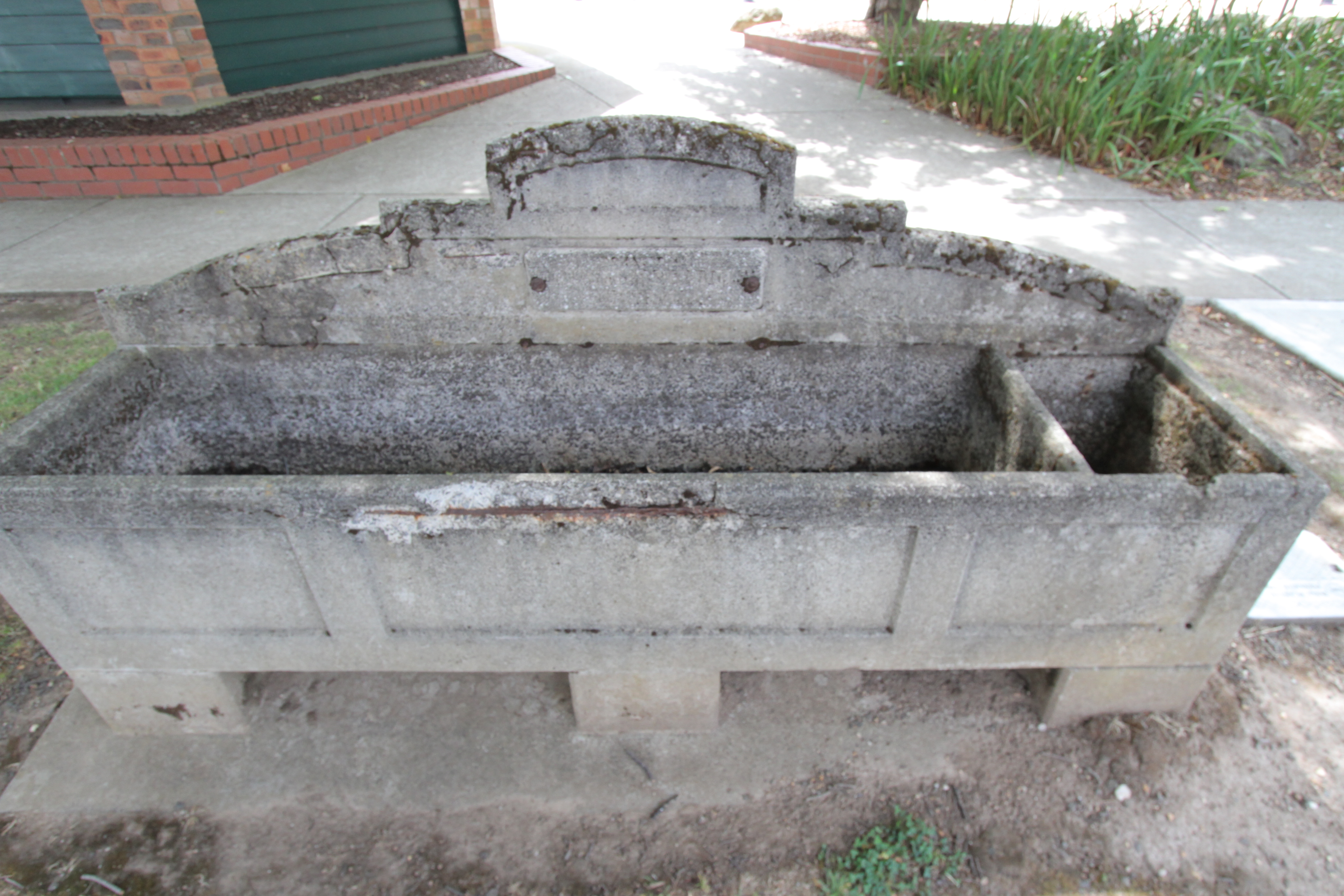

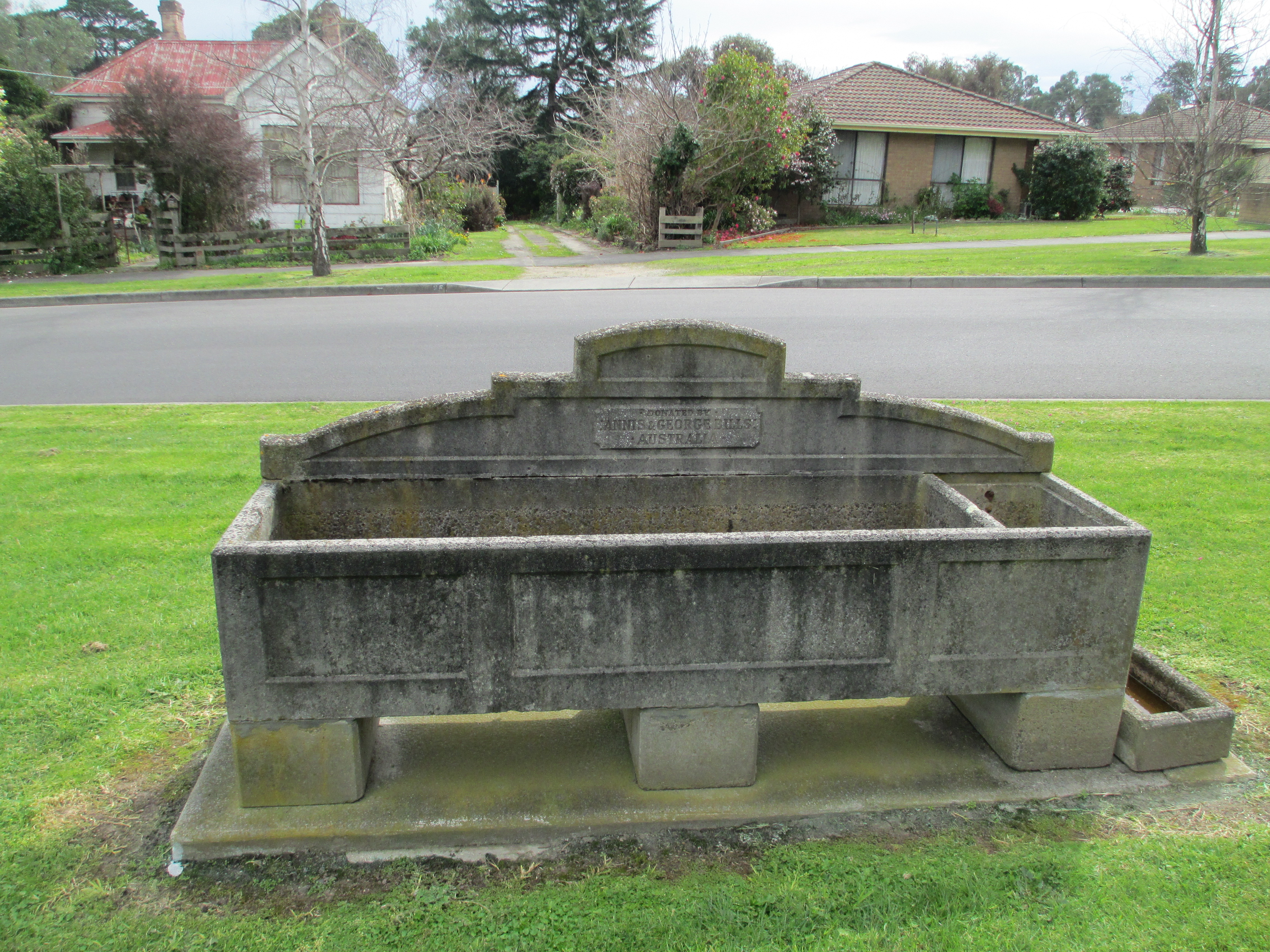
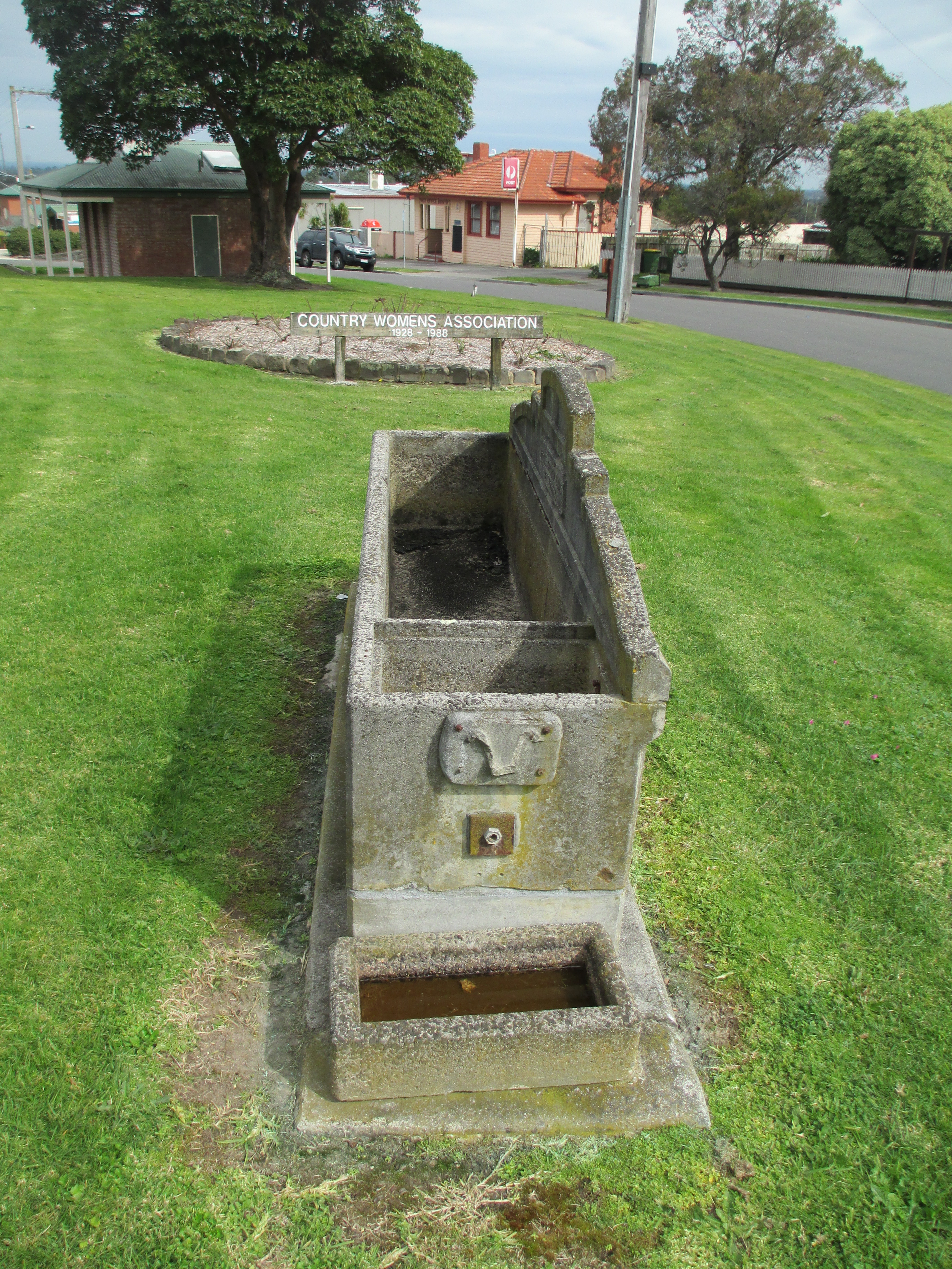
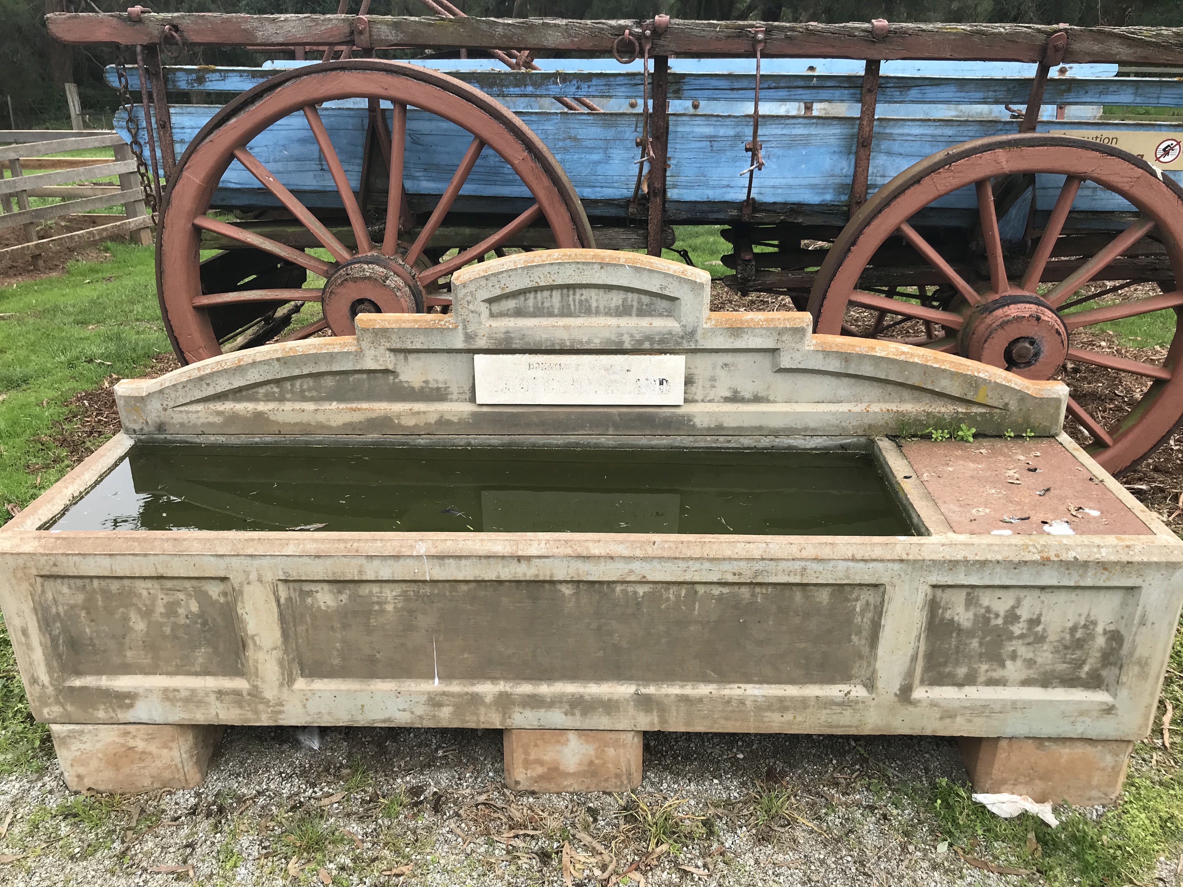


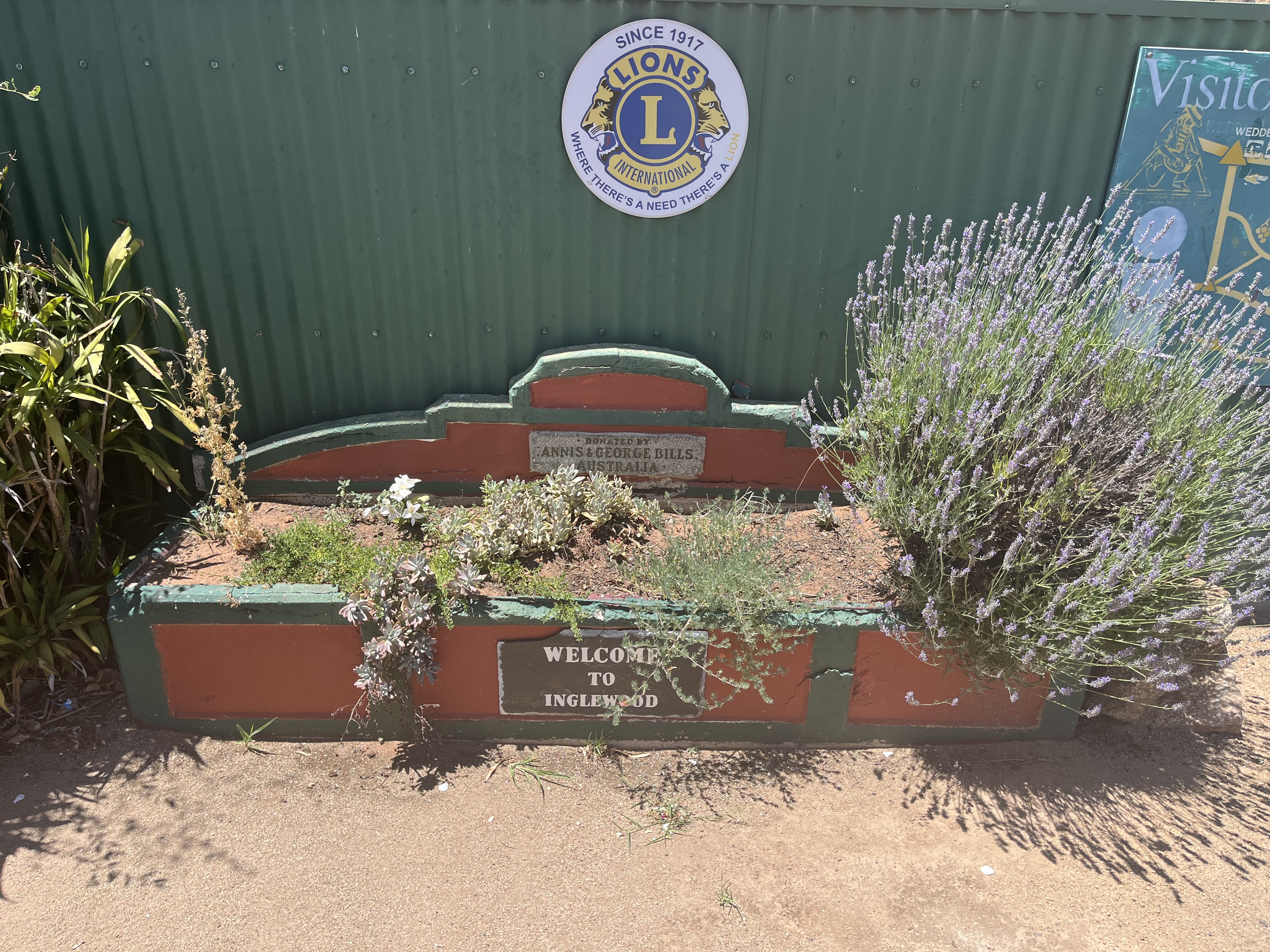


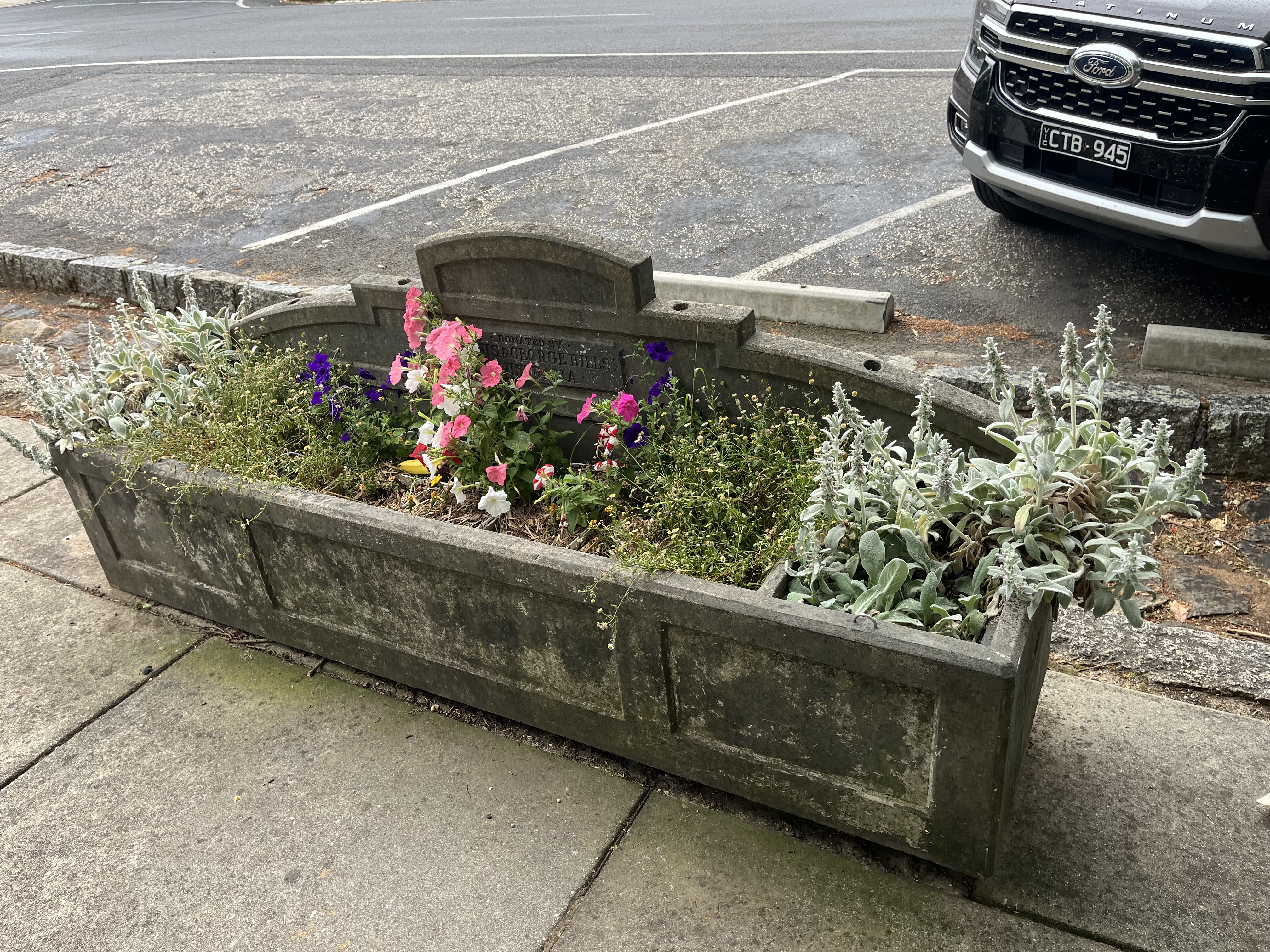
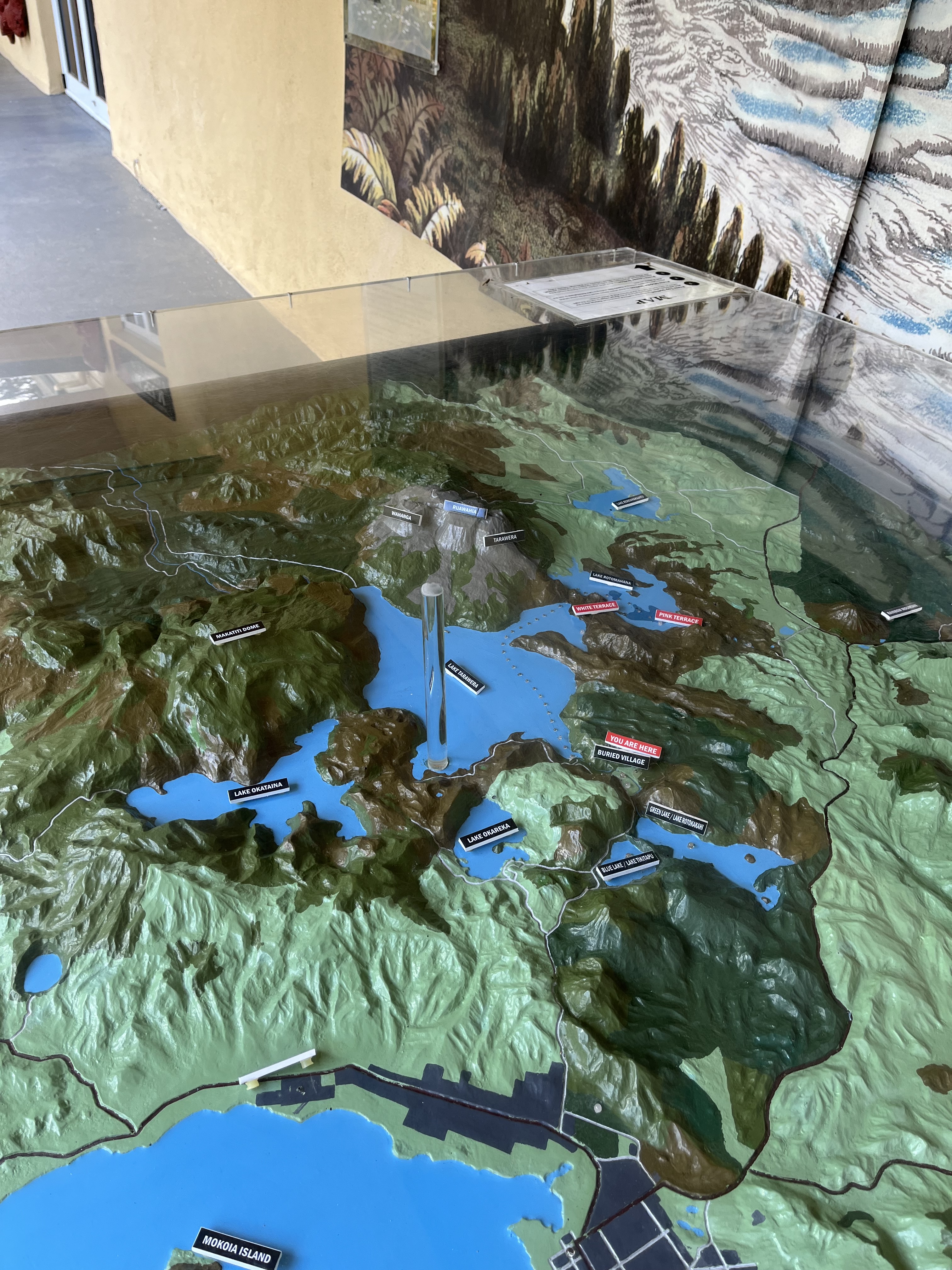

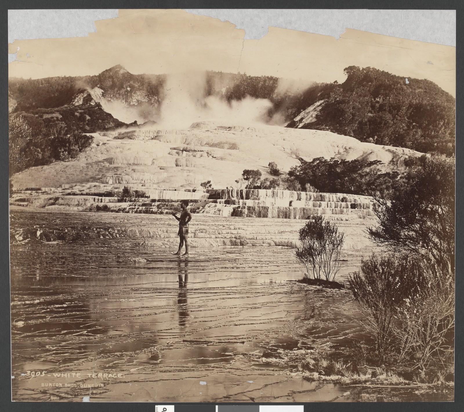
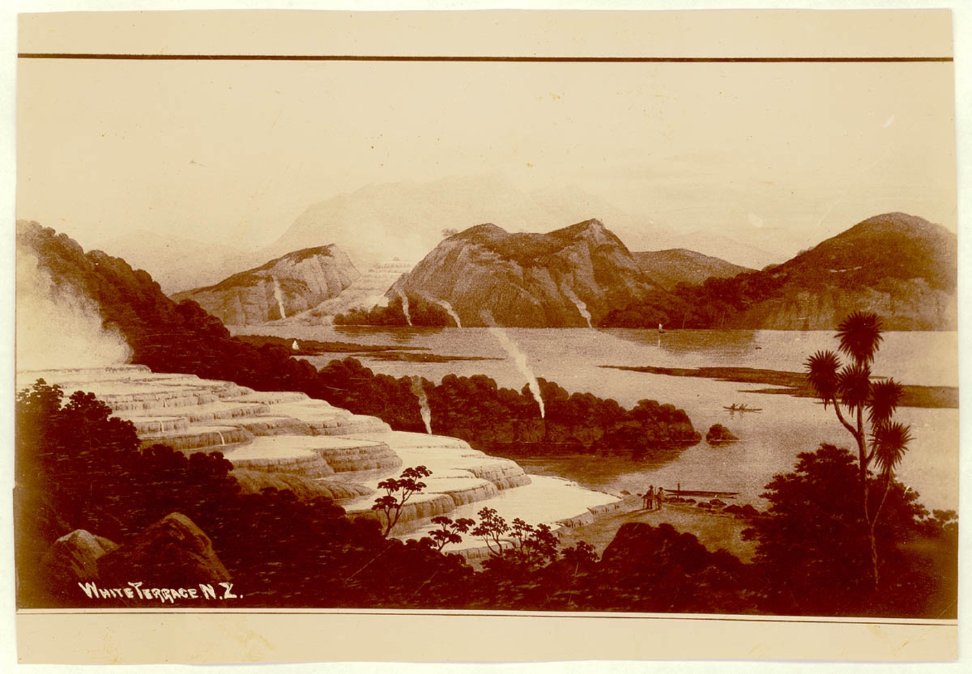


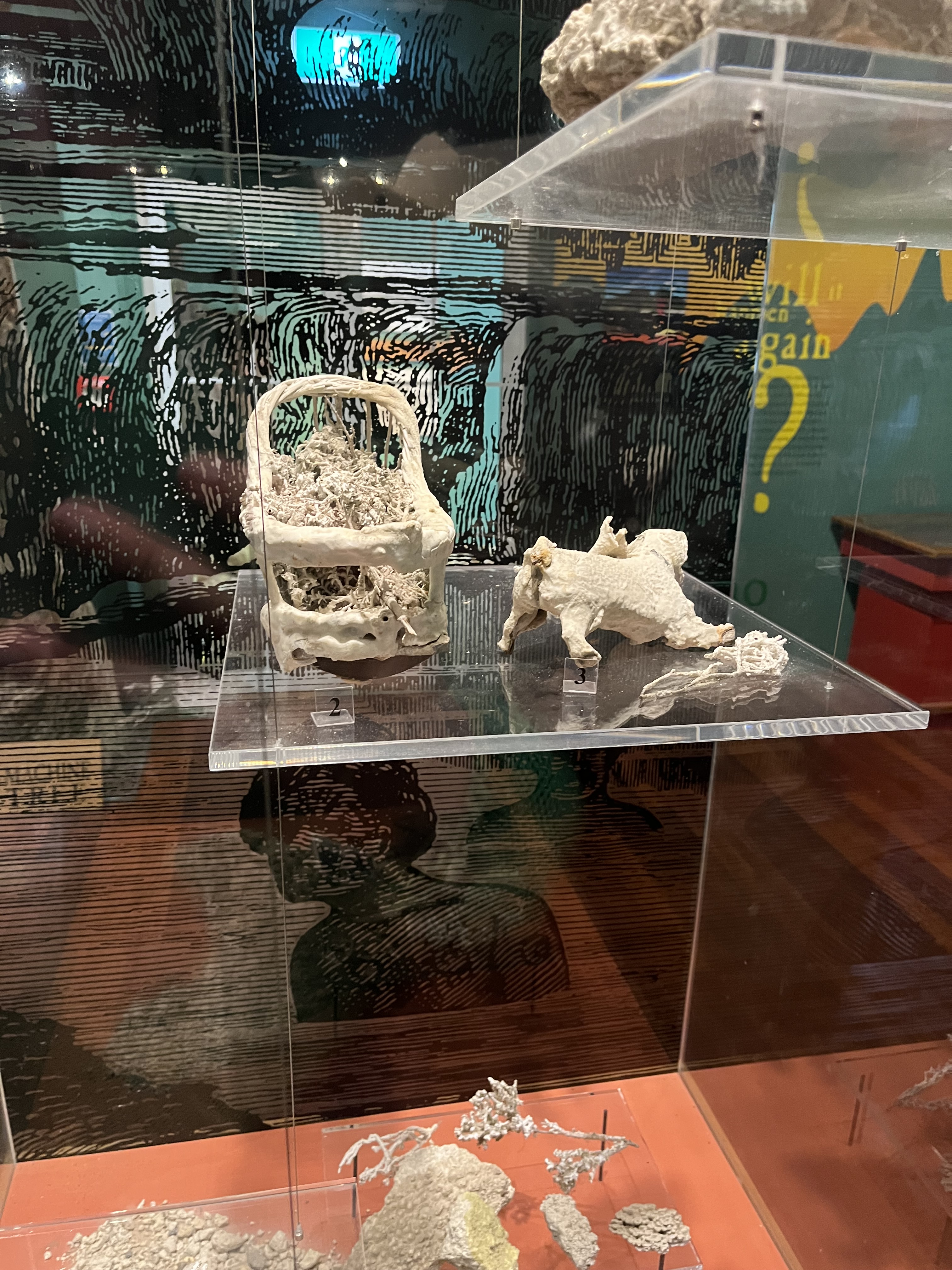

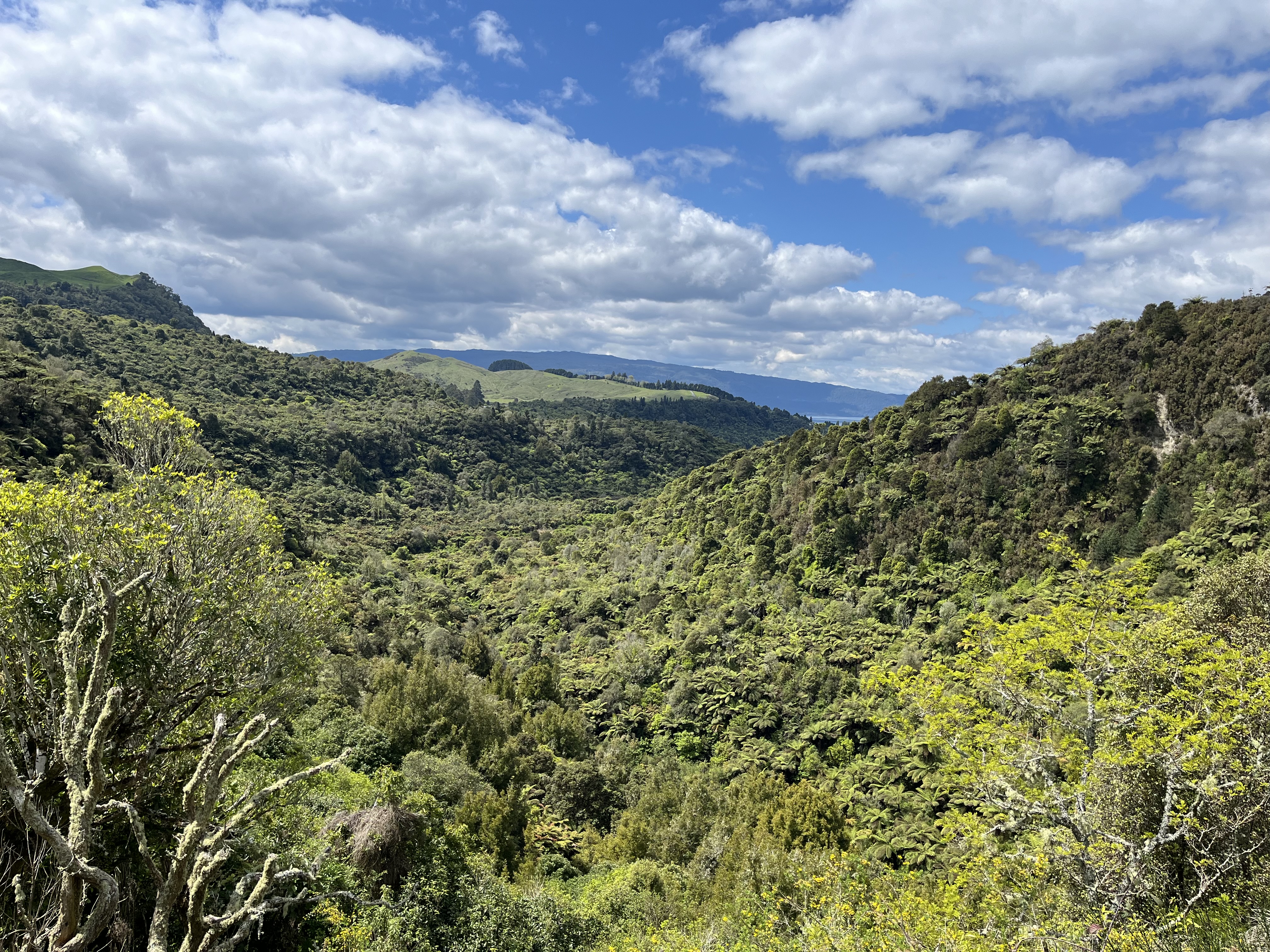
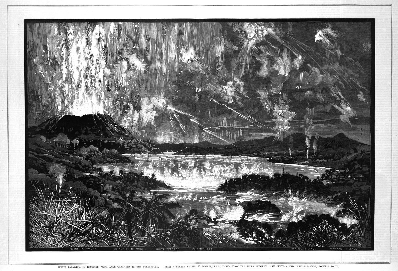

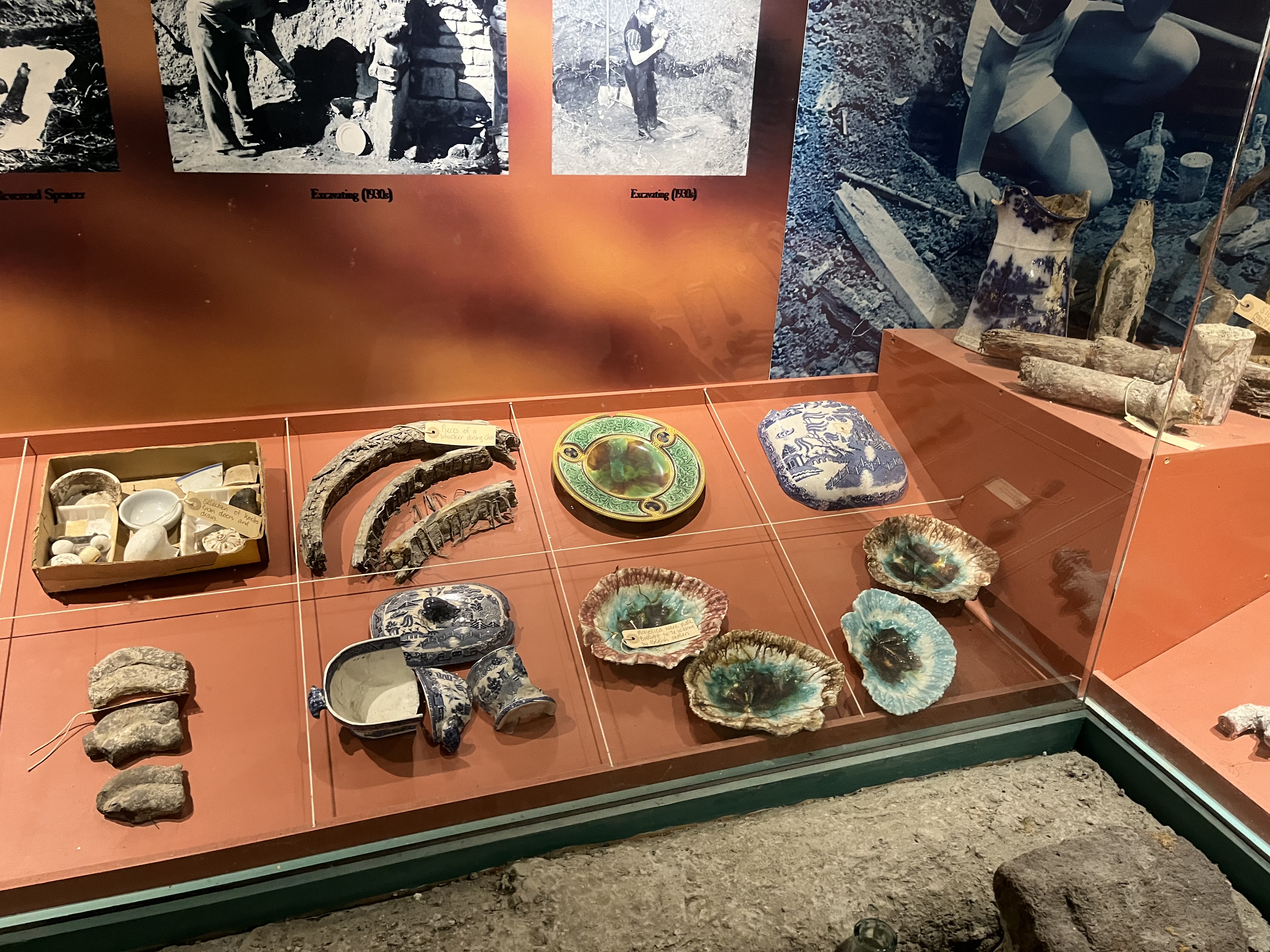
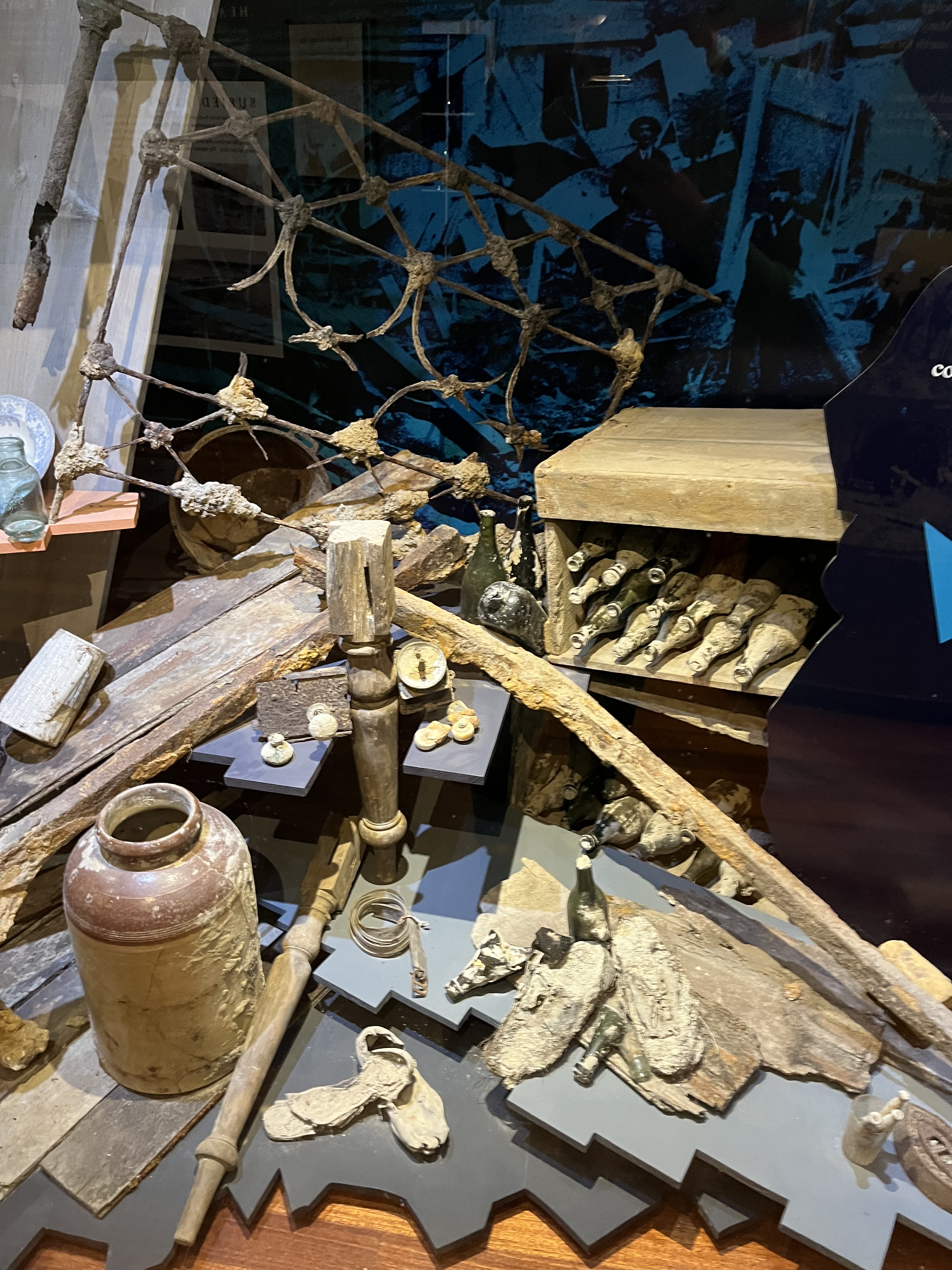


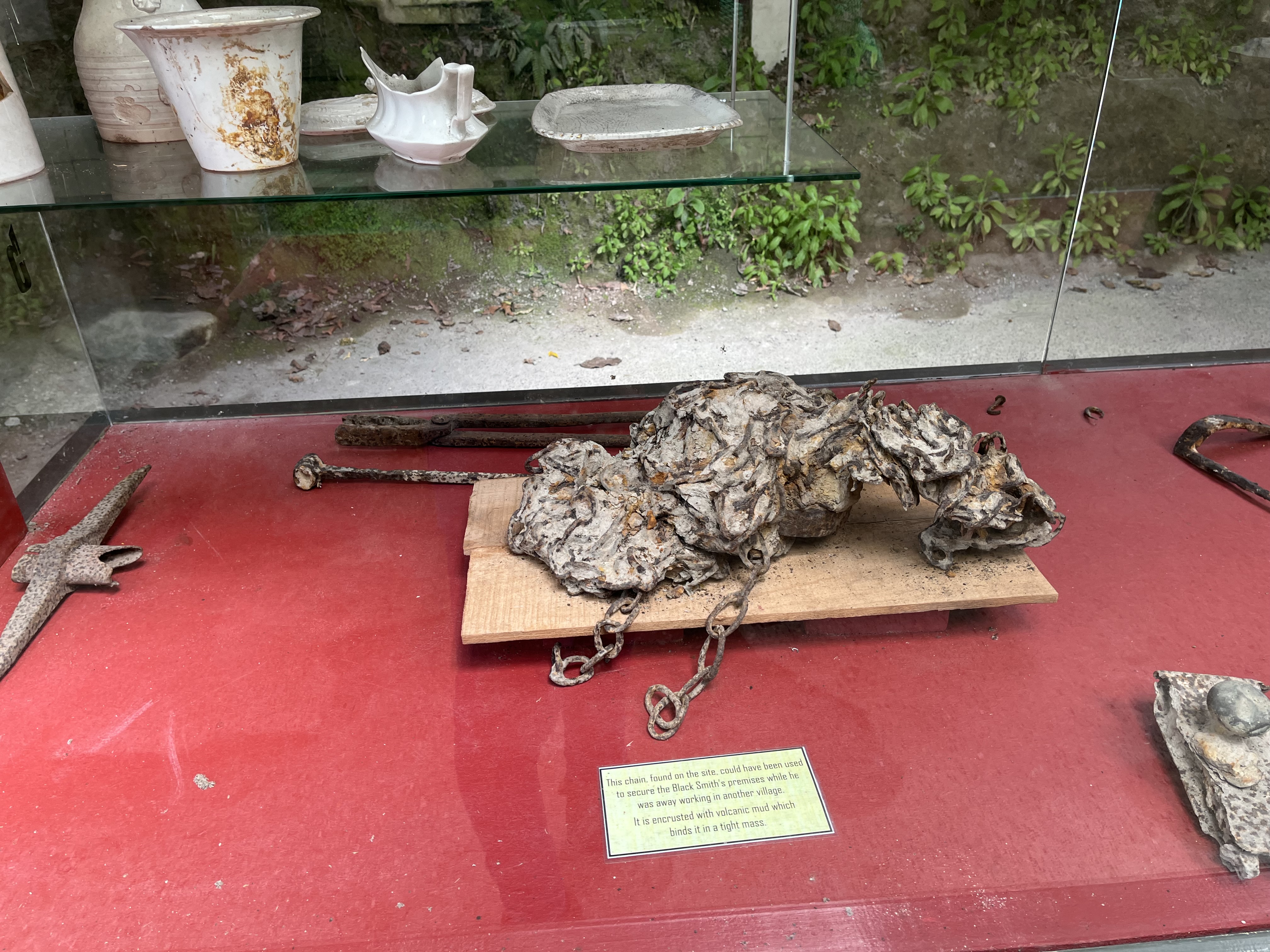
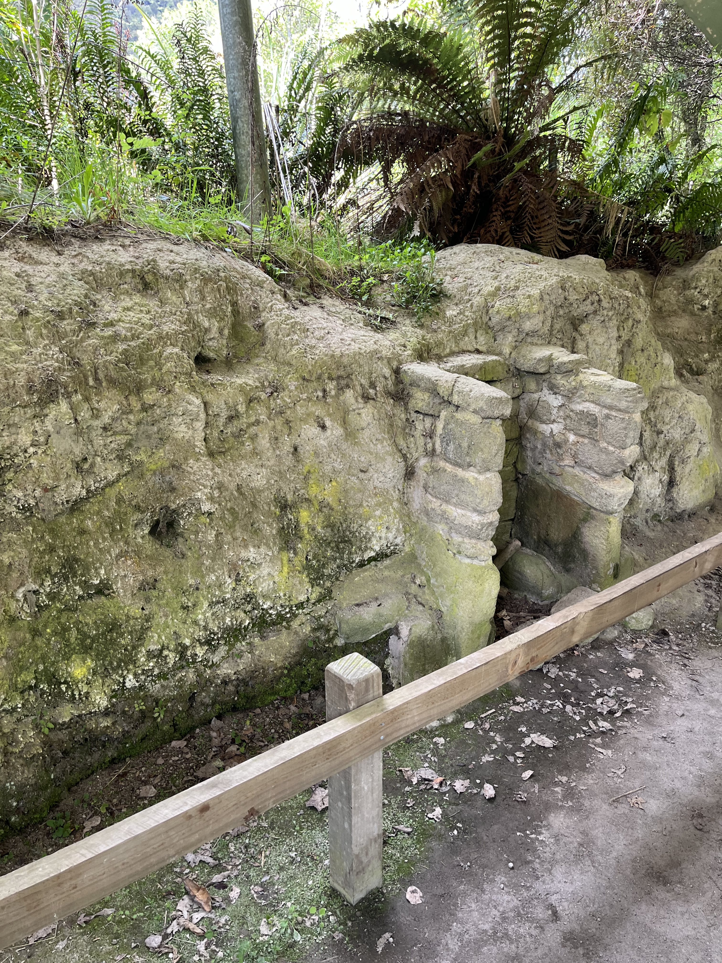


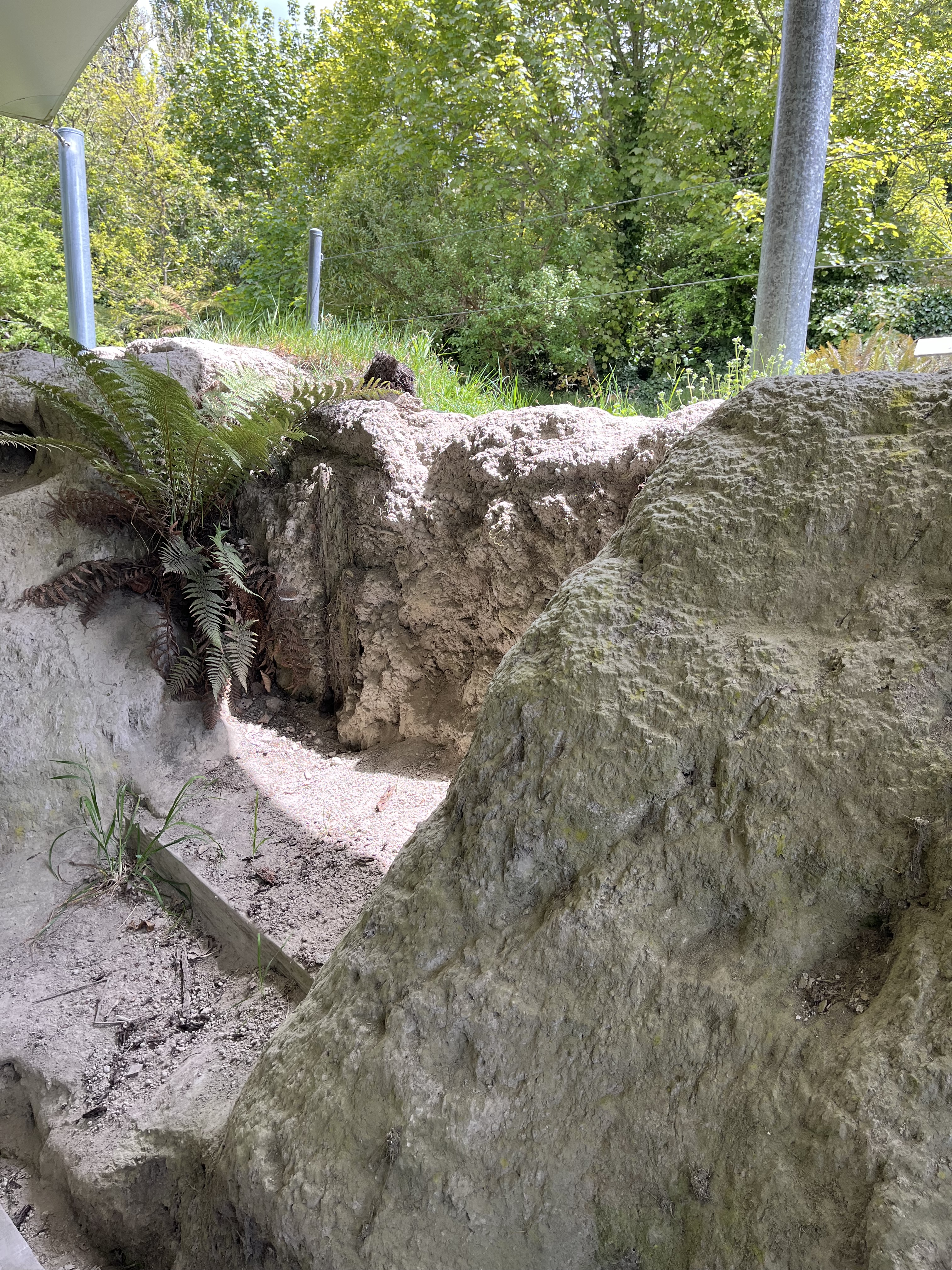


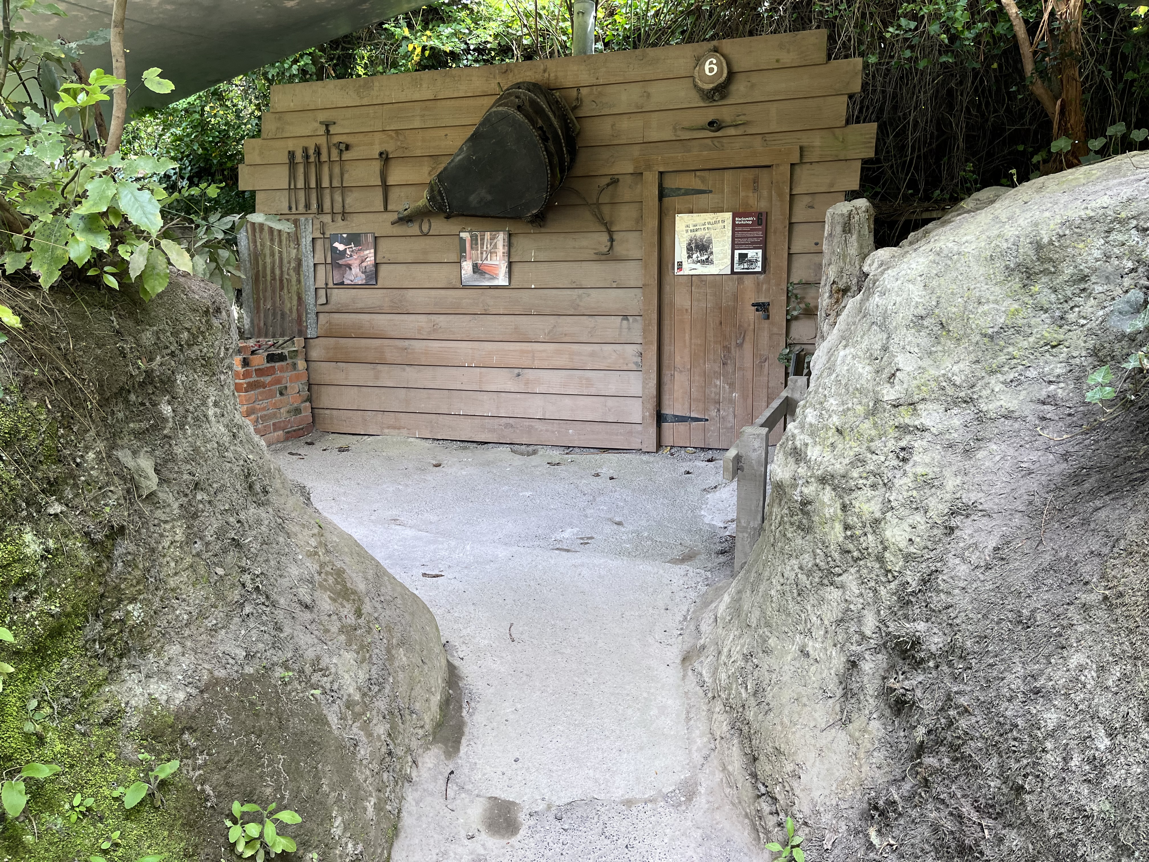

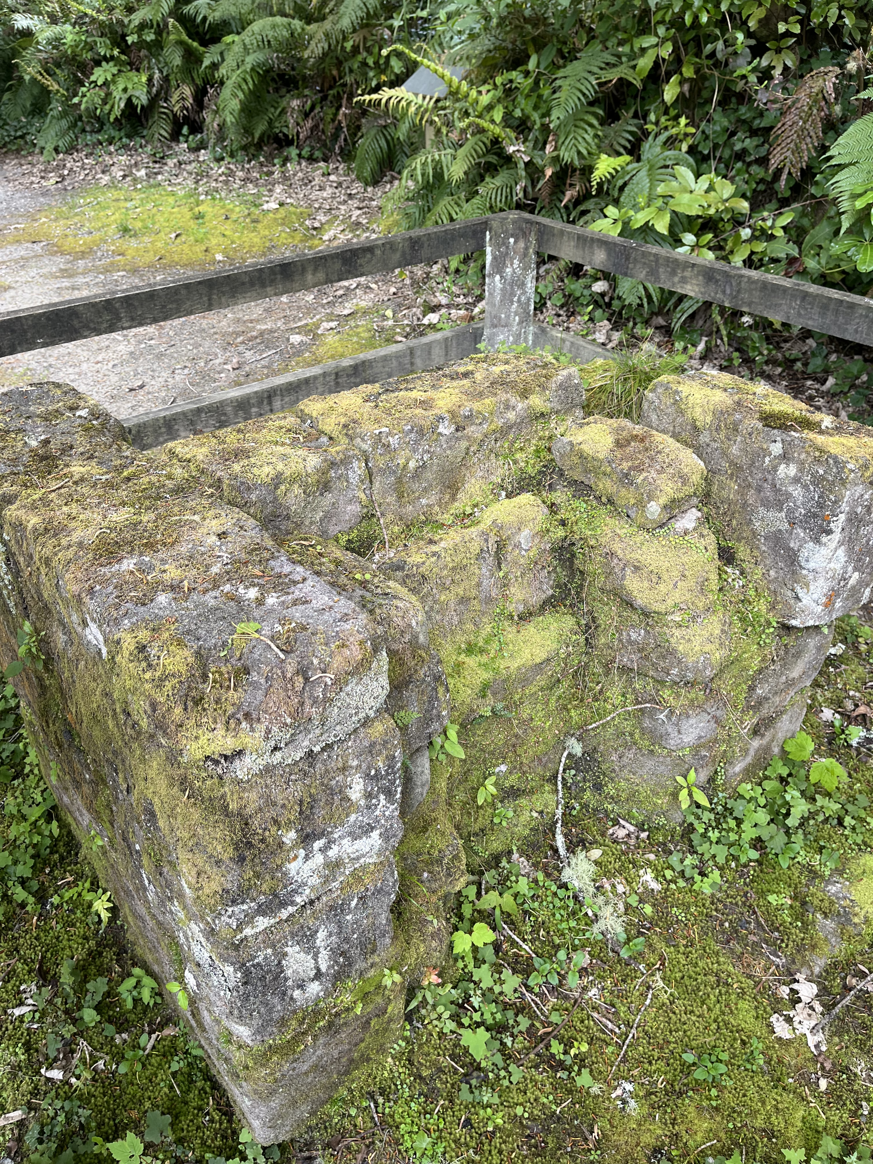

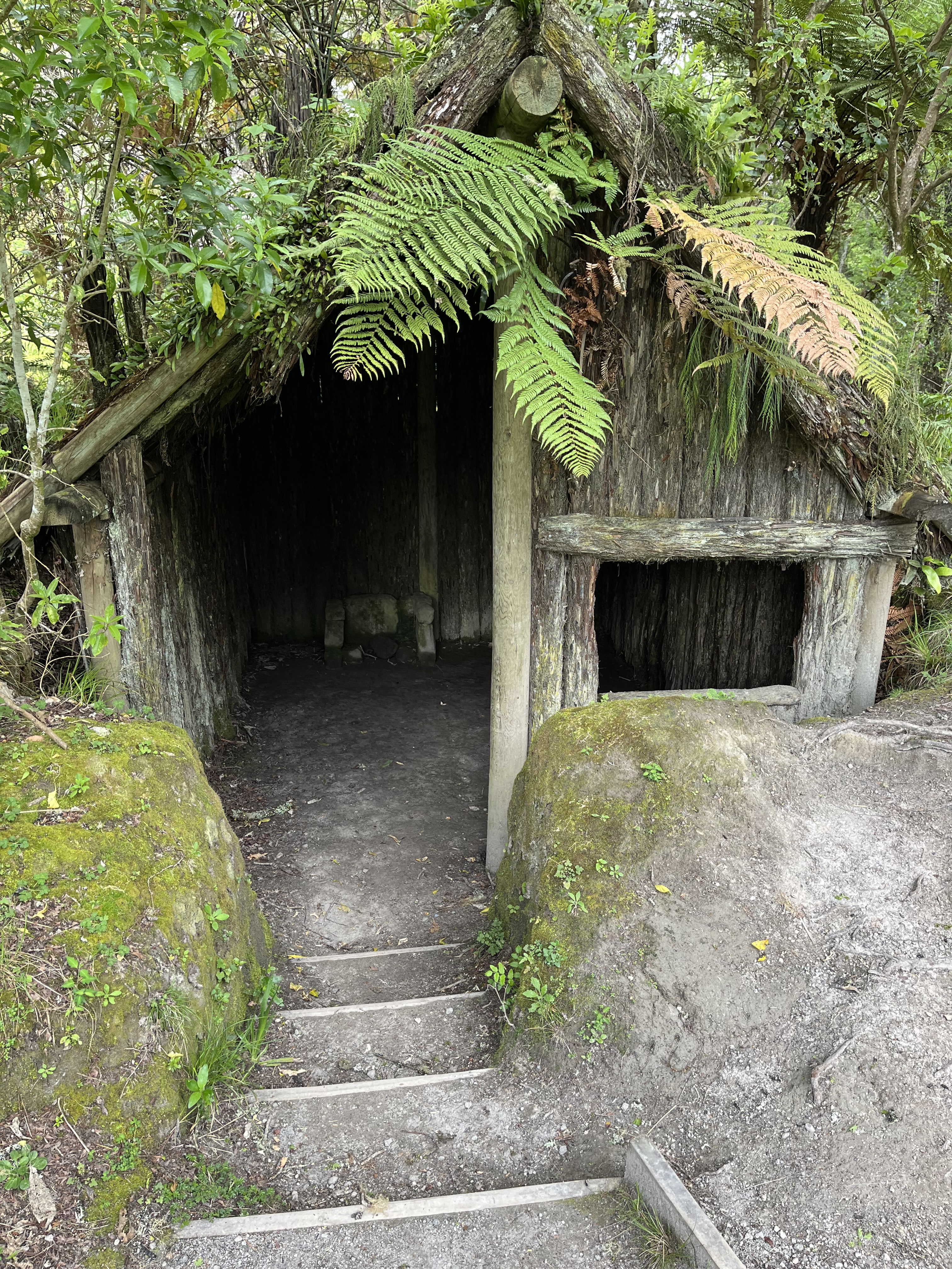
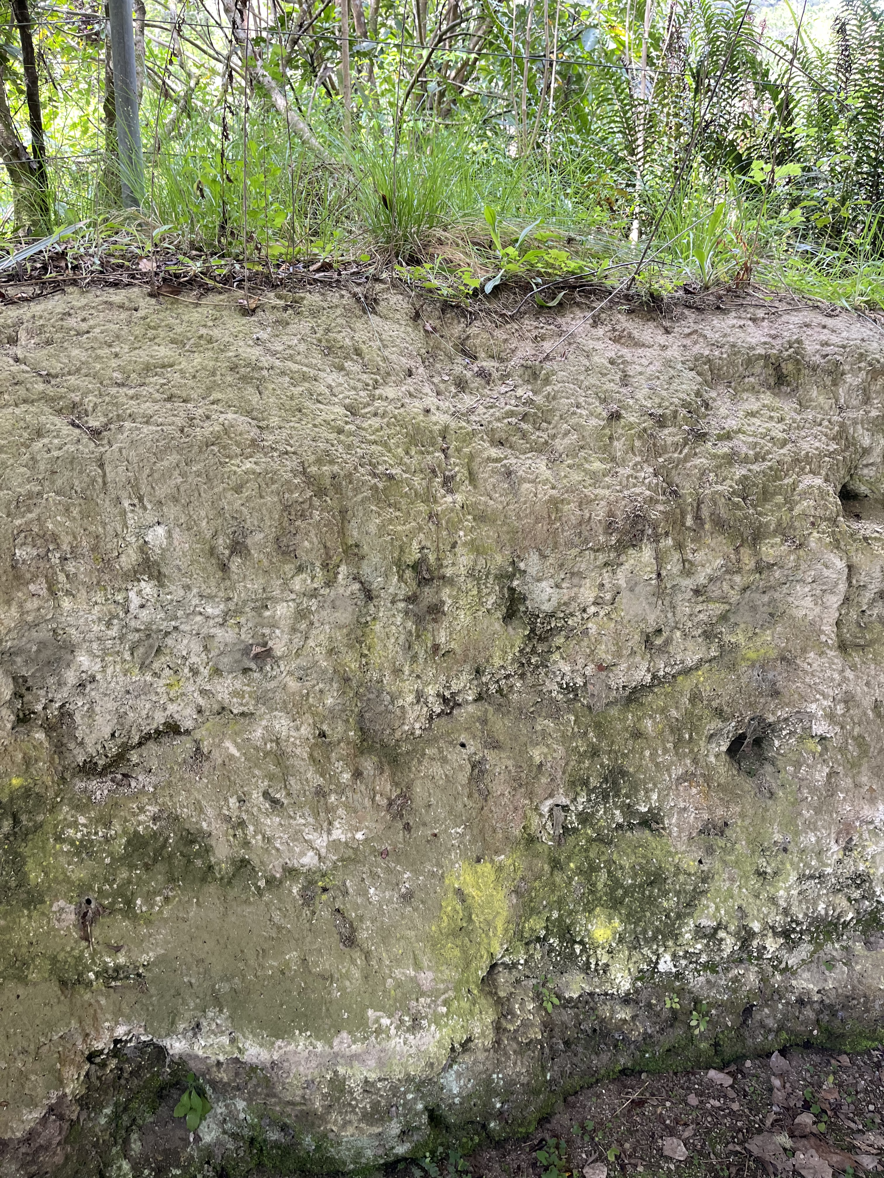
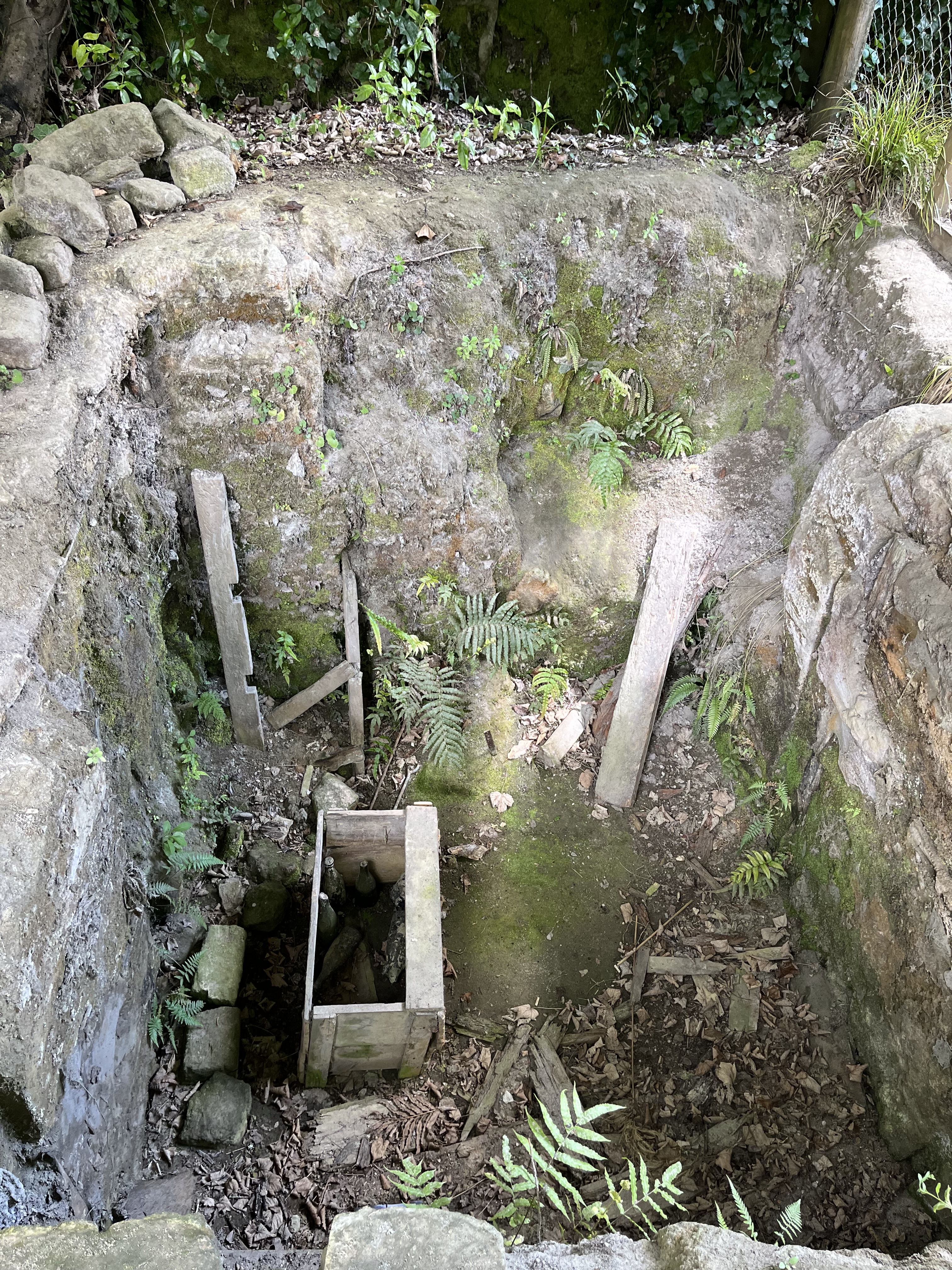


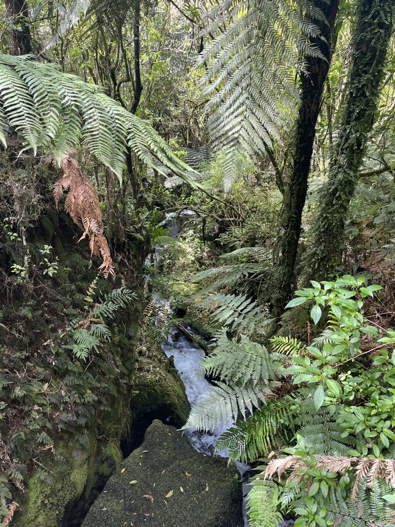


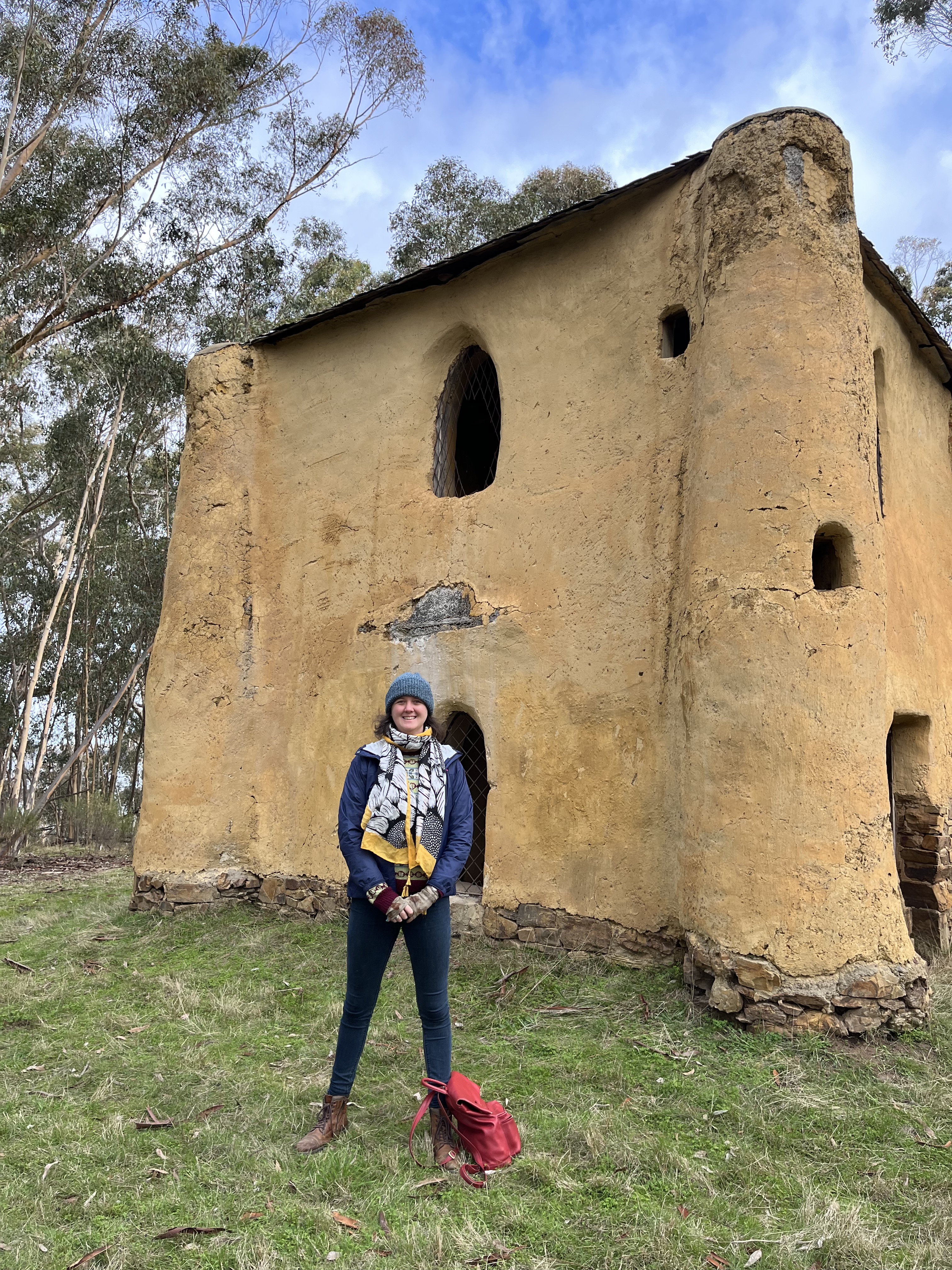


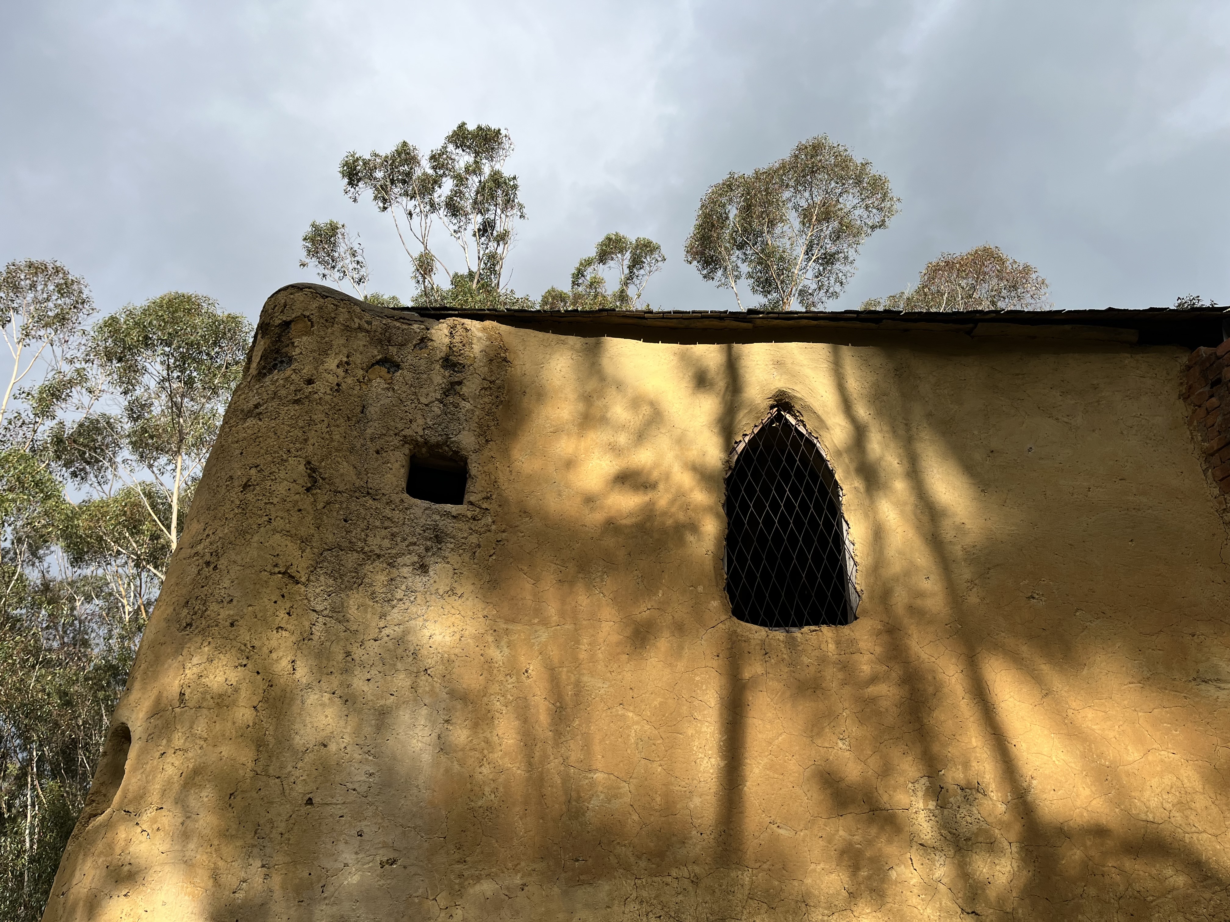


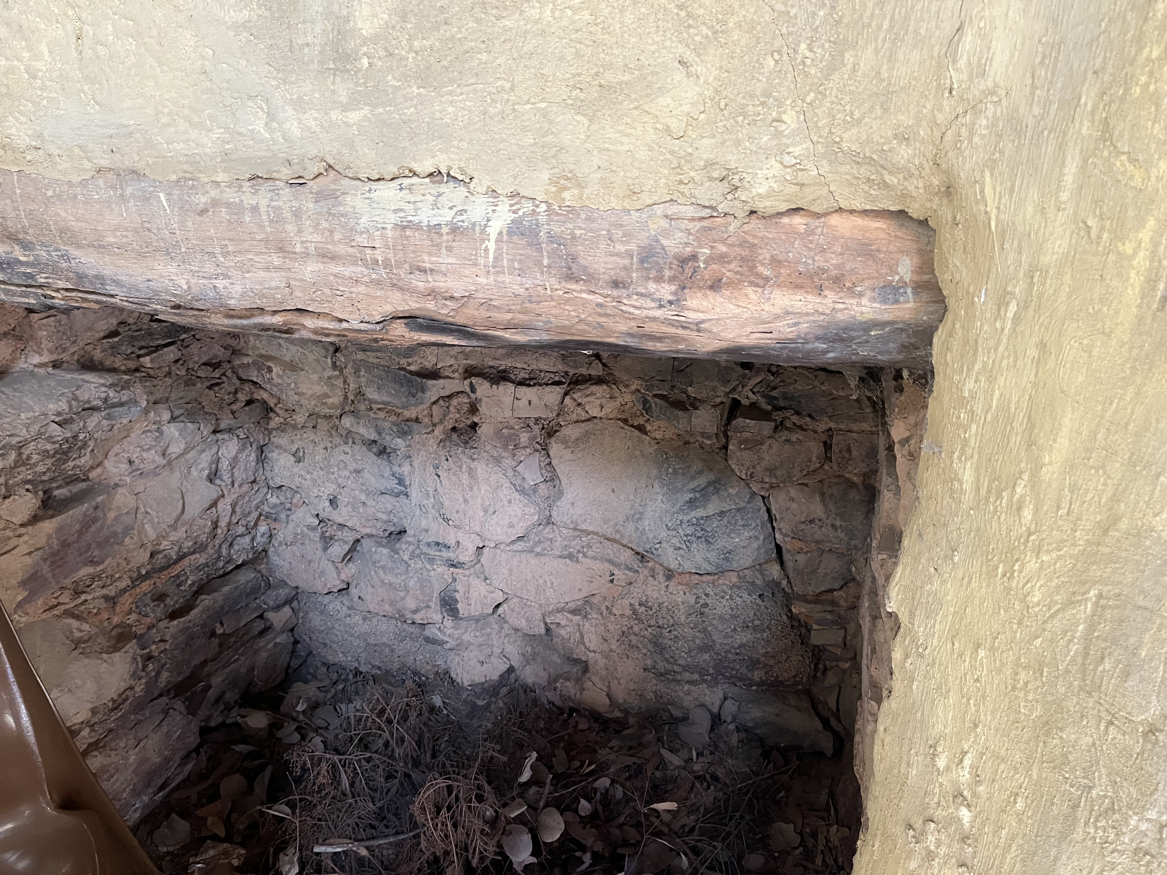
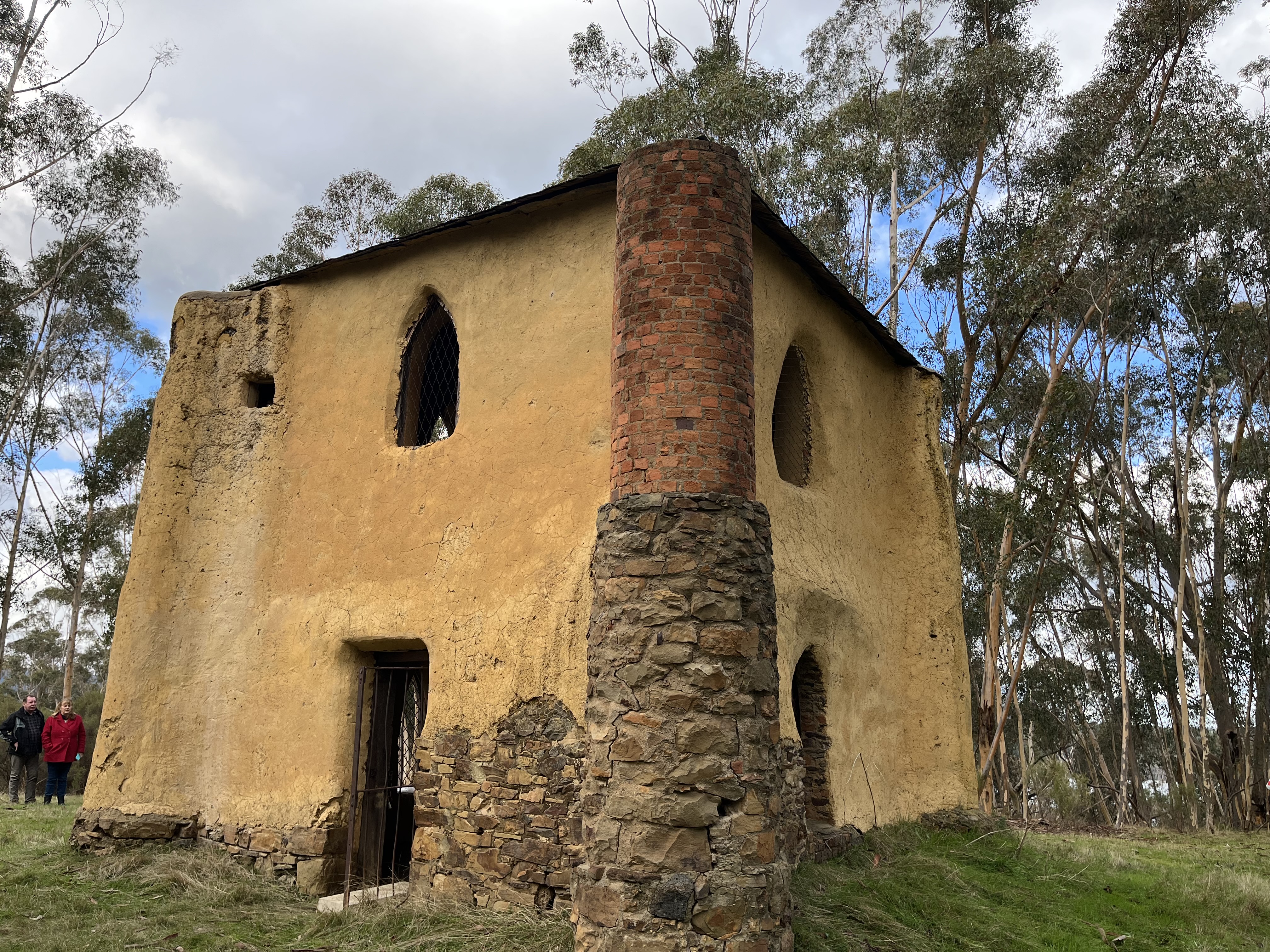
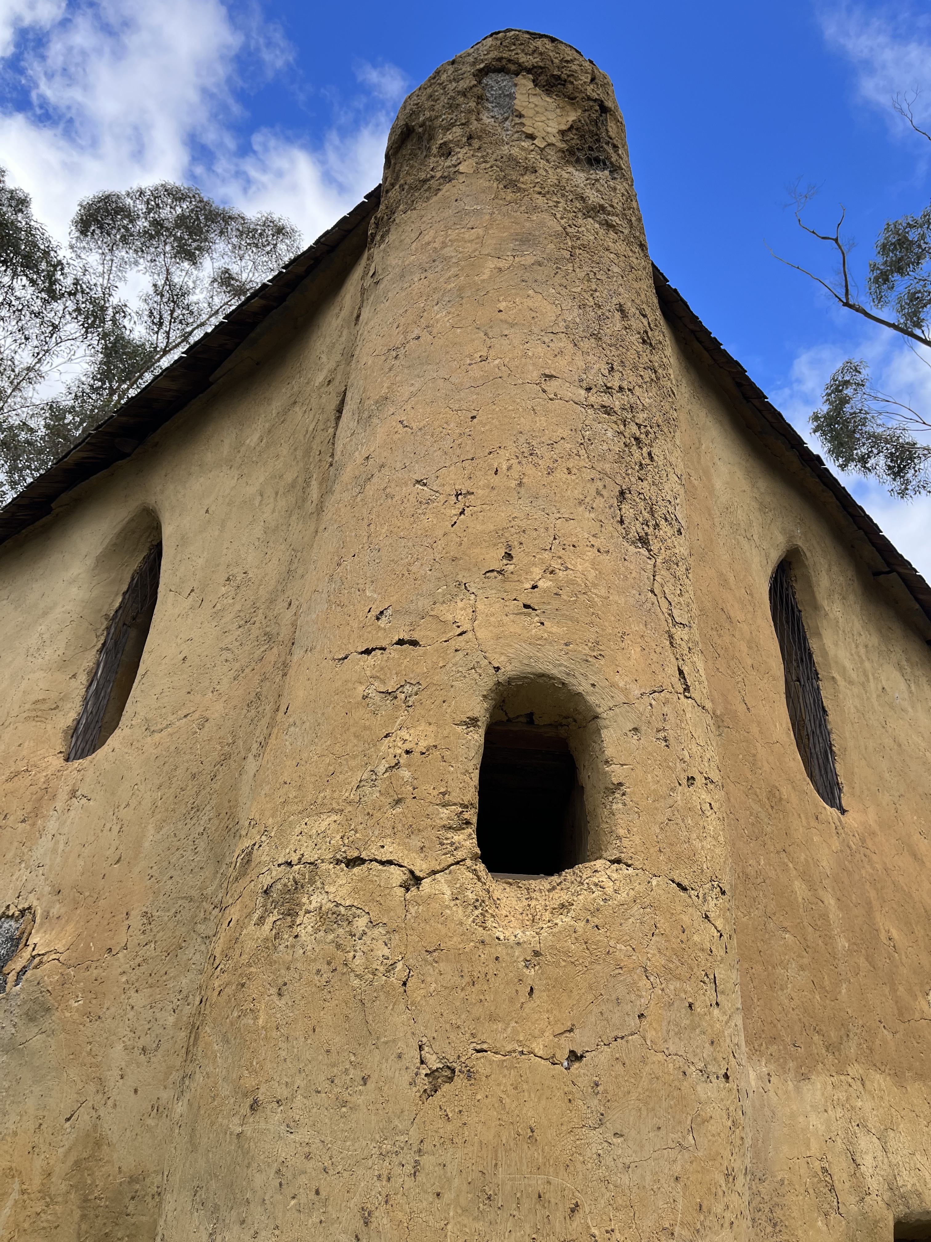
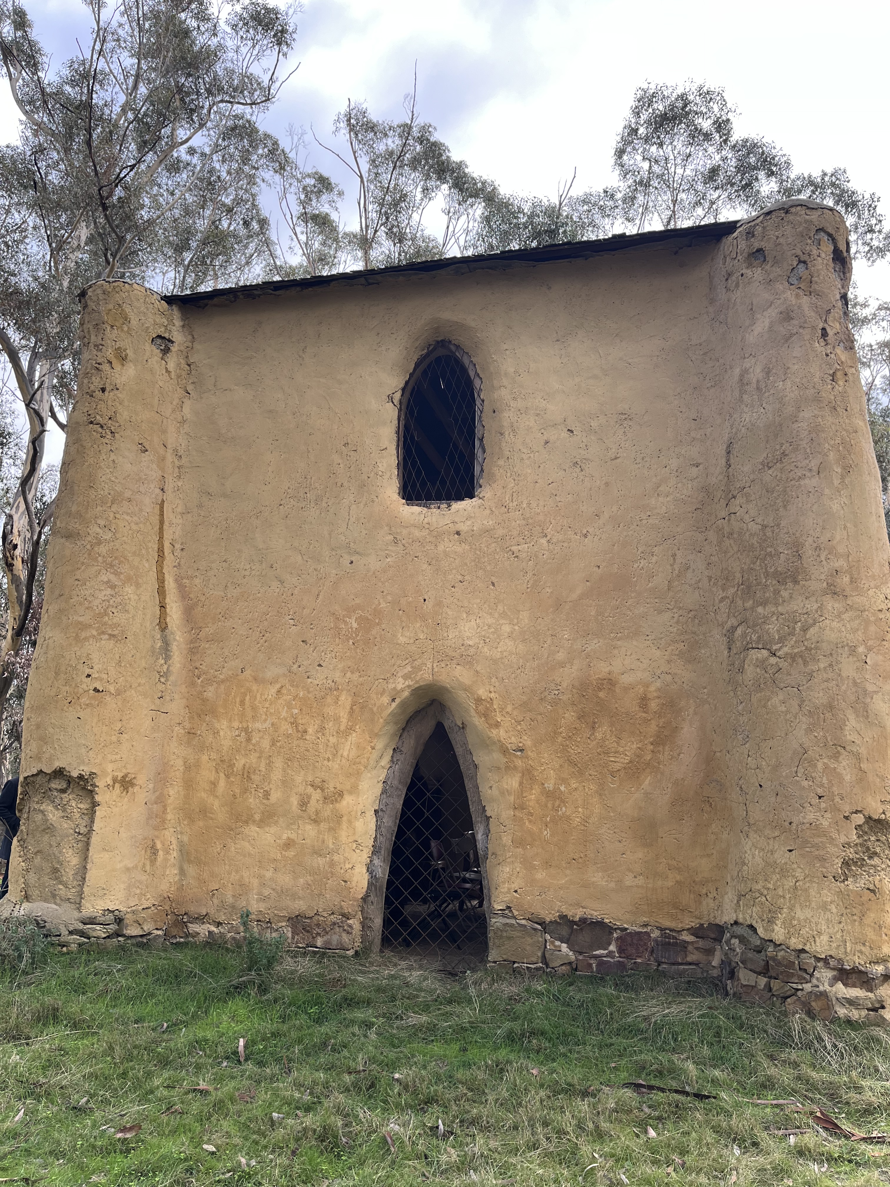


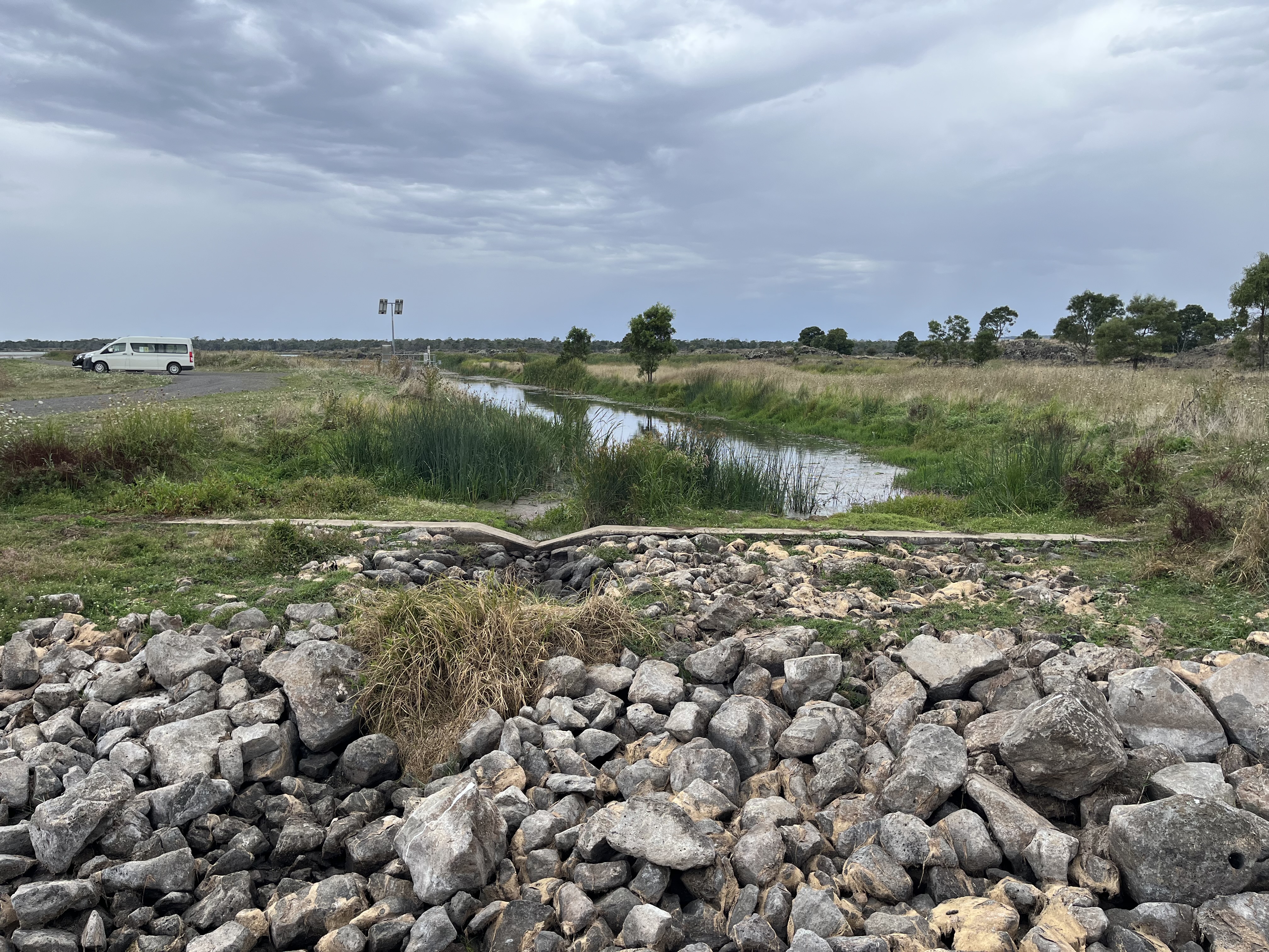


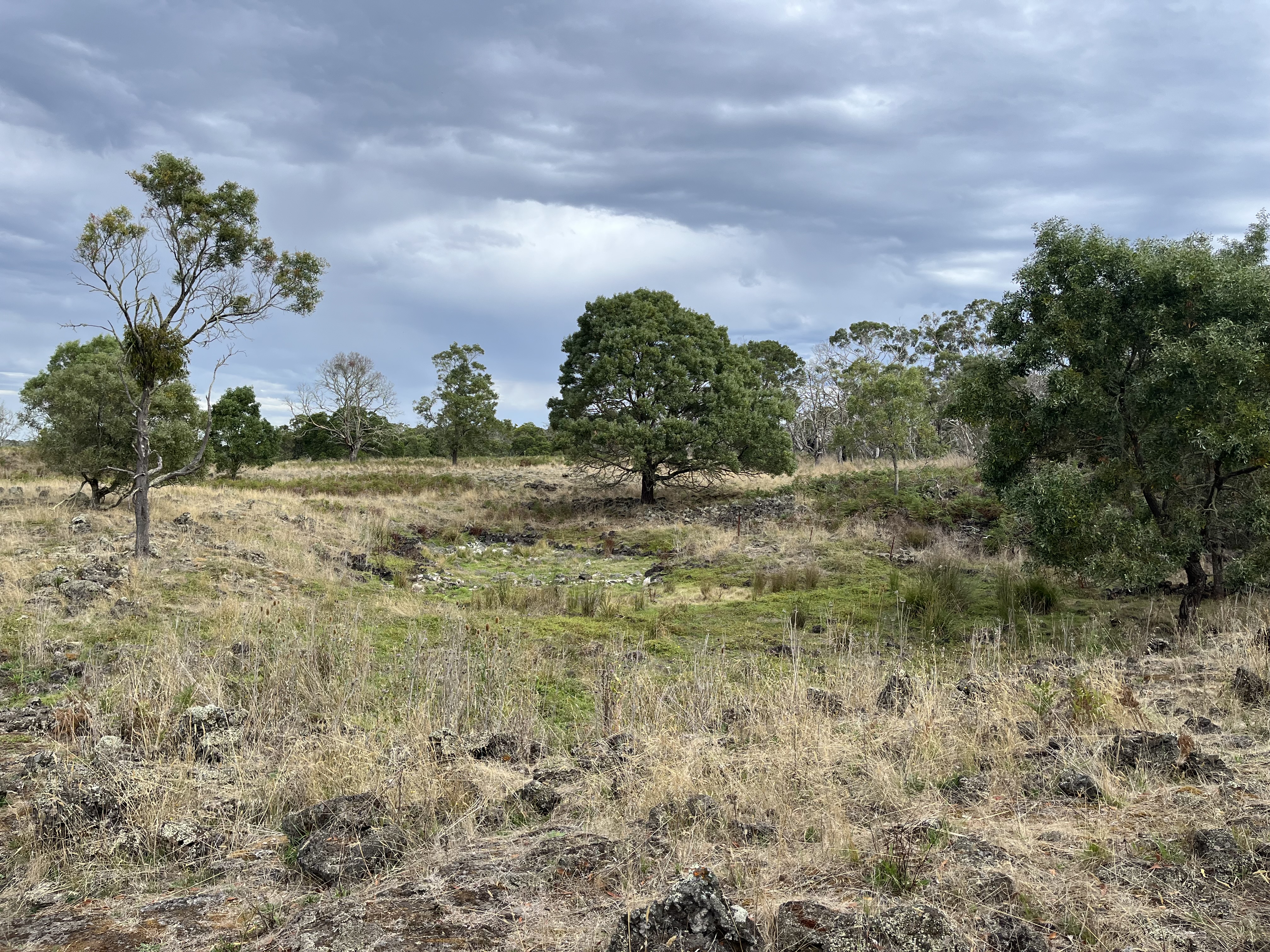
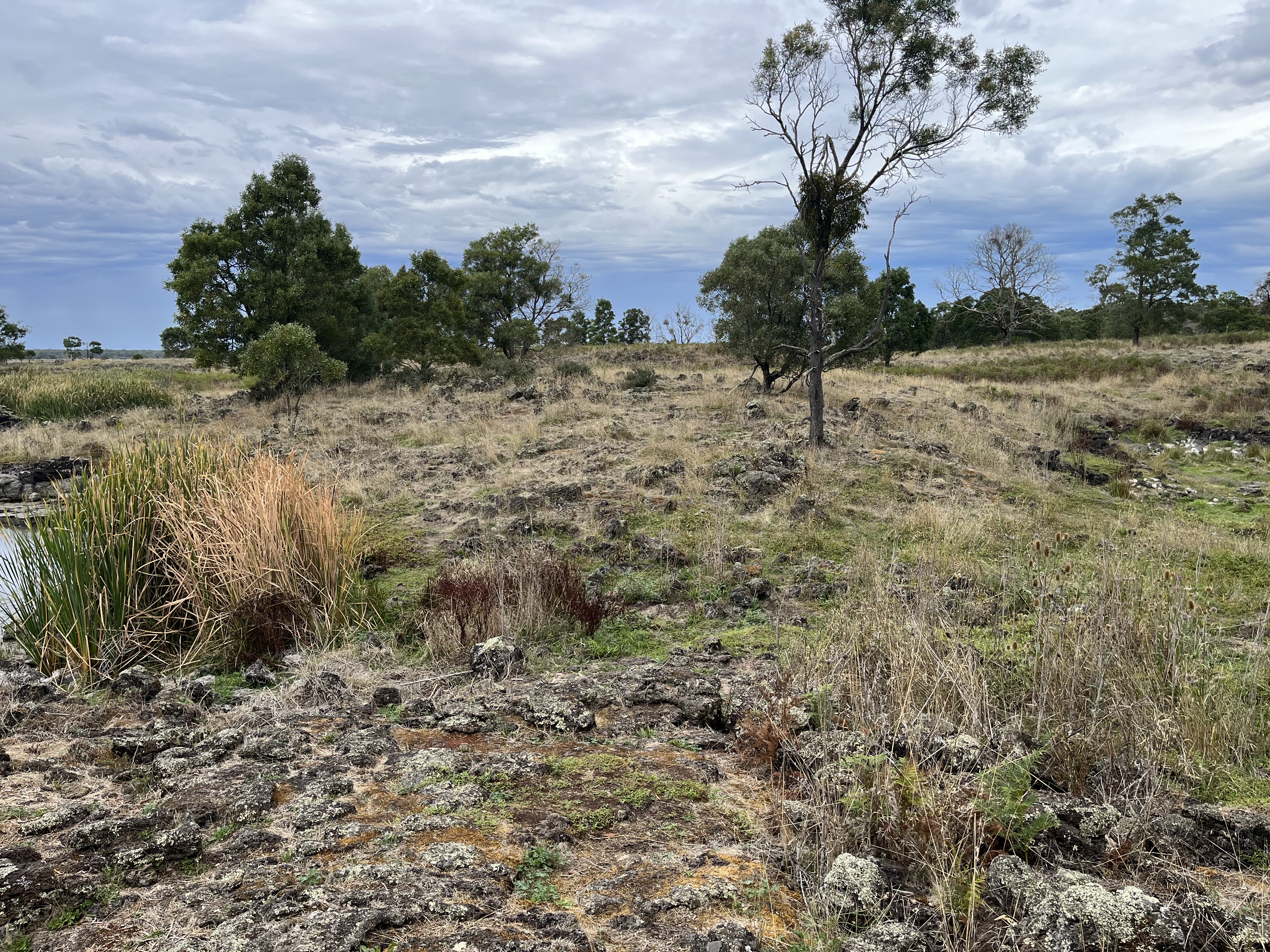


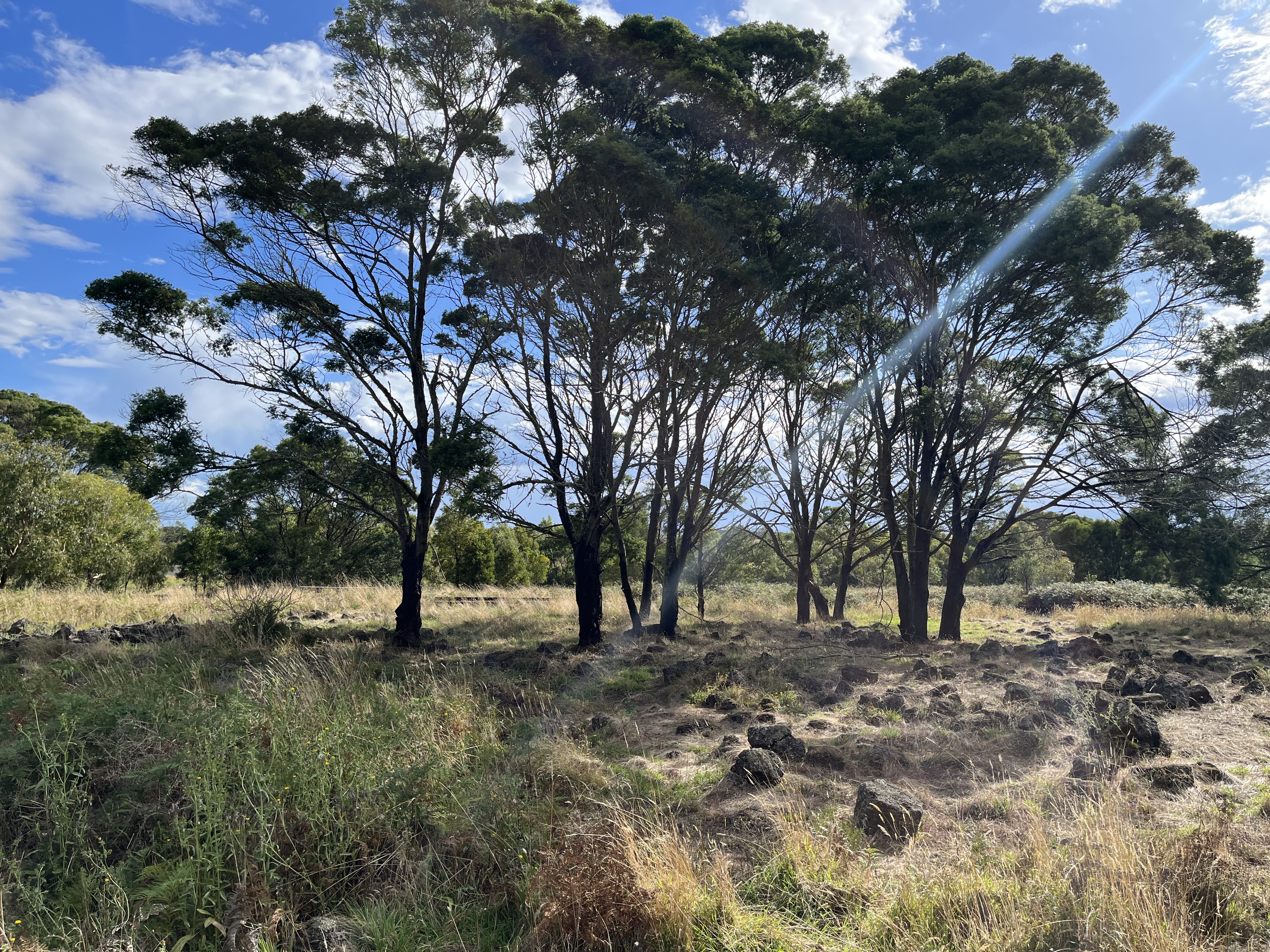


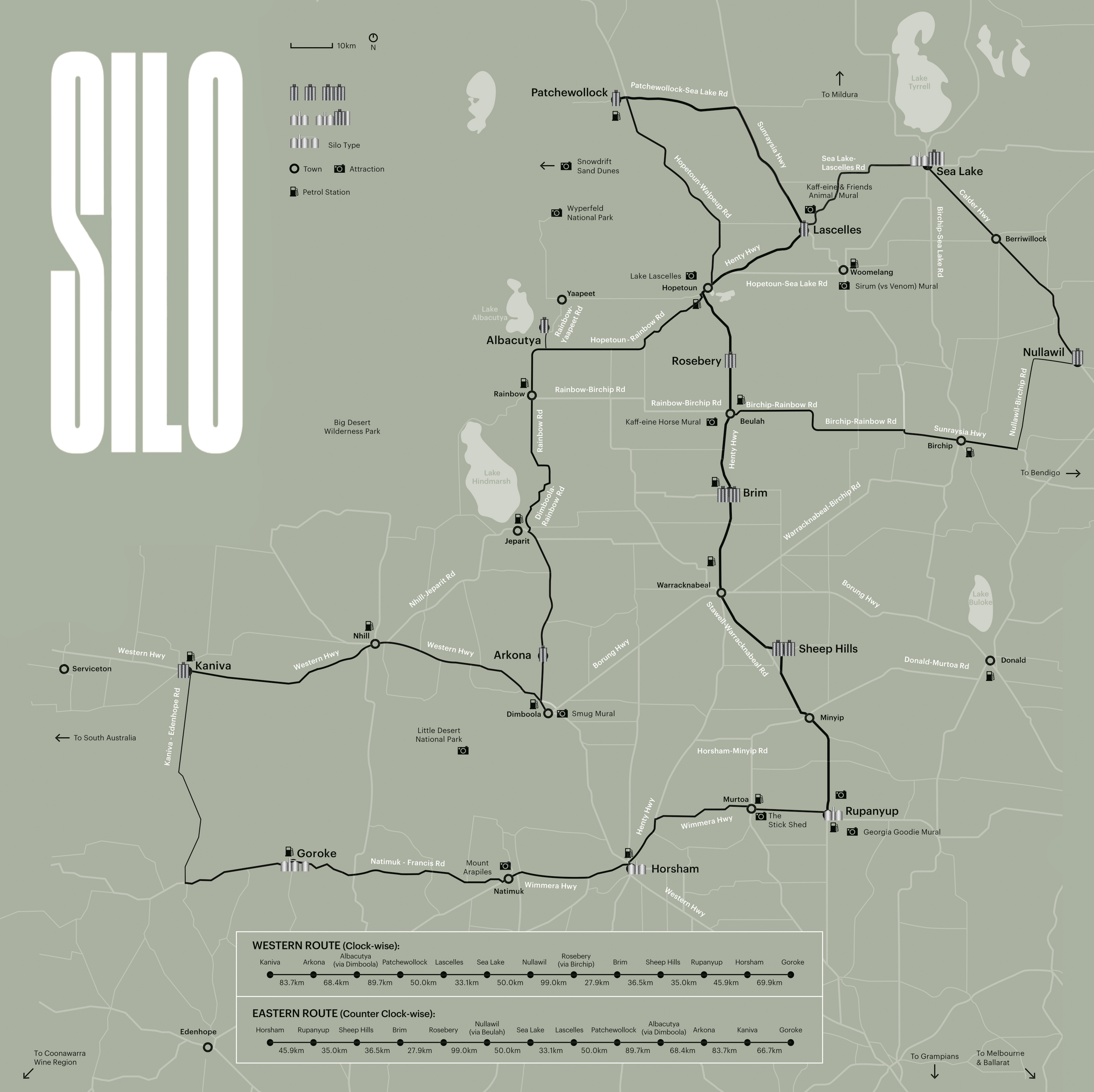


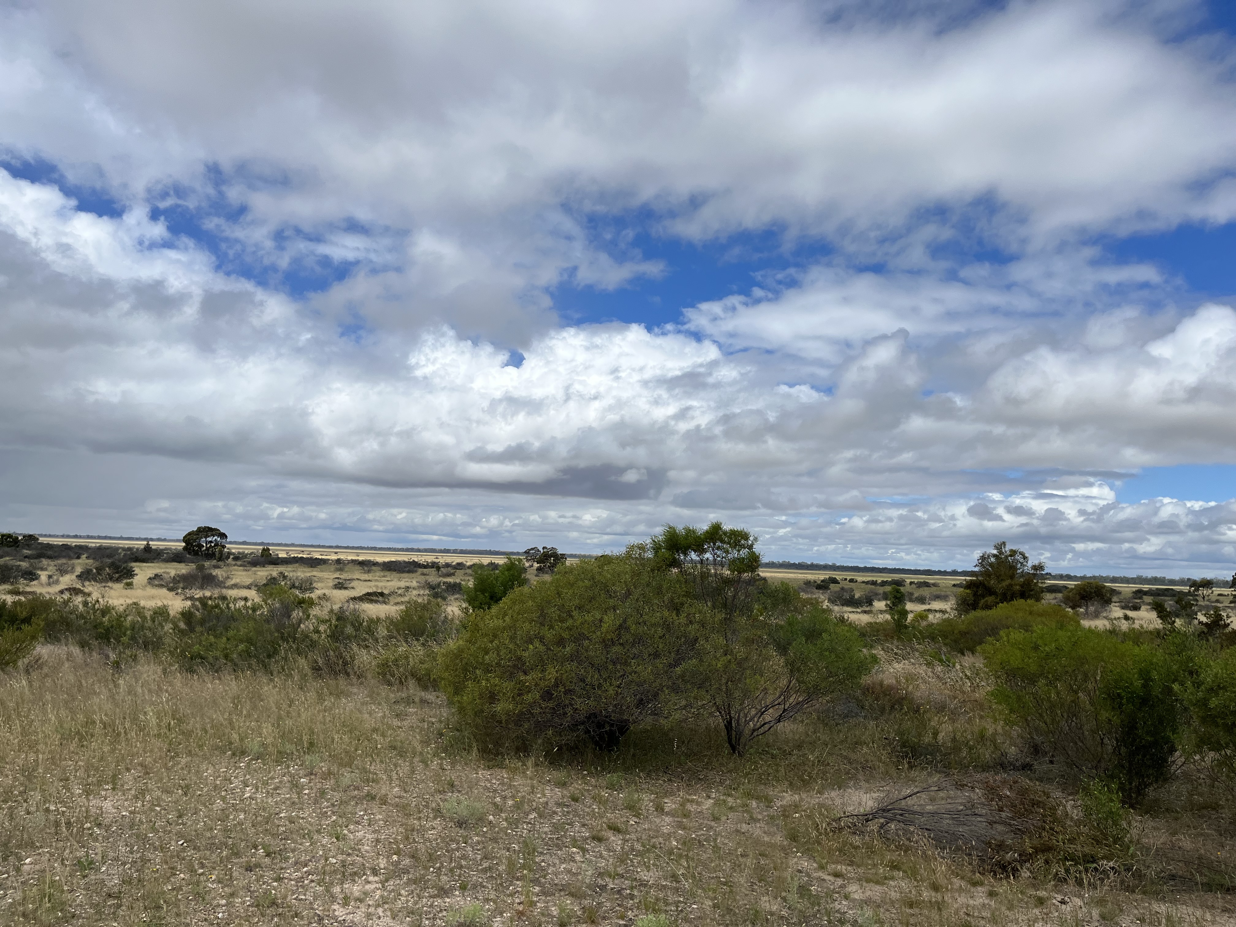


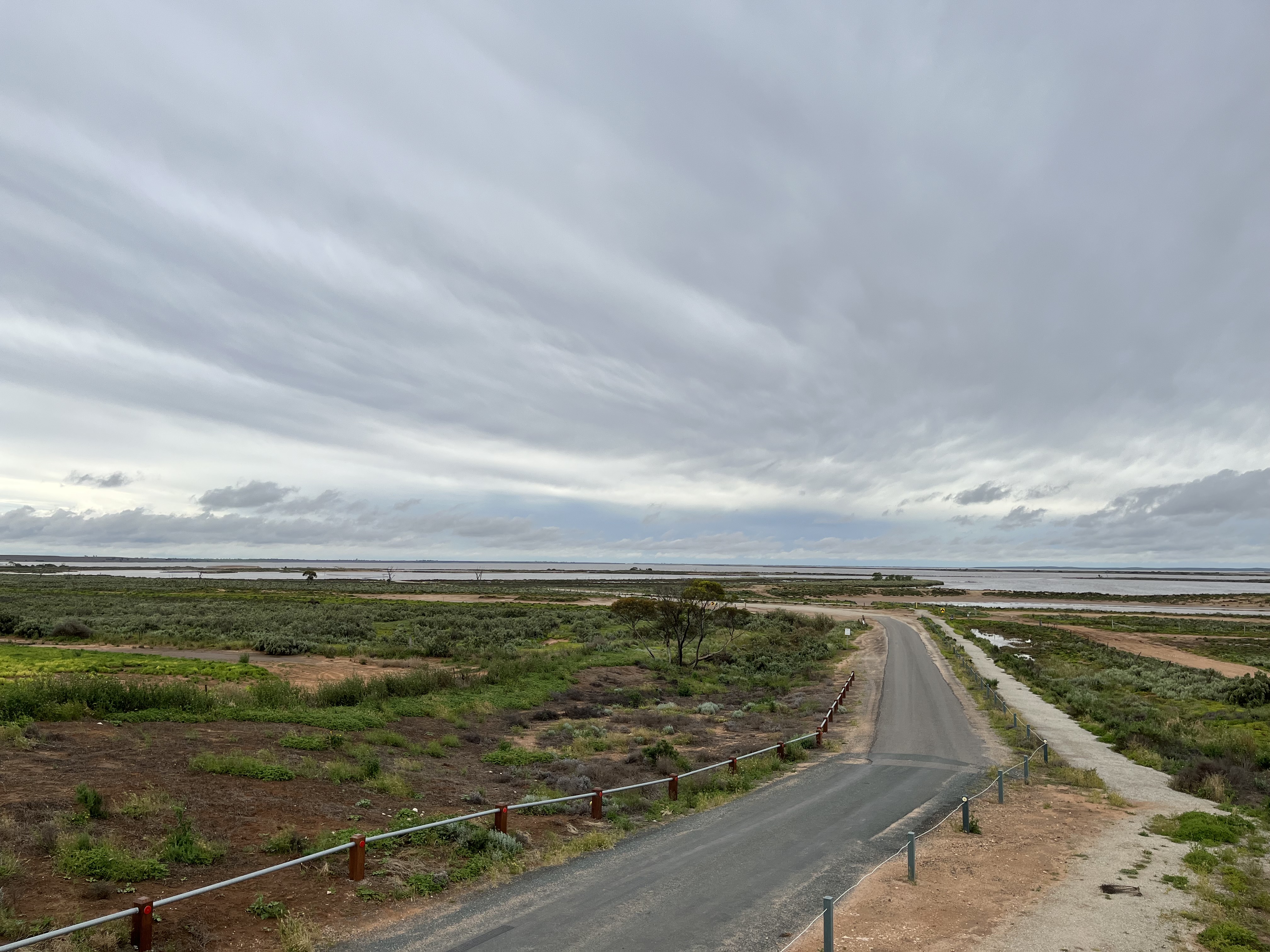


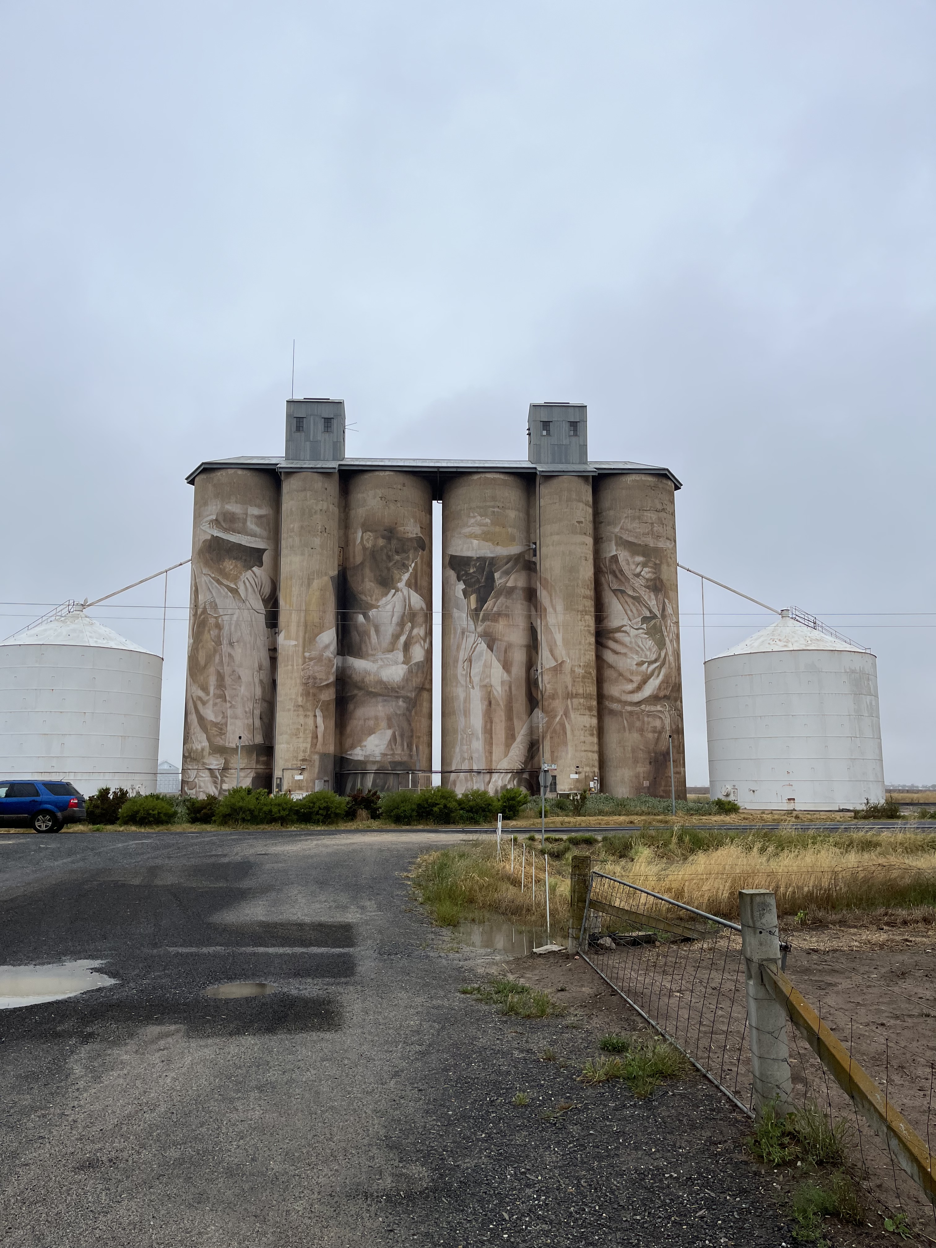


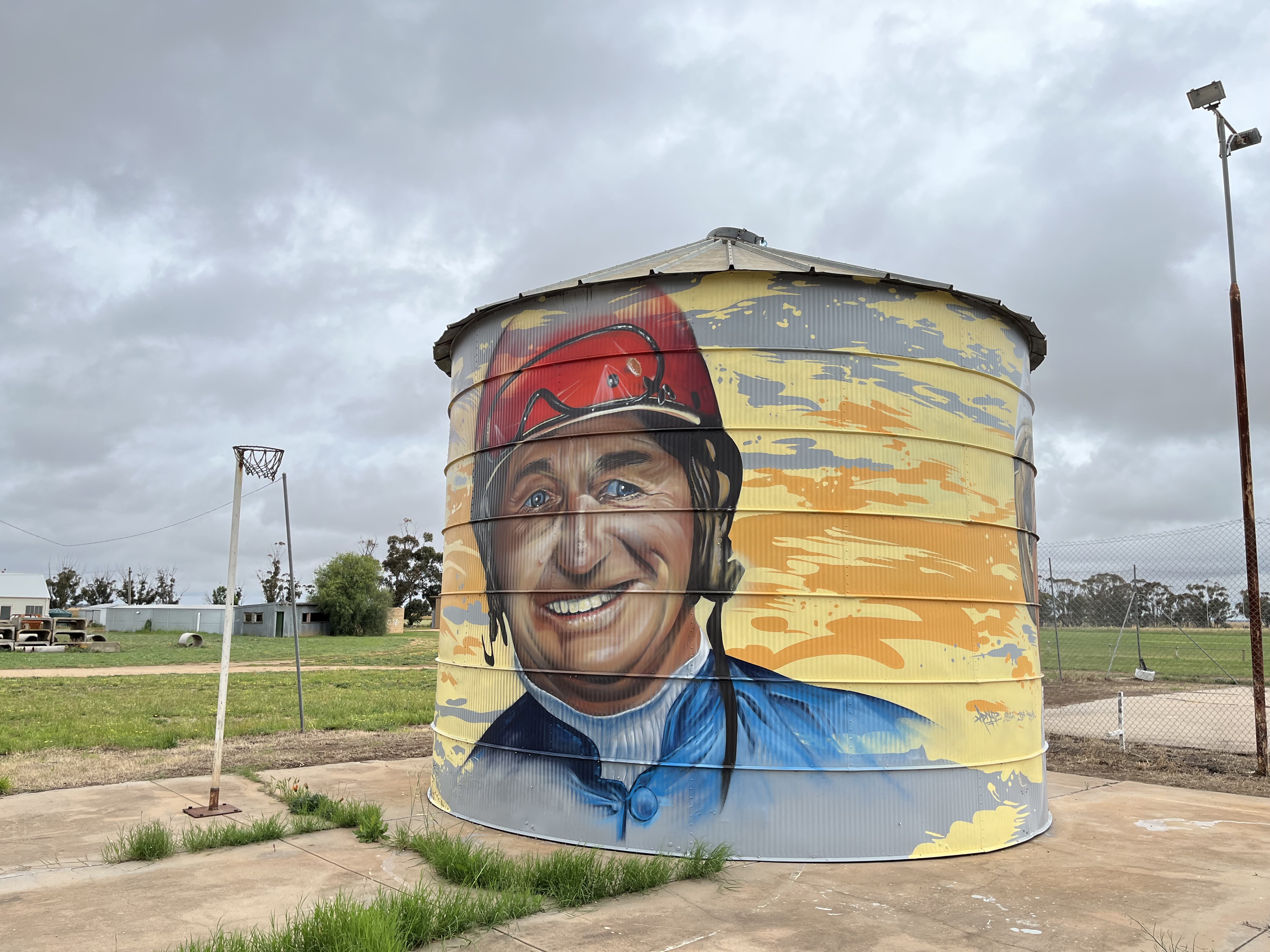


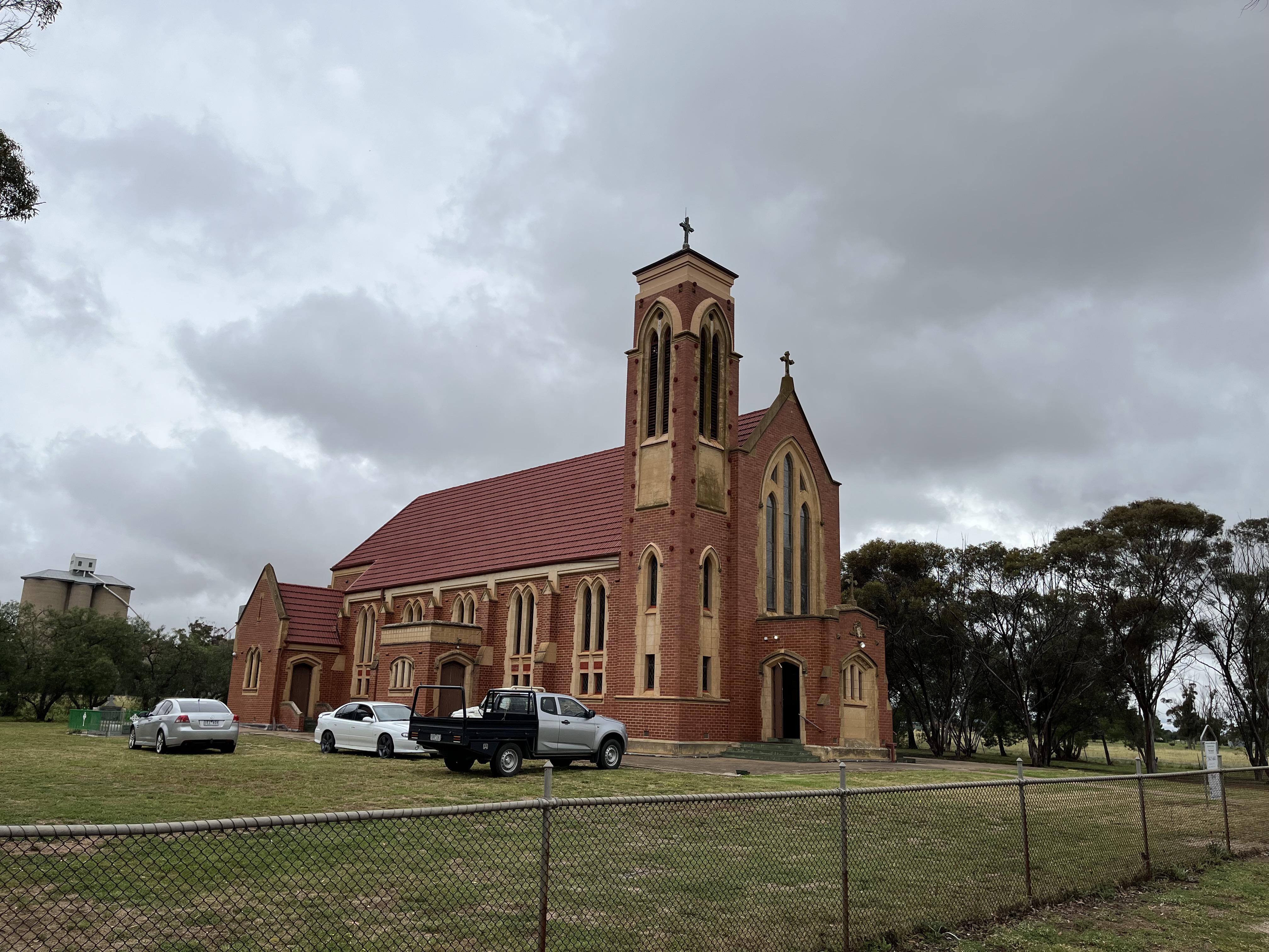
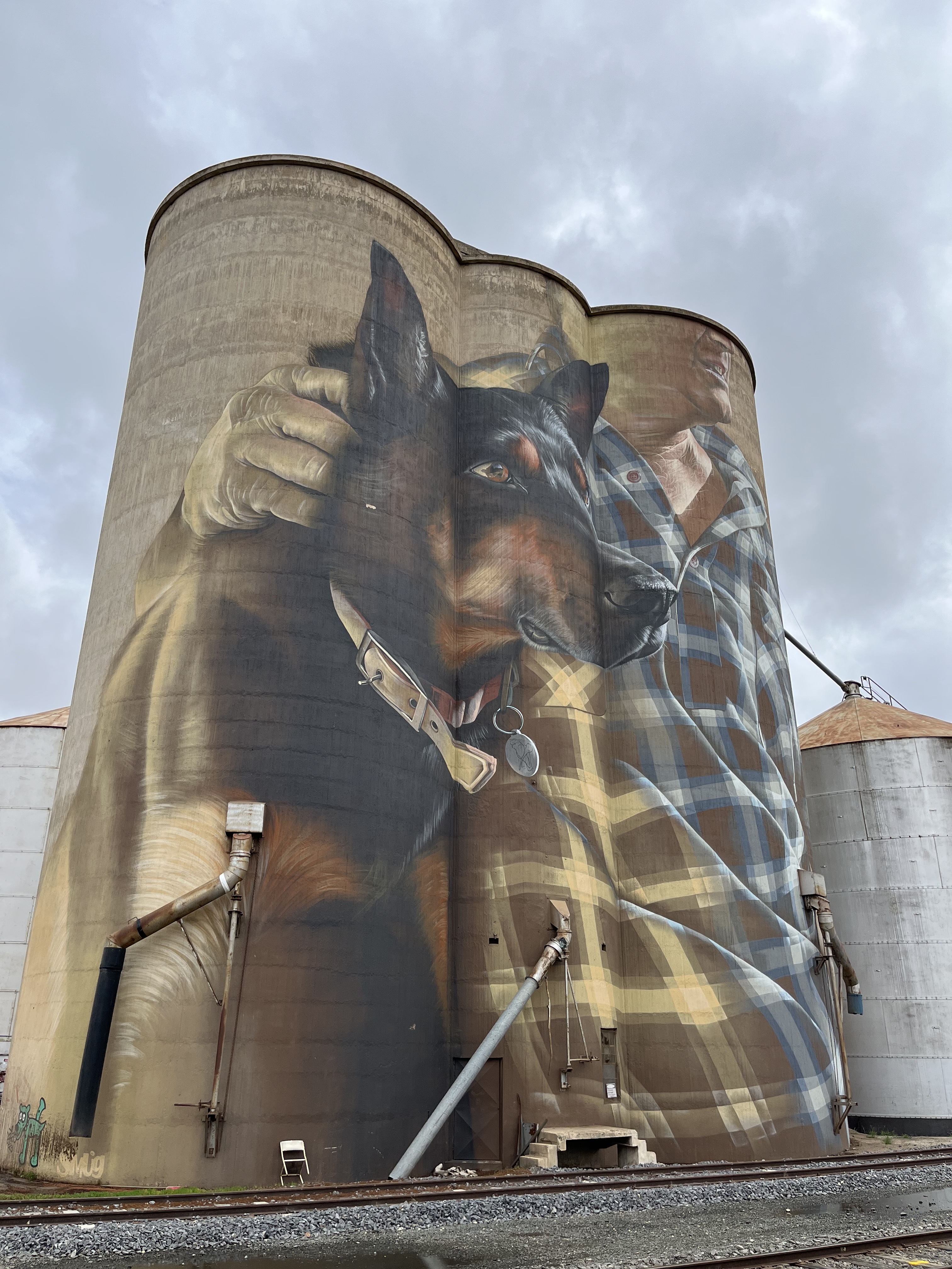


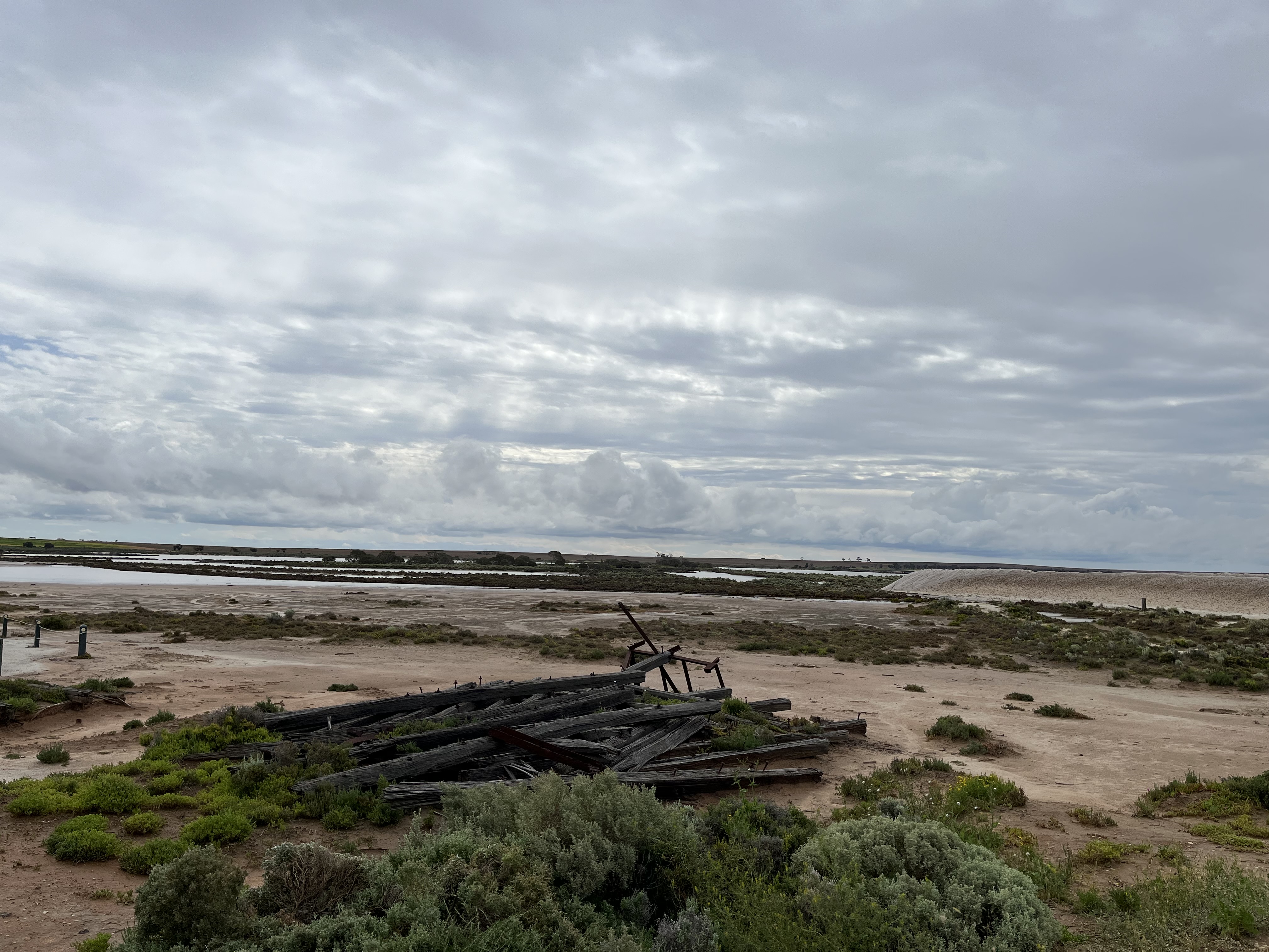
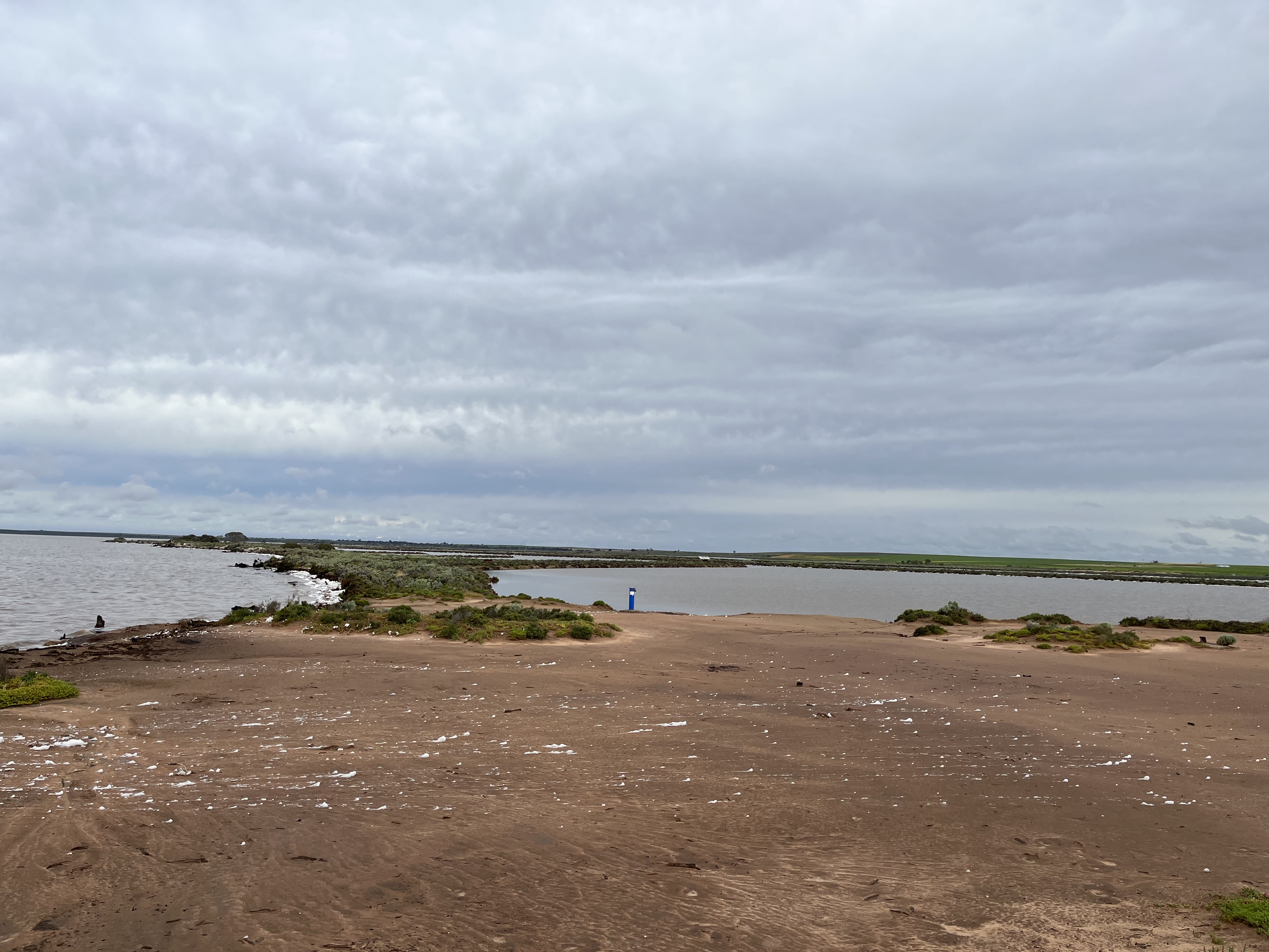


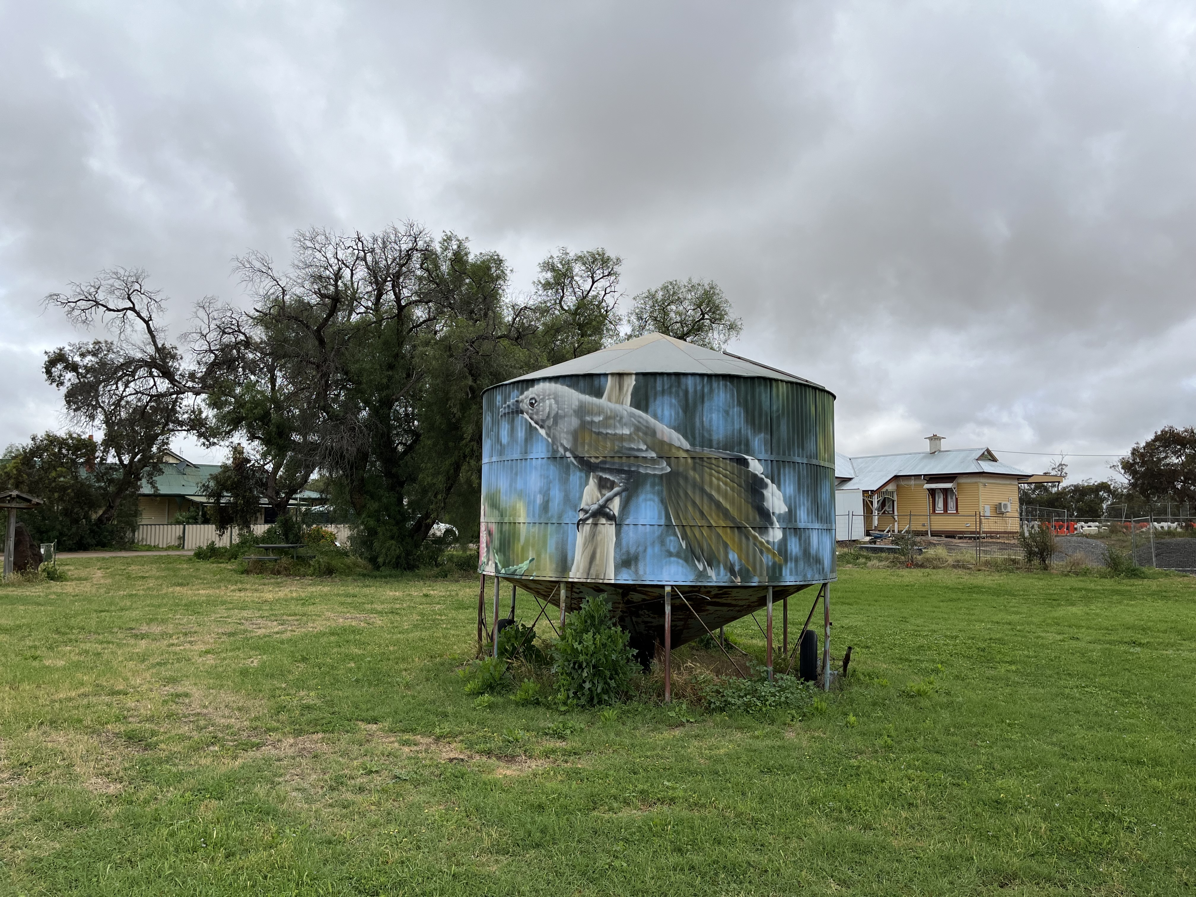

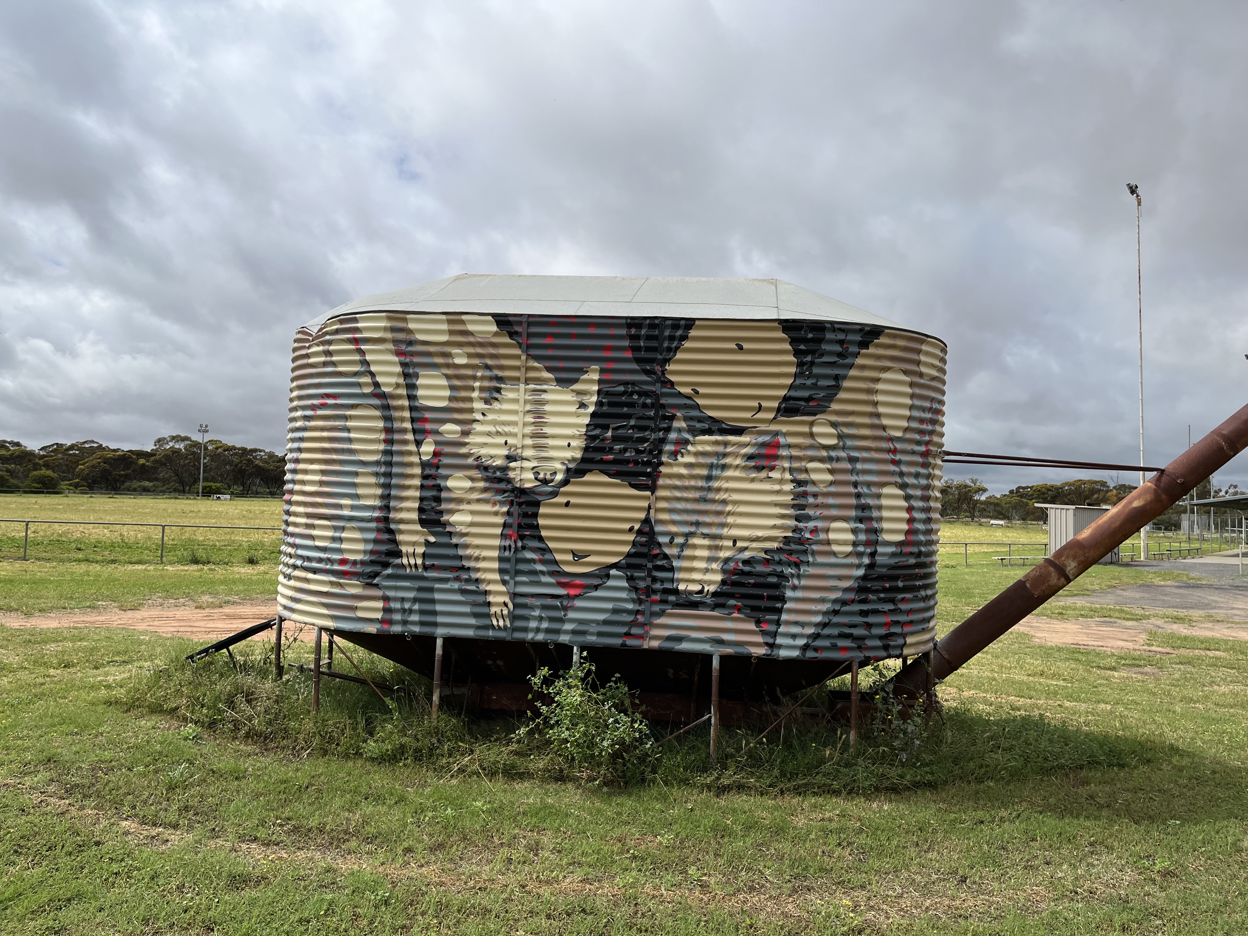

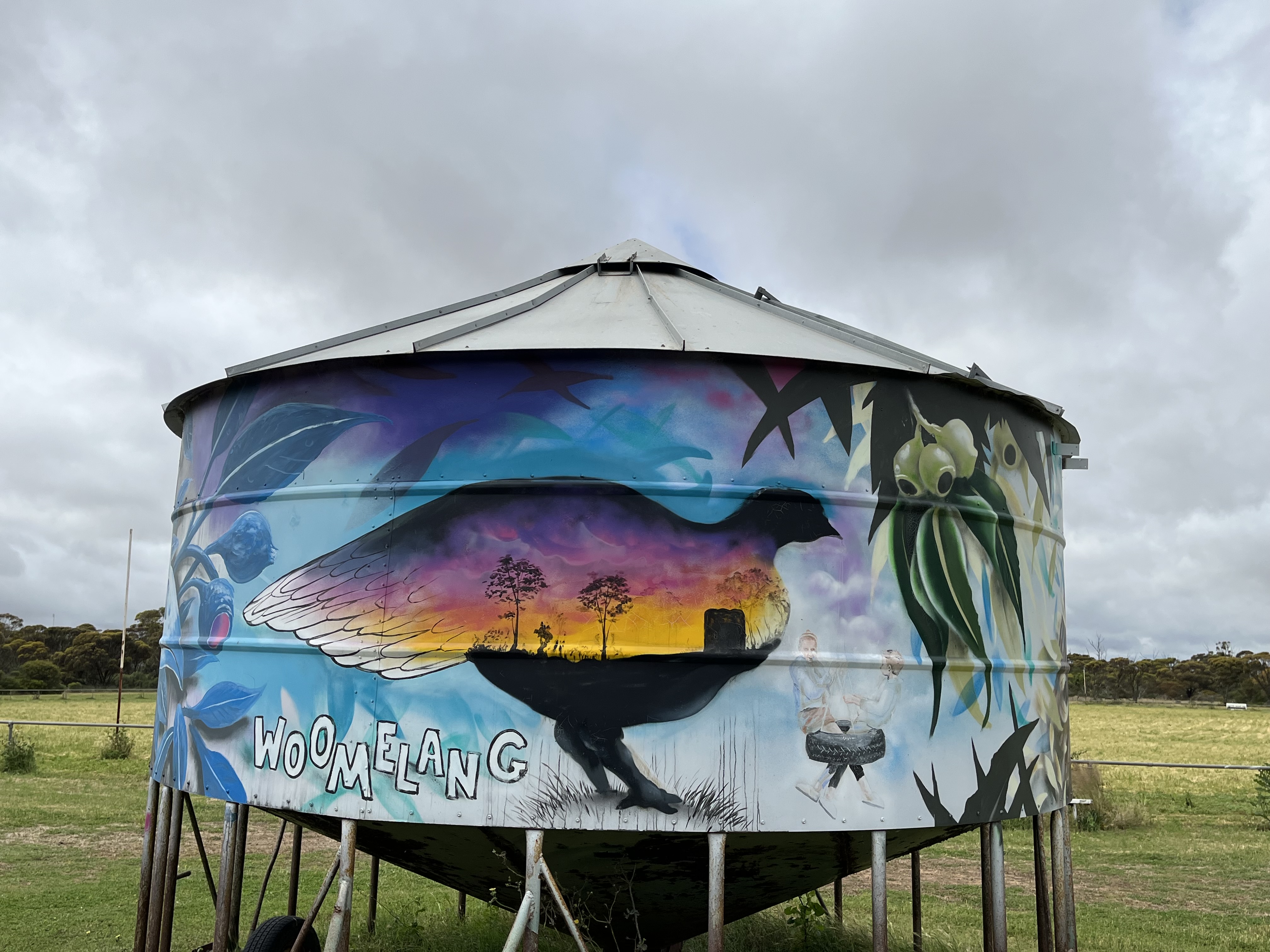


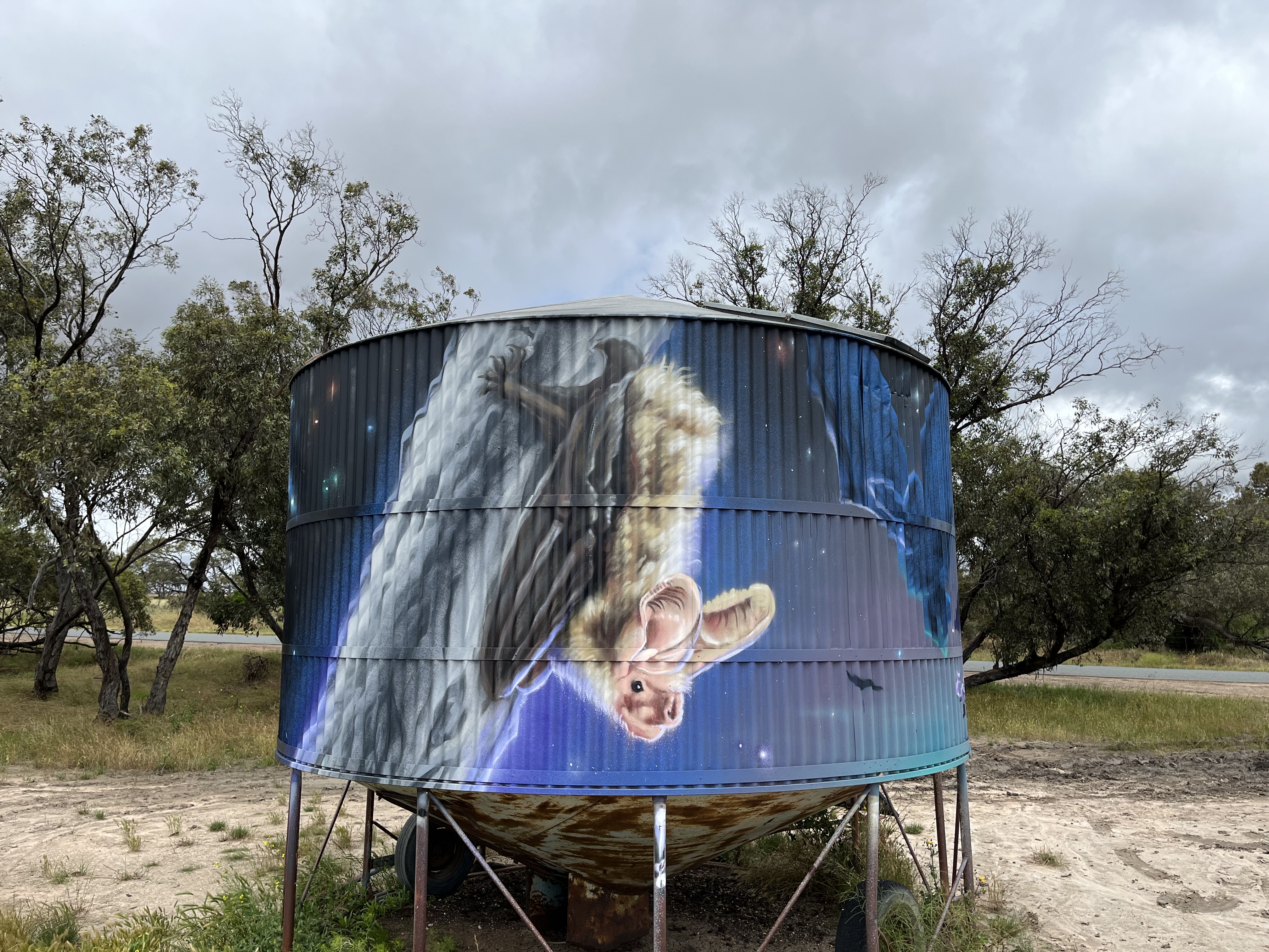
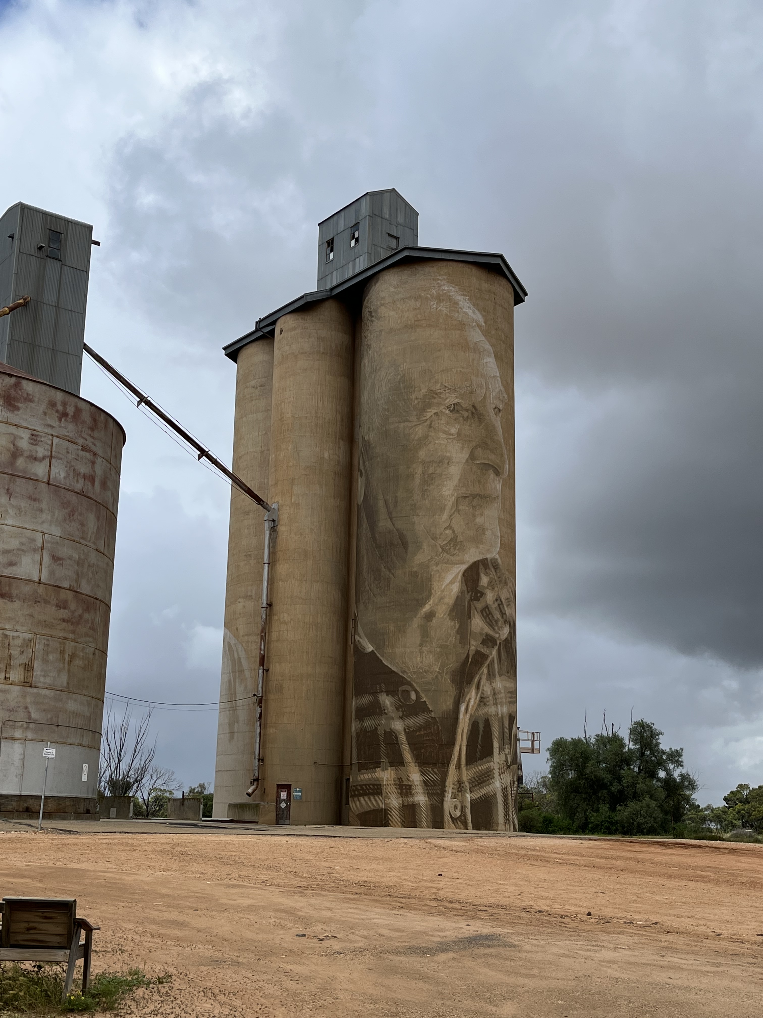

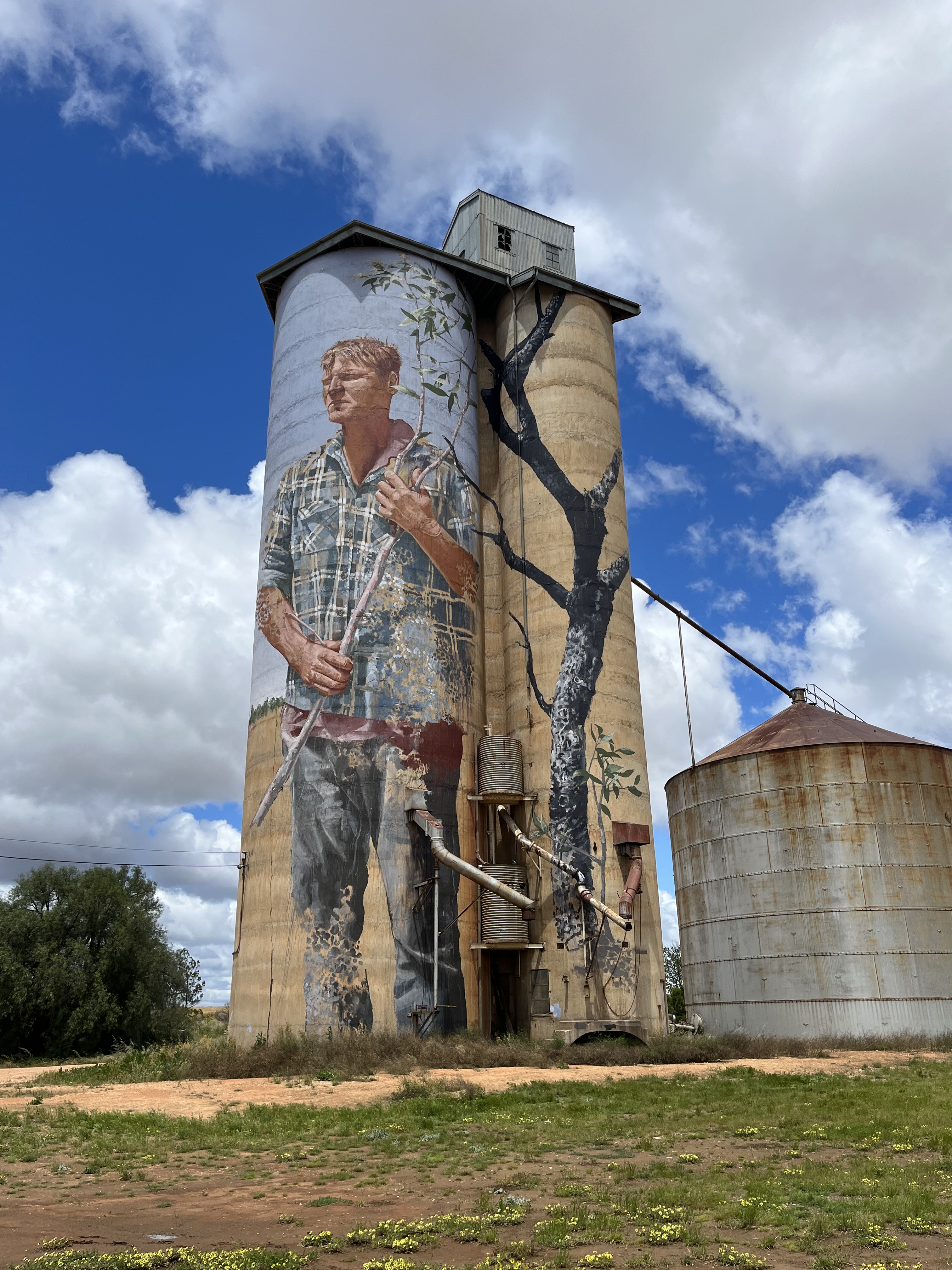

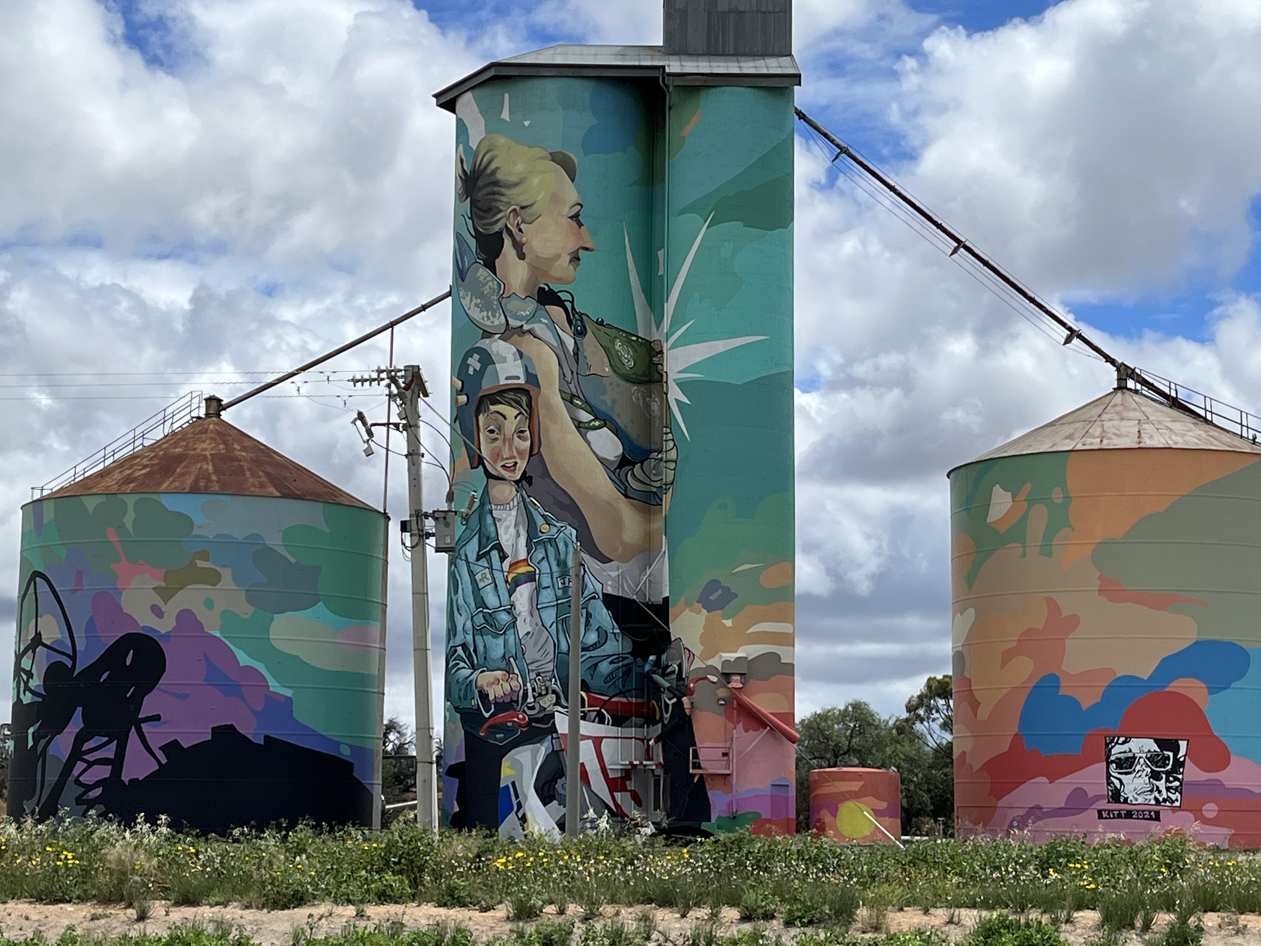


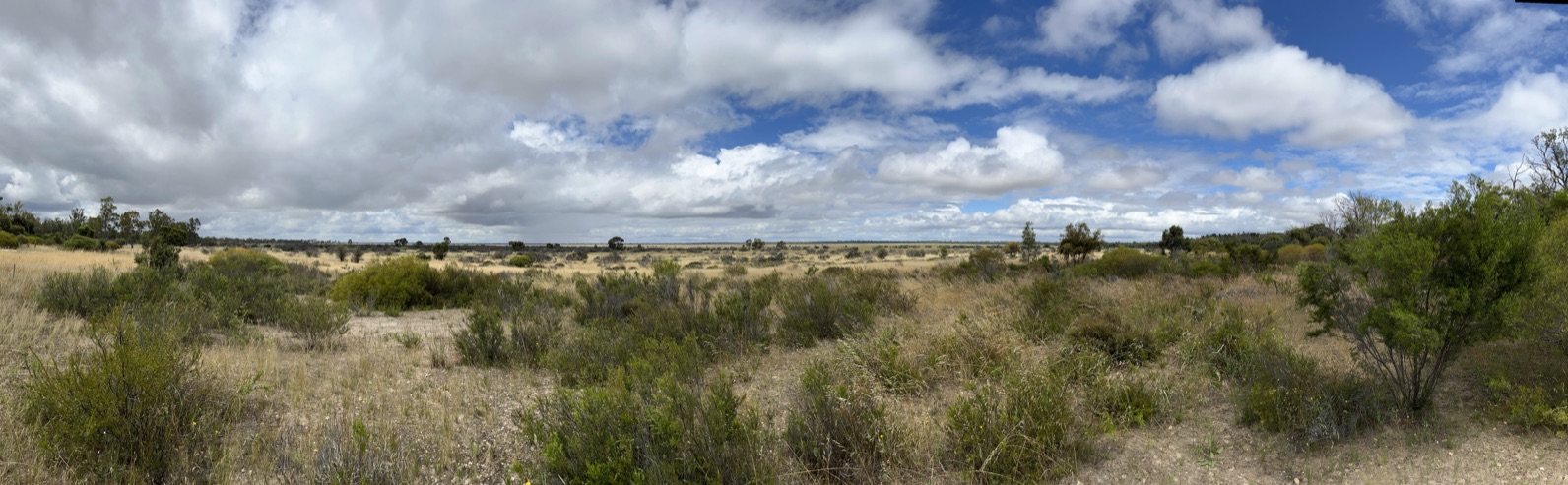

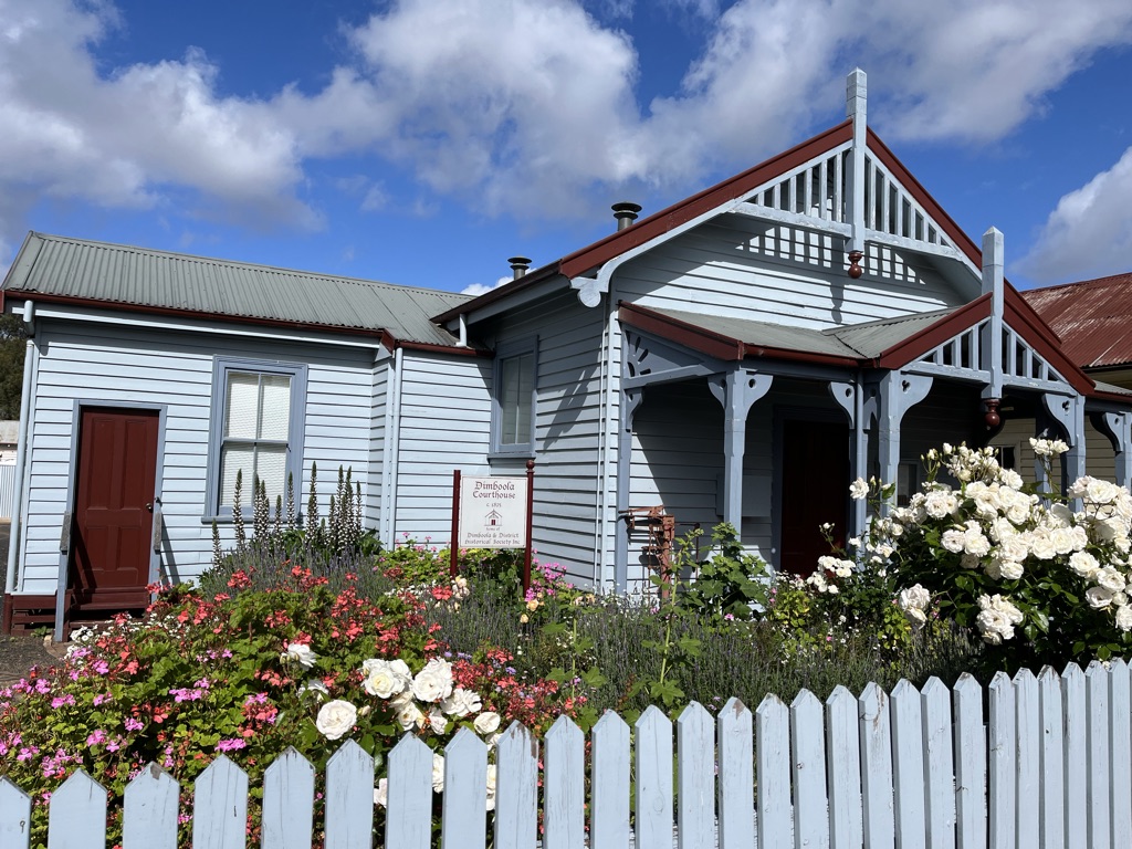
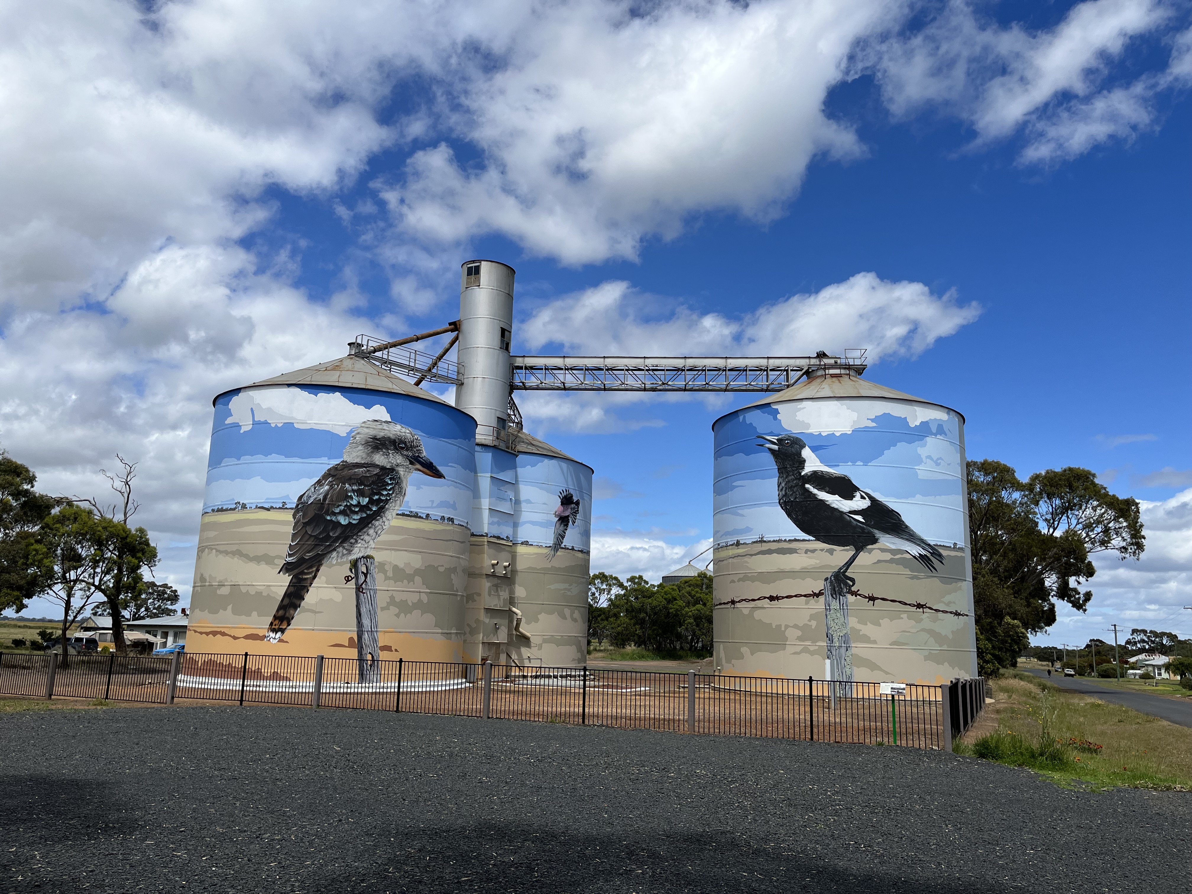


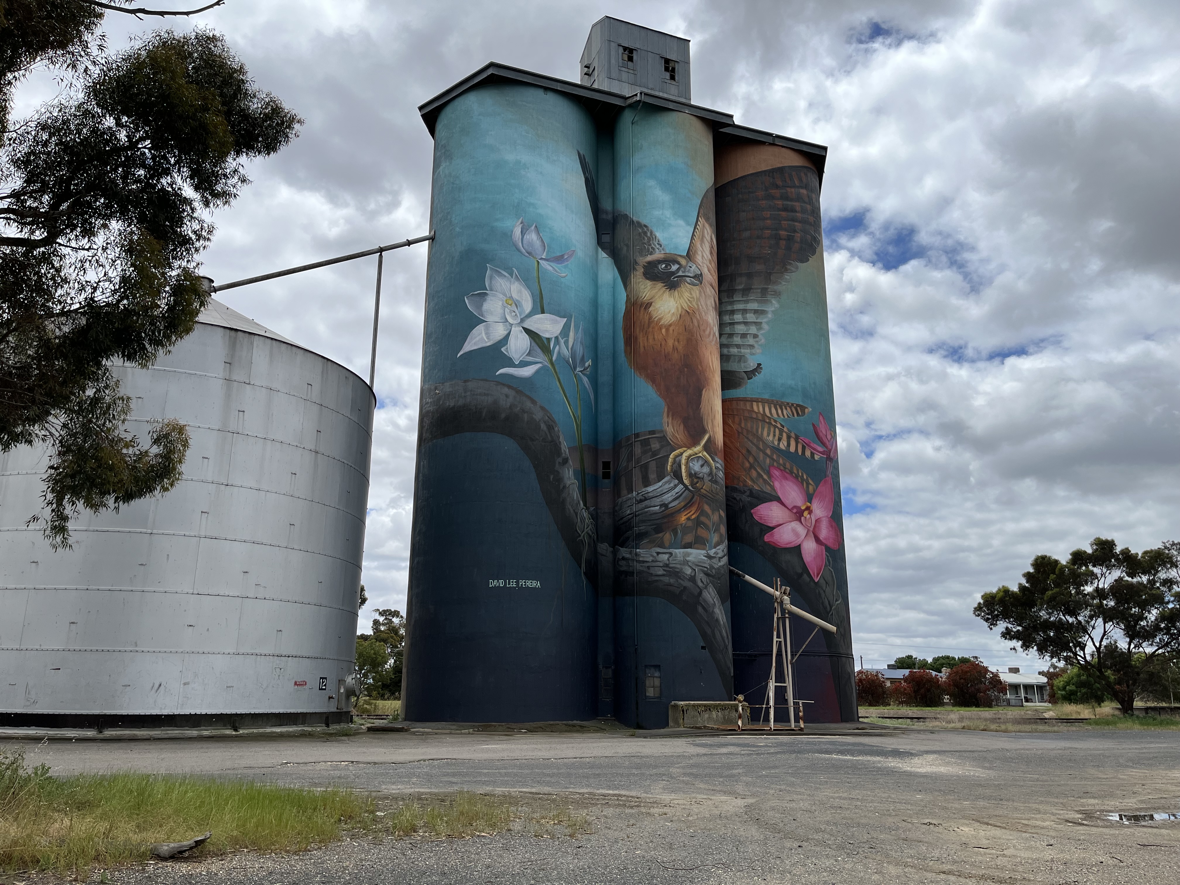


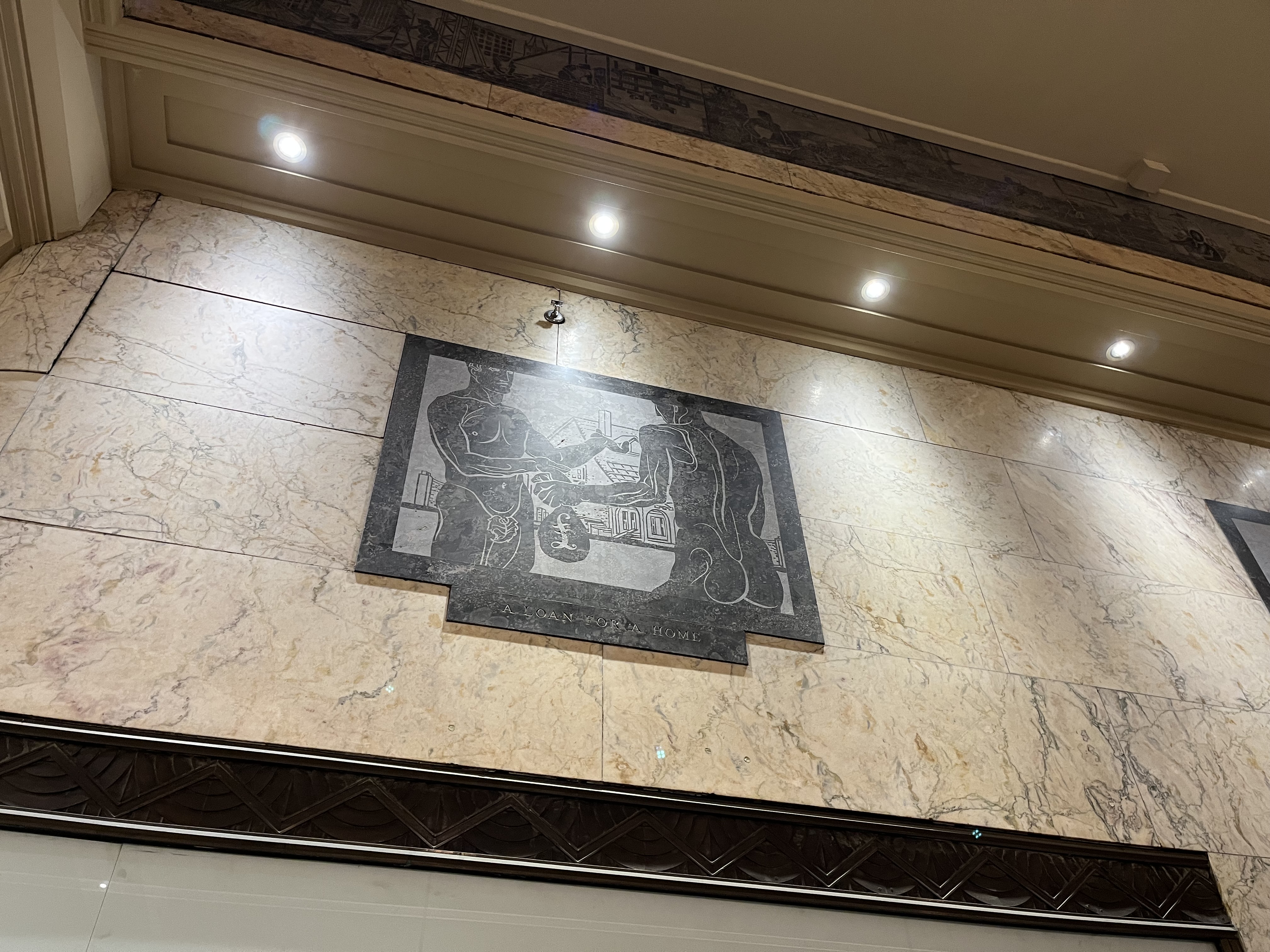
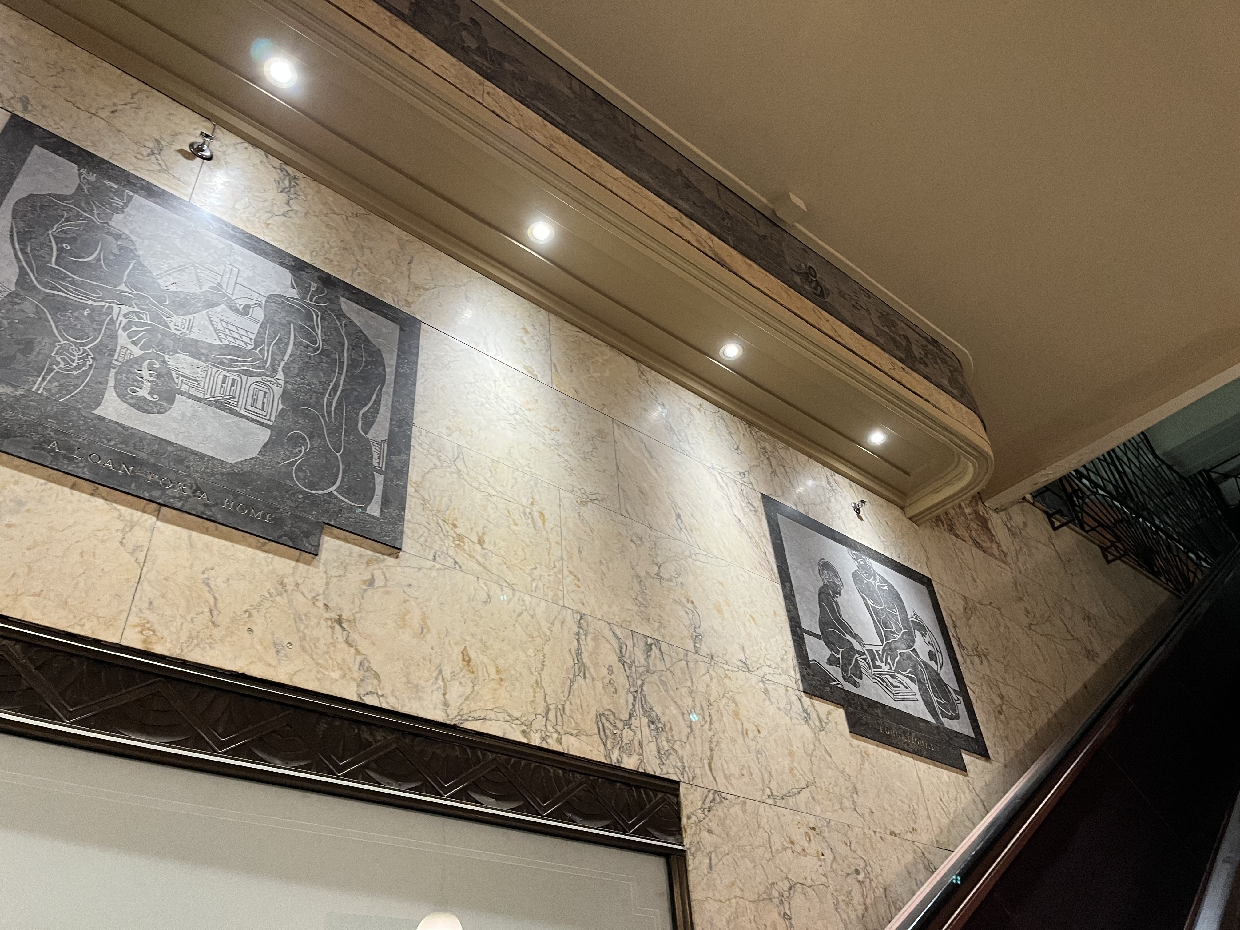


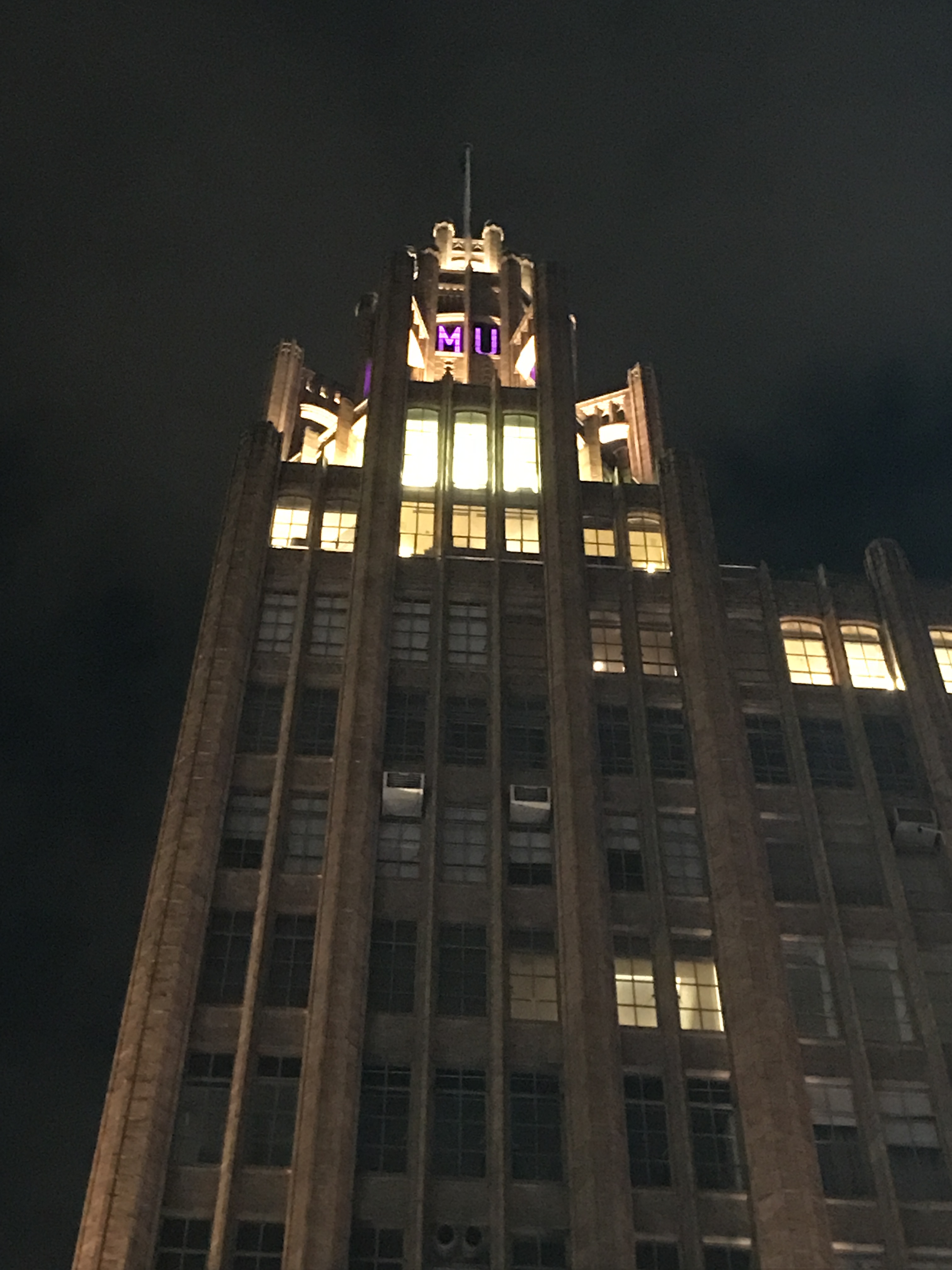


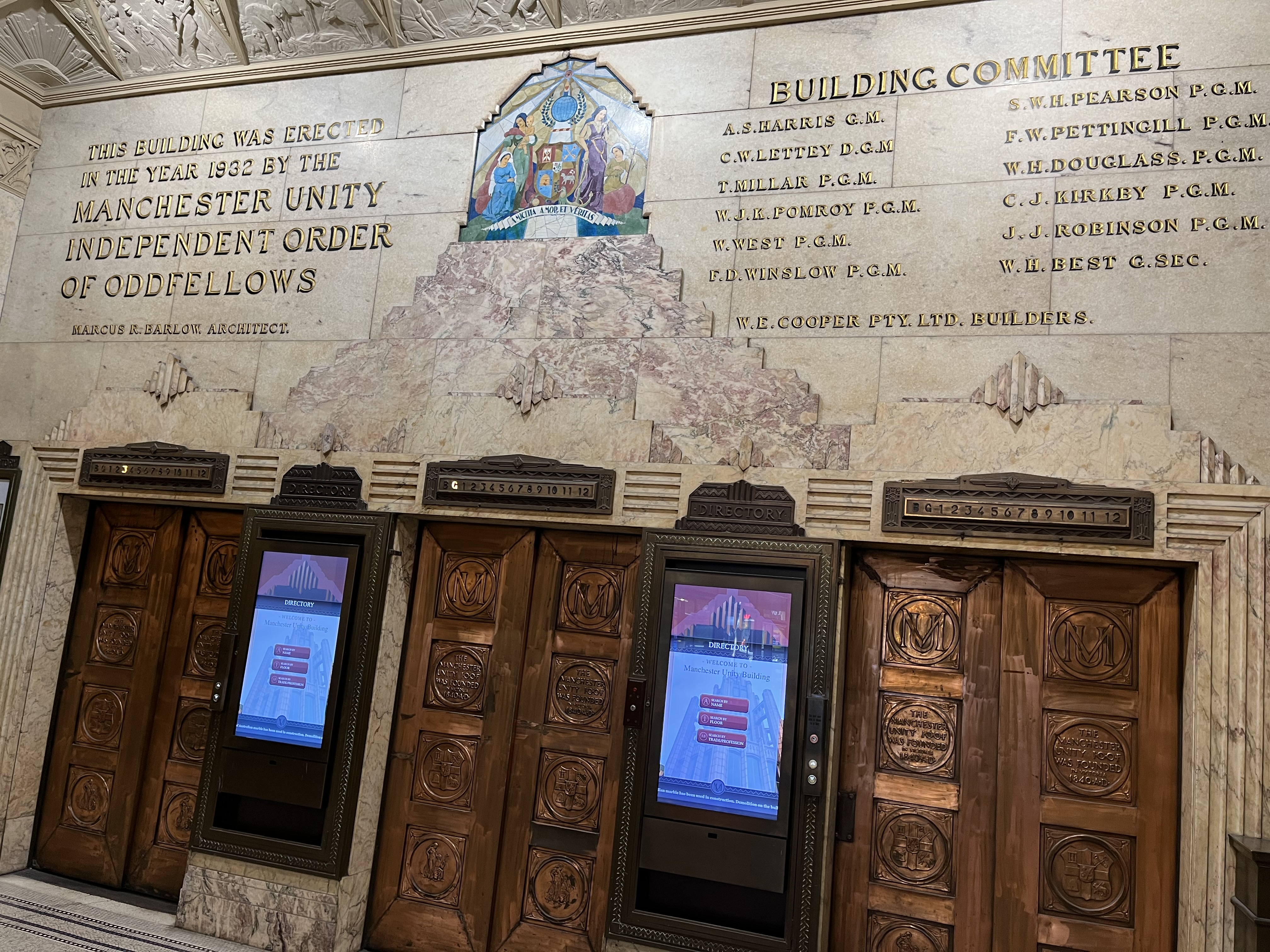


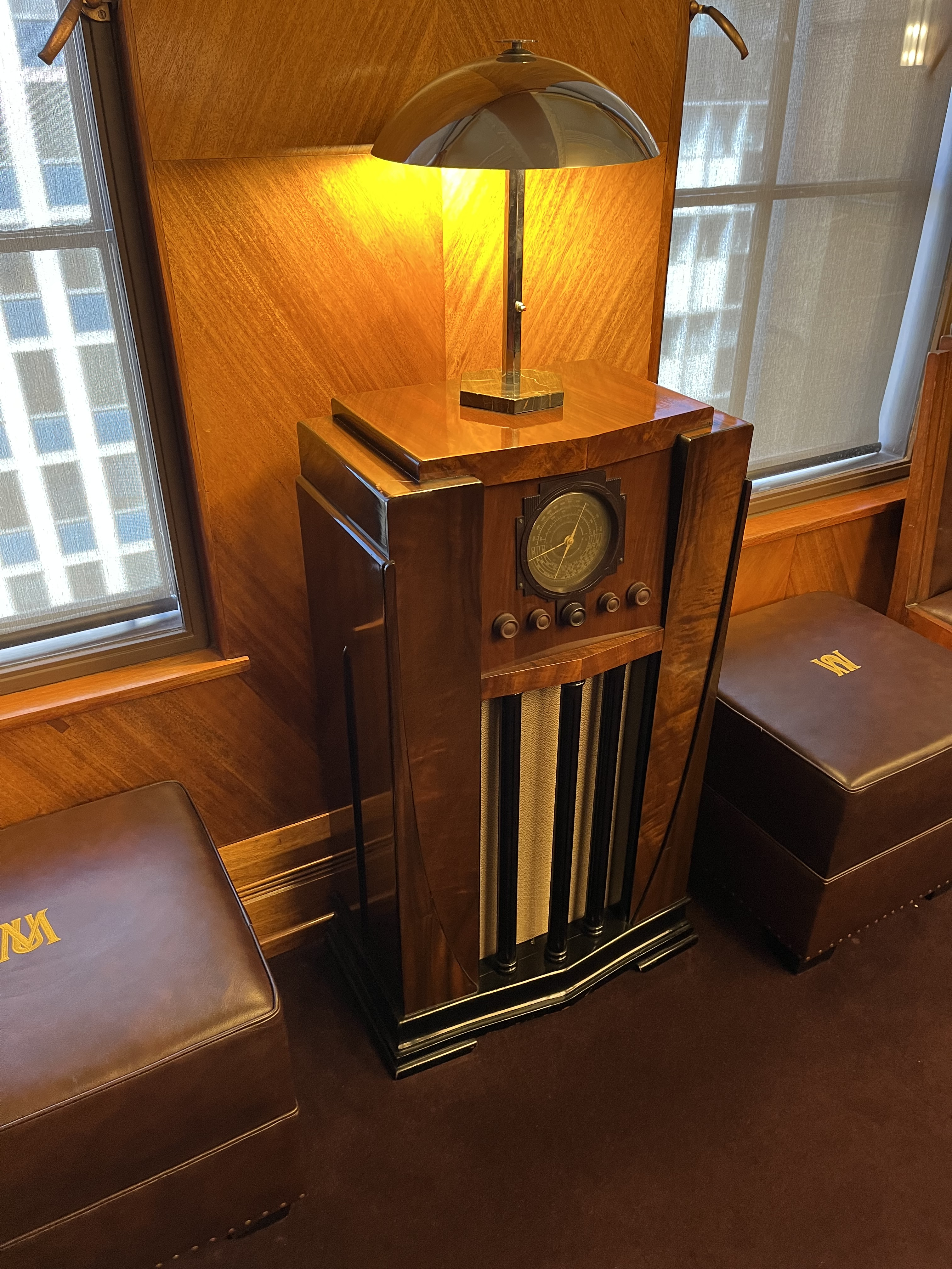

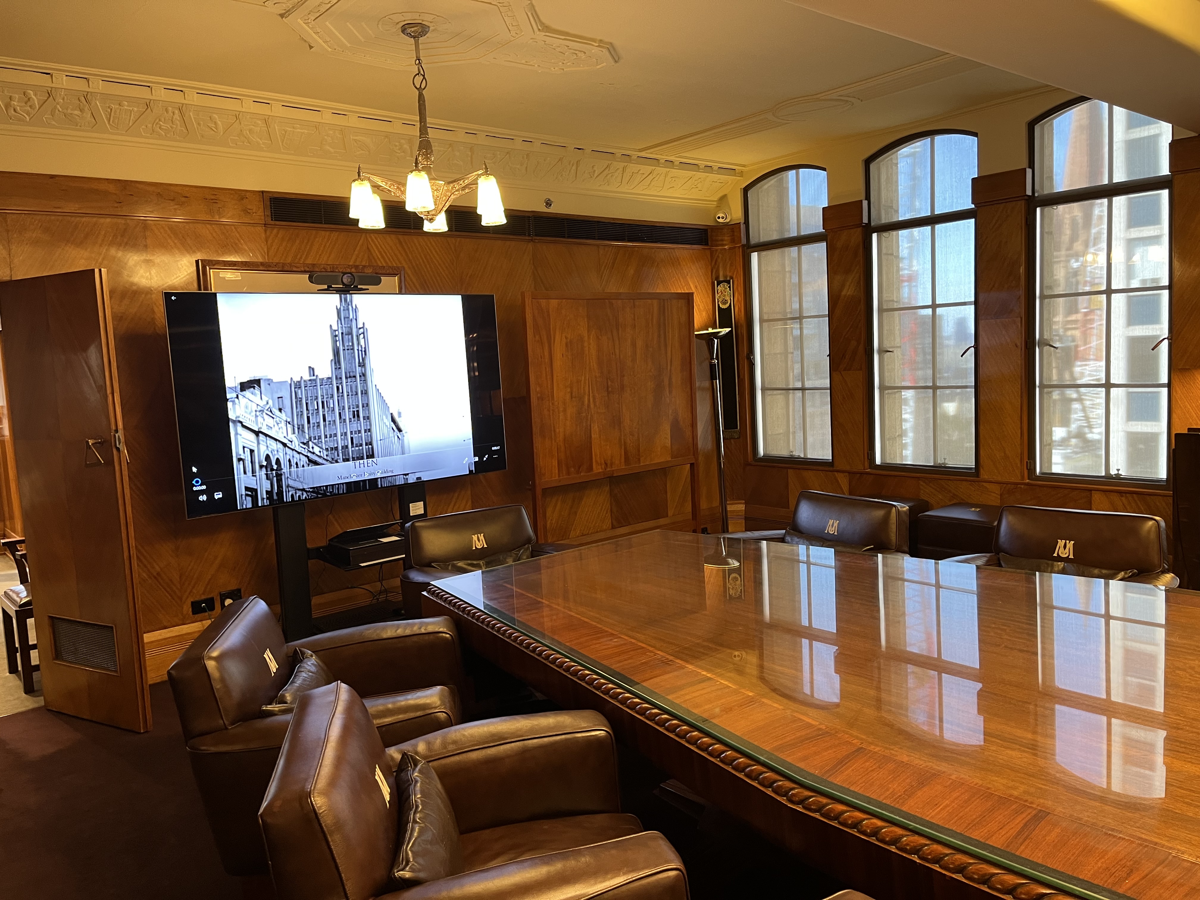


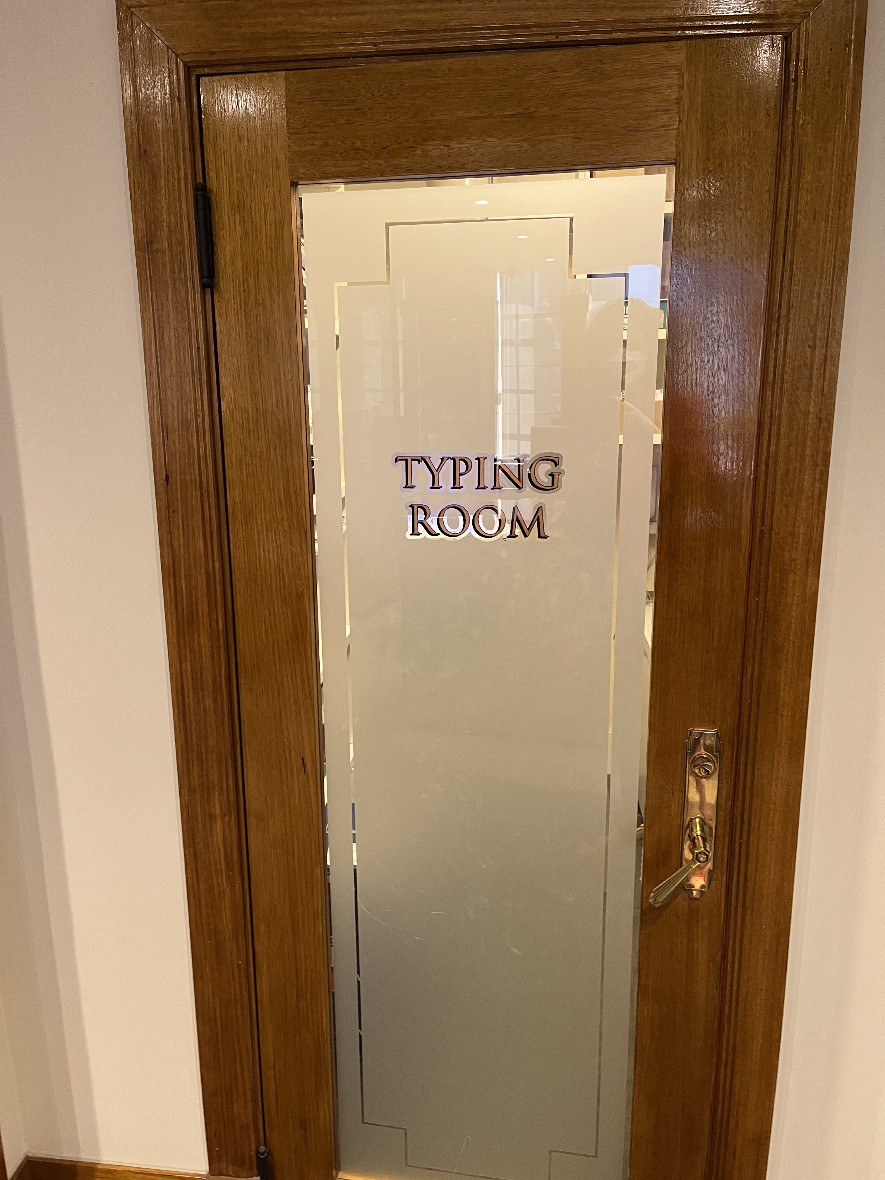


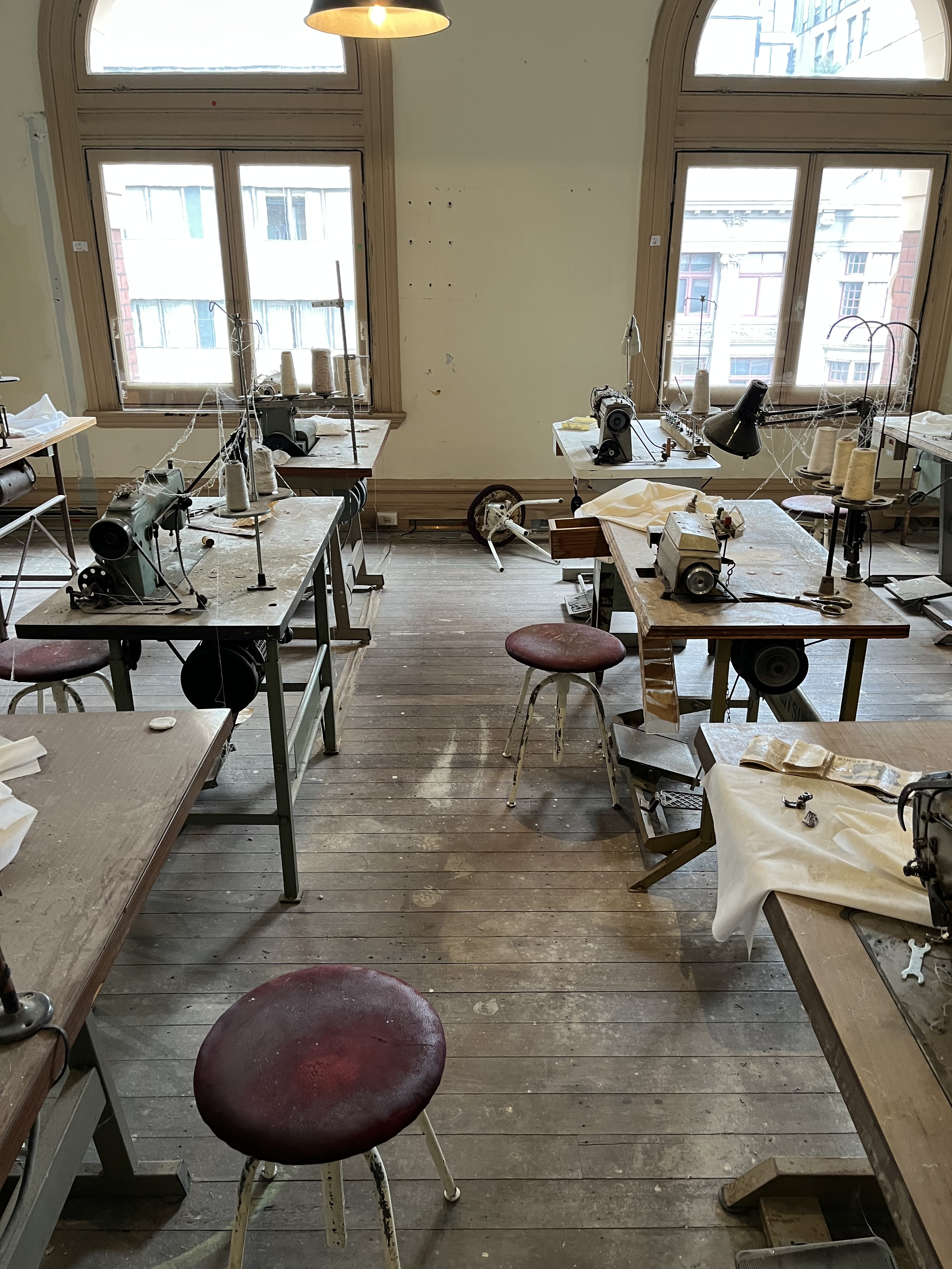


