Advent Calendar of Castles: December 5th: Pickering Castle

pickering-1pickering-2pickering-3

Pickering Castle was established by William the Conqueror in c. 1070. It was built in response to the northern revolts against his rule. William’s stamping of authority on the north is known was the Harrying of the North. Such an innocuous name sounds like it was a minor irritation, however this couldn’t be further from the truth. William the Conqueror led a brutal pillaging of the north, killing people and destroying crops and food. Tens of thousands of people starved to death in the aftermath.

The original castle would have been earth and timber and the motte on which it was built still stands today. The rebuilding of the castle in stone began around 1180 and continued into the 13th century under successive kings. Within the walls there is also a chapel dedicated to St Nicholas which dates to roughly 1227. Until the mid 16th century the castle would have had a resident chaplain.

By the early 14th century the castle has passed into the hands of Thomas Earl of Lancaster, the grandson of Henry III. He married heiress Alice de Lacey and using her money introduced more stone buildings, including building a new hall for the family to live in, within the walls of the castle. In the mid 14th century Edward II ordered the outer walls to be built in stone, including stone towers as part of the walls. He used the castle for raising horses. He established a stud at the castle and often used it as a hunting lodge.

By the time of the civil war the castle had fallen too much into disrepair to be used for defence and in the 17th century parts of the castle were used as a court house. The castle came into the hands of English Heritage in 1926.

References:

Site visit 2012.

http://www.britainexpress.com/counties/yorkshire/castles/pickering.htm

The Harrying of the North: http://www.historyextra.com/article/bbc-history-magazine/battle-of-hastings-aftermath-consequences-harrying-of-the-north


The photos are all mine.


Advent Calendar of Castles: December 4th: York Castle

york-1york-2york-3


The castle you see in the photos is all that remains of York’s once much larger castle. The current structure, known as Clifford’s Tower, was built in the 13th century and served as the heart of government in York and was also used to house the royal treasury. That is not to say that there was not a castle on the site prior to the construction of Clifford’s Tower. A wood and earth Norman tower was built on this site in the 11th century and suffered much damage and rebuilding during these tumultuous times, but it probably survived largely intact until the 12th century. The castle was then the setting for one of the most infamous incidents in York’s history. In 1190 tensions between the York Jewish community and the largely Christian population came to a head and roughly 150 Jews were given protective custody in the wooden castle that stood on the current site of Clifford’s Tower. Something went terribly wrong though and the royal officials found themselves shut out of the castle. They summoned reinforcements to retake the castle and these reinforcements joined with a local mob. The mob and the reinforcements were soon out of control and the Jews in the castle were besieged. On the 16th of March the Jews inside realized there was no way out and they committed suicide and set the tower alight rather than face the wrath of the mob. According to some accounts some Jews did survive and came out under an amnesty to then be massacred by the mob.

The tower burnt down but it was rebuilt, in wood and stone, but it wasn’t until the mid 13th century that the tower you see today was constructed. Henry III ordered a new stone tower to be built in roughly 1245 to help deal with the threat of the Scots. The tower was finished by the end of the 13th century and would have likely stood surrounded by a moat of some description and an outer bailey and walls were added in the 14th century. Over the years the tower and castle acted largely as an administrative centre rather than a royal residence. The first recorded use of the name “Clifford’s Tower’ dates to the mid 16th century but it is possible that the name comes from the rebel Roger de Clifford who was executed in 1322 and whose body was displayed on a gibbet at the castle.


References:

Site visit 2012

http://www.english-heritage.org.uk/visit/places/cliffords-tower-york/history/


The photos are all mine.


Advent Calendar of Castles: December 2nd Lincoln Castle.

lincoln-1

lincoln-3

lincoln-2

Lincoln Castle was begun by William the Conqueror in c.1068 making it one of the first Norman castles built. It was part of the Conqueror’s plan of the domination of England through a network of castles. It was through castles like Lincoln that he administered and controlled his new territory. Lincoln Castle stands on the site of an old roman fort and when it was built 166 Saxon houses were demolished to make way for it.

In the early medieval period Lincoln castle was the site of two decisive battles. The first was in 1141 during the time period known as the Period of Anarchy (1136-1154). King Stephen and the Empress Matilda were fighting for control of the country. It was a time which the Anglo-Saxon Chronicle described as “people openly said that Christ slept, and his saints.” In 1141 the Earl of Chester and his brother William of Roumare had rebelled against King Stephen and taken Lincoln Castle by deceit. Oderic Vitalis’ version says that they sent their wives in on the pretext of a friendly visit and the Earl arrived to collect the women with only three knights and then, “Once inside the castle they suddenly snatched crowbars and weapons which lay to hand and violently expelled the king’s guards. Then William burst in with a force of armed knights, according to a pre‑arranged plan, and in this way the two brothers took control of the castle and the whole city.”

Regardless of how they took the castle they held it and King Stephen arrived to besiege the castle. The Earl of Chester escaped and alerted Robert of Gloucester, Empress Matilda’s brother and the head of her campaign for the crown. Gloucester arrived in Lincoln with an army and there was a pitched and bloody battle, unusual in a war that was mainly looting and skirmishes, Gloucester’s forces were victorious and King Stephen was captured.

The other key battle at Lincoln was in 1217. It was so bloodless that it was soon known as the Fair of Lincoln. William Marshal headed forces fighting for the newly crowned Henry III. Marshal was the young Henry’s regent. They were fighting the remains of the barons who had forced King John to sign the Magna Carta in 1215. The majority of barons had returned to the royal fold after King John’s death, but there were a few hold outs who were still supporting Prince Louis of France as their candidate for king. Prince Louis’ forces were besieging Lincoln which was held by the remarkable Nicola de la Haye (who I hope to write more about later), Marshal’s forces came to relieve the siege. They had help from the inside the castle and the battle was a route. Prince Louis’ forces were demolished and the battle was pretty much the end of the baronial revolt, though it was the Battle of Sandwich and paying off Louis that got rid of him completely.

Outside of these two key battles Lincoln continued to be both a prison and court for centuries to come. It is also the location of one of the only four surviving original copies of the Magna Carta as well as a copy of the 1217 Charter of the Forest.

References

Site visit 2012

Lincoln castle information leaflets.

https://www.lincolncastle.com/content/history

Anglo Saxon Chronicle: http://www.britannia.com/history/docs/1137.html

Battle of Lincoln 1141: http://deremilitari.org/2014/03/the-battle-of-lincoln-1141-from-five-sources/

The Fair of Lincoln 1217: Tout, T.F, ‘The Fair of Lincoln in the ‘Histoire de Guillaume le Maréchal’, The English Historical Review, 18, 1903, pp. 240-265.

The photos are all mine.


Advent Calendar of Castles December 1st: Castle Rising

This year for christmas I’m running an advent calendar of medieval castles. Each day I’ll post three photos of a castle and some information. Today I’m starting with Castle Rising in Norfolk just out of Kings Lynn.

castle-rising-1castle-rising-2castle-rising-3

William d’Albini the Earl of Arundel began having the castle built in c. 1138. It was most likely built for his new wife, who was the widow of Henry I, Adeliza of Louvain. The keep itself was probably envisioned as self-contained accommodation for the lord and his family.  It is curiously domestic in scale, but the massive earthworks make it clear that defence was at least considered. The uppermost levels of the keep were likely added at a later date and this included re-roofing and adding an extra room at the top of the keep. As well as the keep, in the grounds behind the earth works, there are the remains of a Norman church. It most likely predates the castle and would have been replaced by the current parish church in the town of Rising around the time the castle was built.

The d’ Albini family died out in the 13th century and Castle Rising passed into the Montalt family. The Montalt family died out in the 14th century and Castle Rising came into royal hands. It was after this that the castle entered what is probably its best known phase when it became the residence of Queen Isabella, known as the she wolf of England. She was the Queen of Edward II and many argue she had a role in his murder. It has been argued that Castle Rising was her prison, but it is also just as possible that it was the residence she chose in exile. There were certainly buildings erected for her in the grounds of the castle

Castle Rising ultimately came into the hands of the Howard family who still own and manage it today.


References:

Site visit 2012

http://www.castle-rising-history.co.uk/castlecameo.html

http://www.castlerising.co.uk/thecastle.html

http://www.english-heritage.org.uk/visit/places/castle-rising-castle/

The photos are all mine

Cemeteries: Port Fairy

img_9133
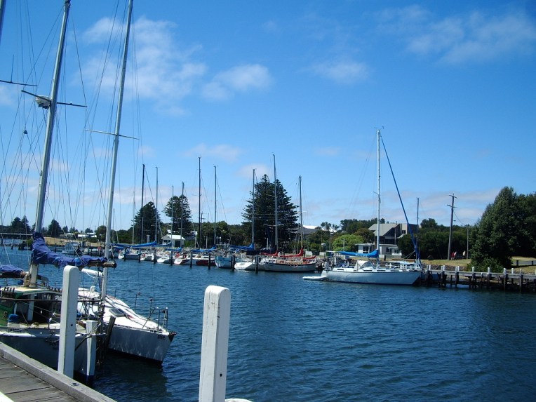
Port Fairy is a town in Western Victoria that was founded as a town in 1843. There were settlers in the area before this date, and the current name for the town comes from the ship the Fairy which is believed to have arrived in the area in c.1828. The area was also regularly visited by whalers and sealers. The date of 1843 comes from the special survey which was granted to James Atkinson at that time. The special surveys were a system where the government of the Colony of New South Wales was able to control ownership of the land in the Port Phillip District. This was well before federation of Australia as a country in 1901, but also before Victoria became a colony independent from New South Wales which happened in 1851. The basic premise behind the special survey system was to stop squatters just claiming land, because when they did there was little ability to regulate it and there was no fee for the government.

Atkinson arrived in Sydney in 1830 from Ireland and became a prominent and well connected member of Sydney society, at least partly due to his family connections to Colonel Charles Wall of the 3rd Buff regiment who was married to his sister. As he had a high social standing he couldn’t use trade to make money, so he turned to land. He was granted the right to the special survey of the Port Fairy region in 1843. He worked with the existing settlers, but also moved to attract new settlers to the town he named Belfast. He most likely applied for the special survey rights to the land without ever seeing it, as there is no evidence he set foot there before arriving in 1846 with his wife and seven children. He offered very long term leases for land in the town he established, but while he was definitely trying to encourage settlement he was not immediately successful. In 1848 he appointed his nephew (and my great, great, great, grandfather) Robert Henry Woodward, who was farming in the area, as his land agent. Woodward was 25 and oversaw the majority of the establishment of the town proper. It was also Woodward who oversaw, with the blessing of Atkinson, the gifting of parcels of land within the town for churches of different denominations and for community purposes, such as a post office, a hospital, government offices, public wharves, a savings bank, a town hall, public meeting places and a cemetery.

IMGP2243.JPG

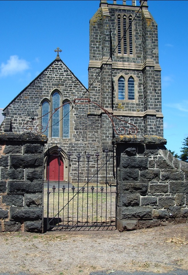
St John’s Anglican Church Port Fairy built between 1854 and 1856. It was the first church in Victoria to have a chancel. The tower was added later in the 1950s.

Atkinson did not remain in Belfast, returning to Sydney and to Ireland, but he did visit to survey the progress of the town in 1859, 1861 and 1864. Atkinson died in Sydney in 1864, though Woodward continued to administer the lands until 1869. The town petitioned, successfully, to change its name to Port Fairy in 1886

Before continuing to discuss the cemetery I would also like to acknowledge the indigenous people of the land which Atkinson bought as the special survey. This area was the land of the Gunditjmara people. If, when Atkinson arrived, there seemed to be a lack of indigenous inhabitants it is not because there wasn’t any ever, but because between the 1830s and the 1840s the indigenous population of the area was destroyed by settlers. A monument to them now stands in Port Fairy on Bank Street. It reads:

In memory of the thousands of aboriginal people who were massacred between 1837 and 1844 in this area of Port Fairy.

Today we pay our respects to them for the unnecessary sacrifices they made.

Your spirit still lives on within our people.  Wuwuurk

This was not isolated to the Port Fairy area. The early history of Western Victoria is mired in bloodshed. A list of the frontier wars in which the indigenous population were by and large overwhelmed and destroyed by superior western weaponry can be seen here.

http://www.australianfrontierconflicts.com.au/index.php/conflicts/chronology/vic

It was also a time of severe retaliations against any interference with livestock and systematic killings, taking of land of the beginning of the removal of children. Not to mention the introduction of alcohol and western disease and their long term affects. This article from the Warrnambool local paper The Standard out lines clearly the actions against the local indigenous population

http://www.standard.net.au/story/792108/the-south-wests-bloody-past/

It is essential that the past of indigenous Australians and the brutal suppression of them is recognised as part of the history of Victoria and Australia. This is especially true when discussing somewhere like a cemetery which provides concrete and tangible records of the deaths of early pioneers, a record that is not available for the deaths of the indigenous population.

img_9148

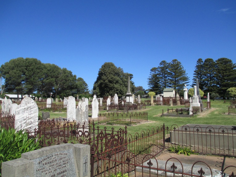
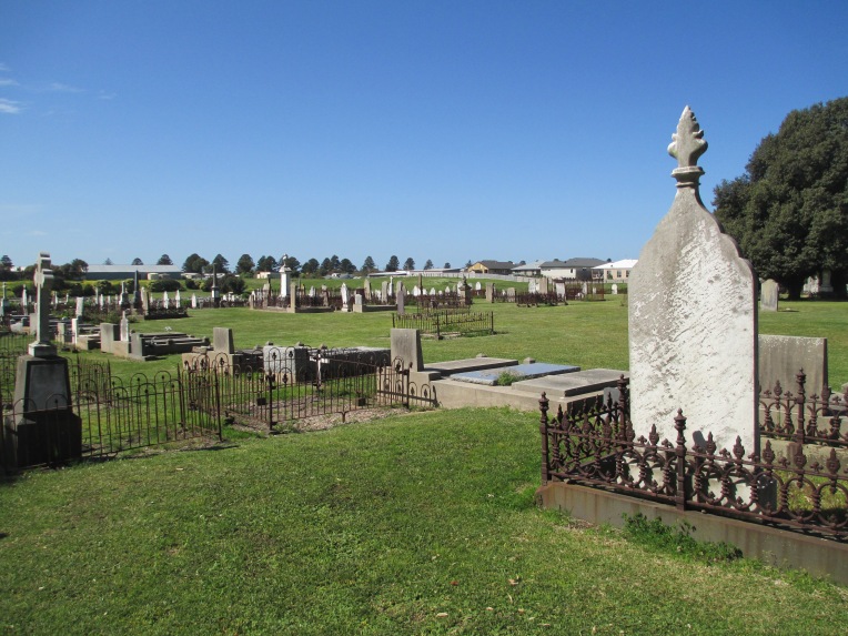
Port Fairy cemetery was founded in the 1850s. There is confusion as to whether it is the ‘old’ or ‘new’ cemetery as many descriptions seem to use the term interchangeably. The other cemetery at Port Fairy was laid out by Robert Hoddle, famous for Melbourne’s CBD grid, at the orders of Governor La Trobe. This other cemetery was in the sand hills out of town, was discontinued and little survives today. The current Port Fairy cemetery has many very early burials and is believed to be one of the first cemeteries in Victoria to have adopted the concept of a lawn cemetery.

The earliest burials in the cemetery are of the local pioneers and their families. These people are often listed as from a local ‘station’ on their tombstones. The pioneers of the area did not have an easy life and as such there are a high number of young burials, very few survived to old age. One of the earliest and one of the youngest is the grave of Harold Woodward, a son of Robert Henry Woodward and his wife Letitia Wall (daughter of Colonel Wall). Harold died on the 8th of October 1856, but was only born on the 4th of December 1855. img_9147

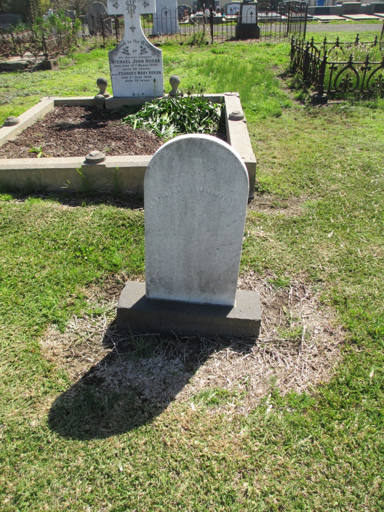
Of Robert Henry and Letitia Woodward’s 11 children Harold was the only one to meet such an early end. I am descended from his brother Albert William Woodward, the youngest of Robert Henry and Letitia’s  children. Robert Henry and Letitia are buried in St Kilda Cemetery.

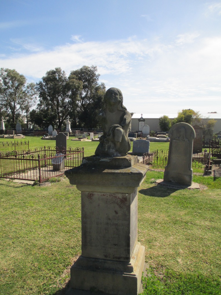
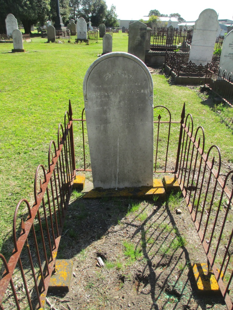
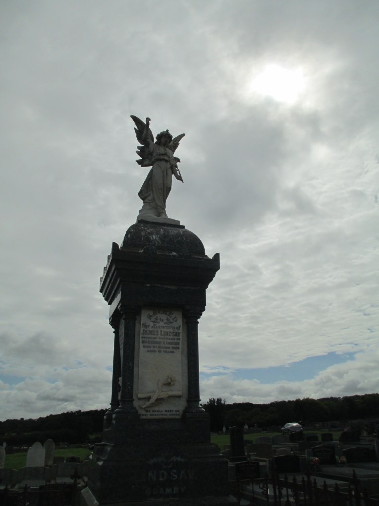
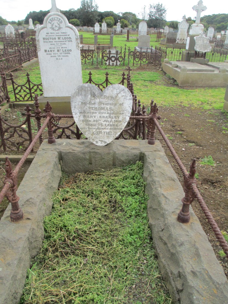
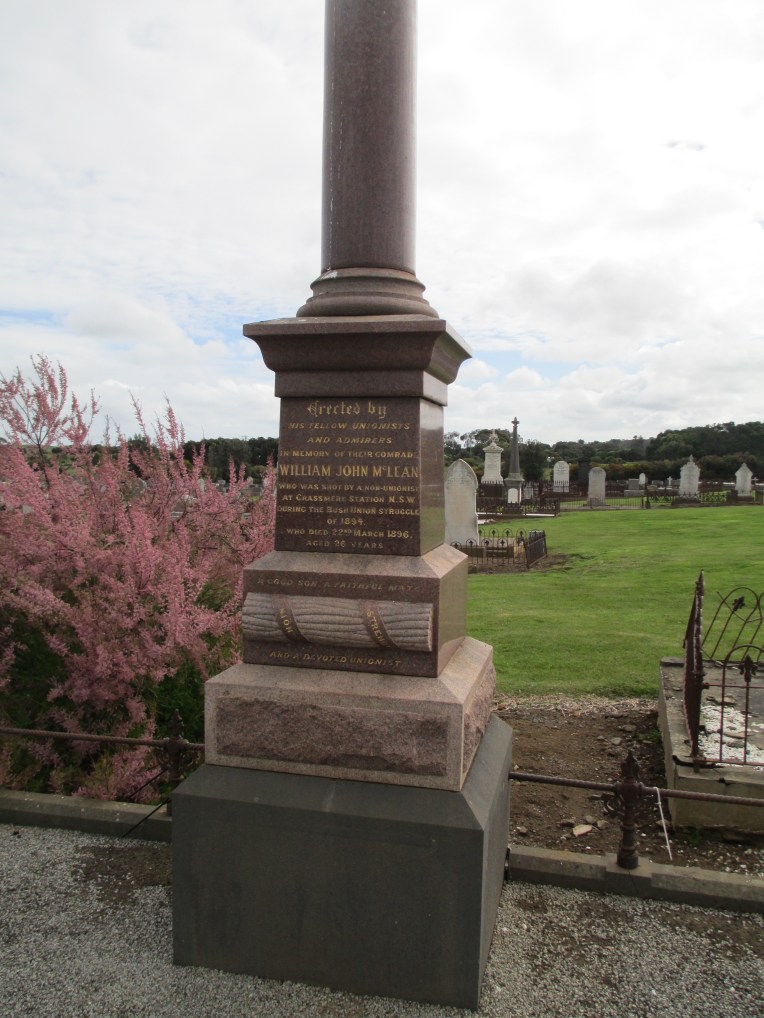
Much of the stone in the cemetery displays intricate examples of early stone masonry. The best example of which is probably the tomb of Abijah Brown.img_9146img_9144
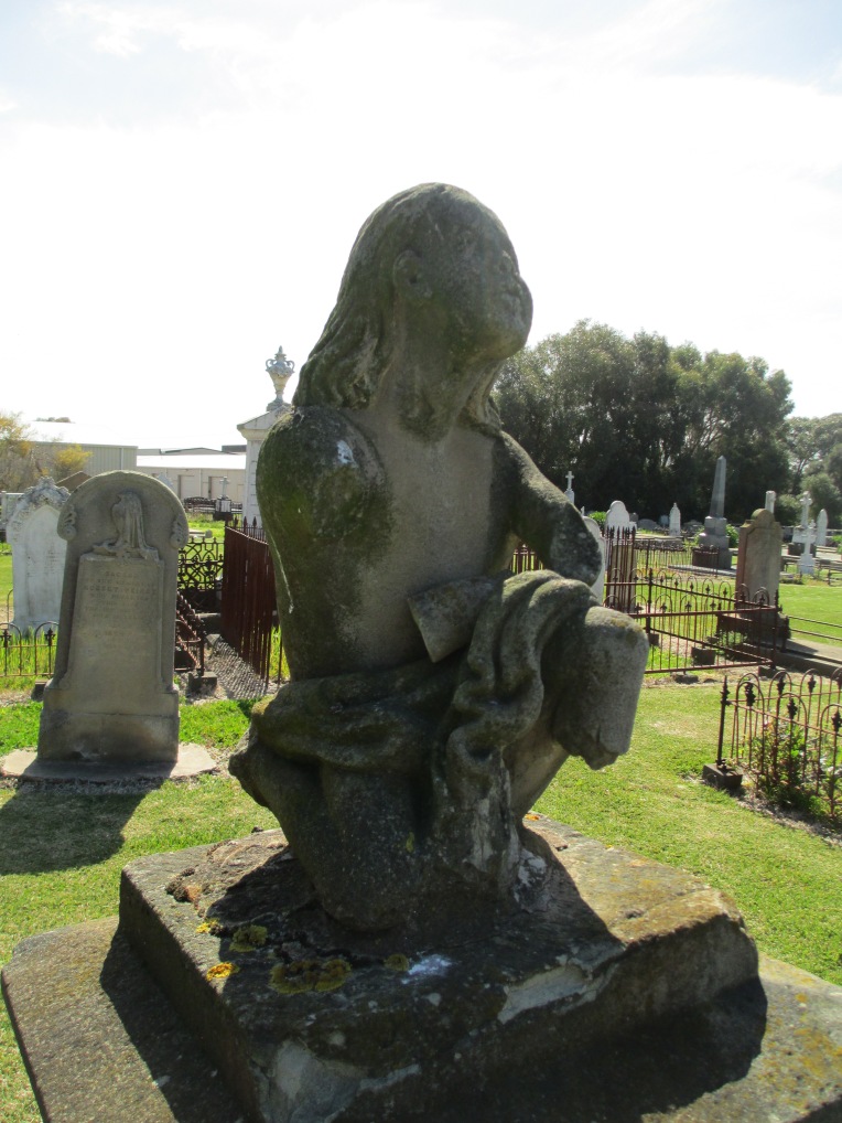
He died in 1862 at the age of 40 and the tomb reads:

In affectionate memory of Abijah John Brown who departed this life July 19th 1862 aged 40 years. Watch for ye know not what hour your Lord doth come. 

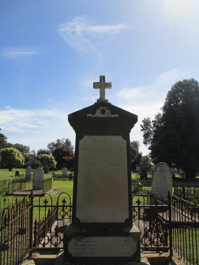
It is an interesting monument because it does not fit any regular pattern seen in Victorian era funeral monuments. It is a, sadly much worn, figure of a young man looking skywards. This man is not an angel or a cherub but a person. It is also a remarkable piece of sculpture in its own right. The Brown tomb is not alone is being striking in the cemetery. The older section of the cemetery is a combination of plain and ornate funeral monuments. Some can be seen in the photos below.

img_9140img_9141img_9150img_9143
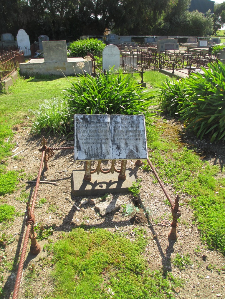
There are more people buried in the cemetery than are known about. Many of the early burials would have been laid to rest under simple wood crosses and these simply wouldn’t have survived the harshness of Port Fairy’s coastal weather. Despite this, the surviving burials provide a fascinating record of the life and death of the early inhabitants of the district.

References:

http://www.ohta.org.au/organs/organs/StJohnsPortFairy.html

http://www.portfairypubliccemetery.com.au/

An Historic Graveyard: Some early records of Port Fairy Cemetery by P. Frazer Simons.

A Special Survey: Aspects of the development of Port Fairy from 1843. Edited by Rod Collins.

Both books can be borrowed from the Prahran Mechanics Institute Victorian History Library

The photos are all mine.

Cemeteries: Tower Hill

Tower Hill Cemetery lies between Port Fairy and Warrnambool in Western Victoria.

img_9230
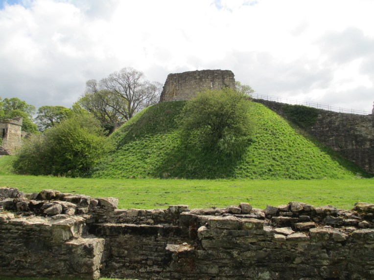
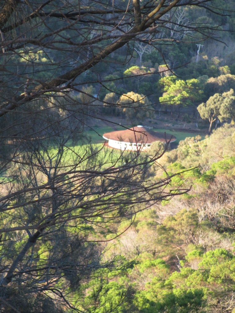
Tower Hill itself is a former volcano not far from Port Fairy and about 3 hours drive west of Melbourne. You can see the view looking over the remains of the Tower Hill crater and looking out towards the sea from the top of Tower Hill in the photos below.
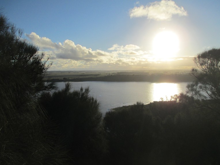
img_1206img_1212

Tower hill itself is not really a town, though there are a few houses around it. Tower Hill was first sighted by Europeans in 1802, the sighting was made by the Frenchmen in the ship the Geographe, but it wasn’t surveyed until 1846. In the surveys conducted between 1846 and 1850 it is described as heavily wooded, with descriptions of ferns and large trees. It was also a favourite site of settler James Dawson of the near by Kangatong station. He had it painted in oils in 1855 so he could show others how beautiful it was. The painting was done by Eugene Von Guerard and you can see the view from the lookout point he painted it from below.

IMG_2581

However between 1857 and 1860 the hill itself and the surrounding area was heavily deforested, mainly for the use of the timber but also for grazing. This use of the land continued until 1961 when Tower Hill was proclaimed Victoria’s seventh state wildlife reserve. There has been significant re planting done since.

I would like to pause in the ongoing narrative of Tower Hill at this point to discuss its pre-European importance. When Tower Hill was first sighted by Europeans it was certainly not an unknown hill. For the local Koroitgundij people it is a site of great importance and their ancestors undoubtably would have witnessed the eruption that created the funnel shaped crater 30 000 years ago. Today there is the Worn Gundidj  visitor’s centre in the middle of Tower Hill which tells the indigenous history of the site.  You can see the visitor’s centre in the picture below.

img_1208

The cemetery at Tower Hill stands at the base of the hill’s slope. It was established in 1856 and contains some of the most impressive monuments for a cemetery of its size that I’ve ever seen.

img_9226

img_9208-1

The monuments range from small, such as the heart shaped stone below.

img_9194

To the significantly more dramatic

img_9206img_9201img_9192

img_9195

There are a number of interesting people buried at Tower Hill, but I thought I’d briefly discuss a man whose death was a key part of Australian labour history. William John Mclean was the first person to die for the union movement in Australia. Known as Billy Mclean he was born in 1869 and lived in Koroit, a small town very near Tower Hill. In the late 1800s the nearby town Port Fairy was one of Australia’s most important international ports, though you certainly wouldn’t know it now.

imgp2398

Port Fairy

As an important port much of the wool shorn in areas as far away as southern NSW was taken by the river system and bullock drays to Port Fairy for transportation. Shearers would hitch rides with the bullock drays back in the opposite direction for the shearing season. Billy Mclean was one such shearer. The shearers often endured awful conditions and pretty terrible pay at the same time as being forced to pay exorbitant prices for food from stores that were owned by the stations. As such there were a number of shearer strikes. On the 26th of August 1894 in NSW the paddle steamer Rodney was transporting a non union labor force up the Darling River to work at the near by station of Tolarno. Many of the river captains refused to support the pastoralists by bringing in non union labour to try to break the strikes. Captain Dickson of the Rodney was not one of them. The paddle steamer was set upon by striking shearers and after the non union labour and the crew had been removed from the boat, the shearers doused it in kerosene and burnt to the water line.

The afternoon of the same day, a little further up river, Billy Mclean was one of about fifty shearers who were headed for Grassmere station near Willcannia where it was believed that non union workers from New Zealand had been brought in. Mclean was one of the first to enter the shearing shed and he was shot in the lung, one of his mates Jack Murphy was also shot. Neither died on the scene and they were arrested by the police on the way back to the strike camp. There is definite argument that the shooting was retaliation for the burning of the Rodney earlier that morning.

Mclean was tried and convicted of unlawful assembly, sentenced to 3 years hard labour and sent to Goulburn gaol. In the cold of the prison and never having recovered from his injury Mclean developed tuberculosis of the lung and was sent home to his mother to die, so it couldn’t be said he died in gaol. He died in 1896. He was 26. The man who shot him was never tried and was given a medal by the pastoralists association.

The other shearers rallied round Mclean’s mother and raised 90 pounds for the erection of the monument over his grave. It still stands in Tower Hill Cemetery today and is 14 feet high. You can see it in the photos below.

img_9211

img_9210The epitaph reads

ERECTED BY

HIS FELLOW UNIONISTS

AND ADMIRERS

IN MEMORY OF THEIR COMRADE,

WILLIAM JOHN McLEAN WHO WAS SHOT BY A NON-UNIONIST

AT GRASSMERE STATION, N.S.W.,

DURING THE STRUGGLE OF 1894,

AND WHO DIED 22nd MARCH, 1896,

AGED 26 YEARS,

A GOOD SON, A FAITHFUL MATE, AND A DEVOTED UNIONIST, UNION IS STRENGTH.

Donald MacDonald, the general secretary of the AWU wrote to Henry Lawson asking him to compose the epitaph. It is not known if Lawson did or not.

For more information on Mclean and the shearers’ strikes see…

http://ro.uow.edu.au/cgi/viewcontent.cgi?article=1007&context=unity

Billy Mclean is only one of a number of fascinating people buried at Tower Hill Cemetery. Alongside the outstanding individual monuments Tower Hill Cemetery also houses several groups of matching monuments such as those that you can see below. img_9220

As with many cemeteries of this era, there is a distressingly large number of young deaths and whole families. You see the same surnames repeated over and over, showing the long term connection to the area.

img_9213

My next post will be on the nearby Port Fairy Cemetery.

References

Billy Mclean: http://ro.uow.edu.au/cgi/viewcontent.cgi?article=1007&context=unity

Tower Hill: Victoria’s heritage. http://parkweb.vic.gov.au/__data/assets/pdf_file/0007/315547/Heritage-story-Tower-Hill-Reserve-history-and-heritage.pdf

Books:

Tower Hill: What happened at Tower Hill? Fisheries and Wildlife Dept 1960.

Tower Hill by M.C Downes.

Both books can be found at the Prahran Mechanics’ Institute Victorian History Library.

The photos are all mine.

Peveril Castle

Peveril Castle perches dramatically on the edge of a craggy hill  looking over the town of Castleton and Hope Valley in the Peak District.img_0519

Peveril Castle

Castleton grew up around Peveril castle and and was first documented in royal accounts in 1196, but was probably there from around 1155 at least. By 1215 it had its own trade fair and it continued on through the centuries to survive as a local hub, even after the demise of the castle.

img_0541

The view over Castleton and Hope Valley.

Peveril castle itself was originally built, most likely of stone, by William Peveril shortly after 1066. However its most striking feature, the keep, was the work of Henry II. The castle came into Henry II’s hands in 1155 and is an excellent example of the common square keeps that he had built up and down the country.  Peveril came into royal hands after William Peveril’s son, also called William, firstly made an enemy of the powerful Earl of Chester and then of Henry FitzEmpress, who shortly became Henry II. In 1153 Henry had already promised to dispossess the younger William of his estates for treachery and plundering and give them to Chester. By 1155, when he carried out the threat, Chester was dead so Henry kept the castle for himself. The name however survived. Henry II used Peveril as a base to oversee the local area and keep the local barons, who had been used to more autonomy during the period of anarchy, in check. Even when he wasn’t there, and there were only a few guards left to man it, Peveril was a potent symbol of royal authority. It also served as an administration point for the Forest of the Peak.

Peveril was part of the Lordship of the Peak and it was given by Richard I to his brother John when Richard came to the throne in 1189. John however was forced to surrender it due to his rebellion. When John came to the throne himself in 1199 William Ferrers, the Earl of Derby, paid the huge sum of 2000 marks to claim much of the lordship for himself. John however refused to hand over the castles of Peveril and Bolsover, which he saw as the symbols of the authority in the area. He only conceded Ferrers’ right to them in 1216 when his authority was crumbling. However his castellan refused to hand them over and John told Ferrers he could take them by force, if he could. John died in 1216 and Ferrers managed to take Bolsover by force during the first year of the reign of Henry III, however he never attacked Peveril and the castellan moved out by negotiation. Ferrers, however had only been given lordship of Peveril until Henry III came of age. Initially, though, he refused to hand it over. He finally gave up and surrendered it to royal hands in 1223.

img_0551

Peveril Keep

Peveril stayed in royal hands until the 1372 when it was given to John of Gaunt, who was the Duke of Lancaster and the third son of Edward III. He was one of the most powerful lords of his time and he possessed many castles. As such he never saw Peveril as being a residential centre and began to strip lead from it to use in other castles. Slowly  the administrative functions of the castle began to drift elsewhere too and by the 16th century the castle was derelict.

The castle was never besieged, so the ruinous state you see it in now is due to decay through time and the stone being repurposed for Castleton below.

img_0561

looking down on Castleton from the keep.

Peveril stands on a steep natural hill with the precipice-like Cave Dale to the back and one side and Cavern Gorge to the right. It commands the main high ground over Hope valley and was a symbol of authority for all the lords who held it. img_0530

a model of what Peveril would have looked like in around 1300.

img_0554img_0568

The landscape around the outcrop on which Peveril stands.

The path that you take up to the castle now leads you through the remains of what would have been the east gate. It was most likely built under Henry II in the late 1100s. It would originally have been a simply decorated arch.

img_0539
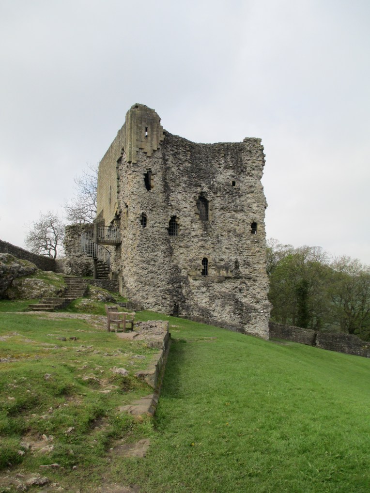
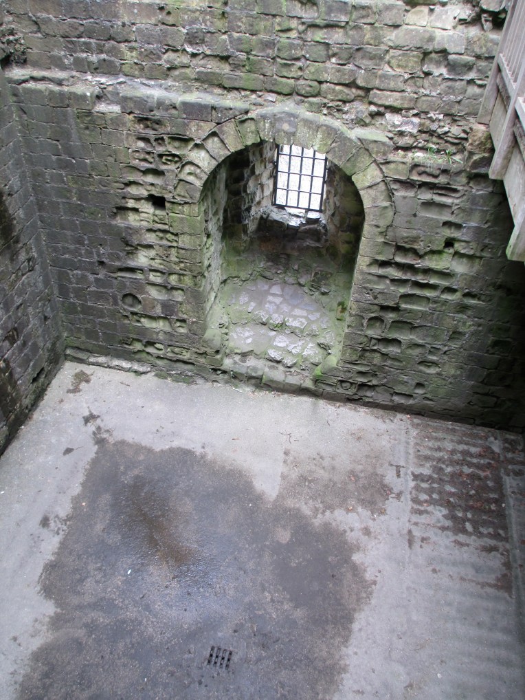
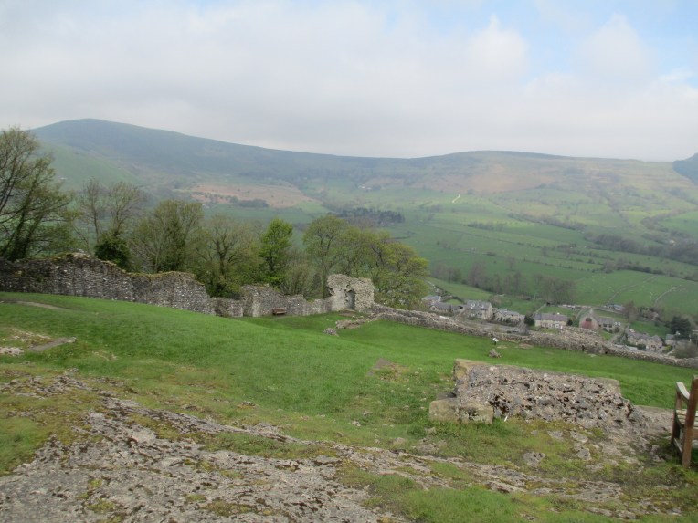
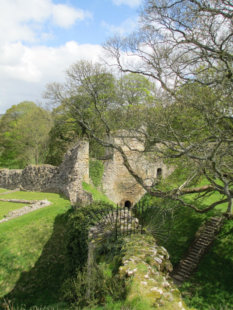
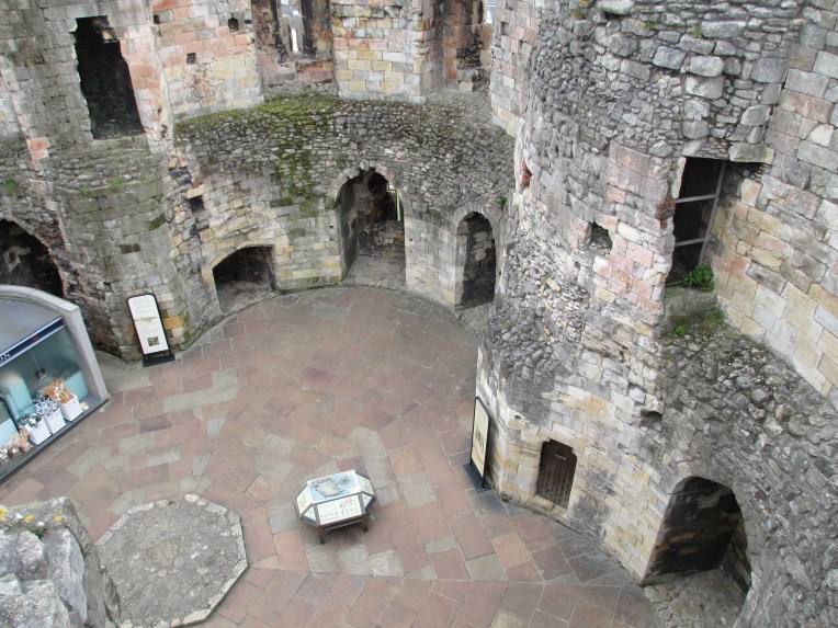
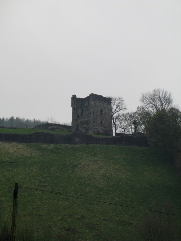
This path is most likely the route through which Peveril would have been accessed for the majority of its existence. It is very steep but it would have just about been accessible to horses.  Upon entrance to the castle precinct it is the keep which immediately dominates the view.

img_0553

It stands at approximately 15m high. It would originally have had a parapet. It is less than 12m square and as such is much smaller than other similar keeps that Henry II had built all over the country. It is said to have cost around 184 pounds and to have been built of stone quarried locally. The spiral stair you can see in the photo above is roughly in the same spot that the original medieval stair, built of either stone or wood, would have stood. The keep would have housed a main public space on the first floor entry, and a basement storage area below. You can see the entrance door in the photo below, it is taken roughly where the floor of the main hall would have been. img_0566

You can see the line of the original pitched roof of the main hall still visible in the outline of the stone in the photo below.img_0558

You can see the basement in the photo below. The stair down still survives.

img_0564

The keep at Peveril was not the only hall. In the photos below you can see the view down from the keep to the area where the new hall and the west gate would have stood.img_0556img_0563

It is not known exactly when the new hall was built, but it was probably in the mid 13th century. It would have had a fire place and a kitchen and been where important people dined. Henry III stayed at Peveril in 1235 and if this hall was complete in time it would have been here that he held court. This area is also the site of the west gate. It would have led to a bridge over the gorge outside, but there are sadly no remains to be seen today. This would have been the other main access point to the castle, apart from the east gate.

Below you can see the area where the old hall and the chapel probably stood.

img_0550

There was also a small circular tower in this section which was built partly of roman stone, repurposed from a nearby Roman site. This was probably a 13th century addition and may not have had much functional defensive use.  The hall itself was most likely in this area in one form or another since the beginning of the castle, the remains today date to roughly the same time as the keep because it was built using the same stone. While it is not certain where the chapel was, we know there was one because of a document from 1264 which mentions it. There is a structure next to the hall that has Norman masonry and is facing roughly east west and has no other known purpose, so it has been interpreted as being the chapel.

This does not cover all of Peveril castle and it is a site well worth a visit. Although it is not one of the largest castles in the country it is certainly one of the more atmospheric and the position it commands is extremely dominating.

References: English Heritage Peveril Castle book and a site visit in 2012.

The photos are all mine.

Victorian History Crossword

NB: If it looks like you’ve seen this crossword before, you have. I put it up yesterday but there was a technical error so I had to take it down. There should be no problems with this version. The questions and answers are all the same as yesterday’s, the lay out is just a little different.

Have a shot, see how you go.  Click this link for a printable version of the crossword grid. Crossword Puzzle

Crossword Puzzle Maker_ Final Puzzle

Screen Shot 2016-08-23 at 6.50.45 PMScreen Shot 2016-08-23 at 6.50.52 PMScreen Shot 2016-08-23 at 6.51.10 PM