
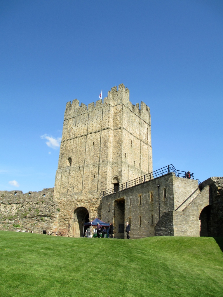
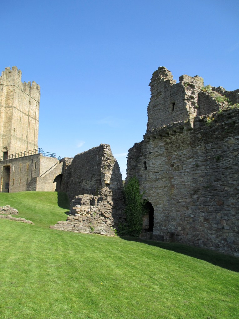
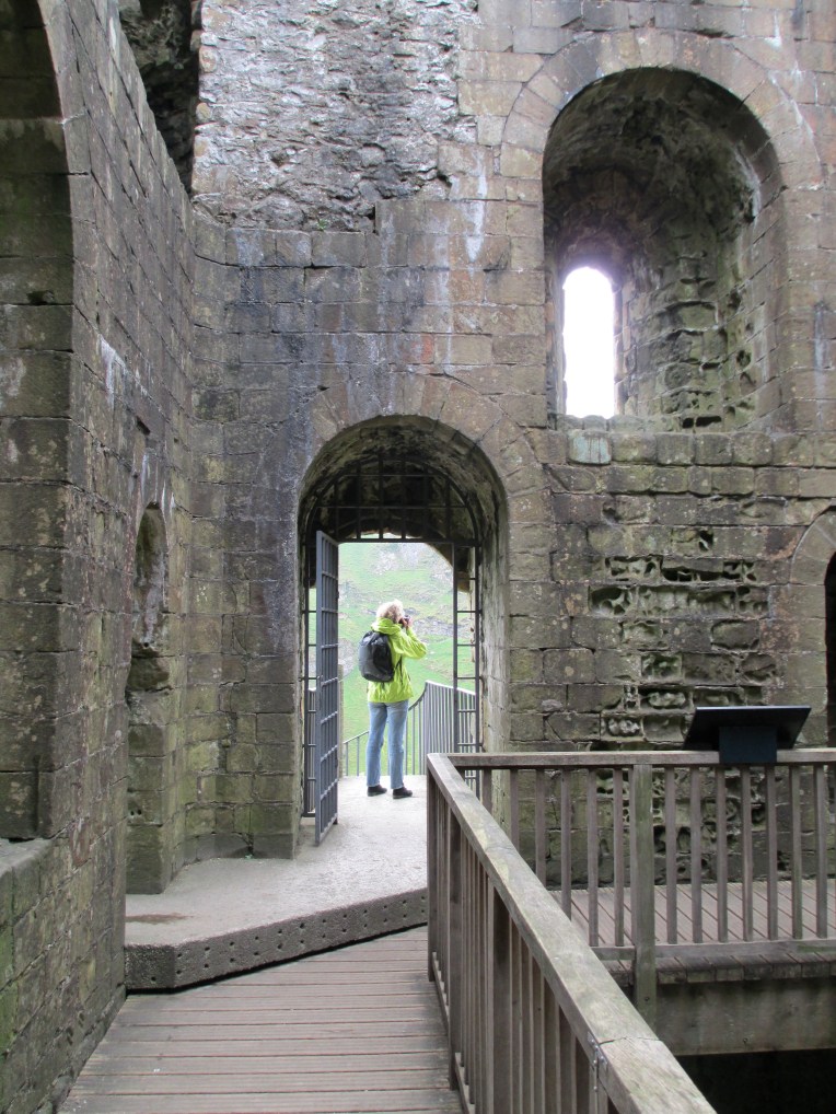
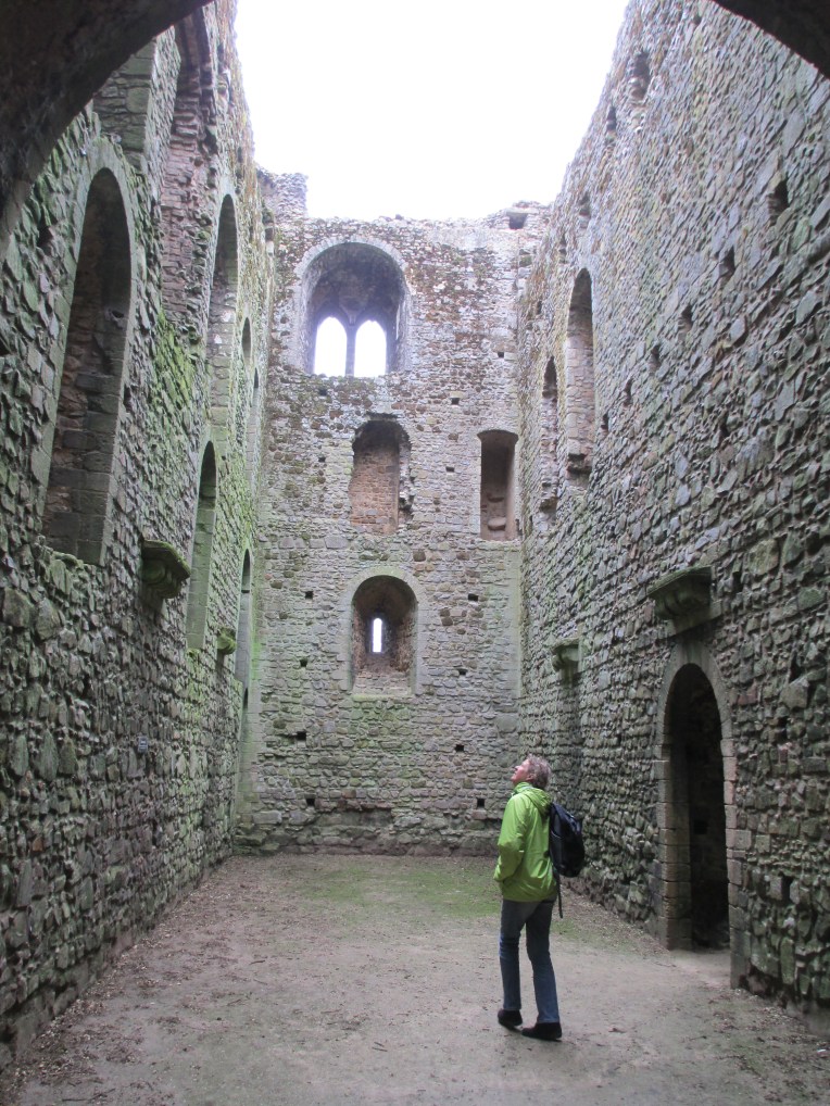
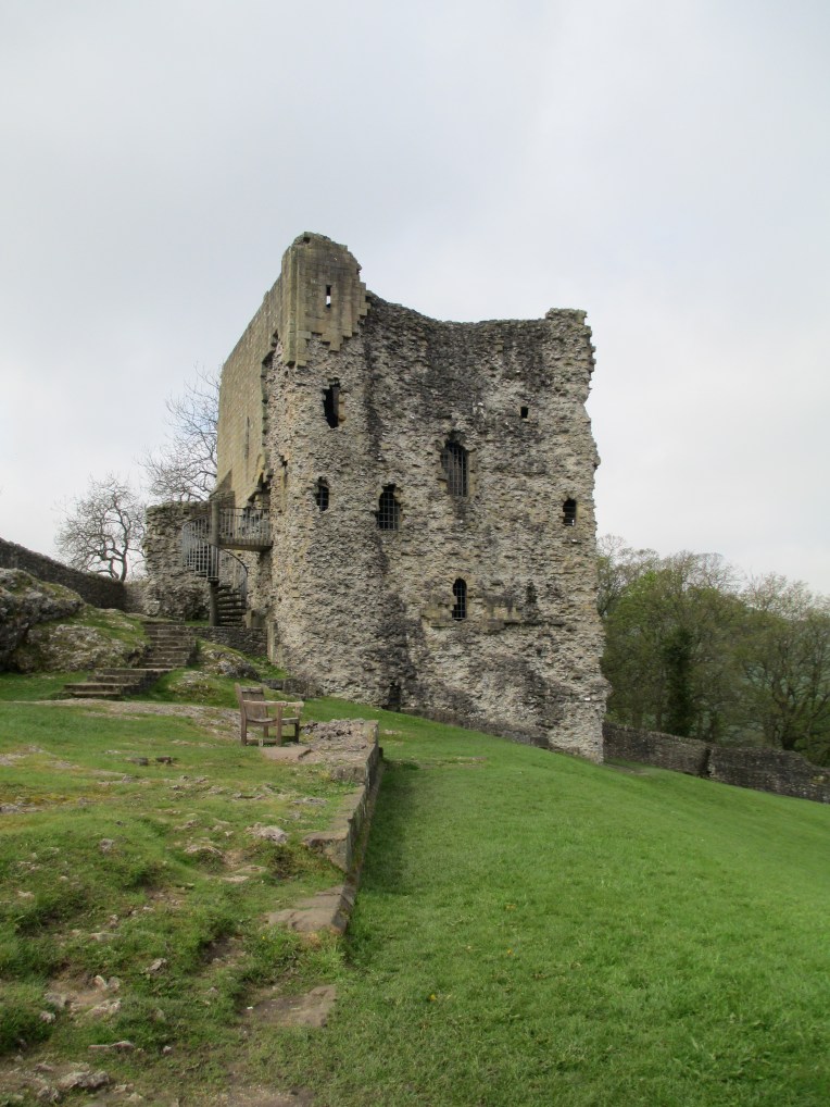
 As Richmond Castle is one I’ve written about before I thought I’d provide the link to the previous post rather than write a new history.
Medieval Structures
Advent Calendar of Castles: December 5th: Pickering Castle
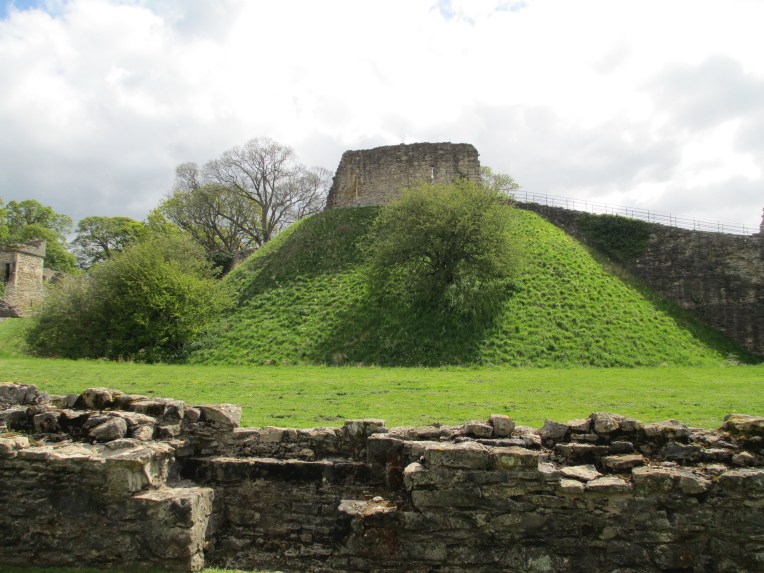

Pickering Castle was established by William the Conqueror in c. 1070. It was built in response to the northern revolts against his rule. William’s stamping of authority on the north is known was the Harrying of the North. Such an innocuous name sounds like it was a minor irritation, however this couldn’t be further from the truth. William the Conqueror led a brutal pillaging of the north, killing people and destroying crops and food. Tens of thousands of people starved to death in the aftermath.
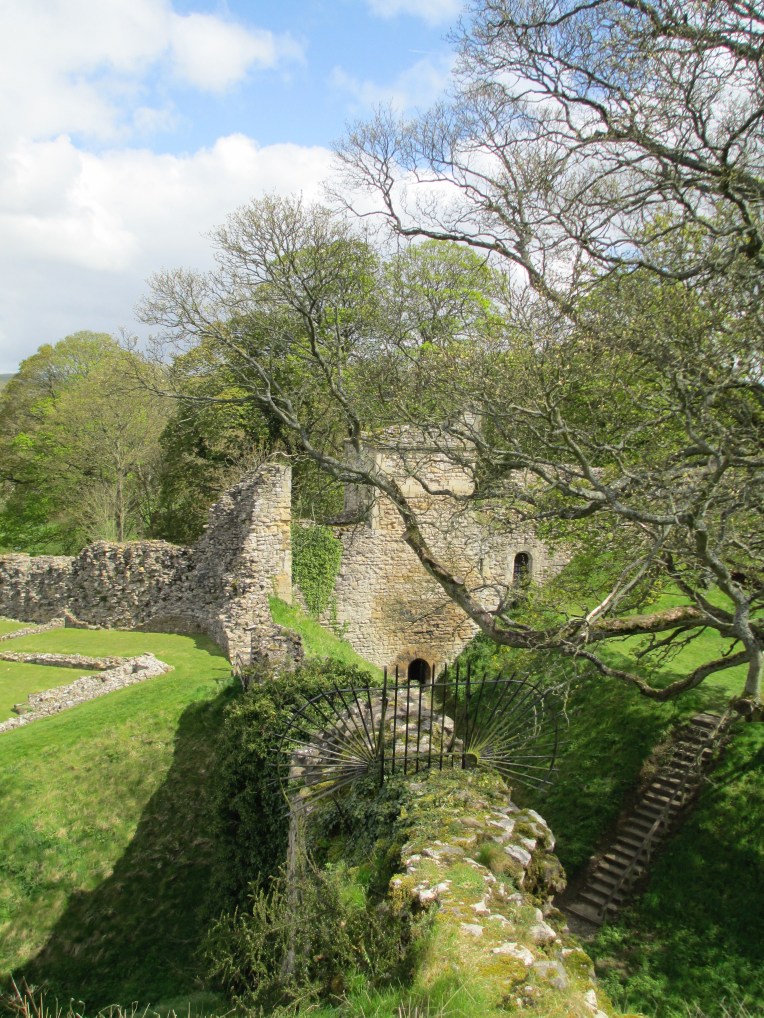
The original castle would have been earth and timber and the motte on which it was built still stands today. The rebuilding of the castle in stone began around 1180 and continued into the 13th century under successive kings. Within the walls there is also a chapel dedicated to St Nicholas which dates to roughly 1227. Until the mid 16th century the castle would have had a resident chaplain.
By the early 14th century the castle has passed into the hands of Thomas Earl of Lancaster, the grandson of Henry III. He married heiress Alice de Lacey and using her money introduced more stone buildings, including building a new hall for the family to live in, within the walls of the castle. In the mid 14th century Edward II ordered the outer walls to be built in stone, including stone towers as part of the walls. He used the castle for raising horses. He established a stud at the castle and often used it as a hunting lodge.
By the time of the civil war the castle had fallen too much into disrepair to be used for defence and in the 17th century parts of the castle were used as a court house. The castle came into the hands of English Heritage in 1926.
References:
Site visit 2012.
http://www.britainexpress.com/counties/yorkshire/castles/pickering.htm
The Harrying of the North: http://www.historyextra.com/article/bbc-history-magazine/battle-of-hastings-aftermath-consequences-harrying-of-the-north
The photos are all mine.
Advent Calendar of Castles: December 4th: York Castle


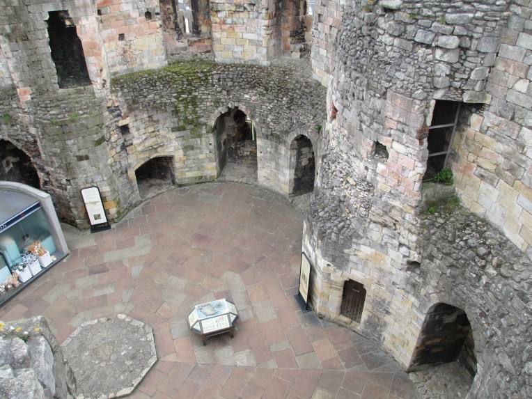
The castle you see in the photos is all that remains of York’s once much larger castle. The current structure, known as Clifford’s Tower, was built in the 13th century and served as the heart of government in York and was also used to house the royal treasury. That is not to say that there was not a castle on the site prior to the construction of Clifford’s Tower. A wood and earth Norman tower was built on this site in the 11th century and suffered much damage and rebuilding during these tumultuous times, but it probably survived largely intact until the 12th century. The castle was then the setting for one of the most infamous incidents in York’s history. In 1190 tensions between the York Jewish community and the largely Christian population came to a head and roughly 150 Jews were given protective custody in the wooden castle that stood on the current site of Clifford’s Tower. Something went terribly wrong though and the royal officials found themselves shut out of the castle. They summoned reinforcements to retake the castle and these reinforcements joined with a local mob. The mob and the reinforcements were soon out of control and the Jews in the castle were besieged. On the 16th of March the Jews inside realized there was no way out and they committed suicide and set the tower alight rather than face the wrath of the mob. According to some accounts some Jews did survive and came out under an amnesty to then be massacred by the mob.
The tower burnt down but it was rebuilt, in wood and stone, but it wasn’t until the mid 13th century that the tower you see today was constructed. Henry III ordered a new stone tower to be built in roughly 1245 to help deal with the threat of the Scots. The tower was finished by the end of the 13th century and would have likely stood surrounded by a moat of some description and an outer bailey and walls were added in the 14th century. Over the years the tower and castle acted largely as an administrative centre rather than a royal residence. The first recorded use of the name “Clifford’s Tower’ dates to the mid 16th century but it is possible that the name comes from the rebel Roger de Clifford who was executed in 1322 and whose body was displayed on a gibbet at the castle.
References:
Site visit 2012
http://www.english-heritage.org.uk/visit/places/cliffords-tower-york/history/
The photos are all mine.
Advent Calendar of Castles: December 3rd: Peveril Castle

Advent Calendar of Castles: 3rd of December Peveril Castle
As this is a castle I have written extensively about before, I thought I’d provide a link to my previous post rather than a new potted history.
https://historicalragbag.com/2016/09/26/peveril-castle/
The photos are all mine.
Advent Calendar of Castles: December 2nd Lincoln Castle.


Lincoln Castle was begun by William the Conqueror in c.1068 making it one of the first Norman castles built. It was part of the Conqueror’s plan of the domination of England through a network of castles. It was through castles like Lincoln that he administered and controlled his new territory. Lincoln Castle stands on the site of an old roman fort and when it was built 166 Saxon houses were demolished to make way for it.
In the early medieval period Lincoln castle was the site of two decisive battles. The first was in 1141 during the time period known as the Period of Anarchy (1136-1154). King Stephen and the Empress Matilda were fighting for control of the country. It was a time which the Anglo-Saxon Chronicle described as “people openly said that Christ slept, and his saints.” In 1141 the Earl of Chester and his brother William of Roumare had rebelled against King Stephen and taken Lincoln Castle by deceit. Oderic Vitalis’ version says that they sent their wives in on the pretext of a friendly visit and the Earl arrived to collect the women with only three knights and then, “Once inside the castle they suddenly snatched crowbars and weapons which lay to hand and violently expelled the king’s guards. Then William burst in with a force of armed knights, according to a pre‑arranged plan, and in this way the two brothers took control of the castle and the whole city.”
Regardless of how they took the castle they held it and King Stephen arrived to besiege the castle. The Earl of Chester escaped and alerted Robert of Gloucester, Empress Matilda’s brother and the head of her campaign for the crown. Gloucester arrived in Lincoln with an army and there was a pitched and bloody battle, unusual in a war that was mainly looting and skirmishes, Gloucester’s forces were victorious and King Stephen was captured.
The other key battle at Lincoln was in 1217. It was so bloodless that it was soon known as the Fair of Lincoln. William Marshal headed forces fighting for the newly crowned Henry III. Marshal was the young Henry’s regent. They were fighting the remains of the barons who had forced King John to sign the Magna Carta in 1215. The majority of barons had returned to the royal fold after King John’s death, but there were a few hold outs who were still supporting Prince Louis of France as their candidate for king. Prince Louis’ forces were besieging Lincoln which was held by the remarkable Nicola de la Haye (who I hope to write more about later), Marshal’s forces came to relieve the siege. They had help from the inside the castle and the battle was a route. Prince Louis’ forces were demolished and the battle was pretty much the end of the baronial revolt, though it was the Battle of Sandwich and paying off Louis that got rid of him completely.
Outside of these two key battles Lincoln continued to be both a prison and court for centuries to come. It is also the location of one of the only four surviving original copies of the Magna Carta as well as a copy of the 1217 Charter of the Forest.
References
Site visit 2012
Lincoln castle information leaflets.
https://www.lincolncastle.com/content/history
Anglo Saxon Chronicle: http://www.britannia.com/history/docs/1137.html
Battle of Lincoln 1141: http://deremilitari.org/2014/03/the-battle-of-lincoln-1141-from-five-sources/
The Fair of Lincoln 1217: Tout, T.F, ‘The Fair of Lincoln in the ‘Histoire de Guillaume le Maréchal’, The English Historical Review, 18, 1903, pp. 240-265.
The photos are all mine.
Advent Calendar of Castles December 1st: Castle Rising
This year for christmas I’m running an advent calendar of medieval castles. Each day I’ll post three photos of a castle and some information. Today I’m starting with Castle Rising in Norfolk just out of Kings Lynn.

William d’Albini the Earl of Arundel began having the castle built in c. 1138. It was most likely built for his new wife, who was the widow of Henry I, Adeliza of Louvain. The keep itself was probably envisioned as self-contained accommodation for the lord and his family. It is curiously domestic in scale, but the massive earthworks make it clear that defence was at least considered. The uppermost levels of the keep were likely added at a later date and this included re-roofing and adding an extra room at the top of the keep. As well as the keep, in the grounds behind the earth works, there are the remains of a Norman church. It most likely predates the castle and would have been replaced by the current parish church in the town of Rising around the time the castle was built.
The d’ Albini family died out in the 13th century and Castle Rising passed into the Montalt family. The Montalt family died out in the 14th century and Castle Rising came into royal hands. It was after this that the castle entered what is probably its best known phase when it became the residence of Queen Isabella, known as the she wolf of England. She was the Queen of Edward II and many argue she had a role in his murder. It has been argued that Castle Rising was her prison, but it is also just as possible that it was the residence she chose in exile. There were certainly buildings erected for her in the grounds of the castle
Castle Rising ultimately came into the hands of the Howard family who still own and manage it today.
References:
Site visit 2012
http://www.castle-rising-history.co.uk/castlecameo.html
http://www.castlerising.co.uk/thecastle.html
http://www.english-heritage.org.uk/visit/places/castle-rising-castle/
The photos are all mine
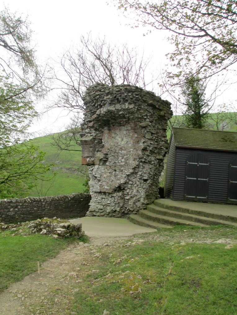
Peveril Castle
Peveril Castle perches dramatically on the edge of a craggy hill looking over the town of Castleton and Hope Valley in the Peak District.
Peveril Castle
Castleton grew up around Peveril castle and and was first documented in royal accounts in 1196, but was probably there from around 1155 at least. By 1215 it had its own trade fair and it continued on through the centuries to survive as a local hub, even after the demise of the castle.

The view over Castleton and Hope Valley.
Peveril castle itself was originally built, most likely of stone, by William Peveril shortly after 1066. However its most striking feature, the keep, was the work of Henry II. The castle came into Henry II’s hands in 1155 and is an excellent example of the common square keeps that he had built up and down the country. Peveril came into royal hands after William Peveril’s son, also called William, firstly made an enemy of the powerful Earl of Chester and then of Henry FitzEmpress, who shortly became Henry II. In 1153 Henry had already promised to dispossess the younger William of his estates for treachery and plundering and give them to Chester. By 1155, when he carried out the threat, Chester was dead so Henry kept the castle for himself. The name however survived. Henry II used Peveril as a base to oversee the local area and keep the local barons, who had been used to more autonomy during the period of anarchy, in check. Even when he wasn’t there, and there were only a few guards left to man it, Peveril was a potent symbol of royal authority. It also served as an administration point for the Forest of the Peak.
Peveril was part of the Lordship of the Peak and it was given by Richard I to his brother John when Richard came to the throne in 1189. John however was forced to surrender it due to his rebellion. When John came to the throne himself in 1199 William Ferrers, the Earl of Derby, paid the huge sum of 2000 marks to claim much of the lordship for himself. John however refused to hand over the castles of Peveril and Bolsover, which he saw as the symbols of the authority in the area. He only conceded Ferrers’ right to them in 1216 when his authority was crumbling. However his castellan refused to hand them over and John told Ferrers he could take them by force, if he could. John died in 1216 and Ferrers managed to take Bolsover by force during the first year of the reign of Henry III, however he never attacked Peveril and the castellan moved out by negotiation. Ferrers, however had only been given lordship of Peveril until Henry III came of age. Initially, though, he refused to hand it over. He finally gave up and surrendered it to royal hands in 1223.
Peveril Keep
Peveril stayed in royal hands until the 1372 when it was given to John of Gaunt, who was the Duke of Lancaster and the third son of Edward III. He was one of the most powerful lords of his time and he possessed many castles. As such he never saw Peveril as being a residential centre and began to strip lead from it to use in other castles. Slowly the administrative functions of the castle began to drift elsewhere too and by the 16th century the castle was derelict.
The castle was never besieged, so the ruinous state you see it in now is due to decay through time and the stone being repurposed for Castleton below.

looking down on Castleton from the keep.
Peveril stands on a steep natural hill with the precipice-like Cave Dale to the back and one side and Cavern Gorge to the right. It commands the main high ground over Hope valley and was a symbol of authority for all the lords who held it. 
a model of what Peveril would have looked like in around 1300.


The landscape around the outcrop on which Peveril stands.
The path that you take up to the castle now leads you through the remains of what would have been the east gate. It was most likely built under Henry II in the late 1100s. It would originally have been a simply decorated arch.
 This path is most likely the route through which Peveril would have been accessed for the majority of its existence. It is very steep but it would have just about been accessible to horses. Upon entrance to the castle precinct it is the keep which immediately dominates the view.
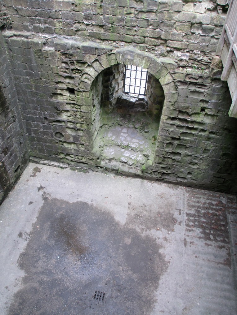
It stands at approximately 15m high. It would originally have had a parapet. It is less than 12m square and as such is much smaller than other similar keeps that Henry II had built all over the country. It is said to have cost around 184 pounds and to have been built of stone quarried locally. The spiral stair you can see in the photo above is roughly in the same spot that the original medieval stair, built of either stone or wood, would have stood. The keep would have housed a main public space on the first floor entry, and a basement storage area below. You can see the entrance door in the photo below, it is taken roughly where the floor of the main hall would have been.
You can see the line of the original pitched roof of the main hall still visible in the outline of the stone in the photo below.
You can see the basement in the photo below. The stair down still survives.
The keep at Peveril was not the only hall. In the photos below you can see the view down from the keep to the area where the new hall and the west gate would have stood.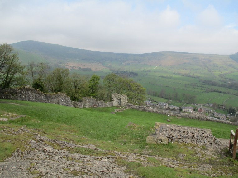

It is not known exactly when the new hall was built, but it was probably in the mid 13th century. It would have had a fire place and a kitchen and been where important people dined. Henry III stayed at Peveril in 1235 and if this hall was complete in time it would have been here that he held court. This area is also the site of the west gate. It would have led to a bridge over the gorge outside, but there are sadly no remains to be seen today. This would have been the other main access point to the castle, apart from the east gate.
Below you can see the area where the old hall and the chapel probably stood.

There was also a small circular tower in this section which was built partly of roman stone, repurposed from a nearby Roman site. This was probably a 13th century addition and may not have had much functional defensive use. The hall itself was most likely in this area in one form or another since the beginning of the castle, the remains today date to roughly the same time as the keep because it was built using the same stone. While it is not certain where the chapel was, we know there was one because of a document from 1264 which mentions it. There is a structure next to the hall that has Norman masonry and is facing roughly east west and has no other known purpose, so it has been interpreted as being the chapel.
This does not cover all of Peveril castle and it is a site well worth a visit. Although it is not one of the largest castles in the country it is certainly one of the more atmospheric and the position it commands is extremely dominating.
References: English Heritage Peveril Castle book and a site visit in 2012.
The photos are all mine.
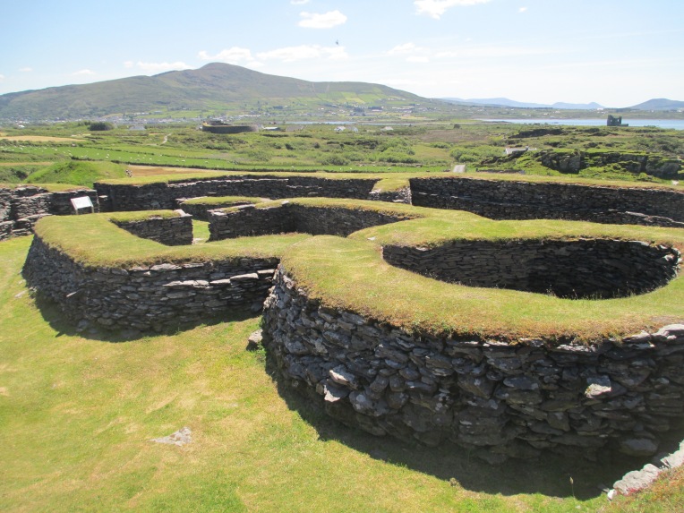
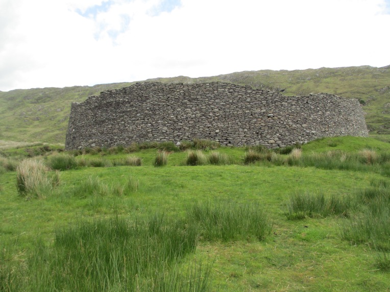
Stone Forts
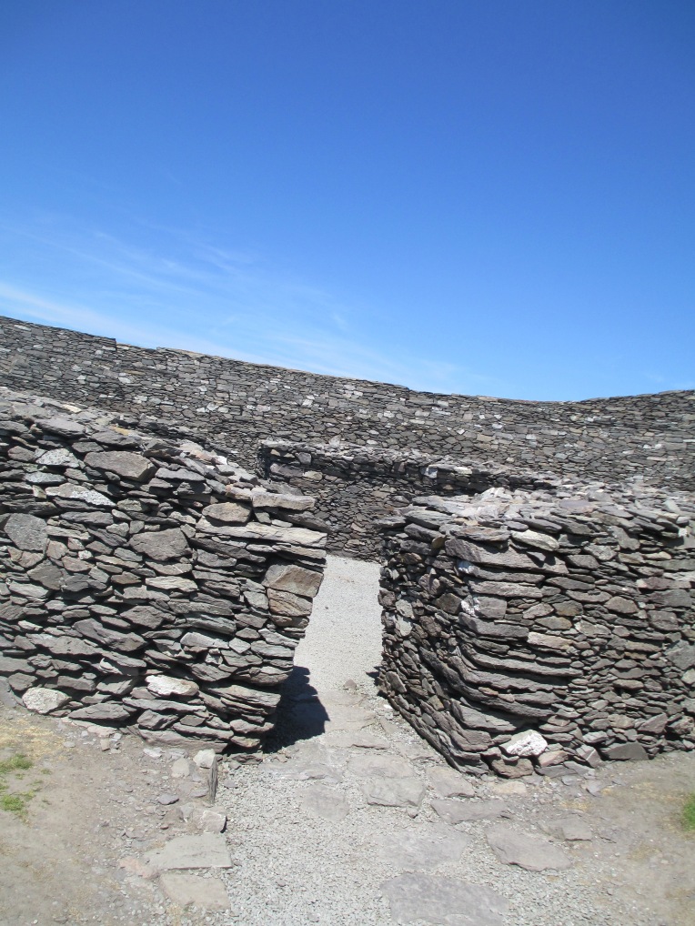
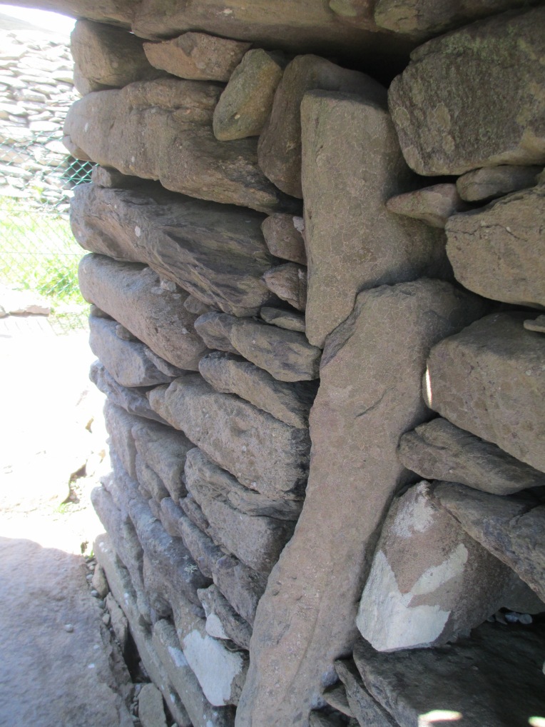
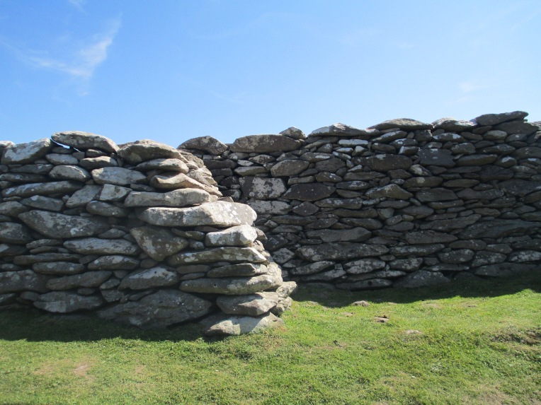
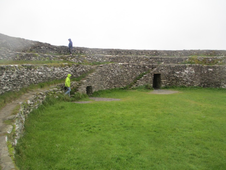
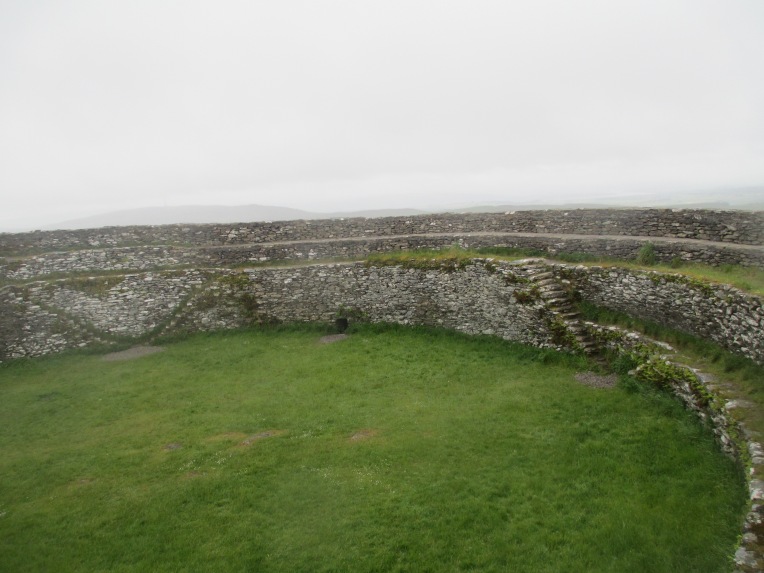
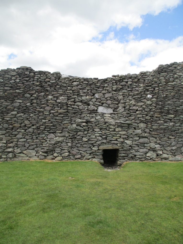
If you ever spend any time in Ireland you will come across the stone forts, also known as ring forts and cashels. They were usually farming settlements and normally date from between 500-900 CE, though they were reused later as well. Many are testaments to the brilliance of drystone walling and the skill of the builders as they are still standing today. Some were ‘fixed’ at later dates of course. They vary in purpose and in style but they usually have some common features. For example the majority contain stairs worked into the side of wall of the fort. These forts were not roofed over to create one residence, in fact the exterior walls were used for protection, from the weather and attack, and houses either of stone or wood were built inside. The design of the stairs allowed people to access the top of the walls simply. The forts often also command the high ground, giving an excellent view to any possible attackers, as well as providing a defensive position. Many stone forts feature souterrains, these are holes or tunnels in the walls of the forts. There is ongoing debate as to whether they were used for storage, for escape or both.
The five stone forts featured below are each good examples of a different aspects of stone fort building. The sites below are listed in no particular order.
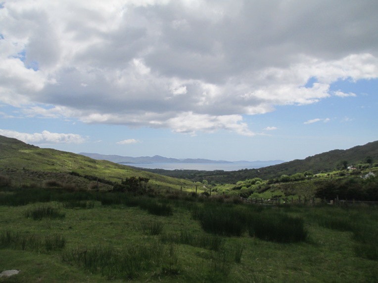
Lecanabuile
Lecanabuile and the next stone fort listed Cahergall in County Kerry are excellent examples of two forts built close together. These are two communities which would have interacted. You can see Cahergall in the distance in most of the photos below. Lecanabuile dates to the 9th or 10th centuries CE. The circular enclosing wall is more than 3m thick and roughly 20m in diameter. There has been some reconstruction. The remains of the round house you can see in the photos below is relatively contemporary to the outside walls and a souterraine inside leads to a gap between the external walls. The external walls were built by building two stone walls and filling the interior. The square building you can see attached to the round one is a later addition showing the ongoing use of these stone forts. The other structures you can see inside the walls are later again.


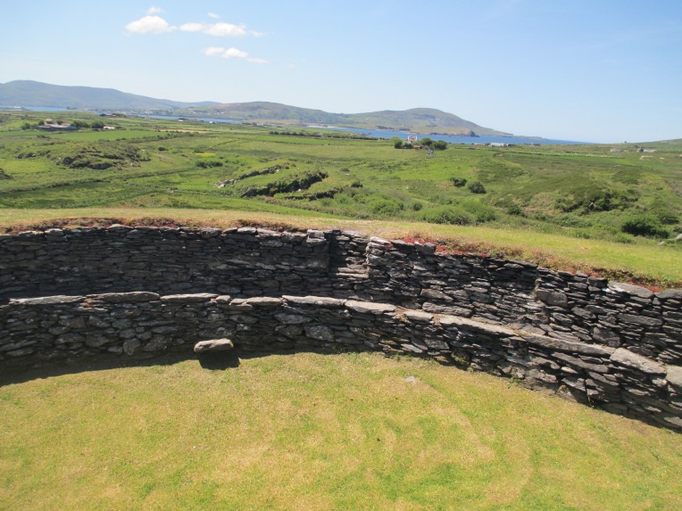
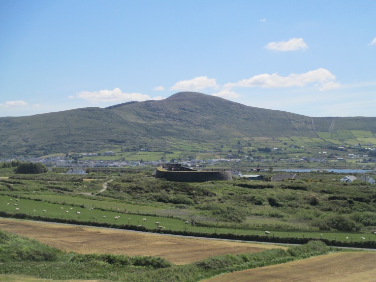
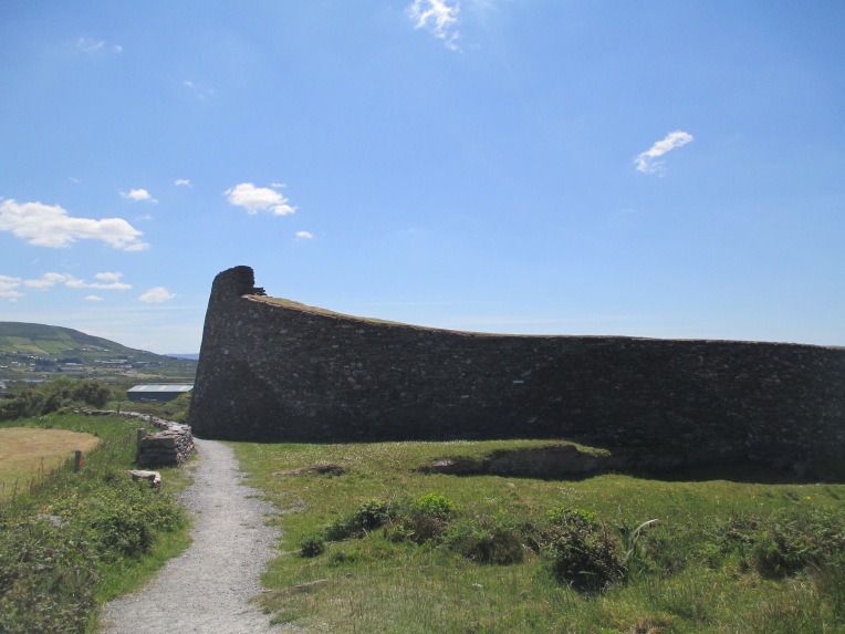
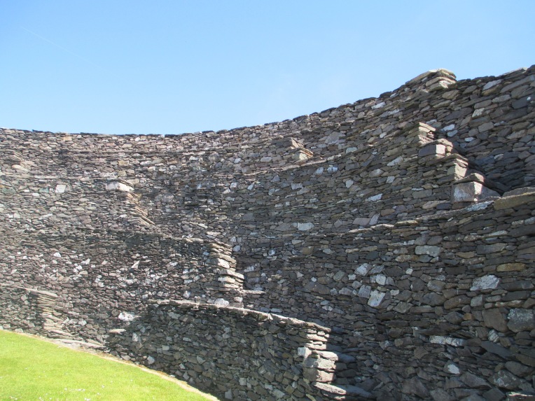
Cahergall
Cahergall, as you can see from its appearance in the earlier photos, is just down the hill from Lecanabuile. Its stone walls are very impressive as they tower over the surrounding landscape. The walls have been reconstructed to an extent in recent times. It was built around 600 CE and the walls stand at around 6m high and 3m thick. There is a stone house inside that is original and would have once likely housed someone important. Like Lecanabuile it is entirely drystone walled.


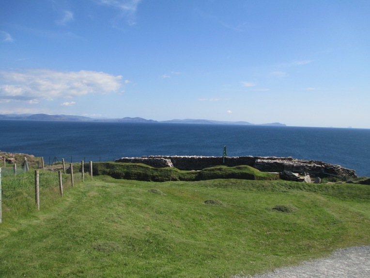
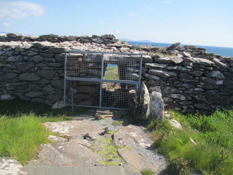
Dunbeg
Dunbeg is a little different to the other stone forts in that it is a promontory fort. It was built around the 8th or 9th centuries CE and was occupied again in the 10th and 11th centuries CE. It stands on a sheer cliff on the Dingle Peninsula. One of the key issues with it standing on a sheer cliff is that the fort is currently falling into the sea, as can be seen in several of the photos below. It also has extensive earthwork defences surrounding it. There was also probably settlement on the site before the building of the fort. Behind the earthworks and the drystone wall there is the clochain, or beehive hut. The life in the fort would have been centred on the two hearths inside the beehive. The main entrance is currently blocked due to instability, but you can see how it is structured in the photos below. Additionally there is a souterrain which runs from the inside to the outside of the fort. There was probably also more buildings originally but they may have been claimed by the coastal erosion.


Grianan Aillgh
The original hill fort in this position would have been built probably sometime around the 1st century CE, but it was the royal citadel of the Ui Neill family from the 5th to the 12th century. It stands in Donegal. There is also a burial mound nearby which dates to roughly 3000 BCE and this might have attracted the builders originally. The walls stand about 4.5m thick and about 5 m high, but there was fairly extensive rebuilding work in the 1870s. The fort is surrounded by three earthen banks and it is believed that the track that runs through them and up to the fort might be the remains of an ancient roadway.


Staigue
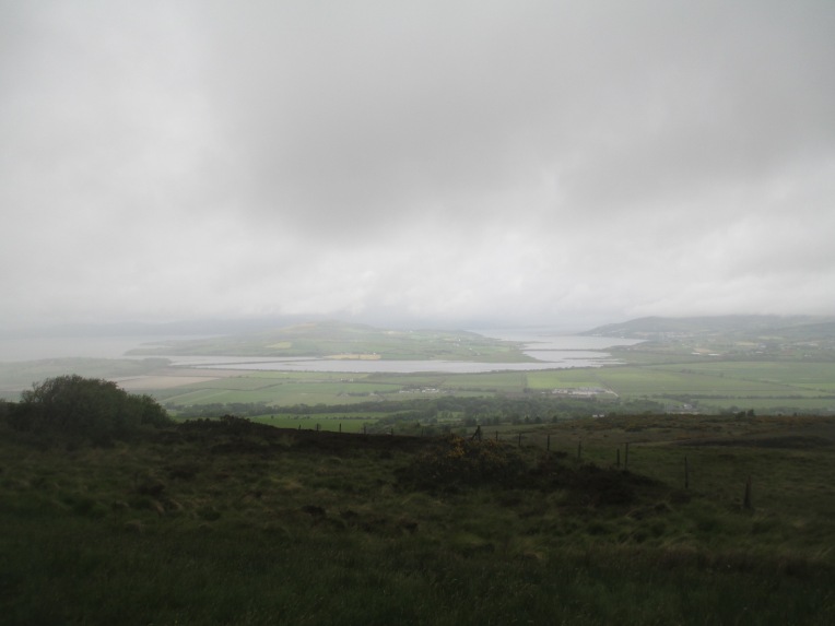
Staigue stands in County Kerry and happened to be the first fort I saw and it remains one of the most impressive. Dating it is uncertain but it is probably from the early centuries CE. The walls are up to 5.5m high, 4m thick and 27.4m in diameter. The steps in the walls run in a distinctive X shape possibly to make it possible for people to pass each other running up and down. There are no surviving buildings inside the walls, but there are two small chambers contained in the walls which might have been for storage. There would have been houses inside; they just either weren’t built in stone or haven’t survived. The top of the walls command an impressive view of Kenmare bay and would have given the local chieftain ample warning of any attack or visit from the sea. The drystone walling here is particularly impressive and seems to be largely original.


These stone forts are only examples of the thousands in Ireland, though not all of them are in anywhere near as good condition. If you ever get the chance they are absolutely worth a visit.
For more information see: http://heritagecouncil.ie/unpublished_excavations/section13.html
References: http://www.theringofkerry.com/cahergal-leacanabuaile-forts
http://www.theringofkerry.com/staigue-fort
http://www.discoverireland.ie/Arts-Culture-Heritage/grianan-of-aileach/73795
Site visits in 2015
All the photos are mine.
Llywelyn The Great
Today, the 11th of April, is the anniversary of the death of one of the most important Welsh Princes. I am not going to be writing about him in detail. I have written about his wife before and that can be found here.
Llywelyn succeeded in almost uniting much of Wales and in holding off the English. Sadly his dream of a united and independent Wales was not to last. Wales was largely conquered by the English under the reign of Edward I, little more than 40 years after Llywelyn’s death.
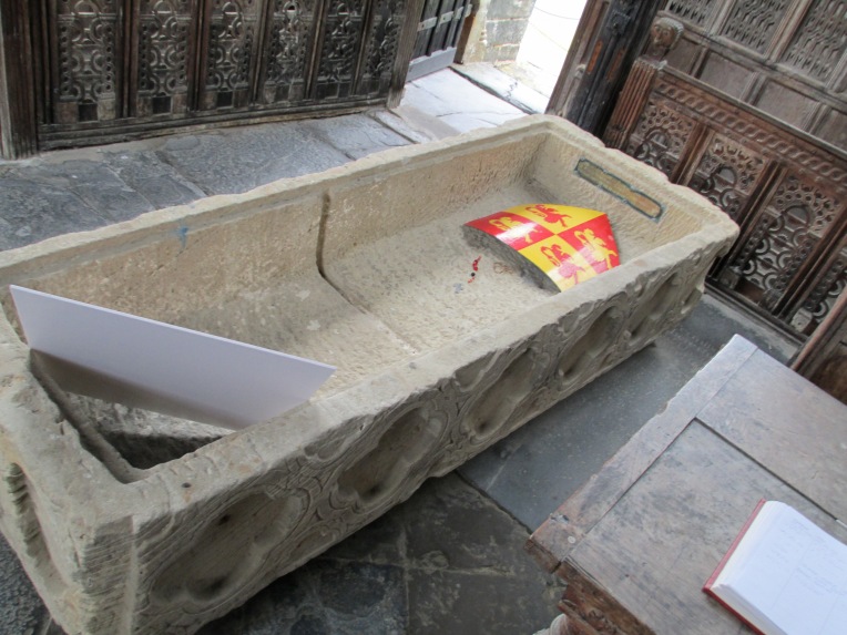
He died on the 11th of April in 1240 and was buried beneath the high altar of Aberconwy Abbey, but about forty years later Edward I wanted the land the abbey stood on to build Conwy Castle. So the monks moved the coffin containing Llywelyn’s body by river to the newly built abbey at Maenan. During the dissolution of the monasteries the coffin was moved for safe keeping to St Grwst’s church where it was forgotten about and was found covered with rubbish some 200 years later. It was then moved to the chapel in Llanrwst parish church. No one knows what happened to Llywelyn’s body.
You can see Llywelyn’s coffin below. When I saw it in 2012 it was located in a chapel out the back of the church and was quite difficult to find. There were no directions to it at all and nothing except a small sign propped up inside to distinguish it from the other random monuments in the room.

Many castles you see today in Wales were in fact built by the English. Castles such as Pembroke, Manorbier, Cilgerran and Carew. There are, however, Welsh built castles and Llywelyn was responsible for part of several of them. Such as:
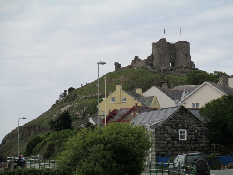
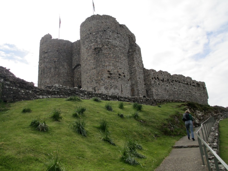 Criccieth Castle

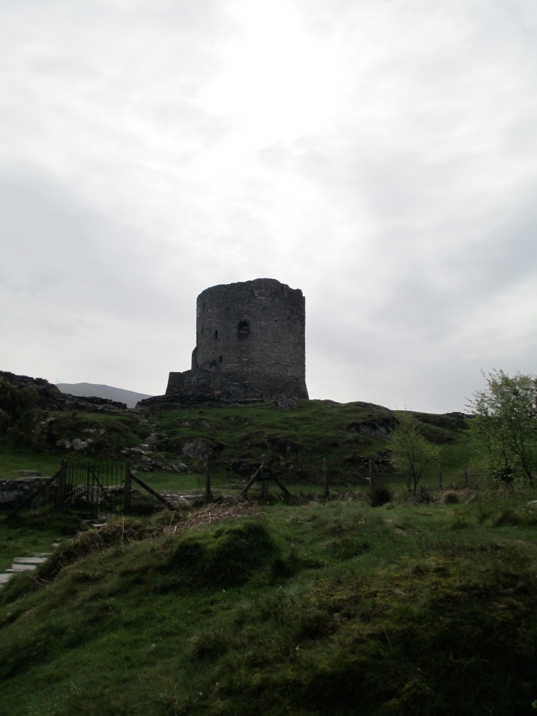 Dolbadarn Castle
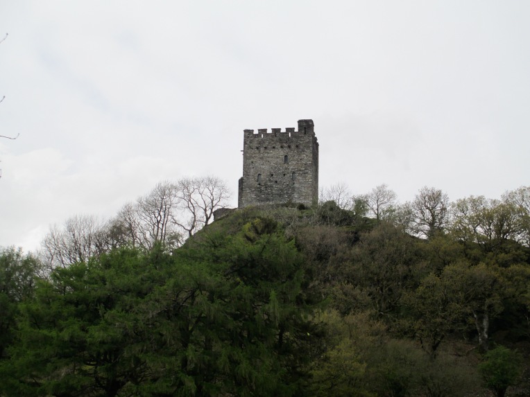
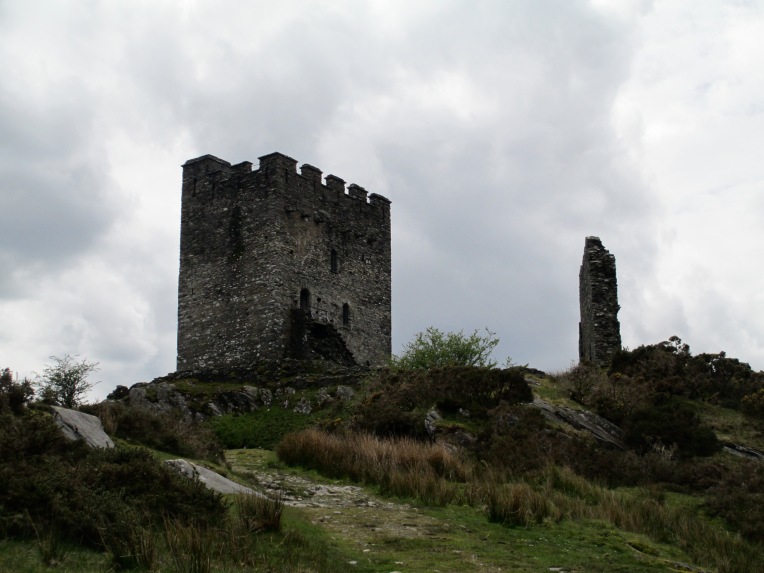 Dolwyddelan Castle
Llywelyn truly made a mark on Welsh soil and was a great Prince who deserves to be remembered.

Statue of Llywelyn in Conwy, which is much smaller than it appears and much smaller than it should be.
References
http://www.englishmonarchs.co.uk/llywelyn_the_great.htm
The photos are all my own.
Incidentally I discovered Llywelyn many years ago in Sharon Kay Penman’s fabulous book Here Be Dragons. As this blog is largely non fiction I don’t usually recommend historical fiction. I am making an exception in this case. Here Be Dragons is a truly wonderful book and everyone should read it.
