Medieval Tiles

When thinking about what to write about today, I was looking at some of my recents posts, book reviews, castles and abbeys for the most part. So I thought, maybe I could write about a person? I hadn’t done a biography in a while, so I had a look at my books and my photos, photos are always a key decision maker when it comes to Historical Ragbag posts, and couldn’t decide on anyone. Therefore I had a look at some of my draft posts, things I’d either started writing about and didn’t finish, or posts that never got further than a heading. I came across one mysteriously titled, 13th century tiles, with nothing but the heading. I have written about medieval tiles before in the context of longer posts: Strata Florida Abbey in Wales and Mellifont Abbey in Ireland. Both have lovely examples of medieval tiles. You can see the posts in the links below

https://historicalragbag.com/2014/09/09/strata-florida-tiles/

https://historicalragbag.com/2017/05/22/mellifont-abbey/

So what had been my original intention been in titling a post 13th century tiles? I’m not 100% sure, but regardless I decided that writing about medieval tiles a little more generally could be fun, and give me an excuse to visit the State Library for some books. So hence, this post was born. I hope you find it interesting. This is by no means an exhaustive exploration of medieval tiles, but it should be (I hope) a nice overall look at them, their purpose, how they were made, as well as lots of photos of course. I’ve deliberately changed the name to medieval tiles because I want to look beyond the 13th century.

As medieval tiles were floor coverings not that many survive in tact, undamaged, or in their original positions. This just makes the ones that have survived all the more precious.

To begin though, I said Historical Ragbag is about photos, hence here’s my favourite of my photos of a medieval tile

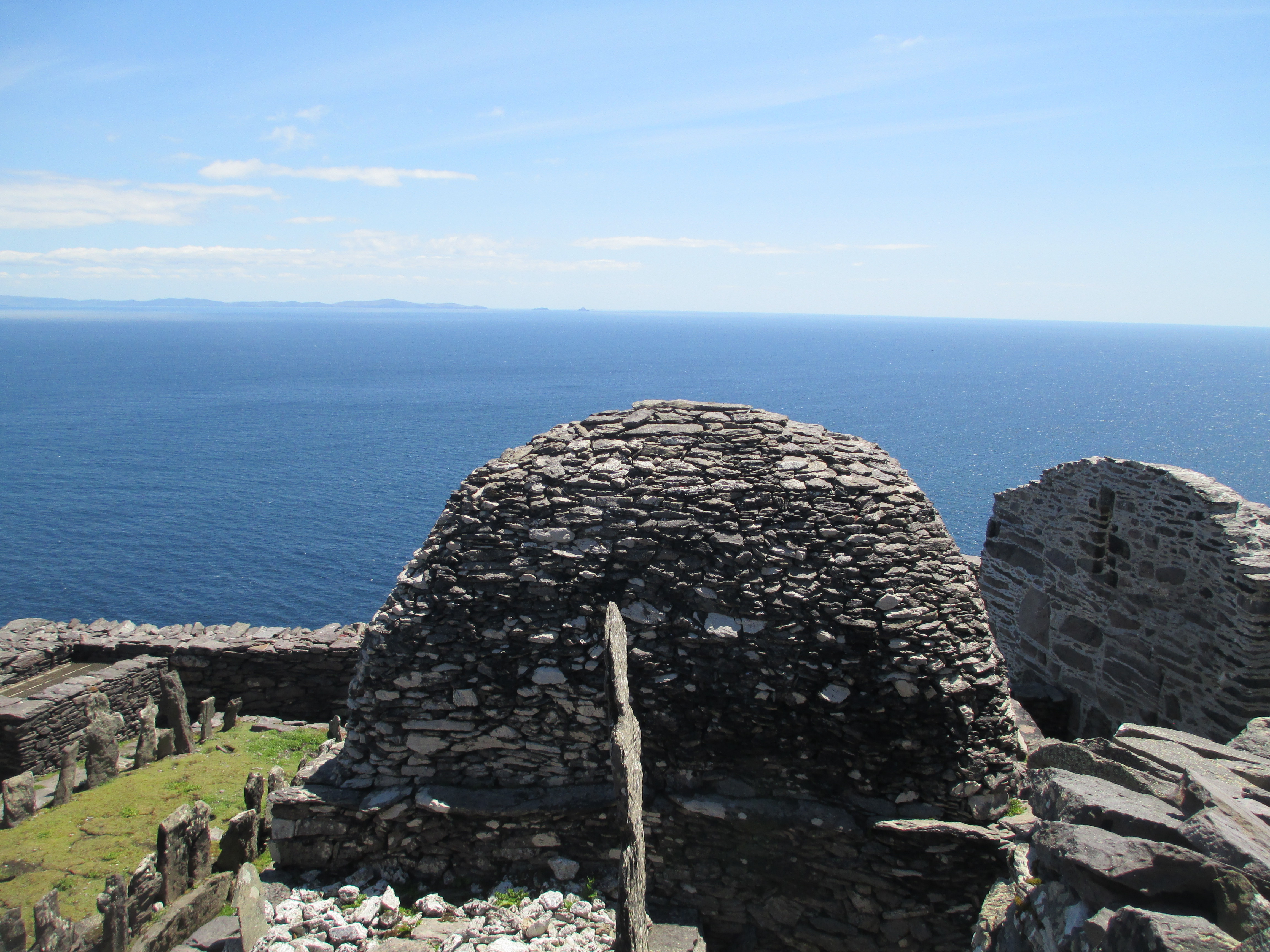
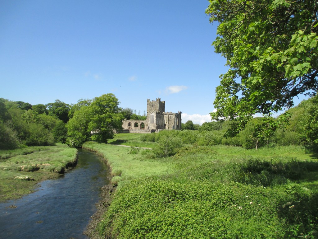
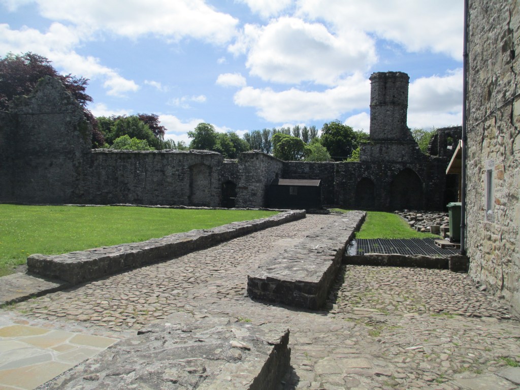
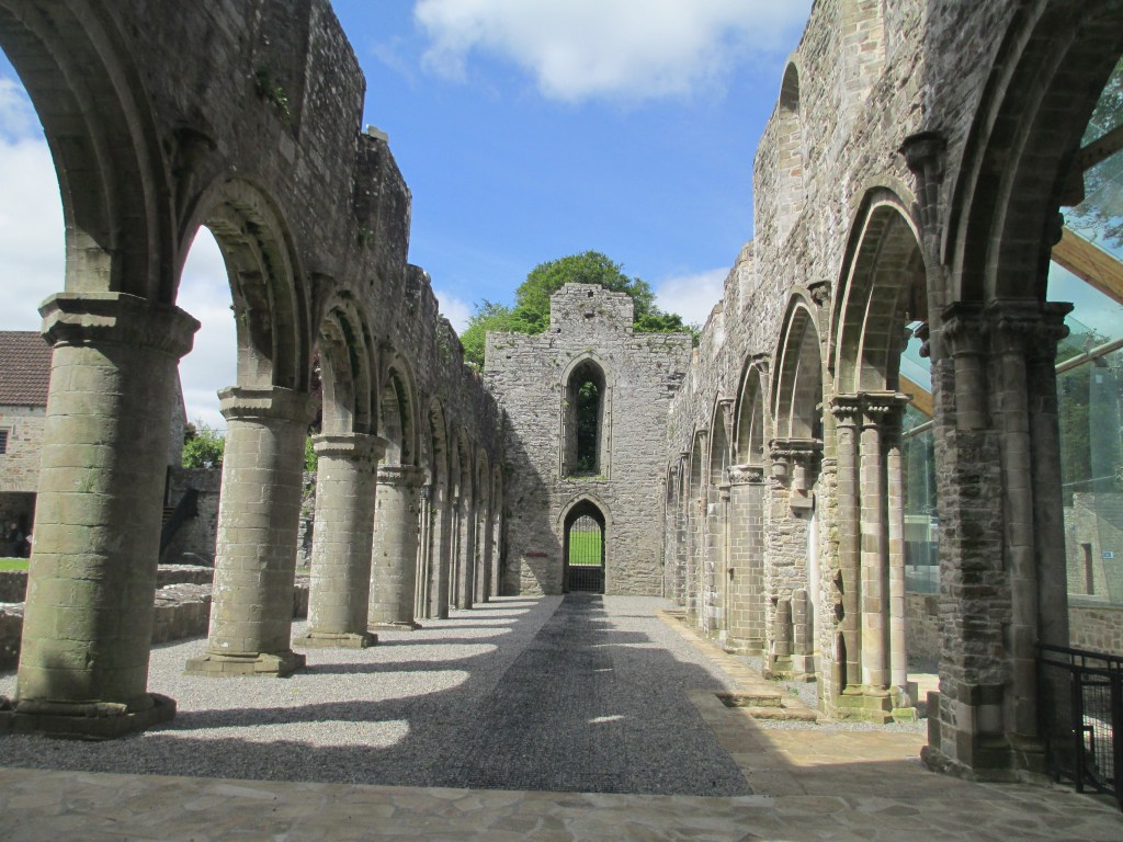
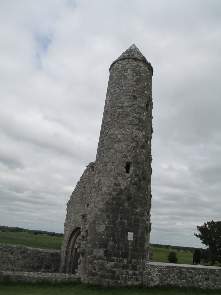
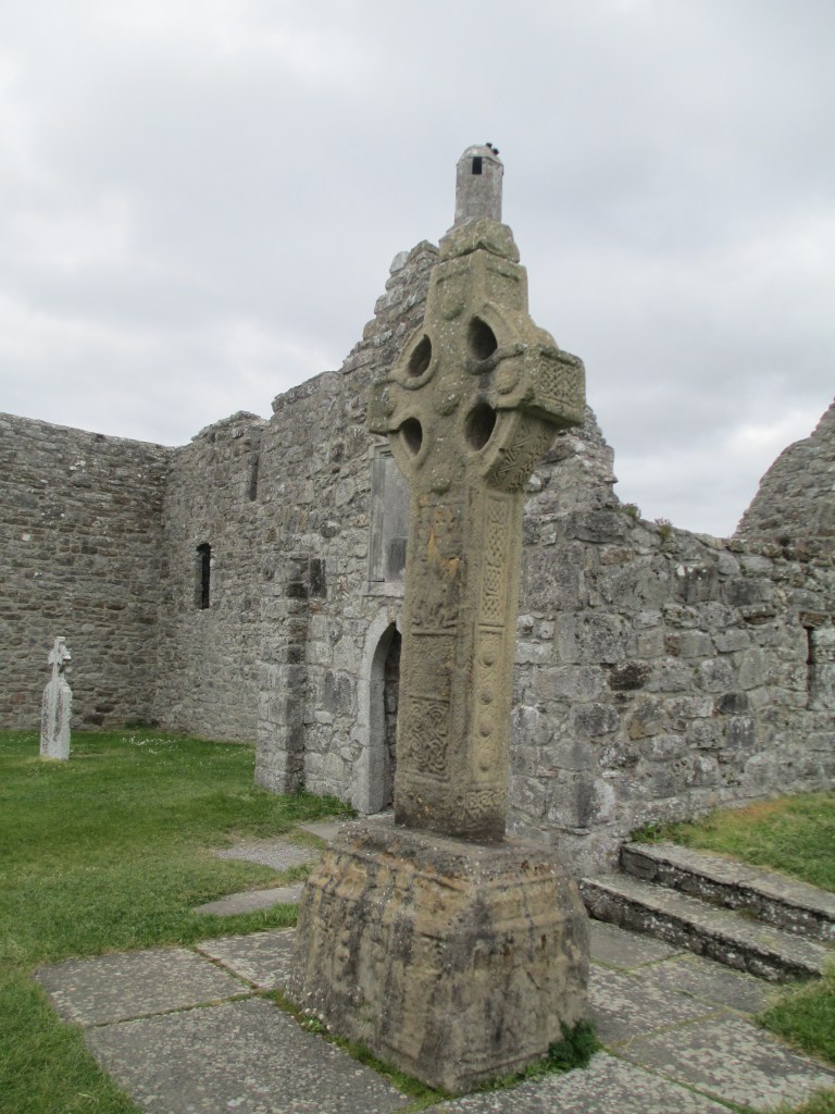
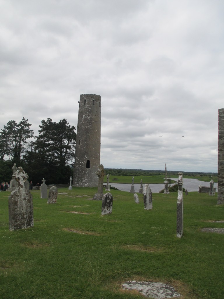
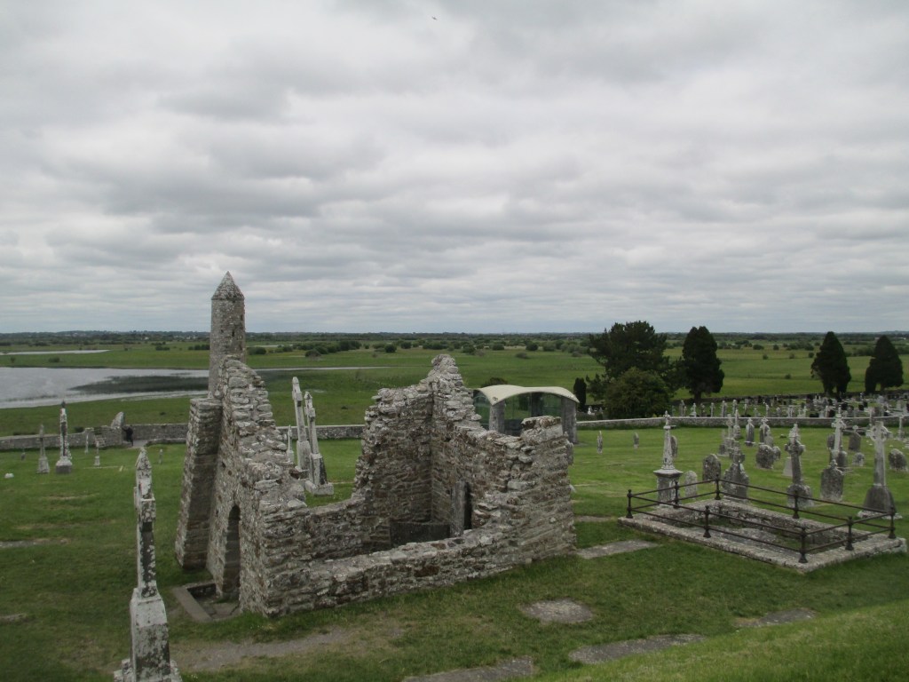
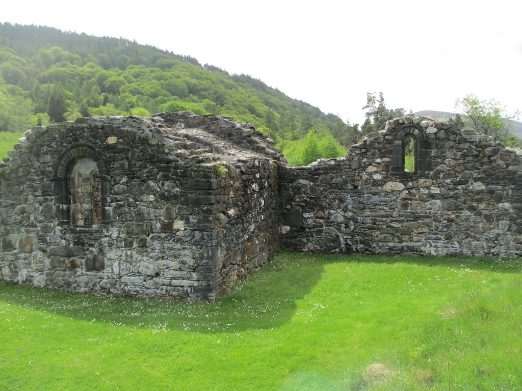
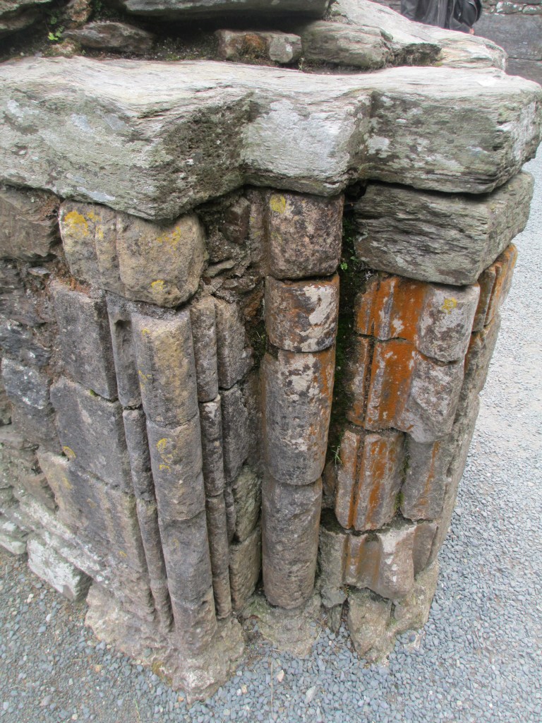
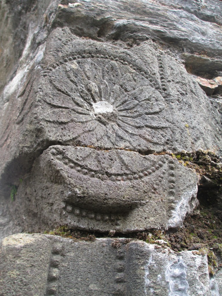
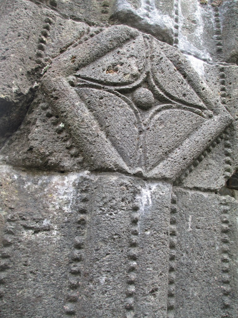
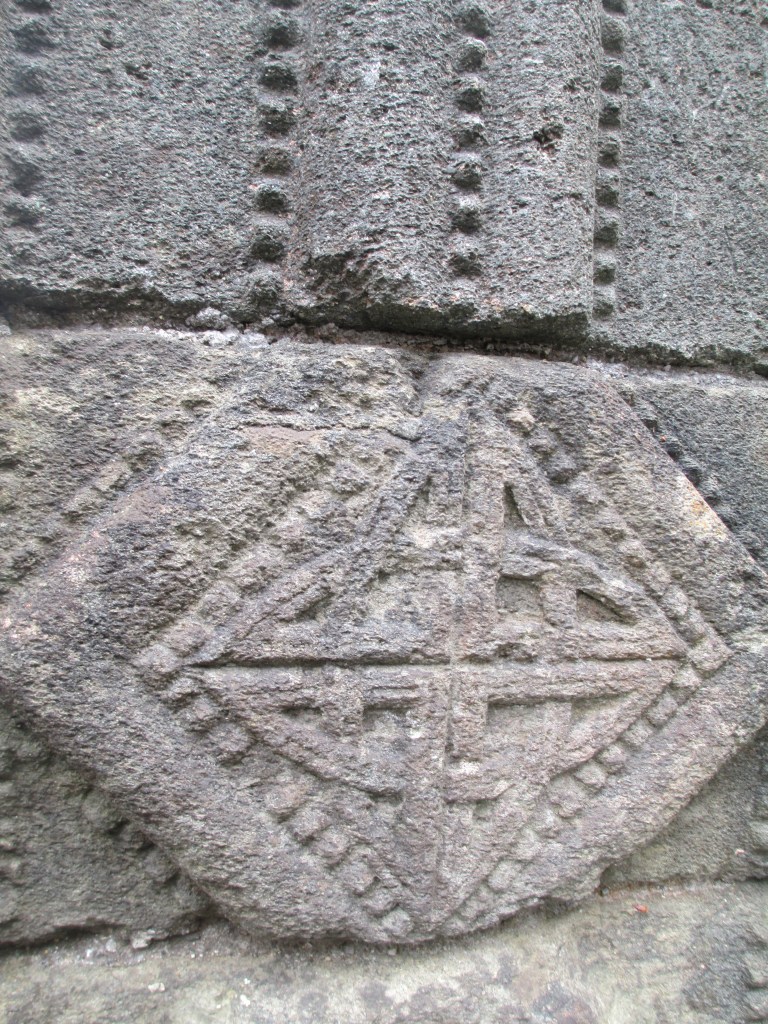
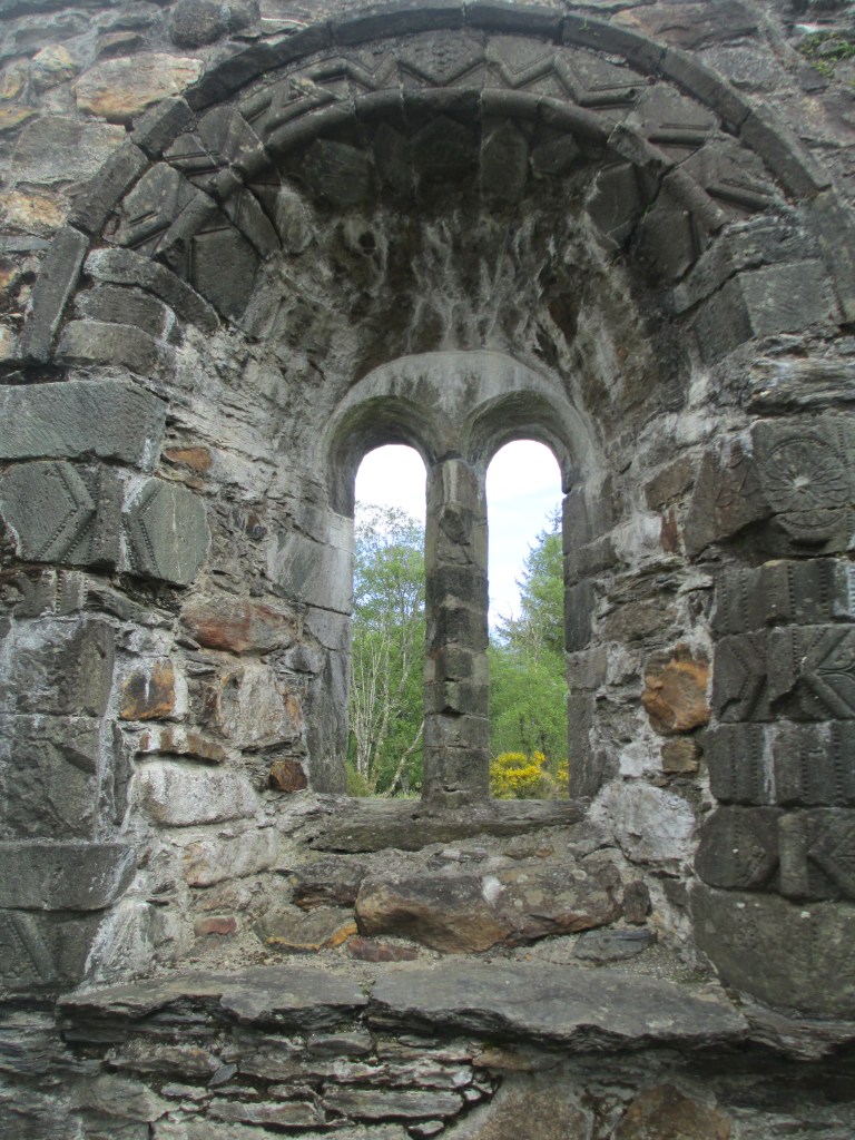
This tile is from Mellifont Abbey in Ireland, probably dates to the early 13th century and was excavated in the 1950s. It’s my favourite for two reasons, firstly the lion rampant design is still so clearly evident and secondly because I was allowed to hold it. It is surprisingly heavy, and made from earthenware with a lead glaze. It’s not the only medieval tile at Mellifont, you can see more in the photos below. As they were excavated in the 1950s they aren’t in their original positions, and while they have been laid out close to their original patterns, they are in a protected area because there was an issue with vandalism.

You’ll find common patterns across most medieval tiles. The ones at Mellifont encompass roughly 25 common designs. It is, though, the only place in Ireland where a lion and a griffin in a circle has been found.

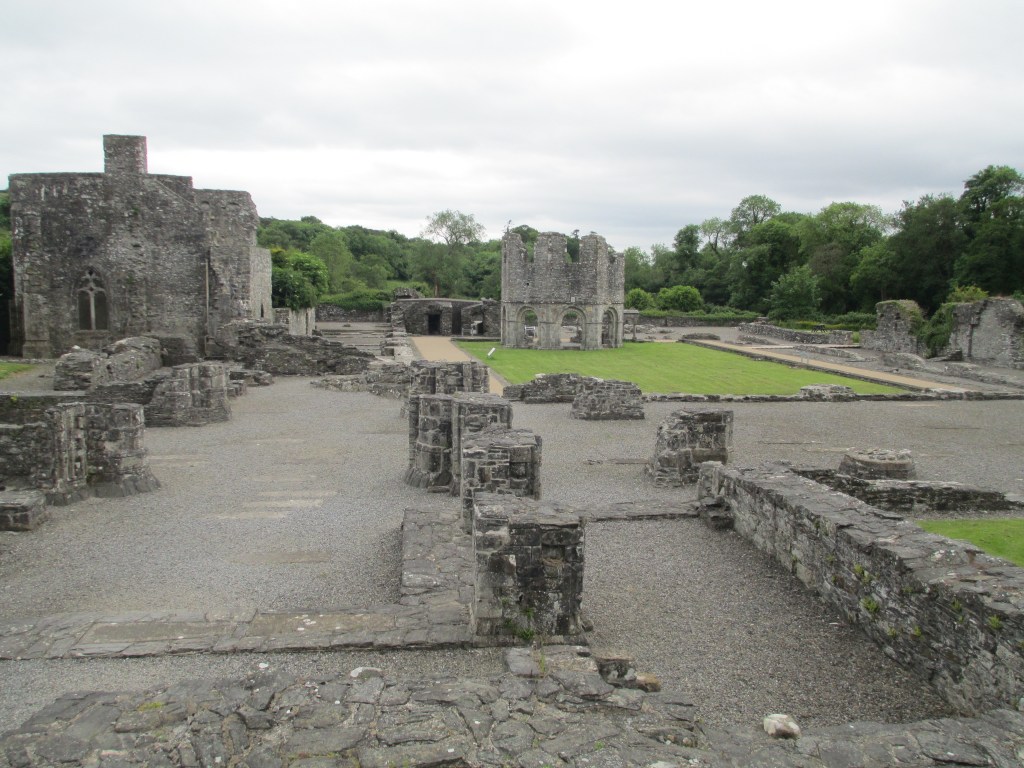
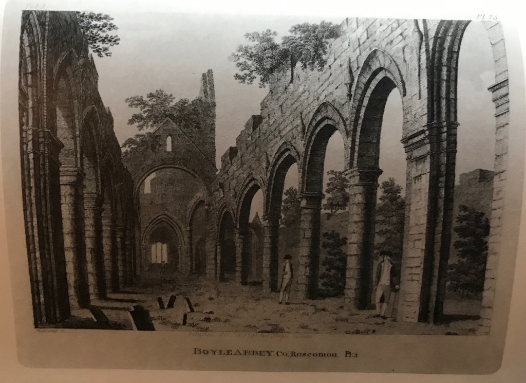
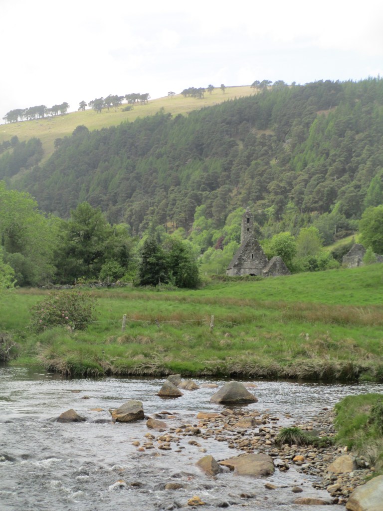
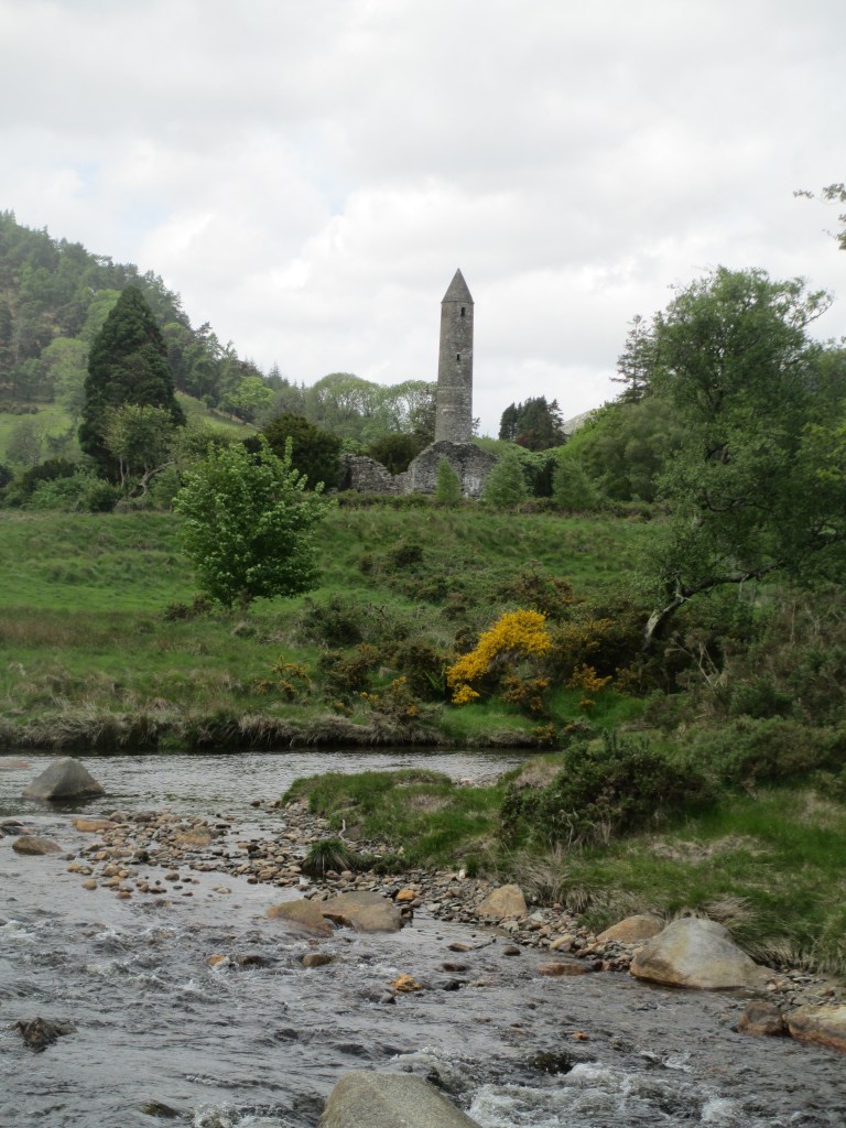
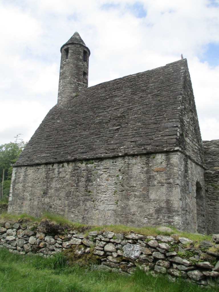
Mellifont is a Cistercian abbey, the oldest in Ireland, and the introduction of tiles there in the 1230s is most likely due to the increasing Anglo Norman influence on Irish religious institutions. The tiles there are lovely, but they are not unusual in terms of medieval tiles more generally.

This brings me to the making of the tiles. It was first thought that they were made by the monks, but most likely they were made by laymen. Originally if you wanted a tile pavement for your religious institution, you’d pay a tiler who would set up on your land and make your tiles, as time went on and more tiles were needed commercial tileries were established. Definitely by the 14th century commercial tileries were the norm. They often stayed local though, and it wasn’t until the mid 14th century that importing tiles was more common. The commercial tileries were high quality, but the designs were more generic. So how were they actually made? A tile kiln was most likely two parallel chambers separated by a spine wall, with a furnace. The kiln was usually built of tiles as well. You can see a hypothetical tile kiln the in the image below- it is from the book Irish Medieval Tiles. The materials the tiles were made from was largely dependant on the soil in the local area. The glazes used for the patterns were lead, and the tiles were most likely fired at 1000 degrees centigrade.

Physical manufacture was only part of the process. The designs of the tiles, either in pattern or layout, was also incredibly important. The tiles would have been coloured, with yellow, green and white glazes being common. The local availability of material could also affect the colour choice. I’m going to run quickly through the main overall design types. I don’t have photographic examples that I can say are definitely correct to a type, so I’m afraid we’ll have to rely on description.

Plain Tile Mosaics: Essentially tiles that were glazed a single colour, without a design, of different shapes and arranged in a pattern.

Two Colour Decoration: A single colour tile with a design impressed on it with another colour, usually done with white clay.

Two Colour Mosacis: When the two colour principle was applied to different shapes to create a mosaic.

Two Colour Square Tiles: More complicated designs, where the design was the point of the tile, not the overall mosaic. These designs were usually figural, heraldic shields, lions, griffins and dragons, sometimes a national symbol.

Line Impression Decoration: These designs were incised into the tiles.

Line Impressed Mosaics: The designs were incised, but intended to be part of a broader mosaic pattern- often irregularly shaped.

Line Impressed Square Tiles: Designs incised into square tiles.

Relief Decoration: The design is impressed with a stamp.

Relief Decorated Mosaic: Stamped designs on tiles intended to be a mosaic.

Relief Decorated Square Tiles: Stamped designs on square tiles.

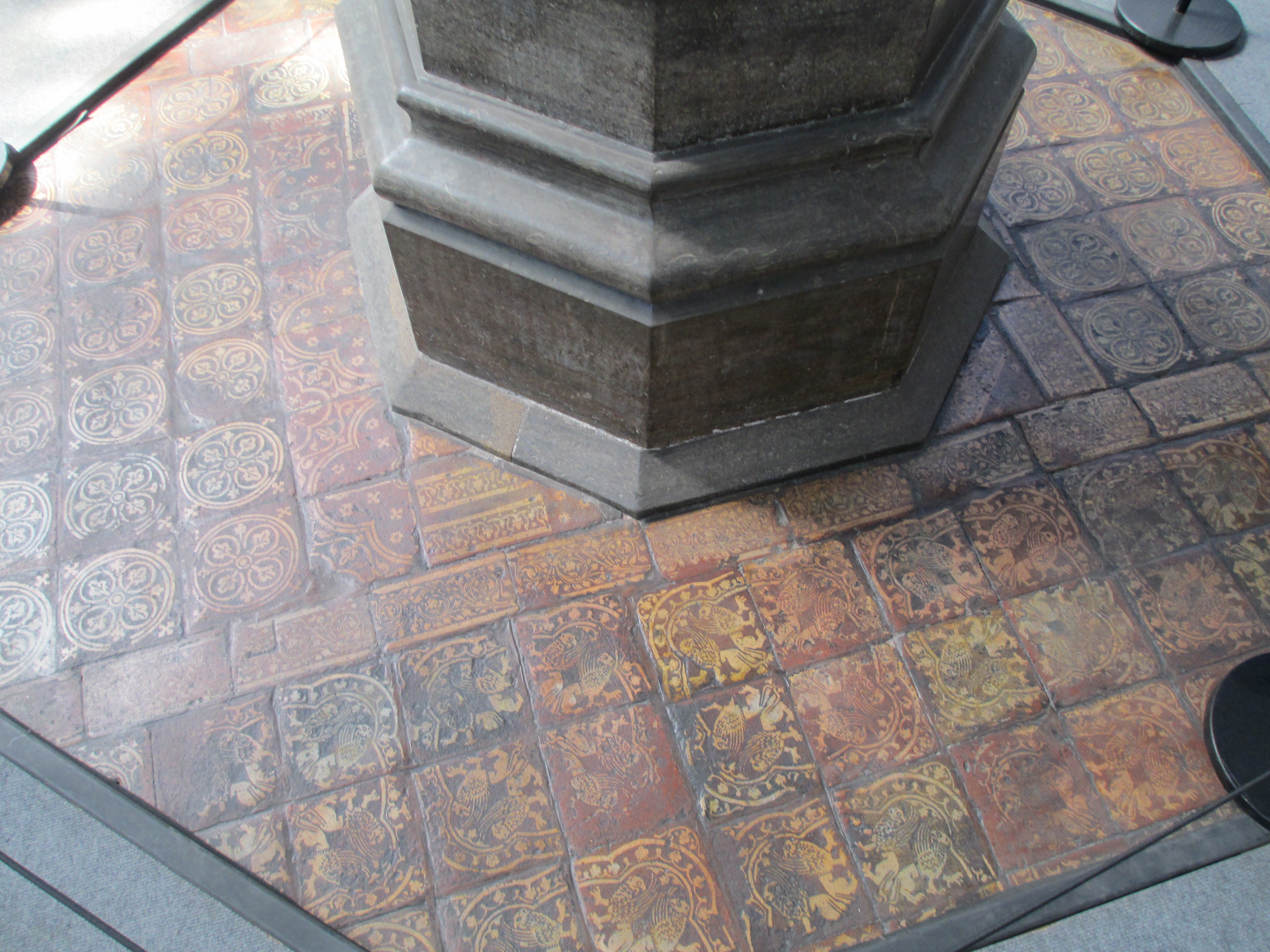
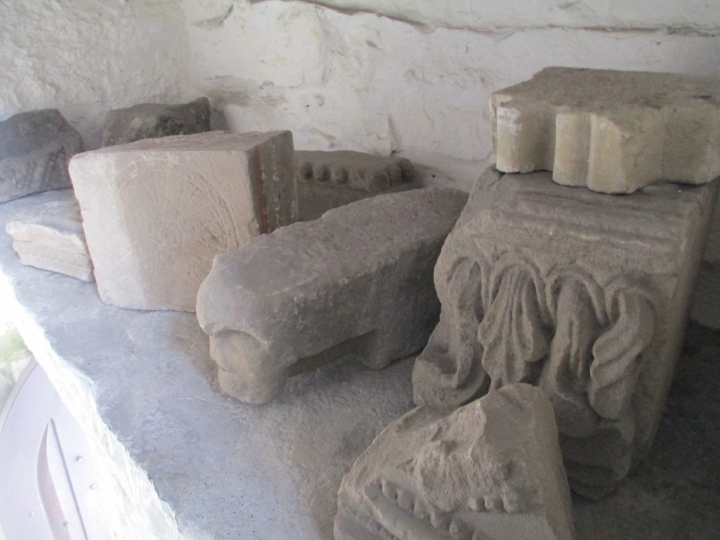
You can see some of the different colours and typical designs in the collection collated at St Augustine’s Abbey in Canterbury below.

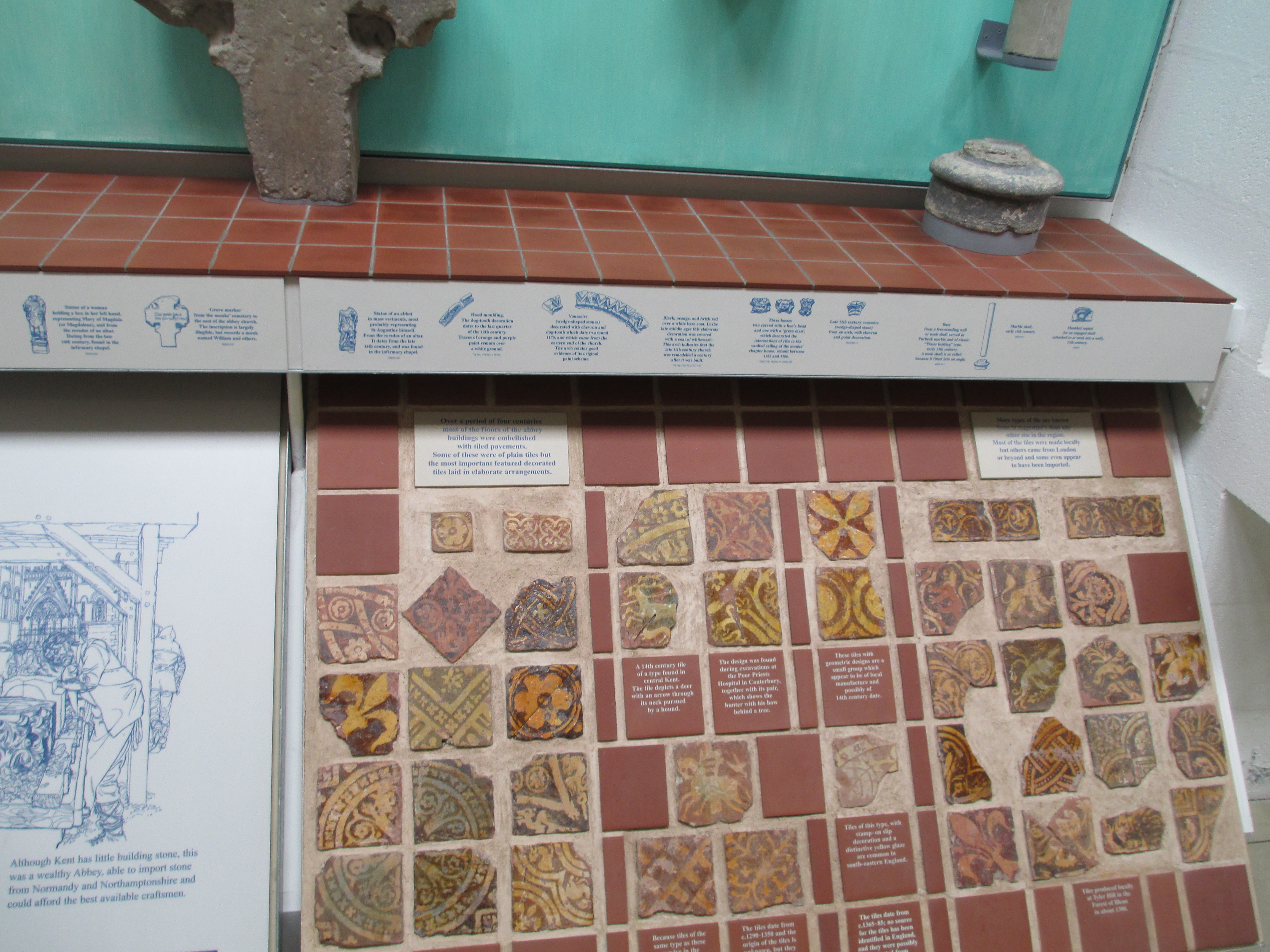
As time went on and the manufacture of tiles was more commercialised the designs on the tiles did become generic, but they would originally have had a figurative power beyond simply being beautiful. In theory the more ascetic monasteries, such as the Cistercians, kept the designs simpler but even in these cases symbolism can be found. Religious motifs were common, with allusions to the Virgin Mary, or a fish on an oval ground, a lily for the annunciation, the Lamb of God for the Templars, or Catherine Wheels for St Catherine. There were also pagan symbols, you find these in a lot of church carvings too, especially the Green Man and lions’ faces. These more figurative tile designs, like a lot of church art work, would have helped to convey the stories of religion and medieval life more generally to a largely illiterate population. Aside from the figurative, coats of arms were also popular along with other heraldric devices. These could indicate a patron of the institution, or a local family.

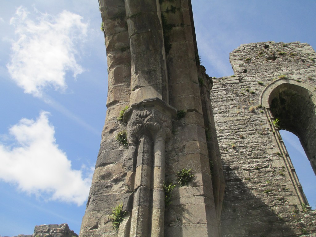
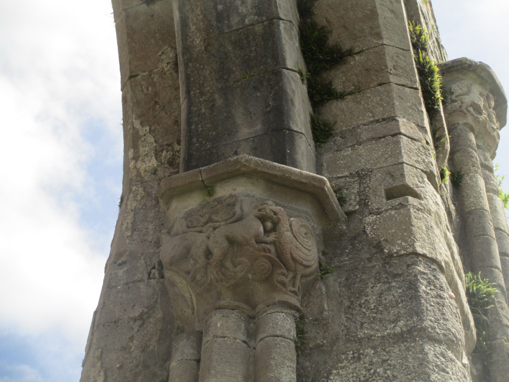
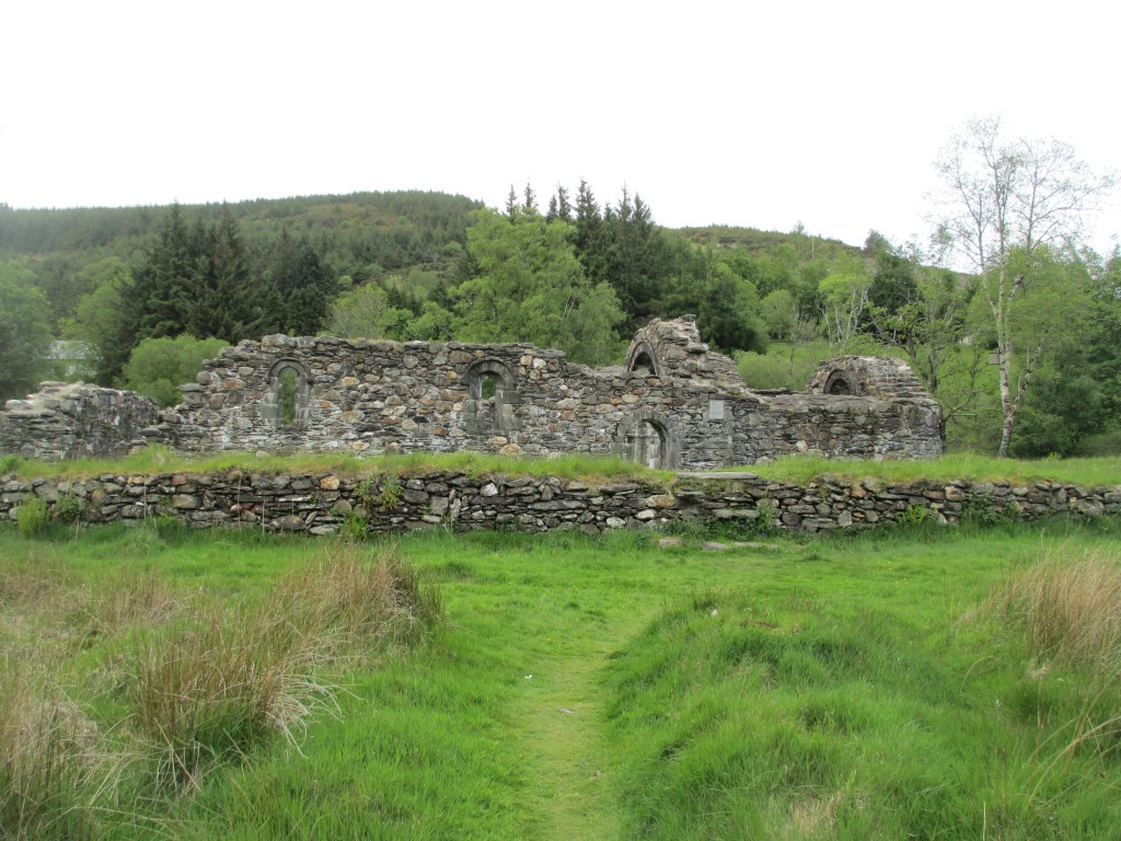
An excellent example of a mixture of the more generic imported tiles, with still some local influence, is Strata Florida in Wales. These have some really interesting patterns. They are most likely 14th century and were uncovered in the 1880s. They have heraldic images, the arms of Hugh Despenser, the Fleur de Lis of France which may be a nod to the Abbey’s mother house in Clairveaux, as well as a few allegorical designs. You can see them in the photos below.

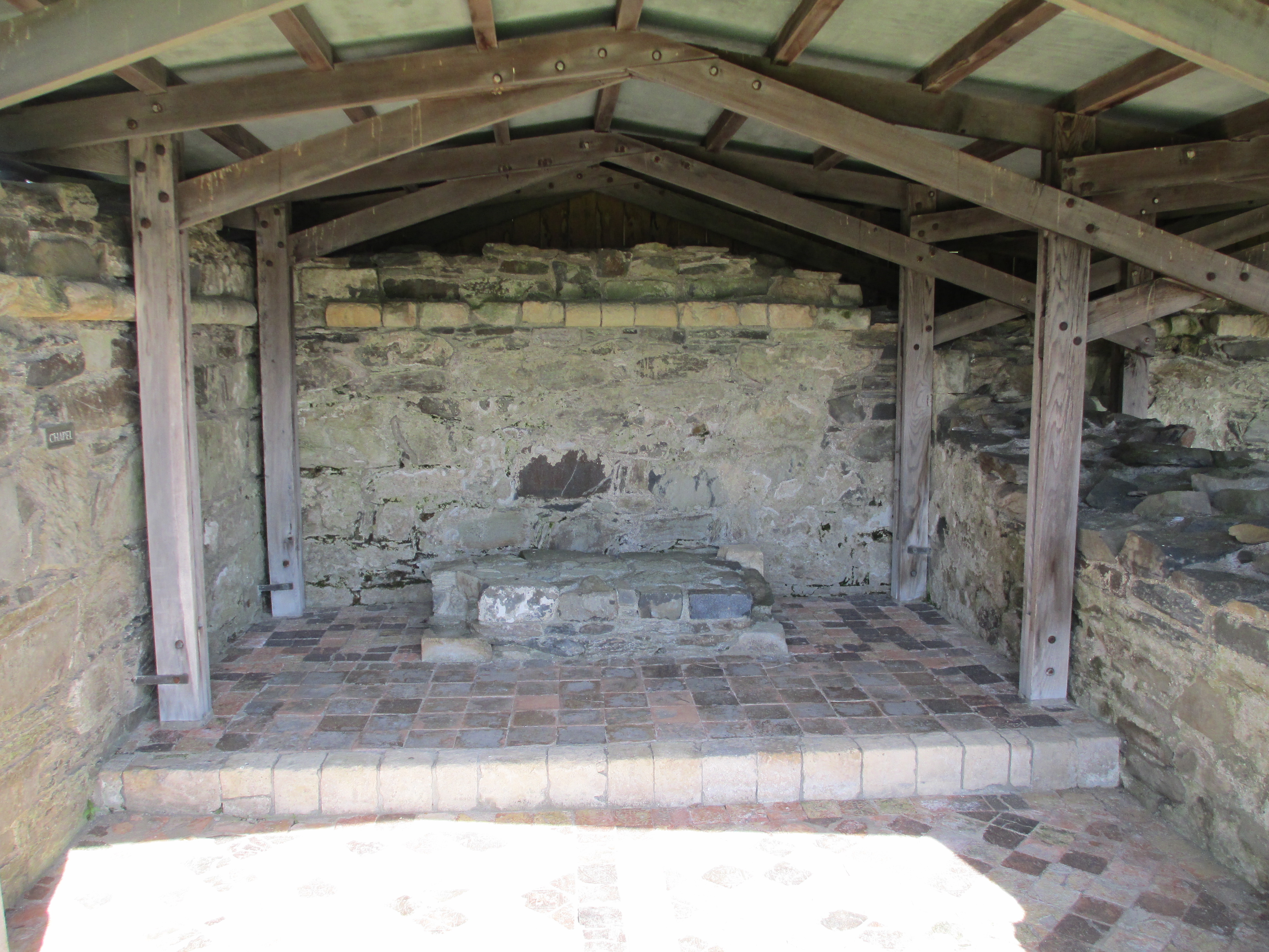
As you can see they are a mixture of some impression designs and some probably either stamped or painted designs. These particular tiles became a tourist attraction at the end of the 19th century and unfortunately some were souvenired. They are now kept under a roofed area for protection from the elements, but would have originally been laid in the main part of the Abbey and tradition is that only important guests and choir monks were allowed to walk on them. They were made in England and imported which might explain the presence of Hugh Despenser’s arms (you can see the shield in the top right of the second photo) as he was reviled by the Welsh.

Now, I promised pictures, so I wanted to move on to some examples of medieval tiles outside of Mellifont and Strata Florida. Hopefully they’ll give you an idea of some of the different uses of medieval tiles, and their geographic range. The selection is limited to tiles I have photographs of, but they should give you a good overview.

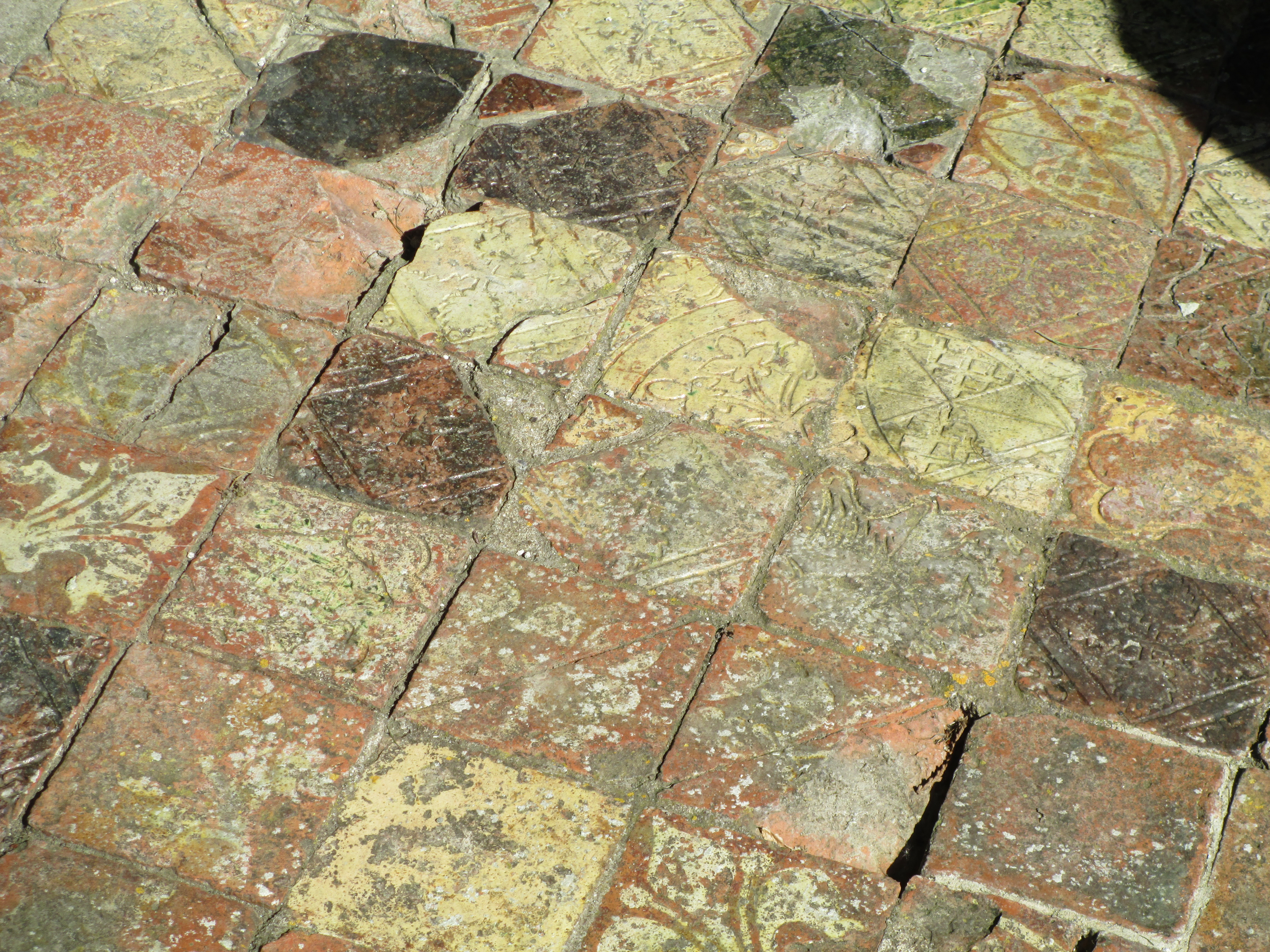
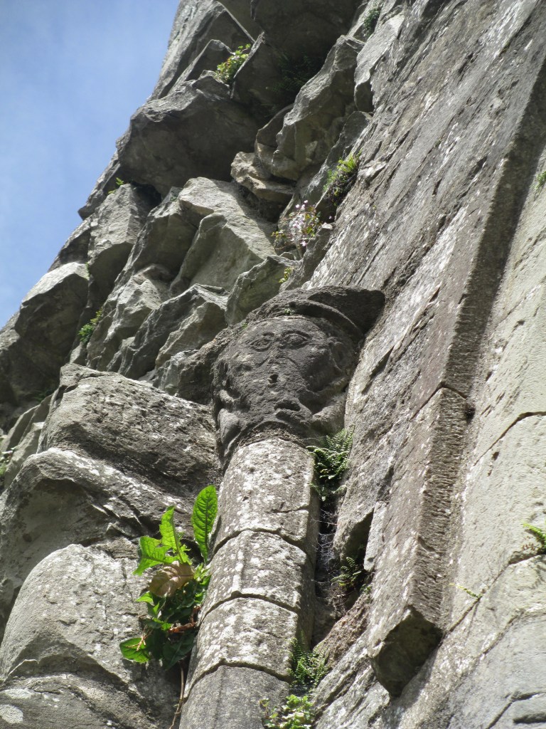
St Dogmael’s in Wales.

The tiles here are out in the elements and incredibly worn, you can see the impact that being a ground cover can have.

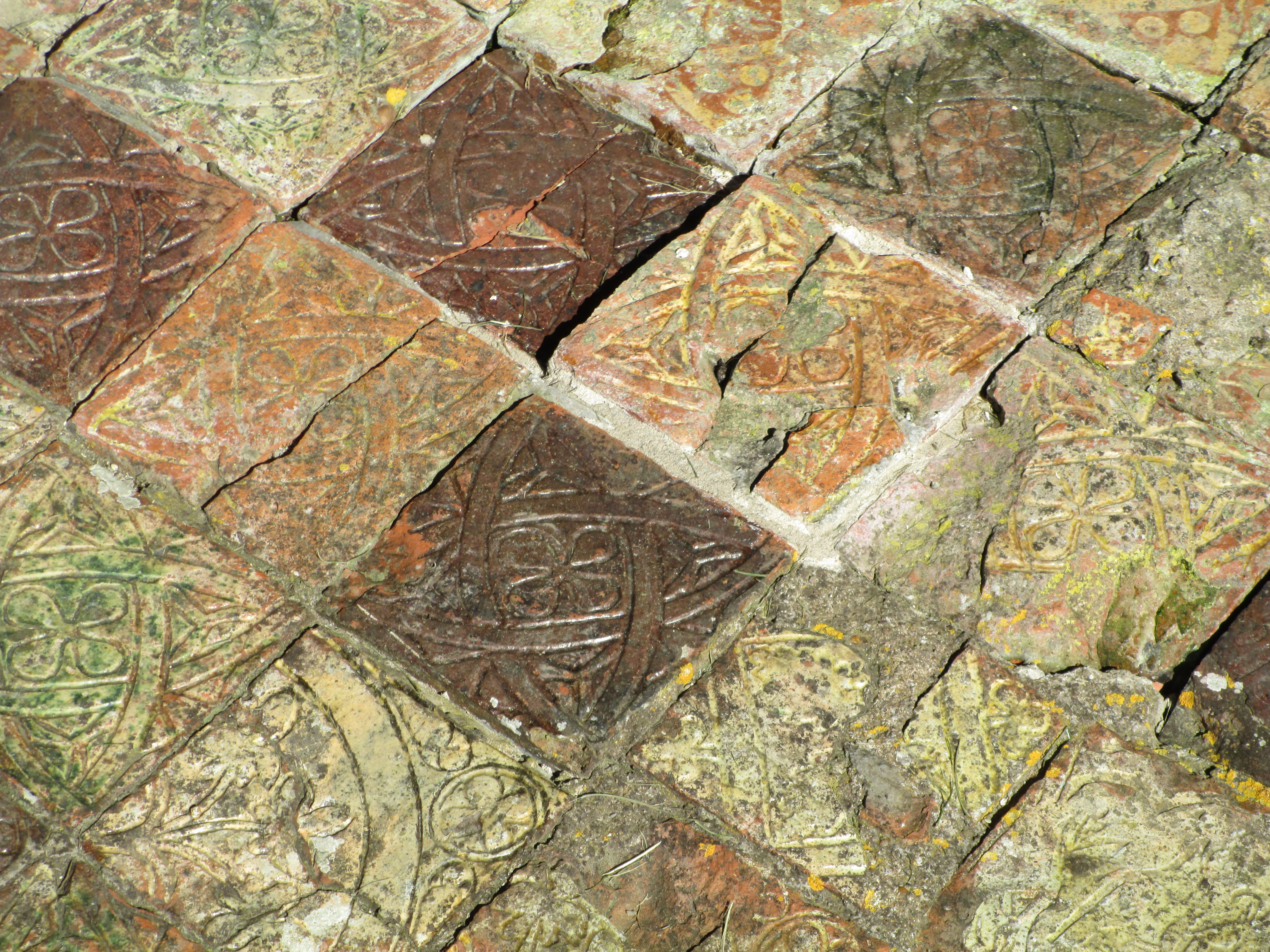
The Franciscan Friary in Waterford Ireland

Like St Dogmael’s these tiles exhibit the wear that medieval tiles are subjected to, but you can make out the remains of some inscribed designs.

A Pavement laid out in the Musee de Cluny- the middle ages museum- in Pairs.

This pavement dates to the end of the 13th century, is of two coloured tiles, with a mosaic border and you can see the heraldic Fleur de Lis as well.
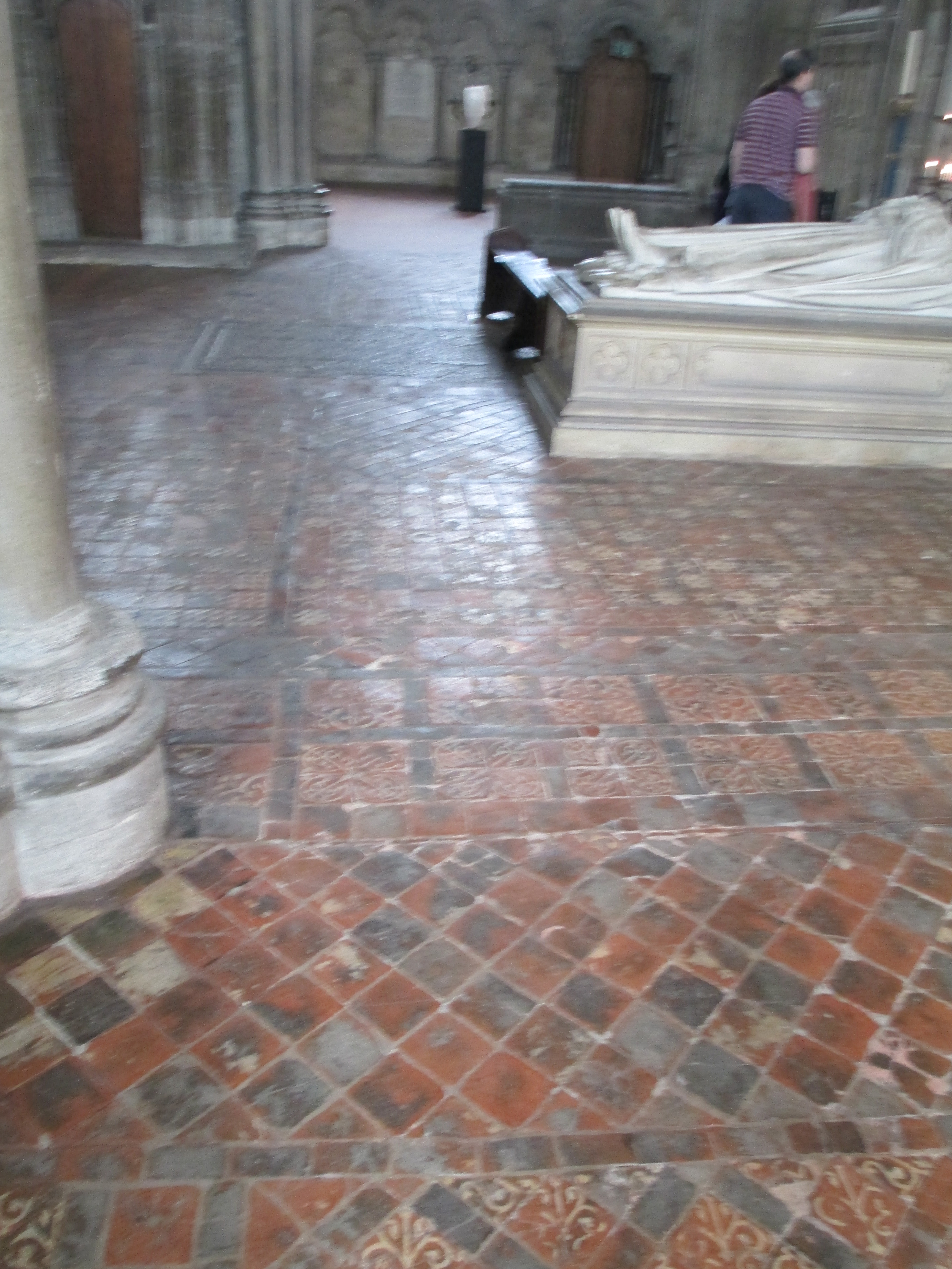
Westminster Abbey

Westminster Abbey is home to the Cosmati Pavement, an unparalleled work of inlaid stone from the mid 13th century. It stands at the high altar and you aren’t allowed to take photos inside the abbey, but you can see it at this link https://www.westminster-abbey.org/about-the-abbey/history/cosmati-pavement . The photo below is from the near the Chapter House, where you are allowed to take photos, and showcases some beautiful designs.

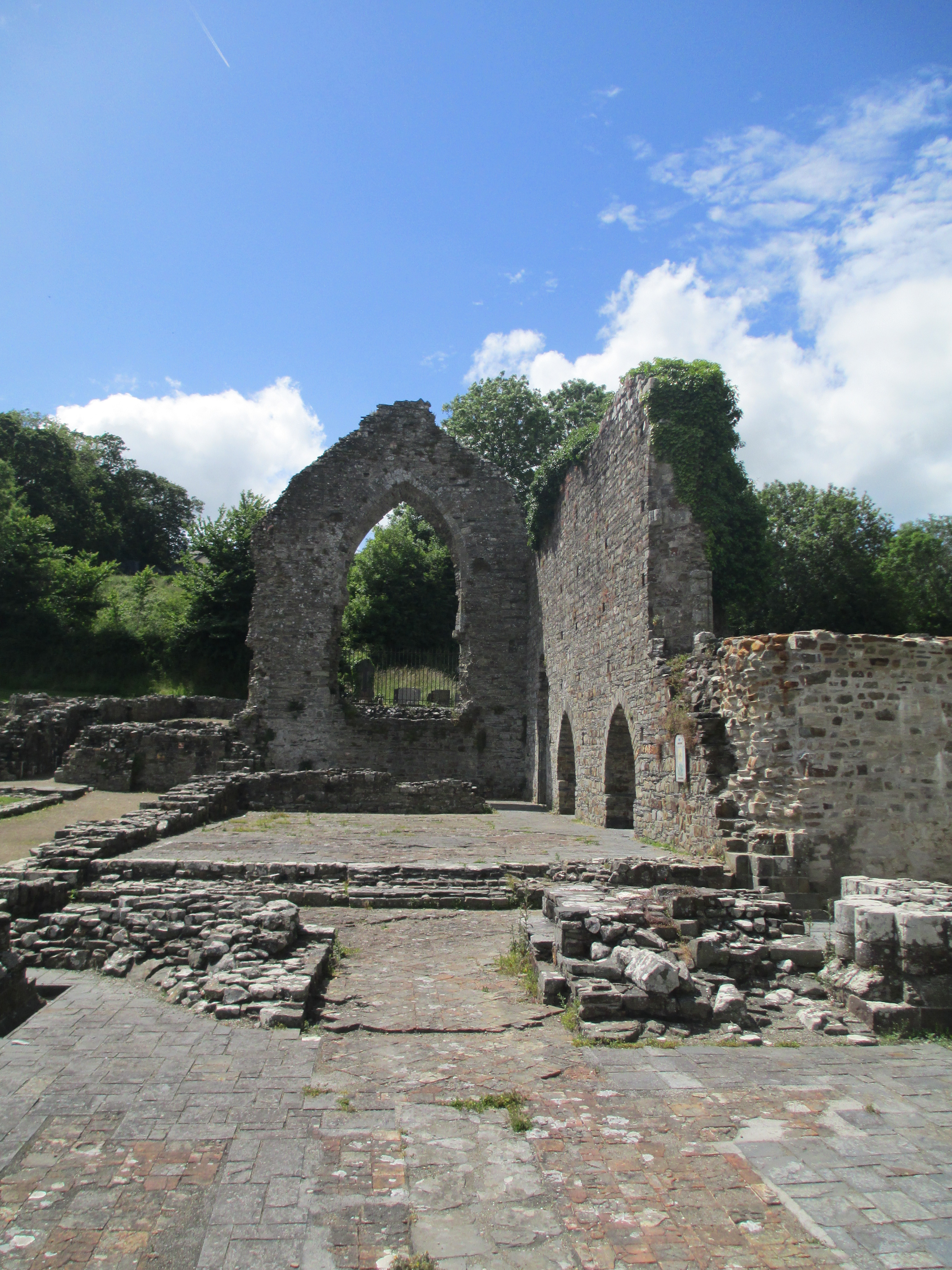
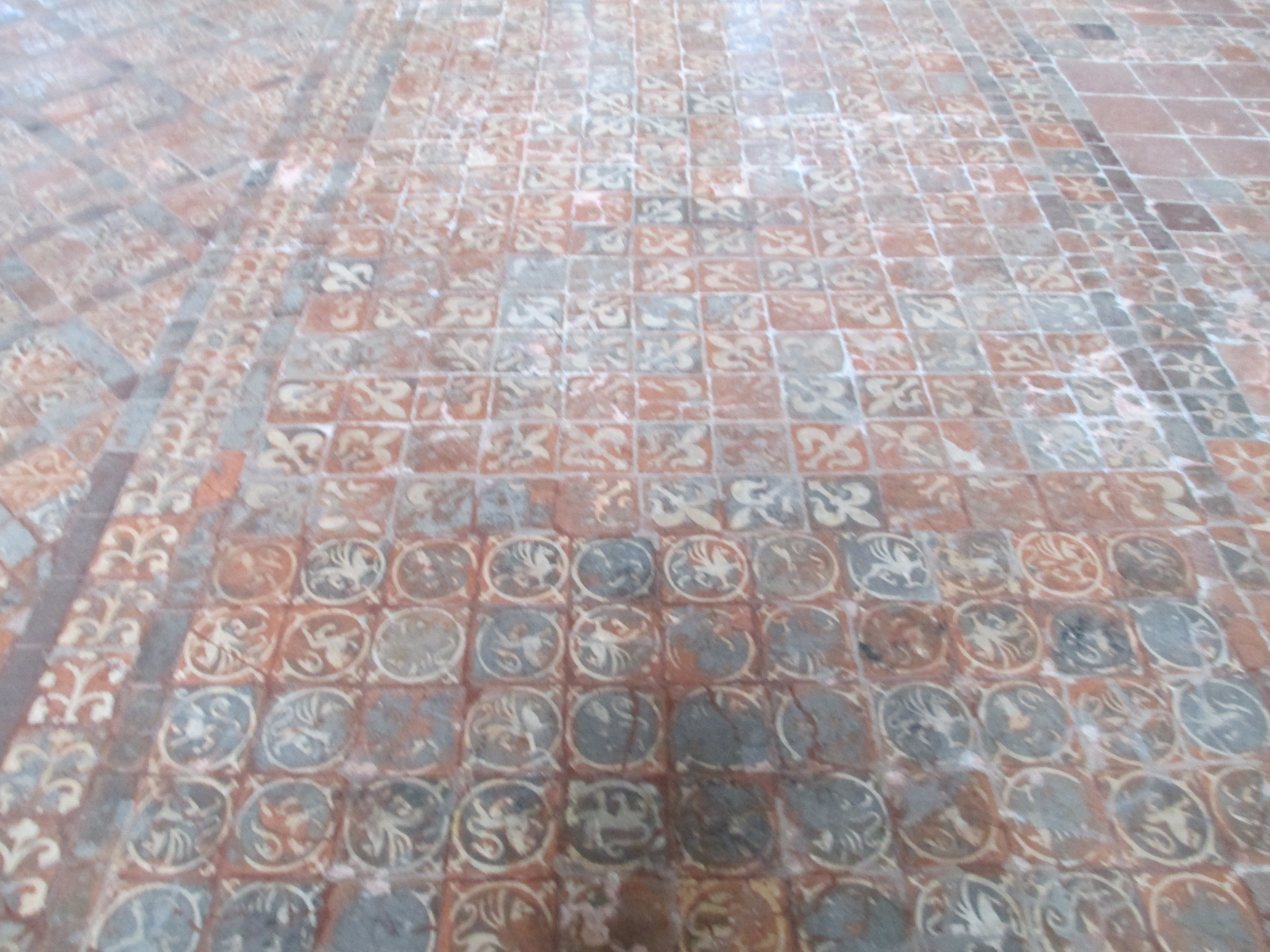
Winchester Cathedral in England

The tiles in Winchester are mainly 13th century and give you an incredible example of the sheer scale of some of these pavements in large religious institutions. They are the oldest area of medieval tiles to survive in England, and you’re still allowed to walk on them!

I wanted to finish the tour with a couple of anomolies, or different ways of covering the floor in medieval religious institions. The first Sainte Chapelle in Paris, the jewell box of a church that Louis IX of France had built to house the holy relics he collected. As you can see the floor is painted, the church dates to the mid thirteenth century.

Secondly, I wanted to look quickly at Chartes and its labyrinth. A subject I will return to in much more detail at a later point. Chartres Cathedral has a labyrinth inlaid into its floor. It most likely dates to the beginning of the 13th century, like a lot of our floor tiles, its exact purpose has never been clear, but pilgrims continue to come to walk its meditative meanderings.

So that brings us to the end of our exploration of medieval tiles. They were first and foremost floor coverings, but they were also beautiful, hand made and told their own stories. The ones that survive are in varied states of repair, but they can give you an idea of how truly majestic these pavements would have been.

References

Medieval Floor Tiles by Jane A Wight

Irish Medieval Tiles by Elizabeth Eames and Thomas Fanning

Medieval Tiles: A handbook by Elizabeth Eames

https://historicalragbag.com/2014/09/09/strata-florida-tiles/

https://historicalragbag.com/?s=mellifont

https://www.westminster-abbey.org/about-the-abbey/history/cosmati-pavement

https://www.westminster-abbey.org/about-the-abbey/history/chapter-house

https://www.atlasobscura.com/places/labyrinth-chartres-cathedral

The photos are all mine.

Boyle Abbey

Boyle Abbey is in the town of Boyle, in County Roscommon in Ireland. I have written about it before as part of my Advent Calendar of Medieval Religious Institutions in 2017, you can see that post here. This post is going to go into more detail though.

Boyle Abbey is one of the many Cistercian abbeys in Ireland. I have written about the foundation of the Cistercian order, Bernard of Clairvaux and the spread of the Cistercian order in Ireland in this previous post about Mellifont Abbey, the first Cistercian abbey in Ireland. https://historicalragbag.com/2017/05/22/mellifont-abbey/

Suffice to say that the Cistercian order was founded on the concept of a life devoted to prayer, study and manual labour. It was a reaction against the more worldly and lavish monasticism that had risen out of the Benedictine monasteries, and the idea was a return to the original ideals of the Order of St Benedict. The Cistercian abbeys all followed a relatively similar layout and you can see how Boyle would have looked originally in the photo below.

Cistercian abbeys were intended to be self-sufficient, relying on fishing and farming to support their communities. Boyle Abbey, like most Cistercian foundations, relied on water and it lies on the banks of Boyle River. The water would have been used for drinking, running the mill and flushing drains. In Boyle, not all the monastic buildings remain even in ruin, as it was converted to a military barracks in the 16th century. You can see the walls and the gatehouse in photo below

There are treasures that survive at Boyle though, especially in the exquisite carvings in the church, but I’ll return to them a little later. To begin at the beginning.

The first monks arrived at Boyle Abbey in 1161. It was a daughter house of Mellifont Abbey which you can see in the photo below.

Abbeys were often founded by a specific person or family. For example Tintern Parva, also in Ireland, was founded by William Marshal in thanks for surviving a particularly rough crossing of the Irish Sea. You can see Tintern in the photo below.

In the case of Boyle though, we don’t know who the founder was, if any, but the MacDermot Family who were Lords of Moylurg were patrons from early on in Boyle’s existence.

Once Boyle was founded in 1161 it maintained its self sufficiency, for the most part continuing as it always had through the years. There are a handful of times where it did step onto the centre stage. The first was in 1202 when the Anglo-Norman lord William de Burgh, who was in alliance with the King of Connacht, ransacked Boyle Abbey for three days. The Annals of Loch Ce described it as

They reached the monastery of Ath-da-larag on the Buill [Boyle Abbey], in which they fixed their residence; and they were three days in it, so that they polluted and defiled the entire monastery; and such was the extent of the defilement that the mercenaries of the army had the women in the hospital of the monks, and in every place in the entire monastery besides. No structure in the monastery was left without breaking and burning except the roofs of the houses alone; and even of these a great portion was broken and burned. No part of the buildings of the entire monastery was allowed to the monks and the brothers, excepting only the dormitory of the monks, and the house of the novices.

This was part of broader fighting both between the Anglo-Norman lords, who had arrived in Ireland in 1169 and began to claim large swathes of Ireland, John King of England and the Irish chieftains and kings. These depredations would have slowed down the construction of Boyle’s buildings as well, the church was still being built at this point. In fact Boyle was almost a perpetual construction site.

Boyle’s next moment in the limelight was when the Abbot was involved with the Conspiracy of Mellifont. This was part of a broader conflict between the Cistercian General Chapter in Clairveaux in France and the Cistercian abbeys in Ireland. The General Chapter believed that the Irish abbeys were answering only to Mellifont and were behaving not in accordance with the rule of the General Chapter. It’s perfectly possible that this didn’t mean that their conduct with problematic, more that they just weren’t directly under the control of the General Chapter as much as the General Chapter wanted. It was a conflict years in the making, but resulted in the General Chapter deposing five of the abbots of Irish Cistercian monasteries, including Boyle, and ensuring that they were answerable directly to the General Chapter in Clairveaux, taking Mellifont out of the chain of command. This conflict was also part of the even broader conflict between the native Irish and the Anglo-Norman world.

Unfortunately for Boyle this secondary conflict continued and it was caught in the middle more than once. In 1235 it was attacked by the English who, according to the Annals of Loch Ce

broke open the sacristy; and all its valuable things, and its mass-chalices and altar cloths, were taken of it.

Eventually reparations were paid.

Apart from being the site of a few prominent burials Boyle stayed out of centre stage until the Dissolution of the Monasteries. While Henry VIII’s Act of Suppression of the Monasteries was passed in 1534, it took some time for all the monasteries to be suppressed, especially remote sites like Boyle. So Boyle hung on until 1584 when it was finally dissolved and its abbot Abbot Glaisne O’Culleanain was executed in Dublin when he refused to renounce Rome. Boyle was leased to William Usher from 1589 until 1599 and then until the 18th century it was under military occupation, and was known as Boyle Castle. It came into the hands of the Commissioners of Public Works as a National Monument in 1892 and is today in the hands of the OPW.

Before it was restored in 20th century, Boyle was allowed to return somewhat to nature. You can see some etchings of it in the 1800s below.

So despite being a military fortification for over 300 years, a surprisingly large part of the Cistercian structure of Boyle remains. You can see some of the surviving structures in the photos below

The jewel in the crown at Boyle though is the church.

It is a truly remarkable survival and actually my reason for wanting to write about Boyle, because it has some incredible carvings. The church was built over a number of years, with sections begun with the foundation of the abbey in 1161 including the presbytery and the transepts, where the tower also began.

The church was not built quickly. Its construction was interrupted by things like raids from Anglo-Norman lords, but a building of its grandeur simply takes time to build. The church wasn’t consecrated until 1218, and even then it was most likely not entirely complete, you can see elements of both Romanesque and gothic, and an early adoption of more English styles, such as the tower. The earliest part dates to the late 12th century and the latest part, mainly the north piers, to the start of the 13th. It was added to as time went on as well, with much of the current tower dating to the 1300s. The really interesting thing about Boyle’s church is its grandeur. Cistercian churches were meant to be plain and austere, towers were frowned upon because they were considered extravagant and elaborate carvings and ornamentations were also not approved. Boyle’s church, however, adheres to none of these rules. Illustrating how the Irish Cistercian churches were separating themselves from the General Chapter of the Cistercian order which led to the Mellifont Conspiracy.

To return though, to the carvings I keep mentioning. When the church was complete, there were nearly 40 new capitals (the top part of a column) that needed to be decorated, and it is these decorations that survive today. Again, this was against Cistercian tradition. Most were adorned with floral motifs, which were fairly common at the time.

Others were decorated with animals and similar figures.

The most remarkable though is one that depicts little men

This carving, and some of the animals, was completely out of keeping with anything you’d find in any Cistercian church. This indicates the Irishness of these churches, and their separation from the rest of the Cistercian order. They also indicate the wealth and influence of Boyle Abbey, and apart from anything else they are just lovely.

These aren’t the only carvings to survive at Boyle, you can see some of the others that have become dislodged over the years in the small museum on site. These include a sundial- which you can see on the left.

Boyle Abbey represents much of Irish history, with its incursion from Anglo-Norman lords and the English, along with conflict with the broader Cistercian order. Boyle is part of a large network of Cistercian churches throughout Ireland, but it stands out for its size and grandeur and especially its carvings.

References:

Site visit 2015

Boyle Abbey OPW booklet

The Antiquities of Ireland Volume I Grosse

The Daily Telegraph Castles and Ancient Monuments of Ireland by Damien Noonan

https://archive.org/details/annalsoflochcc01hennuoft/page/n11/mode/2up

https://www.dhi.ac.uk/cistercians/abbeys/boyle.php

Smith, Brendan. “The Armagh-Clogher Dispute and the ‘Mellifont Conspiracy’: Diocesan Politics and Monastic Reform in Early Thirteenth Century Ireland.” Seanchas Ardmhacha: Journal of the Armagh Diocesan Historical Society, vol. 14, no. 2, 1991, pp. 26–38. JSTOR, http://www.jstor.org/stable/29742491. Accessed 5 Oct. 2020.

https://historicalragbag.com/2017/05/22/mellifont-abbey/

https://historicalragbag.com/2017/12/18/advent-calendar-of-medieval-religious-institutions-december-18th-boyle-abbey/

The photos are all mine.

Glendalough

Glendalough, is a name to conjure with. Standing in County Wicklow, it is an amazingly intact example of a scholastic form of Christianity that grew in Ireland, centred around remote communities, where a simple life was lived and learning was at its core. It is by no means the only such site remaining. The bigger, showier Clonmacnoise sometimes gets more of the attention, but in its remote and quiet beauty, Glendalough has to be my favourite.

I have written about Glendalough before, as part of an advent calendar of medieval religious institutions in 2017, but this post will go into more detail about the history of the site itself and the buildings that can be found on it.

The first place to start with Glendalough is its name. It comes from the Irish; Gleann de Loch which translates as a valley of two lakes. The name really exemplifies the quiet, isolated beauty of the place.

St Kevin founded Glendalough in the second half of the 6th century CE, it wouldn’t have been on the site where the main monastic settlement now stands. When he originally came into the area it wasn’t to begin a monastic settlement, he wanted to live as a hermit. St Kevin was probably born in the first half of the 6th century CE and would have grown up with the development of Celtic christianity, which was rooted in holy men seeking isolated places to live an ascetic lifestyle and be closer to God. So this is probably what Kevin was intending when he first moved into the Glendalough region. It was said that he lived alone for seven years, possibly in the site now known as St Kevin’s cell.

You can see the remains of what would have probably been a beehive cell, like those you see on Skellig Michael- you can see them in the photo below. You can learn more about Skelling Michael here

The spot has a spectacular view over the nearby lough, which is one of the loughs of Glendalough’s name

When students began to arrive to learn from St Kevin, he moved the settlement possibly across the lake, but also possibly to the site it now stands on. Essentially, either way, he needed more space.

The site you see today is a combination of a number of eras and was occupied as a monastic settlement from roughly 600 CE to 1500 CE. Glendalough, might have begun with one man but it became a monastic school, a place of scholarly learning. Monastic schools, like Glendalough, trained young men as scholars, often fostering the children of the Irish kings. They also produced manuscripts, sometimes copying them, sometimes creating a completely new manuscripts and shared them with other scholastic institutions. In the case of Glendalough, there were close ties with Clonmacnoise in County Offaly, you can see it in the photos below.

Life at Glendalough was not always a peaceful one though. There were viking raids in 790 CE, 894 CE, 889 CE and 938 CE. These would have been swift raids and would have resulted in the theft of precious objects and possibly monks, as well as destruction of property, but they would not have stopped the overall growth of Glendalough itself. By the early 1100s the diocese of Glendalough covered over 50 000 acres. This was now far beyond what St Kevin began, and the community of monks and scholars would have been supported by a broader community of farmers, craftsmen, and labourers. It was effectively a town. Pilgrims would also have come to Glendalough, seeking absolution from a variety of sins, up to and including murder. This was a thriving self sufficient community. The future of Glendalough, indeed the future of Ireland, changed when the Anglo-Normans invaded in 1169 CE. I’m not going to go into a great deal of detail here regarding the Anglo-Norman invasion, but a basic run down is that King Dermot MacMurrough invited some of them to help him reclaim his Kingdom of Leinster. Essentially they never left. It allowed Henry II to establish an Anglo-Norman toe hold in Ireland that expanded as the years and centuries passed. This influence was seen in Glendalough in some of the later buildings, which reflect more Norman style architecture. It was also under Norman influence that Glendalough was incorporated into the Dublin diocese in 1214 CE. Glendalough survived through wars between the local Irish tribes and English forces from Dublin. It was actually ransacked by the English in 1398 and it was partly ruined. Over the succeeding centuries Glendalough slowly declined and gradually fell into disuse by the start of the 16th century. When the last of the Irish chieftains fled in 1601 CE- an event known as the Flight of the Earls- any hope of re-establishing the community (which had been a Gaelic symbol) vanished. The buildings were left to become ruins, you can see what it looked like in the late 18th century in the engraving below.

Glendalough remained unprotected until the 1870s CE when it was taken over by the Board of Works. Thankfully, quite a lot still survives and you can really immerse yourself in the world of Glendalough.

I’m now going to go through some of the buildings you can see in Glendalough, I’m not going to cover all of them, but hopefully I’ll give you a good overview. As I said earlier it is made up of a number of structures from different eras.

I wanted to begin with the gates.

Glendalough would have originally had a wall surrounding the main settlement, and a gated main entrance with a watchtower. The gates you see today would have originally had a second story, but nothing remains of it today, the stones you can see in the ground are actually part of the original road into the settlement. These gates are the last remaining gateway to a monastic site in Ireland.

There are a number of buildings surviving in the Glendalough settlement itself. The two that stand out the most are St Kevin’s Church and the round tower. I’m going to start with St Kevin’s Church. It is a truly remarkable building, and is both largely intact and original.

St. Kevin’s Church is dedicated to St Kevin and most likely replaced a wooden church that stood on the site. The belfry looks a bit like a chimney, so it is also known as Kevin’s Kitchen. The church most likely dates from the 1100s CE, though the tower was probably added later. There would have been a second story within the church, which would have acted as living quarters. You aren’t allowed into the church, but if you are wondering how I have included a photo of the interior, you can see my method in the image below.

The other building which features most in all depictions of Glendalough is the round tower.

The purpose of round towers is very much up for debate, and I’ve written about the round towers of Ireland before. So you can discover more about them here. This particular round tower dates most likely from the early 1100s CE. The round tower at Glendalough is just over 100ft tall (30.5m), the cone on the top is not original, as it collapsed in a storm and was replaced in 1876. The tower tapers as it climbs, at its base the diameter is 4.9 m and 4.2m by the time you reach the top. It also extends about .9 m below the surface to rest on a gravel subsoil. I love round towers, for their idiosyncrasies and the Glendalough Round Tower is one of the best examples I’ve seen.

The other key building in the settlement is the cathedral. The oldest parts of the cathedral date to 900-1000 CE, with some additions from 1100-1200 CE

It was only designated as a cathedral until 1214 CE when the Glendalough Diocese was combined into the Dublin Diocese. The exterior stonework is rough, but would most likely have been plastered originally. The building is a bit of an amalgam, with the chancel definitely being added later and being of rougher construction than the rest of the building. There is still some lovely carving that you can see in the images above. The other interesting feature of the cathedral is an embrasure in one wall. It would have had a door for storing precious objects and the small basin in it is the piscina, and would have been using for pouring away holy water so it couldn’t be used for unauthorised purposes.

The final building I’m going to discuss is actually a short walk from the main settlement of Glendalough. St Saviour’s Priory was probably the last of the major buildings at Glendalough. It stands alone in a landscape that can’t have changed much since it was built in the mid 12th century CE. It is also the most elaborate of the Glendalough buildings, with a clear Norman Romanesque construction. It was restored in 1875. It is an unusually wide building, but what is most memorable for me, and most interesting, is the amount of carvings that have survived. You can see them and the church itself in the photos below.

So that brings me to the end of my journey through Glendalough. I haven’t covered every building surviving in the settlement, but I hope I’ve given you a good idea of its history, importance and beauty. If you take nothing else from this post, I hope you’ve had the chance to appreciate how striking Glendalough truly is. I’ll leave you with one more picture of the round tower.

References:

Site visit 2015

Glendalough: A guide ISBN: 9181905487462

The Antiquities of Ireland, Volume II Grosse

Early Medieval Ireland 400-1200 Daibhi O Croinin

The Daily Telegraph: Castles and Ancient Monuments of Ireland

The photos are all mine, apart from the first photo of St Kevin’s, the photo of me leaning into St Kevin’s and the photo of the exterior of the Cathedral. These were taken by Penny Woodward.

Kells, County Meath

IMG_4212
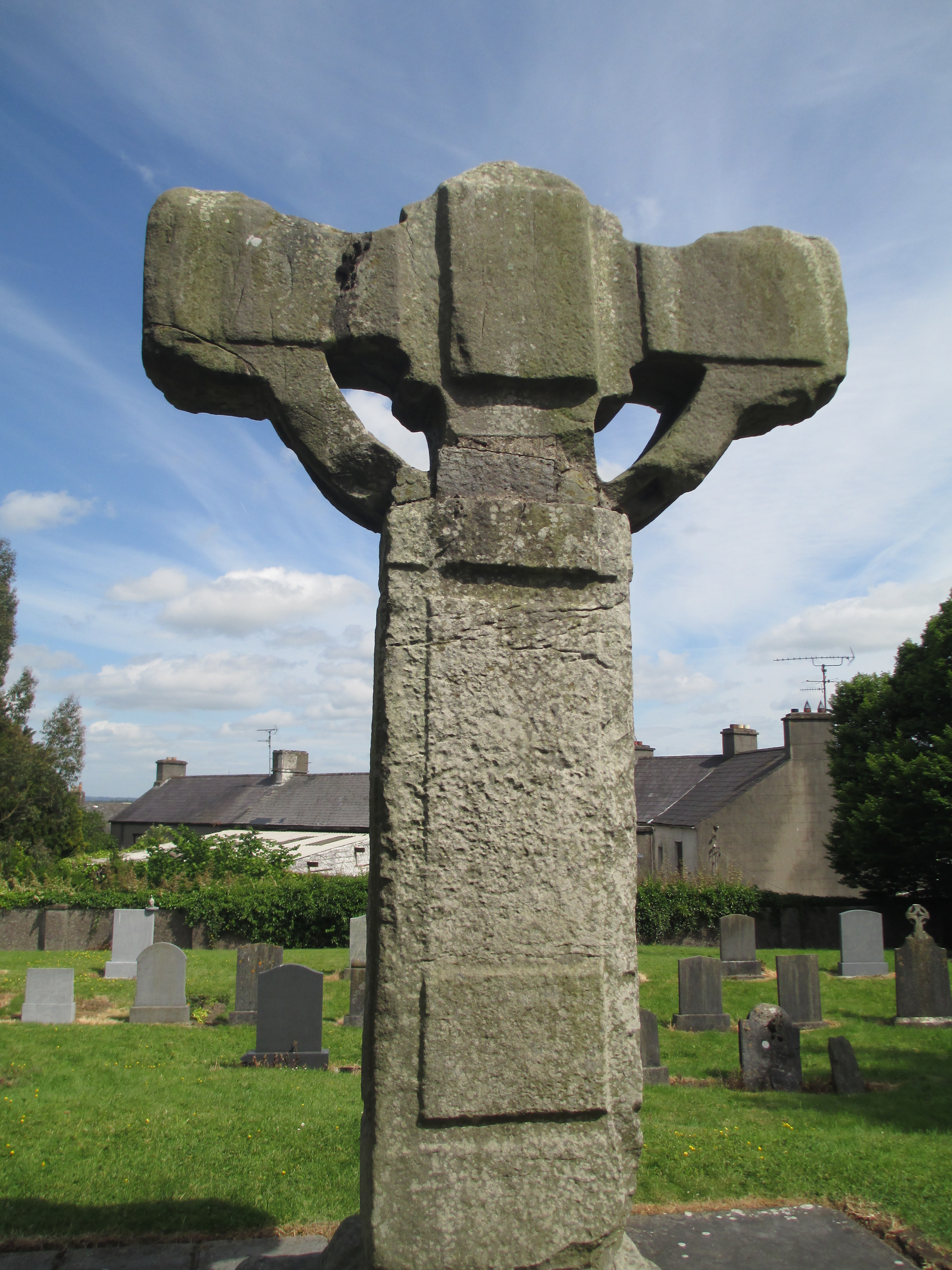
For a town with a population of not much over 6000 Kells has made an inordinately strong mark on Irish History.

It is best known as the original home of what is , arguably,  the most famous illuminated manuscript in the world.

But while the Book of Kells is truly incredible, and I’ll talk more about it later, Kells itself (especially the abbey) has its own fascinating history. I am also slightly biased as some of my family comes from Kells and the surrounding area. A plaque to one of my ancestors can still be seen in the church at the abbey.

This post isn’t going to cover the entire history of Kells, there’s simply too much of it. It will, however, look at the early history of the town, the Book of Kells, and some of the key buildings in town.

So to begin at the beginning.

There were possibly people in the area before, but the history of Kells as a settlement dates back to the 6th century, when it was a fortification of the High King Diarmait mac Cerbaill.  The site was gifted to Saint Colmcille who founded the abbey which remains today, though none of the exisiting building are contemporary.

IMG_4249IMG_2318 copy

The second image is an etching from the late 1700s.

Saint Colmcille (known in latin as Columba) was born to the ruling family of present day Donegal. Still standing in Kells today is Colmcille’s cell which dates around the 10th century. It is too late to actually have been used by Colmcille and was in fact probably an oratory that may have housed his relics, with some sleeping accommodation for some monks. IMG_4260

In roughly 561 Colmcille travelled to Scotland as a ‘pilgrim for Christ’ and to convert the Picts. In 563 he settled on Iona and founded the abbey there. It went on to be one of the most influential in the area inspiring the foundation of other houses, including Lindisfarne. In the 9th century Iona was subject to fearsome Viking raids and they relocated most of the community to Kells in 804. It is agreed by most scholars that the Book of Kells originated in around 800 making it possible that it was originally made in either Kells or Iona. It was definitely at Kells by 1007 when the Annals of Ulster record it as being stolen from the stone church in Kells.

This is not the church we see today. From 808 to 814 a new church was built, though it was rebuilt after the Viking raid of 920 and most likely again after other raids over the years. By 1655 it was well and truly in ruins and it was used as a horse barracks by Cromwell. The current church dates to 1788.

IMG_4225IMG_3746IMG_4246

IMG_4252

It is in St Columba’s Church that you can also see the plaque dedicated to my ancestor.

IMG_3743

However there are parts of the site that do date to earlier. Firstly the round tower. Round towers are honestly one of my favourite structures ever and I’ve visited quite a number. You can find out more about their history in this previous post.

IMG_4218IMG_4222img_4220.jpg

The Kells round tower dates to the 10th century and it is 90 feet tall without its roof, which would have been conical. Is has six floors and would probably have been accessed by ladders. There is still a lot of debate as to the purpose of round towers. It is possible that they were simply bell towers, part of the system of the call to prayer with the height made necessary by the size of the ecclesiastical sites. They may have also been symbols reaching towards the glory of God and illustrating the importance of the ecclesiastical site, conveying messages of spiritual and temporal power. There is also an argument, though currently thought of as a little less likely, that they were watch towers and were part of defence systems. They may have been built partly as a response to Viking and other attacks. The monks would have been able to climb in, store their treasures, burn the stairs to the door, keep the raiders out and possibly ring bells from the top of the tower to call for assistance. Essentially no one is absolutely certain as to their purpose. It is also plausible that there were multiple purposes, combinations of the possibilities listed above.

Kells Abbey also boasts three partly complete high crosses. There are between 60 and 70 high crosses remaining in Ireland (in varying states of repair), they are usually richly decorated often with biblical scenes and probably served as sermons in stone, telling the stories of the bible to the mostly illiterate population.

IMG_4242IMG_4243

The 9th century south cross depicts: the crucifixion, the miracle of the loaves and fishes, the sacrifice of Isaac, Daniel in the lions den, the fall of man, the death of Able, Saints Paul and Anthony and the Evangelists.

IMG_4247

IMG_4248

The 10th century west cross depicts: the entry into Jerusalem, the presentation in the temples, the miracle at Canna, the baptism of  Christ, Noah’s Arc and the fall of Able. There would have been more on the arms of the cross.

IMG_4253IMG_4254
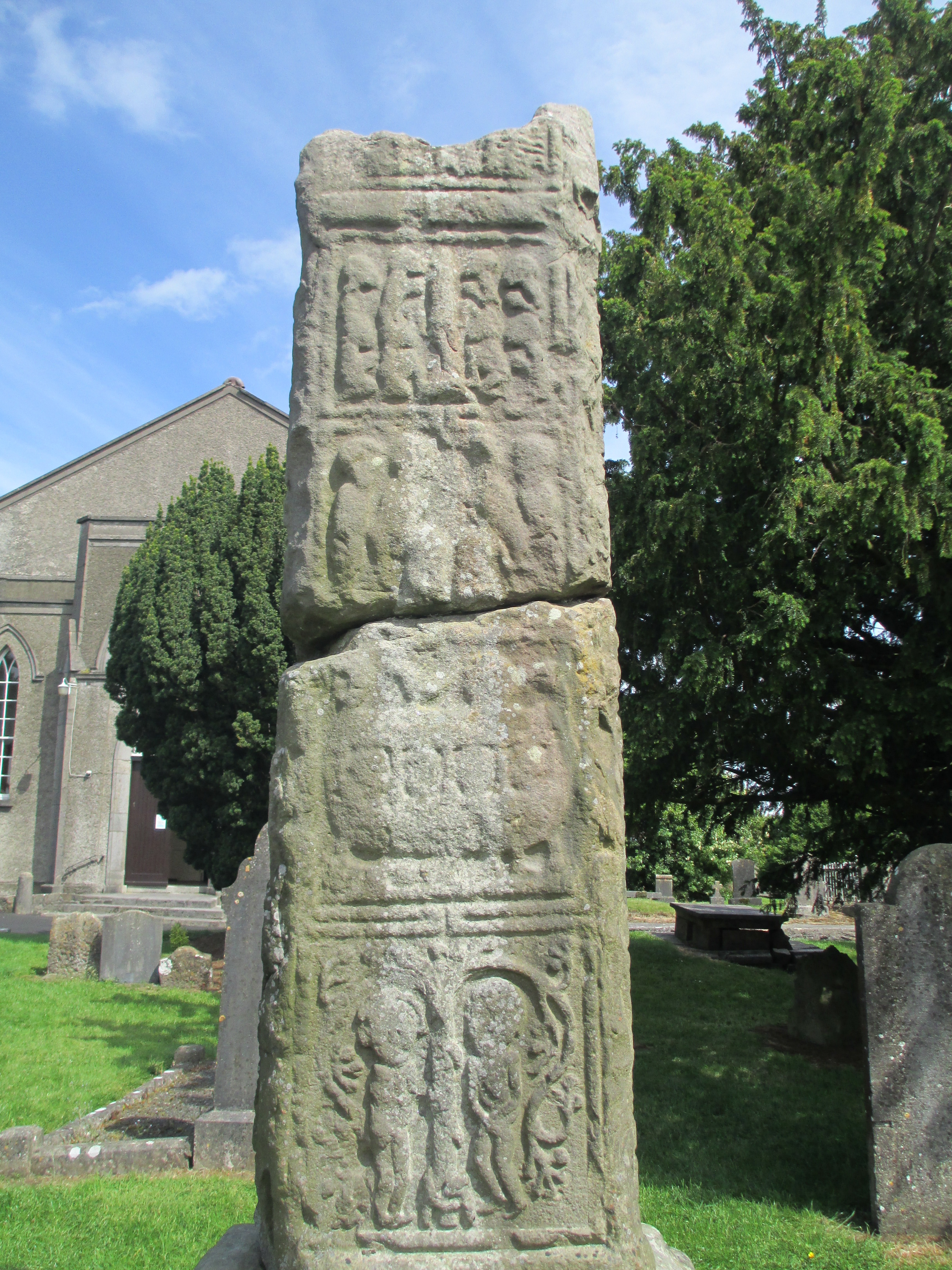
The 12th century east cross shows the crucifixion

There is also a north cross, of which only the stub remains and I don’t have a photo. In the town of Kells itself is the market cross, which unfortunately I didn’t see on my visit, so I don’t have a photo of it either.

The high crosses in the church yard were constructed in a time of great prosperity for the abbey and the town. By the tenth century it was the most important Columban abbey in Ireland. The downside was that as it was wealthy Kells became one of the most attacked towns in Ireland. In 951 a Viking raid was said to have carried off 3000 people and goods. By the 12th century Kells had been burned twenty one times and plundered seven times. These were not all Viking raids, several Irish kingdoms were also responsible. It was also not all raids. In 1152 the Synod of Kells was held and many laws were codified. It was in this period that the other treasure of Kells (apart from the Book of Kells) was probably made. the Crozier of Kells dates to the 9th 11th and 12th centuries and is housed in the British Museum.

By the time the Normans arrived in 1172 Kells (along with the rest of Meath) passed into the hands of Hugh de Lacey one of  Henry II’s barons and one of the key Normans in Ireland. A castle was constructed in Kells in around 1176, though pretty much nothing remains today. The town’s walls were constructed by de Lacey in the early 1170s. The Normans also founded the abbey of St Mary and the priory of St John again pretty much nothing remains of the buildings.

Over the following centuries Kells suffered and profited with the fortunes of both England and Ireland. It was burned a number of times and rebuilt, it was caught in raids and rebuilt. Today it is a small Irish town steeped in history and its greatest legacy and claim to fame is the Book of Kells.

I’ll be using two of my favourite books to discuss the Book of Kells.

Meetings With Remarkable Manuscripts by Christopher De Hamel

IMG_2316

It is a fascinating dialogue with some of history’s most interesting illuminated manuscripts. De Hamel not only tells the stories of the manuscripts, he traces his own journey in accessing the manuscripts. It is a truly remarkable read.

The Book of Kells by Bernard Meehan

IMG_2315

This book is an in depth examination of the Book of Kells and contains truly incredible facsimiles of much of the Book of Kells. The photos you’ll see below are my pictures of images in Meehan’s book, I apologise for the glare in a handful of them.

So, as I explained earlier the first definite mention of the Book of Kells was when it was stolen in 1007. The Annals of Ulster describes it thus:

“The Great Gospel of Colum Cille was sacrilegiously stolen in the night from the Western Sacristy of the church of Cennas. It was the most precious object of the Western Would, on account of its covers with human forms. The Gospel was recovered after two months and twenty nights, its gold [probably a shrine it was housed in] having been taken off it and with a sod over it.”

The Book of Kells remains a ‘treasure of the Western World.’ It is a national monument of Ireland, it’s included on the Memory of World list put together by UNESCO, it’s been on Irish coins, Irish stamps and its designs and scripts are synonymous with Ireland. Today it is housed in Trinity College library in Dublin and attracts 520 000 people to view it each year, of which I was one in 2012. You can see the viewing queue below

IMG_6389
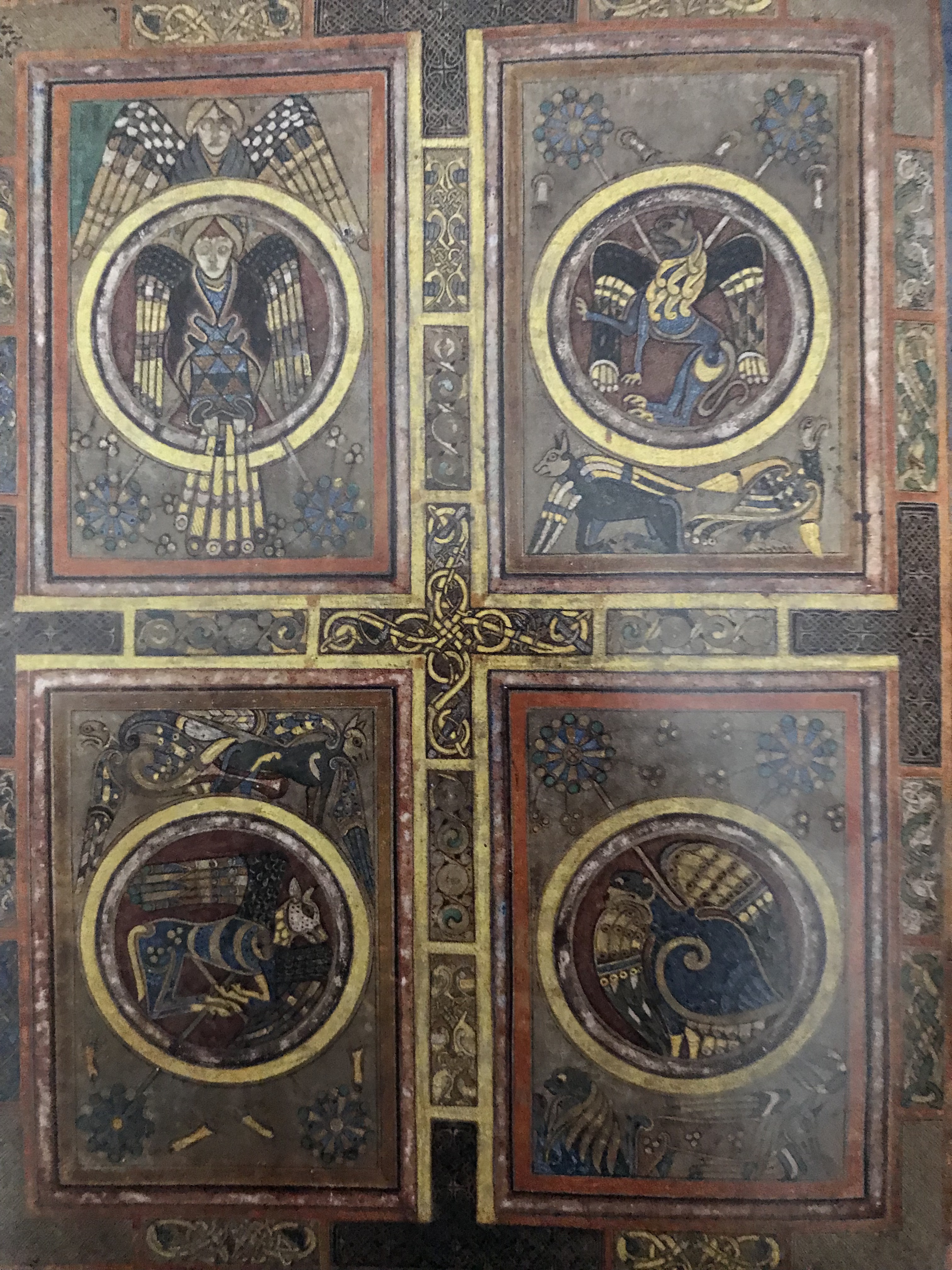
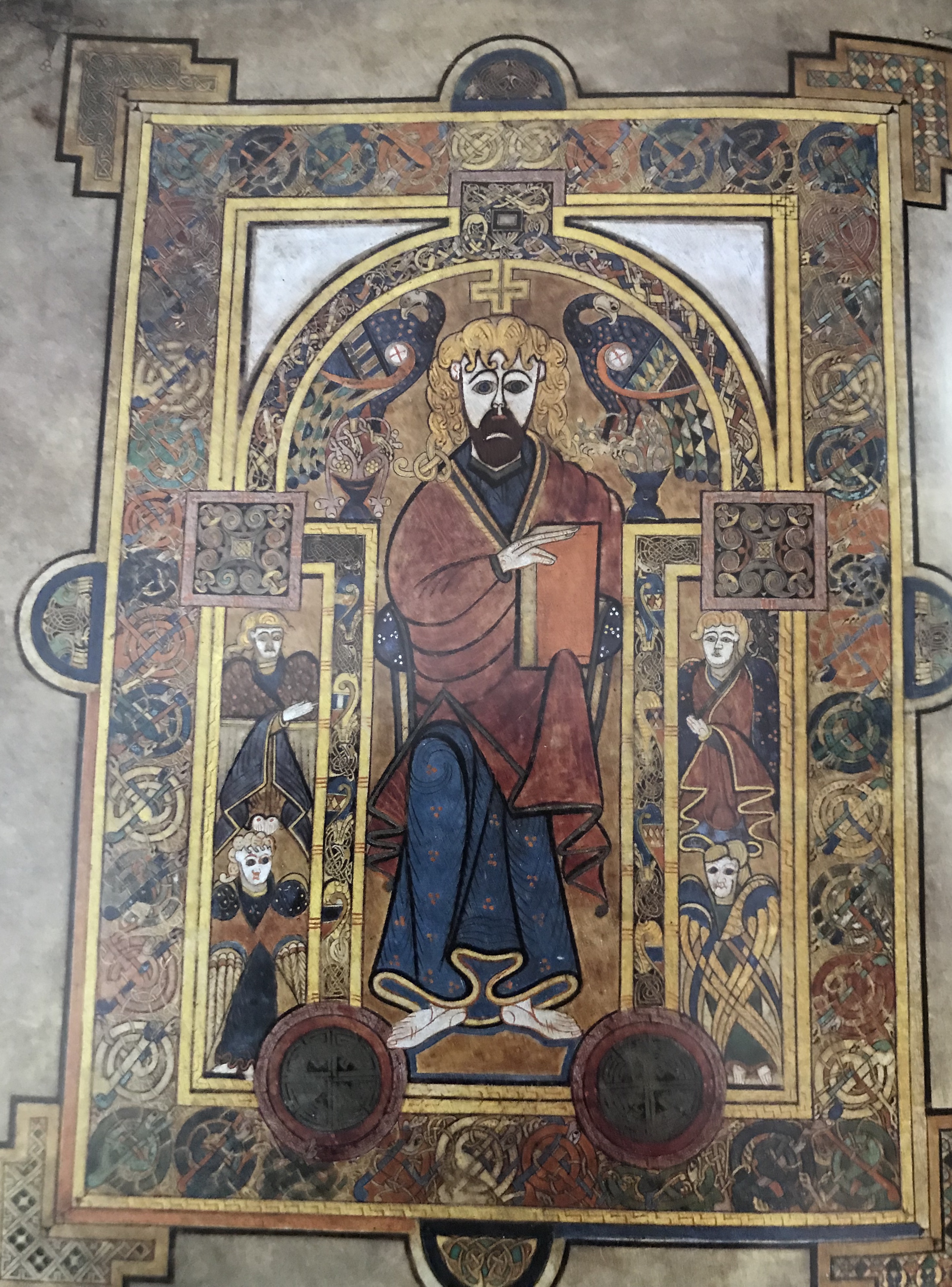
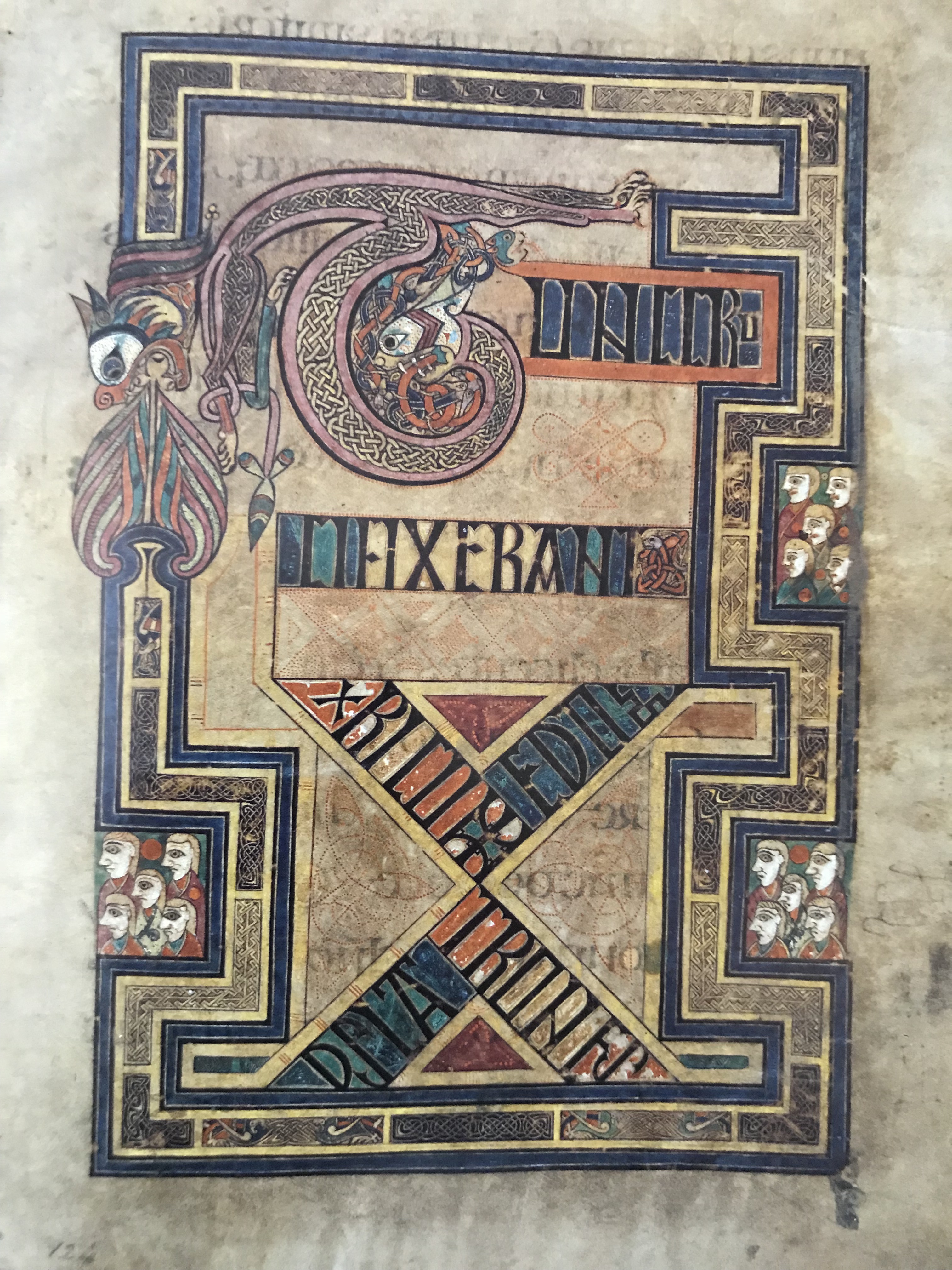
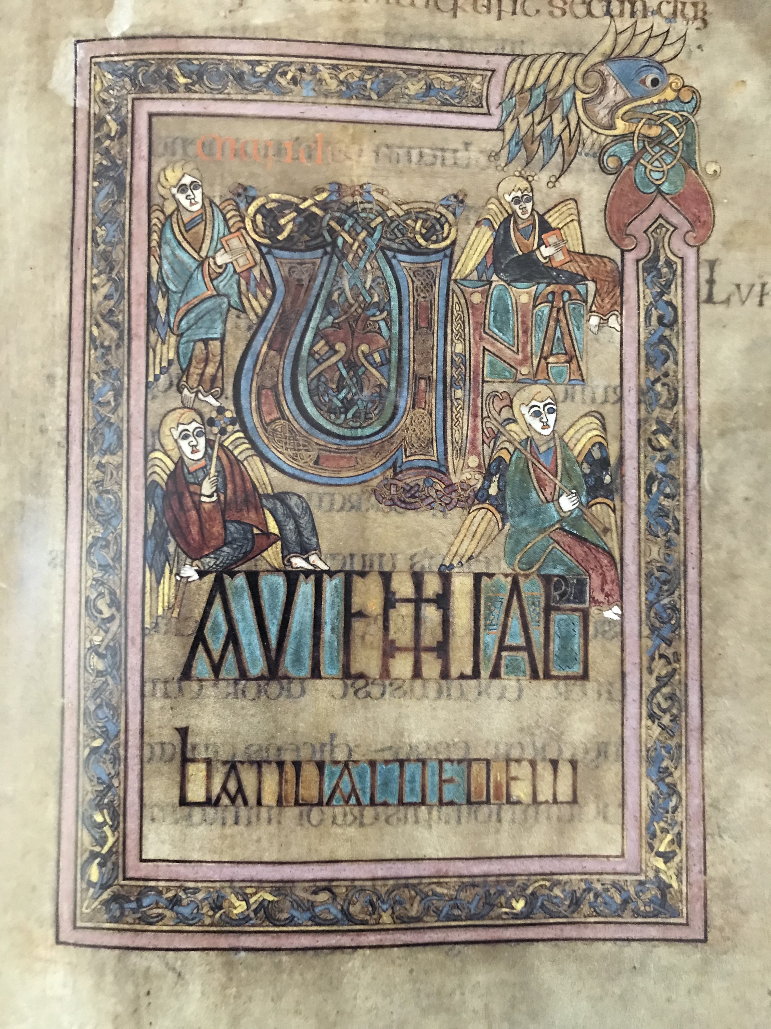
The Book of Kells was absolutely worth the wait, it is truly remarkable.

IMG_2307

But how did it come to end up in Dublin at Trinity College?

The Book remained in Kells until 1641 when Irish rebellion against Protestant settlers caused serious harm to Kells. The church would remain ruined for another forty years. It was decided the Book wasn’t safe there anymore so it was removed in Dublin probably in 1653 by the Governor of Kells Charles Lambert, 1st Earl of Cavan. Henry Jones the Bishop of Meath presented it along with the Book of Durrow to Trinity College. The Book entered popular consciousness in the early 19th century and at this time it was assumed that it dated to the 6th century and had been created by Columba. Queen Victoria was shown it as the book of Columba. In 1874 it was described as the oldest book in the world, which is definitely not true. The Queen’s visit and the Exhibition in Ireland generated even more interest and the Book became cemented in the consciousness of Ireland.

The Book of Kells is a manuscript of the four Gospels:

Matthew

IMG_2322

The opening page of this gospel is portrait of Matthew

Mark

IMG_2323 copy

The opening page of this gospel is the four symbols of the Evangelists.

Luke

IMG_2310

The opening of this Gopspel is the word QOU N IAM

John

IMG_2312 copy

The opening of this Gospel is a portrait of John.

The evangelists aren’t the only portraits in the Book of Kells. Other key biblical figures feature as well. Such as:

Jesus

IMG_2313 copy

and Mary

IMG_2314 copy

Along with others. It is reasonable to assume that originally portraits of Mark and Luke were probably also intended. They may have been lost over the years. The Book of Kells has been rebound at least five times. One of the most disastrous was the rebinding in 1826 by George Mullen. He trimmed the pages so he could gild them (losing decoration in the process), he painted some of the margins with purple wash and filled in all the natural holes in the vellum with new vellum.

The current binding was undertaken in 1953 by Roger Powel, many of Mullen’s additions were removed and Book of Kells was split into four volumes, one for each Gospel. The Book of Kells has had a hard life and it is remarkable that any of it has survived.

It is a symbol of a time of learning and culture. The detail is extraordinary as is the depth of colour, even in the pages that are predominately writing.

IMG_2308

The work is very Celtic, very much of its time. We have no hope of understanding what all the symbols and imagery would have meant to the people of the time. We can, though, appreciate it for its beauty and have the enjoyment of trying to understand the people who could have made something this exquisite.

IMG_2309


IMG_2311

The Book of Kells will always be inextricably be linked with the town of Kells, as it should be. But as I hope I’ve shown, the Book is not the only worthwhile part of the history of Kells. This small Irish town has been at the heart of Irish history for centuries, it is well worthwhile being celebrated in its own right.

References:

Iona Past and Present with Maps by Ritchie 1934

Meetings With Remarkable Manuscripts by Christopher De Hamel 2016

ISBN: 9780241003046

The Book of Kells by Bernard Meehan 2012

ISBN: 9780500238943

The Antiquities of Ireland Volumes I and II facsimile copy 1982

ISBN: 0946198020

The Story of Kells by  Leo Judge

ISBN: 18724901070

http://www.heritagetowns.com/kells.shtml

The photos are all mine apart from the photo of the plaque and one photo of the church which are by Penny Woodward (used with permission)


St Michael’s Mount

St Michael’s Mount in Cornwall.

IMG_4617
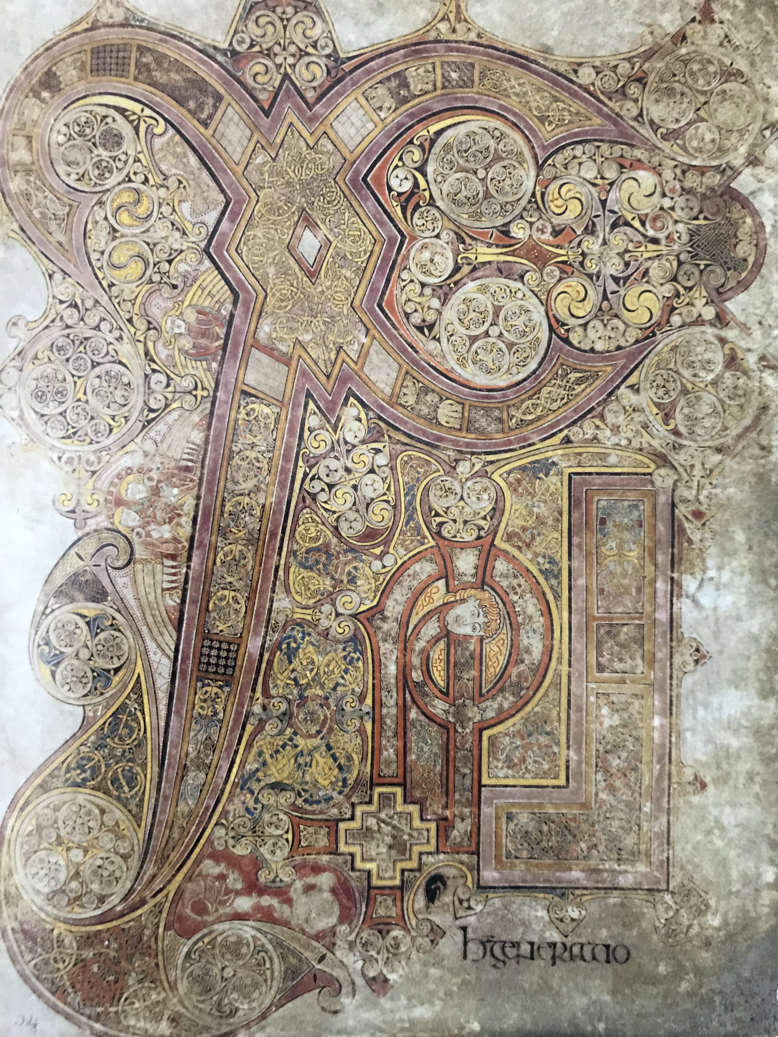
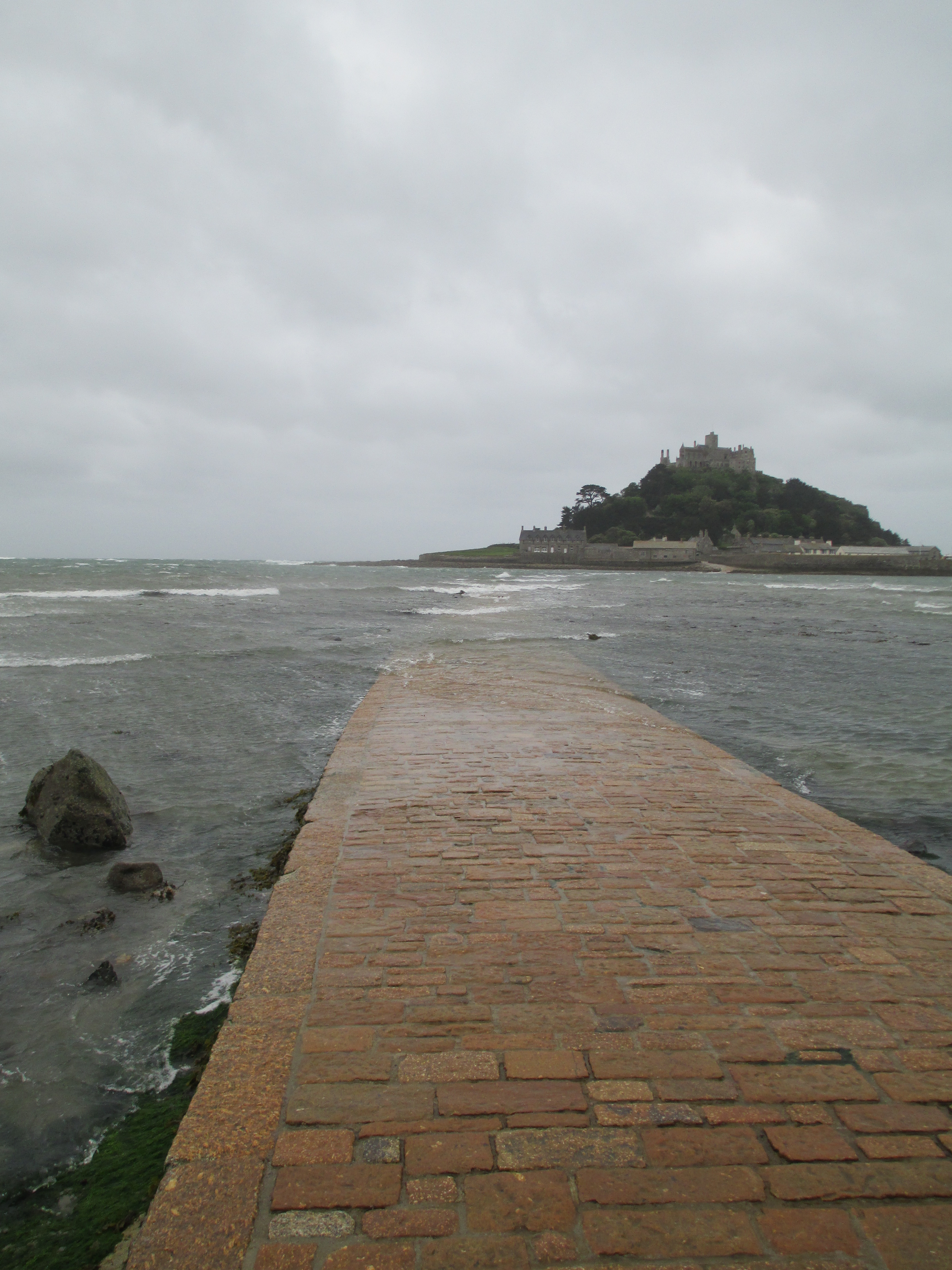
St Michael’s Mount stands off the coast of Marazion in Cornwall.

IMG_4615

It can only be reached by boat or by a tidal causeway.

IMG_4618IMG_4624

The origins of the castle  are medieval, it began life as a 12th century monastery. The castle you can see today is formed from this original monastery, but the majority dates to much later. It is run and part owned by the National Trust but still part owned by the St Aubyn family who do still live in areas of the castle.

The origins of the rock itself are even older. The rock of the Mount is one of a number of granite outcrops along the Cornish coast. These are the remains of a granite intrusion that rose up some 300 million years ago and has worn down over millennia to the outcrops you see today. Others in Cornwall include St Agnes Beacon and the Godolphin Hills.

Geology aside, legend has it that the Mount was the work of giants. There are several versions of the tale, but one is that it was built by the giant Cormoran and his wife Cormelian. This particular legend adds that chapel rock, which lies between Marzion and the Mount, fell from Cormelian’s apron as she carried it to the Mount. You can see the rock below.

IMG_4609

Other stories tell of the Mount being used in the giants’ sports as a sort of platform where targets were laid to be hit by rocks thrown from Trencrom Hill. Looking at the Mount protruding so dramatically, it is very easy to see why it attracted stories of giants.

IMG_4606The Mount was probably used by the local Celts and has been caught up in Arthurian legends and the Tristan and Isolde myth in particular. It has also been tradition that it was a central point for shipping tin to the continent, but sadly this hasn’t been born out by archaeology.

The origins of the current castle on the Mount are medieval. There was probably secular occupation of the Mount before the 11th century, but in the late 11th century the Mount was granted (possibly by Edward the Confessor) to the monastery of Mont Saint Michel in Normandy. The matching  names of the two rocks is not a coincidence (but very confusing), their geographical and geological similarity wasn’t lost on the medieval monks.

Between 1135 and 1144 a church was built on the Mount by Abbot Bernard. It is this monastery which is the core of the existing building. The monastery was fortified in 1193 when it was seized by Henry de la Pomeray who disguised his men as pilgrims. Pilgrims were common on the Mount and the path you follow today runs along the main pilgrim route to the castle.

IMG_4629

The Mount was re-garrisoned a number of times through various English-French wars and the War of the Roses. The monastery was a casualty of the Dissolution of the Monasteries and came into Crown hands. In 1599 Elizabeth I sold it to Robert Cecil. In 1640 the Mount was sold to Sir Frances Basset and he fortified it for the Crown in the Civil War, the garrison surrendered in 1646 to Parliament and Captain John St Aubyn was put in charge. He bought the Mount from Basset’s son in 1659. It has been in the St Aubyn family ever since. The Mount has seen a number of battles including driving off a Napoleonic ship and being the site of  one of the beacons lit to alert London to the arrival of the Spanish Armada.

It was fortified again in World War II against German invasion and Ribbentrop had apparently chosen it as his residence if Germany won the war. In 1954 the National Trust was given part of the Mount and part remains in the ownership of the St Aubyns.

As you can see the Mount has had a long and varied history and any visit to it highlights its complex path. When I was lucky enough to go there in 2012 it was such a wet and miserable day that I certainly got a real feeling of how desolate the Mount can be.

IMG_4634

Getting to the Mount is very much tide dependant. Even in the horrific weather, which certainly added to to the drama of my visit, a large number of people were waiting impatiently for the tide to die down enough to cross to the Mount and climb up to the castle.

IMG_4621

The castle is very much not alone on the Mount. There is also an active harbour and town. IMG_4627IMG_4626
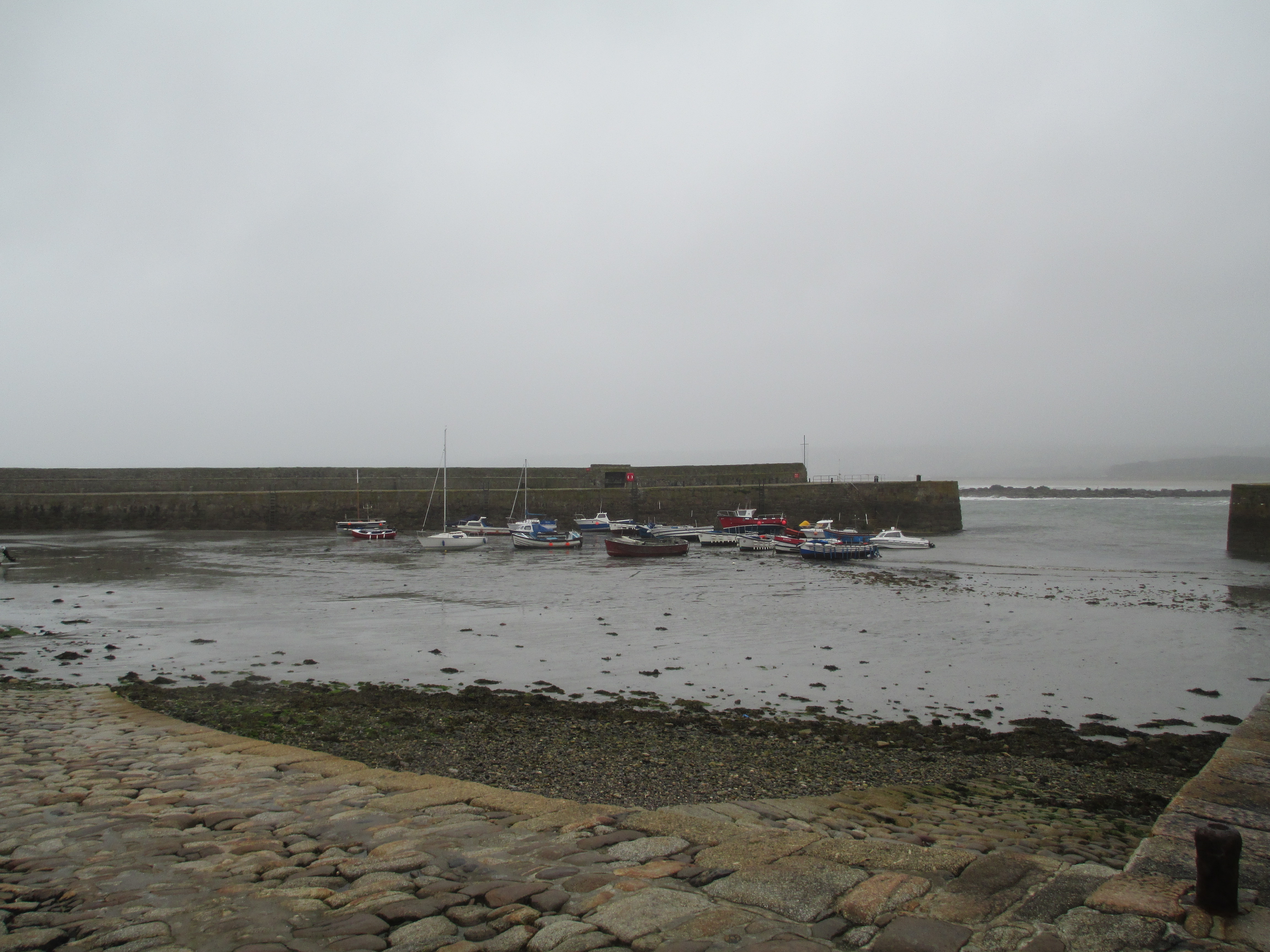
There has been some sort of settlement on the rock for centuries and today 30 people live and work on the Mount.

The buildings that stand at the top of the Mount are collectively known as the castle, but also contain a church and a 19th century mansion. They are all built on the foundations, physical and metaphorical, of the original priory. There is also a Victorian garden clinging precariously to the edge of the Mount. I don’t have any photos of it specifically, it was too wet to get close enough, but you can see the very attractive wilderness in the photo below.

IMG_4630

When you reached the castle itself, its immensity is actually quite surprising.

IMG_4632
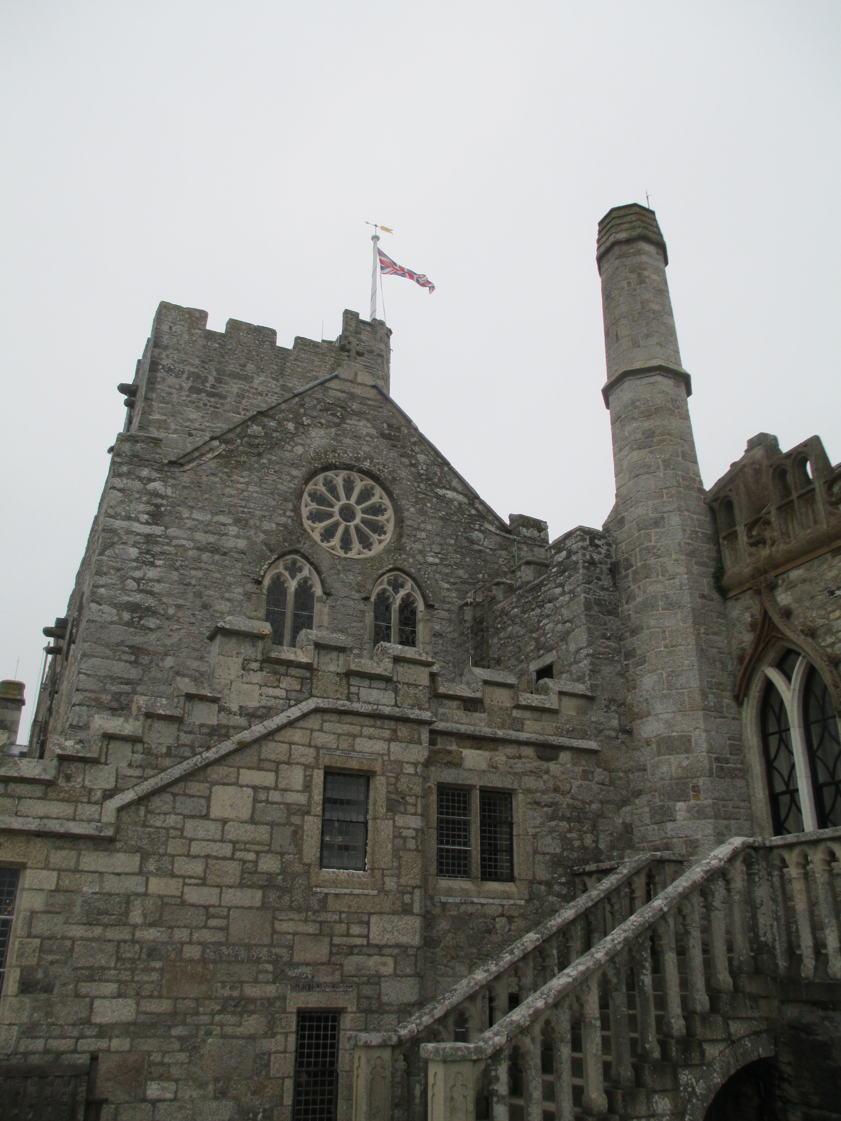
I’m not going to cover every room in the castle, but just highlight some of my favourites.

The Library:

It was part of the monastic buildings, but from the late 18th century was used by the family for relaxing. What really strikes you as you walk in is how intimate and cosy the room is, especially when you consider the gale which was howling outside.

IMG_4636

The Chevy Chase Room:

This area was originally the priory’s refectory, but it became the great hall of the castle. The plaster frieze around the walls is of the medieval hunting ballad the Chevy Chase. The frieze was created some time between the late sixteenth and mid seventeenth century. It has been meticulously restored.

IMG_4638IMG_4643IMG_4645
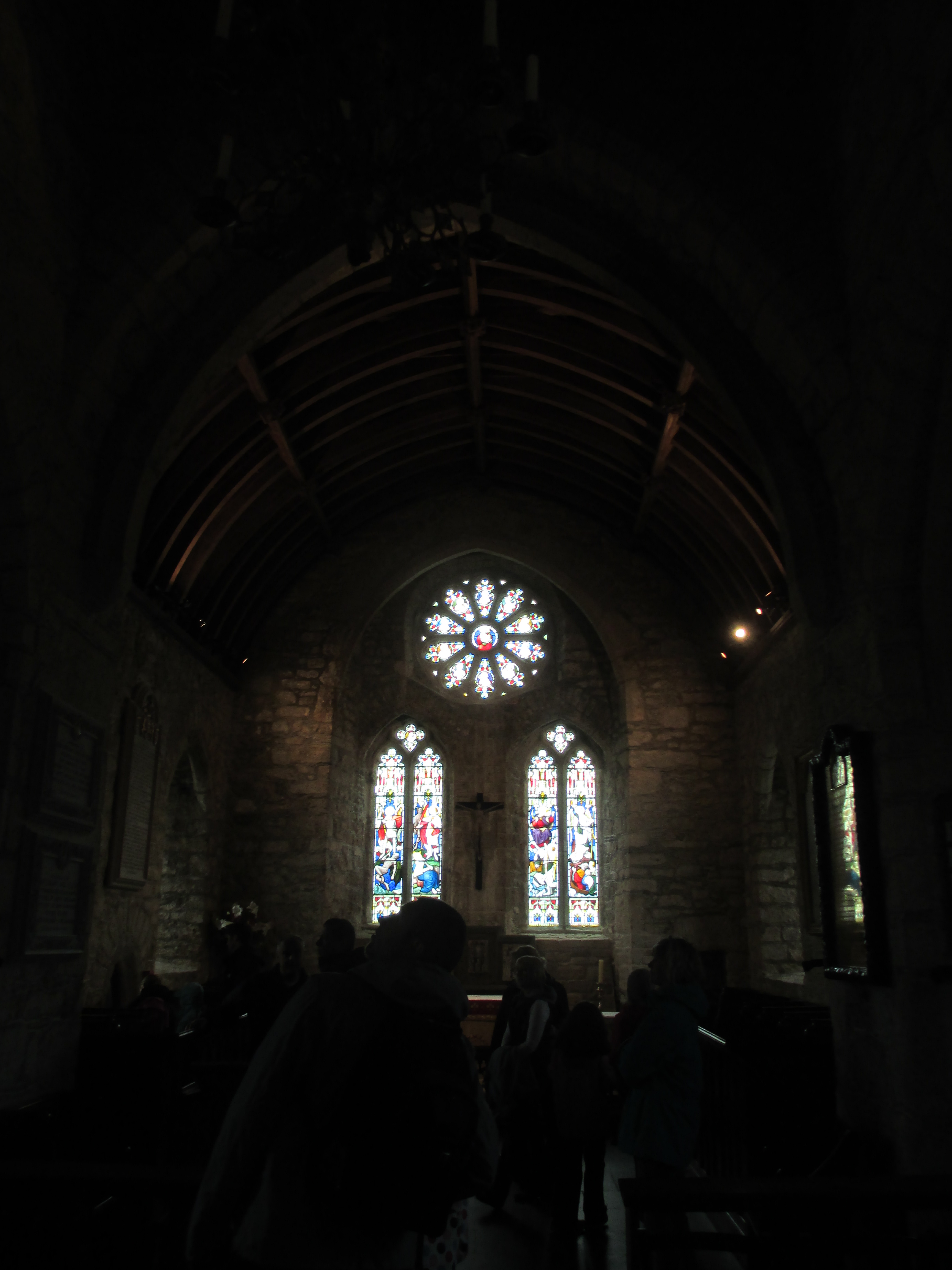
The other highlight of the Chevy Chase Room is the stain glass windows which were gathered from chapels and priories from all over Europe. IMG_4642

The Priory Church

It stands on the summit of the Mount and dates back to the original 12th century monastery, though the current building is very much an amalgam of the decades.

IMG_4650IMG_4656IMG_4657Protected inside the church is a truly beautiful 15th century lantern cross. It is carved from one piece of stone, which probably came from Padstow. The pinnacles are part of the nineteenth century restoration. It has four panels which depict: the Virgin and Child, a king who may be Edward the Confessor, the crucifixion and an ecclesiast who is probably one of the priors of the Mount.

IMG_4662
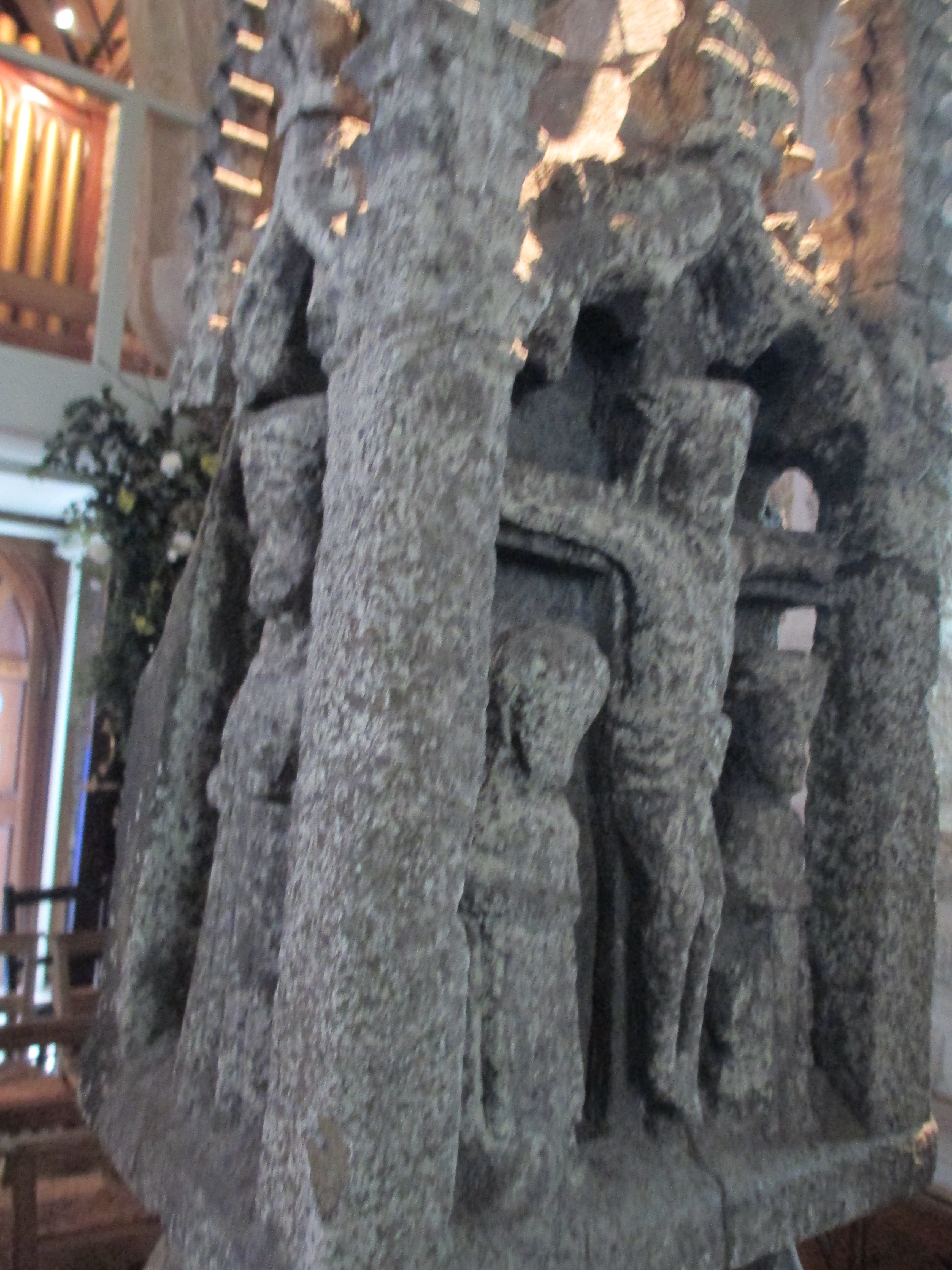
The Blue Drawing Room

In complete contrast to the grand hall, library and the church is the Blue Room which is very late 18th-early 19th century

IMG_4665The room would have originally have been the Lady Chapel of the priory, which by the late 18th century had fallen into disrepair and was rebuilt as the drawing room you see today.

There are other intriguing parts of the castle, but what you are left with most after your visit is an impression of time, and in my case the power of the weather. The Mount reflects many eras and it remains in many ways a family home. It is a place steeped in legend as well as history and deservedly holds its place as one of the jewels of Cornwall.

IMG_4622


References:

Site visit 2012

Castles and Ancient Monuments of England by Damien Noonan. ISBN: 9781854106216

Cornwall: A History by Philip Payton. ISBN: 9781904880059

https://www.stmichaelsmount.co.uk/

https://www.nationaltrust.org.uk/st-michaels-mount

https://historicengland.org.uk/listing/the-list/list-entry/1000654

http://www.cornwall-online.co.uk/heritage-trail/heritage-national-trust/stmichaelsmount/Welcome.asp

The photos are all mine: the rain drops on the lens in some of them were a bit unavoidable.

Advent Calendar of Medieval Religious Institutions: December 25th: Abbaye-aux-Hommes, Caen

This is the final post in my advent calendar. Thank you to everyone who has read them along the way, commented, shared and most importantly enjoyed them. Have a great Christmas and holiday season

Ellen

Du Hommes1Hommes3

hommes2

IMG_7063

The Abbaye-aux-Hommes was founded by William the Conqueror. It was a Benedictine abbey and dedicated to Saint Steven. The church of Saint-Etienne was consecrated in 1077. The majority dates to the 11th century but the choir was redesigned in the 13th century to reflect the then contemporary gothic style. The majority of the church is built in the romanesque style. The monastic buildings were erected in the 11th century but they were destroyed in the first war of religion  (1562-63) the first of the wars fought between the Roman Catholics and the Huguenots. They were rebuilt in the 18th century.

The church is also the burial place of William the Conqueror. His marble tomb can be seen in the photo above.

William married Matilda of Flanders in 1053 despite the fact that the Pope had banned the marriage due to consanguinity, they were distant cousins. They fought the Papal ban for nearly a decade and when it was finally lifted both of them built abbeys in Caen as a sign of gratitude. Matilda’s abbey was the Abbaye-aux-Dames which was the subject of yesterday’s post. Matilda is also buried in the abbey she founded.

The French Revolution forced the closure of the monastery and the monks were removed. In 1802 the abbey church becme the parish church and in 1804 the monastic buildings became a boy’s school.

In WWII in 1944 the high school provided refuge for the residents of Caen during bombing and survived intact. The monastic buildings are now home to the local council.

References:

Site visit 2015

Abbaye-aux-Hommes information booklet.

http://www.caen-tourisme.fr/en/discover-caen/william-the-conqueror/abbaye-aux-hommes

https://thefreelancehistorywriter.com/2012/05/10/matilda-of-flanders-queen-of-england-and-duchess-of-normandy/

The photos are all mine.


Advent Calendar of Medieval Religious Institutions: December 24th: Abbaye aux Dames Caen

dames1

Dames2dames3

IMG_7109
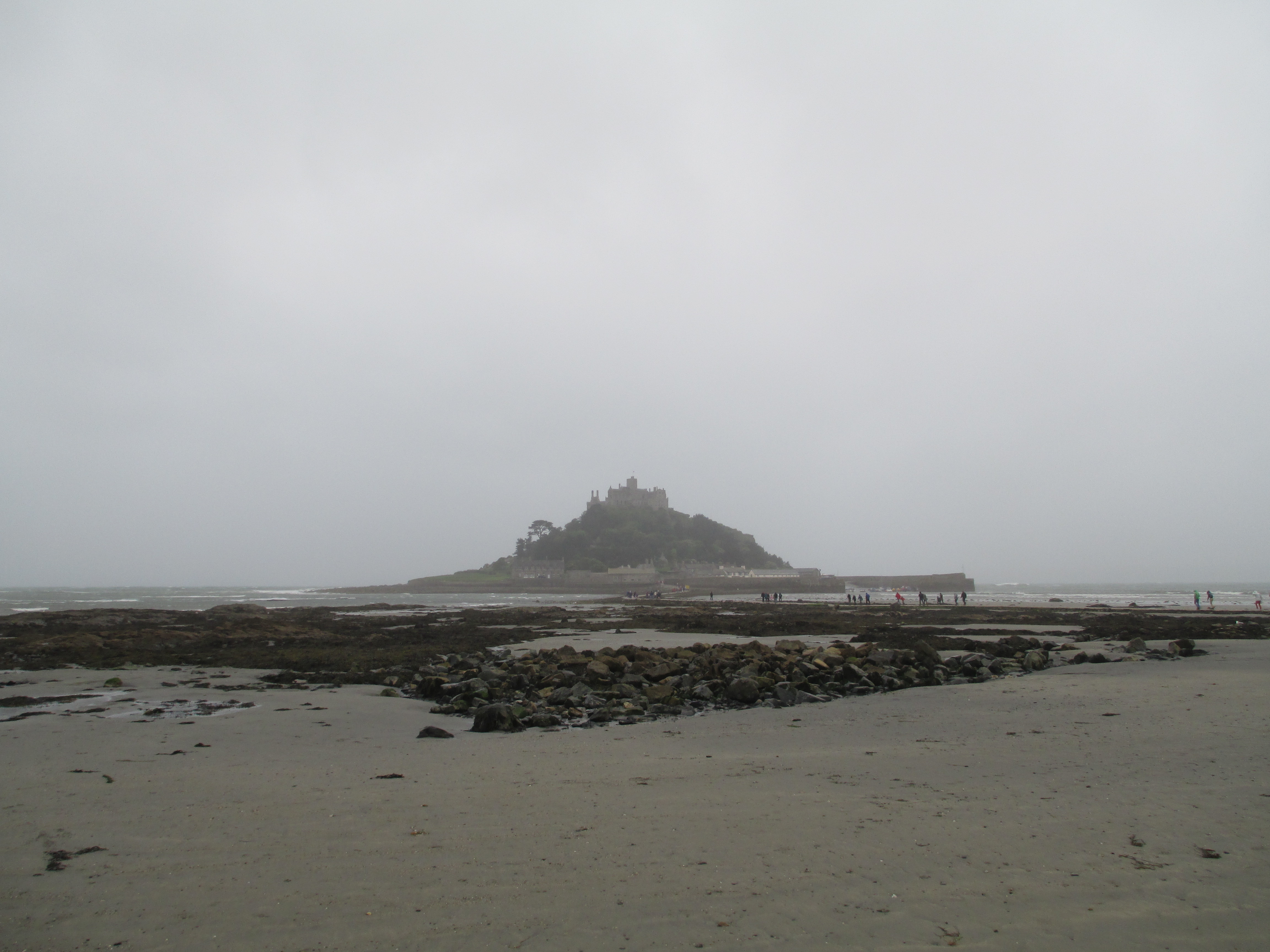
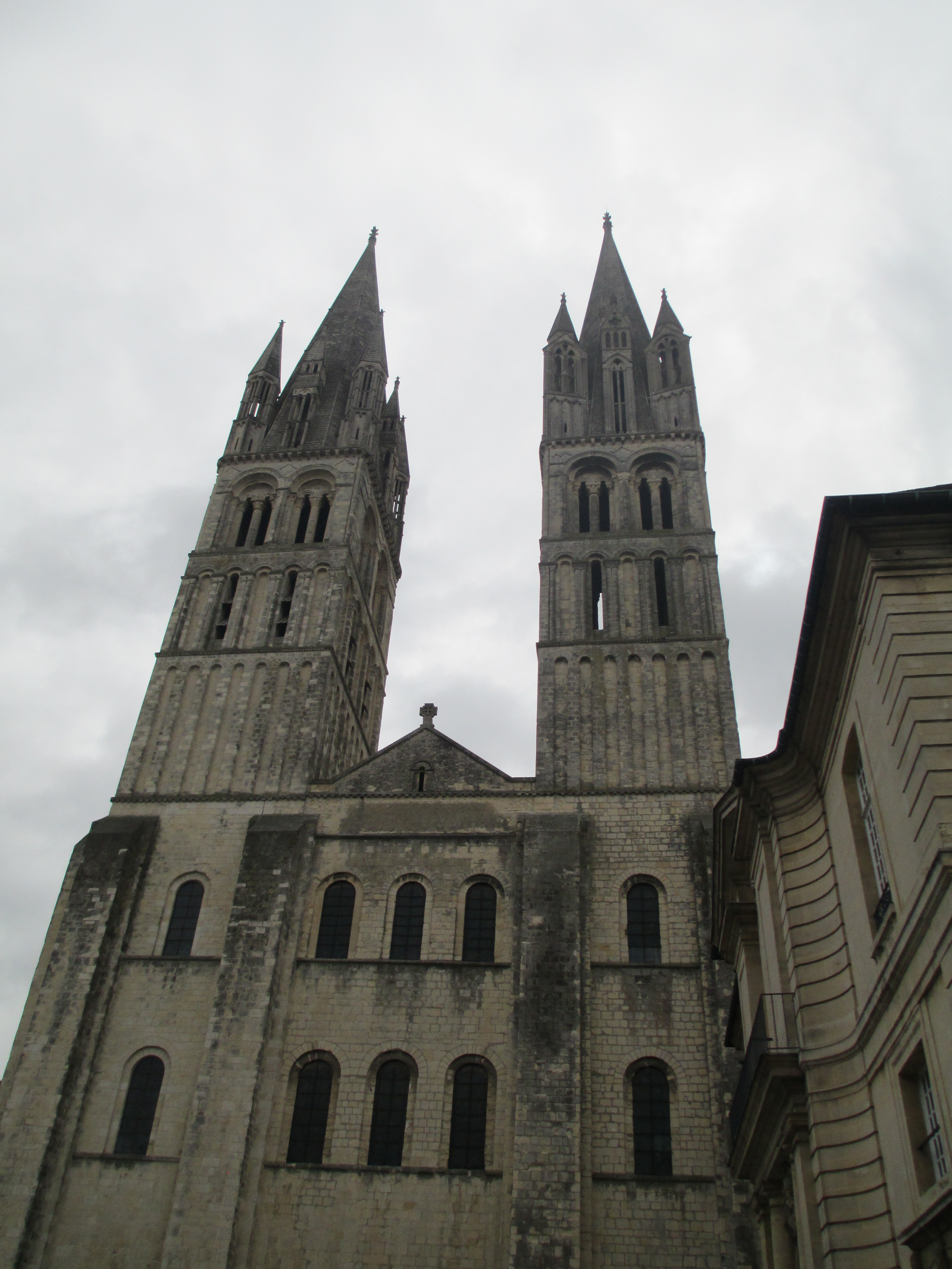
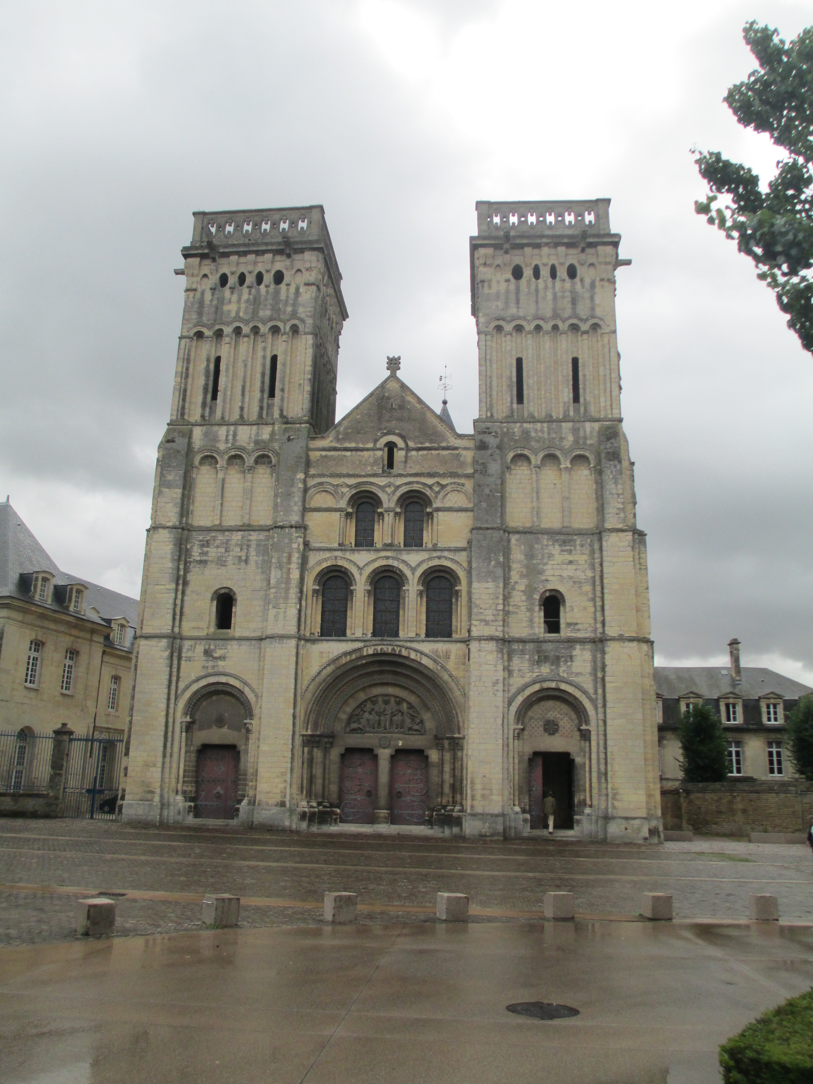
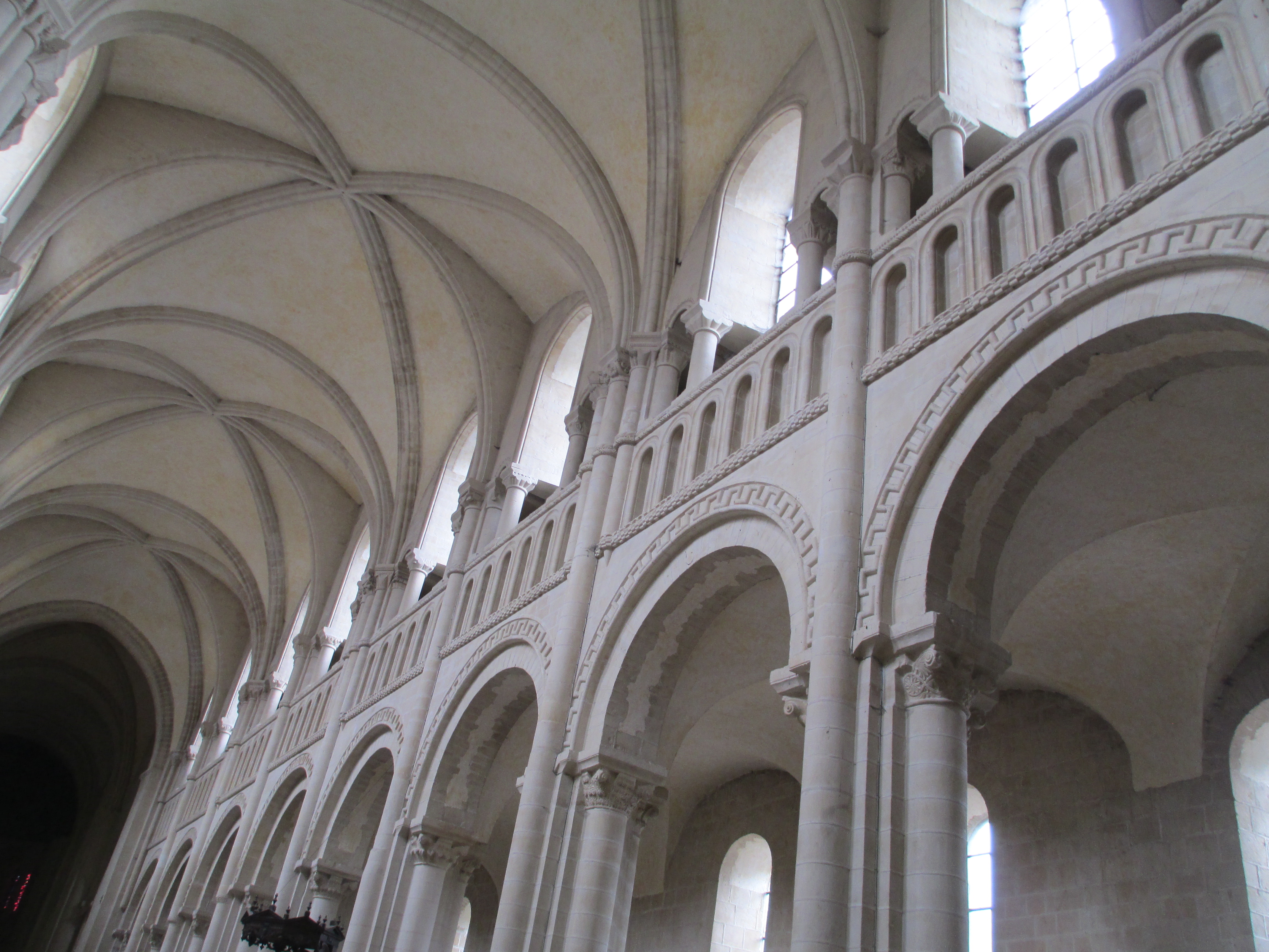
The abbaye was founded roughly in 1060 by Matilda of Flanders the wife of William the Conqueror. It was consecrated in 1066 and was dedicated to the Holy Trinity. When Matilda died in 1083 she was buried in the abbaye and her tomb of black marble can still be seen today.

Matilda married William of Normandy in 1053 despite the fact that the Pope had banned the marriage due to consanguinity, they were distant cousins. They fought the Papal ban for nearly a decade and when it was finally lifted both of them built abbeys in Caen as a sign of gratitude. William’s abbey was the Abbaye-aux-Hommes which will be the subject of tomorrow’s post. William is also buried in the abbey he founded.

In the late 11th century William II of England granted the abbaye the Priory of Horestead in England, they held it until 1414 when the alien properties in England were dissolved.

Until the French Revolution the abbaye sheltered young girls of the Norman aristocracy. In return the families gave a dowry to the abbaey.

The church exemplifies the most spectacular forms of Norman romanesque architecture. The extension to the chancel was added in the beginning of the 12th century.  and the crypt was probably an 11th century addition.

The Abbaye  buildings deteriorated significantly over the centuries many of the convent buildings were reconstructed at the beginning of the 18th century at the order the Abbess Madame de Froulay de Tesse. The work was done by Benedictine Architect Dom Guillaume de Tremblaye, it took nearly a century and is still incomplete in places.

The arrival of the French Revolution brought about the end of the abbaye. The convent was closed and the property sold off. The church was used as a forage warehouse and the convent became the barracks, this is the reason for the lack of wood and decoration.

In 1823 the buildings became the Hotel Dieu and from 1908 they were a hospice. The last of the St Louis hospice nuns left in 1984 and the buildings became the headquarters of the Regional council. The buildings were then restored again and cleaned extensively in the 1990s.

The church itself remains active today.

References:

Site visit 2015

The Abbaye Aux-Dames booklet

http://www.sacred-destinations.com/france/caen-abbaye-aux-dames

http://www.british-history.ac.uk/vch/norf/vol2/p463

https://thefreelancehistorywriter.com/2012/05/10/matilda-of-flanders-queen-of-england-and-duchess-of-normandy/

Advent Calendar of Medieval Religious Institutions: December 22nd: Skellig Michael

IMG_2546IMG_2543

img_2532img_25291IMG_2596IMG_2557

There is debate over when the Skellig monastery was first founded, but it was part of the early Christian monks’ attempts to find sanctuary, refuge, seclusion and closeness with God in distant and remote places. As a rock in the Atlantic 11.6 km off the coast of the Iveragh Peninsula in County Kerry, Skellig is about as remote as it gets.

The monastery was probably founded in around the sixth century, no one is entirely sure and I have been unable to find any real agreement on this date. It consists of a collection of drystone beehive huts that are as weathertight today as they would have been when they were built. The integrity of the construction is truly remarkable.

They would have been inhabited by a community of 12 monks and an Abbot. The conditions would have been harsh to say the least. We know they had fresh water because a rainwater collection system still exists, and works as well when it’s been cleaned out, but beyond that we don’t know much about their day to day existence. They would have lived and eaten very simply.

If the community of 12 on Skellig Michael was not remote enough then there was also a hermitage built high on another point of the rock, it’s almost a sheer cliff so currently inaccessible. It is possible that this was also a refuge during viking attacks of which there were several.

The first was in c. 795 CE. They were attacked again in 812 CE and again in 823 CE. Some records of this third attack remain beyond the fact that it occurred. It is recorded in the Annals of Ulster and the Annals of Inishfallen that this time the Vikings took Etgal, the Abbott of Skellig Michael, and they starved him to death. There were also further attacks in 833 CE and 839 CE.

Somehow despite all this the Skellig community survived. It isn’t known exactly when monks ceased to live on the rock, but Gerald of Wales reported that they returned to the mainland to become part of the Augustinian priory in Ballinskelligs at the end of the 12th century, however other sources report that there was still repair work going on into the 1300s.

For more information and References see my extended post on Skellig.

https://historicalragbag.com/2015/06/14/skellig-michael/

The photos are all mine