Tae Rak: Budj Bim World heritage landscape

Tae Rak, a wetlands environment which is part of the World Heritage Listed Budj Bim Landscape, is a remarkable place. Not only is it a place of evident beauty, but it a landscape that has been actively cultivated for thousands of years by the Gunditjmara people. The presence not only of eel traps, but the remains of dwellings, makes Tae Rak (and the surrounding Budj Bim landscape) one of the oldest examples of aquaculture in the world. This post is going to look at Tae Rak, the life cycle of the kooyang, or short-finned eel, and the Gunditjmara use of the land. There will as always be photos.

I want to stop here to discuss the privileges I am bringing to writing this post. As with other posts about Australia’s First Nations’ history and the landscapes that reflect it, it is important to understand two things. Firstly that I am not a First Nations Australian. I write these posts with no claim to special knowledge, I am reiterating the information from the guides on the day as well as some external research (see the references listed at the end). Secondly, that I am in the position of having benefited from the invasion and colonisation of Victoria’s First Nations people, both from my heritage and my job. The first of this is especially true when looking at Tae Rak, as it’s less than an hour’s drive from Port Fairy, a town that my ancestors founded on land that was stolen from the  Gunditjmara. My ancestors were not specifically involved in massacres in the area, but that was largely a result of timing, they arrived too late, but they were definitely active recipients of the immediate dispossession of land. I am fifth generation Australian on both sides of my family, most of my ancestors arrived in the 1850s, and thus my ability to sit here comfortably on my laptop and write this post is a privilege inherited from 200 years of dispossession. I also work for a library, which are inherently colonial organisations, that privilege a western system of knowledge keeping and knowledge management. While we are doing what we can to rebalance those scales, it is a not a simple process.

So having said all that, why am I writing this post at all? The answer is because the history is fascinating and deserves to be more widely known, and if I can contribute to that even a little then that is worth it. Also the landscape is so lovely, and the stories so interesting that I wanted to have a chance to tell them.

The final disclaimer is that there is a lot that is not known. This is common across First Nations groups across Australia, due to colonisation, invasion and quite intentional destruction of knowledge. In Victoria is is especially true as First Nations people were forced off country into missions in the 1860s, and language and culture were actively banned.

So what is Tae Rak? It is the wetlands system known as Lake Condah to the Europeans. It is part of the broader Budj Bim Landscape in Western Victoria, which includes the (probably) extinct volcano Budj Bim. The landscape was cultivated and shaped by First Nations peoples for thousands of years before the invasion by Europeans. In recognition of this, it was World Heritage listed in 2019.

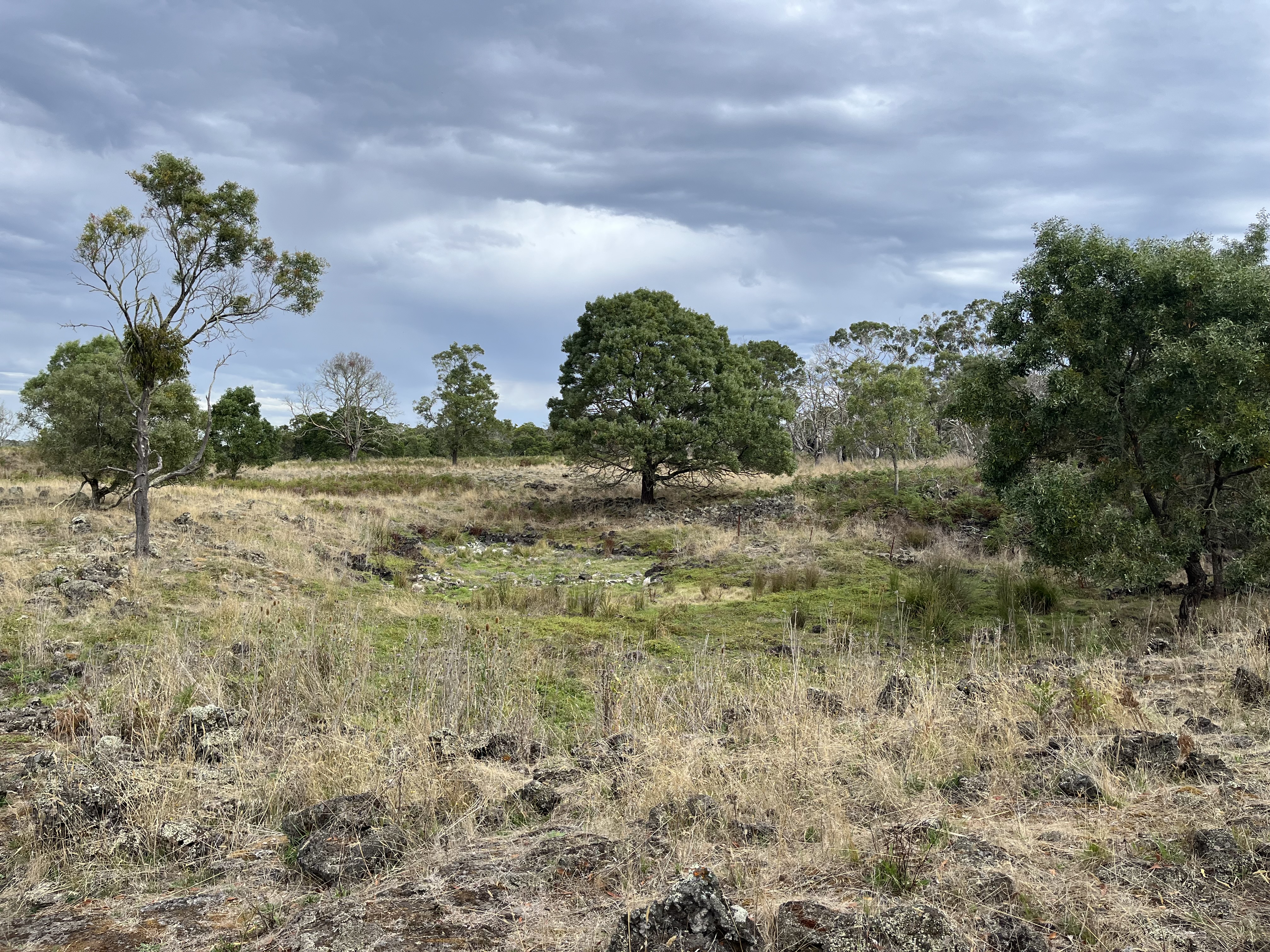
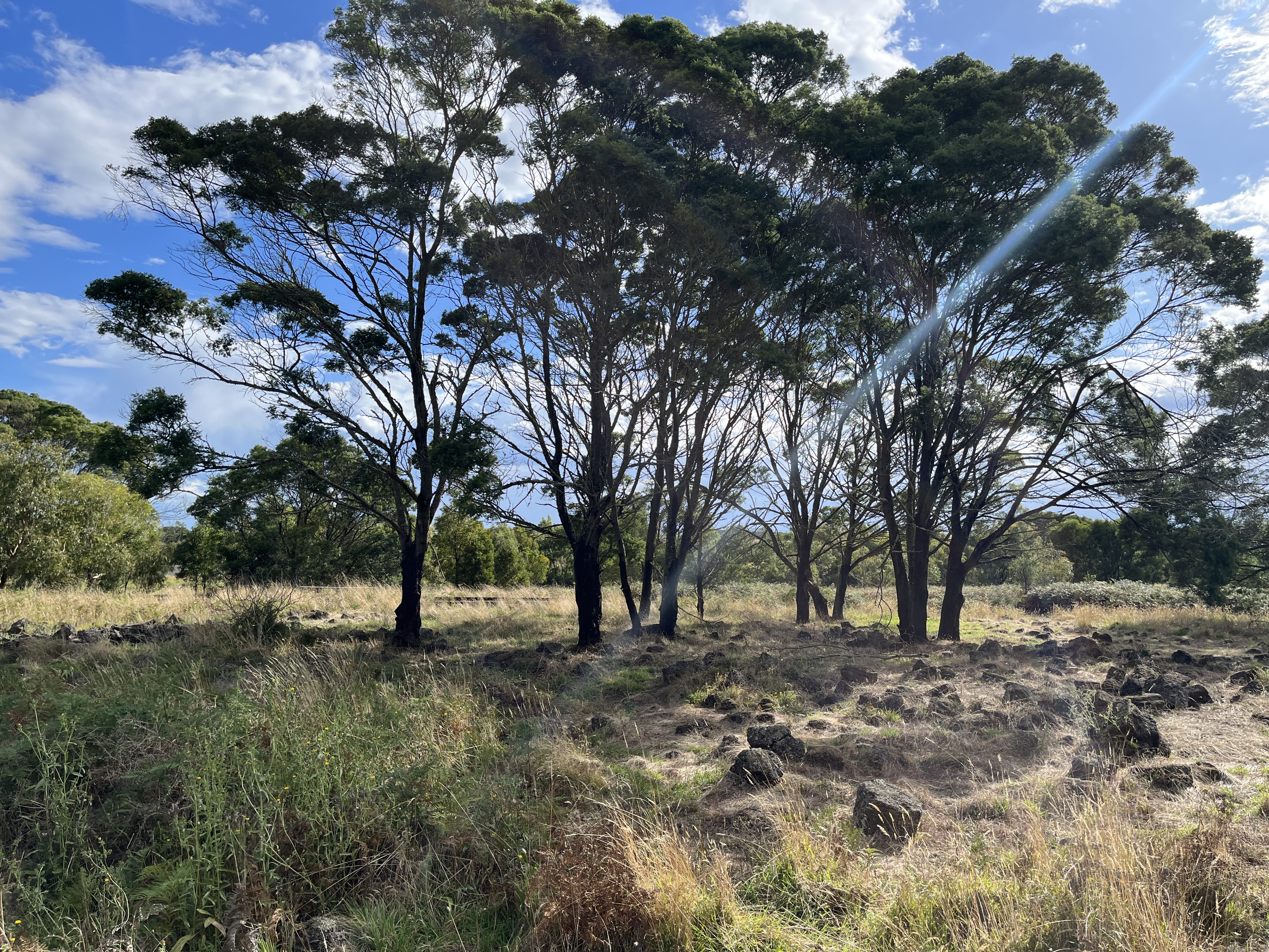
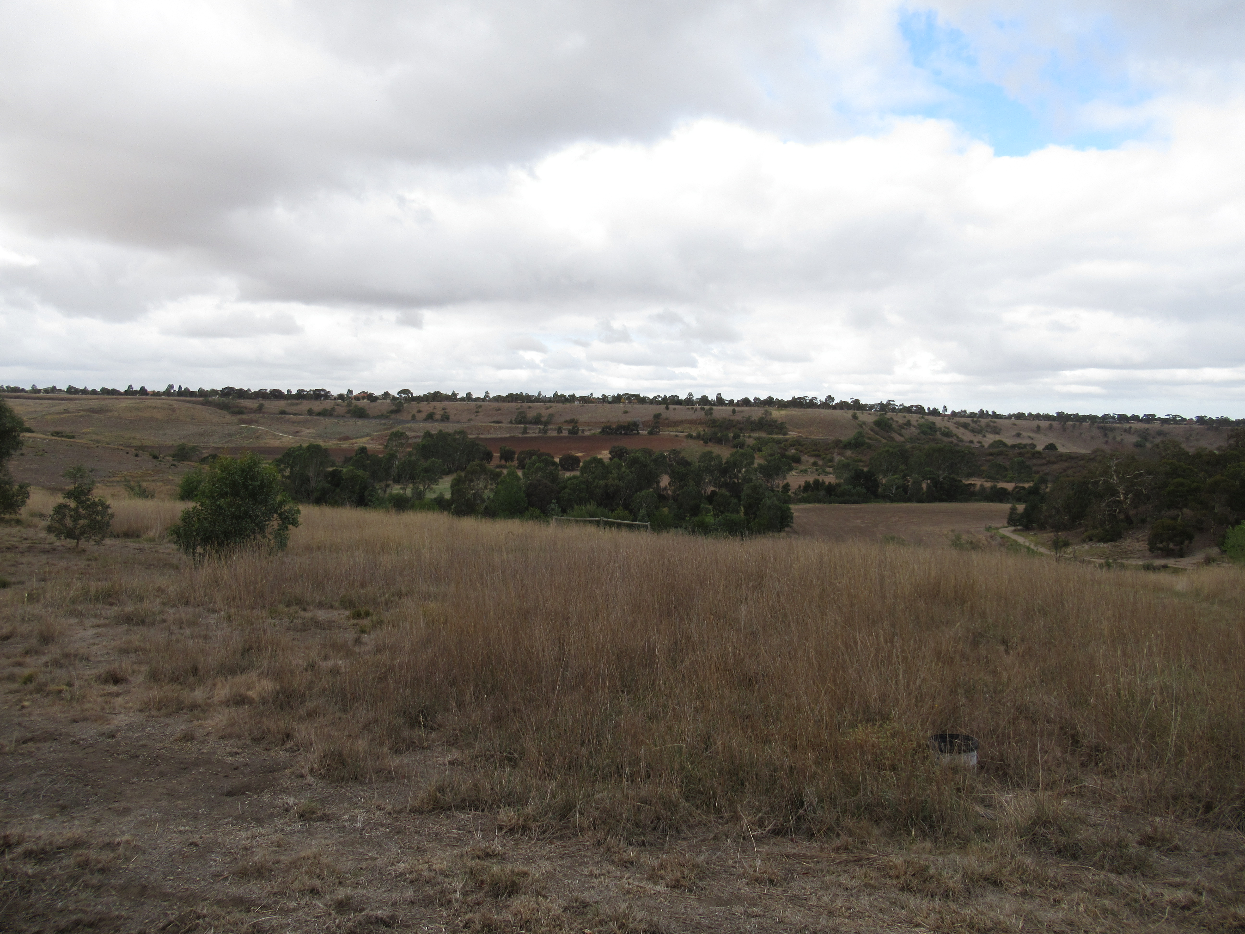
I wanted to begin by giving an idea of what the landscape looks like. It is volcanic, which is a key point. This whole area of Victoria was shaped from the eruptions that gave rise to Budj Bim about 27 000 years ago. Though Tae Rak was created by larva flow from an eruption about 8000 years ago. This all gave rise to the basalt landscape that you can see in the photos below.

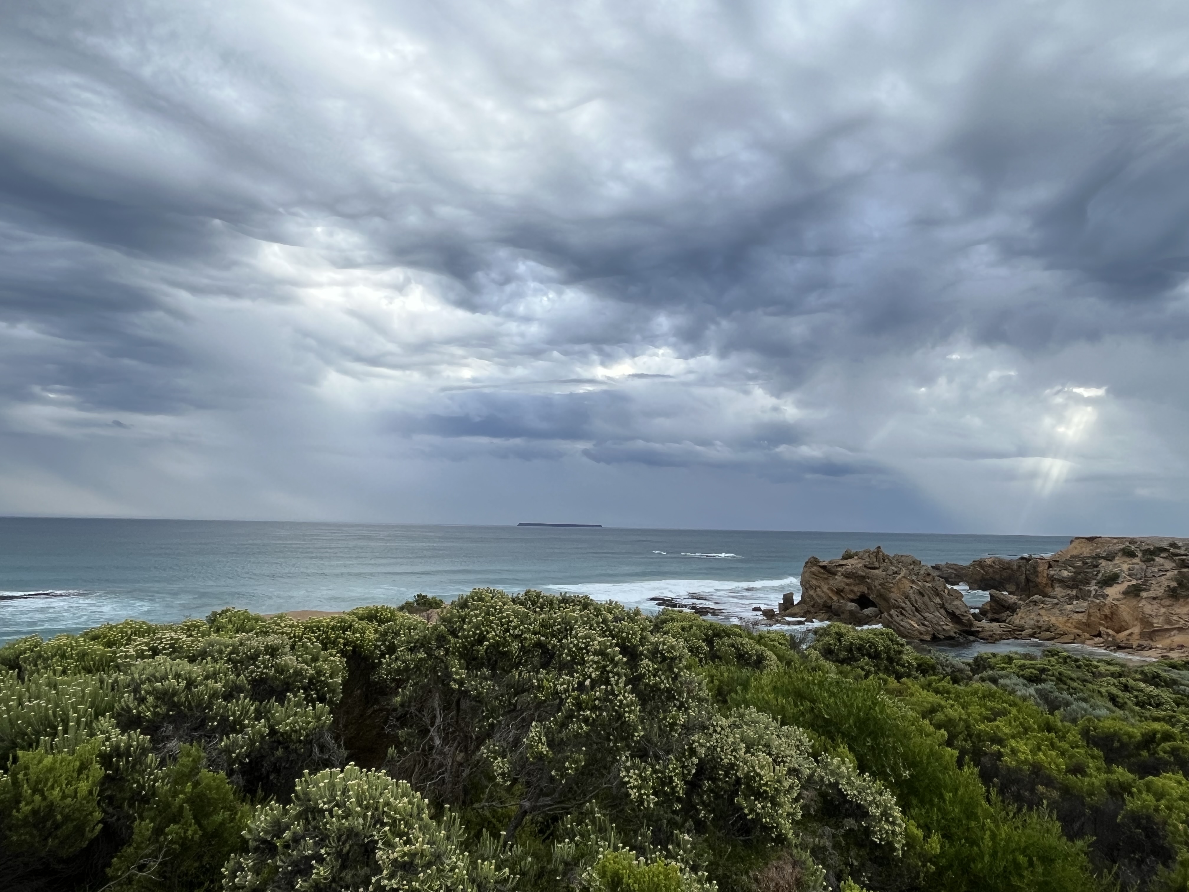
Bud Bim is actually one of Victoria’s newest volcanoes. First Nation belief systems record the eruption, with Budj Bim being the head of the ancestral being who left behind part of themselves at the end of their dreaming journey, and the larva flow being the teeth. The same belief system tells of journeys of creator beings to near by landmarks, including to the south where Deen Maar (Lady Julia Percy Island) guards the final resting place of the Gunditjmara people when they die. You can see Deen Maar on the horizon below.

Essentially the Gunditjmara belief systems speak of a landscape, described by Eileen Alberts from the Gunditjmara, as left to them by the ancestral beings, with the resources to live a settled lifestyle. They had the dammed waterways, the stones and the rocks to build aquaculture systems and wetlands where reeds grew to make baskets, and the food enriched landscape to survive.

This was a land that was shaped and cultivated, lived on for thousands of years.

Geologically, what the eruption of Budj Bim 8000 years ago did was to dam the Darlot Creek, which through time and, what is now called Condah swamp working its way through the larva flow, created Tae Rak.

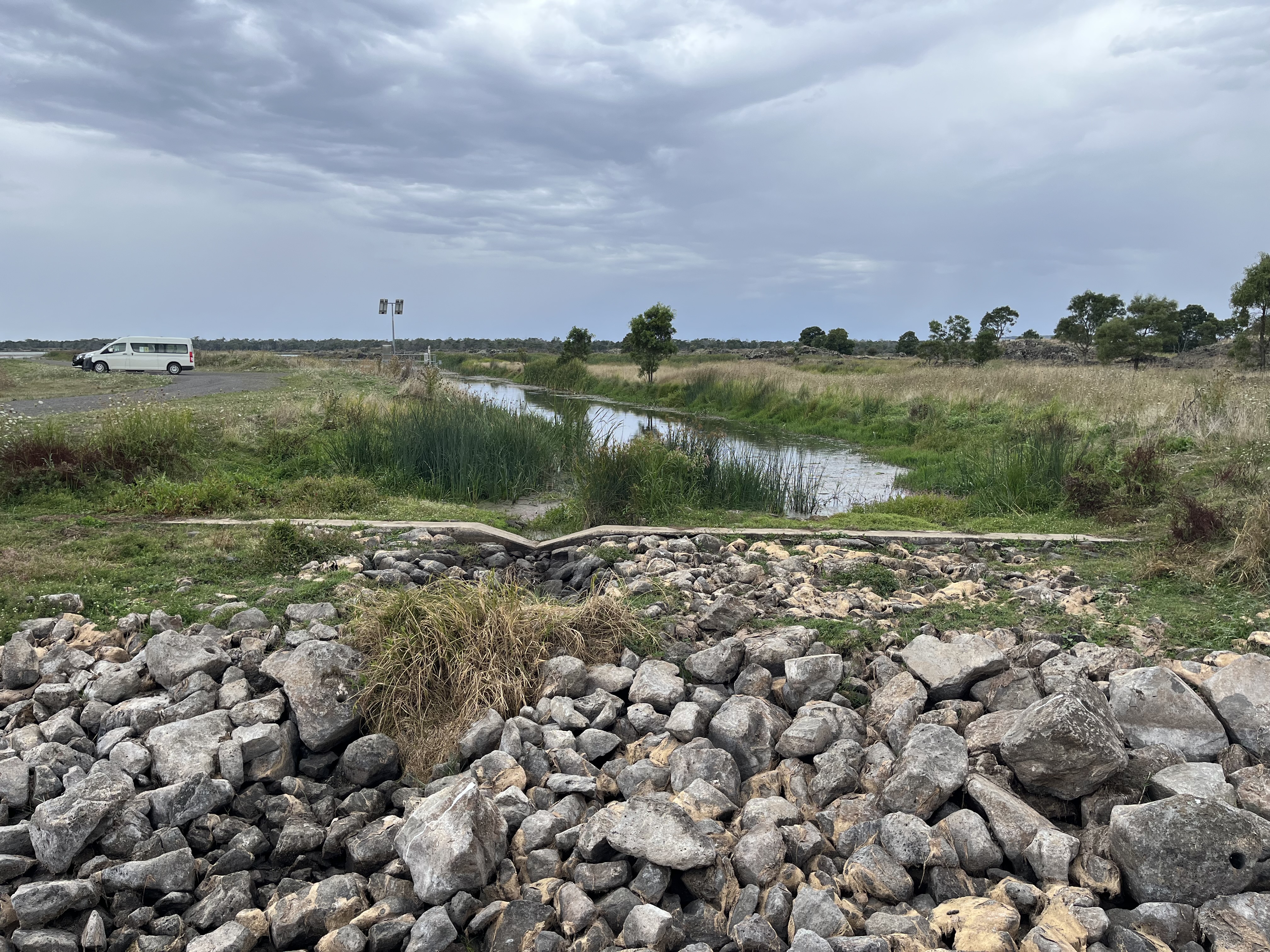
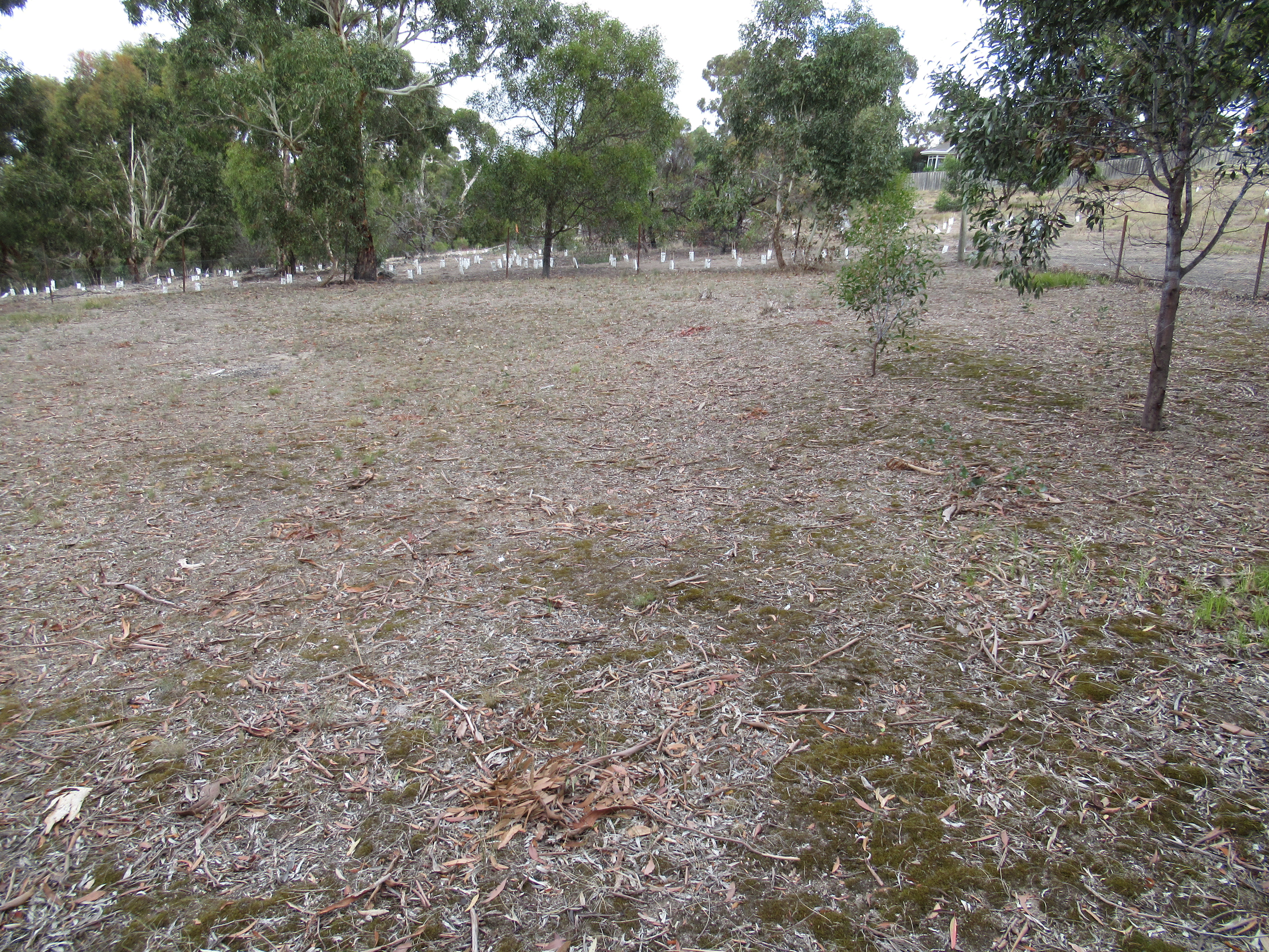
What you see today is only a fraction of the size of the original wetlands that the Gunditjmara used for everything. But, conversely, it is much bigger than what you would have seen even fifteen years ago. This is because the decision was taken to drain Tae Rak following severe flooding in 1946, work was completed in the 1950s, and Tae Rak became largely farming land. In 2010 a new weir was built to again create a facsimile of the dam created by larva flow thousands of years ago, and water was returned to the wetlands, though nothing to the capcity it would have once held. You can see the weir below.

First, though, to return to the purpose of the aquaculture systems that were constructed. And to understand this, I need to properly introduce an extraordinary creature- the kooyang, or short-finned eel. You can see some in the tank in the video below.

Now, saying eels are fascinating is not something I thought I’d ever be saying, but their lifecycle is truly extraordinary. The kooyang you see in the tank above are somewhere in the middle ish of this cycle. They can grow up to 1.1 meters long and live for 14 years for males and 18 years for females. They’ll eat most things, including any carrion that ends up in the water. When they are headed towards the end of their life cycle, they close over their anus to ensure they keep all their nutrition in, then they fin their way out of the wetlands, through river systems, and mud sometimes, out into the ocean. From here they fin their way up the east coast of Australia to the coral sea, a journey of thousands of kilometres, when there they, probably, dive down to the depths, explode, all the eggs and the sperm mix in the warm water and new eels are spawned. These tiny glass eels begin to make their way back down the coast of Australia where they follow the smell of freshwater back to Tae Rak, often climbing weirs, dams and waterfalls to make it, growing as they do so, to become a yellow eel and then ultimately a silver eel, before starting the whole process again when they’re ready to spawn.

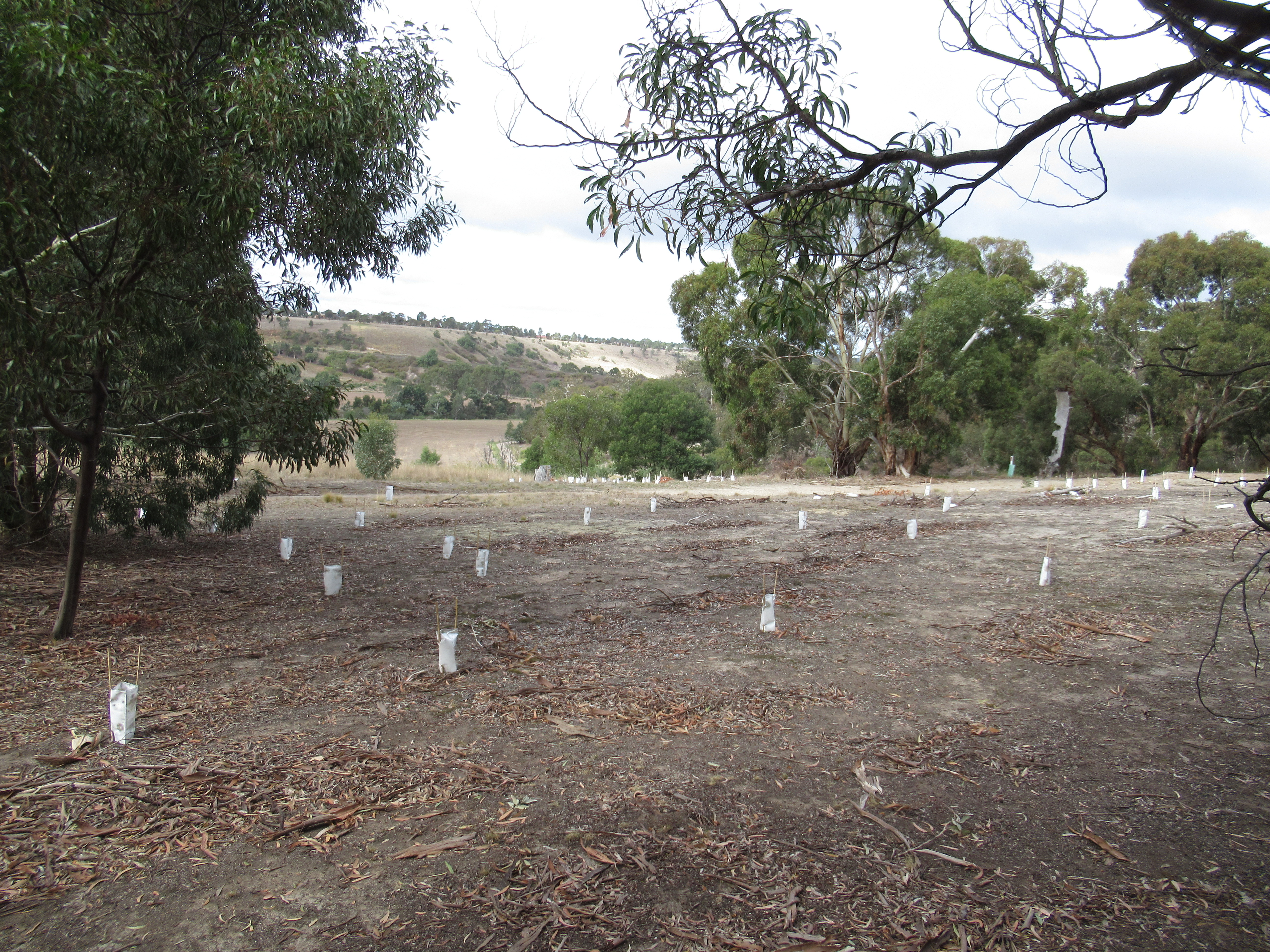
These incredible creatures also make incredible nutritious food, and are the reason for the Tae Rak eel traps, though other things were caught in them too. Essentially the larva flows from Budj Bim created pockets in the ground which became pools and the Gunditjmara created channels between them to take advantage of seasonal changes in water height. They created these connecting channels between the pockets to move eels around to where they wanted them. These channels were created through solid basalt, probably through a combination of digging it out and setting it on fire and rapidly cooling it to make it crack and easy to remove. Some channels are more than 50 m long. They also made weirs to control the velocity of the flow of the water. There are deliberate narrowing points in channels, where traps made from reeds were placed to force an eel through a V which they couldn’t swim out of, and from where they could be easily harvested. These aquaculture systems were also used to ferry eels into larder pools where they would be kept for later harvesting. You can see one of the latter systems below.

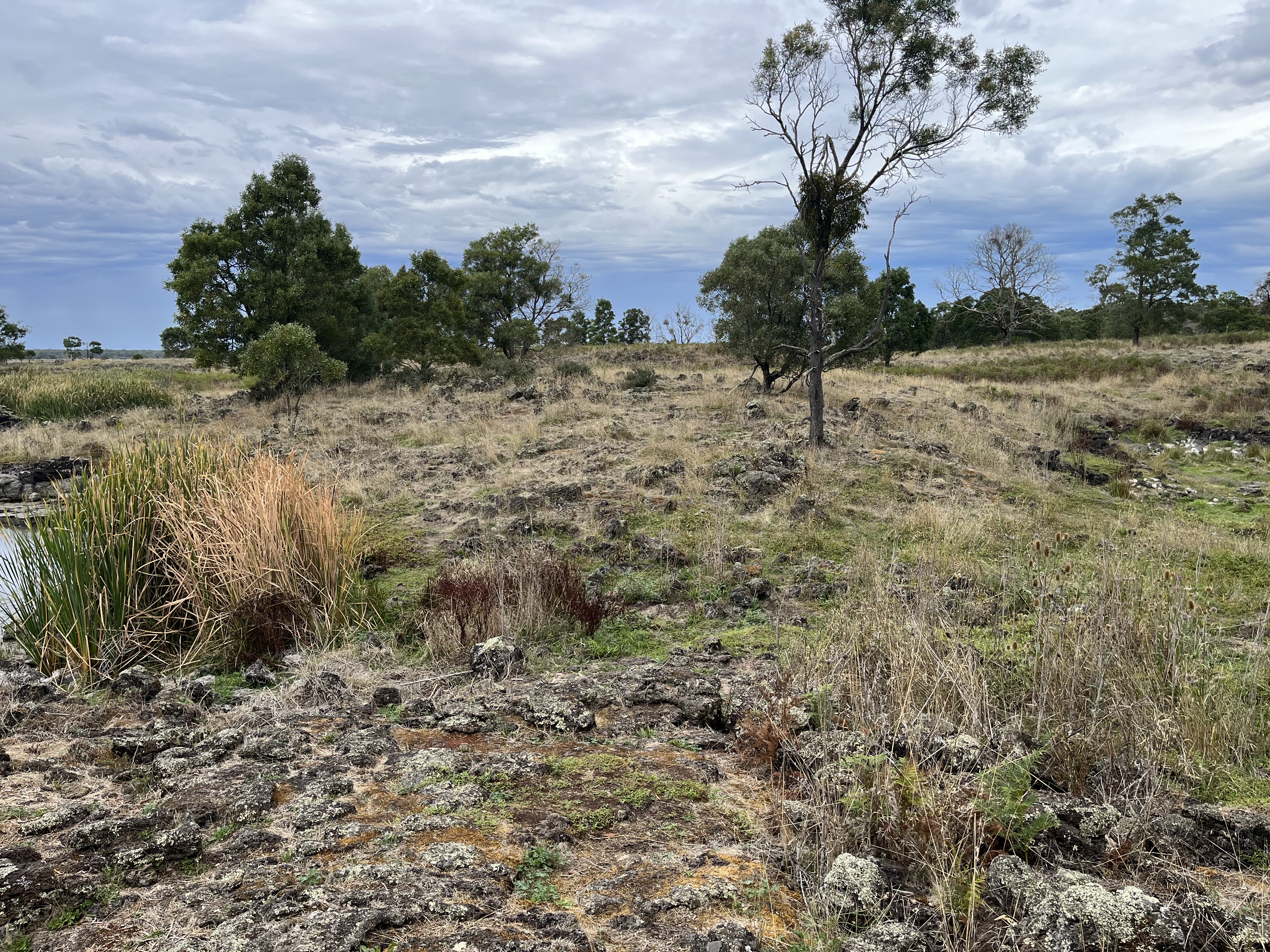
The final image is the channel between the pools.

So, with this incredible food source, and aquaculture system, you needed somewhere to live. There are remains of permanent dwellings at Tae Rak. They were often built on the ridges, for the advantage of the vantage point. You can see the foundations of one below.

This particular house would probably not have been lived in all year round, but would have been occupied by the Gunditjmara when they were using the resources at Tae Rak, though this isn’t true of all First Nations dwellings in the area. They would not have been built entirely of stone. These domed dwellings would have been a stone wall topped with wattle and daub, and reeds. You can see some modern interpretations below (admittedly in a slightly decrepit state).

The image above is from the near by Tyrendarra Indigenous Protected area, which is about half an hour from Tae Rak and would have been a meeting and gathering place for the Gunditjmara. You can see one of the gathering place below with the foundations of dwellings, which unlike image from Tae Rak would have been communal and interconnected.

At Tyrendarra you can also see a further extension of the wetlands and the remains of the formerly vast reed beds.

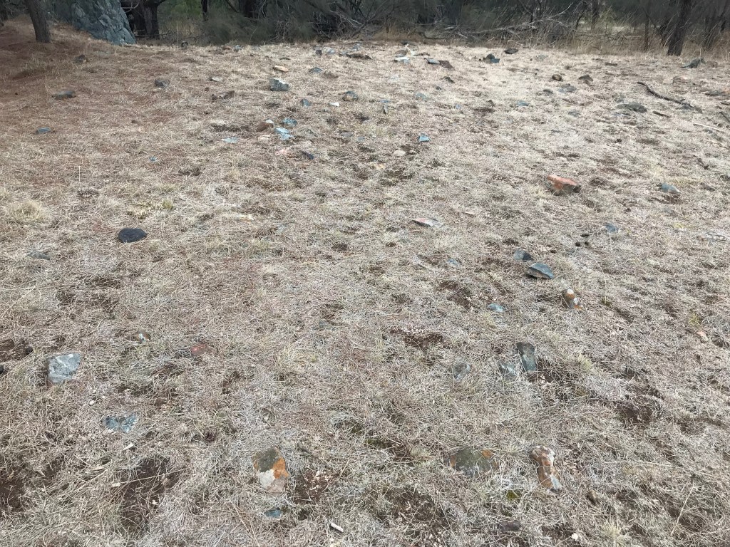
I am aware I have been using the word ‘remains’ a lot, that is because quite often that is all we have left. The basic question of ‘what happened to all the stone dwellings’ is answered by the photos below.

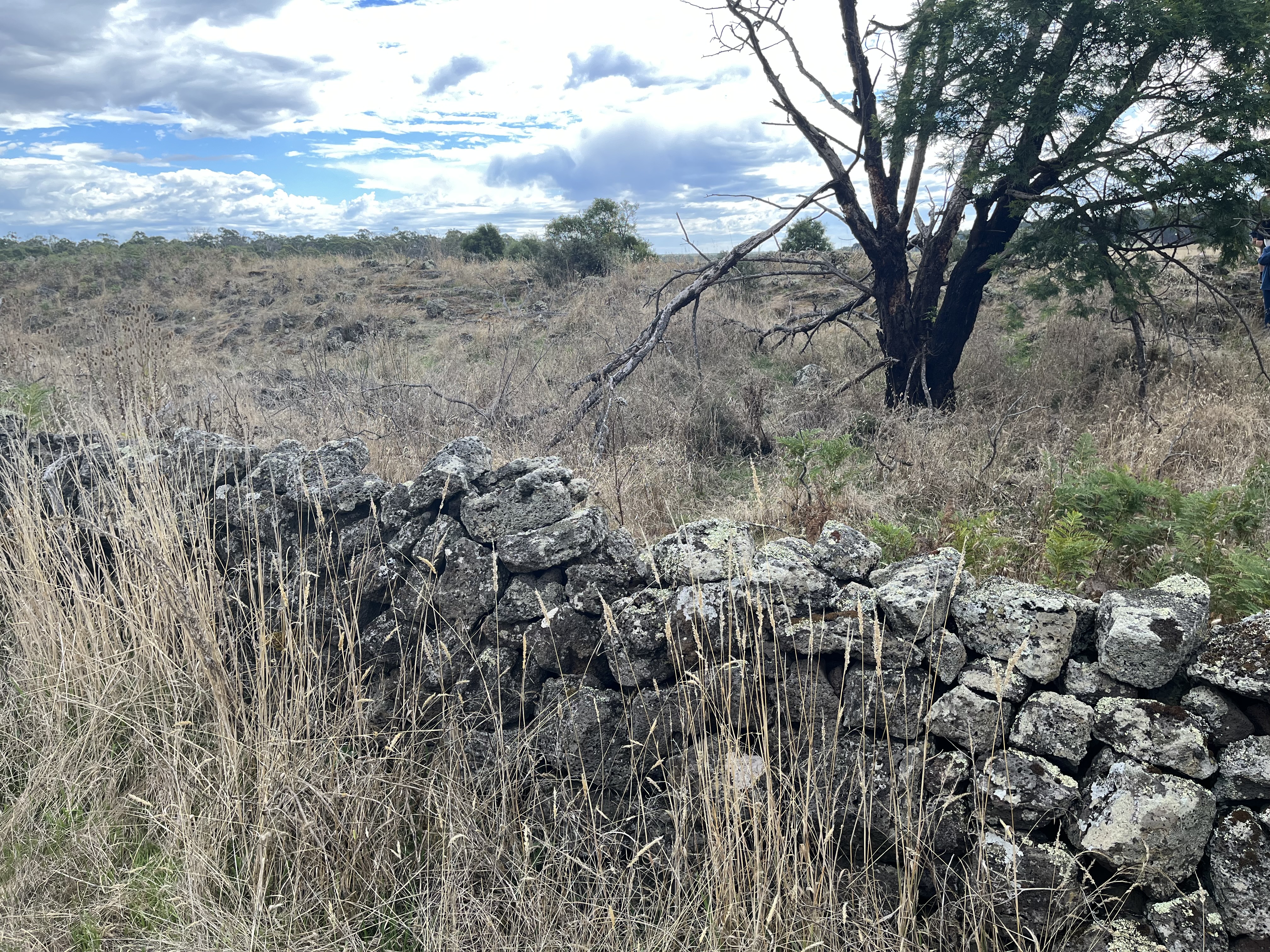
Most of the stone was appropriated for use by the invaders, including through stone walls to mark out the boundaries of this land they were now claiming to be theirs. The wall you can see above is about 10 m from the first house. Now taking stone from old dwellings and repurposing it is something done the world over, there’s plenty of buildings constructed from Hadrian’s wall for example. The key difference here is that these dwellings didn’t just fall into disuse, the people who had been using them were killed or forced off their land, and no one ever tried to deny that Hadrian’s wall existed in the first place. Even today with mounting archaeological evidence, accounts from early pastoralists and surveyors describing large groups of Gunditjmara living in permanent structures, and the Gunditjmara’s own belief system and oral tradition, which is just as valid as any western version of history, the existence of these dwellings is denied, sometimes actively.

This sadly brings me back to where I began, the dispossession of the Gunditjmara. This isn’t intended to be a history of dispossession, invasion and colonisation of the Gunditjmara, as that would be a whole post on its own and I can not do it justice here. But have a look at my reference list at the end for more information. I will however give an overview. The key fact is that the Gunditjmara didn’t magically vanish, they fought for their land, their lifestyle and their people as did all First Nations people in Australia.

Invasion happened quickly. Major Thomas Mitchell (who I have written about before here) surveyed the Western District in 1836, and whalers and sealers had been moving up and down the coast. As more colonisers moved in, there was more conflict with First Nations people and more were killed, and more women were attacked. ‘Protector’, and not very nice man but avid diary keeper, George Augustus Robinson noted that some shepherds ‘appeared to devote more time to the native women than to their sheep’. The best known of these massacres in the area was a bit south and west of Tae Rak, where 20 Gunditjmara people were killed in 1834, known as the Convincing Ground Massacre. But this was not an isolated incident and violence did not remain the realm of whalers, sealers and surveyors. Pastoralists moved in and, by 1841, there were more than 88 stations between Geelong and Portland, many covering vast areas of land. And with the pastoralists came sheep and cattle who destroyed the natural ecosystems and the soil in their wake. The land that had been cared for by First Nations people for thousands of years was irrevocably damaged, as well as being stolen. This wasn’t a passive resistance to this invasion either, the Eumerella Wars fought in the 1840s were a sustained campaign by the Gunditjmara against invasion. The rocky Budj Bim landscape was an ideal place to wage war from. It was the use of native police, brought in from other parts of the country, that ultimately turned the tide against the Gunditjmara.

Physical violence was not the limit of the influence of the colonisers. The place names changed too, and the colonisers laid their own belief and world views and history across the landscape, shaping it culturally to match. The western name for Budj Bim is especially galling, as it began a Mount Eeles after a British aristocrat, but was bastardised to Mount Eccles which means absolutely nothing. By the 1860s First Nations people were being herded into missions, often not on their own country, and language and culture was being banned. It’s the equivalent in the Western world of burning the library and the museum to the ground.

For the Gunditjmara this mission was the Lake Condah mission, and while ultimately in some ways it became a place of community, it was in essence a place of control and many times punishment.

So this is a brief overview of the tangled web we are only just starting to beginning to untangle today. This brutal history must be understood and recognised as part of our own foundation myth. And First Nations histories and stories and perspectives must always be at the heart of it.

Today Tae Rak stands as a symbol of this. It is owned now by Gunditjmara, though they are still trying to buy back more of the surrounding land. This came about through a series of land mark native title cases, which sadly I don’t have the space to discuss here- again that might be another post. The Tae Rak Aquaculture Centre, again run by the Gunditjmara, is a starting point for cultural tours of this unique landscape, so the story of Tae Rak can continue to be told.

References:

Site Visit 2023

The People of Budj Bim: Engineers of aquaculture, builders of stone house settlements and warriors defending country / Gunditjmara People with Gib Wettenhall

https://www.budjbim.com.au/

https://www.gunditjmirring.com/lake-condah-restoration-project#:~:text=Lake%20Condah%20and%20the%20Condah,to%20and%20through%20Lake%20Condah.

https://www.vewh.vic.gov.au/news-and-publications/stories/creature-feature-short-finned-eels#:~:text=Male%20short%2Dfinned%20eels%20generally,habitat%20and%20fuel%20its%20diet.

https://www.budjbim.com.au/visit/cultural-sites/tyrendarra-ipa/

https://www.visitvictoria.com/regions/great-ocean-road/see-and-do/nature-and-wildlife/national-parks-and-reserves/tae-rak-aquaculture-centre

https://historicalragbag.com/2016/02/13/major-mitchell-and-his-trail/

https://c21ch.newcastle.edu.au/colonialmassacres/map.php

https://lens.monash.edu/@politics-society/2021/04/23/1382962/the-frontier-wars-undoing-the-myth-of-the-peaceful-settlement-of-australia

https://www.sbs.com.au/nitv/article/how-the-fighting-gunditjmara-used-country-to-wage-a-15-year-war-of-resistance/1ghh36cu1

All the photos are mine

Wil-im-ee Moor-ring Indigenous Stone Quarry

The Wil-im-ee Moor-ring Indigenous Stone Quarry (also known as Mount William) is just out of Lancefield in Victoria. It’s an area of green stone that was quarried by Indigenous Australians for more than a 1000 years. The name means place of the axe.

I was lucky enough to go on a tour of Wil-im-ee Moor-ring as part of the Australian Heritage Festival this year. It is land administered by the Wurundjeri Tribe Council. Last year I visited the Wurundjeri Earth Rings just out of Sunbury and wrote about them on this blog. You can see the post here:

https://historicalragbag.com/2018/05/21/wurundjeri-rings/

I want to reiterate what I said in that post about the Indigenous history of Australia and my place in writing about it. Firstly Indigenous history is something that all Australians should know more about, it’s arguably the oldest continuous culture in the world and over the years it has been (often deliberately) relegated to a footnote. This is slowly changing and I’m certainly trying to learn more and to share what I find. It’s also just fascinating.

I’d like to pause here to say that I am aware that as a non Indigenous person writing Indigenous history can be problematic. This post is intended to encapsulate the possible history of the site as was explained by a Wurundjeri Elder on the tour and laid out in the National Trust Heritage List report, and I claim no more than that. Wil-im-ee Moor-ring is just so interesting and important that I want to make sure people know about it and to help ensure that Indigenous history is a part of the history of Victoria, if only in my small way.

So to begin. I wanted to start with an analogy, it’s the best description I’ve heard of what’s known of Indigenous history in Victoria. Bill Nicholson, the Elder who took the group I was part of the round Wil-im-ee Moor-ring, described it as a 100 page book, with maybe 30 pages left that are in the wrong order. When Victoria was colonised not only were a lot of Indigenous people killed, through disease like small pox but also through massacres, but culture and language was often banned and they were rounded up, removed from Country and installed in missions. At Coranderk (one of the main missions just out of Melbourne) Woiwurrung, the language group that the Wurundjeri are part of, was banned in 1863. Knowledge was simply lost. Breaking up a culture that is rooted in oral history, is tantamount to burning libraries and archives in Western culture. Efforts are being made to reclaim Indigenous history and new information is being found in archives all the time, but by the time a lot of it was being written down, usually by the colonisers like William Thomas who was an Assistant Protector of Aborigines, what they were seeing was only the tip of the iceberg of what had existed. This is why sites like Wil-im-ee Moor-ing are so essential. Apart from being spiritually important, they are physical manifestation of Indigenous culture and history. There’s a lot more around than most Victorians know about too, and again I include myself in this. There’s scar trees, possible smoking trees, burials, other quarries and more.

Possible smoking tree. Would have been used for smoking meat to preserve it.

There’s been stone formations found in the Western District that are as old or older than Stone Henge and have possible astronomical alignments. Budj Bim, also in the Western District, with its sophisticated eel and fish trap systems and remains of housing is under consideration for World Heritage Status. Petroglyphs are being un-earthed all over Victoria and then you’ve got the earth rings like the ones near Sunbury. Wil-im-ee Moor-ring is part of a large system of sophisticated land management, language, law, ceremony, trade routes, Country and family that stretched across Victoria and Australia.

To return to Wil-im-ee Moor-ring itself. It’s roughly forty acres (though the original quarry would have covered more land), and has been fenced off since the 80s. It’s been a tourist attraction of sorts since the 1800s, visited on day trips along with the near by Hanging Rock. So it has been thoroughly picked over and much of the land was cleared. That being said, since the 1800s it has been acknowledged as a site of an Indigenous quarry pre dating European colonisation, which is very unusual in Australia (it’s much earlier than any Indigenous activity pre colonisation was usually acknowledged). The first European reference to Wil-im-ee Moor-ring comes from William Buckley, who was an escaped convict living in the bush from 1803 to 1833, he describes a hard black stone from a place called Kar-keen which was shaped into stone heads. William Barak, a prominent Wurundjeri Elder in the mid 1800s, witnessed the final operation of Wil-im-ee Moor-ring as a quarry and described it to an anthropologist called Howitt as one of the places that “a group of people claimed for some special reason, and in which the whole tribe had an interest.” This clear recorded history of Indigenous custodial rights and processes is very unusual.

To return to Wil-im-ee Moor-ring physically. The rock in is class five diorite. Simply put, it’s very hard.

Above you can see one of the rocks from which the stone was split. It was done by heating the rock up with fire and then pouring water on it to cause the cracking. The axe heads themselves were shaped on a flaking floor, one of which you can see below. You can also see what might be broken rejects.

Wattle branches were probably split to make a loop for the handles of the axes and Xanthorrhoea sap was boiled to make glue to hold it all together and it was bound with kangaroo sinew. These weren’t axes that were used for fighting, they were used whilst hunting and for things like stripping bark off trees. These specific axes have been found as far as South Australia and Southern Queensland. They were immensely valued, not only for their utility but probably for the spiritual significance of Wil-im-ee Moor-ring itself. Part of the Indigenous belief system of the area is that the ancestral spirits formed themselves into the landscape, and Wil-im-ee Moor-ring is one of these landscape features. There is also records of axes being physically traded in the 1830s when William Bradley observed one polished axe head being traded for two possum skin cloaks, and a rough head for a large number of spears. To understand the value of possum cloaks you only have to think about how small a possum is, and how many you would need and how long it would take to construct one full cloak, let alone two. The axe heads were valued.

While there is more known about Wil-im-ee Moor-ring that a lot of other Indigenous sites there is still a lot to learn and hopefully be discovered and reconstructed where it can be. It’s a beautiful place, part of a broader landscape, that more people should know more about.

References:

Site visit and tour 2019, information provided by Wurundjeri Tribe Council https://www.wurundjeri.com.au/

National Trust Heritage List Report of Mount William.

The photos are all mine.

Wurundjeri Earth Rings

The history of Indigenous Australians is a vitally important part of the history of Victoria and Australia. It is something that nowhere near enough Australians, and I include myself in this, know enough about. It is a truly ancient history dating back roughly 70 000 years, making Indigenous Australians pretty much the oldest continuing culture in the world. There are Indigenous sites across Australia, many of which are thousands of years old, and if these were in Europe they’d be celebrated and visited by millions, even in places where there isn’t a lot to actually see. In Australia, however, they can be very hard to find. I’ve lived in and around Melbourne my whole life and I work in the heritage field, but I’d never even heard of the earth rings just out of Sunbury until they were part of a National Trust Heritage Festival tour this year. I jumped at the chance to visit and find out more.

I’d like to pause here to say that I am aware that as a non Indigenous person writing Indigenous history can be problematic. This post is intended to encapsulate the possible history of the site as was explained by a Wurundjeri Elder on the tour, and I claim no more than that. The rings are just so fascinating that I want to make sure people know about them and to help ensure that Indigenous history is a part of the history of Victoria.

I’d also like to say that the rings don’t show up amazingly well in photos, but I’m hoping the pictures will at least give you an idea of what I’m talking about. You can certainly see them when you’re on the site.

The rings are earthwork formations and can be found just out of Sunbury, which is an hour or so outside of Melbourne. The landscape has been farmed since 1842, but is slowly being reclaimed, and is surrounded by the curve of Jackson’s Creek. The land is being looked after by the Wurundjeri Tribe Council, using a mix of traditional and modern methods. You can see some general photos of the land and wildlife below.

IMG_0763IMG_0762IMG_0768IMG_0767The current site is 13 hectares, but it might be expanding as negotiations are currently in train to give the land council more land as part of another development.

Some of the land was owned by Salesian College, which you can see in the distance below.

IMG_0770

The Wurundjeri Tribe Council has begun revegetating the land, planting roughly 3000 trees and other plants. They have also cleared an extraordinary amount of weeds, including a lot of box thorn. They are using burning to help rejuvenate the land to bring back the native grasses and plants. Currently pasture grasses dominate the site, as you can see above. The smoke helps to stimulate seeds beneath the ground and regular small burns make it easier for native bushes and grasses to come back as the pasture grasses don’t regrow as easily if they are burnt regularly. You can see what I believe is an everlasting daisy which has come up below.

IMG_0765

While there would have been some trees originally, like the ones below, this area would have been a significant grassland.

IMG_0769

The Wurundjeri Tribe Council land managers have also been trying to build up the quality of the soil by raking together the leaves etc and letting them catch silt after rain before planting.

IMG_0761IMG_0760

So, that is the overall site, but what about the rings themselves. Development actually plays a key part in the history of the rings. No one knew the rings were there until a development went up on the edge of the reserve in the 1970s and they were re-discovered.

They are definitely man made and probably date to at least a thousand years, but in the invasion of western settlers in the 1800s the local Indigenous population was so decimated that the oral history of the rings was lost. They were dug out by hand with digging sticks, with nothing brought in from outside

On the site that I visited there are three rings, though there are others in the area. Unfortunately no one knows exactly what the rings were used for, only one has been archaeologically investigated. The Wurundjeri don’t want these sacred sites dug up, even for archaeology. Rings in NSW are thought to have been burial places, but there is no evidence of this for the Sunbury rings.

The first of the rings is in the worst condition. It has been too open to the public interference, especially from motorbikes. There is also a bad rabbit problem and a recent lack of rain has caused problems as well (this extends to the whole site)

The first ring was the one that was rediscovered in the 1970s with the nearby development. Once this one was re-found it was realised what the other two just over the hill were as well. You can see the ring in the photo below.

IMG_0759

IMG_0754It has been fenced off now, but even this doesn’t always work as you can see from the drain in the photo below.

IMG_0758The ring was dug out from the middle and the earth was piled up around.

The second and third rings are in better condition and it was the second one that was excavated in the 1970s. When the ring was excavated it had a pile of stones in the middle, it was thought that there might be burials underneath. There wasn’t, and it is thought that the stones were removed when the ring was dug (there is a lot of rock in the local soil) and piled in the middle. You can see the remains of the stones in the photos below.IMG_0773

IMG_0775The third ring is a little father up the hill and is actually a double ring. There is a larger ring with a smaller ring inside it.

IMG_2326IMG_0786IMG_0783

While it is not, currently, possible to know exactly what the rings were used for it is hoped that it will be in the future. New information is being discovered in diaries and old documentation all the time as for the first time researchers (especially Indigenous ones) really begin to look. The current theory is that the rings might have been used for marriage. You can’t see the first ring from the second and visa-versa and the idea is that the men would have got prepared in one and the women in the other and they would have joined each other in the double ring and actually married there. There is a flat section on the double ring where someone could have officiated from.

IMG_0782While at the moment this is only a theory, it is one that seems to make sense. Hopefully more answers will be discovered.

I am not in the least superstitious, but the rings do have a certain atmosphere. The atmosphere is of a place that has been used for a purpose for a very very long time, a land that has been shaped by human hands for time out of mind. It reminded me a little of the Hill of Tara in Ireland, a site that dates back thousands of years (which is perfectly possible for the rings).  This site and others like it should be part of the education of every Victorian child the way Eureka and the gold rush is. Places like the Wurundjeri rings and Indigenous history  in general needs to become an integral part of the overt history of Victoria rather than the background or subvert history. Indigenous history needs to become part of the historical consciousness of Australia, as important (if not more important) than the First Fleet and the ANZAC legends. It should be celebrated that we have this incredible history stretching back for thousands and thousands of years, and if doing this means coming to terms with and acknowledging how close European invasion came to destroying it all (much of the time quite intentionally) then so much the better.

Since writing this post in 2018 there has been new research done on the earth rings that adds more details. You can view the article here:

Since writing this post in 2018 there has been more research done on the earth rings that adds more detail. You can view the article here:

https://theconversation.com/new-excavation-of-rings-of-mystery-in-victoria-reveals-rich-aboriginal-history-246408

References: Site visit 2018.

https://www.wurundjeri.com.au/services/natural-resource-management/

The photos are all mine.

Cemeteries: Port Fairy

img_9133
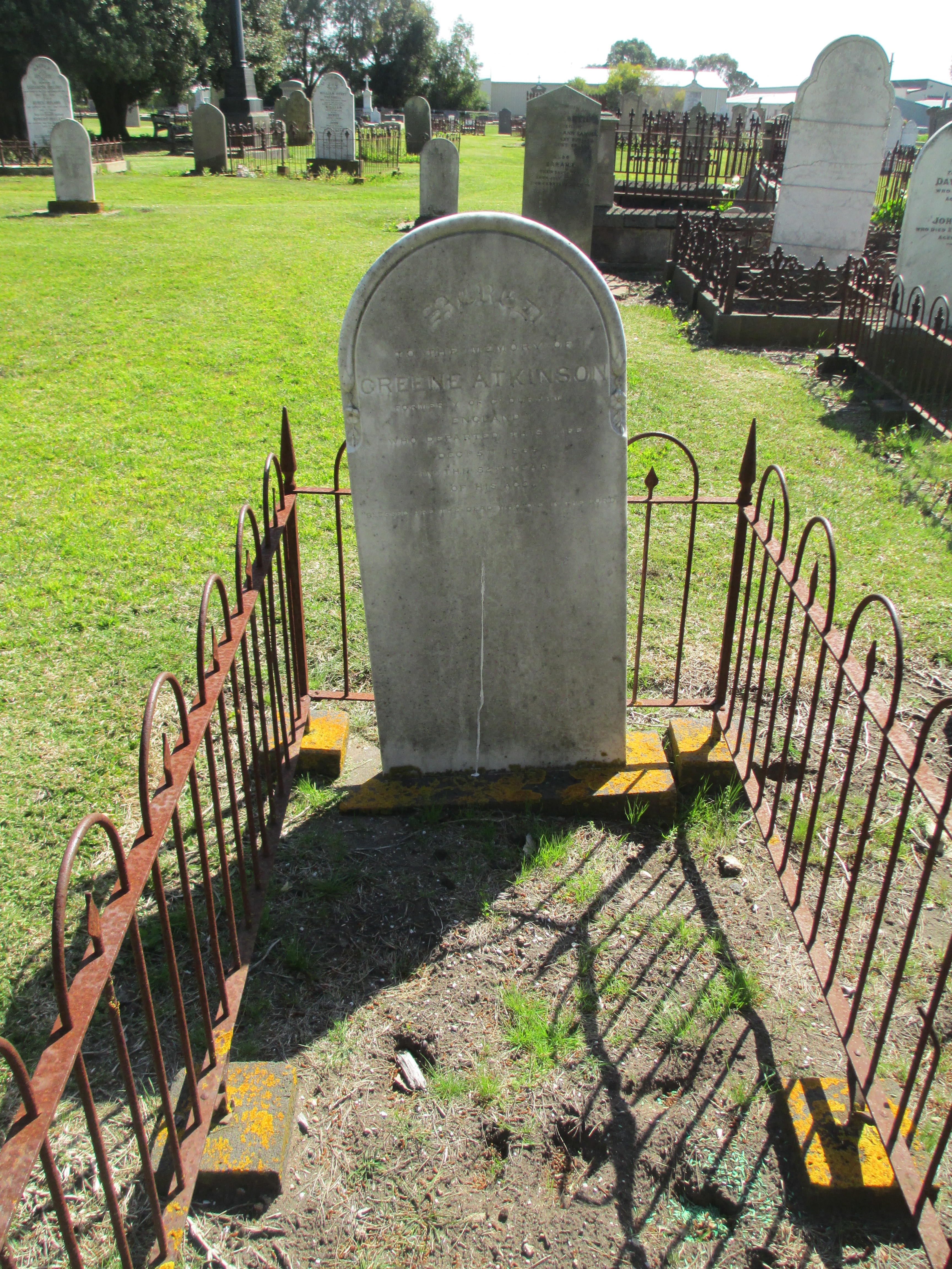
Port Fairy is a town in Western Victoria that was founded as a town in 1843. There were settlers in the area before this date, and the current name for the town comes from the ship the Fairy which is believed to have arrived in the area in c.1828. The area was also regularly visited by whalers and sealers. The date of 1843 comes from the special survey which was granted to James Atkinson at that time. The special surveys were a system where the government of the Colony of New South Wales was able to control ownership of the land in the Port Phillip District. This was well before federation of Australia as a country in 1901, but also before Victoria became a colony independent from New South Wales which happened in 1851. The basic premise behind the special survey system was to stop squatters just claiming land, because when they did there was little ability to regulate it and there was no fee for the government.

Atkinson arrived in Sydney in 1830 from Ireland and became a prominent and well connected member of Sydney society, at least partly due to his family connections to Colonel Charles Wall of the 3rd Buff regiment who was married to his sister. As he had a high social standing he couldn’t use trade to make money, so he turned to land. He was granted the right to the special survey of the Port Fairy region in 1843. He worked with the existing settlers, but also moved to attract new settlers to the town he named Belfast. He most likely applied for the special survey rights to the land without ever seeing it, as there is no evidence he set foot there before arriving in 1846 with his wife and seven children. He offered very long term leases for land in the town he established, but while he was definitely trying to encourage settlement he was not immediately successful. In 1848 he appointed his nephew (and my great, great, great, grandfather) Robert Henry Woodward, who was farming in the area, as his land agent. Woodward was 25 and oversaw the majority of the establishment of the town proper. It was also Woodward who oversaw, with the blessing of Atkinson, the gifting of parcels of land within the town for churches of different denominations and for community purposes, such as a post office, a hospital, government offices, public wharves, a savings bank, a town hall, public meeting places and a cemetery.

IMGP2243.JPG

St John’s Anglican Church Port Fairy built between 1854 and 1856. It was the first church in Victoria to have a chancel. The tower was added later in the 1950s.

Atkinson did not remain in Belfast, returning to Sydney and to Ireland, but he did visit to survey the progress of the town in 1859, 1861 and 1864. Atkinson died in Sydney in 1864, though Woodward continued to administer the lands until 1869. The town petitioned, successfully, to change its name to Port Fairy in 1886

Before continuing to discuss the cemetery I would also like to acknowledge the indigenous people of the land which Atkinson bought as the special survey. This area was the land of the Gunditjmara people. If, when Atkinson arrived, there seemed to be a lack of indigenous inhabitants it is not because there wasn’t any ever, but because between the 1830s and the 1840s the indigenous population of the area was destroyed by settlers. A monument to them now stands in Port Fairy on Bank Street. It reads:

In memory of the thousands of aboriginal people who were massacred between 1837 and 1844 in this area of Port Fairy.

Today we pay our respects to them for the unnecessary sacrifices they made.

Your spirit still lives on within our people.  Wuwuurk

This was not isolated to the Port Fairy area. The early history of Western Victoria is mired in bloodshed. A list of the frontier wars in which the indigenous population were by and large overwhelmed and destroyed by superior western weaponry can be seen here.

http://www.australianfrontierconflicts.com.au/index.php/conflicts/chronology/vic

It was also a time of severe retaliations against any interference with livestock and systematic killings, taking of land of the beginning of the removal of children. Not to mention the introduction of alcohol and western disease and their long term affects. This article from the Warrnambool local paper The Standard out lines clearly the actions against the local indigenous population

http://www.standard.net.au/story/792108/the-south-wests-bloody-past/

It is essential that the past of indigenous Australians and the brutal suppression of them is recognised as part of the history of Victoria and Australia. This is especially true when discussing somewhere like a cemetery which provides concrete and tangible records of the deaths of early pioneers, a record that is not available for the deaths of the indigenous population.

img_9148

Port Fairy cemetery was founded in the 1850s. There is confusion as to whether it is the ‘old’ or ‘new’ cemetery as many descriptions seem to use the term interchangeably. The other cemetery at Port Fairy was laid out by Robert Hoddle, famous for Melbourne’s CBD grid, at the orders of Governor La Trobe. This other cemetery was in the sand hills out of town, was discontinued and little survives today. The current Port Fairy cemetery has many very early burials and is believed to be one of the first cemeteries in Victoria to have adopted the concept of a lawn cemetery.

The earliest burials in the cemetery are of the local pioneers and their families. These people are often listed as from a local ‘station’ on their tombstones. The pioneers of the area did not have an easy life and as such there are a high number of young burials, very few survived to old age. One of the earliest and one of the youngest is the grave of Harold Woodward, a son of Robert Henry Woodward and his wife Letitia Wall (daughter of Colonel Wall). Harold died on the 8th of October 1856, but was only born on the 4th of December 1855. img_9147

Of Robert Henry and Letitia Woodward’s 11 children Harold was the only one to meet such an early end. I am descended from his brother Albert William Woodward, the youngest of Robert Henry and Letitia’s  children. Robert Henry and Letitia are buried in St Kilda Cemetery.

Much of the stone in the cemetery displays intricate examples of early stone masonry. The best example of which is probably the tomb of Abijah Brown.img_9146img_9144He died in 1862 at the age of 40 and the tomb reads:

In affectionate memory of Abijah John Brown who departed this life July 19th 1862 aged 40 years. Watch for ye know not what hour your Lord doth come. 

It is an interesting monument because it does not fit any regular pattern seen in Victorian era funeral monuments. It is a, sadly much worn, figure of a young man looking skywards. This man is not an angel or a cherub but a person. It is also a remarkable piece of sculpture in its own right. The Brown tomb is not alone is being striking in the cemetery. The older section of the cemetery is a combination of plain and ornate funeral monuments. Some can be seen in the photos below.

img_9140img_9141img_9150img_9143
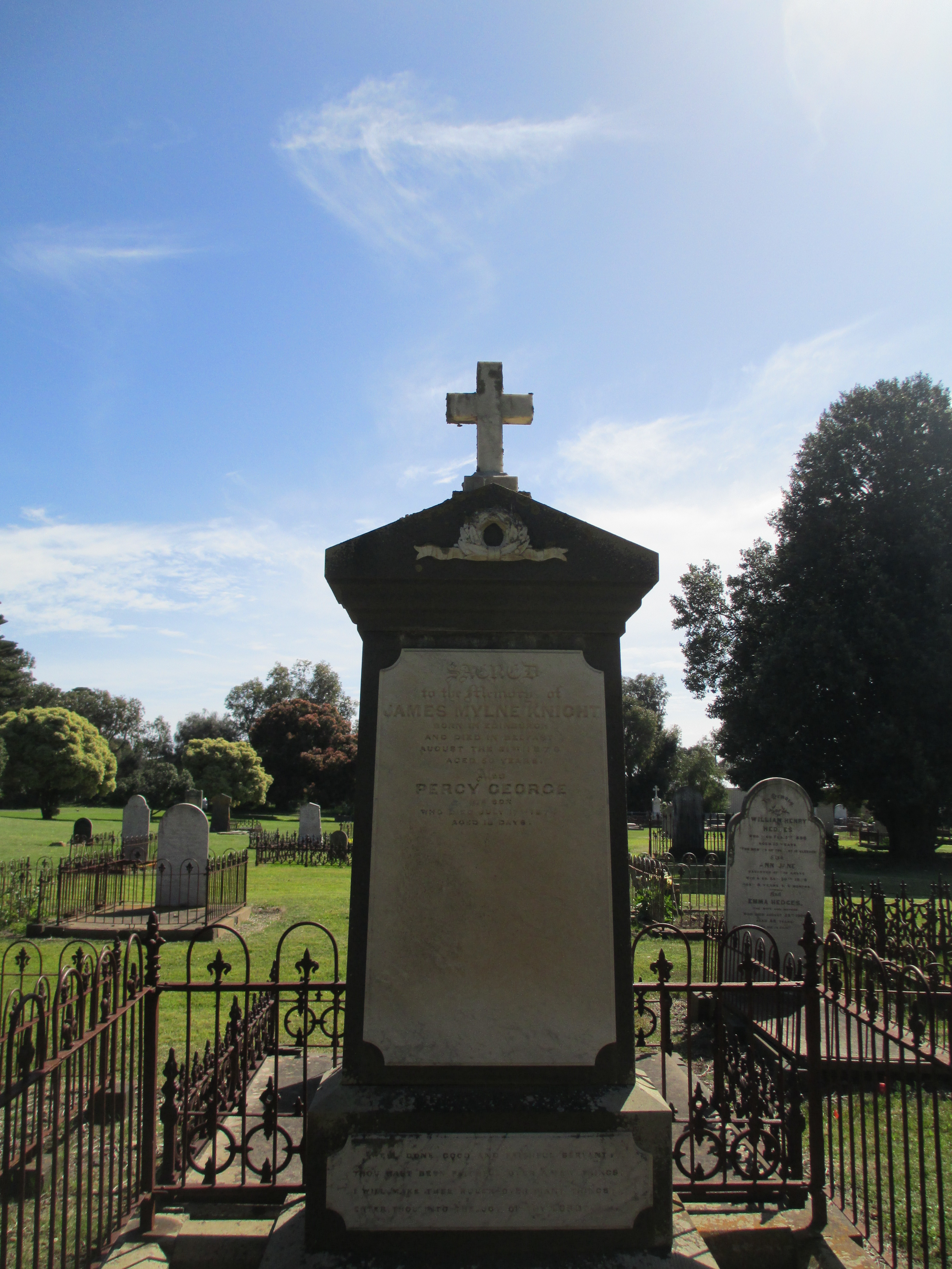
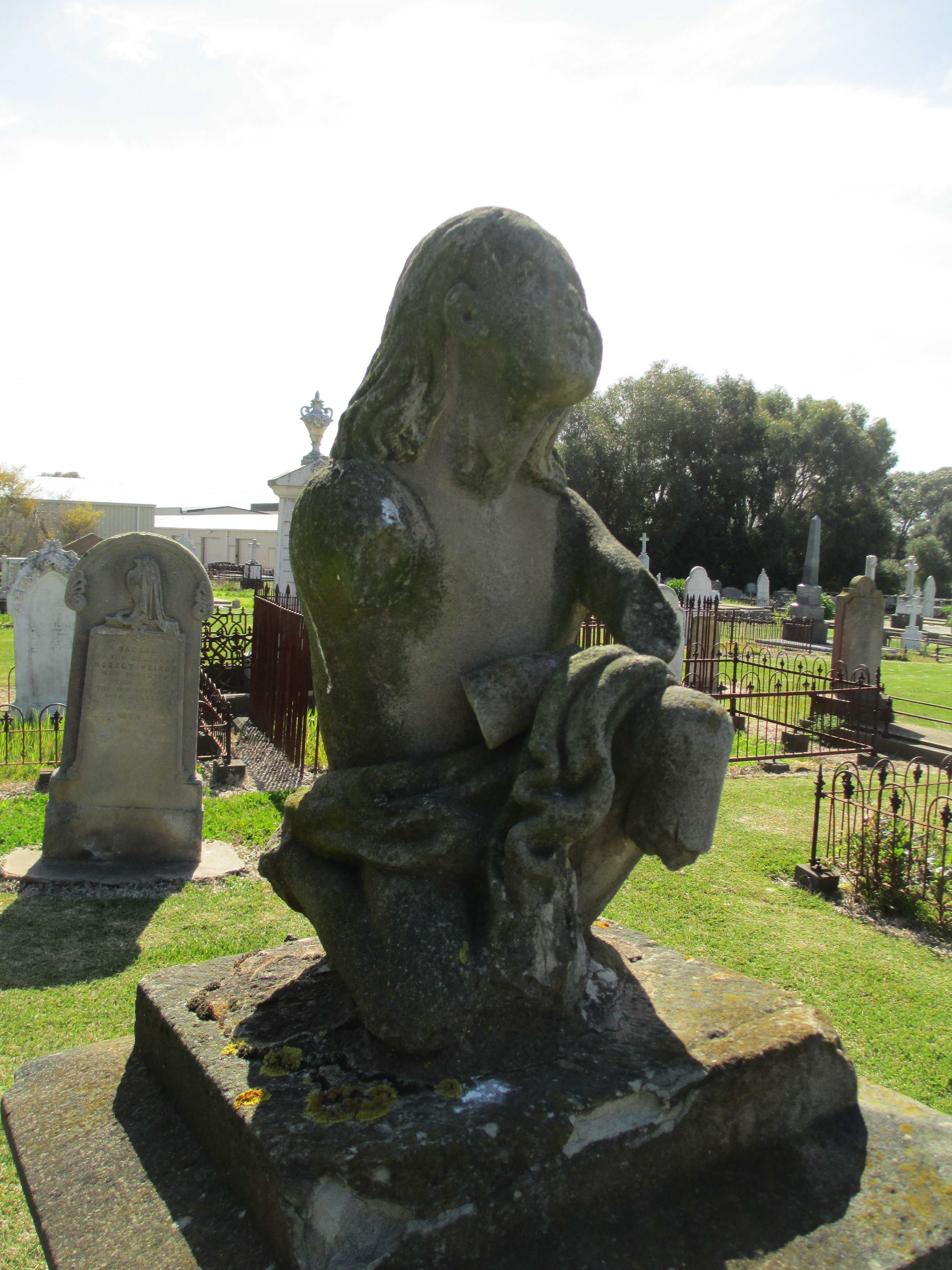
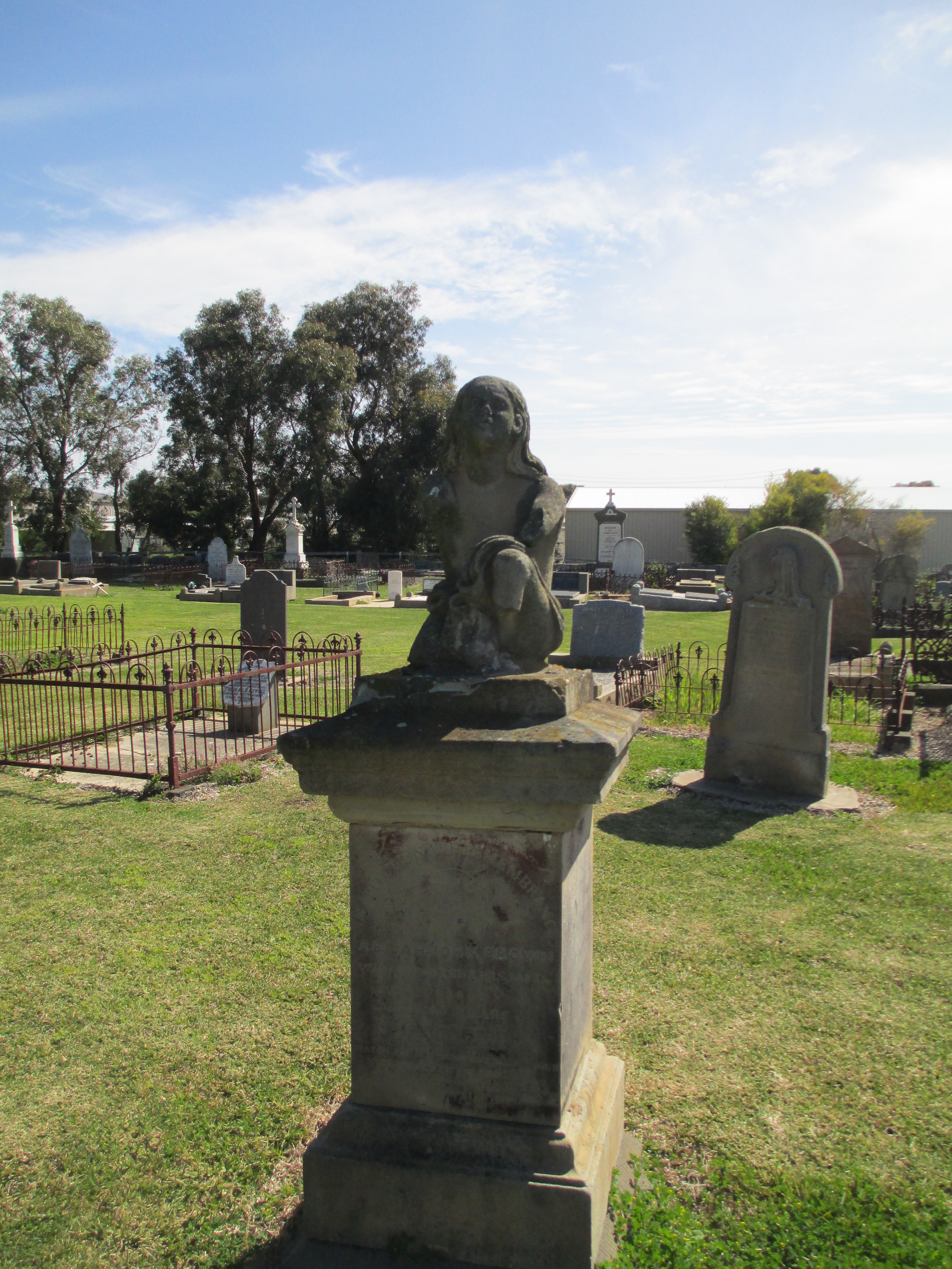
There are more people buried in the cemetery than are known about. Many of the early burials would have been laid to rest under simple wood crosses and these simply wouldn’t have survived the harshness of Port Fairy’s coastal weather. Despite this, the surviving burials provide a fascinating record of the life and death of the early inhabitants of the district.

References:

http://www.ohta.org.au/organs/organs/StJohnsPortFairy.html

http://www.portfairypubliccemetery.com.au/

An Historic Graveyard: Some early records of Port Fairy Cemetery by P. Frazer Simons.

A Special Survey: Aspects of the development of Port Fairy from 1843. Edited by Rod Collins.

Both books can be borrowed from the Prahran Mechanics Institute Victorian History Library

The photos are all mine.